Log in
All resources
Create a design
38,713 Free Artworks of Map
bibliothèque nationale de france
maps from university of amsterdam special collections
atlas der neederlanden
copperplate print
special collections of the university of amsterdam
gemeente atlas van nederland - south holland
1860s maps of south holland
description de l'universe
alain manesson mallet
1685 maps of europe
walter riemer (illustrator)
1935 maps of germany
maps by john cary
1801 maps
maps from the earth and its inhabitants, vol. x
1910s maps of somalia
maps of hofgarten düsseldorf
kunstakademie düsseldorf
maps from university of amsterdam special collections
atlas der neederlanden
maps from university of amsterdam special collections
atlas der neederlanden
maps from university of amsterdam special collections
atlas der neederlanden
general atlas (1773)
old maps of sakhalin
turgot map of paris – derivative files
ville l'évêque (paris)
brazilian paintings in the museu antônio parreiras
antônio rafael pinto bandeira
old maps of south africa
maps of transvaal
1794 rocque wall map of ireland
graphical scales
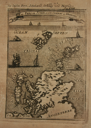
eran laor cartographic collection
willem blaeu
old maps of leopoldstadt
old maps of brigittenau
maps in the british museum
john cooke
maps by jacques chiquet
1719 maps of africa
16th-century maps of ireland
copper engravings
1600s maps of bremen (state)
17th-century maps of bremen
gemeente atlas van nederland - south holland
1860s maps of south holland
17th-century maps of the americas
island of california
gemeente atlas van nederland - south holland
1860s maps of south holland
gemeente atlas van nederland - south holland
1860s maps of south holland
maps from the earth and its inhabitants, vol. xi
africa in the 1890s
curt teich postcard archives
postcards of illinois
maps of alsace by guillaume sanson
1660s maps of alsace
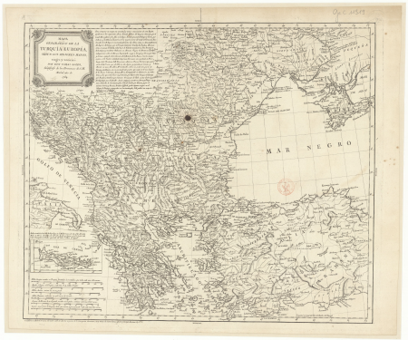
1780s maps of the balkans
maps by tomas lopez
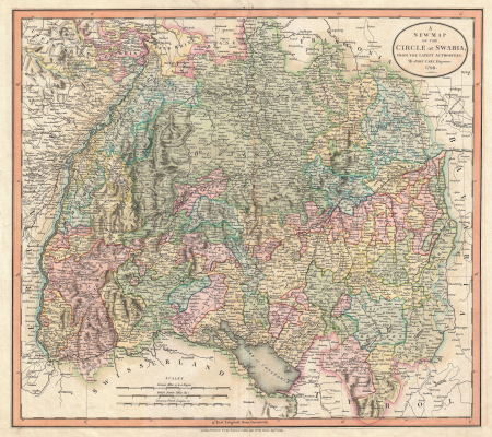
old maps of swabia
maps by john cary
coats of arms verteidigungsbezirkskommandos (bundeswehr)
hermannsdenkmal
maps by willem and johannes blaeu
old maps of loiret
old maps of former departments of france
maps from gallica
old maps of former departments of france
maps from gallica
maps in the library of congress
1861 maps of the united states
gemeente atlas van nederland - south holland
1860s maps of south holland
gemeente atlas van nederland - south holland
1860s maps of south holland
gemeente atlas van nederland - south holland
1860s maps of south holland
maps from the earth and its inhabitants, vol. xiii
africa in the 1890s
hendrik van langren map of south asia
1600 maps of asia
maps of kodagu district
edward weller
maps of asia by mercator-hondius
jodocus hondius i
maps of royal palace of amsterdam
dutch baroque architecture
gewerbe-ausstellung für rheinland, westfalen und benachbarte bezirke
old maps of düsseldorf
collections of hauptstaatsarchiv stuttgart
1651 maps
maps by thomas conder
1778 maps of africa
old maps of whole wales (alone)
description de l'universe
description de l'universe
1680s maps of scotland
1680s maps of lower saxony
description de l'universe
1680s maps of baden-württemberg
description de l'universe
17th-century maps of the iberian peninsula
description de l'universe
17th-century maps of italy
description de l'universe
17th-century maps of france
description de l'universe
maps of béthune by braun & hogenberg
city walls of béthune
maps of ancient italy by philipp clüver
maps of ancient latium
maps of liège by johannes blaeu - derivative files
seven collegiate churches of liège
maps from the earth and its inhabitants, vol. x
19th-century maps of africa
ackermann's repository of arts/series 1/volume 01
1809 maps of the russian empire
maps from the earth and its inhabitants, vol. x
19th-century maps of africa
maps of castile by mercator-hondius
details of old maps
description de l'universe
1680s maps of ireland
maps of bremen by braun & hogenberg
maps of stade by braun & hogenberg
copper engravings by benjamin cole
maps of the city of westminster
miniature speed atlas (1627) pieter van den keere
old county maps of herefordshire
maps of paris from the open data hauts-de-seine
1710s maps of paris
maps from university of amsterdam special collections
atlas der neederlanden
maps from university of amsterdam special collections
atlas der neederlanden
maps of the waterloo campaign
emery walker
guide joanne espagne et portugal-1915
1915 maps
allemagne – rhénanie-du-nord-westphalie
guillaume sanson
hamburgische elbkarte von melchior lorichs
historical maps of uetersen
19th-century maps of cairo
1888 in egypt
maps of 12th-century asia
maps of the crusades
cartouches by sanson family
old maps of atlantis
curt teich postcard archives
map postcards
maps from the earth and its inhabitants, vol. x
19th-century maps of africa
topographischer atlas der schweiz
old maps of fribourg
maps from university of amsterdam special collections
atlas der neederlanden
16th-century maps of amsterdam
maps by jacob van deventer
maps by willem and johannes blaeu
old maps of arnhem
glaciers and glaciation (1910)
maps of glaciers of alaska
maps from university of amsterdam special collections
atlas der neederlanden
maps from university of amsterdam special collections
atlas der neederlanden
maps of paris from the david rumsey historical map collection
1778 in paris
maps of delft by braun & hogenberg
bibliotheek, tu delft
gemeente atlas van nederland - south holland
maps of spijkenisse
turgot map of paris, norman b. leventhal map center – derivative files
rue de braque on maps
gemeente atlas van nederland - south holland
maps of stompwijk
maps of antwerp by braun & hogenberg
city map
1594 in aschaffenburg
1594 maps of bavaria
maps in the library of congress
old maps of antigua and barbuda
siege of steenwijk 1592
maps of steenwijk
maps of ancient italy by philipp clüver
eran laor cartographic collection
maps of florence by braun & hogenberg
eran laor cartographic collection
maps of genoa by braun & hogenberg
eran laor cartographic collection
demographic maps of algeria
cartes de franz schrader
maps of the ottoman empire by mercator-hondius
map
old maps of the bering sea
old maps of kamchatka
1770s maps of the world
maps by tomas lopez
1739 maps of france
plan de turgot
maps by john cary
1799 maps
old maps of delfzijl
atlas van loon
maps by jean-baptiste bourguignon d'anville
solomon boulton
14501 - 14600 of 38,713
Next page
/ 388


![T Hoogh-Heemraetschap vande Uytwaterende Sluysen in Kennemerlant and West Frieslant / [Johannes Douw], Isaak Tirion, [1756]](https://cdn.creazilla.com/illustrations/10000560278/t-hoogh-heemraetschap-vande-uytwaterende-sluysen-in-kennemerlant-and-west-frieslant-johannes-douw-isaak-tirion-1756-sm.webp)
![Map of the polder of Nieuw-Helle-Voet / I. Luiken fecit cum aqua forti; A. Steyaart invented; I. Stemmer's sculpsit, Romeyn de Hooghe, [1701]](https://cdn.creazilla.com/illustrations/10001032148/map-of-the-polder-of-nieuw-helle-voet-i-luiken-fecit-cum-aqua-forti-a-steyaart-invented-i-stemmer-s-sculpsit-romeyn-de-hooghe-1701-md.jpg)
![T Hoogh-Heemraetschap vande Uytwaterende Sluysen in Kennemerlant and West Frieslant / [Johannes Douw], Isaak Tirion, [1756]](https://cdn.creazilla.com/illustrations/10001440533/t-hoogh-heemraetschap-vande-uytwaterende-sluysen-in-kennemerlant-and-west-frieslant-johannes-douw-isaak-tirion-1756-sm.webp)


![Senonois, and the southern part of Champagne / [Johannes Blaeu], 1662](https://cdn.creazilla.com/illustrations/10000743635/senonois-and-the-southern-part-of-champagne-johannes-blaeu-1662-sm.webp)
![Topographical Map of the Department of Montenotte / Written by the care of Mr. Count de Chabrol Prefect. Scale of 10,000 Meters [=Om. 050; 1: 200,000]; Drawn by Cecchi, geographer, between 1806 and 1812](https://cdn.creazilla.com/illustrations/10000886036/topographical-map-of-the-department-of-montenotte-written-by-the-care-of-mr-count-de-chabrol-prefect-scale-of-10-000-meters-om-050-1-200-000-drawn-by-cecchi-geographer-between-1806-and-1812-sm.jpg)
![Topographical Map of the Department of Montenotte / Written by the care of Mr. Count de Chabrol Prefect. Scale of 10,000 Meters [=Om. 050; 1: 200,000]; Drawn by Cecchi, geographer, between 1806 and 1812](https://cdn.creazilla.com/illustrations/10000562582/topographical-map-of-the-department-of-montenotte-written-by-the-care-of-mr-count-de-chabrol-prefect-scale-of-10000-meters-om-050-1-200000-drawn-by-cecchi-geographer-between-1806-and-1812-sm.webp)


![Benjamin Cole02, Benjamin Cole, circa 1755[1][2]](https://cdn.creazilla.com/illustrations/10000478895/benjamin-cole02-benjamin-cole-circa-1755-1-2-md.jpg)


![T Hoogh-Heemraetschap vande Uytwaterende Sluysen in Kennemerlant and West Frieslant / [Johannes Douw], Isaak Tirion, [1756]](https://cdn.creazilla.com/illustrations/10000841147/t-hoogh-heemraetschap-vande-uytwaterende-sluysen-in-kennemerlant-and-west-frieslant-johannes-douw-isaak-tirion-1756-sm.webp)


![Map of the craftsmanship of the Old and New Streuyt / A. Steyaart invenit; I. Stemmer's sculpsit; I. Shutters fecit cum aqua forti, Romeyn de Hooghe, [1701]](https://cdn.creazilla.com/illustrations/10000536041/map-of-the-craftsmanship-of-the-old-and-new-streuyt-a-steyaart-invenit-i-stemmers-sculpsit-i-shutters-fecit-cum-aqua-forti-romeyn-de-hooghe-1701-md.jpg)
![T Hoogh-Heemraetschap vande Uytwaterende Sluysen in Kennemerlant and West Frieslant / [Johannes Douw], Isaak Tirion, [1756]](https://cdn.creazilla.com/illustrations/10000976652/t-hoogh-heemraetschap-vande-uytwaterende-sluysen-in-kennemerlant-and-west-frieslant-johannes-douw-isaak-tirion-1756-md.jpg)


