Log in
All resources
Create a design
8,995 Free Images of Scale
bibliothèque nationale de france
topographisch, oeconomisch und militaerische charte von mecklenburg, schwerin und ratzeburg
topographisch, oeconomisch und militaerische charte des herzogthums mecklenburg schwerin and des fürstenthums ratzeburg - schmettau
maps of spain by tomas lopez
guillaume sanson
maps from gallica
guides joanne
carte des environs de paris (1678)
cartouches by tomas lópez
ambroise tardieu
19th-century textiles of the united kingdom in the cooper–hewitt, smithsonian design museum
cherwell (textile)
bibliothèque nationale de france
cartouches by tomas lópez
topographisch, oeconomisch und militaerische charte des herzogthums mecklenburg schwerin and des fürstenthums ratzeburg - schmettau
topographisch, oeconomisch und militaerische charte von mecklenburg, schwerin und ratzeburg
1650s maps of the atlantic ocean
joan blaeu
maps from gallica
guides joanne
bibliothèque nationale de france
ambroise tardieu
nouvelle géographie universelle
1887 maps of africa
topographisch, oeconomisch und militaerische charte des herzogthums mecklenburg schwerin and des fürstenthums ratzeburg - schmettau
topographisch, oeconomisch und militaerische charte von mecklenburg, schwerin und ratzeburg
carte des environs de paris (1678)
bibliothèque nationale de france
territorio di perugia - valerio spada - btv1b53165376s
valerio spada
1780s maps of italy
maps by juan lopez
maps by alexis-hubert jaillot
maps by guillaume sanson
maps of the basque autonomous community
1770 maps of spain
antoine-françois tardieu
maps from gallica
maps of spain by tomas lopez
old maps of castile and león
maps of spain by tomas lopez
1766 maps of spain
coloured lithographs in the british museum
josef lanzedelli der jüngere
maps of the province of ávila
maps of spain by tomas lopez
maps of spain by tomas lopez
1783 maps of spain
antoine-françois tardieu
1800s maps of hispaniola
maps of spain by tomas lopez
1783 maps of spain
maps of spain by tomas lopez
1783 maps of spain
maps of spain by tomas lopez
1765 maps of spain
old maps of vardø
guillaume sanson
aircraft
vehicle
bibliothèque nationale de france
guillaume sanson
topographisch, oeconomisch und militaerische charte des herzogthums mecklenburg schwerin and des fürstenthums ratzeburg - schmettau
topographisch, oeconomisch und militaerische charte von mecklenburg, schwerin und ratzeburg
bibliothèque nationale de france
guillaume sanson
bibliothèque nationale de france
cartouches by tomas lópez
1667 map of madagascar by guillaume sanson
bibliothèque nationale de france
bibliothèque nationale de france
ambroise tardieu
maps of the course of the rhine by guillaume sanson
bibliothèque nationale de france
maps from gallica
guides joanne
le royaume de france distingué by guillaume sanson
1724 maps of france
bibliothèque nationale de france
ambroise tardieu
bibliothèque nationale de france
guillaume sanson
maps from gallica
guides joanne
topographisch, oeconomisch und militaerische charte des herzogthums mecklenburg schwerin and des fürstenthums ratzeburg - schmettau
topographisch, oeconomisch und militaerische charte von mecklenburg, schwerin und ratzeburg
1770s maps of morocco
maps by tomas lopez
topographisch, oeconomisch und militaerische charte des herzogthums mecklenburg schwerin and des fürstenthums ratzeburg - schmettau
topographisch, oeconomisch und militaerische charte von mecklenburg, schwerin und ratzeburg
topographisch, oeconomisch und militaerische charte des herzogthums mecklenburg schwerin and des fürstenthums ratzeburg - schmettau
topographisch, oeconomisch und militaerische charte von mecklenburg, schwerin und ratzeburg
topographisch, oeconomisch und militaerische charte des herzogthums mecklenburg schwerin and des fürstenthums ratzeburg - schmettau
topographisch, oeconomisch und militaerische charte von mecklenburg, schwerin und ratzeburg
maps from gallica
guides joanne
liguria, o stato della republica di genova - guiljelmus blaeu - btv1b53165414s
bibliothèque nationale de france
carte des environs de paris (1678)
bibliothèque nationale de france
floor plans of abbeys, convents, monasteries in france
couvent des ursulines de montpellier
bibliothèque nationale de france
cartouches by tomas lópez
maps of the course of the rhine by guillaume sanson
bibliothèque nationale de france
maps from gallica
guides joanne
le royaume de france distingué by guillaume sanson
1724 maps of france
animals
fish
maps from university of amsterdam special collections
atlas der neederlanden
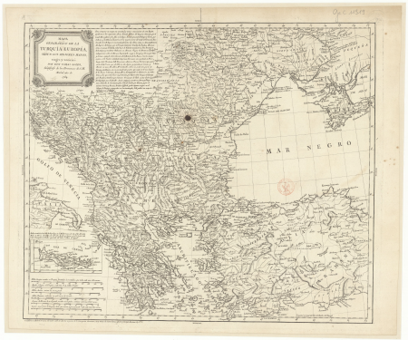
estats de l'empire des turqs en europe subdivisés suivant l'estendüe des beglerbeglicz ou gouvernements dans lesquels sont marquées les résidences des sangiacz qui en dépendent . tirés de plusieurs... - btv1b53081211n
guillaume sanson
satirical prints in the british museum
1783 cartoons
1780s maps of the balkans
maps by tomas lopez
maps of spain by tomas lopez
old maps of castile and león
maps of spain by tomas lopez
old maps of extremadura
1660s maps of france
maps of le mans
maps of alsace by guillaume sanson
1660s maps of alsace
magni ducatus lithuaniae
maps facing west
johann friedrich walther
1737 in berlin-mitte
helianthus annuus - botanical illustrations
alexander marshal - florilegium
service
awful
maps in the british museum
maps by john speed
estats de l'empire des turqs en europe subdivisés suivant l'estendüe des beglerbeglicz ou gouvernements dans lesquels sont marquées les résidences des sangiacz qui en dépendent . tirés de plusieurs... - btv1b53081211n
guillaume sanson
van langren map of southeast asia
renaissance
floor plans of abbeys, convents, monasteries in france
couvent des ursulines de montpellier
bibliothèque nationale de france
cartouches by tomas lópez
topographisch, oeconomisch und militaerische charte des herzogthums mecklenburg schwerin and des fürstenthums ratzeburg - schmettau
topographisch, oeconomisch und militaerische charte von mecklenburg, schwerin und ratzeburg
carte des environs de paris (1678)
bibliothèque nationale de france
topographisch, oeconomisch und militaerische charte des herzogthums mecklenburg schwerin and des fürstenthums ratzeburg - schmettau
topographisch, oeconomisch und militaerische charte von mecklenburg, schwerin und ratzeburg
topographisch, oeconomisch und militaerische charte des herzogthums mecklenburg schwerin and des fürstenthums ratzeburg - schmettau
topographisch, oeconomisch und militaerische charte von mecklenburg, schwerin und ratzeburg
carte des environs de paris (1678)
bibliothèque nationale de france
topographisch, oeconomisch und militaerische charte des herzogthums mecklenburg schwerin and des fürstenthums ratzeburg - schmettau
topographisch, oeconomisch und militaerische charte von mecklenburg, schwerin und ratzeburg
carte de l'isle de ceylan by guillaume delisle (1722)
bibliothèque nationale de france
topographisch, oeconomisch und militaerische charte des herzogthums mecklenburg schwerin and des fürstenthums ratzeburg - schmettau
topographisch, oeconomisch und militaerische charte von mecklenburg, schwerin und ratzeburg
topographisch, oeconomisch und militaerische charte des herzogthums mecklenburg schwerin and des fürstenthums ratzeburg - schmettau
topographisch, oeconomisch und militaerische charte von mecklenburg, schwerin und ratzeburg
carte des environs de paris (1678)
bibliothèque nationale de france
territorio di perugia - valerio spada - btv1b53165376s
valerio spada
sanson maps of the circles of germany
1670s maps of baden-württemberg
bibliothèque nationale de france
guillaume sanson
topographisch, oeconomisch und militaerische charte des herzogthums mecklenburg schwerin and des fürstenthums ratzeburg - schmettau
topographisch, oeconomisch und militaerische charte von mecklenburg, schwerin und ratzeburg
16th-century maps of le havre
ferrando bertelli
1640s maps of hesse
old maps of nassau
fashion
doll
space
sky
17th-century maps of england and wales
maps by jodocus hondius
17th-century maps of amsterdam
1620s maps of the netherlands
maps by willem and johannes blaeu
william camden
maps of chester by braun & hogenberg
bibliothèque nationale de france
maps of portugal by fernando álvares seco
bibliothèque nationale de france
maps in the library of congress
1768 maps of north america
bibliothèque nationale de france
maps by thomas kitchin
maps of provence by pierre-jean de bompar
bibliothèque nationale de france
fb event cover
draft
august kneisel
atlases
aus dem alten frankfurt. radirungen von bertha bagge.
haus zur goldenen waage
old maps of the northern hemisphere
old maps of the arctic
facebook
draft
travel
water
7001 - 7100 of 8,995
Next page
/ 90


![The High Council of Delflant / according to order by Kruikius; [mapped by N. and J. Kruikius]; L. van Anse, T. Doesburch, Jac. et Joan. Deur, and P. Ruyter sculpt, 1712](https://cdn.creazilla.com/illustrations/10001543120/the-high-council-of-delflant-according-to-order-by-kruikius-mapped-by-n-and-j-kruikius-l-van-anse-t-doesburch-jac-et-joan-deur-and-p-ruyter-sculpt-1712-sm.webp)


![Abla de Grace / [Ferrando Bertelli], Ferrando Bertelli, 1568](https://cdn.creazilla.com/illustrations/10001599324/abla-de-grace-ferrando-bertelli-ferrando-bertelli-1568-md.jpg)


![Lodge atop the roof of the Goldene Waage [Golden Scales] (Alter Markt [Old Market] No. 5.), Bertha Bagge, 1890](https://cdn.creazilla.com/illustrations/10000383670/lodge-atop-the-roof-of-the-goldene-waage-golden-scales-alter-markt-old-market-no-5-bertha-bagge-1890-sm.webp)


