Log in
All resources
Create a design
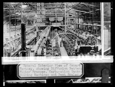
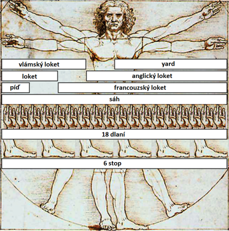
8,995 Free Images of Scale
bibliothèque nationale de france
atlante geografico del regno di napoli (1812)
maps from university of amsterdam special collections
atlas der neederlanden
copperplate print
special collections of the university of amsterdam
atlas der neederlanden deel iii: holland 2. zuid-holland
old maps of delfland
nicolaas samuel crucquius
maps of spain by tomas lopez
atlante geografico del regno di napoli (1812)
bibliothèque nationale de france
bibliothèque nationale de france
cartouches by tomas lópez
atlante geografico del regno di napoli (1812)
bibliothèque nationale de france
atlante geografico del regno di napoli (1812)
bibliothèque nationale de france
atlante geografico del regno di napoli (1812)
bibliothèque nationale de france
atlante geografico del regno di napoli (1812)
bibliothèque nationale de france
atlante geografico del regno di napoli (1812)
bibliothèque nationale de france
atlante geografico del regno di napoli (1812)
bibliothèque nationale de france
bibliothèque nationale de france
cartouches by tomas lópez
bibliothèque nationale de france
carolus allard
atlante geografico del regno di napoli (1812)
bibliothèque nationale de france
atlante geografico del regno di napoli (1812)
bibliothèque nationale de france
bibliothèque nationale de france
cartouches by tomas lópez
atlante geografico del regno di napoli (1812)
bibliothèque nationale de france
ravi varma press
hinduism
masonic temple, boston (boylston street: 1867)
imperial war museum first world war artwork
donald maxwell
high renaissance,renaissance
comparisons
maps from university of amsterdam special collections
atlas der neederlanden
maps from university of amsterdam special collections
atlas der neederlanden
19th-century maps of bohemia
1880s maps of czechia
admiralty charts 2001-2200
westport, county mayo
compass
train
people
group
damascus in the 1750s
old maps of damascus
history of basra
maps of basra
the turkish empire in europe, asia and africa (1752)
history of bursa
atlante geografico del regno di napoli (1812)
bibliothèque nationale de france
atlante geografico del regno di napoli (1812)
bibliothèque nationale de france
atlante geografico del regno di napoli (1812)
bibliothèque nationale de france
atlante geografico del regno di napoli (1812)
bibliothèque nationale de france
bibliothèque nationale de france
cartouches by tomas lópez
atlante geografico del regno di napoli (1812)
bibliothèque nationale de france
atlante geografico del regno di napoli (1812)
bibliothèque nationale de france
bibliothèque nationale de france
guillaume sanson
atlante geografico del regno di napoli (1812)
bibliothèque nationale de france
atlante geografico del regno di napoli (1812)
bibliothèque nationale de france
bibliothèque nationale de france
cartouches by tomas lópez
atlante geografico del regno di napoli (1812)
bibliothèque nationale de france
atlante geografico del regno di napoli (1812)
bibliothèque nationale de france
full hd video
draft
facebook
draft
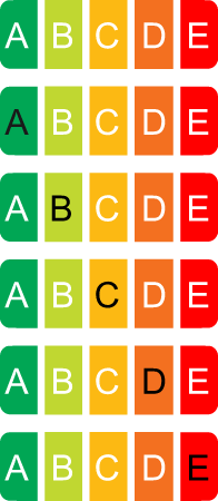
red to green
rating
performance
score
maps by jan eduard wagner
františek kytka
animated post
draft
maps of portugal by fernando álvares seco
bibliothèque nationale de france
maps of portugal by fernando álvares seco
bibliothèque nationale de france
territorium argentoratense (1652 map)
bibliothèque nationale de france
malerischer plan von frankfurt am main und seiner nächsten umgebung
19th-century maps of frankfurt am main
details of polyptyque du jugement dernier
early netherlandish painting
history of derbent
maps of derbent
maps of portugal by fernando álvares seco
bibliothèque nationale de france
old maps of the kingdom of naples
lago patria
jacques burkhardt scientific drawings
1865 in art
maps from university of amsterdam special collections
atlas der neederlanden
maps from university of amsterdam special collections
atlas der neederlanden
maps from university of amsterdam special collections
atlas der neederlanden
maps from university of amsterdam special collections
atlas der neederlanden
maps from university of amsterdam special collections
atlas der neederlanden
maps from university of amsterdam special collections
atlas der neederlanden
maps from university of amsterdam special collections
atlas der neederlanden
maps from university of amsterdam special collections
atlas der neederlanden
1857 maps of berlin
liesenbrücken
maps in the library of congress
old maps of florida
maps of spain by tomas lopez
1779 maps of spain
maps of spain by tomas lopez
1773 maps of spain
maps of spain by tomas lopez
1773 maps of spain
maps of spain by tomas lopez
1779 maps of spain
1770s maps of portugal
1770 maps of spain
reverse sides from gallica
herman padtbrugge
bibliothèque nationale de france
guillaume sanson
maps of strasbourg in the 17th century
gerard jollain
bibliothèque nationale de france
cartouches by tomas lópez
bibliothèque nationale de france
cartouches by tomas lópez
leonard schenk jansz.
maps from gallica
maps of ancona by braun & hogenberg
jacopo fontana
west-indische paskaert (doncker, 1660s)
herman padtbrugge
carte des régences d'alger by hérisson
bibliothèque nationale de france
bibliothèque nationale de france
cartouches by tomas lópez
west-indische paskaert (doncker, 1660s)
herman padtbrugge
bibliothèque nationale de france
guillaume sanson
bibliothèque nationale de france
guillaume sanson
bibliothèque nationale de france
nouvelle géographie universelle
west-indische paskaert (doncker, 1660s)
herman padtbrugge
carte des régences d'alger by hérisson
bibliothèque nationale de france
bibliothèque nationale de france
sanson maps of south america
carte des régences d'alger by hérisson
bibliothèque nationale de france
california
history
historical
history
maps from university of amsterdam special collections
atlas der neederlanden
maps from university of amsterdam special collections
atlas der neederlanden
maps from university of amsterdam special collections
atlas der neederlanden
maps from university of amsterdam special collections
atlas der neederlanden
historical
history
maps of spain by tomas lopez
1782 maps of spain
old maps of tenerife
1779 maps of spain
maps of spain by tomas lopez
1779 maps of spain
maps of spain by tomas lopez
1782 maps of spain
maps of spain by tomas lopez
1779 maps of spain
6601 - 6700 of 8,995
Next page
/ 90


![The course of the Meuse, with the neighboring countries, dukedoms and counties / by Mr. Sanson ..., [after 1696]](https://cdn.creazilla.com/illustrations/10001348889/the-course-of-the-meuse-with-the-neighboring-countries-dukedoms-and-counties-by-mr-sanson-after-1696-sm.jpg)


![Ancona / Jacomo Fontana Anc[onian]o in., 1569](https://cdn.creazilla.com/illustrations/10000797800/ancona-jacomo-fontana-anconiano-in-1569-md.jpg)