Log in
All resources
Create a design
8,995 Free Images of Scale
bibliothèque nationale de france
atlante geografico del regno di napoli (1812)
atlantic ocean
united states,uss kearsarge (lhd 3)
large scale exercise 2021
lse21
maps in the library of congress
maps by willem and johannes blaeu
draft
maps from gallica
atlantic ocean
city
atlantic ocean
people
atlantic ocean
people
pieter verbiest (ii)
maps from gallica
maps from gallica
guides joanne
bibliothèque nationale de france
guillaume sanson
libra (astrology)
scale icons
storkyrkan, stockholm
graves in sweden
maps from university of amsterdam special collections
atlas der neederlanden
department of american paintings and sculpture, metropolitan museum of art
naïve art
bhagavata purana
ravi varma press
agriculture
building
historical
history
images provided by the münzkabinett (berlin) - 17th century
coins of jahangir
images provided by the münzkabinett (berlin) - 17th century
coins of jahangir
1670s maps of rhineland-palatinate
maps of vangiones by sanson
maps from gallica
guides joanne
17th-century maps of the indian ocean
maps by willem and johannes blaeu
bibliothèque nationale de france
guillaume sanson
maps by hendrik hondius the younger
old maps of gâtinais and sénonais
atlantic ocean
group
atlantic ocean
people
17th-century maps of the indian ocean
maps by willem and johannes blaeu
illustration
book
maps by willem and johannes blaeu
17th-century maps of europe
maps from university of amsterdam special collections
atlas der neederlanden
maps of spain by tomas lopez
1760 maps of spain
old maps of former departments of france
maps from gallica
old maps of former departments of france
maps from gallica
19th-century maps of the ottoman empire
maps in the british museum
maps by willem and johannes blaeu
novus atlas blaeu
bibliothèque nationale de france
sanson maps of asia
maps by willem and johannes blaeu
1640s maps
1744 maps of asia
baroque painting
1780s maps of the caribbean
maps by juan lopez
chicago and the midwest, newberry library
great chicago fire of 1871
maps from university of amsterdam special collections
atlas der neederlanden
map of the circle of the rhineland by sanson
1700s maps of rhineland-palatinate
views from admiralty charts
richard brydges beechey
control
body
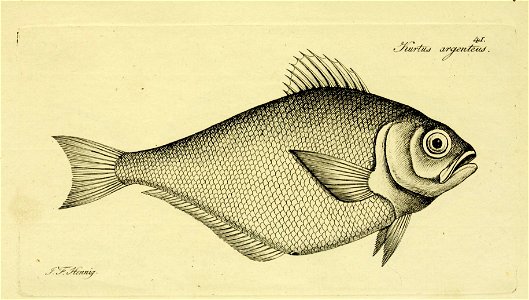
ichthyology
fish
maps of the course of the rhine by guillaume sanson
bibliothèque nationale de france
girls and tanks
vehicle
pre-raphaelite brotherhood
details of paintings
old maps of norway
guillaume sanson
new york and brooklyn, with jersey city and hoboken water front
maps in the library of congress
maps in the library of congress
1889 maps of michigan
views from admiralty charts
richard brydges beechey
maps of île-de-france by françois de la guillotière
bibliothèque nationale de france
maps of paris by braun & hogenberg
bibliothèque nationale de france
maps of île-de-france by françois de la guillotière
bibliothèque nationale de france
maps of asia minor by mercator-hondius
bibliothèque nationale de france
amphibian
reptiles
maps in the library of congress
1886 maps of massachusetts
1570s maps of africa
1570s maps of egypt
maps in the library of congress
old maps of new hampshire
facebook cover
draft
flayer
draft
arnold van langren map of southwest africa
1600 maps of africa
maps from university of amsterdam special collections
atlas der neederlanden
new zealand
vehicle
high renaissance,renaissance
units of measure
maps of abyssinia by mercator-hondius
bibliothèque nationale de france
maps of île-de-france by françois de la guillotière
bibliothèque nationale de france
maps in the library of congress
1886 maps of vermont
magazine fort, dublin
maps by john rocque
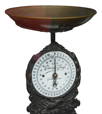
balance scale
history
historical
history
antonio palomino
hipólito rovira
new york and brooklyn, with jersey city and hoboken water front
maps in the library of congress
17th-century maps of the strait of magellan
maps by jodocus hondius
maps of seville by joris hoefnagel
bibliothèque nationale de france
facebook cover
draft
facebook ad
draft
facebook
draft
facebook
draft
aircraft
aviation
people
group
garden
home
atlante geografico del regno di napoli (1812)
bibliothèque nationale de france
atlante geografico del regno di napoli (1812)
bibliothèque nationale de france
atlante geografico del regno di napoli (1812)
bibliothèque nationale de france
atlante geografico del regno di napoli (1812)
bibliothèque nationale de france
atlante geografico del regno di napoli (1812)
bibliothèque nationale de france
atlante geografico del regno di napoli (1812)
bibliothèque nationale de france
bibliothèque nationale de france
félix robaut
atlante geografico del regno di napoli (1812)
bibliothèque nationale de france
atlante geografico del regno di napoli (1812)
bibliothèque nationale de france
atlante geografico del regno di napoli (1812)
bibliothèque nationale de france
bibliothèque nationale de france
cartouches by tomas lópez
atlante geografico del regno di napoli (1812)
bibliothèque nationale de france
atlantic ocean
light
people
group
shober & carqueville lithographing company
maps in the library of congress
files with no machine-readable source
unbalanced scales of justice
robert gordon of straloch
old maps of sutherland
self-published work
scales in art
historical
history
atlante geografico del regno di napoli (1812)
bibliothèque nationale de france
6501 - 6600 of 8,995
Next page
/ 90


![Topographical Map of the Department of Montenotte / Written by the care of Mr. Count de Chabrol Prefect. Scale of 10,000 Meters [=Om. 050; 1: 200,000]; Drawn by Cecchi, geographer, between 1806 and 1812](https://cdn.creazilla.com/illustrations/10000562582/topographical-map-of-the-department-of-montenotte-written-by-the-care-of-mr-count-de-chabrol-prefect-scale-of-10000-meters-om-050-1-200000-drawn-by-cecchi-geographer-between-1806-and-1812-sm.webp)
![Topographical Map of the Department of Montenotte / Written by the care of Mr. Count de Chabrol Prefect. Scale of 10,000 Meters [=Om. 050; 1: 200,000]; Drawn by Cecchi, geographer, between 1806 and 1812](https://cdn.creazilla.com/illustrations/10000886036/topographical-map-of-the-department-of-montenotte-written-by-the-care-of-mr-count-de-chabrol-prefect-scale-of-10-000-meters-om-050-1-200-000-drawn-by-cecchi-geographer-between-1806-and-1812-sm.jpg)


![L'Isle de France. Parisiensis agri descrip[tio]. Fr. Guilloterius... describebat..., 1598](https://cdn.creazilla.com/illustrations/10000601334/lisle-de-france-parisiensis-agri-descriptio-fr-guilloterius-describebat-1598-md.jpg)

![L'Isle de France. Parisiensis agri descrip[tio]. Fr. Guilloterius... describebat..., 1598](https://cdn.creazilla.com/illustrations/10001295929/l-isle-de-france-parisiensis-agri-descrip-tio-fr-guilloterius-describebat-1598-md.jpg)


![L'Isle de France. Parisiensis agri descrip[tio]. Fr. Guilloterius... describebat..., 1598](https://cdn.creazilla.com/illustrations/10000225305/lisle-de-france-parisiensis-agri-descriptio-fr-guilloterius-describebat-1598-md.jpg)


![Hispalis: Qui non ha visto Sevilla non ha visto maravilla / D. Nicolao Malepart amico veteri et congerroni hispalensi lepidissimo Georgius Houfnaglius amicitie monume[n]tu[m] d. a[nn]o MDXCIII Francf. ad Moenum, Joris Hoefnagel, between 1593 and 1640](https://cdn.creazilla.com/illustrations/10001007051/hispalis-qui-non-ha-visto-sevilla-non-ha-visto-maravilla-d-nicolao-malepart-amico-veteri-et-congerroni-hispalensi-lepidissimo-georgius-houfnaglius-amicitie-monume-n-tu-m-d-a-nn-o-mdxciii-francf-ad-moenum-joris-hoefnagel-between-1593-and-1640-md.jpg)