Log in
All resources
Create a design
8,995 Free Images of Scale
bibliothèque nationale de france
john rocque
john rocque 1746 london map (216 parts)
historical
maps from gallica
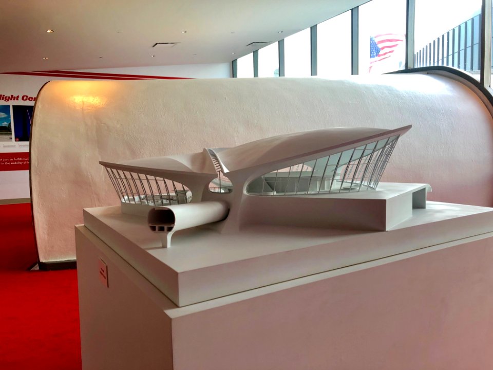
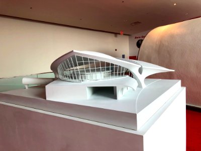
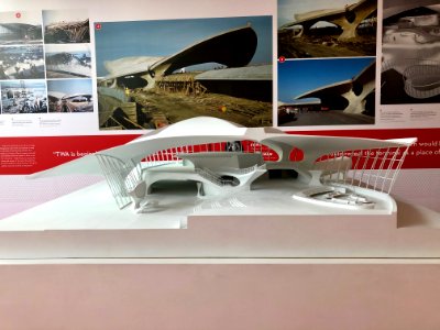
mid-20th century architecture
twa flight center
draft
guides joanne
history
interiors of churches in the canton of zürich
oswaldkapelle breite (nürensdorf)
maps in the library of congress
1877 maps of the united states
building
house
historical
history
maps of the united kingdom of the netherlands
françois bohn
paintings in the museu paulista
brazil in history paintings
plano de la bahia de argel situada en la costa de africa - explicacion del ataque que executo en esta bahia el ex.mo señor don antonio barcelo, siendo su mayor general el capitan de navio don joseph... - btv1b53238422p
maps by tomas lopez
facebook
draft
caricatures of denmark
p.c. klæstrup
crime
scale
maps published by hendrik de leth
algiers in the 18th century
françois de la pointe
maps of barbary coast
balloon aircraft in art
1837 in london
flayer
draft
a plan of the operations of the king's army under the command of general sr. william howe, k.b. in new york and east new jersey, against the american forces commanded by general washington, from the 12th. of october, to the 28th. of november 1776
battle of white plains
bibliothèque nationale de france
félix robaut
bibliothèque nationale de france
félix robaut
éléphant de la bastille
1830 in art
animated post
draft
admiralty charts 2601-2800
sligo bay
maps in the library of congress
cartouches by tomas lópez
dragon
head
fantasy
dragon
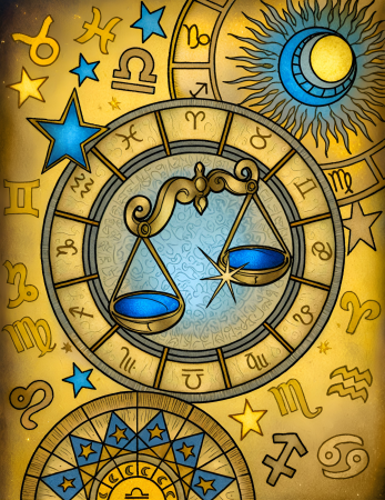
zodiac sign
libra
maps from university of amsterdam special collections
atlas der neederlanden
sanson maps of the netherlands
1670s maps of belgium
john rocque 1746 london map (216 parts)
john rocque
john rocque 1746 london map (216 parts)
john rocque
john rocque 1746 london map (216 parts)
john rocque
measuring
ruler
ravi varma press
virata
jahangir weighing prince khurram against gold and silver
weighing scale
nature
plants
18th-century maps of kent
maps by thomas kitchin
john rocque 1746 london map (216 parts)
john rocque
john rocque 1746 london map (216 parts)
john rocque
john rocque 1746 london map (216 parts)
john rocque
animals
fish
maps from gallica
guides joanne
maps from gallica
guides joanne
17th-century maps of pembrokeshire
maps by jodocus hondius ii
vehicle
toy
instagram ad
draft
draft
card
prints by william hogarth in the british museum
realism
old maps of skagerrak
maps of oslofjorden
festung berlin
baroque
maps from university of amsterdam special collections
atlas der neederlanden
historical
history
historical
history
midle-sex described with the most famous cities of london and westminster (1610)
context files from gallica
midle-sex described with the most famous cities of london and westminster (1610)
bibliothèque nationale de france
mid-20th century architecture
checkflickr2
mid-20th century architecture
checkflickr2
john rocque 1746 london map (216 parts)
john rocque
john rocque 1746 london map (216 parts)
john rocque
john rocque 1746 london map (216 parts)
john rocque
historical
history
insects
india
mid-20th century architecture
checkflickr2
mid-20th century architecture
checkflickr2
mid-20th century architecture
checkflickr2
mid-20th century architecture
checkflickr2
mid-20th century architecture
checkflickr2
italy
rome
18th-century maps of the philippines
baroque painting
maps from gallica
guides joanne
old administrative maps of the ottoman empire
1909 maps of asia
measuring
scale
speedometer
device
french school,naturalism
château figeac
historical
history
kentropyx calcarata
ameiva ameiva
cartoons by joseph keppler
puck, 1886
cartoons by joseph keppler
puck, 1886
business card 85x55mm
draft
admiralty charts region b: england wales ireland english channel southern north sea
admiralty charts 2401-2600
maps from gallica
guides joanne
images provided by the münzkabinett (berlin) - 17th century
coins of jahangir
1858 in illinois
1858 maps
character
fantasy
fish scale
fish
landais & oberthur
maps from gallica
bodleian maps collection
old maps of oxford
bird's eye view maps of illinois
maps in the library of congress
printing
woman
portrait paintings of james francis edward stuart
antonio david
bibliothèque nationale de france
guillaume sanson
drawings on vellum in the british museum
sienese school
18th-century maps of hispaniola
maps by juan lopez
carte de france instructive et amusante divisée en quatrevingt six départements - btv1b84949605
bibliothèque nationale de france
maps from gallica
guides joanne
maps from gallica
guides joanne
claude auguste berey
gallia narbonensis
history of greenwich (district of london)
john rocque 1746 london map (a1-h3)
weight loss
male
weight loss
male
animals
fish
animals
fish
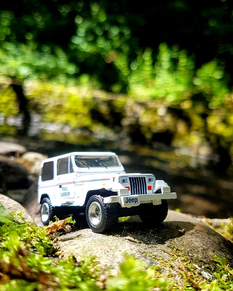
toy
car
6301 - 6400 of 8,995
Next page
/ 90


![Joanne Guides. Surroundings of Plombières. Scale 10 km. [= Om. 066; 1: 150 000]. L. Thuillier delt, 1891](https://cdn.creazilla.com/illustrations/10000683074/joanne-guides-surroundings-of-plombi-res-scale-10-km-om-066-1-150-000-l-thuillier-delt-1891-sm.jpg)


![Midle-Sex described with the most famous cities of London and Westminster / Described by Iohn Norden; Augme[n]ted by I. Speed; Jodocus Hondius caelavit, 1610](https://cdn.creazilla.com/illustrations/10001372370/midle-sex-described-with-the-most-famous-cities-of-london-and-westminster-described-by-iohn-norden-augmented-by-i-speed-jodocus-hondius-caelavit-1610-md.jpg)
![Midle-Sex described with the most famous cities of London and Westminster / Described by Iohn Norden; Augme[n]ted by I. Speed; Jodocus Hondius caelavit, 1610](https://cdn.creazilla.com/illustrations/10001324000/midle-sex-described-with-the-most-famous-cities-of-london-and-westminster-described-by-iohn-norden-augmented-by-i-speed-jodocus-hondius-caelavit-1610-md.jpg)


![Joanne Guides. Surroundings of Plombières. Scale 10 km. [=Om. 066; 1: 150 000]. L.Thuillier delt, 1889](https://cdn.creazilla.com/illustrations/10001400709/joanne-guides-surroundings-of-plombi-res-scale-10-km-om-066-1-150-000-l-thuillier-delt-1889-sm.jpg)


![[Agas map of Oxford, 1578], Augustine Ryther](https://cdn.creazilla.com/illustrations/10001154709/agas-map-of-oxford-1578-augustine-ryther-md.jpg)

![Utagawa Kuniyoshi – AGEO: Takao of the Miuraya (Miura no Takao) [from The Sixty-nine Stations of the Kisokaido]](https://cdn.creazilla.com/illustrations/7775510/utagawa-kuniyoshi-ageo-takao-of-the-miuraya-miura-no-takao-from-the-sixty-nine-s-sm.jpeg)


![Joanne Guide. The Vosges. The Vosges. Scale, 30 kilometers [=Om. 068; 1: 440,000 approx.]. L. Thuillier delt, 1888](https://cdn.creazilla.com/illustrations/10001545562/joanne-guide-the-vosges-the-vosges-scale-30-kilometers-om-068-1-440-000-approx-l-thuillier-delt-1888-sm.jpg)