Log in
All resources
Create a design
38,713 Free Artworks of Map
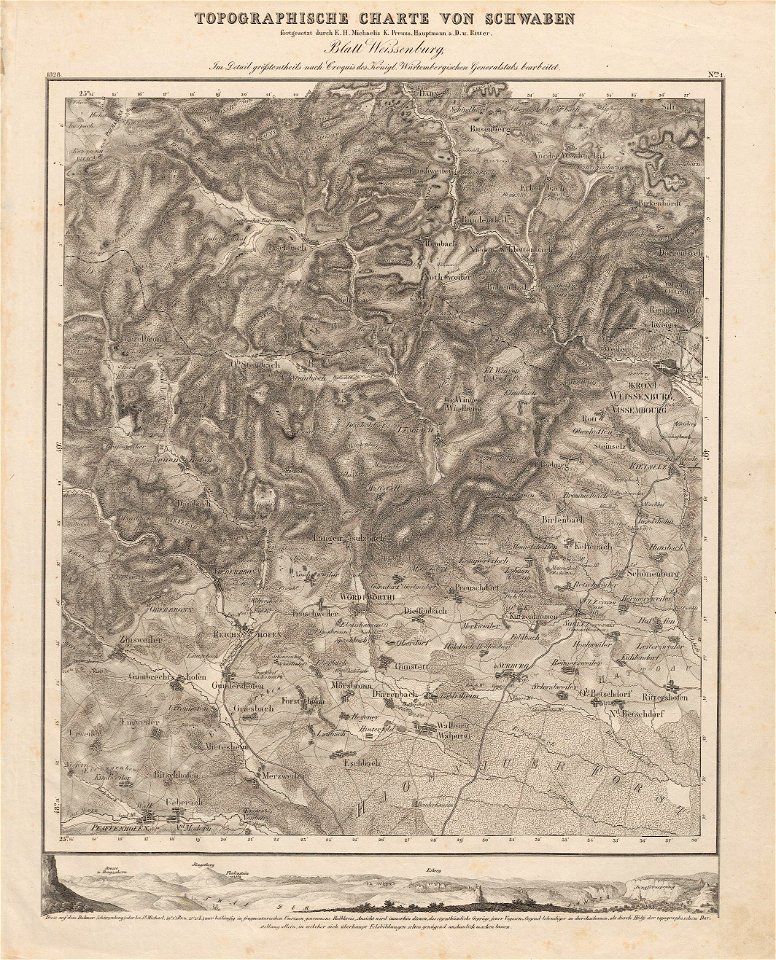
charte von schwaben (bohnenberger)
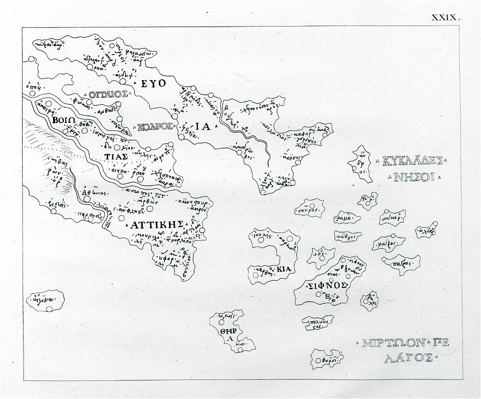
old maps of islands of the aegean sea
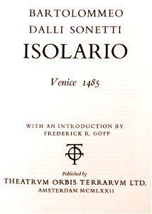
bartolommeo dalli sonetti
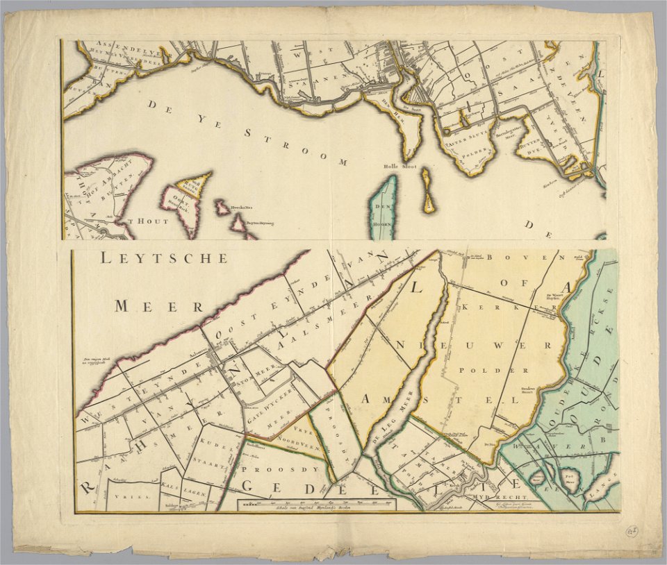
maps in the stadsarchief amsterdam
daniel stoopendaal
bibliothèque municipale de reims
19th-century maps of bavaria
maps in the library of congress
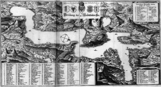
geographical illustrations by coronelli
old maps of the peloponnese
old maps of zürich
zürich
maps by willem and johannes blaeu
copper engraving
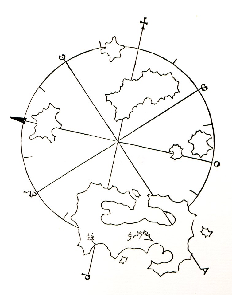
old maps of islands of the aegean sea
bartolommeo dalli sonetti
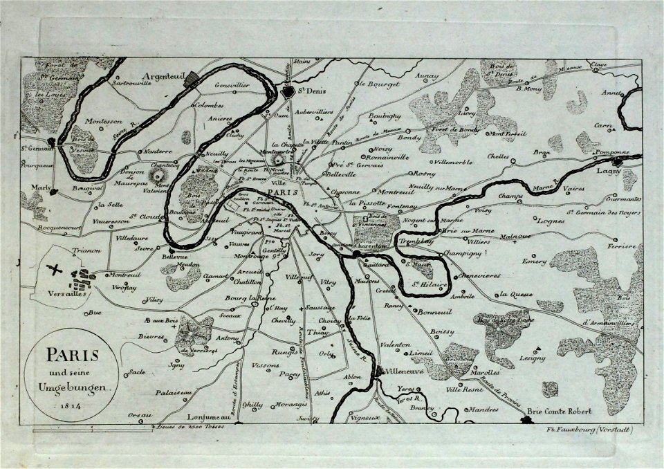
old maps of île-de-france
maps and topographical views by joris hoefnagel
engravings in the hungarian national museum
maps in the library of congress
maps in the library of congress
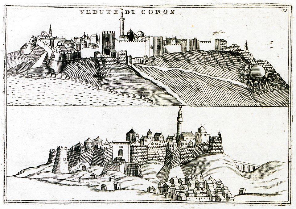
geographical illustrations by coronelli
koroni
il devotissimo viaggio di gerusalemme fatto
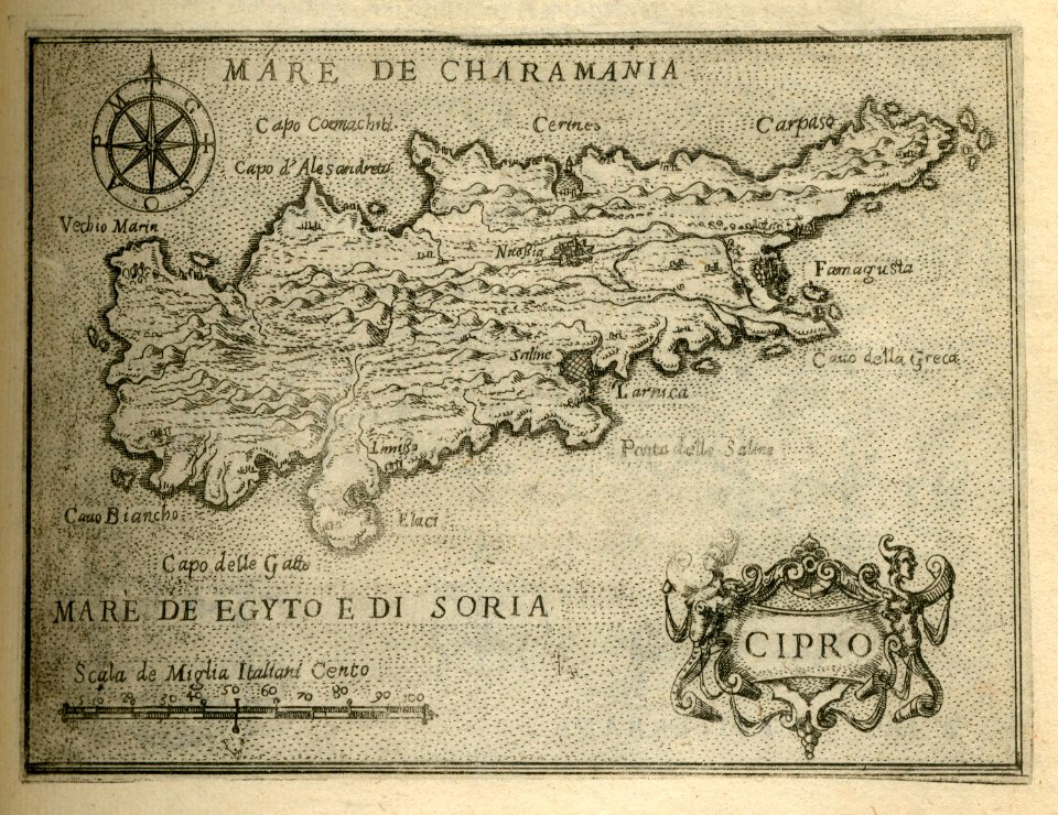
16th-century maps of cyprus
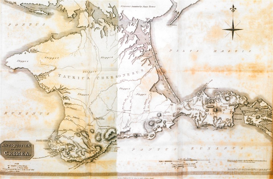
travels in various countries of europe
asia and africa
bibliothèque municipale de reims
rès. g 153
bibliothèque municipale de reims
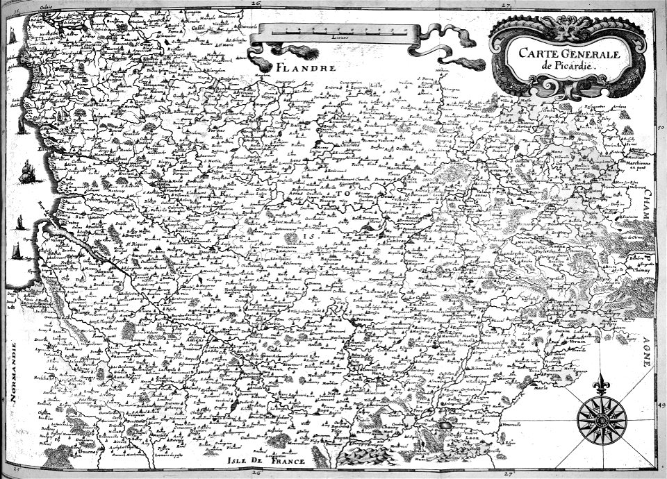
maps of the county of flanders
bibliothèque municipale de reims
rès. g 153
geographical illustrations by coronelli
old maps of the peloponnese
prints from pieter christiaansz bor nederlantsche oorloghen
maps of the dutch republic
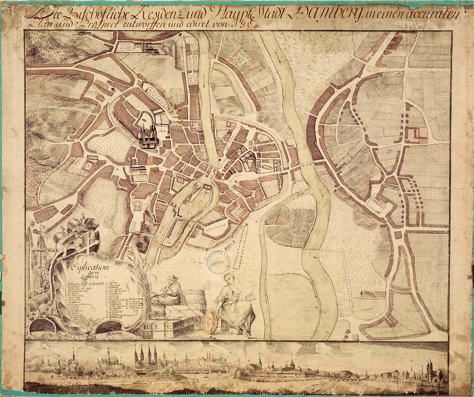
collections of staatsbibliothek bamberg
history of bamberg
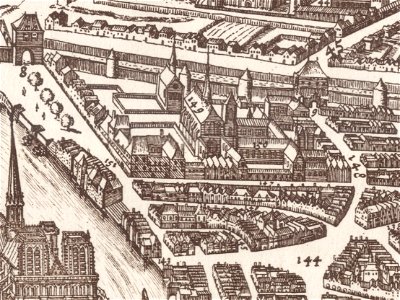
map of paris by claes jansz. visscher - derivate files
collège des bernardins
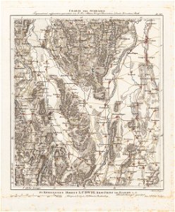
charte von schwaben (bohnenberger)
19th-century maps of bavaria
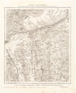
charte von schwaben (bohnenberger)
old maps of switzerland
charte von schwaben (bohnenberger)
19th-century maps of bavaria
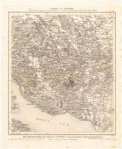
charte von schwaben (bohnenberger)
old maps of lake constance
de wikisource book leaflet
de nordseeküste (karten)
historical images of minsk
old maps of minsk
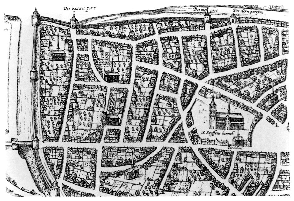
old maps of nijmegen
etchings by giovanni battista piranesi
map of campus martius (robert adam)
old maps of ancient rome (city)
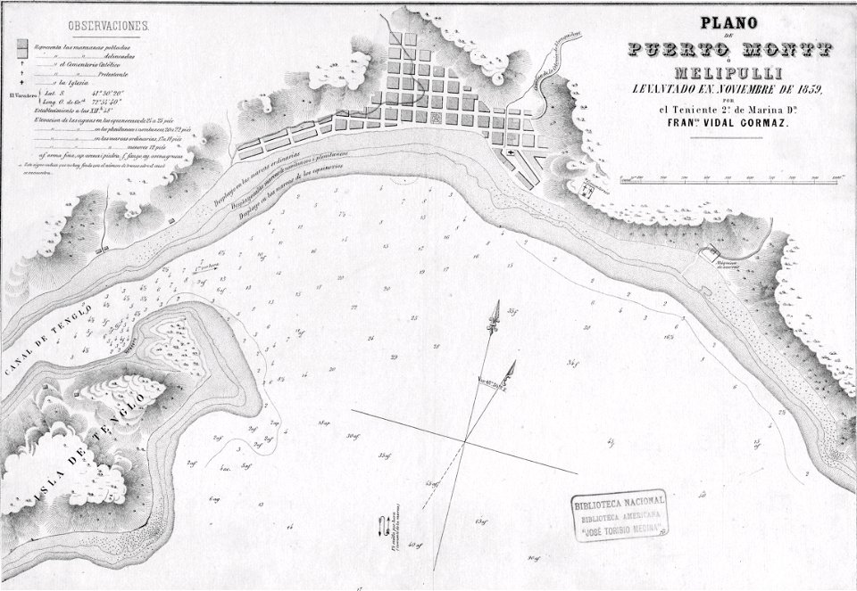
history of puerto montt
1859
etchings by giovanni battista piranesi
map of campus martius (robert adam)
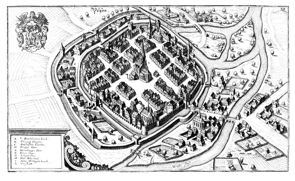
historical maps of plzeň
coats of arms of plzeň
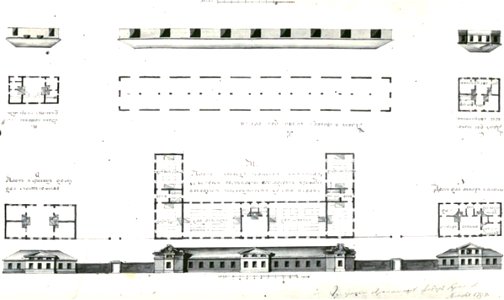
johann christoph brotze
old maps of riga
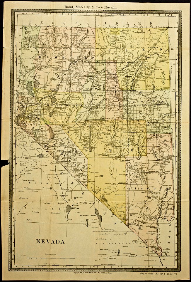
everett d. graff collection of western americana
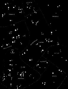
popular science monthly illustrations/volume 32
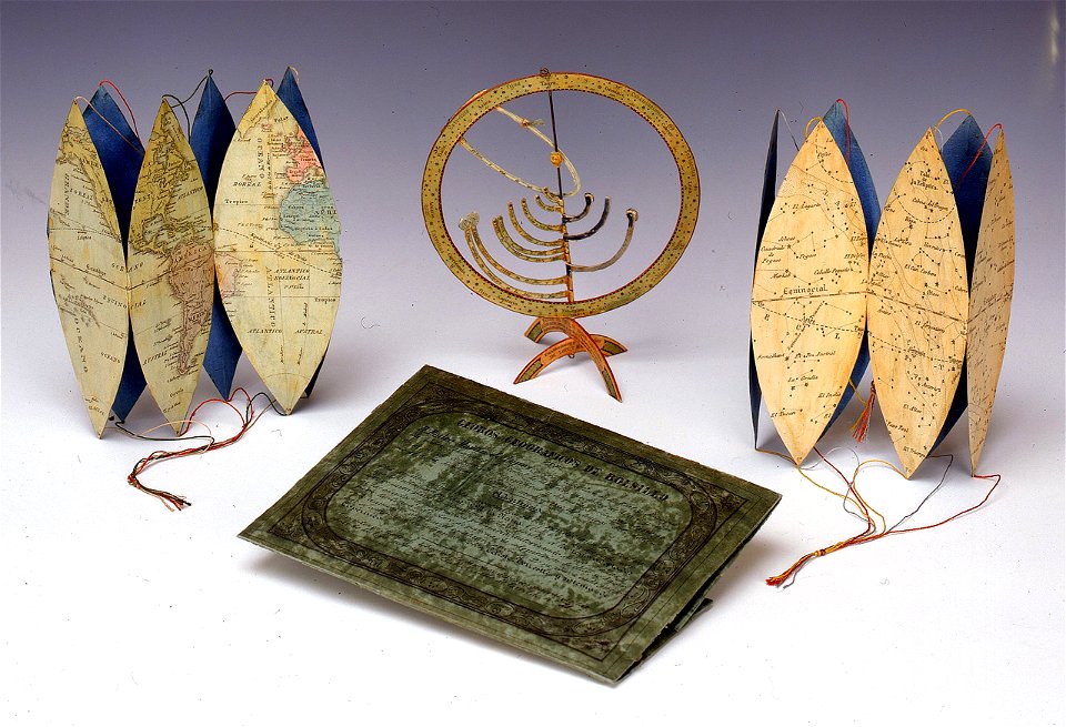
astronomical maps
popular science monthly illustrations/volume 32
astronomical maps
portolan charts by willem and johannes blaeu
17th-century maps of europe
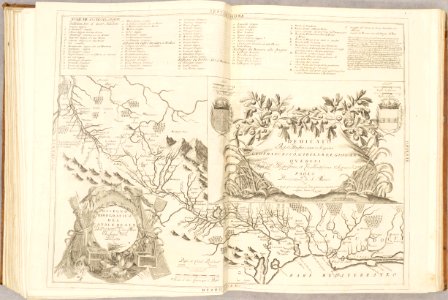
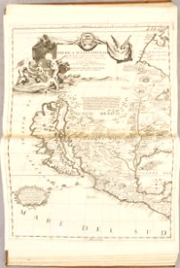
atlante veneto (raremaps.com) volume 1
old maps of the pacific ocean
atlante veneto (raremaps.com) volume 1
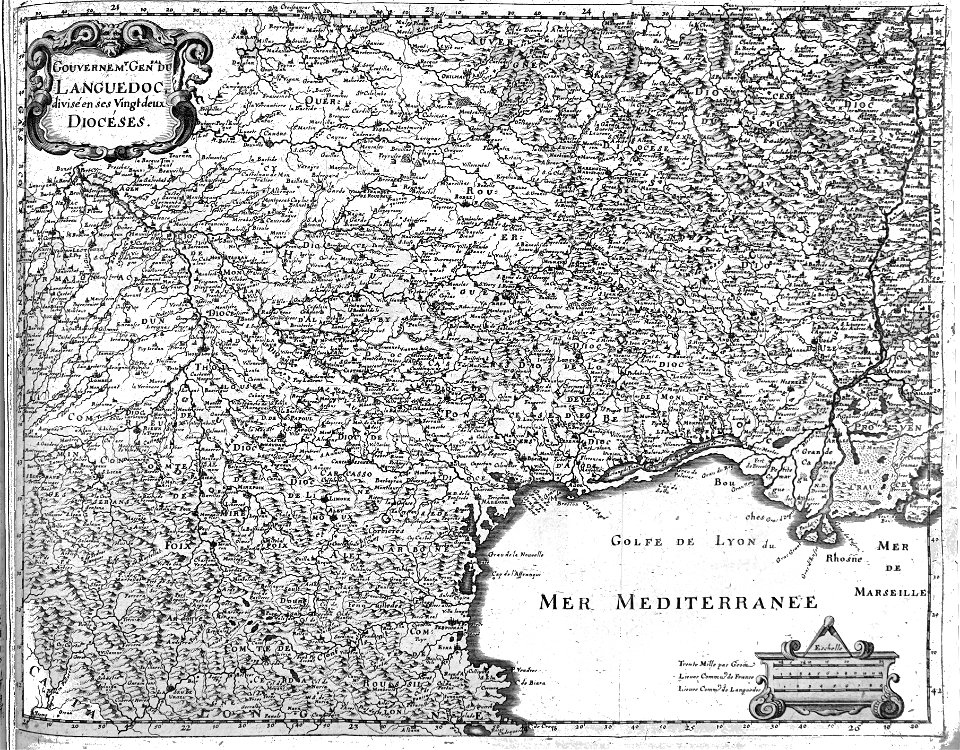
maps of the canal du midi
atlante veneto (raremaps.com) volume 1
old maps of north america
maps of the dutch east india company - indonesia
1724
west-indische compagnie
1745
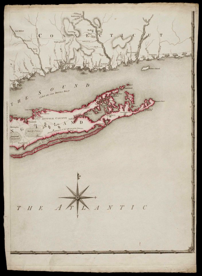
old maps of new york (state)
old maps of new york (state)
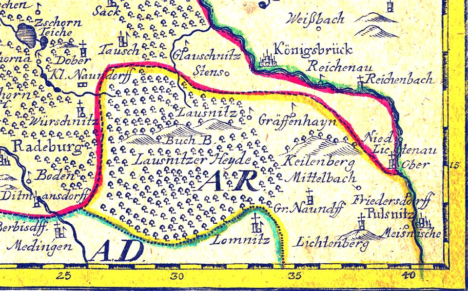
johann george schreiber
old maps of saxony
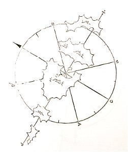
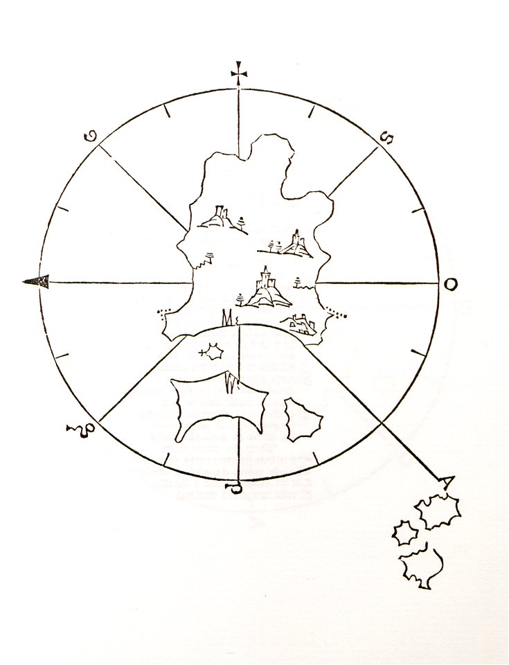
old maps of islands of the aegean sea
bartolommeo dalli sonetti
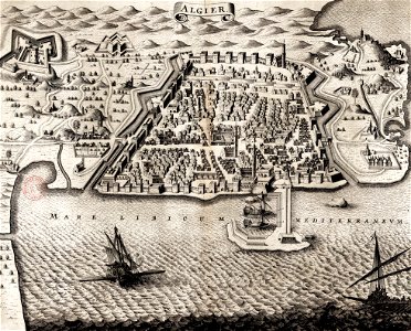
historic views of cities in germany by matthäus merian
historical images of algiers
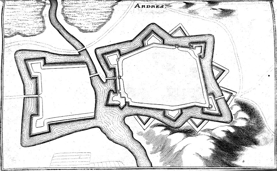
bibliothèque municipale de reims
rès. g 152
atlas of the russian empire (1800)
old maps of tobolsk governorate
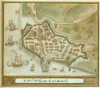
atlas schoemaker-zeeland
atlas schoemaker
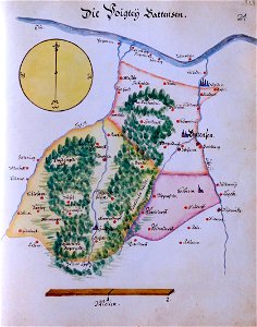
ämteratlas des fürstentums lüneburg von johannes mellinger
elbe in lower saxony
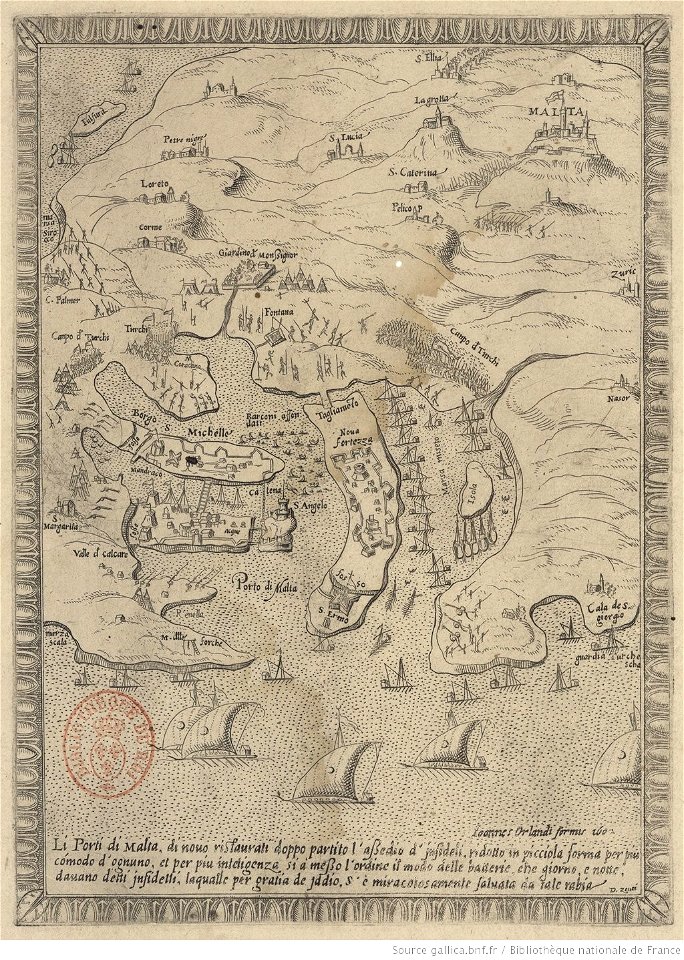
great siege of malta
old maps of malta
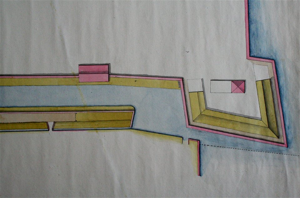
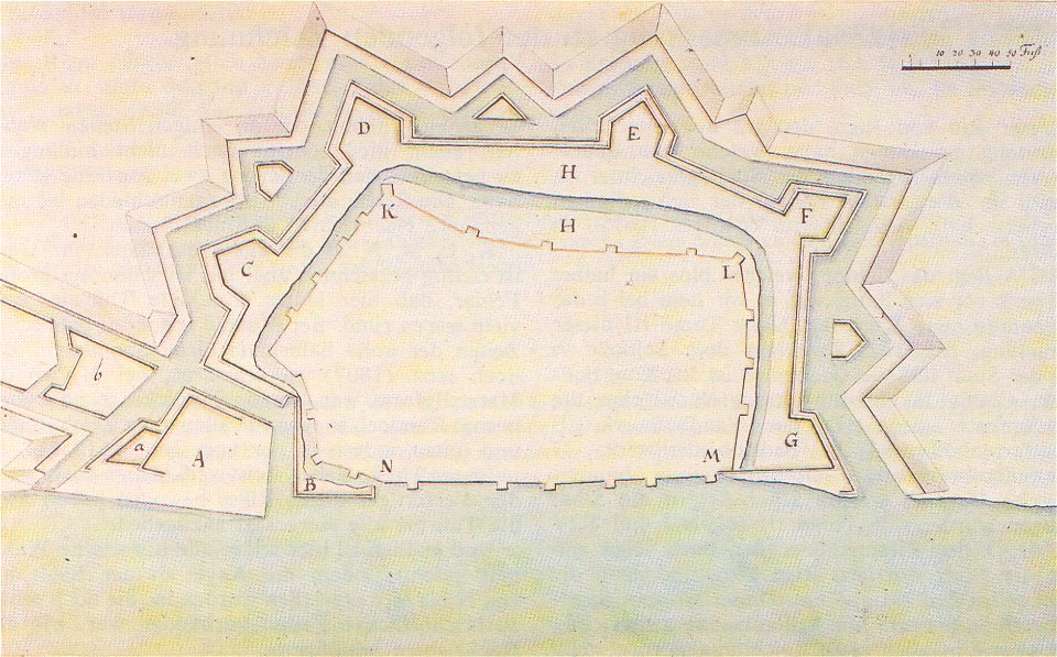
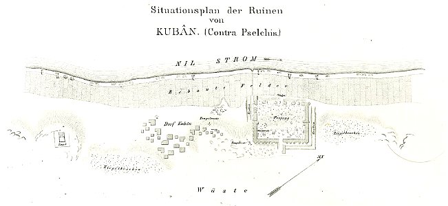
lepsius-projekt - fortifications
lepsius-projekt - maps
voyagie door italien
dalmatien
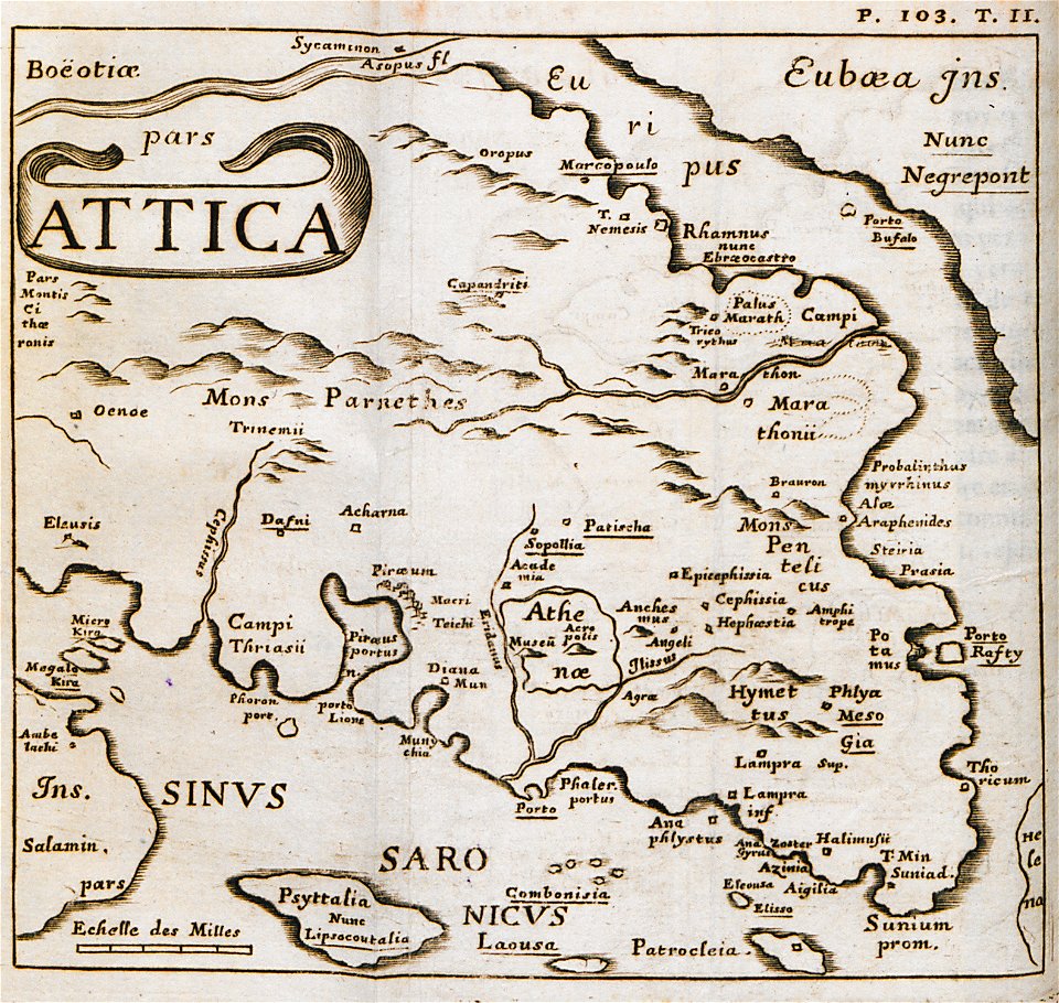
reisen und untersuchungen in griechenland (1826-1830)
old maps of livorno
walls of livorno
drawings in the museu antônio parreiras
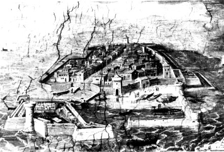
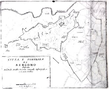
mura venete (bergamo)
old maps of bergamo
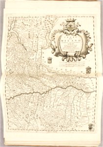
atlante veneto (raremaps.com) volume 2
18th-century maps of lombardy
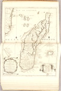
atlante veneto (raremaps.com) volume 2
17th-century maps of madagascar
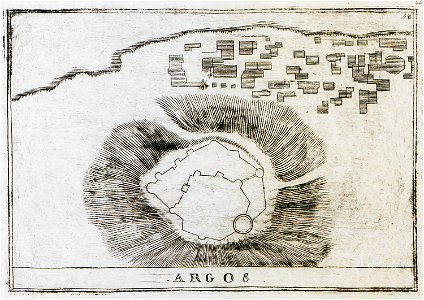
history of argos
argos castle
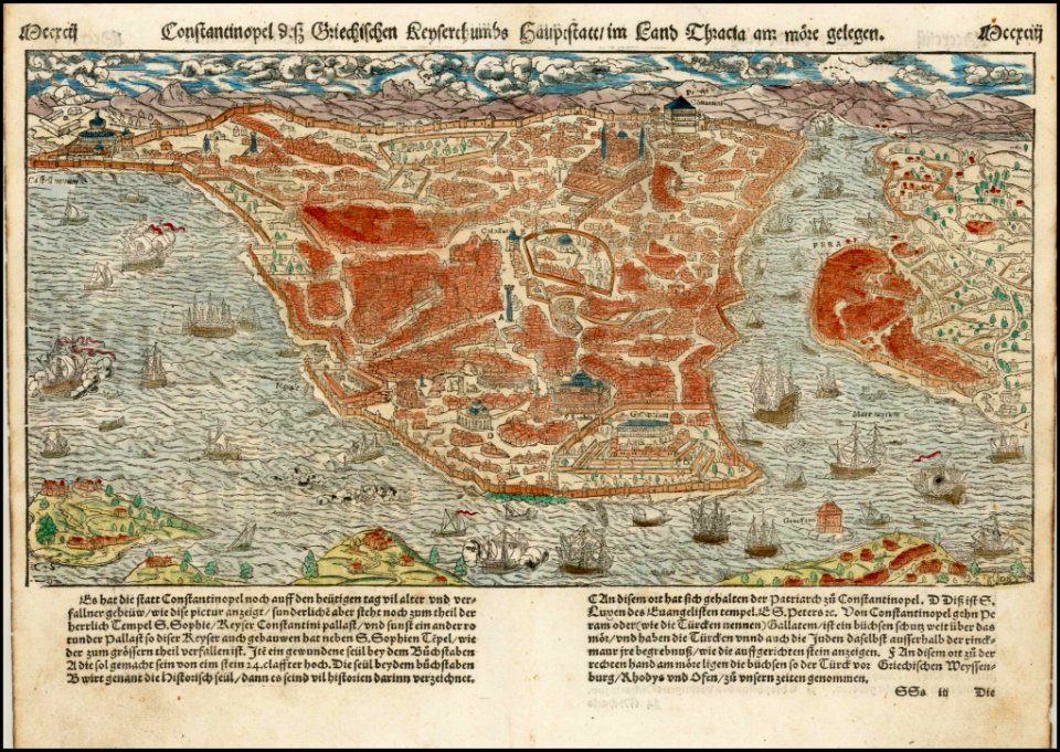
maps by sebastian münster
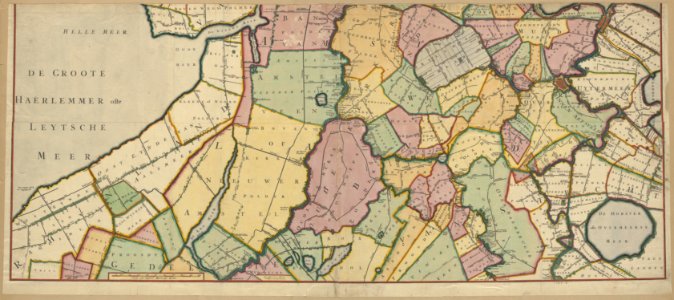
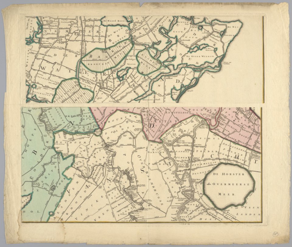
maps in the stadsarchief amsterdam
daniel stoopendaal
maps in the stadsarchief amsterdam
daniel stoopendaal
maps in the library of congress
ships on maps
rhaetiae et valesiae
merian helvetiae
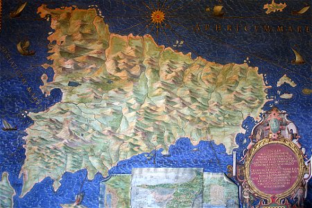
sicilia (galleria delle carte geografiche)
old maps of sicily
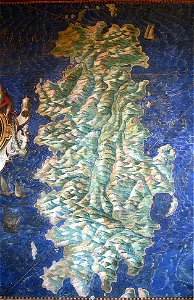
sardinia (galleria delle carte geografiche)
old maps of sardinia
charts and maps of the royal museums greenwich
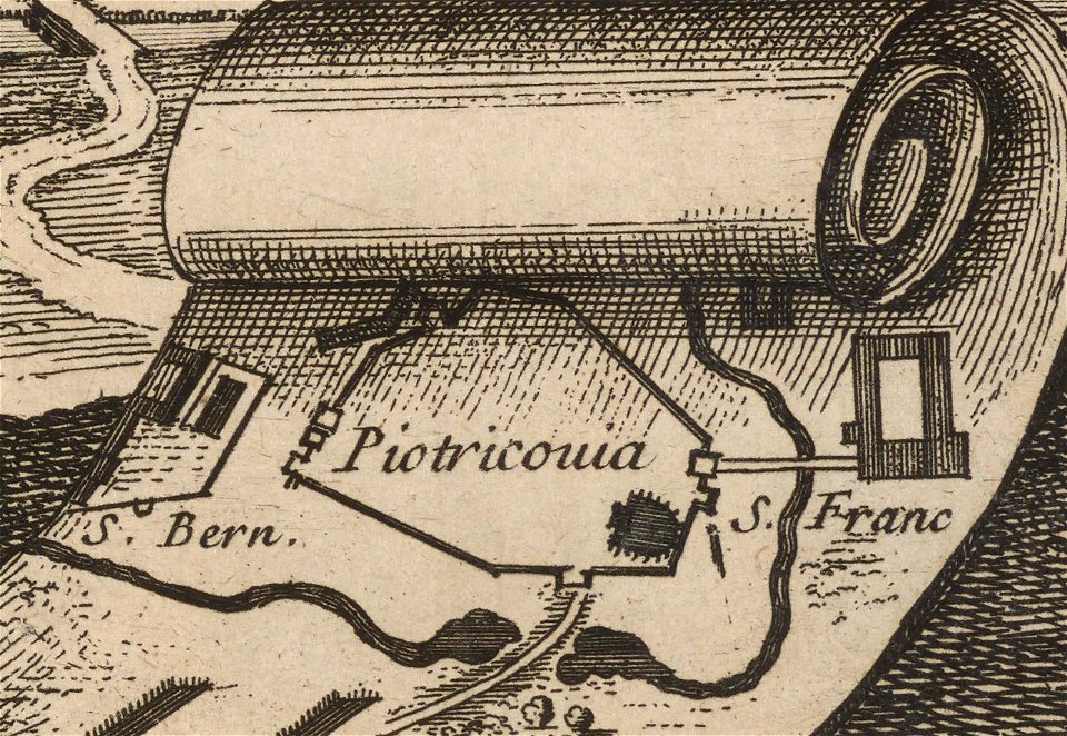
historical images of city walls of piotrków trybunalski
drawings of piotrków trybunalski
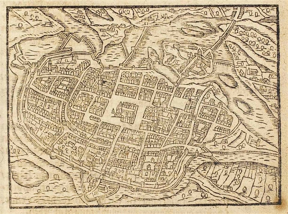
maps of the history of breslau (wrocław)
wrocław in the 16th century
paintings in the museu antônio parreiras
charts and maps of the royal museums greenwich
engravings by matthäus merian
historical maps of plzeň
popular science monthly illustrations/volume 11
astronomical maps
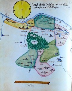
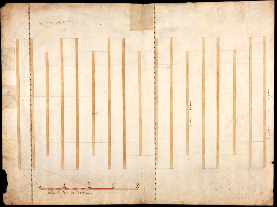
ämteratlas des fürstentums lüneburg von johannes mellinger
elbe in lower saxony
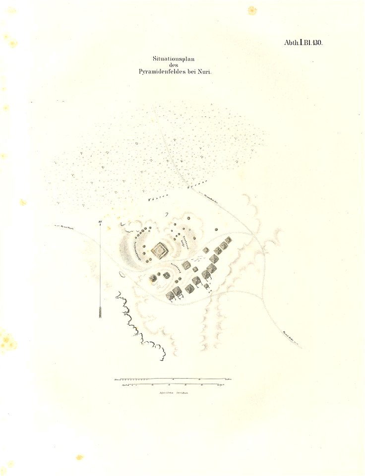
lepsius-projekt - pyramids
lepsius-projekt - maps
historical images of solothurn
old maps of switzerland
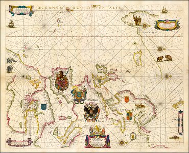
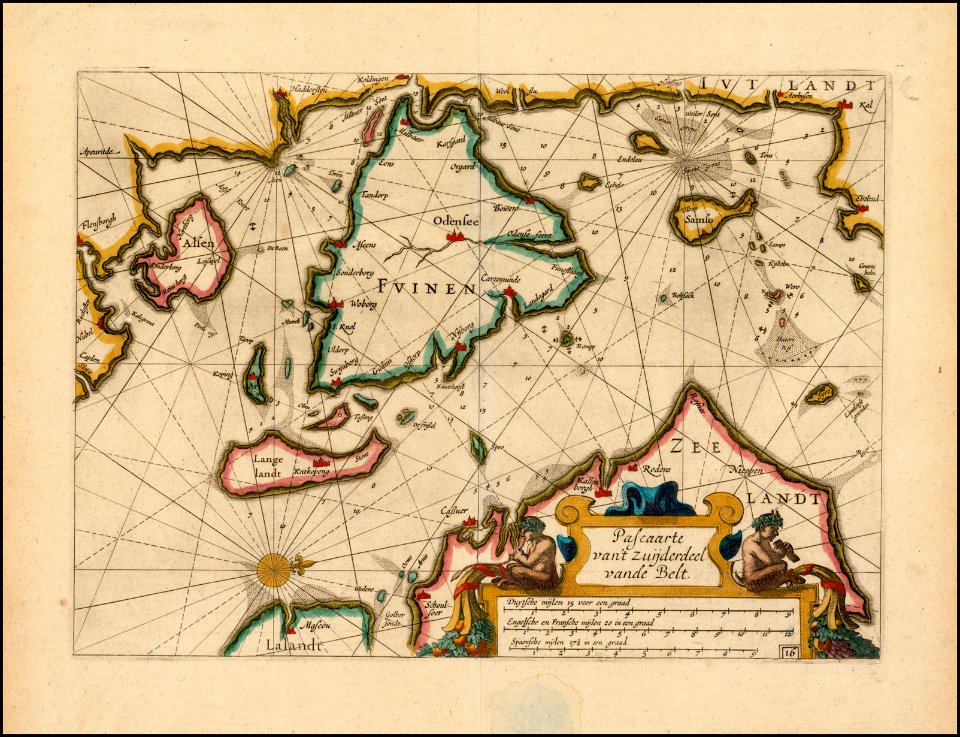
portolan charts by willem and johannes blaeu
old maps of scandinavia
andreas cellarius
maps of the dutch east india company - sri lanka
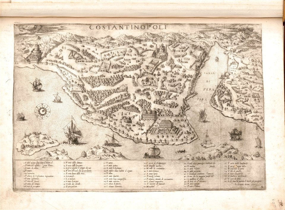
copper engravings in the universitätsbibliothek salzburg
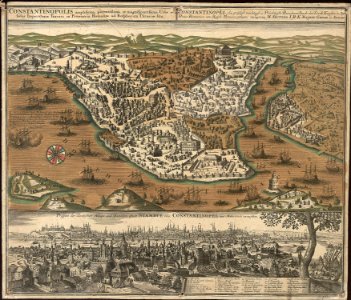
old maps of istanbul
old maps of islands of the aegean sea
bartolommeo dalli sonetti
old maps of islands of the aegean sea
bartolommeo dalli sonetti
old maps of islands of the aegean sea
bartolommeo dalli sonetti
maps by gerardus mercator
mercator celestial globe
maps in the stadsarchief amsterdam
daniel stoopendaal
maps in the stadsarchief amsterdam
daniel stoopendaal
maps in the stadsarchief amsterdam
daniel stoopendaal
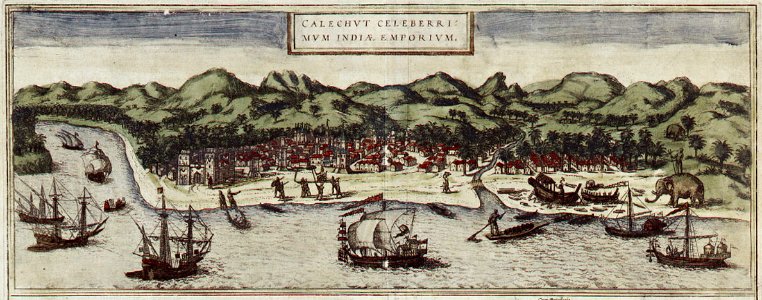
historical images of kozhikode
braun & hogenberg
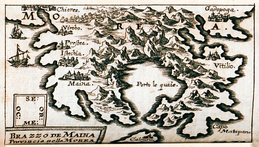
kurtze beschreibung von republick venedig
maps of mani
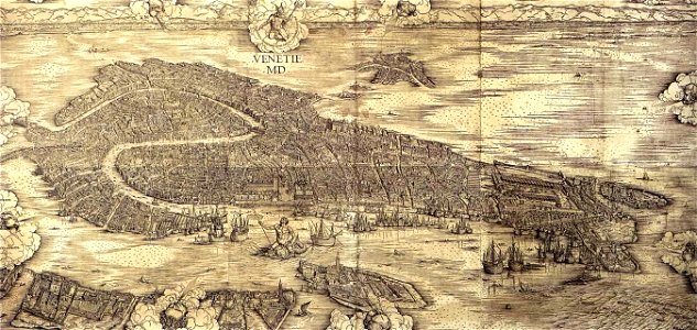
images of venice by jacopo de' barbari
maps in the museo correr
volume 7 of le tour du monde
maps of nimrud
maps of osaka prefecture
settsu province
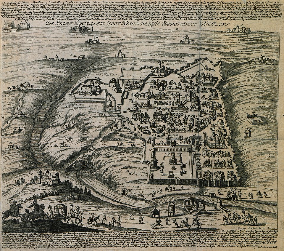
itinerarium hierosolymitanum et syriacum..., 1619
description des principales villes (1690)
old maps of jerusalem
rhaetiae et valesiae
merian helvetiae
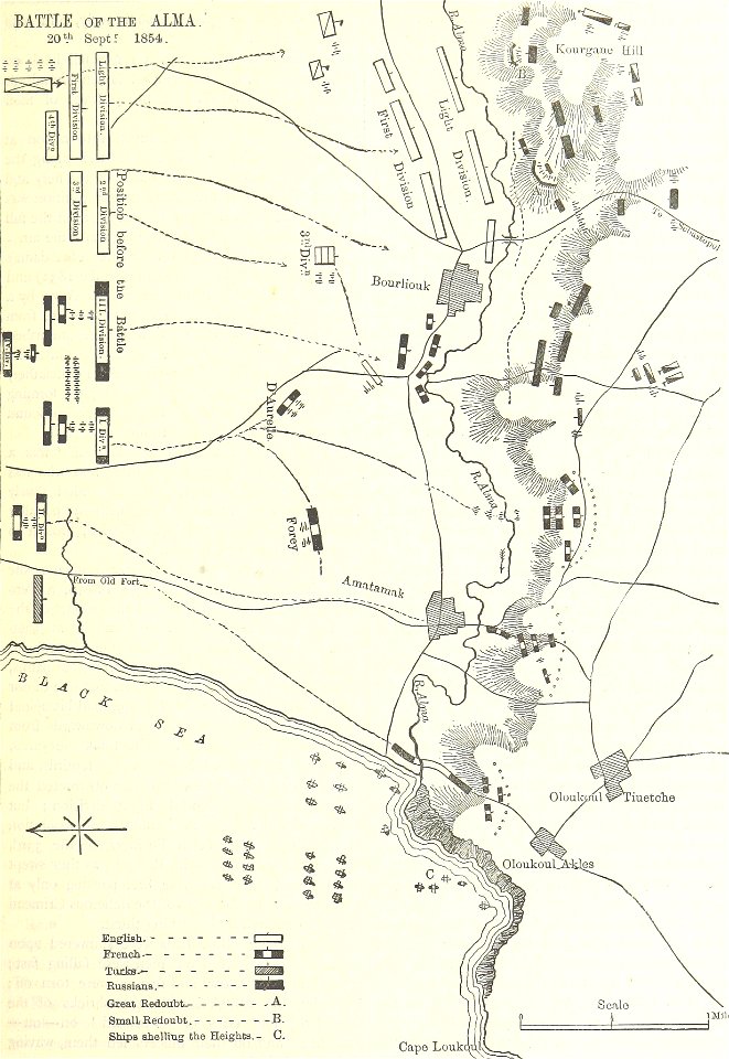
british battles on land and sea
battle of the alma
charte von schwaben (bohnenberger)
19th-century maps of bavaria
charte von schwaben (bohnenberger)
old maps of bas-rhin
charte von schwaben (bohnenberger)
19th-century maps of bavaria
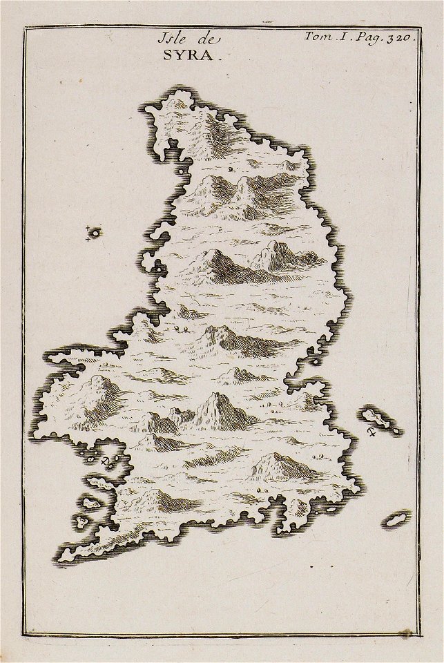
joseph pitton de tournefort
maps of syros
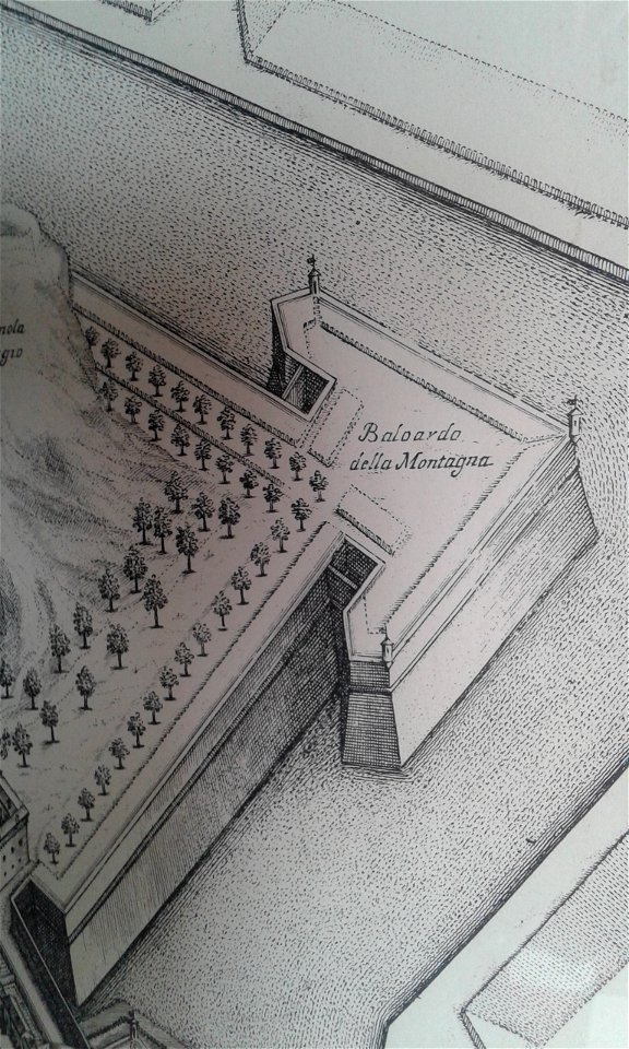
baluardo della montagna (ferrara)
map of ferrara by andrea bolzoni
8401 - 8500 of 38,713
Next page
/ 388