Log in
All resources
Create a design
38,713 Free Artworks of Map
müller's map of moravia
maps made in the 17th century
atlas van der hagen
maps with cartouches
gerard valck
maps by pieter schenk (i)
atlantis magni tomus tertius (biblioteca comunale di trento)
atlantis magni tomus quartus (biblioteca comunale di trento)
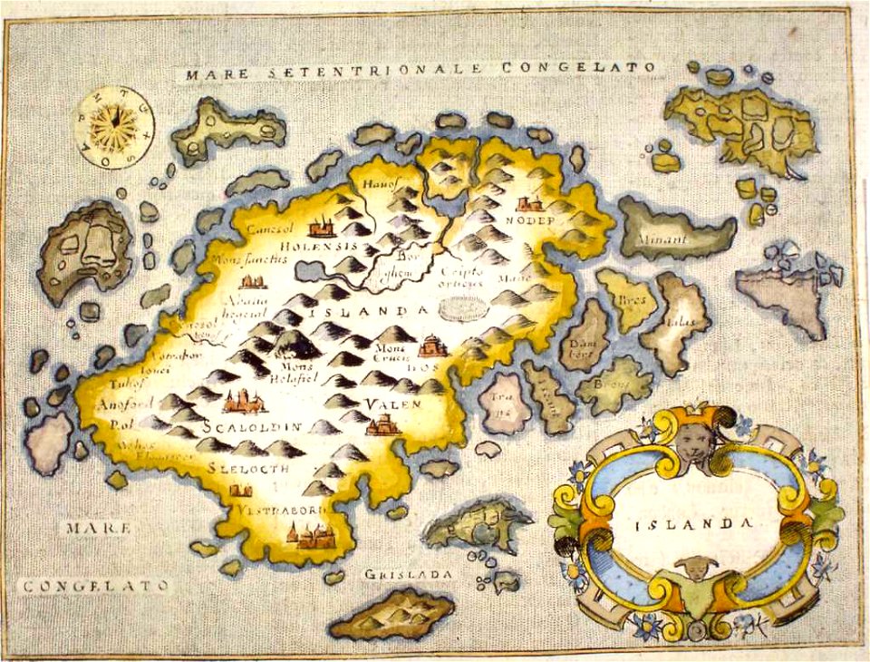
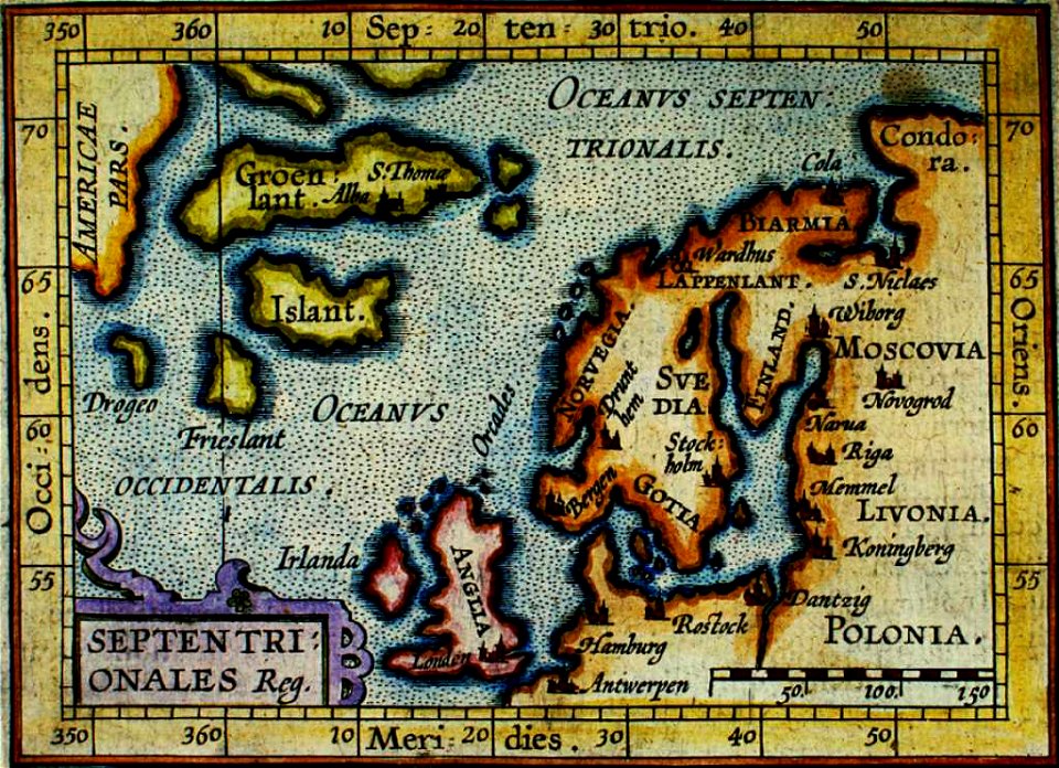
old maps of iceland
provided by landsbókasafn íslands
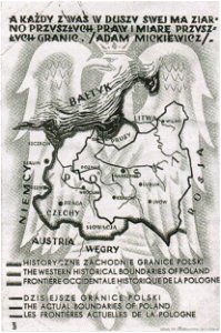
greater poland
map postcards
maps made in the 17th century
jan janssonius
charts and maps of the royal museums greenwich
1590 maps
maps made in the 17th century
gerard valck
gerard valck
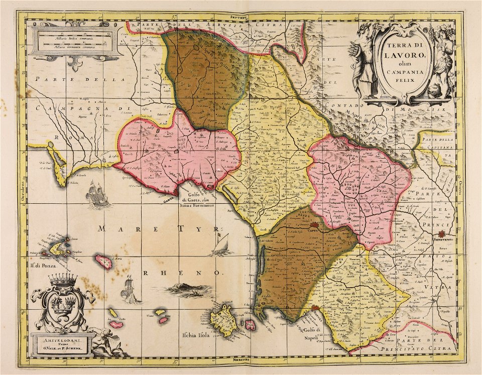
campania
maps made in the 17th century
frederick de wit
maps made in the 17th century
gerard valck
atlantis magni tomus tertius (biblioteca comunale di trento)
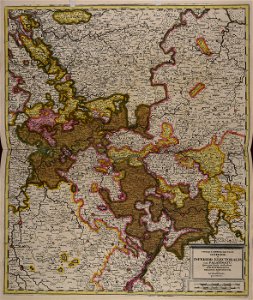
maps of territories in the electoral rhenish circle
maps made in the 18th century
johann baptist homann
maps with cartouches
atlas van der hagen
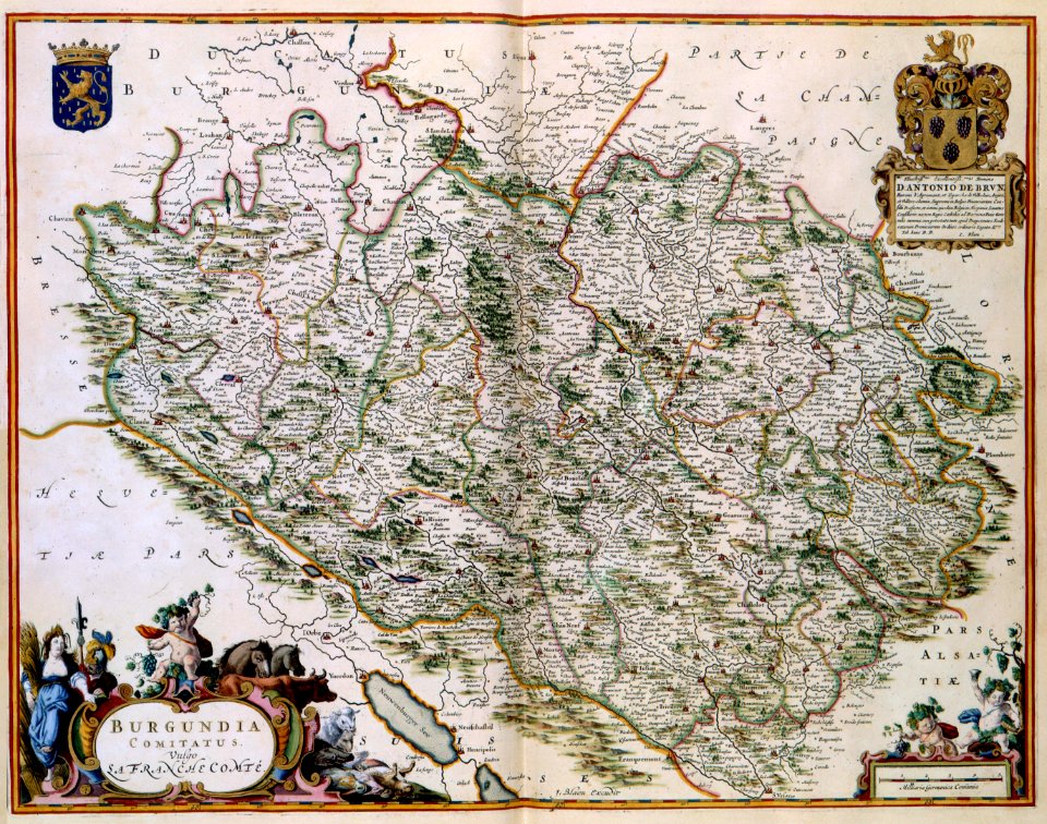
17th-century maps of france
maps with cartouches
maps with cartouches
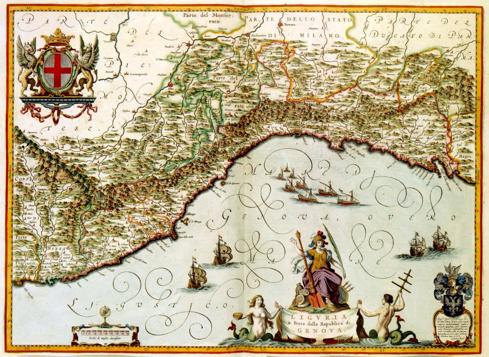
old maps of genoa
old maps of amsterdam
maps with cartouches
17th-century maps of china
maps with cartouches
maps by willem and johannes blaeu
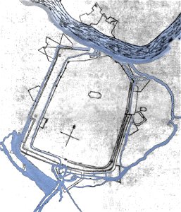
circumvallation
prints in the royal collection of the united kingdom
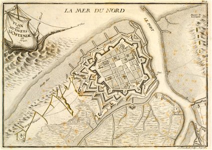
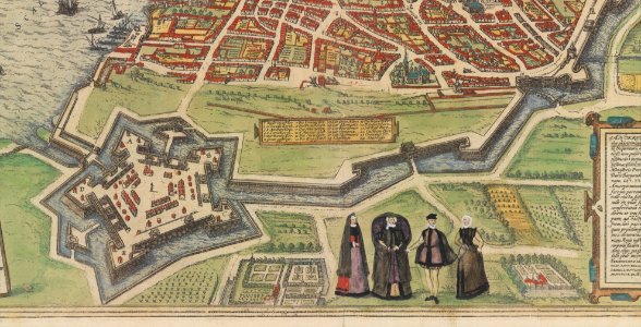
history of ostend
history of fashion in paris
paris in the 17th century
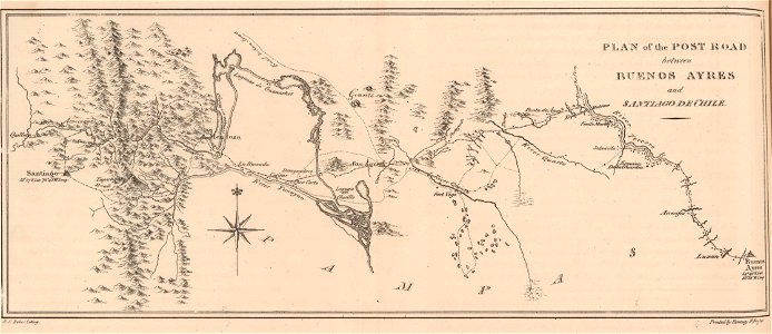
19th-century maps of argentina
1820s lithographs
maps made in the 18th century
johann baptist homann
cornell university library
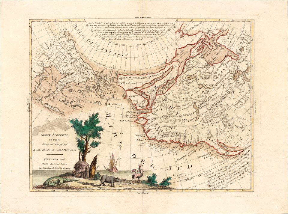
north pacific
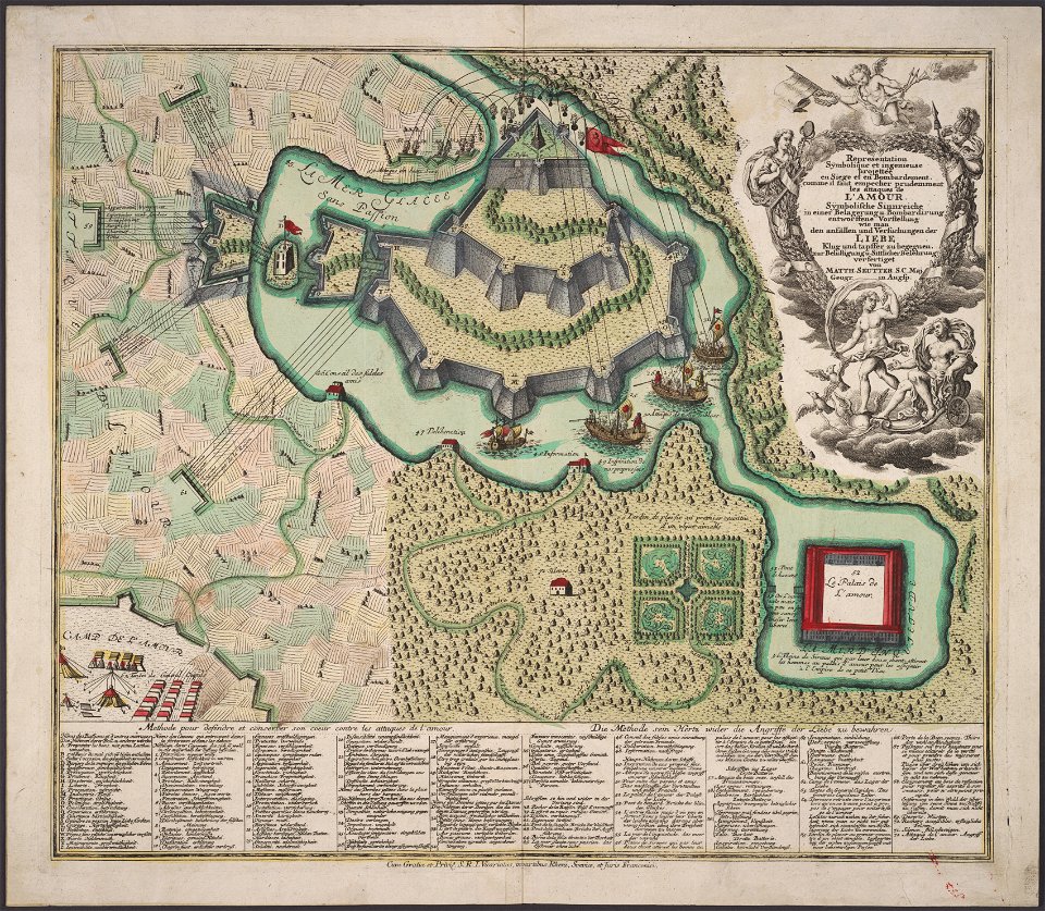
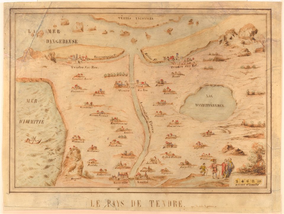
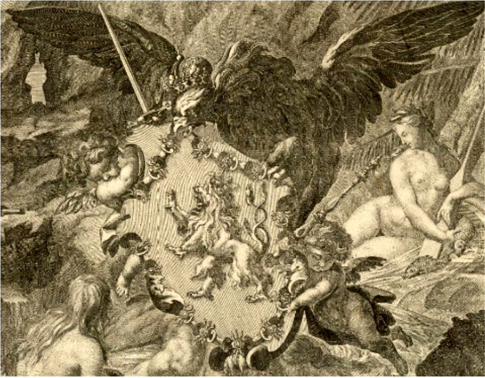
allegory
love
maps with cartouches
atlas van der hagen
maps with cartouches
atlas van der hagen
maps with cartouches
atlas van der hagen
atlas van der hagen
old maps of france
jan huygen van linschoten
1596 maps
history of fashion in paris
paris in the 17th century
maps made in the 17th century
gerard valck
maps from the mechanical curator collection
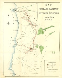
saltpeter works of chile
maps made in the 17th century
gerard valck
cornell: persuasive cartography: the pj mode collection
cornell university library
atlantis magni tomus primus (biblioteca comunale di trento)
maps made in the 17th century
fonds ancely - bibliothèque municipale de toulouse - maps
joseph-bernard abadie
maps made in the 17th century
gerard valck
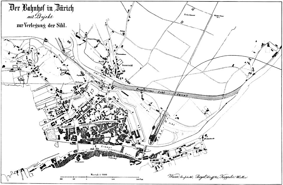
history of rail transport in switzerland
aussersihl
prints from bonne atlas de toutes les parties at the peace palace library
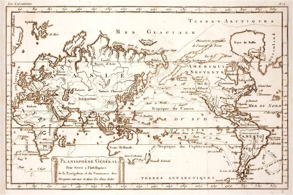
world map
cornell: persuasive cartography: the pj mode collection
cornell university library
maps made in the 17th century
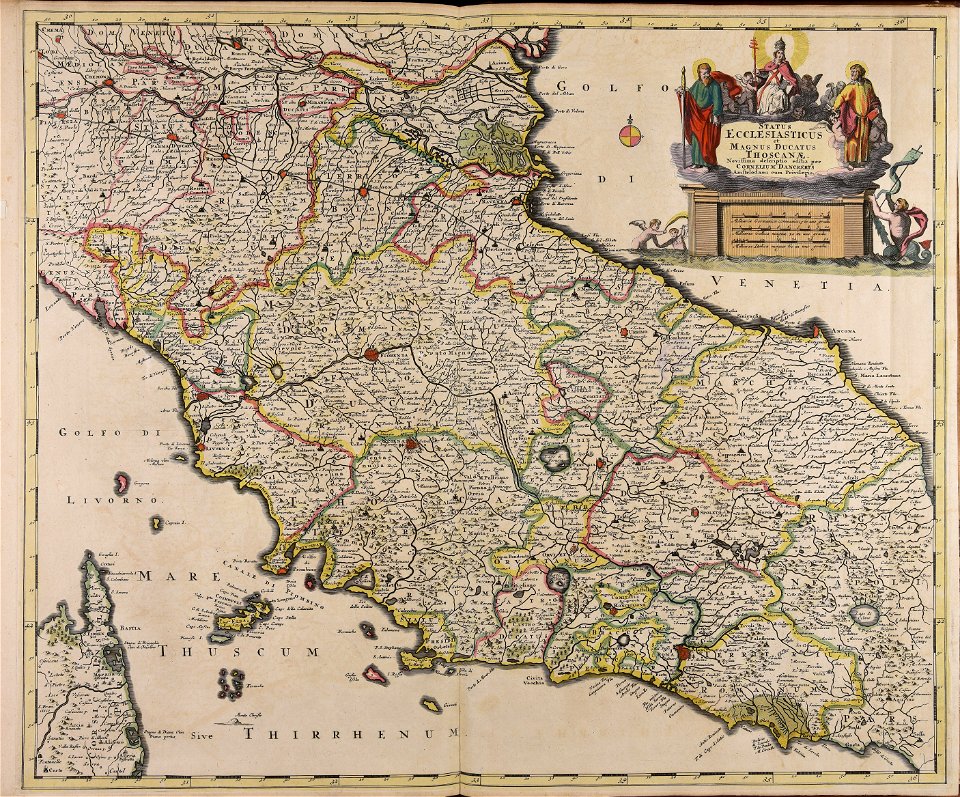
old maps of italy
thomas salmon (historian)
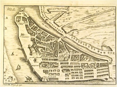
old maps of india
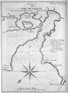
old maps of valdivia
frézier's travel
paintings in the museu antônio parreiras
nürburgring circuit maps
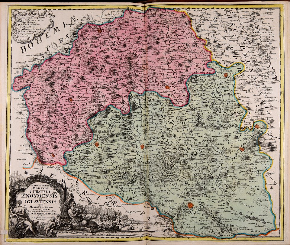
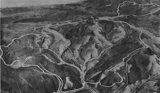
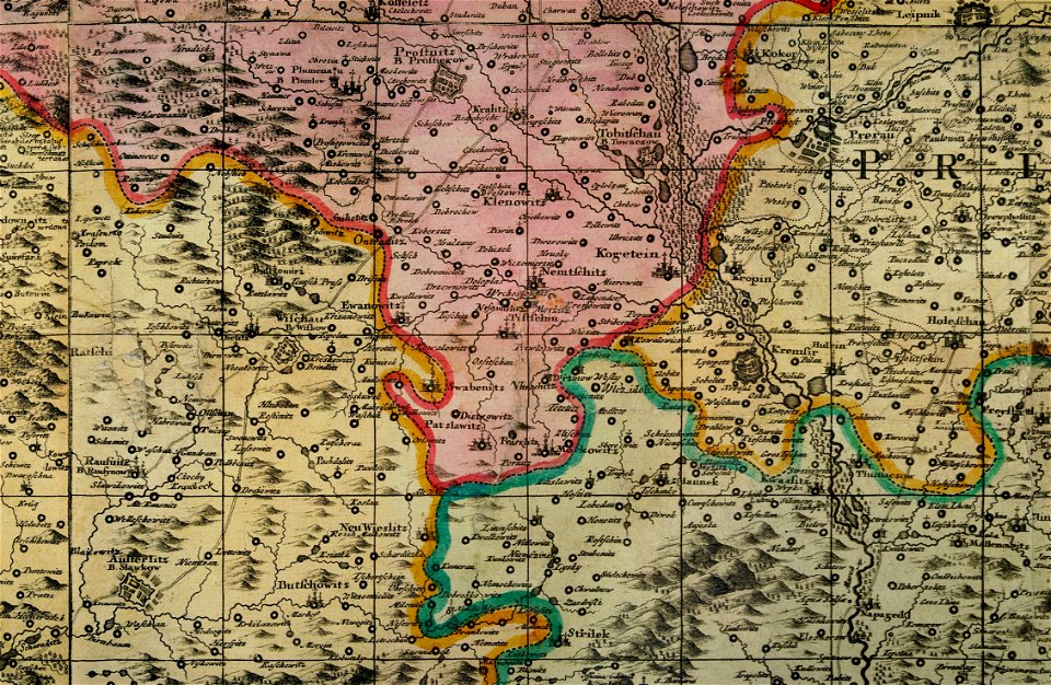
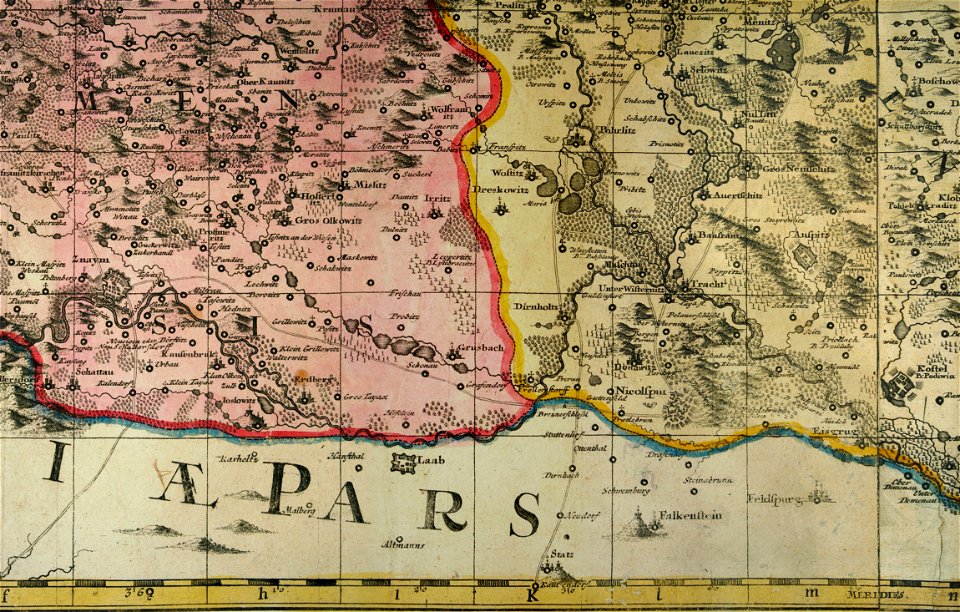
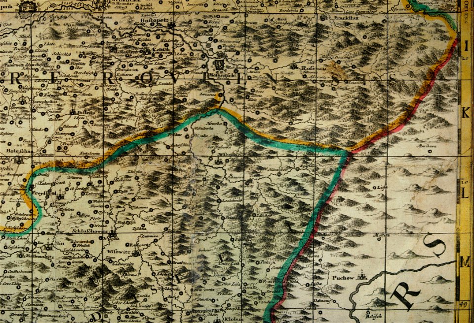
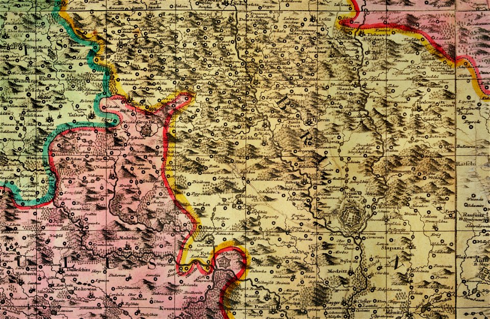
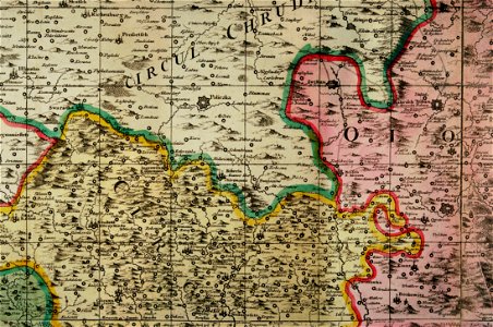
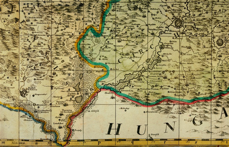
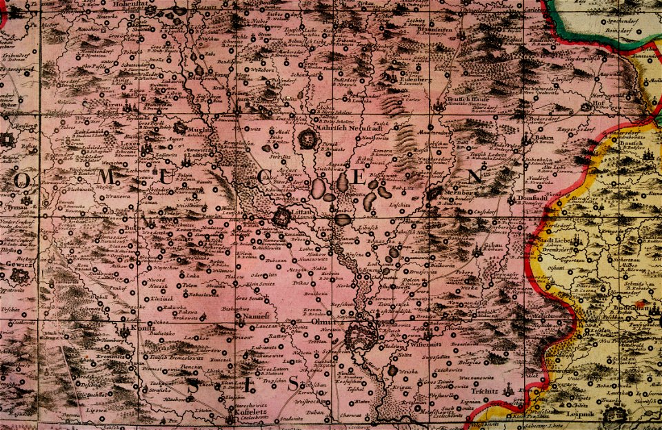
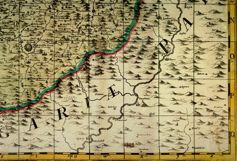
müller's map of moravia
müller's map of moravia
müller's map of moravia
müller's map of moravia
müller's map of moravia
müller's map of moravia
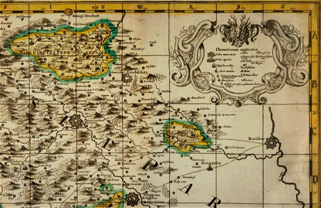
müller's map of bohemia
müller's map of moravia
paintings in the museu antônio parreiras
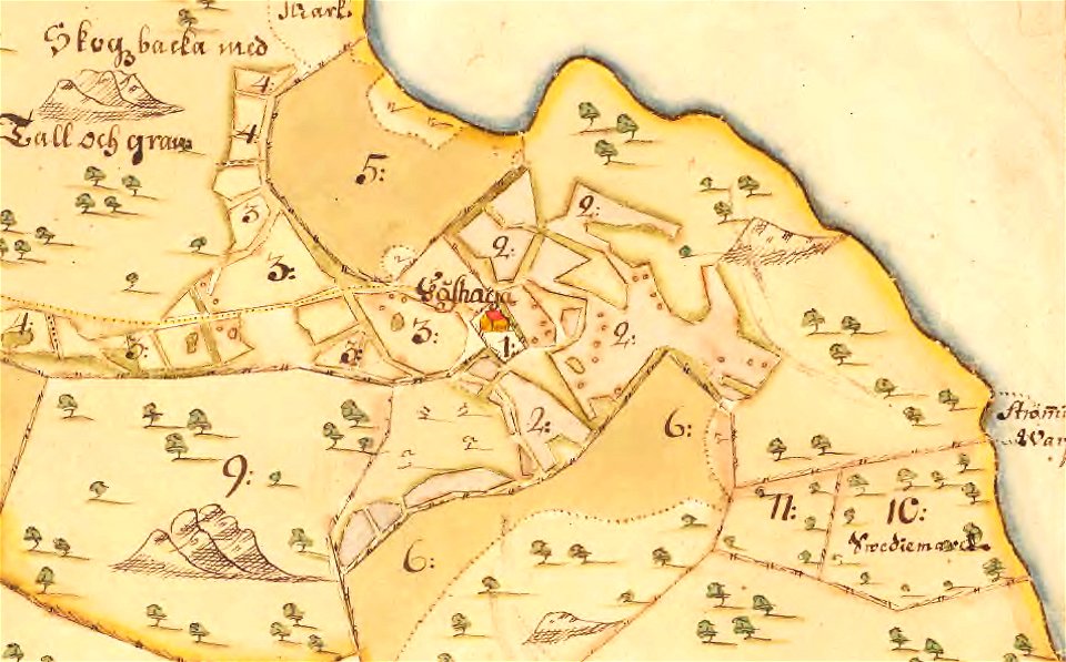
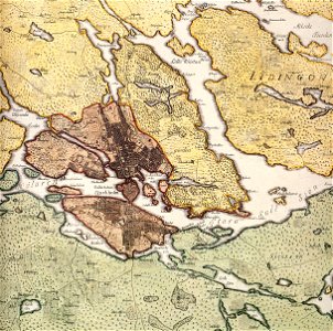
maps of lidingö
gåshaga gård
paintings in the museu antônio parreiras
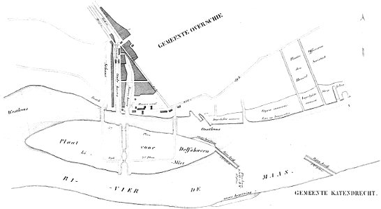
maps of delfshaven
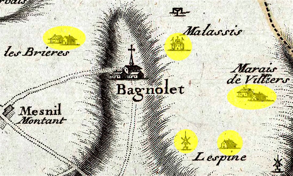
maps of bagnolet
old map of stockholm 1642
södermalm
provided by landsbókasafn íslands
old maps of iceland
provided by landsbókasafn íslands
old maps of iceland
map of gouda by jacob van deventer
old maps of stockholm by georg biurman
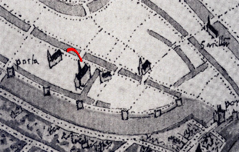
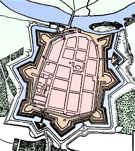
stadtbefestigung rinteln
maps of rinteln
provided by landsbókasafn íslands
old maps of iceland
provided by landsbókasafn íslands
old maps of iceland
flandria illustrata
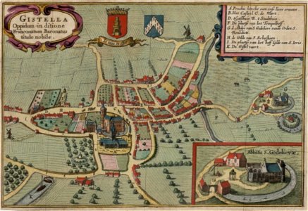
old maps of gistel
drawings in the museu antônio parreiras
history of vilnius
maps of vilnius
maps by matthäus seutter
sticklinge gård
maps of lidingö
16th-century maps of the world
provided by landsbókasafn íslands
old maps of iceland
maps by martin waldseemüller
1665
braun & hogenberg
maps of rome
maps of bagnolet
flandria illustrata
old maps of gistel
description de l'universe
illustrations of cosmographia (münster)
old map
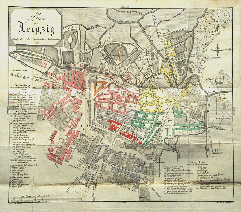
leipzig in the 1820s
old maps of leipzig
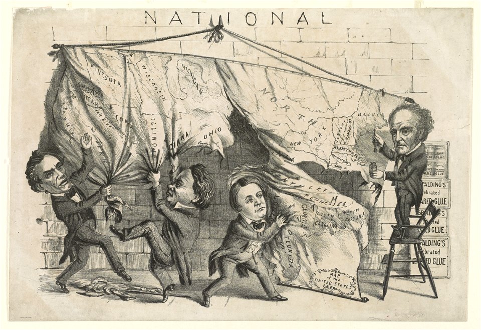
cartoons of the united states
drawings in the museu antônio parreiras
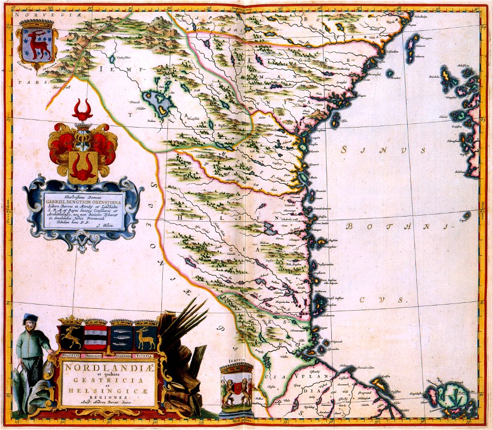
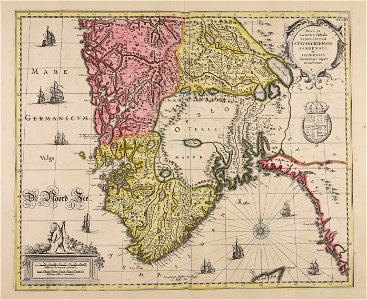
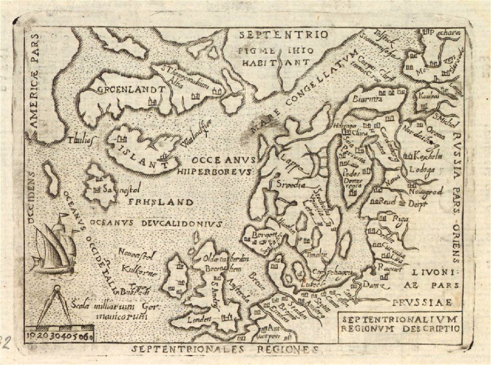
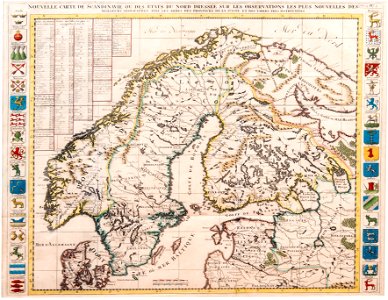
old maps of scandinavia
müller's map of moravia
müller's map of moravia
müller's map of moravia
müller's map of moravia
müller's map of moravia
müller's map of bohemia
václav vavřinec reiner
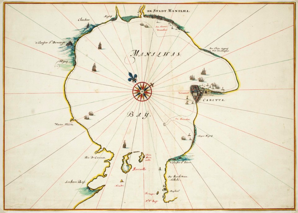
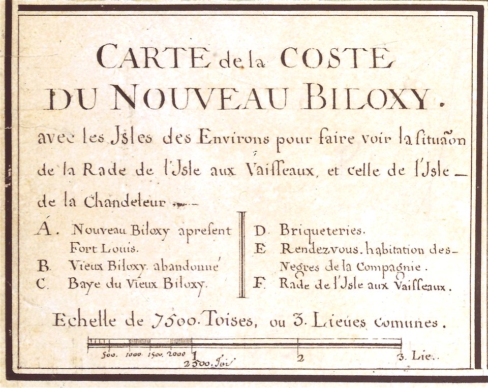
mississippi
biloxi
17th-century maps of stockholm
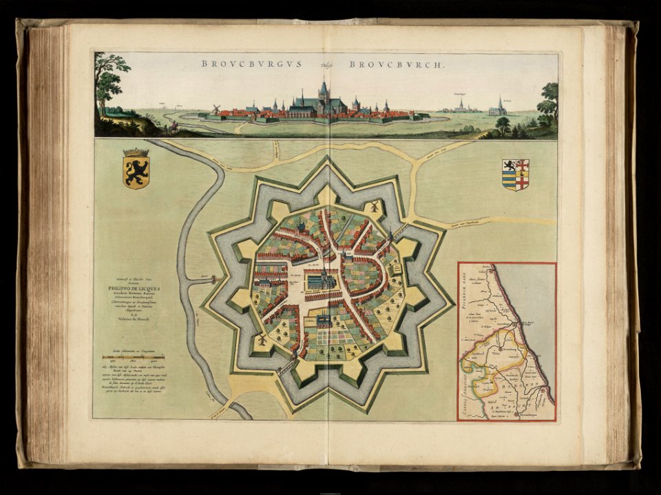
old maps of bourbourg
flandria illustrata
potala palace
maps of tibet
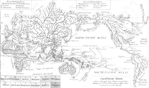
evolution of life (1873)
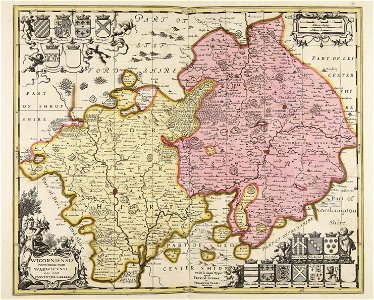
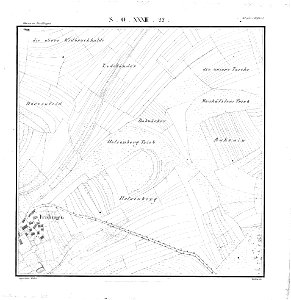
maps of württemberg
langenenslingen
stadtbefestigung rinteln
maps of rinteln
artworks with known accession number
artworks without wikidata item
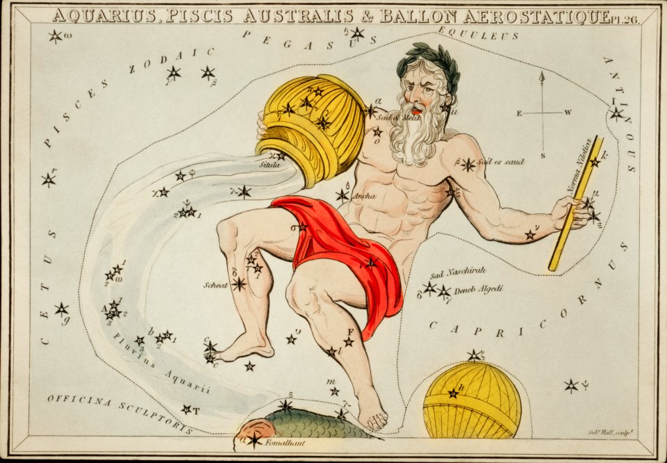
balloon
maps
old maps of salzburg (state)
johann baptist homann
maps made in the 18th century
johann baptist homann
atlantis magni tomus secundus (biblioteca comunale di trento)
maps made in the 17th century
maps of antwerp city walls
old maps of antwerp
6701 - 6800 of 38,713
Next page
/ 388