Log in
All resources
Create a design
38,713 Free Artworks of Map
maps in the library of congress
pennsylvania
west virginia
atlante veneto (raremaps.com) volume 2
o. h. bailey
maps made in the 17th century
maps by pieter schenk (i)
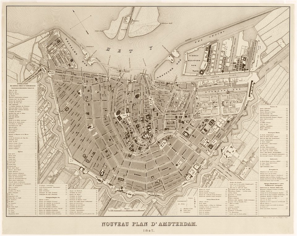
maps in the stadsarchief amsterdam
old maps of amsterdam
published by frans buffa & zonen
west virginia
cairo
description des principales villes (1690)
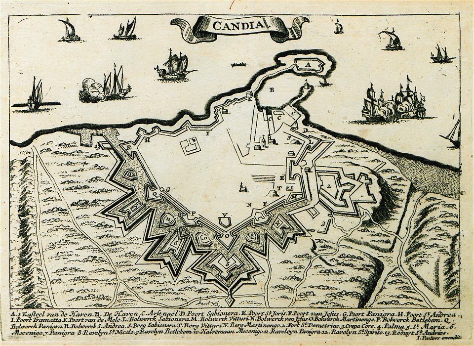
old maps of crete
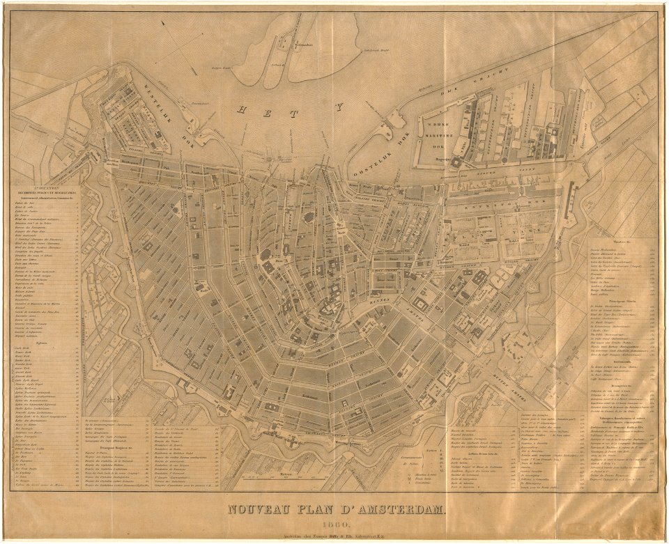
maps in the stadsarchief amsterdam
old maps of amsterdam
maps in the stadsarchief amsterdam
old maps of amsterdam
maps in the stadsarchief amsterdam
old maps of amsterdam
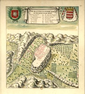
maps of les baux-de-provence
louis boudan
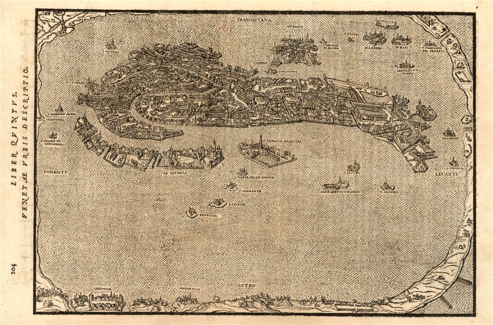
atlante veneto (raremaps.com) volume 2
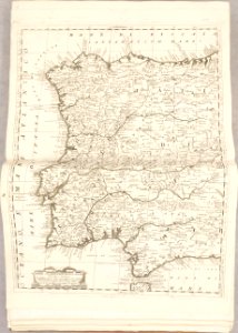
old maps of portugal
atlante veneto (raremaps.com) volume 2
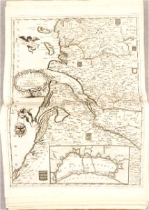
old maps of france
atlante veneto (raremaps.com) volume 2
old maps of louisiana
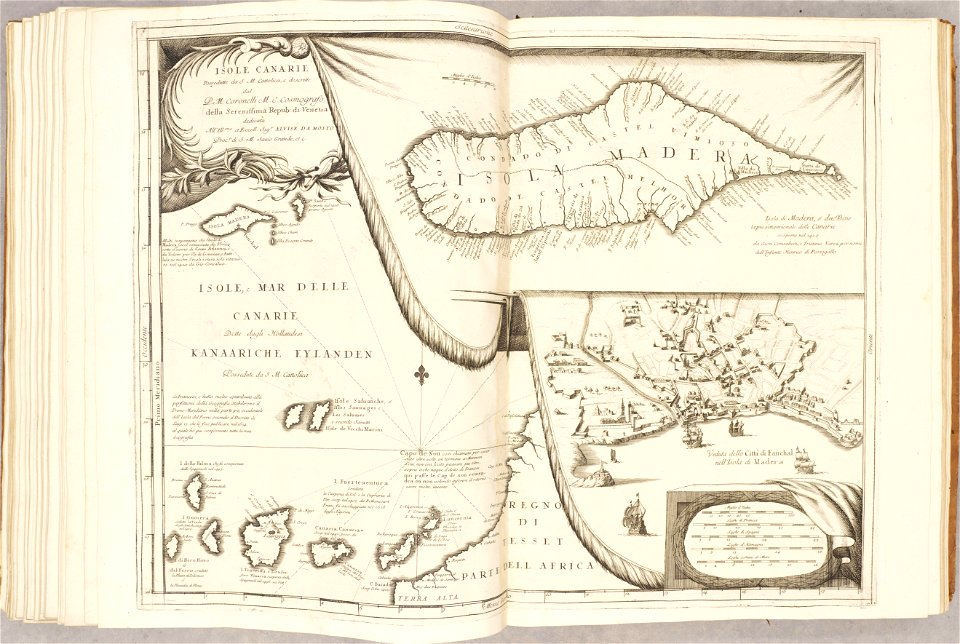
atlante veneto (raremaps.com) volume 2
canary islands
old maps of japan
old maps of korea
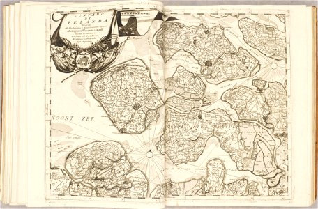
1690s maps of the netherlands
old maps of zeeland
atlante veneto (raremaps.com) volume 2
old maps of poland
pictorial maps
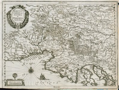
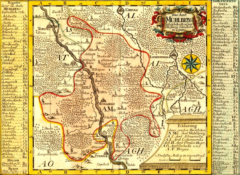
thüringiae
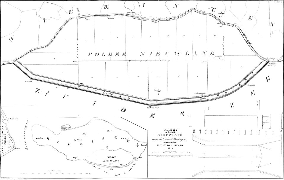
maps of polders in north holland
bouwkundige bijdragen
maps in the library of congress
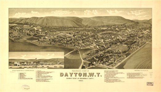
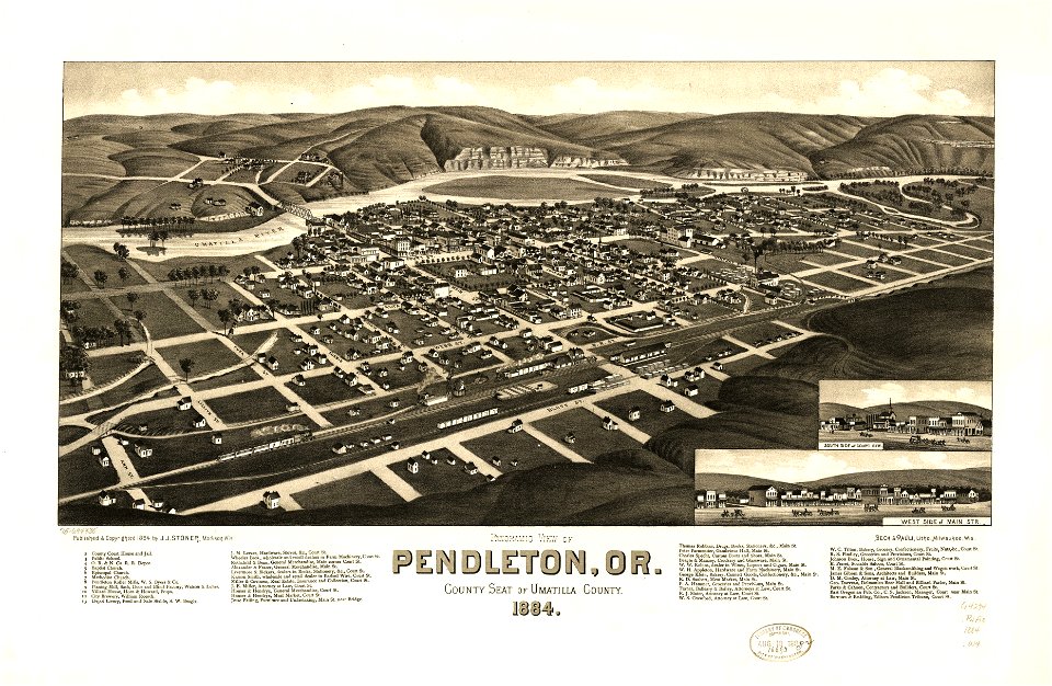
1884 maps
maps in the library of congress
1884 maps
maps in the library of congress
1884 maps of oregon
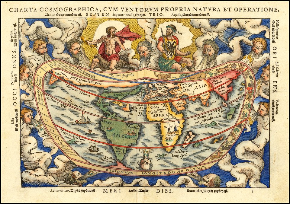
cosmographia claudii ptolomaei alexandrini
latin-language maps
maps by willem and johannes blaeu
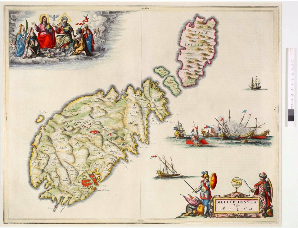
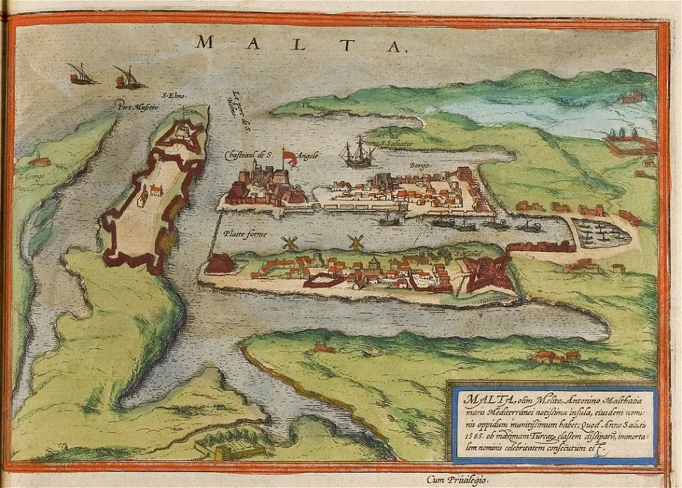
old maps of malta
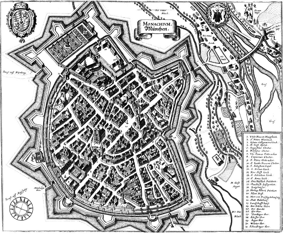
engravings by matthäus merian
engraved maps
charts and maps of the royal museums greenwich
1572 maps
charte von schwaben (bohnenberger)
old maps of the danube
collections of staatsbibliothek bamberg
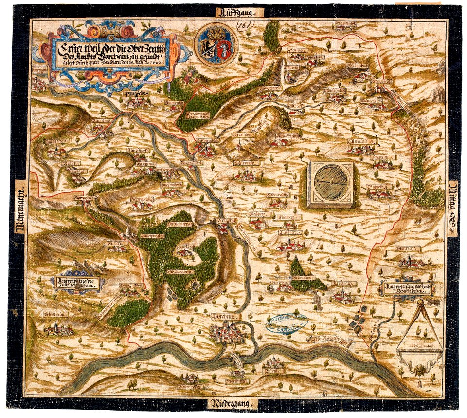
1602 maps
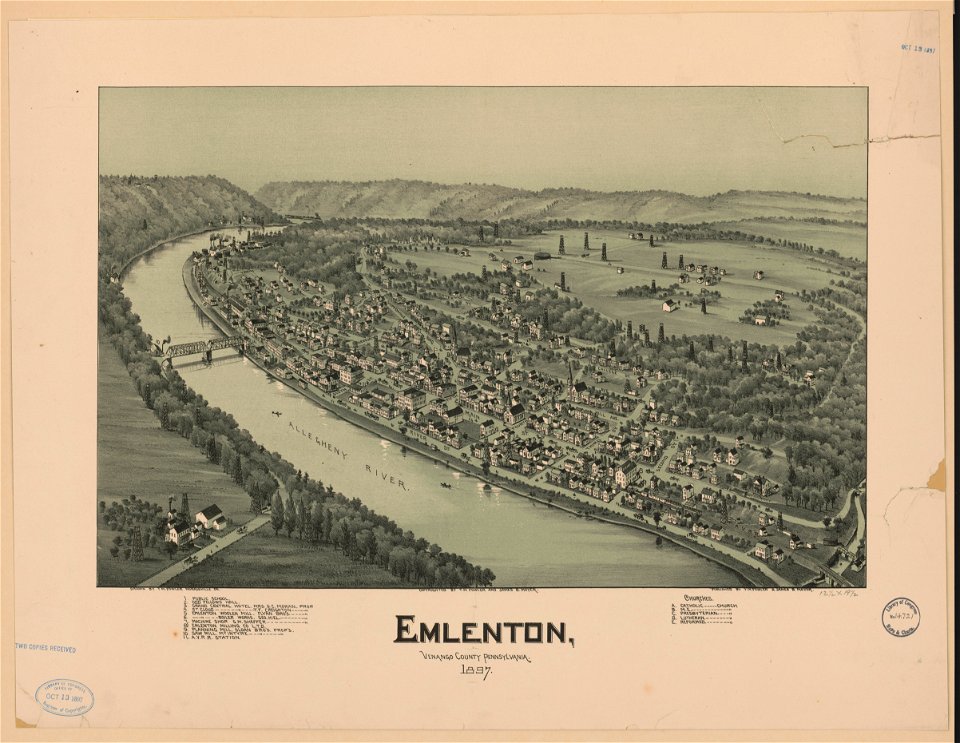
bird's eye view maps of pennsylvania
pennsylvania
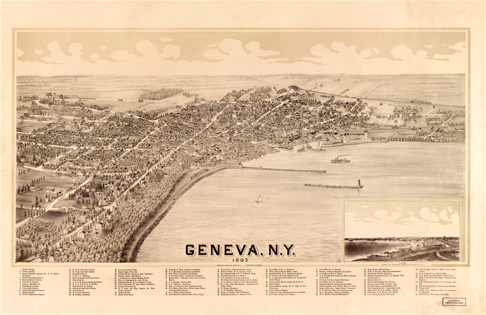
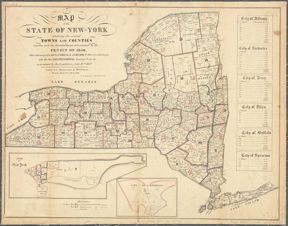
new york
geneva
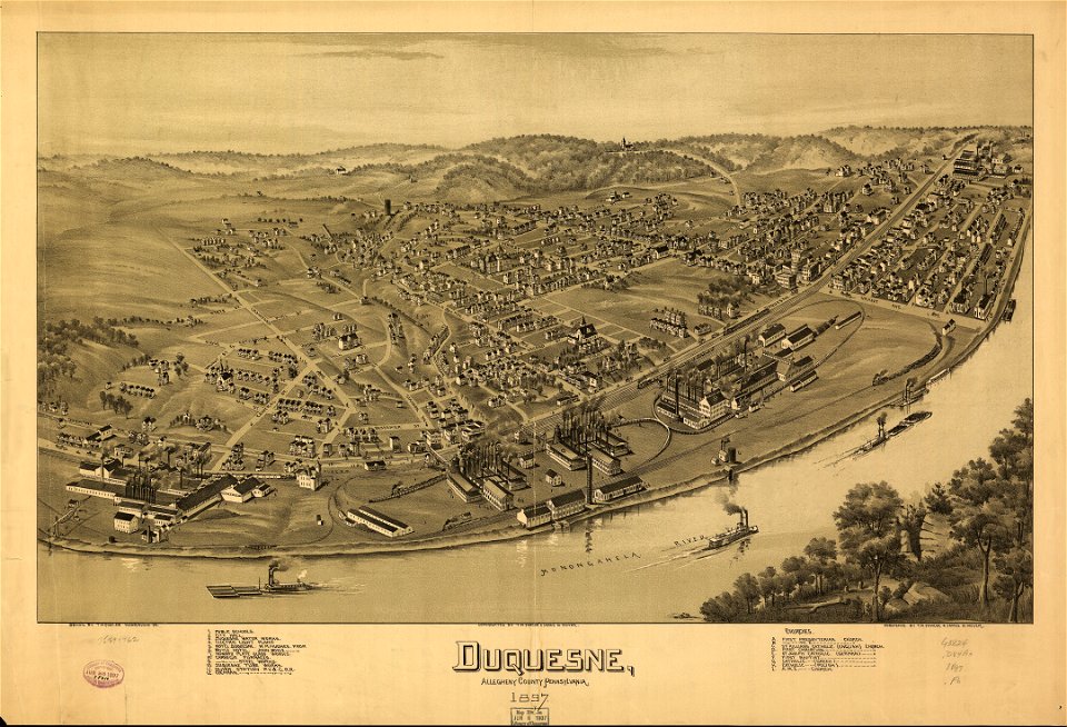
pennsylvania
duquesne
details of 1830 vienna map series by carl graf vasquez
fahnenstangenwasser
details of 1830 vienna map series by carl graf vasquez
stuwerviertel
maps in the library of congress
pennsylvania
waldseemüller map
age of discovery
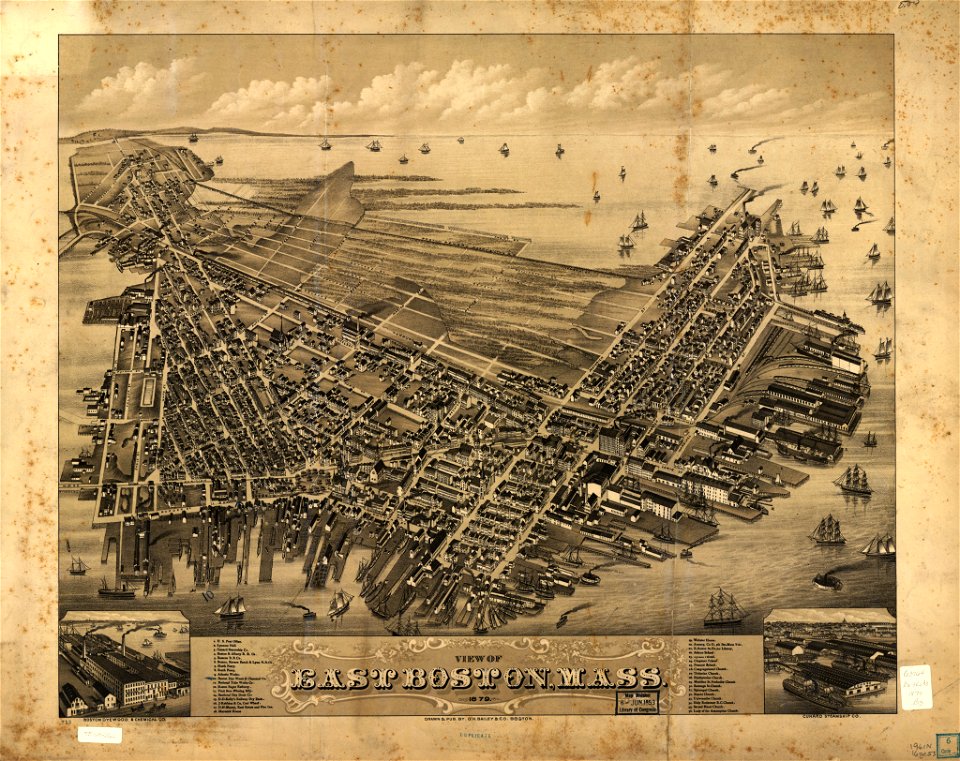
massachusetts
palmer
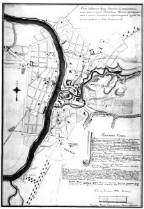
maps in russian state archives of ancient documents
historical images of viciebsk
engravings by matthäus merian
1649 maps
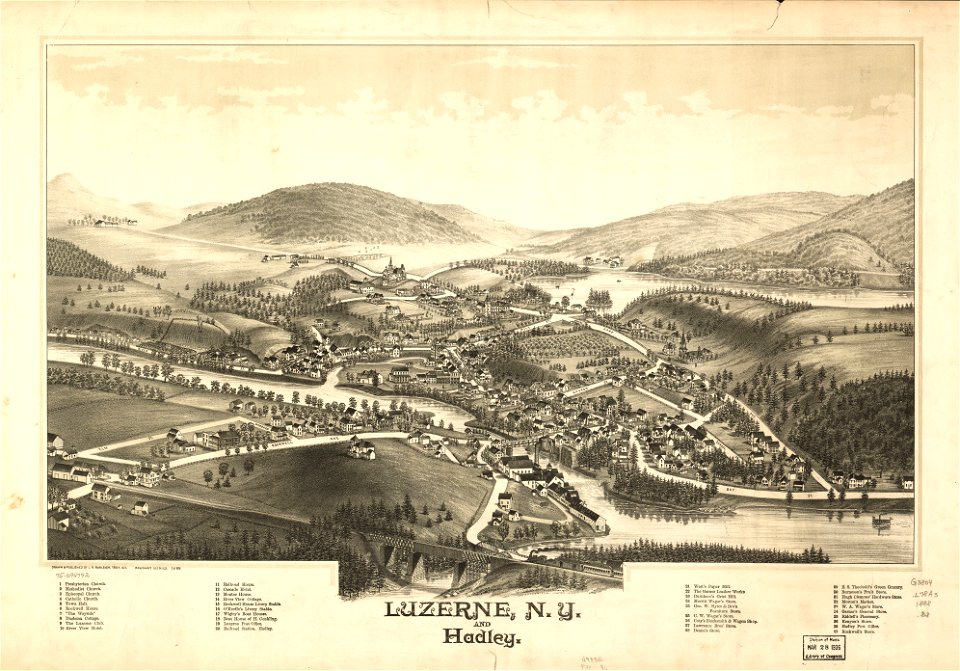
new york
hadley
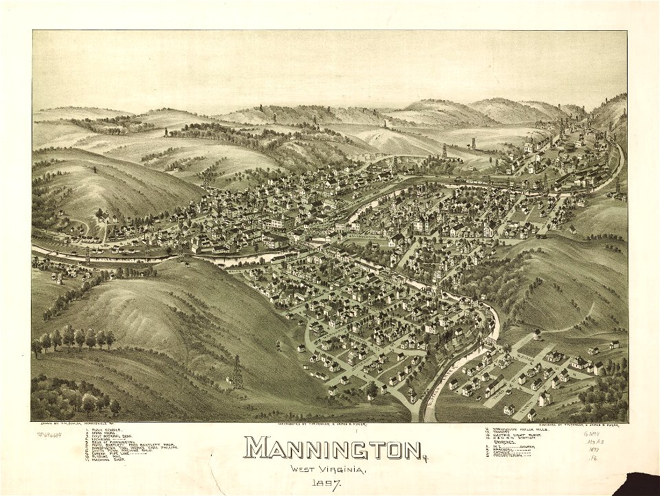
west virginia
morgantown
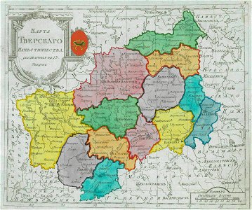
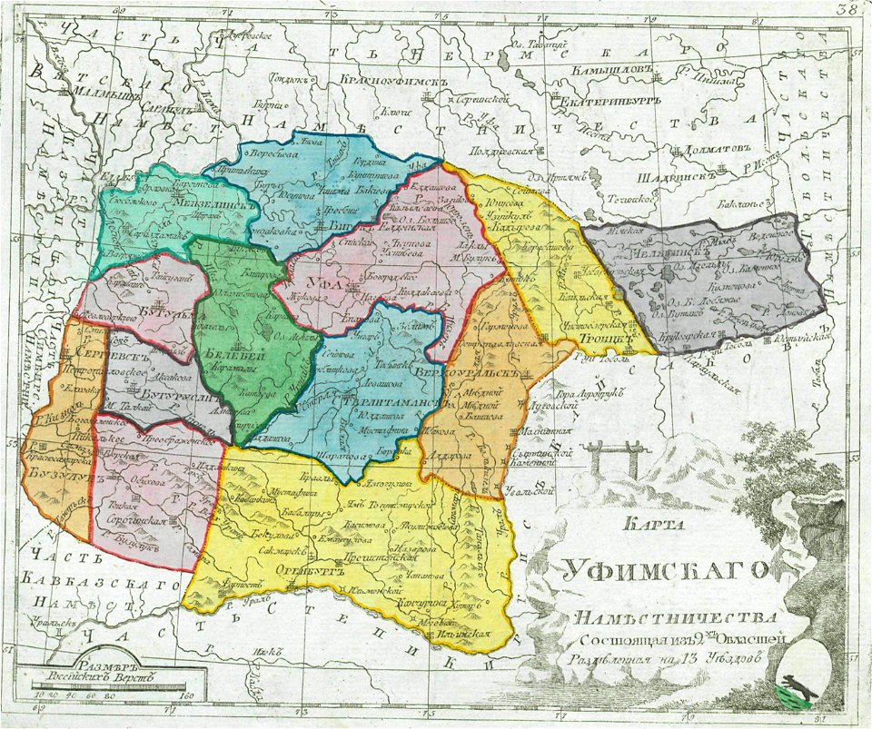
small atlas of the russian empire (1792)
maps of vologda governorate
old maps of governorates of the russian empire
small atlas of the russian empire (1792)
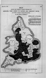
maps in london labour and the london poor (1851)
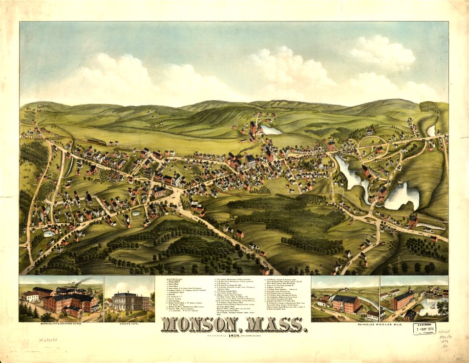
massachusetts
monson
maps in the library of congress
west virginia
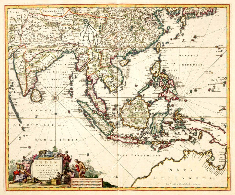
maps of the dutch east india company - india
1680s
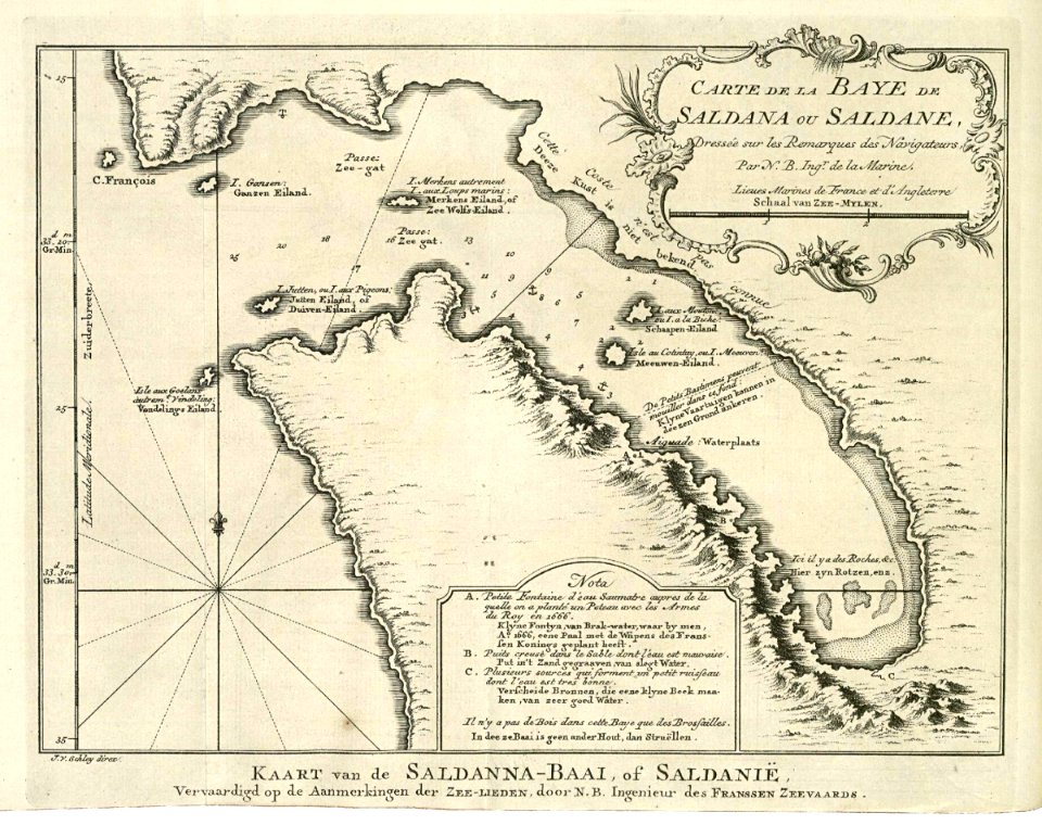
saldanha bay
1747)
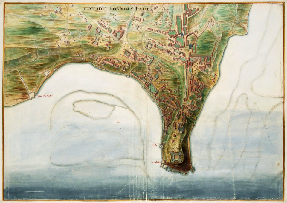
maps of the west-indische compagnie
1746
maps of the west-indische compagnie
1772
trịnh lords
1732
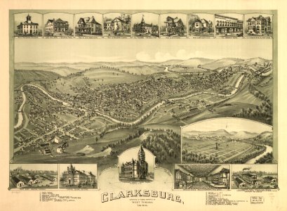
west virginia
clarksburg
old maps of islands of the aegean sea
bartolommeo dalli sonetti
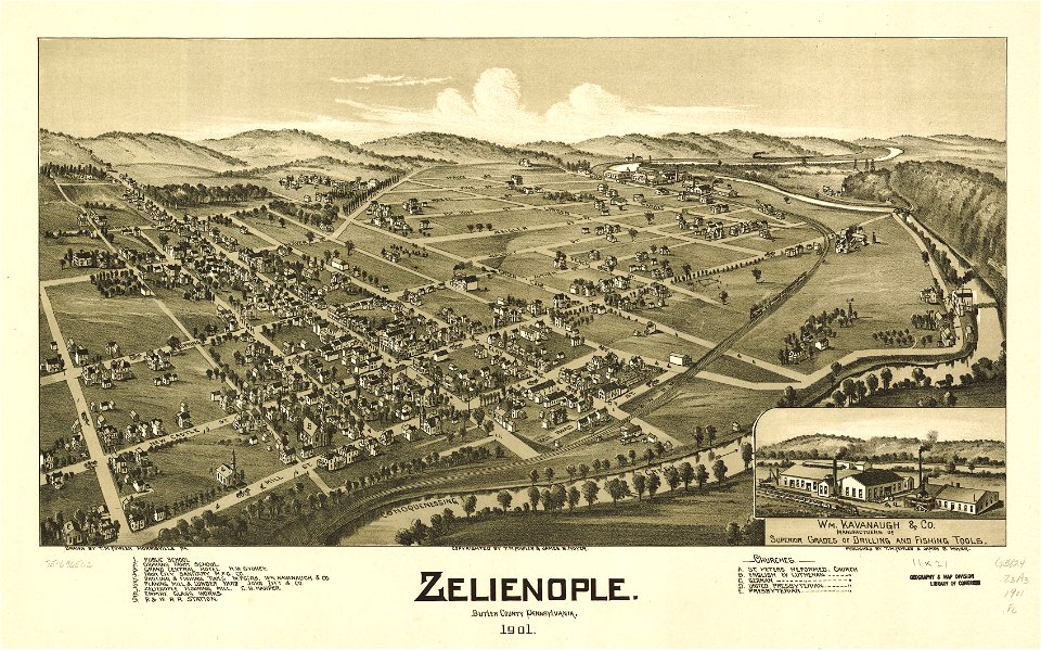
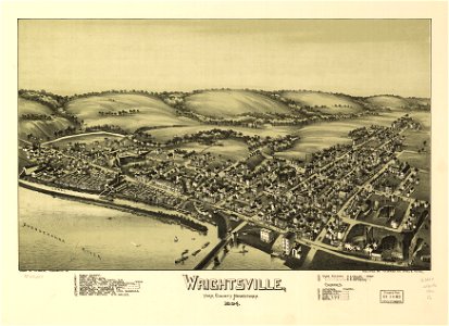
pennsylvania
wrightsville
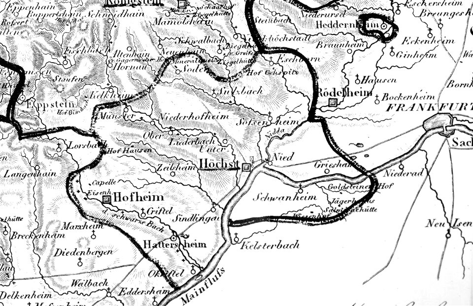
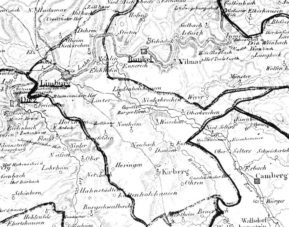
map „das herzogthum nassau“ by j.b. fischer
1828
map „das herzogthum nassau“ by j.b. fischer
1828
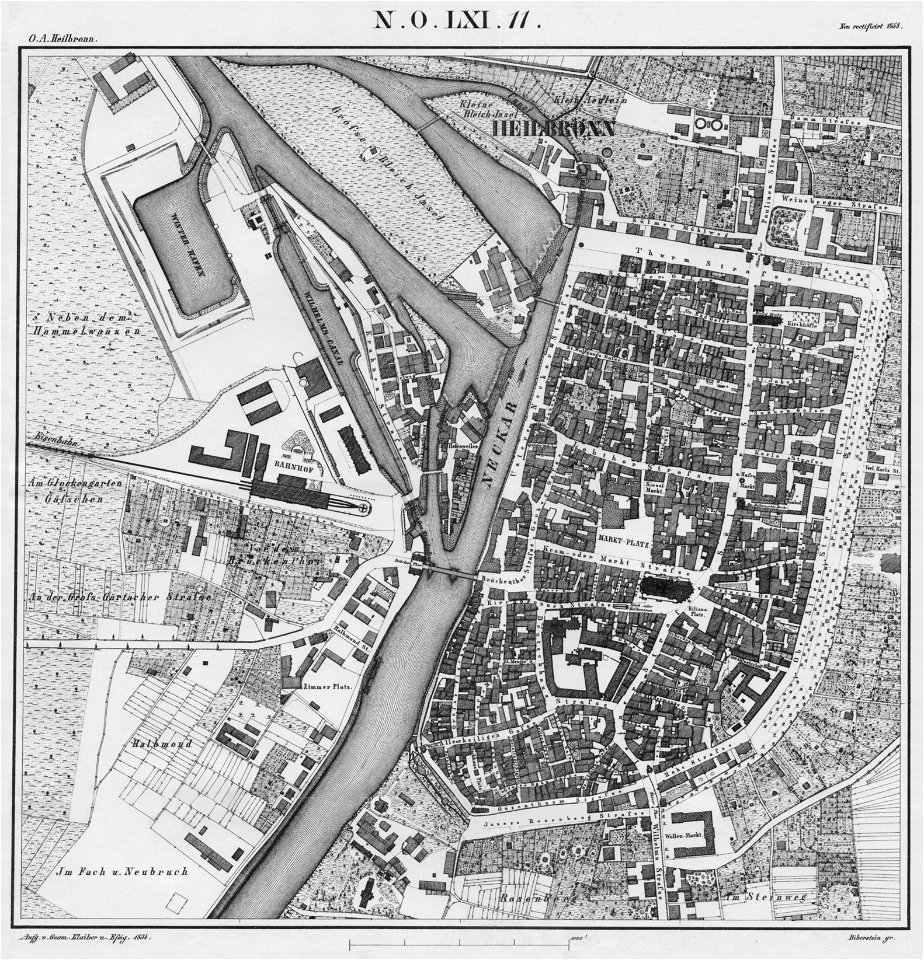
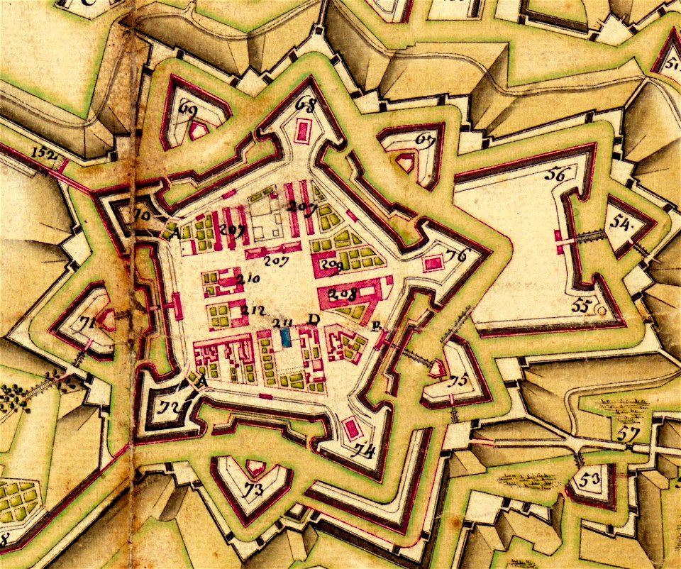
württembergische flurkarte 1:2.500
heilbronn
pennsylvania
sheffield
pennsylvania
sheffield
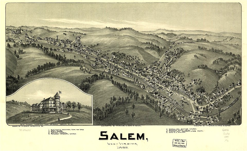
west virginia
salem
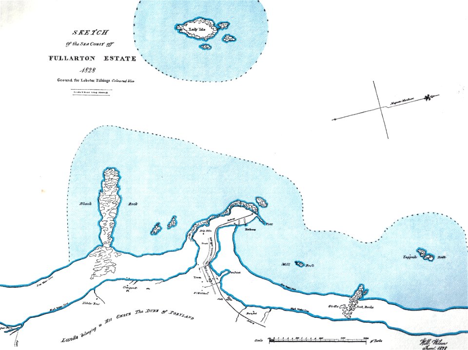
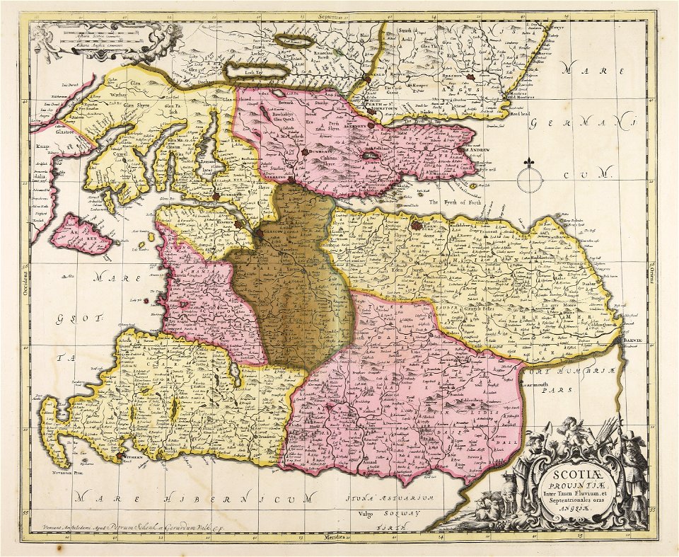
islands of scotland
maps of scotland
harvard university
pictorial maps
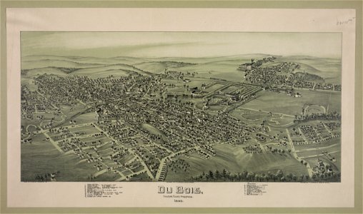
pennsylvania
dubois
maps made in the 17th century
gerard valck
maps made in the 17th century
maps by nicolaes visscher i
fonds ancely - bibliothèque municipale de toulouse - maps
coats of arms of cities in pyrénées-atlantiques
maps made in the 17th century
old maps of gelderland
collections de la bibliothèque nationale et universitaire de strasbourg
maps of strasbourg in the 18th century
maps made in the 17th century
gerard valck
maps with cartouches
atlas van der hagen
maps made in the 18th century
old maps of iran
maps made in the 18th century
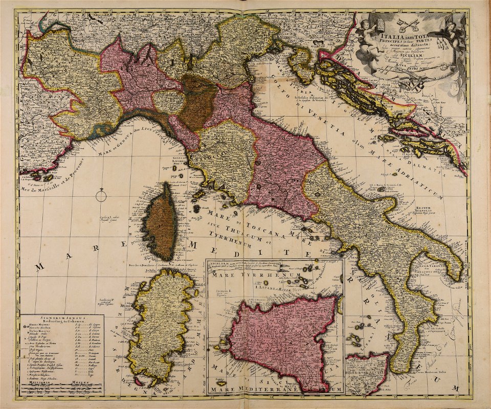
18th-century maps of italy
maps made in the 17th century
lochaber
images from the new york public library
george hayward
ocean
maps
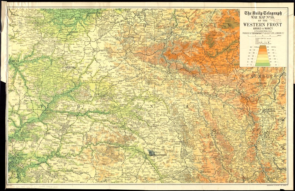
maps of world war i by the daily telegraph
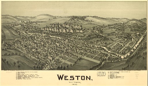
west virginia
weston
west virginia
weston
1830 vienna map series by carl graf vasquez
old maps of landstraße (vienna)
maps in the library of congress
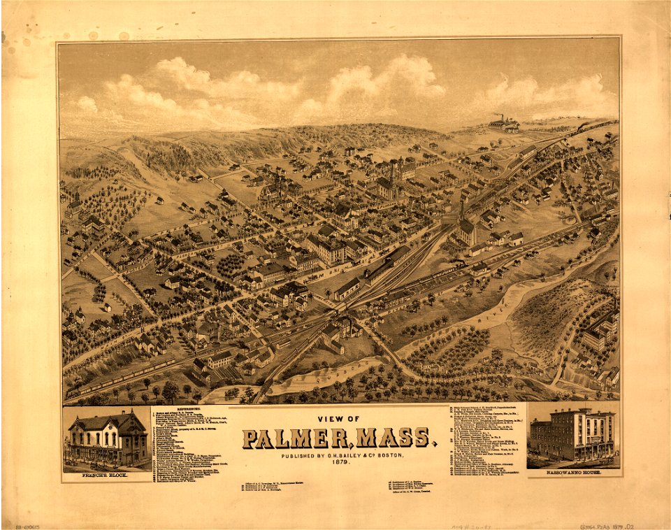
o. h. bailey
maps in the library of congress
o. h. bailey
massachusetts
palmer
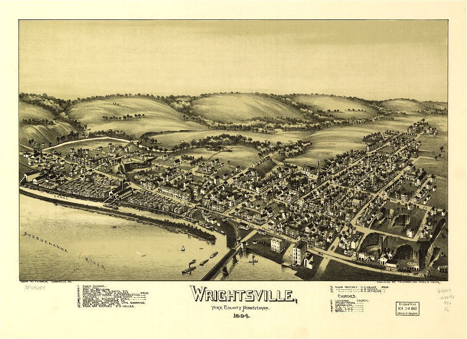
pennsylvania
wrightsville
1550s maps of the world
petrus apianus
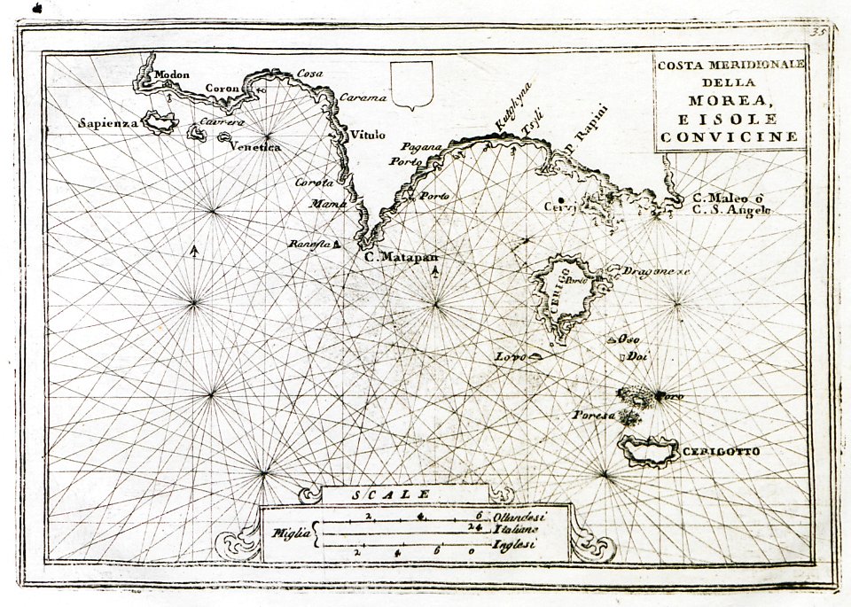
old maps of the peloponnese
maps by coronelli
maps of the history of malta
braun & hogenberg
maps by frederick de wit
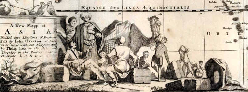
1680s maps of asia
stockholm
mälaren
history of lorenzkirch
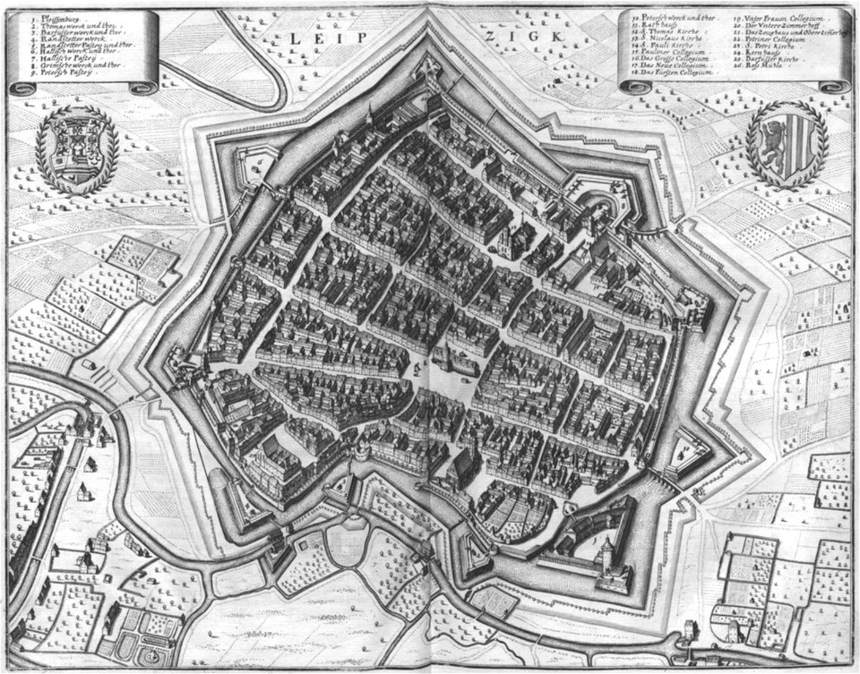
old maps of saxony
gerard van keulen
1720s
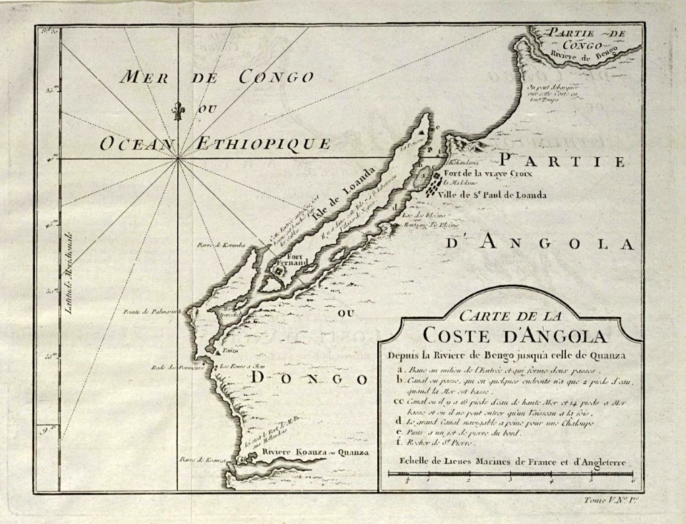
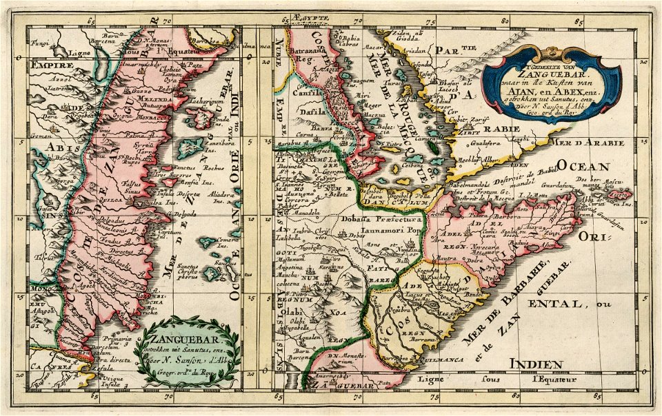
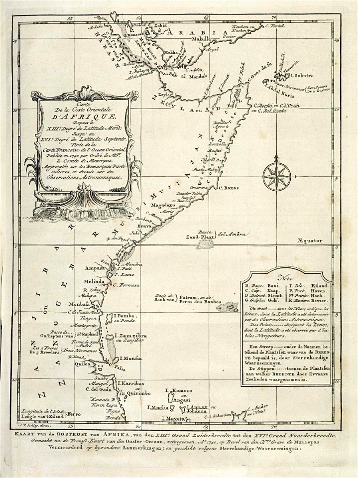
old maps of the dutch east india company - africa
1705
maps of the west-indische compagnie
1665
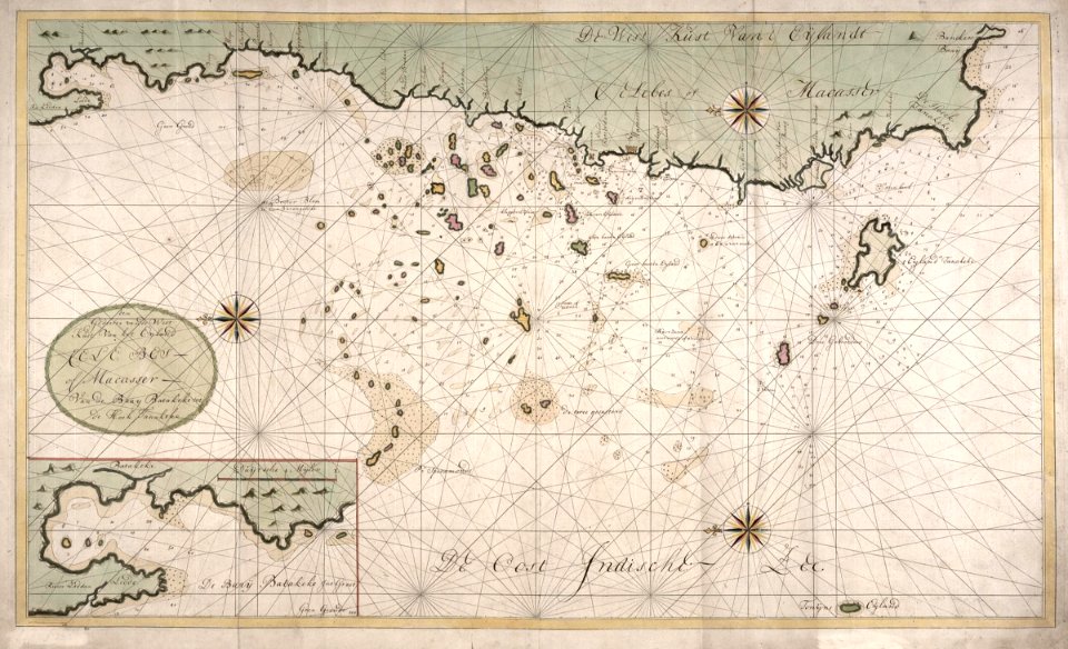
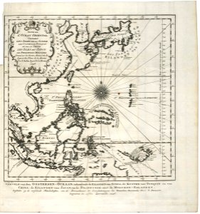
maps of the dutch east india company - indonesia
1740
old maps of the dutch east india company
1747)
old maps of the dutch east india company - africa
1747)
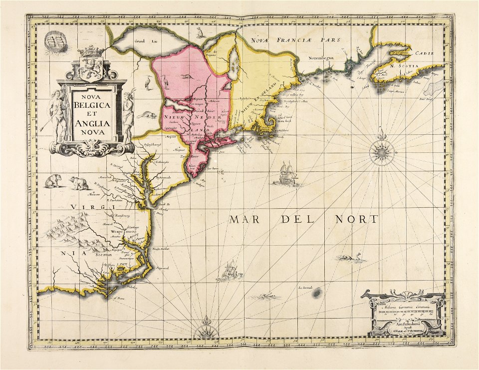
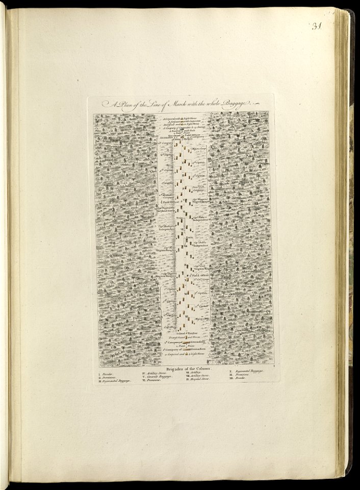
maps of the french and indian war
1768 maps
old maps of governorates of the russian empire
small atlas of the russian empire (1792)
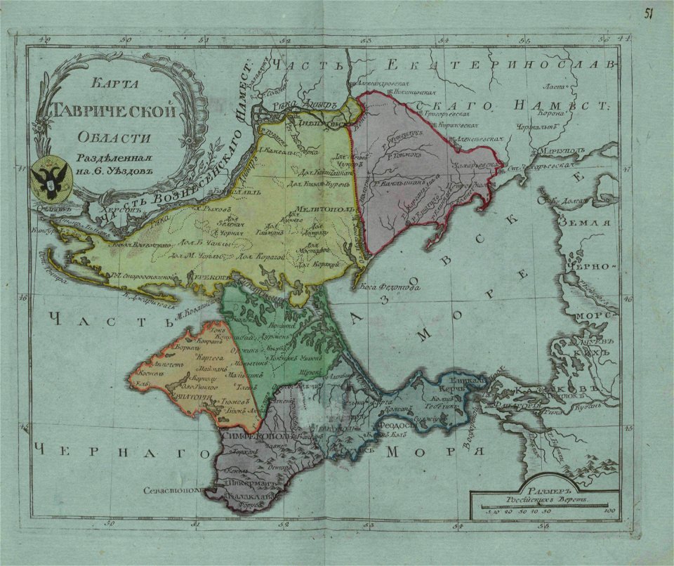
old maps of oblasts of the russian empire
small atlas of the russian empire (1796)
maps in the library of congress
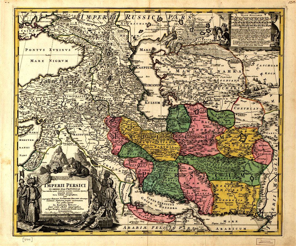
1724 maps of iran
maps in the library of congress
1724 maps of iran
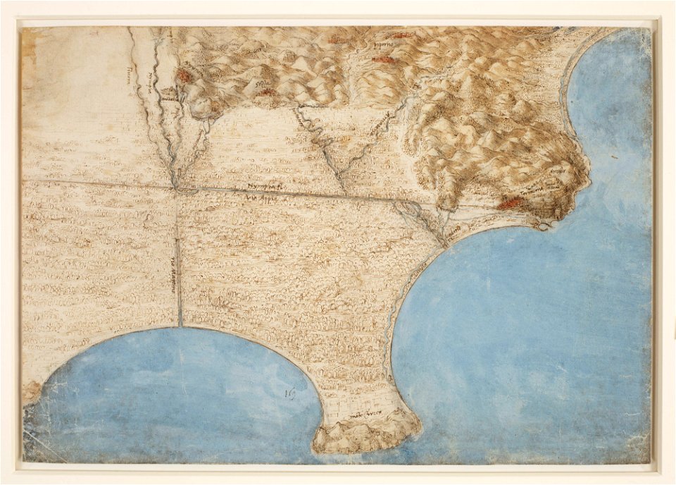
a map of the pontine marshes (rcin 912684)
maps in the library of congress
1724 maps of iran
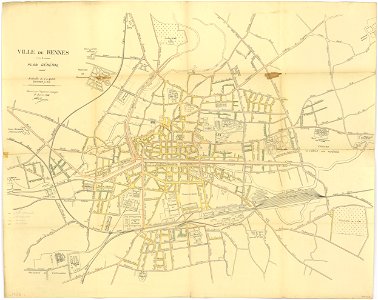
rennes in the 1910s
1914 maps
maps from the mechanical curator collection
british battles on land and sea
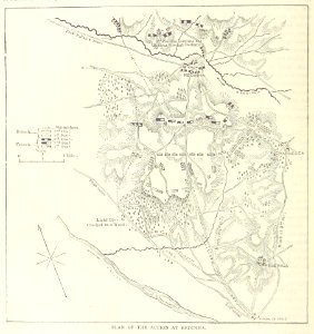
rennes in the 1850s
old maps of rennes
5001 - 5100 of 38,713
Next page
/ 388