Log in
All resources
Create a design
38,713 Free Artworks of Map
maps in the library of congress
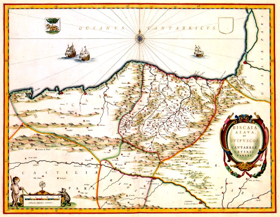
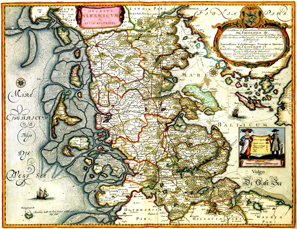
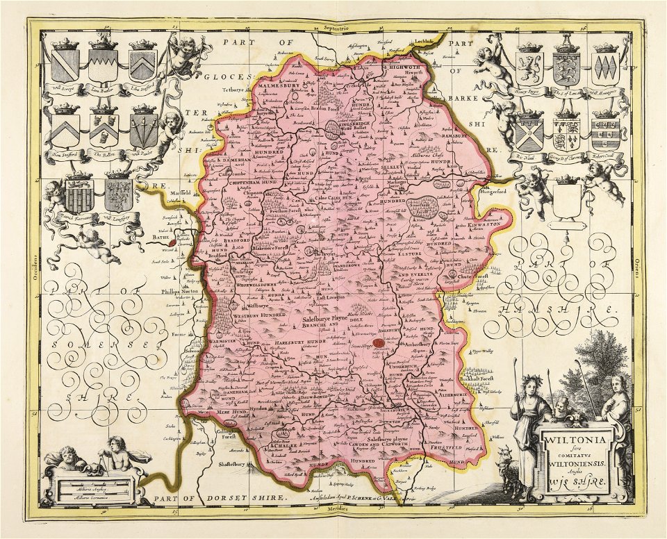
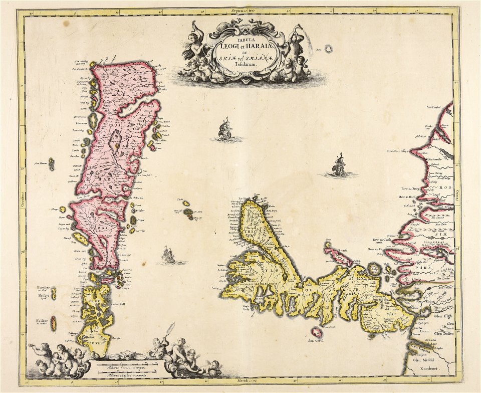
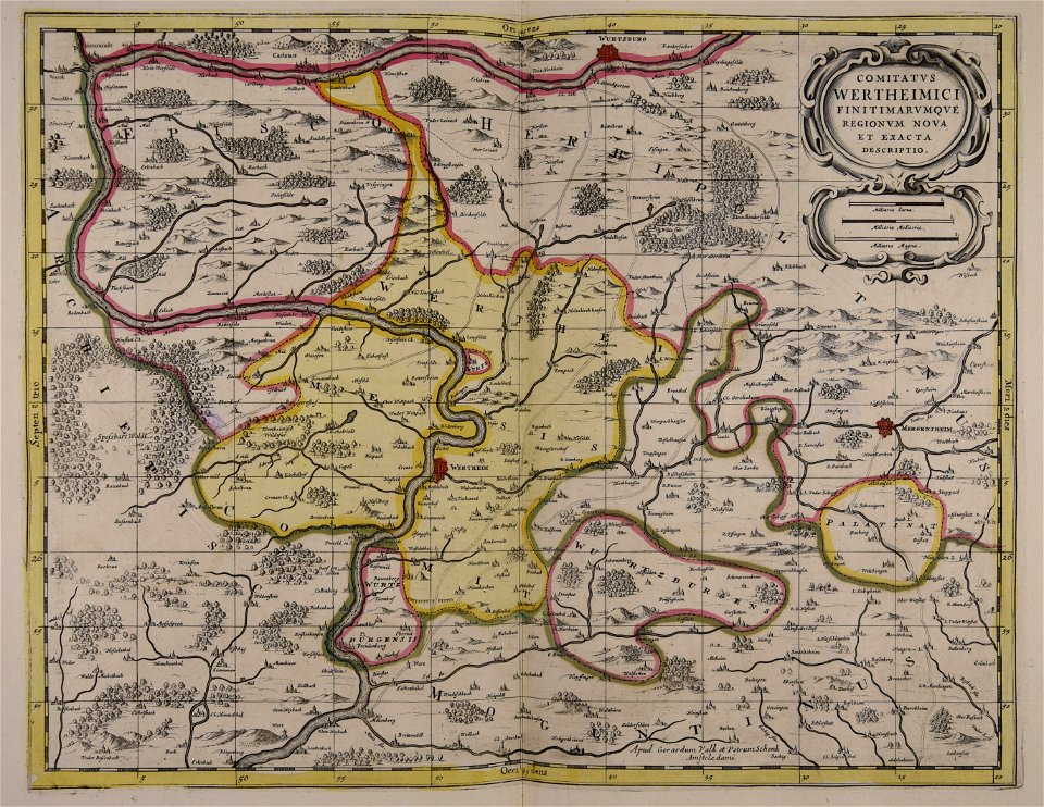
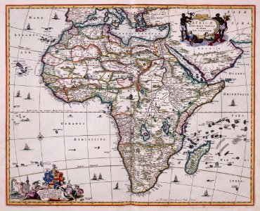
maps made in the 17th century
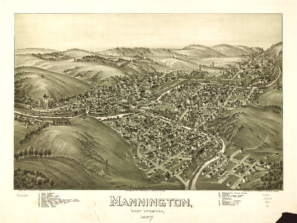
west virginia
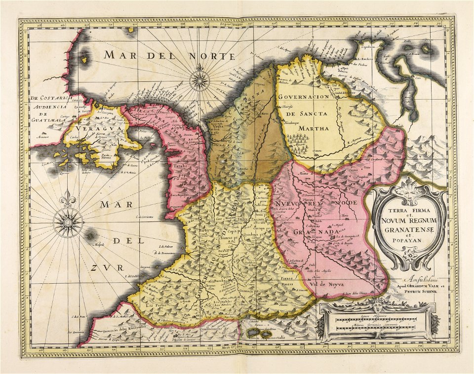
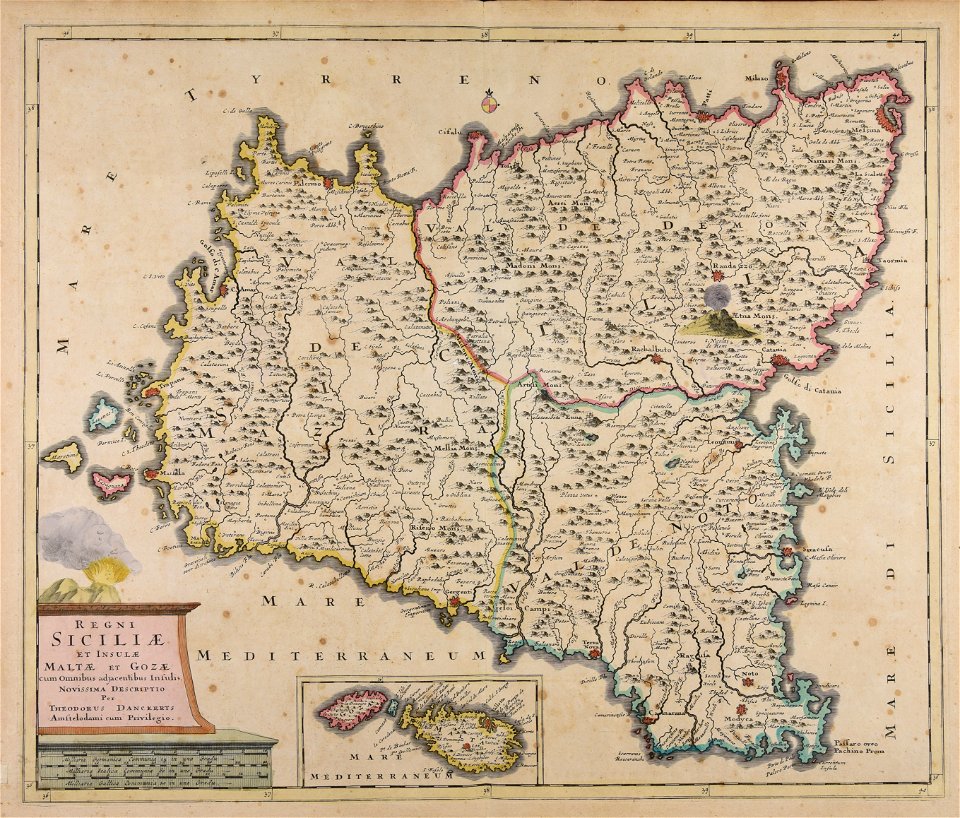
gerard valck
maps by pieter schenk (i)
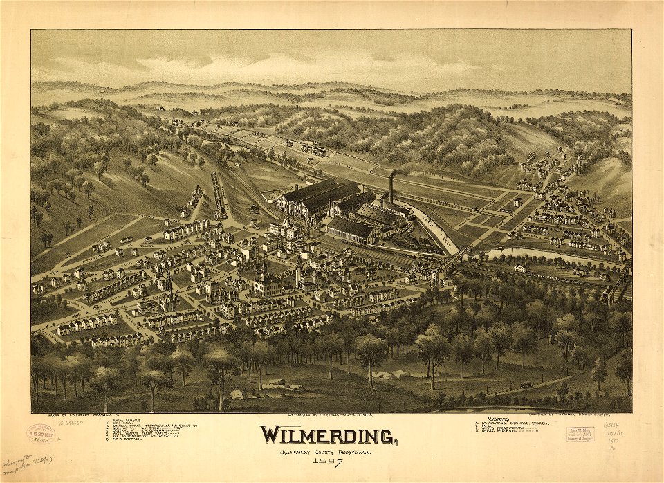
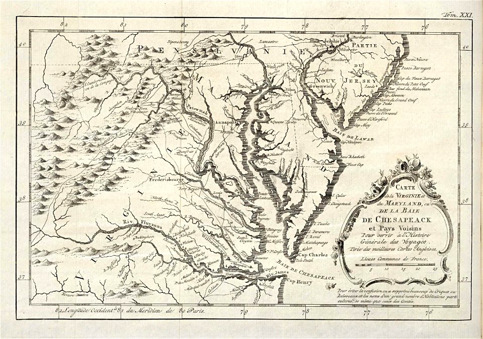
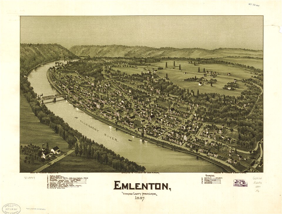
pennsylvania
maps of the west-indische compagnie
fonds ancely - bibliothèque municipale de toulouse - maps
atlantis magni tomus quintus (biblioteca comunale di trento)
maps from the mechanical curator collection
fonds ancely - bibliothèque municipale de toulouse - maps
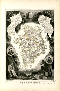
coats of arms of cities in cher
fonds ancely - bibliothèque municipale de toulouse - maps
jean bart
maps made in the 17th century
gerard valck
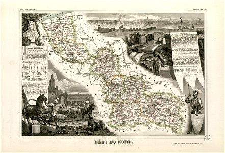
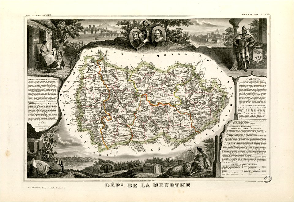
1880 maps of france
auguste logerot
cornell university library
1888 maps
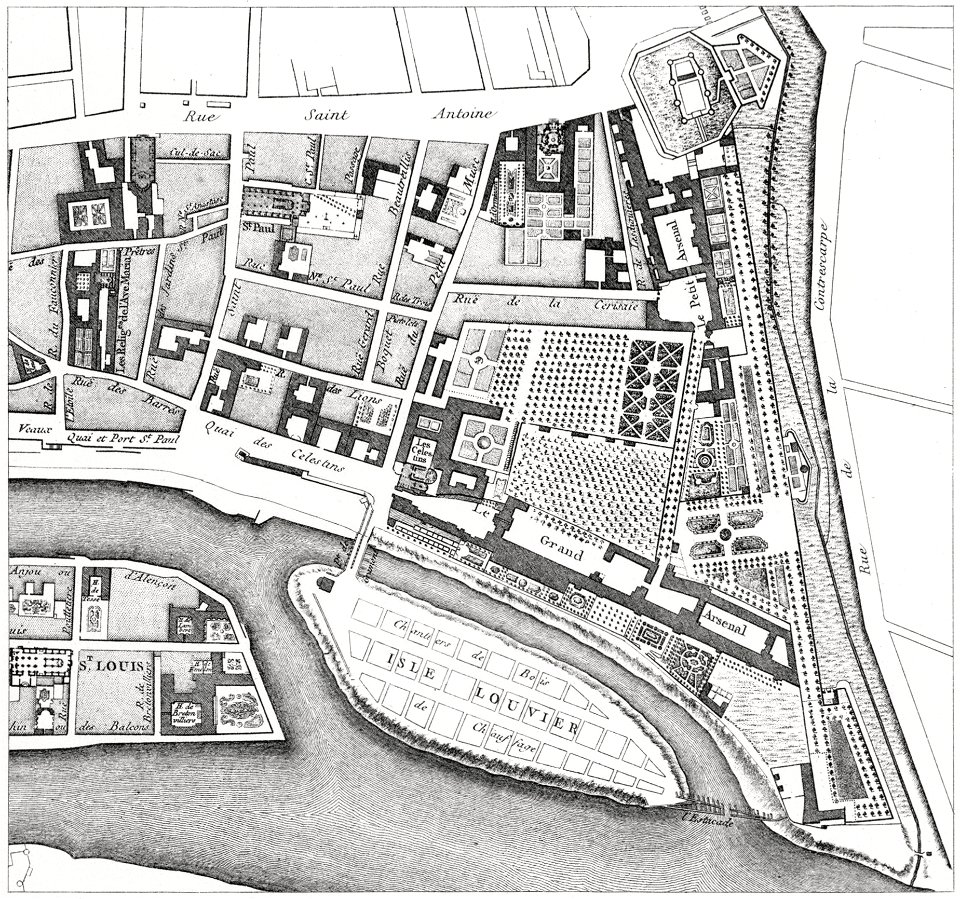
quartier de l'arsenal
bastille
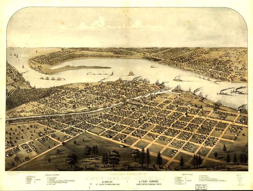
maps in the library of congress
1867 maps
maps from the mechanical curator collection
1899 books
maps made in the 17th century
gerard valck
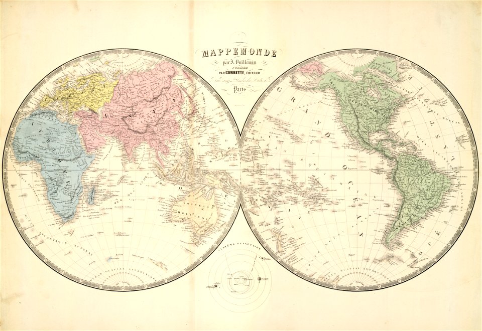
double hemisphere world maps
old maps of the world
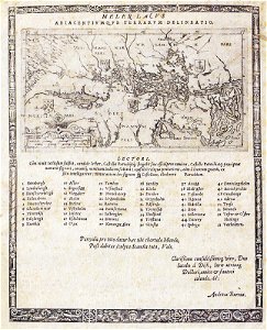
maps with cartouches
atlas van der hagen
17th-century maps of france
maps with cartouches
maps with cartouches
atlas van der hagen
maps made in the 17th century
gerard valck
atlantis magni tomus secundus (biblioteca comunale di trento)
maps made in the 17th century
maps made in the 17th century
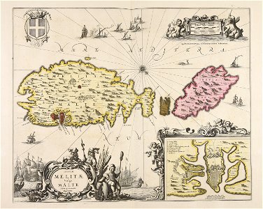
old maps of malta
maps made in the 17th century
gerard valck
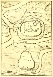
french-language maps of china
old maps of fujian
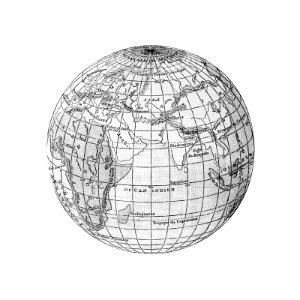
ocean
maps
maps in the library of congress
1720 maps
maps in the library of congress
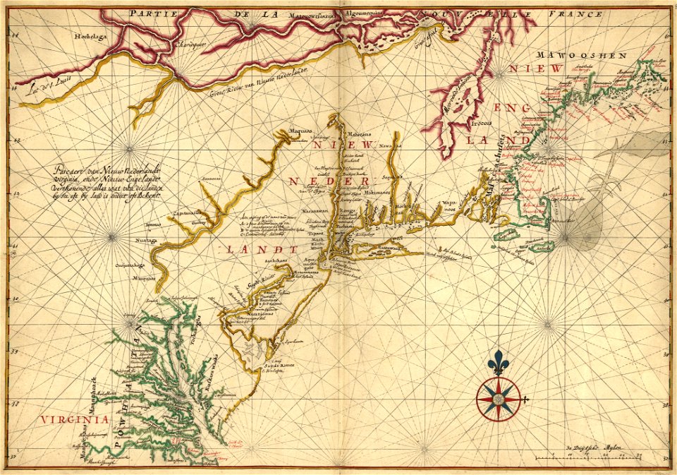
old maps of new england
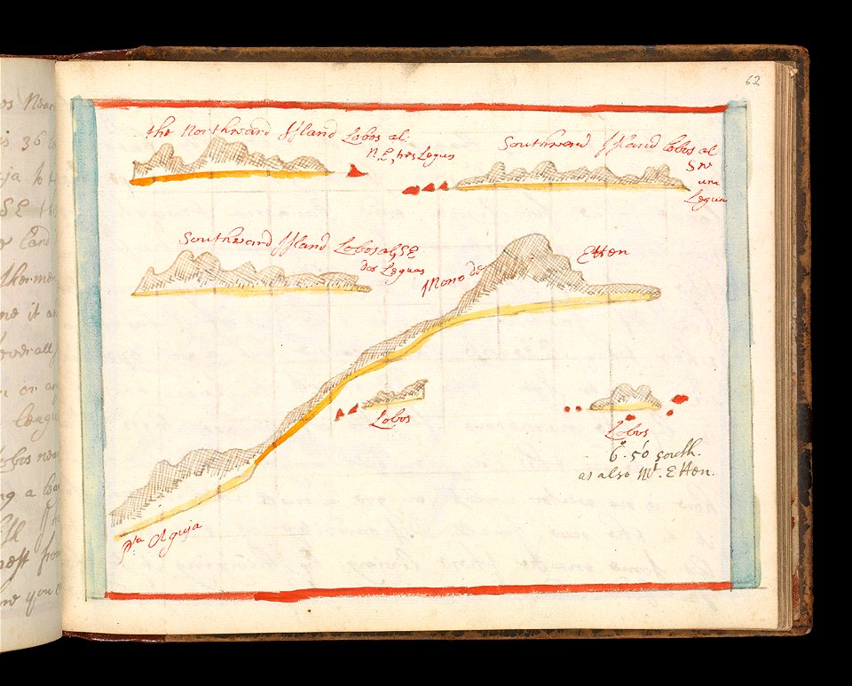
sketch
maps
maps with cartouches
atlas van der hagen
maps made in the 17th century
gerard valck
maps in the library of congress
1867 maps
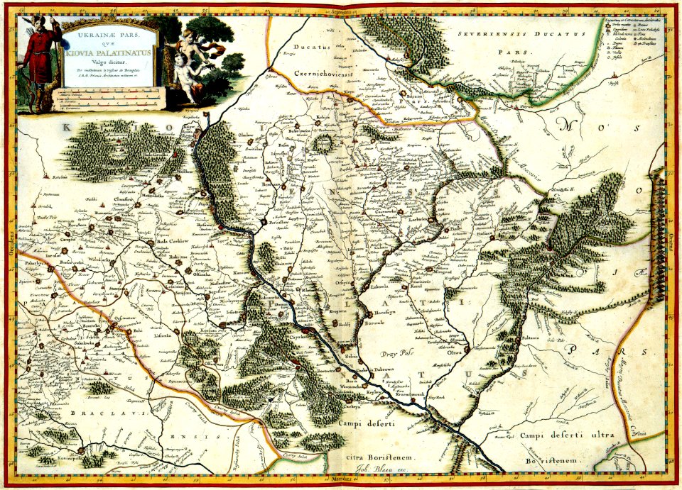
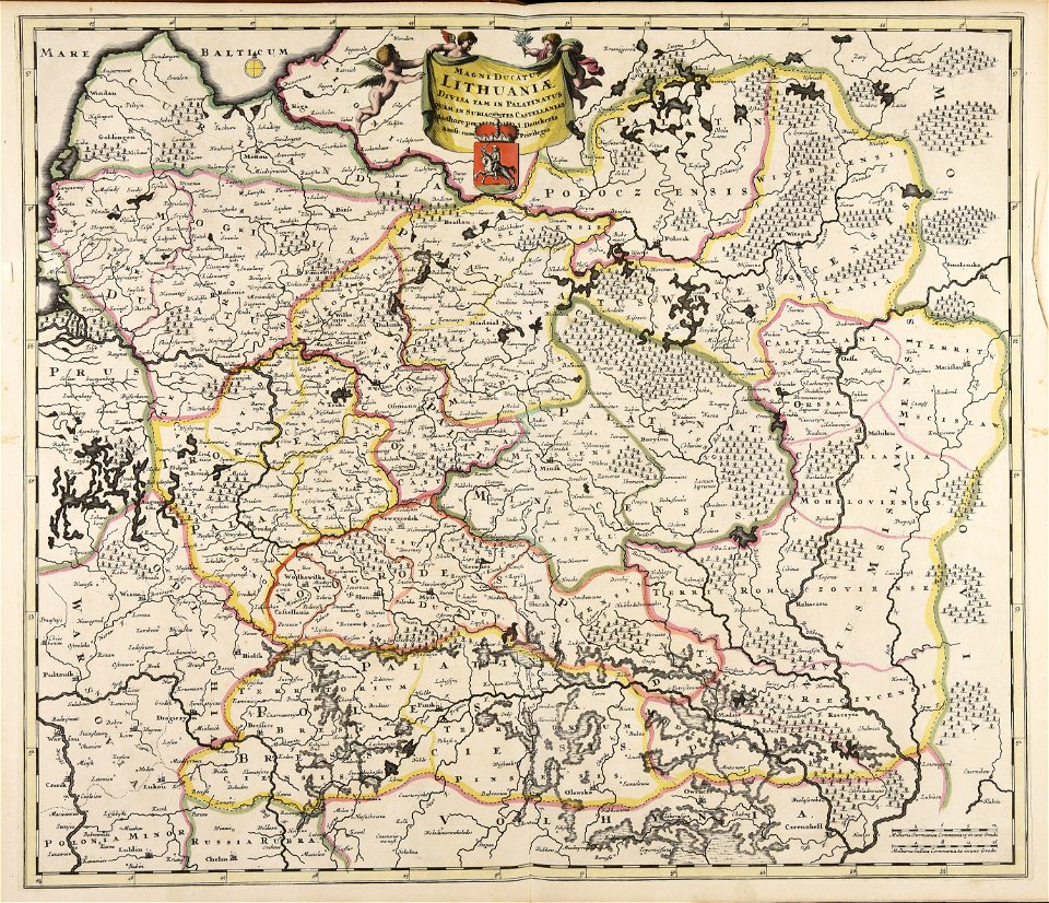
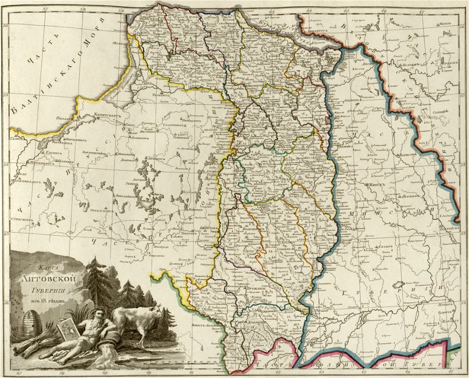
old maps of the grand duchy of lithuania
maps made in the 17th century
maps made in the 17th century
gerard valck
fonds ancely - bibliothèque municipale de toulouse - maps
coats of arms in nancy
maps made in the 17th century
gerard valck
maps by nicolaes visscher i
old maps of greece
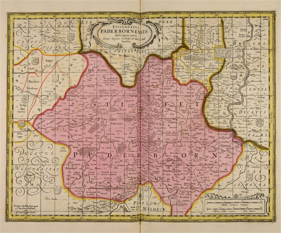
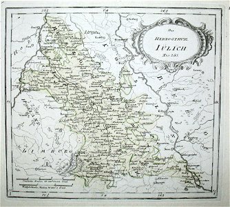
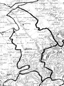
old maps of north rhine-westphalia
netherlands
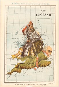
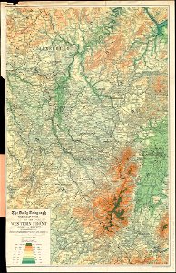
maps of world war i by the daily telegraph
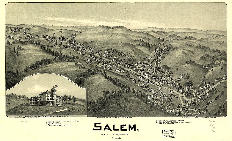
west virginia
salem
university of toronto wenceslas hollar digital collection
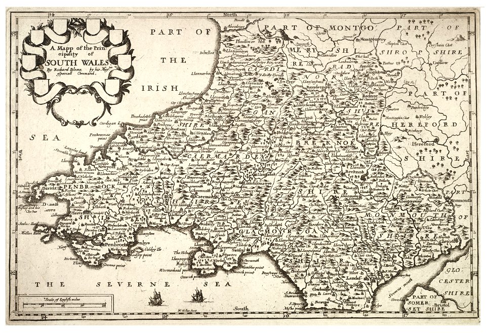
old maps of wales
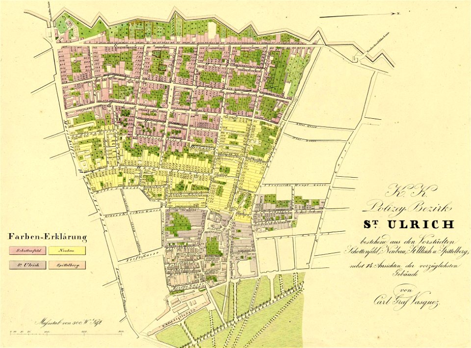
1830 vienna map series by carl graf vasquez
old maps of neubau (vienna)
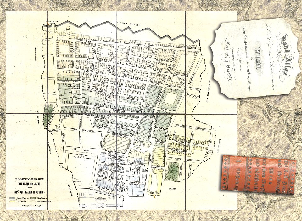
details of 1830 vienna map series by carl graf vasquez
old maps of neubau (vienna)
maps in the library of congress
pennsylvania
geographical illustrations by coronelli
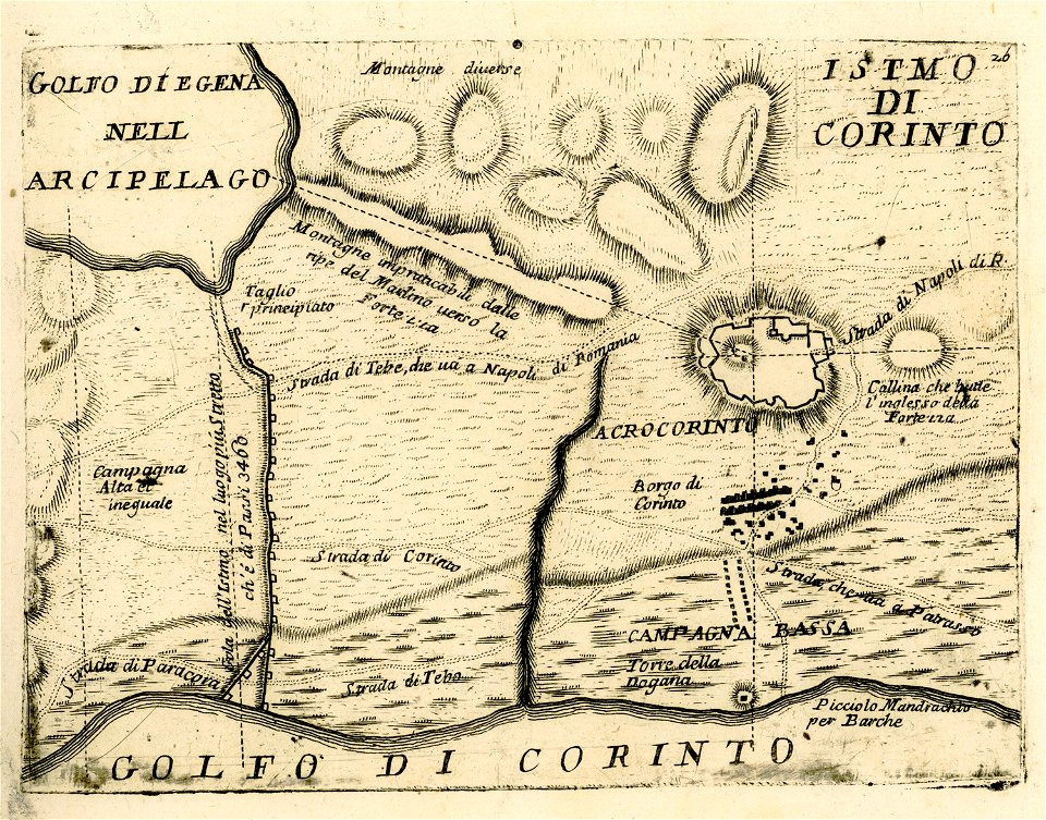
maps of ancient corinth
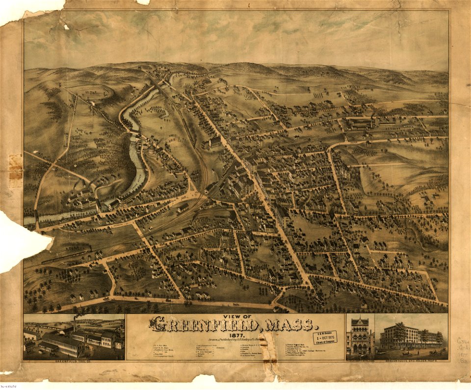
massachusetts
greenfield
maps in the library of congress
pennsylvania
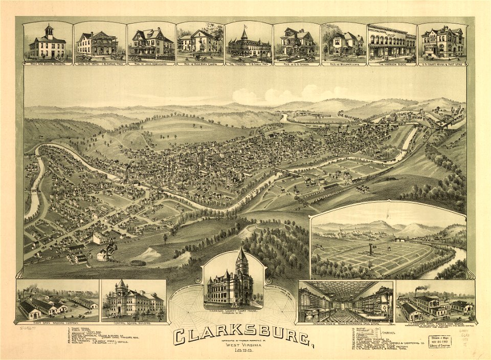
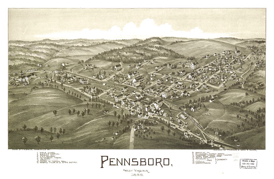
west virginia
clarksburg
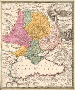
atlas of the russian empire (1800)
1800 maps of lithuania
old maps of the dutch east india company - africa
nicolaes visscher ii
stockholm
mälaren
map „das herzogthum nassau“ by j.b. fischer
1828
maps of the dutch east india company - sri lanka
1730s
maps of the dutch east india company - sri lanka
1730s
maps of the west-indische compagnie
1716
maps of the west-indische compagnie
johannes van keulen
maps of the west-indische compagnie
1780
maps of the west-indische compagnie
1770s
maps of the west-indische compagnie
1780
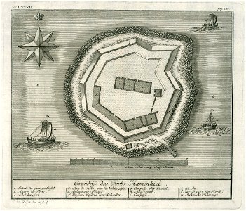
charts and maps of the royal museums greenwich
1682 maps
atlante veneto (raremaps.com) volume 1
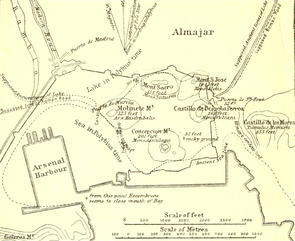
maps of the bay of kotor
military bases of the united states
old maps of the history of normandy
maps from the mechanical curator collection
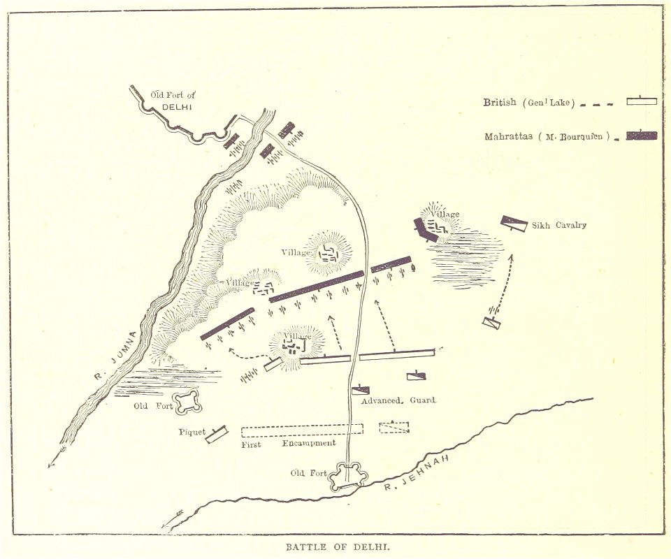
british battles on land and sea
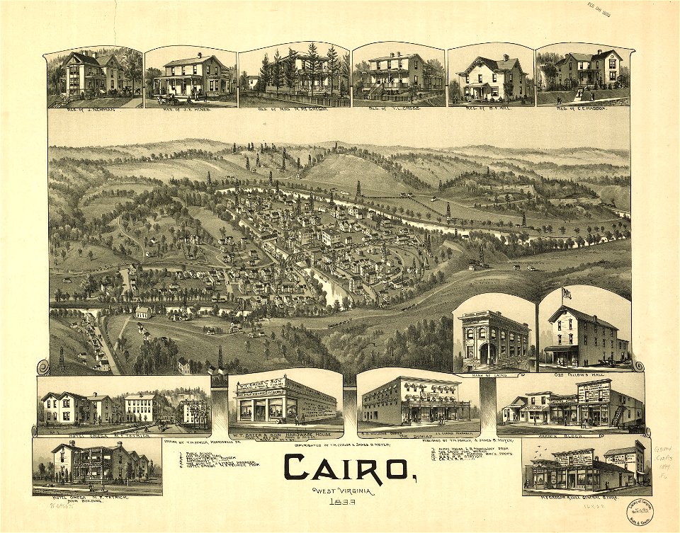
west virginia
cairo
maps from turris babel
by athanasius kircher
atlante veneto (raremaps.com) volume 2
old maps of russia
old maps of rhineland-palatinate
maps of the palatinate
1690s maps of the netherlands
old maps of zeeland
maps of rivers of south africa
mountains of south africa
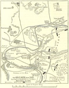
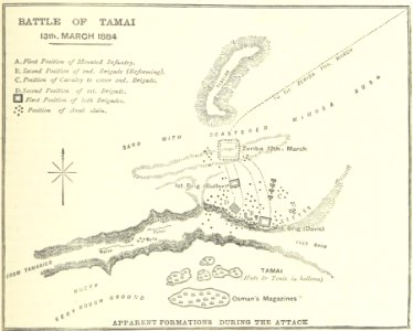
battle of villiers
1895 drawings
illustrated battles of the nineteenth century
1895 drawings
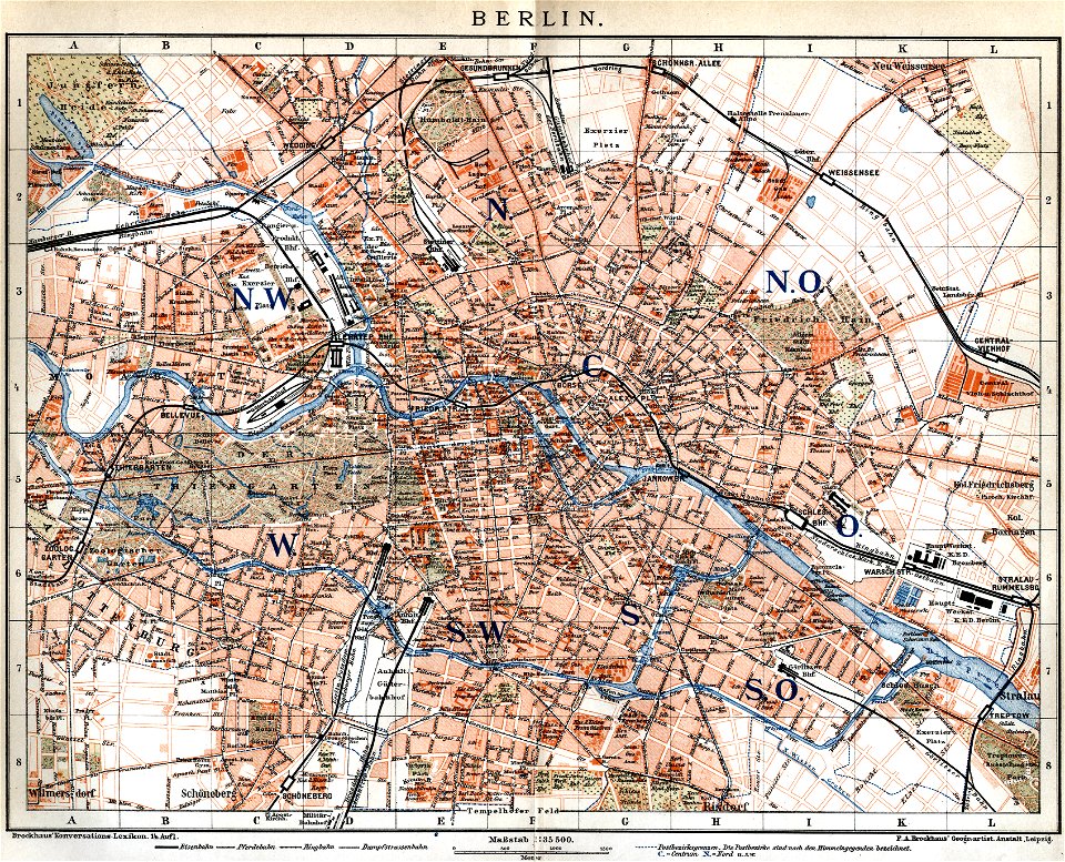
19th-century maps of berlin
maps by brockhaus
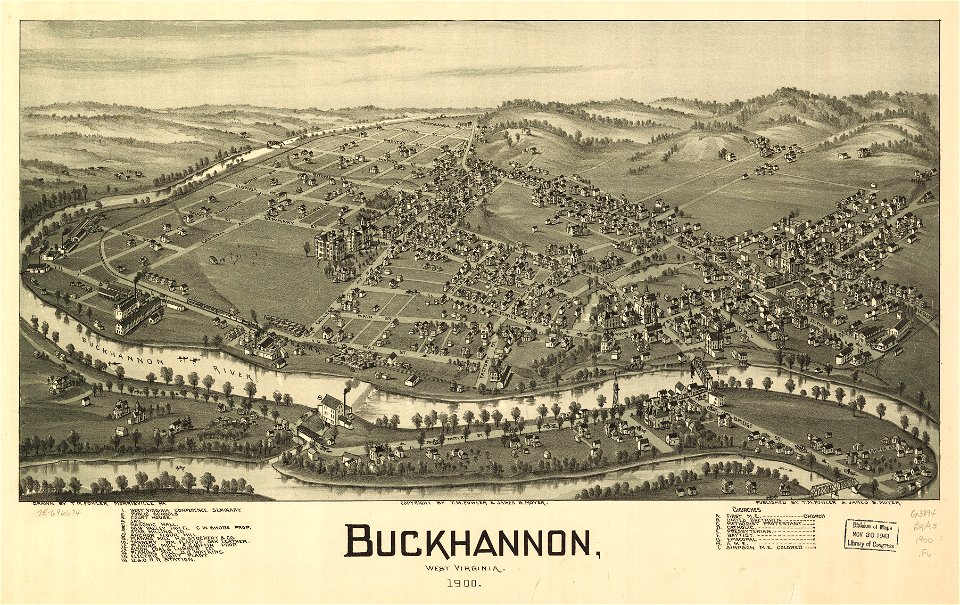
west virginia
buckhannon
west virginia
buckhannon
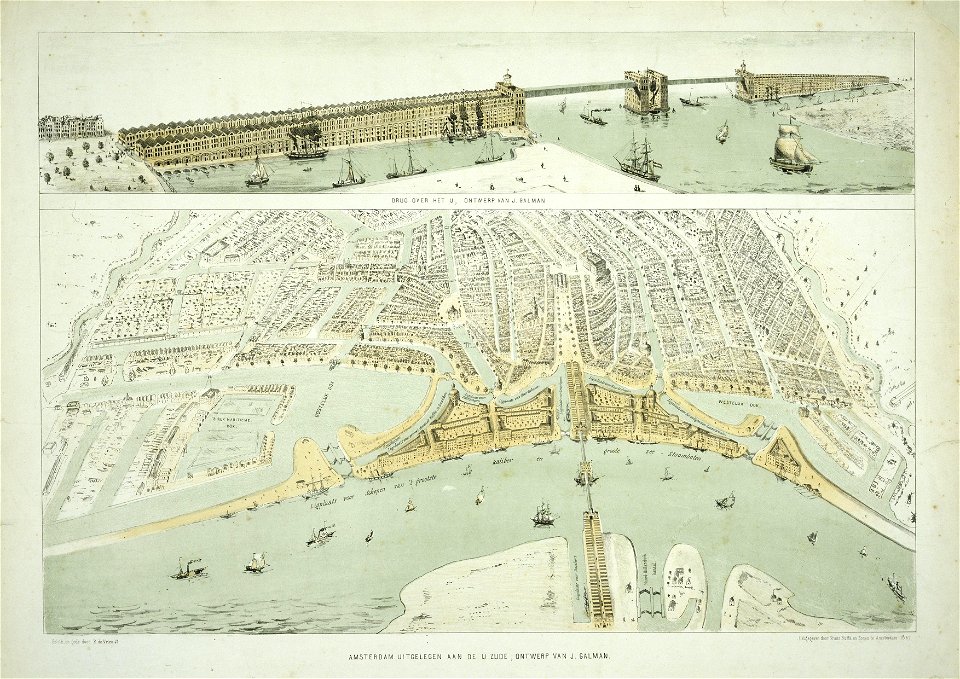
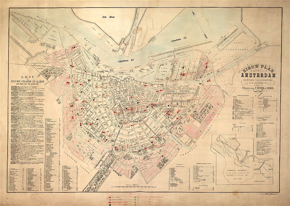
maps in the stadsarchief amsterdam
old maps of amsterdam
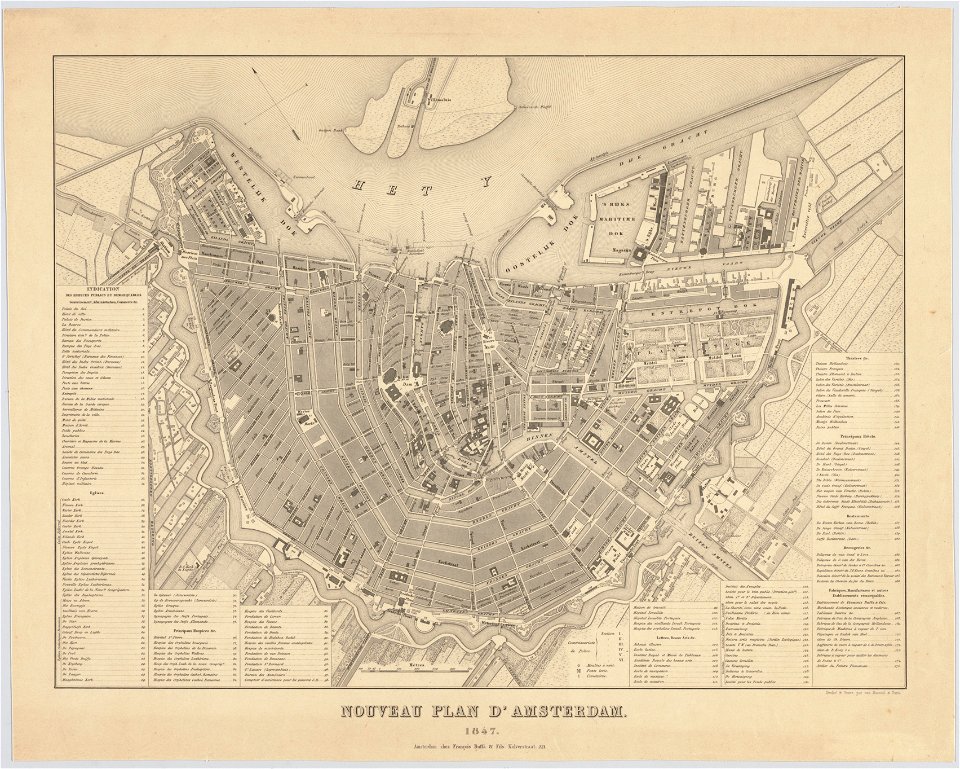
maps in the stadsarchief amsterdam
old maps of amsterdam
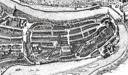
maps in the stadsarchief amsterdam
old maps of amsterdam
kümmerly & frey
maps of bern
pennsylvania
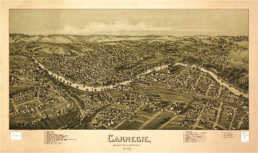
carnegie
pennsylvania
carnegie
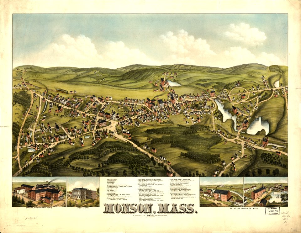
massachusetts
monson
maps in the library of congress
west virginia
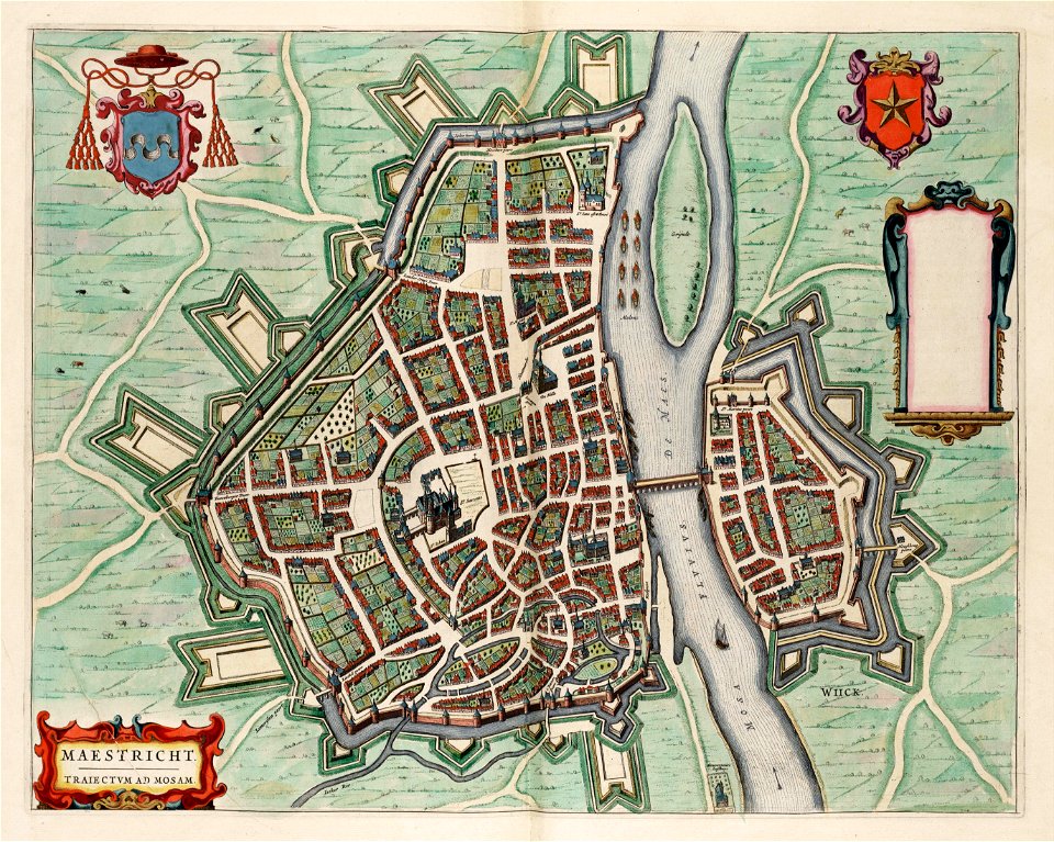
coats of arms of maastricht
coats of arms on maps
historical images of lüneburg
maps by matthäus seutter
west virginia
morgantown
small atlas of the russian empire. 1796 year
old maps of yaroslavl governorate
encyclopaedia universalis mundaneum
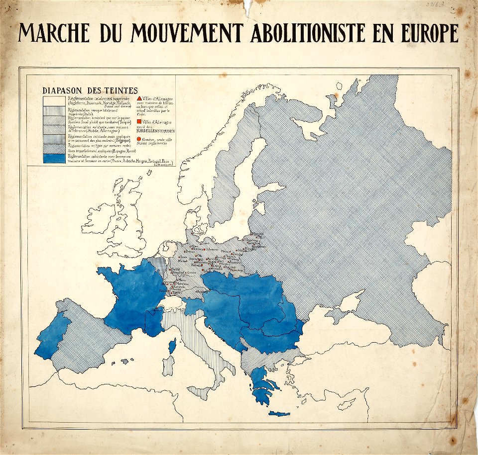
french-language maps of europe
small atlas of the russian empire (1792)
maps of nizhny novgorod governorate
old maps of islands of the aegean sea
bartolommeo dalli sonetti
maps in london labour and the london poor (1851)
old maps of governorates of the russian empire
small atlas of the russian empire (1792)
maps in the library of congress
1724 maps of iran
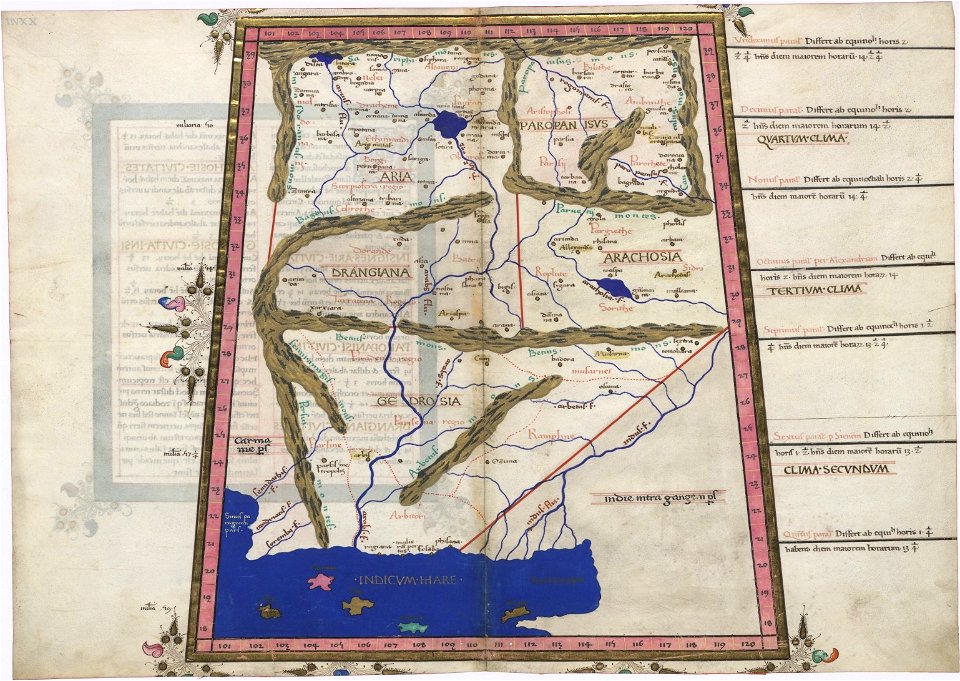
old maps of asia
1749 maps
maps in the library of congress
west virginia
cosmographia claudii ptolomaei alexandrini
latin-language maps
charts and maps of the royal museums greenwich
1682 maps
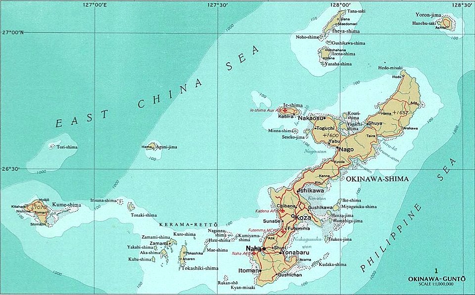
okinawa island
aguni island
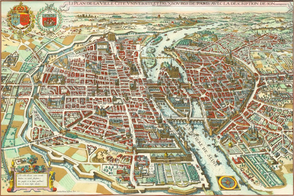
bird's eye view maps of paris
pictorial maps of paris
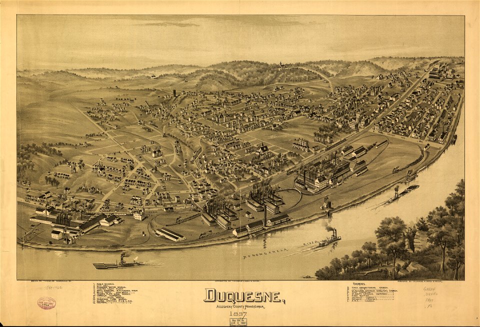
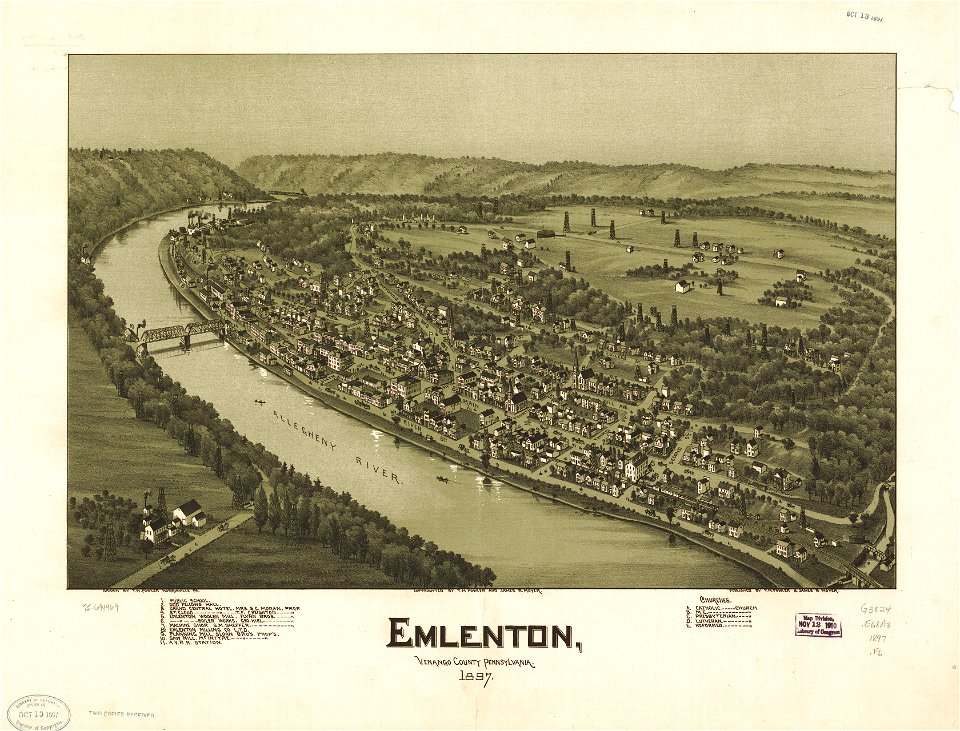
pennsylvania
duquesne
maps in the library of congress
pennsylvania
maps in the library of congress
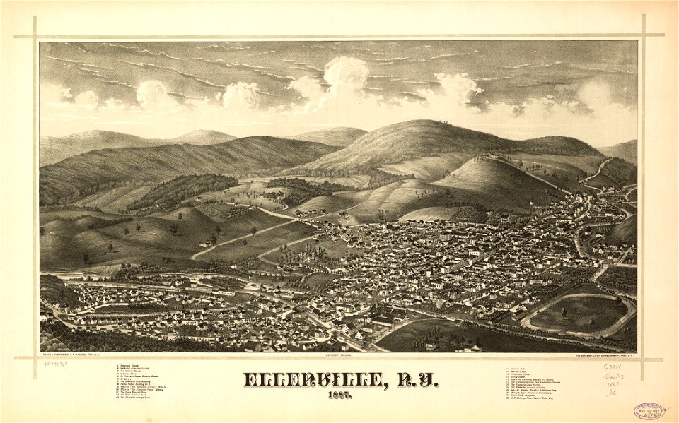
new york
maps in the library of congress
pennsylvania
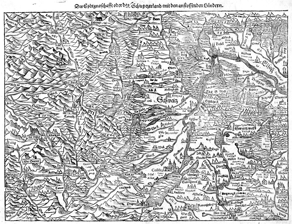
illustrations of cosmographia (münster)
old maps of switzerland
1902 maps
spain
massachusetts
greenfield
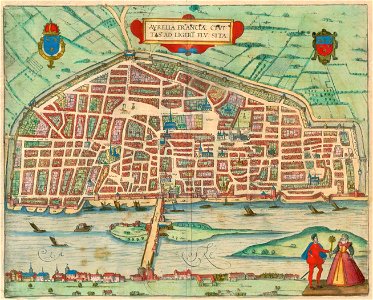
braun & hogenberg
orléans
prints by giovanni battista piranesi
old maps of rome
4901 - 5000 of 38,713
Next page
/ 388