Log in
All resources
Create a design
38,713 Free Artworks of Map
description de l'universe
alain manesson mallet
maps of africa
africa in the 1890s
bibliothèque nationale de france
maps from the earth and its inhabitants, vol. xii
maps from the earth and its inhabitants, vol. xiii
mappa geographica novissima regni hungariae, - divisi in suos comitatus cum districtibus jazygum et cumanorum banatus temesiensis ejusque districtuum nec non regnorum croatiae sclavoniae dalmatiae magni... - btv1b532332906
tranquillo mollo
maps from the earth and its inhabitants, vol. xi
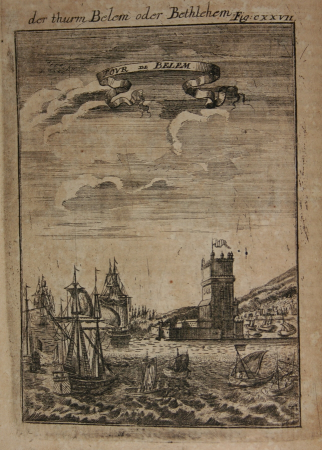
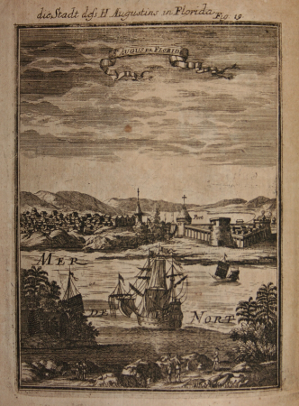
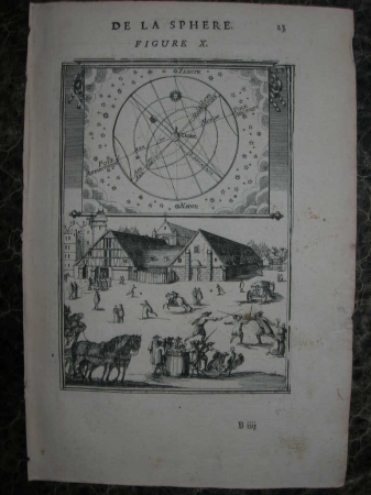
description de l'universe
alain manesson mallet
description de l'universe
alain manesson mallet
description de l'universe
alain manesson mallet
description de l'universe
alain manesson mallet
description de l'universe
alain manesson mallet
maps by jakob van der schley
old maps of southeast asia
description de l'universe
alain manesson mallet
description de l'universe
alain manesson mallet
description de l'universe
alain manesson mallet
description de l'universe
1685 in spain
description de l'universe
alain manesson mallet
description de l'universe
alain manesson mallet
description de l'universe
westminster
description de l'universe
alain manesson mallet
description de l'universe
alain manesson mallet
description de l'universe
alain manesson mallet
description de l'universe
alain manesson mallet
description de l'universe
alain manesson mallet
description de l'universe
alain manesson mallet
description de l'universe
alain manesson mallet
description de l'universe
alain manesson mallet
description de l'universe
alain manesson mallet
description de l'universe
alain manesson mallet
description de l'universe
alain manesson mallet
description de l'universe
alain manesson mallet
description de l'universe
alain manesson mallet
maps from the earth and its inhabitants, vol. xii
africa in the 1890s
maps from the earth and its inhabitants, vol. xii
africa in the 1890s
maps from the earth and its inhabitants, vol. xii
africa in the 1890s
maps from the earth and its inhabitants, vol. xiii
africa in the 1890s
maps from the earth and its inhabitants, vol. xii
africa in the 1890s
map of ghent by jan blaeu
sint-lievenspoort (ghent)
maps from the earth and its inhabitants, vol. xii
africa in the 1890s
18th-century maps of kent
old county maps of kent
maps from the earth and its inhabitants, vol. xiii
africa in the 1890s
maps from the earth and its inhabitants, vol. xiii
africa in the 1890s
maps from the earth and its inhabitants, vol. xii
africa in the 1890s
maps from the earth and its inhabitants, vol. xi
africa in the 1890s
maps from the earth and its inhabitants, vol. xii
africa in the 1890s
maps from the earth and its inhabitants, vol. xiii
africa in the 1890s
1750s maps of london
maps by isaak tirion
arnold's geographical handbook (1899)
maps of river clyde
bibliothèque nationale de france
maps by thomas kitchin
old maps of chania
1651 in chania
ceiling of the terrace of the geographical maps (uffizi gallery, florence)
ceiling of the terrace of the geographical maps (uffizi gallery, florence)
maps from the earth and its inhabitants, vol. xi
africa in the 1890s
maps from the earth and its inhabitants, vol. xii
africa in the 1890s
maps from the earth and its inhabitants, vol. xiii
people of africa
maps from the earth and its inhabitants, vol. xii
africa in the 1890s
maps from the earth and its inhabitants, vol. xiii
africa in the 1890s
maps from the earth and its inhabitants, vol. xiii
africa in the 1890s
maps from the earth and its inhabitants, vol. xi
africa in the 1890s
historical images of église saint-nicolas-du-chardonnet
map of paris by braun & hogenberg - derivative files
maps from the earth and its inhabitants, vol. xiii
africa in the 1890s
maps from the earth and its inhabitants, vol. xii
africa in the 1890s
the antiquities of england and wales (1773)
18th-century maps of lancashire
maps from the earth and its inhabitants, vol. xii
africa in the 1890s
maps from the earth and its inhabitants, vol. xi
africa in the 1890s
maps from the earth and its inhabitants, vol. xiii
africa in the 1890s
mappa geographica novissima regni hungariae, - divisi in suos comitatus cum districtibus jazygum et cumanorum banatus temesiensis ejusque districtuum nec non regnorum croatiae sclavoniae dalmatiae magni... - btv1b532332906
tranquillo mollo
mappa geographica novissima regni hungariae, - divisi in suos comitatus cum districtibus jazygum et cumanorum banatus temesiensis ejusque districtuum nec non regnorum croatiae sclavoniae dalmatiae magni... - btv1b532332906
tranquillo mollo
mappa geographica novissima regni hungariae, - divisi in suos comitatus cum districtibus jazygum et cumanorum banatus temesiensis ejusque districtuum nec non regnorum croatiae sclavoniae dalmatiae magni... - btv1b532332906
tranquillo mollo
maps in the library of congress
1779 maps of new york (state)
mappa geographica novissima regni hungariae, - divisi in suos comitatus cum districtibus jazygum et cumanorum banatus temesiensis ejusque districtuum nec non regnorum croatiae sclavoniae dalmatiae magni... - btv1b532332906
tranquillo mollo
landkreis eichsfeld in the 17th century
maps from gallica
bijou theatre (knoxville, tennessee)
maps in the library of congress
maps in the rijksmuseum amsterdam
old maps of tholen
mappa geographica novissima regni hungariae, - divisi in suos comitatus cum districtibus jazygum et cumanorum banatus temesiensis ejusque districtuum nec non regnorum croatiae sclavoniae dalmatiae magni... - btv1b532332906
tranquillo mollo
mappa geographica novissima regni hungariae, - divisi in suos comitatus cum districtibus jazygum et cumanorum banatus temesiensis ejusque districtuum nec non regnorum croatiae sclavoniae dalmatiae magni... - btv1b532332906
tranquillo mollo
mappa geographica novissima regni hungariae, - divisi in suos comitatus cum districtibus jazygum et cumanorum banatus temesiensis ejusque districtuum nec non regnorum croatiae sclavoniae dalmatiae magni... - btv1b532332906
tranquillo mollo
siege of zaltbommel 1599
1599 in the netherlands
maps of the greek colonies
old maps of ancient greece
maps by willem and johannes blaeu
1640 maps of africa
david rumsey historical map collection
old maps of the holy roman empire
maps of heidelberg by braun & hogenberg
gaisberg of heidelberg
1660s maps of france
old maps of nevers
map of ancient assyria by philippe de la rué
old maps of mesopotamia
maps by pieter van der keere
1598 maps of italy
maps made in the 18th century
johann david schleuen
maps by pieter van der keere
old maps of gelderland
maps in the library of congress
1660s maps of the americas
maps by willem and johannes blaeu
old maps of flanders
maps of algiers by braun & hogenberg
eran laor cartographic collection
algiers in the 19th century
old maps of algiers
maps by christian sgrothen
wurm
historical maps of crema
maps by pieter mortier
atlas de jacoubet, bibliothèque historique de la ville de paris
proletarian literature
eran laor cartographic collection
latin-language maps
maps of görlitz by braun & hogenberg
eran laor cartographic collection
maps of genoa by braun & hogenberg
maps in the british museum
maps of paris from bibliothèque nationale de france
plan de roussel
eran laor cartographic collection
lucas janszoon waghenaer
tinted lithographs in the british museum
victorian architecture
1730s maps of the philippines
baroque painting
1640s maps of hesse
old maps of nassau
merian mainz trier köln
baroque
tinted lithographs in the british museum
victorian architecture
maps of heidelberg by braun & hogenberg
19th-century maps of senegal
orientalist painting
18801 - 18900 of 38,713
Next page
/ 388


![An accurate Map of Dorset shire: drawn from the best maps charts etc. & regulated by astron[omy] observ[atio]ns / by T. Kitchin, Thomas Kitchin](https://cdn.creazilla.com/illustrations/10000227853/an-accurate-map-of-dorset-shire-drawn-from-the-best-maps-charts-etc-regulated-by-astronomy-observations-by-t-kitchin-thomas-kitchin-md.jpg)


![Map of Paris ([Reprod. in facsim.]) / by Roussel, engineer in 1700, 1730](https://cdn.creazilla.com/illustrations/10001522196/map-of-paris-reprod-in-facsim-by-roussel-engineer-in-1700-1730-md.jpg)


