Log in
All resources
Create a design
38,713 Free Artworks of Map
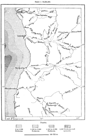
africa in the 1890s
maps of africa
maps from the earth and its inhabitants, vol. xiii
maps from the earth and its inhabitants, vol. xii
bibliothèque nationale de france
eran laor cartographic collection
shadows of the east; or, slight sketches of scenery, persons and customs, from observations during a tour in 1853 and 1854, in egypt, palestine, syria, turkey, and greece (1855) by tobin
maps from university of amsterdam special collections
atlas der neederlanden
copperplate print
maps from the earth and its inhabitants, vol. xii
africa in the 1890s
maps from the earth and its inhabitants, vol. xiii
maps of africa
maps from the earth and its inhabitants, vol. xiii
africa in the 1890s
maps from the earth and its inhabitants, vol. xi
africa in the 1890s
maps from the earth and its inhabitants, vol. xi
africa in the 1890s
situs terrae promissionis by christian van adrichom
eran laor cartographic collection
hofgartenstraße (düsseldorf)
romanticism
maps from the earth and its inhabitants, vol. ix
maps of tehran
maps from the earth and its inhabitants, vol. ix
maps of tehran
maps from the earth and its inhabitants, vol. vii
maps of keelung
maps from the earth and its inhabitants, vol. xvi
maps of mexico
maps from the earth and its inhabitants, vol. x
maps of uganda
maps from the earth and its inhabitants, vol. iii
maps of the rhine
maps from the earth and its inhabitants, vol. ix
maps of the tigris
topographischer atlas der schweiz
maps of glaciers of switzerland
sanborn fire insurance map from ashtabula, ashtabula county, ohio
1909 maps of ohio
maps from the earth and its inhabitants, vol. xi
africa in the 1890s
maps from the earth and its inhabitants, vol. xiii
africa in the 1890s
maps from the earth and its inhabitants, vol. xiii
africa in the 1890s
maps from the earth and its inhabitants, vol. xii
africa in the 1890s
maps from the earth and its inhabitants, vol. xii
africa in the 1890s
maps from the earth and its inhabitants, vol. xiii
africa in the 1890s
maps from the earth and its inhabitants, vol. xiii
maps of africa
maps from the earth and its inhabitants, vol. xiii
africa in the 1890s
maps from the earth and its inhabitants, vol. xiii
africa in the 1890s
maps from the earth and its inhabitants, vol. xiii
africa in the 1890s
maps from the earth and its inhabitants, vol. xii
africa in the 1890s
maps from the earth and its inhabitants, vol. xii
africa in the 1890s
africa in the 1890s
maps of africa
maps from the earth and its inhabitants, vol. xiii
africa in the 1890s
maps from the earth and its inhabitants, vol. xiii
africa in the 1890s
old maps of the dutch gold coast
willem cornelis van baarsel
maps from the earth and its inhabitants, vol. xiii
africa in the 1890s
maps from the earth and its inhabitants, vol. xii
africa in the 1890s
maps from the earth and its inhabitants, vol. xii
africa in the 1890s
maps from the earth and its inhabitants, vol. xii
africa in the 1890s
maps of paris from the david rumsey historical map collection
environs de paris levés géométriquement by jean delagrive
shadows of the east; or, slight sketches of scenery, persons and customs, from observations during a tour in 1853 and 1854, in egypt, palestine, syria, turkey, and greece (1855) by tobin
maps of upper egypt
shadows of the east; or, slight sketches of scenery, persons and customs, from observations during a tour in 1853 and 1854, in egypt, palestine, syria, turkey, and greece (1855) by tobin
1850s maps of palestine
lawrence h. slaughter collection of english maps, charts, globes, books and atlases
nypl lionel pincus and princess firyal map division
18th-century copper engravings
jonas haas
danubius pannonico-mysicus
drobeta
history of weißenfels
baroque
maps
sea
lucas janszoon waghenaer
maps facing east
maps of bergamo city walls
maps in the museo correr
maps by willem and johannes blaeu
old maps of purmerend
turgot map of paris – derivative files
abbaye de montmartre
cartouches by willem and johannes blaeu
people of turkey in art
the loyal west in the times of the rebellion (michigan)
mackinac island, michigan
maps in the national archives of sweden
erik dahlbergh
celeberrimi fluvii albis nova delineatio by willem janszoon blaeu
old maps of germany from deutsche fotothek
maps of wales by humphrey llwyd
theatrum orbis terrarum
eran laor cartographic collection
joan blaeu
eran laor cartographic collection
william hughes (geographer)
town of bamberg (world heritage site)
maps of bamberg by braun & hogenberg
eran laor cartographic collection
alexander anderson (illustrator)
eran laor cartographic collection
william hughes (geographer)
eran laor cartographic collection
renaissance
eran laor cartographic collection
joan blaeu
map of the circle of austria by sanson
maps by nicolas sanson
maps in the british museum
old maps of norfolk
maps from the earth and its inhabitants, vol. xii
africa in the 1890s
gemeente atlas van nederland - south holland
polytechnische school te delft
maps in the topographia austriacarum (merian)
baroque
backs of postcards in curt teich postcard archives
postcards of springfield, illinois
maps from university of amsterdam special collections
atlas der neederlanden
maps from university of amsterdam special collections
atlas der neederlanden
maps from university of amsterdam special collections
atlas der neederlanden
maps from university of amsterdam special collections
atlas der neederlanden
proletarian literature
plan de jaillot (1713)
antoine-françois tardieu
maps from gallica
18th-century maps of bretagne
robert cordier (engraver)
nieuwe en beknopte hand-atlas (1754)
baronie van breda
shadows of the east; or, slight sketches of scenery, persons and customs, from observations during a tour in 1853 and 1854, in egypt, palestine, syria, turkey, and greece (1855) by tobin
1855 maps of spain
shadows of the east; or, slight sketches of scenery, persons and customs, from observations during a tour in 1853 and 1854, in egypt, palestine, syria, turkey, and greece (1855) by tobin
1850s maps of palestine
old maps of the nile delta
1850s maps of egypt
geographia universalis (1545) in the british museum
german renaissance,northern renaissance
maps in the rijksmuseum amsterdam
1627 maps
turgot map of paris – derivative files
café de la régence (paris)
a map of the provinces of new york and new jersey, with a part of pennsylvania and the province of quebec
maps in the library of congress
maps of westmorland and man by gerardus mercator
ateliers bmb mercator
maps in the stadsarchief amsterdam
works after map of amsterdam, 1544
maps by pieter mortier
le neptune francois
old maps of enkhuizen
atlas van loon
maps of the hague by braun & hogenberg
1666 in the hague
lucas janszoon waghenaer
1580s maps of spain
1750s maps of california
1705 maps of california
15th-century maps of the caucasus
fra mauro map details
maps of paris from the university of wisconsin-milwaukee libraries
map of paris by claes jansz. visscher
maps of cairo by braun & hogenberg
matteo pagano della fede
maps in the library of congress
propaganda map
sheets of stamps of russia, 1997
moscow on stamps
maps of the holy land by mercator-hondius
maps in the library of congress
maps made in the 17th century
old maps of alsace
maps by louis brion de la tour
1786 maps of africa
maps of bernkastel-kues by braun & hogenberg
maps of zell (mosel) by braun & hogenberg
maps of 's-hertogenbosch by braun & hogenberg
maps of leuven by braun & hogenberg
old maps of genoa
nicolò armanino
old maps of the kingdom of naples
maps by alexis-hubert jaillot
18101 - 18200 of 38,713
Next page
/ 388


![General map of the entire lordship and jurisdiction of Grys Oort / Heyman van Dyck fact; I. Shutters fecit cum aqua forti; A. Steyaart invented; I. Stemmer's sculpsit, Romeyn de Hooghe, [1701]](https://cdn.creazilla.com/illustrations/10001487784/general-map-of-the-entire-lordship-and-jurisdiction-of-grys-oort-heyman-van-dyck-fact-i-shutters-fecit-cum-aqua-forti-a-steyaart-invented-i-stemmers-sculpsit-romeyn-de-hooghe-1701-md.jpg)
![Map of the Nieuwe Tonge in the lovely country of Grys Oort / Heyman van Dyck fecit; A. Steyaart invented; I. Shutters fecit cum aqua forti; I. Stemmer's sculpsit, Romeyn de Hooghe, [1701]](https://cdn.creazilla.com/illustrations/10001291381/map-of-the-nieuwe-tonge-in-the-lovely-country-of-grys-oort-heyman-van-dyck-fecit-a-steyaart-invented-i-shutters-fecit-cum-aqua-forti-i-stemmer-s-sculpsit-romeyn-de-hooghe-1701-md.jpg)
![Map of the Slaperdijk stretching from the Stichtse mountains to the height of Gelderland / ... Justus van Broeckhuysen ... measured and charted accordingly ... in September 1705; [engraved by Caspar Specht], Caspar Specht, 1705](https://cdn.creazilla.com/illustrations/10001059198/map-of-the-slaperdijk-stretching-from-the-stichtse-mountains-to-the-height-of-gelderland-justus-van-broeckhuysen-measured-and-charted-accordingly-in-september-1705-engraved-by-caspar-specht-caspar-specht-1705-md.jpg)
![Map of the polder of the old Oost dyck in West Voorn / A. Steyaart invenit; I. Stemmer's sculpsit; I. Shutters fecit cum aqua forti; H. van Dyck fecit, Romeyn de Hooghe, [1701]](https://cdn.creazilla.com/illustrations/10000341870/map-of-the-polder-of-the-old-oost-dyck-in-west-voorn-a-steyaart-invenit-i-stemmers-sculpsit-i-shutters-fecit-cum-aqua-forti-h-van-dyck-fecit-romeyn-de-hooghe-1701-md.jpg)


