Log in
All resources
Create a design
38,713 Free Artworks of Map
maps of africa
africa in the 1890s
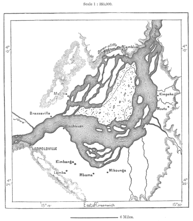
maps from the earth and its inhabitants, vol. xii
maps from the earth and its inhabitants, vol. xi
maps from the earth and its inhabitants, vol. xiii
bibliothèque nationale de france
eran laor cartographic collection
paper
british museum
latin-language maps
tian shan
alps
atlas maior, vol 2 (sweden, russia, poland, eastern europe, and greece) - joan blaeu, 1667 - bl 114.h(star).2
17th-century maps of scandinavia
1590s maps of the world
cornelis de jode
maps by jakob van der schley
old maps of southeast asia
old maps of the environments of paris
maps by alexis-hubert jaillot
maps of bernkastel-kues by braun & hogenberg
maps of zell (mosel) by braun & hogenberg
map of ancient armenia by philippe de la rué
eran laor cartographic collection
maps from the earth and its inhabitants, vol. iii
mining in austria
eran laor cartographic collection
jacob peeters
eran laor cartographic collection
guillaume sanson
eran laor cartographic collection
jacob peeters
carte de partie de lithuanie (vilnius, troki) by nicolas sanson
cartouches by sanson family
old maps of the moon
tobias mayer
old maps of southeast asia
philips galle
turgot map of paris, kyoto university library
plan de turgot
madagascar in the 17th century
description de l'universe
maps from géographie illustrée de la france et de ses colonies
orientalist painting
beschreibung der städt der welt - braun & hogenberg - btv1b52512111k
dresden in the 1580s
maps of liège by johannes blaeu - derivative files
maps from the earth and its inhabitants, vol. xi
africa in the 1890s
maps from the earth and its inhabitants, vol. xii
africa in the 1890s
maps from the earth and its inhabitants, vol. xii
africa in the 1890s
africa in the 1890s
maps of africa
maps from the earth and its inhabitants, vol. xii
africa in the 1890s
maps from the earth and its inhabitants, vol. xiii
africa in the 1890s
maps from the earth and its inhabitants, vol. xiii
africa in the 1890s
maps from the earth and its inhabitants, vol. xii
africa in the 1890s
maps from the earth and its inhabitants, vol. xi
africa in the 1890s
maps from the earth and its inhabitants, vol. xii
africa in the 1890s
maps from the earth and its inhabitants, vol. xii
africa in the 1890s
maps from the earth and its inhabitants, vol. xii
africa in the 1890s
gemeente atlas van nederland - south holland
1860s maps of south holland
maps from the earth and its inhabitants, vol. xii
africa in the 1890s
maps from the earth and its inhabitants, vol. xiii
africa in the 1890s
maps from the earth and its inhabitants, vol. xi
africa in the 1890s
maps from the earth and its inhabitants, vol. xi
africa in the 1890s
maps from the earth and its inhabitants, vol. xii
africa in the 1890s
maps from the earth and its inhabitants, vol. xii
africa in the 1890s
maps from the earth and its inhabitants, vol. xi
africa in the 1890s
maps from the earth and its inhabitants, vol. xi
africa in the 1890s
maps from géographie illustrée de la france et de ses colonies
orientalist painting
maps from géographie illustrée de la france et de ses colonies
orientalist painting
mauritshuis in the 17th century
dutch baroque architecture
description de l'universe
alain manesson mallet
1640s maps of the americas
copper engravings
maps made in the 17th century
old maps of upper austria
maps by willem and johannes blaeu
maps made in the 17th century
maps by willem and johannes blaeu
maps made in the 17th century
maps from the earth and its inhabitants, vol. xi
africa in the 1890s
maps from the earth and its inhabitants, vol. xi
africa in the 1890s
maps from the earth and its inhabitants, vol. xii
africa in the 1890s
maps from the earth and its inhabitants, vol. xiii
maps of africa
maps from the earth and its inhabitants, vol. xii
africa in the 1890s
maps from the earth and its inhabitants, vol. xii
africa in the 1890s
maps from the earth and its inhabitants, vol. xii
africa in the 1890s
maps from the earth and its inhabitants, vol. xi
africa in the 1890s
maps from the earth and its inhabitants, vol. xii
africa in the 1890s
maps from the earth and its inhabitants, vol. xii
africa in the 1890s
maps from the earth and its inhabitants, vol. xi
africa in the 1890s
maps from the earth and its inhabitants, vol. xiii
africa in the 1890s
africa in the 1890s
maps of africa
maps from the earth and its inhabitants, vol. xii
africa in the 1890s
maps from the earth and its inhabitants, vol. xi
africa in the 1890s
maps from the earth and its inhabitants, vol. xii
africa in the 1890s
maps from the earth and its inhabitants, vol. xi
africa in the 1890s
maps from the earth and its inhabitants, vol. xii
africa in the 1890s
maps from the earth and its inhabitants, vol. xi
africa in the 1890s
maps from the earth and its inhabitants, vol. xiii
africa in the 1890s
maps from the earth and its inhabitants, vol. xi
africa in the 1890s
maps from the earth and its inhabitants, vol. xiii
africa in the 1890s
blaeu atlas of scotland 1654
timothy pont
maps from the earth and its inhabitants, vol. xii
africa in the 1890s
maps from the earth and its inhabitants, vol. xii
africa in the 1890s
maps from the earth and its inhabitants, vol. xiii
africa in the 1890s
maps from the earth and its inhabitants, vol. xii
africa in the 1890s
maps from the earth and its inhabitants, vol. xii
africa in the 1890s
maps from the earth and its inhabitants, vol. xiii
africa in the 1890s
maps from the earth and its inhabitants, vol. xiii
maps of africa
chicago and the midwest, newberry library
cartographic reliefs
maps from the earth and its inhabitants, vol. xii
africa in the 1890s
maps from the earth and its inhabitants, vol. xiii
africa in the 1890s
maps from the earth and its inhabitants, vol. xii
africa in the 1890s
maps from the earth and its inhabitants, vol. xiii
africa in the 1890s
maps of asia by mercator-hondius
eran laor cartographic collection
german renaissance,humanism
eran laor cartographic collection
cornelis de bruyn
18th-century maps of rutland
maps in the british museum
maps of alsace by guillaume sanson
1660s maps of baden-württemberg
the british monarchy (1743)
maps in the british museum
maps of alsace by guillaume sanson
1690s maps of baden-württemberg
maps of alsace by guillaume sanson
1660s maps of alsace
maps of alsace by guillaume sanson
1660s maps of alsace
details of old maps
la virginea pars
details of old maps
la virginea pars
details of old maps
la virginea pars
details of old maps
la virginea pars
jan huygen van linschoten
baptista van doetecum
eran laor cartographic collection
guillaume sanson
maps of bremen by braun & hogenberg
bremen in the 16th century
maps by willem and johannes blaeu
ducatus holsatiæ nova tabula
17701 - 17800 of 38,713
Next page
/ 388