Log in
All resources
Create a design
38,713 Free Artworks of Map
maps from the earth and its inhabitants, vol. iv
bibliothèque nationale de france
eran laor cartographic collection
maps from the earth and its inhabitants, vol. xiii
paper
maps from the earth and its inhabitants, vol. xi
maps from the earth and its inhabitants, vol. x
british museum
africa in the 1890s
maps from the earth and its inhabitants, vol. xvii
maps from the earth and its inhabitants, vol. iv
queensferry crossing
maps from the earth and its inhabitants, vol. xvii
old maps of washington, d.c.
maps from the earth and its inhabitants, vol. xvi
ethnographic maps of north america
maps from the earth and its inhabitants, vol. v
ringkjøbing
maps from the earth and its inhabitants, vol. vii
charles eugène perron
maps from the earth and its inhabitants, vol. xviii
south america in the 19th century
maps from the earth and its inhabitants, vol. iv
snaith
maps from the earth and its inhabitants, vol. xvii
linguistic maps of north america
our arctic province, alaska and the seal islands (1886)
old maps of alaska
transpadana venetorum ditio (galleria delle carte geografiche)
old maps of the province of bergamo
admiralty charts region b: england wales ireland english channel southern north sea
admiralty charts 1401-1600
cartes de franz schrader
old maps of the alps
17th-century maps of the mediterranean sea
portolan charts made in the 17th century
jean-baptiste-henri delahaye
philippe buache
18th-century maps of western europe
1754 maps of europe
le antichità romane (piranesi)
neoclassicism
drawings by james mcneill whistler in the metropolitan museum of art
aestheticism
maps of abyssinia by mercator-hondius
pedemontium et monsferratus (galleria delle carte geografiche)
old maps of liguria
maps of the battle of shiloh
memoirs of henry villard
gemeente atlas van nederland - north holland
bennebroek
maps by alain manesson-mallet
history of galle fort
gemeente atlas van nederland - north holland
old maps of hoorn, north holland
chicago and the midwest, newberry library
rand mcnally
maps from the earth and its inhabitants, vol. x
pyramids of meroe
17th-century maps of istanbul
baroque
maps from the earth and its inhabitants, vol. xii
people of africa in 2009
maps from the earth and its inhabitants, vol. x
1890 maps of egypt
maps from the earth and its inhabitants, vol. xi
old maps of oran province
chicago and the midwest, newberry library
rand mcnally
topographisch-historische ansicht der belagerung kopenhagens (1807)
maps from the mechanical curator collection
old county maps of hertfordshire
maps by thomas kitchin
geographia universalis (1545) in the british museum
german renaissance,northern renaissance
lawrence h. slaughter collection of english maps, charts, globes, books and atlases
1700 maps of the atlantic ocean
extra-ptolemaic maps of the americas (1540 design by münster)
german renaissance,northern renaissance
geographia universalis (1545) in the british museum
german renaissance,northern renaissance
maps in the biblioteca nacional do brasil
1587 maps
eran laor cartographic collection
guillaume sanson
map of amsterdam by gerrit de broen (ii)
maps in the stadsarchief amsterdam
maps of cambridge by braun & hogenberg
1575 maps of england
maps by jakob van der schley
history of hormuz island
old maps of heraklion
baroque
maps in the british museum
jan baptist berterham
maps from the earth and its inhabitants, vol. xiii
africa in the 1890s
maps of edinburgh by braun & hogenberg
18th-century maps of scotland
maps from the earth and its inhabitants, vol. x
1890 maps of egypt
maps from the earth and its inhabitants, vol. xi
africa in the 1890s
maps from the earth and its inhabitants, vol. xi
africa in the 1890s
maps in the library of congress
1752 maps of north america
maps of aalst by braun & hogenberg
cartouche (cartography)
gemeente atlas van nederland - zeeland
19th-century maps of zeeland
maps of aalst by braun & hogenberg
coats of arms on maps
andrée rexroth
old maps of north holland
zaandam
old maps of whole wales (alone)
1640s maps of wales
plan de roussel - derivative files
maps of the bois de boulogne
maps from the earth and its inhabitants, vol. xi
africa in the 1890s
latin-language title pages
girolamo porro
1860s maps of georgia (u.s. state)
maps in the library of congress
anteckning om krigshändelserna i kurland
maps of the great northern war
maps of goa by linschoten
philippus baldaeus
17th-century maps of the strait of magellan
maps by jodocus hondius
maps of rotterdam by braun & hogenberg
maps of delft by braun & hogenberg
eran laor cartographic collection
william hughes (geographer)
maps in the topographia austriacarum (merian)
baroque
eran laor cartographic collection
joan blaeu
eran laor cartographic collection
william hughes (geographer)
city gates in gouda
old maps of gouda
eran laor cartographic collection
cornelis de bruyn
eran laor cartographic collection
cornelis de bruyn
eran laor cartographic collection
william hughes (geographer)
maps from the earth and its inhabitants, vol. iv
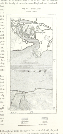
maps of dumbartonshire
maps from the earth and its inhabitants, vol. iv
charts of plymouth sound
maps from the earth and its inhabitants, vol. iv
peterborough
maps from the earth and its inhabitants, vol. iv
19th-century maps of derbyshire
rivers of the western cape
maps of the western cape
1870s maps of venezuela
1878 in venezuela
maps from the earth and its inhabitants, vol. xi
oases of libya
maps from the earth and its inhabitants, vol. xvii
linguistic maps of north america
maps from the earth and its inhabitants, vol. vii
provinces of japan
maps of the districts of the canton of bern
biel/bienne (administrative district)
maps from the earth and its inhabitants, vol. v
maps of the north atlantic
maps from the earth and its inhabitants, vol. xvi
19th-century maps of mexico city
maps from the earth and its inhabitants, vol. xiii
maps of journeys
mining in south africa
maps of vaal river
maps from the earth and its inhabitants, vol. iv
lowestoft
maps from the earth and its inhabitants, vol. iv
milford haven
maps from the earth and its inhabitants, vol. iv
huddersfield
maps from the earth and its inhabitants, vol. xiv
exploration of australia
maps from the earth and its inhabitants, vol. iv
sewers in london
maps from the earth and its inhabitants, vol. xv
19th-century maps of central america
maps from the earth and its inhabitants, vol. iv
romney marsh
maps from the earth and its inhabitants, vol. xvi
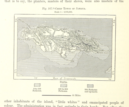
19th-century maps of jamaica
maps from the earth and its inhabitants, vol. xiii
19th-century maps of namibia
maps from the earth and its inhabitants, vol. xiii
1878 maps of africa
maps from the earth and its inhabitants, vol. x
khedivate of egypt
maps from the earth and its inhabitants, vol. xiii
19th-century maps of madagascar
maps from the earth and its inhabitants, vol. iv
firth of inverness
maps from the earth and its inhabitants, vol. vi
topographic maps of asia
maps from the earth and its inhabitants, vol. xiv
maps of voyages
17501 - 17600 of 38,713
Next page
/ 388


![Wallia principatus, vulgo Wales. Serenmo Domino Carolo, Magnae Britanniae, etc. principi Joh. Blaeu / [Excudit J. Blaeu.], 1645](https://cdn.creazilla.com/illustrations/10001591803/wallia-principatus-vulgo-wales-serenmo-domino-carolo-magnae-britanniae-etc-principi-joh-blaeu-excudit-j-blaeu-1645-sm.jpg)