Log in
All resources
Create a design
38,713 Free Artworks of Map
copper engraving print
british library
joan blaeu
atlas maior, vol 5 (england) - joan blaeu, 1667 - bl 114.h(star).5
maps from university of amsterdam special collections
atlas der neederlanden
atlas der neederlanden deel v: holland 4. noord-holland
abraham deur
hendrik de leth
copperplate print
austro-hungarian north pole expedition
maps of franz joseph land
charts and maps of the royal museums greenwich
1590 maps
maps by willem and johannes blaeu
old maps of flanders
maps by louis brion de la tour
18th-century maps of tartary
old maps of fictional countries
bernard sleigh
1594 in aschaffenburg
1594 maps of bavaria
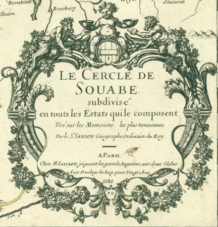
cartouches by alexis-hubert jaillot
sanson (surname)
maps by pieter mortier
old maps of asia
1740s maps of the united kingdom
maps in the british museum
old maps of lusatia
maps of bohemia
miniature speed atlas (1627) pieter van den keere
county maps of england by john speed
old maps of the eastern hemisphere
1710s maps of the world
maps of switzerland by johann jakob scheuchzer
1712 maps
the comprehensive history of england (1876)
english-language maps showing history
chicago and the midwest, newberry library
old maps of the mississippi river
atlas maior, vol 5 (england) - joan blaeu, 1667 - bl 114.h(star).5
17th-century maps of berkshire
atlas maior, vol 6 (scotland and ireland) - joan blaeu, 1667 - bl 114.h(star).6
1667 maps
atlas maior, vol 5 (england) - joan blaeu, 1667 - bl 114.h(star).5
17th-century maps of cheshire
atlas maior, vol 6 (scotland and ireland) - joan blaeu, 1667 - bl 114.h(star).6
1667 maps
atlas maior, vol 5 (england) - joan blaeu, 1667 - bl 114.h(star).5
17th-century maps of surrey
atlas maior, vol 7 (france i) - joan blaeu, 1667 - bl 114.h(star).7
1667 maps
atlas maior, vol 5 (england) - joan blaeu, 1667 - bl 114.h(star).5
17th-century maps of cornwall
atlas maior, vol 9 (italy) - joan blaeu, 1667 - bl 114.h(star).9
1667 maps of italy
atlas maior, vol 12 (america) - joan blaeu, 1667 - bl 114.h(star).12
1667 maps
atlas maior, vol 11 (asia) - joan blaeu, 1667 - bl 114.h(star).11
1667 maps
atlas maior, vol 5 (england) - joan blaeu, 1667 - bl 114.h(star).5
17th-century maps of gloucestershire
atlas maior, vol 5 (england) - joan blaeu, 1667 - bl 114.h(star).5
17th-century maps of devon
atlas maior, vol 5 (england) - joan blaeu, 1667 - bl 114.h(star).5
17th-century maps of norfolk, england
maps of polders in zeeland
maps of terneuzen
weir farm national historical park
gemeente atlas van nederland - north brabant
maps of willemstad, north brabant
maps from the earth and its inhabitants, vol. vi
charles eugène perron
charles william meredith van de velde
eran laor cartographic collection
maps from the earth and its inhabitants, vol. iv
boston, england
maps from university of amsterdam special collections
atlas der neederlanden
maps from university of amsterdam special collections
atlas der neederlanden
maps from university of amsterdam special collections
atlas der neederlanden
maps from university of amsterdam special collections
atlas der neederlanden
1800s maps of denmark
1801 maps of europe
maps from university of amsterdam special collections
atlas der neederlanden
maps from university of amsterdam special collections
atlas der neederlanden
maps from university of amsterdam special collections
atlas der neederlanden
maps from university of amsterdam special collections
atlas der neederlanden
maps from university of amsterdam special collections
atlas der neederlanden
maps from university of amsterdam special collections
atlas der neederlanden
maps from university of amsterdam special collections
atlas der neederlanden
maps from university of amsterdam special collections
atlas der neederlanden
maps by john cary
1801 maps
maps in the national archives of sweden
carl gustaf gillberg
grosser deutscher atlas
old maps of switzerland
gemeente atlas van nederland - south holland
1860s maps of south holland
topographia braunschweig lüneburg (merian)
baroque
maps of wachtendonk
atlas van loon
old maps of siberia
erik palmqvist
collections of the kobe city museum
18th-century maps of africa
maps from the mechanical curator collection
realism
maps from the earth and its inhabitants, vol. viii
buddhist pilgrimage sites in india
geocentric model
1730 maps
media contributed by university of illinois urbana-champaign university library
1685 maps of africa
brazilian paintings in the museu antônio parreiras
clóvis arrault
maps made in the 17th century
africa settentrionale
eran laor cartographic collection
afbeeldinge der stad jerusalem
maps of gouda by braun & hogenberg
hollandse ijssel in gouda
details of old maps of düsseldorf
pharus-plan
17th-century maps of mecklenburg-vorpommern
johann lauremberg
carte de la mer mediterranée (1764) by roux
eran laor cartographic collection
drawings in the museu antônio parreiras
paper and india ink
19th-century maps of antwerp
maps of antwerp city walls
drawings in the museu antônio parreiras
paper and graphite
eran laor cartographic collection
afbeeldinge der stad jerusalem
17th-century maps of lower saxony
atlas novus (blaeu)
old maps of the polish-lithuanian commonwealth
coats of arms on maps
everett d. graff collection of western americana
george woolworth colton
description de l'universe
old maps of the nile
17th-century maps of greenland
description de l'universe
eran laor cartographic collection
german renaissance,humanism
eran laor cartographic collection
german renaissance,humanism
old maps of washington, d.c.
pre-raphaelite brotherhood
atlas - voyage pittoresque à l'île-de-france, au cap de bonne-espérance et à l'île de ténériffe (1812) by milbert
maps from the mechanical curator collection
atlas maior, vol 5 (england) - joan blaeu, 1667 - bl 114.h(star).5
17th-century maps of wiltshire
atlas maior, vol 5 (england) - joan blaeu, 1667 - bl 114.h(star).5
17th-century maps of cardiganshire
atlas maior, vol 5 (england) - joan blaeu, 1667 - bl 114.h(star).5
17th-century maps of hampshire
atlas maior, vol 5 (england) - joan blaeu, 1667 - bl 114.h(star).5
17th-century maps of sussex
atlas maior, vol 9 (italy) - joan blaeu, 1667 - bl 114.h(star).9
1667 maps of italy
atlas maior, vol 5 (england) - joan blaeu, 1667 - bl 114.h(star).5
17th-century maps of suffolk
miniature speed atlas (1627) pieter van den keere
maps of scotland by john speed
1700s maps of the tsardom of russia
1700s maps of eastern europe
maps of ancient israel by philippe de la rué
old maps of ancient israel
saltsjöbadens sjukhus
saltsjöbaden, maps
old maps of suriname
elias spanier
atlas maior, vol 5 (england) - joan blaeu, 1667 - bl 114.h(star).5
17th-century maps of kent
atlas maior, vol 5 (england) - joan blaeu, 1667 - bl 114.h(star).5
17th-century maps of cumberland
atlas maior, vol 9 (italy) - joan blaeu, 1667 - bl 114.h(star).9
1667 maps of italy
atlas maior, vol 5 (england) - joan blaeu, 1667 - bl 114.h(star).5
17th-century maps of county durham
atlas maior, vol 3 (germany) - joan blaeu, 1667 - bl 114.h(star).3
17th-century maps of silesia
atlas maior, vol 5 (england) - joan blaeu, 1667 - bl 114.h(star).5
17th-century maps of dorset
maps by john cary
1799 maps
old maps of the northern hemisphere
old maps of the arctic
old maps of kobe
1872 in kobe
maps of impact craters on mars
maps of hellas quadrangle
15701 - 15800 of 38,713
Next page
/ 388


![Kennemerland Water Board Map - Rijnland Water Board, Hendrik de Leth, [1729]](https://cdn.creazilla.com/illustrations/10000578202/kennemerland-water-board-map-rijnland-water-board-hendrik-de-leth-1729-md.jpg)
![Kennemerland Water Board Map - Rijnland Water Board, Hendrik de Leth, [1729]](https://cdn.creazilla.com/illustrations/10000534022/kennemerland-water-board-map-rijnland-water-board-hendrik-de-leth-1729-md.jpg)
![Kennemerland Water Board Map - Rijnland Water Board, Hendrik de Leth, [1729]](https://cdn.creazilla.com/illustrations/10000405711/kennemerland-water-board-map-rijnland-water-board-hendrik-de-leth-1729-md.jpg)
![Kennemerland Water Board Map - Rijnland Water Board, Hendrik de Leth, [1729]](https://cdn.creazilla.com/illustrations/10001090722/kennemerland-water-board-map-rijnland-water-board-hendrik-de-leth-1729-md.jpg)

![Kennemerland Water Board Map - Rijnland Water Board, Hendrik de Leth, [1729]](https://cdn.creazilla.com/illustrations/10000704117/kennemerland-water-board-map-rijnland-water-board-hendrik-de-leth-1729-md.jpg)
![Kennemerland Water Board Map - Rijnland Water Board, Hendrik de Leth, [1729]](https://cdn.creazilla.com/illustrations/10000761895/kennemerland-water-board-map-rijnland-water-board-hendrik-de-leth-1729-md.jpg)
![Kennemerland Water Board Map - Rijnland Water Board, Hendrik de Leth, [1729]](https://cdn.creazilla.com/illustrations/10001181332/kennemerland-water-board-map-rijnland-water-board-hendrik-de-leth-1729-md.jpg)
![Kennemerland Water Board Map - Rijnland Water Board, Hendrik de Leth, [1729]](https://cdn.creazilla.com/illustrations/10000978808/kennemerland-water-board-map-rijnland-water-board-hendrik-de-leth-1729-md.jpg)
![Kennemerland Water Board Map - Rijnland Water Board, Hendrik de Leth, [1729]](https://cdn.creazilla.com/illustrations/10001059183/kennemerland-water-board-map-rijnland-water-board-hendrik-de-leth-1729-md.jpg)
![Kennemerland Water Board Map - Rijnland Water Board, Hendrik de Leth, [1729]](https://cdn.creazilla.com/illustrations/10001356914/kennemerland-water-board-map-rijnland-water-board-hendrik-de-leth-1729-md.jpg)
![Kennemerland Water Board Map - Rijnland Water Board, Hendrik de Leth, [1729]](https://cdn.creazilla.com/illustrations/10001510543/kennemerland-water-board-map-rijnland-water-board-hendrik-de-leth-1729-md.jpg)
![Kennemerland Water Board Map - Rijnland Water Board, Hendrik de Leth, [1729]](https://cdn.creazilla.com/illustrations/10001456497/kennemerland-water-board-map-rijnland-water-board-hendrik-de-leth-1729-md.jpg)


