Log in
All resources
Create a design
38,713 Free Artworks of Map
maps by willem and johannes blaeu
eran laor cartographic collection
africa in the 1890s
latin-language maps
bibliothèque nationale de france
maps from the earth and its inhabitants, vol. xii
maps of africa
frans hogenberg
the geographical distribution of animals (book)
maps of ecozones
maps of amersfoort by braun & hogenberg
maps by jan janssonius
old maps of the tuamotus
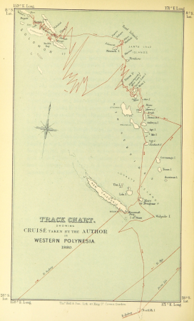
old maps of polynesia
the geographical distribution of animals (book)
nearctic
the geographical distribution of animals (book)
indomalayan fauna
the geographical distribution of animals (book)
neotropic
maps from the earth and its inhabitants, vol. xi
1891 maps of africa
maps of kodagu district
old maps of india
itinerario (jan huygen van linschoten)
renaissance
maps from the earth and its inhabitants, vol. xii
africa in the 1890s
map of moscow by matthäus merian
baroque
maps from the earth and its inhabitants, vol. xii
africa in the 1890s
maps of konstanz by braun & hogenberg
eran laor cartographic collection
maps of mons (hainaut) by braun & hogenberg
eran laor cartographic collection
maps of cusco by braun & hogenberg
eran laor cartographic collection
1804 maps of europe
maps by john cary
maps by alain manesson-mallet
1685 maps
avenionensis ditio et venaisinus comitatus (galleria delle carte geografiche)
john rocque 1746 london map (a1-h3)
john rocque's map of london, 1746
turgot map of paris, kyoto university library – derivative files
maps of palais de l'élysée
1700s maps of the world
le neptune francois
description de l'universe
old maps of newfoundland
maps from the mechanical curator collection available to georeference
maps from the mechanical curator collection
old maps of gravelines
flandria illustrata
maps of ischia by mario cartaro
old maps of procida
17th-century maps of rotterdam
old maps of delfland
winthrop square (boston)
downtown crossing
locator maps of the harbour of rotterdam
maps of scheepvaartkwartier
map of ghent by jan blaeu
reynier blokhuysen
africa in the 18th century
1794 maps of africa
africa in the 18th century
1794 maps of africa
18th-century maps of korea
nouvel atlas de la chine
hummelmora torp
hummelmora hage
maps from the earth and its inhabitants, vol. xiii
maps of africa
charles eugène perron
old maps of trabzon
cartes de franz schrader
1894 maps of france
maps by willem and johannes blaeu
old maps of schoonhoven
maps by willem and johannes blaeu
1648 maps of africa
maps of chimay by braun & hogenberg
maps of chimay city walls
16th-century maps of london
maps of old london (book)
maps from the earth and its inhabitants, vol. xii
africa in the 1890s
maps by nicolas sanson
1730s maps of france
media from the national library of finland
classicism
media from the national library of finland
classicism
turgot map of paris, david rumsey historical map collection – derivative files
église saint-sulpice on old maps
maps from the earth and its inhabitants, vol. xii
africa in the 1890s
maps of lisbon by braun & hogenberg (1572)
eran laor cartographic collection
16th-century maps of london
maps of old london (book)
16th-century maps of london
maps of old london (book)
maps of rotterdam by berckenrode
maps of haringvliet (rotterdam)
maps from the earth and its inhabitants, vol. x
1890 maps of africa
dexter press postcards of arizona
curt teich postcard archives
maps from the earth and its inhabitants, vol. xi
africa in the 1890s
topographia alsatiae (merian)
baroque
curt teich postcard archives
postcards of arizona
gemeente atlas van nederland - south holland
maps of geervliet
r. hausermann, carte de la terre sainte, 1914
eran laor cartographic collection
maps of duisburg by braun & hogenberg
maps of emmerich by braun & hogenberg
maps from the earth and its inhabitants, vol. v
maps of sea ice
maps from the earth and its inhabitants, vol. vii
floods in china
ismailïa. a narrative of the expedition to central africa for the suppression of the slave trade (1874)
1874 maps of africa
maps of the kingdom of córdoba (crown of castile)
maps of spain by tomas lopez
maps of the kingdom of seville
maps of spain by tomas lopez
maps of bruges by basire
james basire
maps by willem and johannes blaeu
maps of steenwijk
maps made in the 17th century
old county maps of cornwall
maps of ghent by braun & hogenberg
map of ghent by foppens
maps by willem and johannes blaeu
copper engravings
old maps of bordelais
maps of médoc
old county maps of essex
christopher saxton
lawrence h. slaughter collection of english maps, charts, globes, books and atlases
nypl lionel pincus and princess firyal map division
old maps of the new kingdom of granada
maps by willem and johannes blaeu
atlas maior, vol 12 (america) - joan blaeu, 1667 - bl 114.h(star).12
1667 maps of north america
eran laor cartographic collection
pierre mortier
eran laor cartographic collection
pierre françois tardieu
gemeente atlas van nederland - south holland
1860s maps of south holland
algeria in the 1880s
old maps of algeria
den danske hærs historie til nutiden og den norske hærs historie indtil 1814
maps from the mechanical curator collection
maps of bruges by braun & hogenberg
1880s maps of tunisia
tunisia in the 1880s
maps from the earth and its inhabitants, vol. vi
maps of samarkand
old maps of geraardsbergen
1649 in europe
maps from the earth and its inhabitants, vol. xi
africa in the 1890s
maps made in the 17th century
1630s maps of taiwan
old maps of manchuria
general atlas (1773)
copper engravings in the universitätsbibliothek salzburg
wolf-dietrich-klebeband städtebilder
17th-century maps of sumatra
maps by gerard valck
maps of oceania and maritime southeast asia
maps of australasia
maps from university of amsterdam special collections
atlas der neederlanden
maps of ceylon by petrus plancius
ketheeswaram temple
john rocque's 1746 map of london
details of old maps of london
miniature speed atlas (1627) pieter van den keere
county maps of england by john speed
kaart van het hoogheemraadschap van schieland, 1611-1635
17th-century maps of rotterdam
r. hausermann, carte de la terre sainte, 1914
eran laor cartographic collection
lawrence h. slaughter collection of english maps, charts, globes, books and atlases
nypl lionel pincus and princess firyal map division
wanderings, south and east (1882)
old maps of polynesia
maps by willem and johannes blaeu
old maps of vlaardingen
maps by willem and johannes blaeu
johannes blaeu - map of antwerp
hamburgische elbkarte von melchior lorichs
parts of old maps of hamburg
maps of torzhok
erik palmqvist
14001 - 14100 of 38,713
Next page
/ 388


![Map of Bourdelois, the country of Medoc, and the provostship of Born / [Blaeu], 1635](https://cdn.creazilla.com/illustrations/10001341609/map-of-bourdelois-the-country-of-medoc-and-the-provostship-of-born-blaeu-1635-sm.webp)


![TERRA FIRMA et NOVUM REGNUM GRANATENSE et POPAYAN., [1630-1670]](https://cdn.creazilla.com/illustrations/10001462419/terra-firma-et-novum-regnum-granatense-et-popayan-1630-1670-md.jpg)


![Map and images of the glory of Abbenbroek 1701 / I. Stemmers sculpsit; A. Steyaart invenit, Romeyn de Hooghe, [1701]](https://cdn.creazilla.com/illustrations/10000431246/map-and-images-of-the-glory-of-abbenbroek-1701-i-stemmers-sculpsit-a-steyaart-invenit-romeyn-de-hooghe-1701-md.jpg)