Log in
All resources
Create a design
38,713 Free Artworks of Map
bibliothèque nationale de france
eran laor cartographic collection
cartouche (cartography)
national library of israel
maps by willem and johannes blaeu
gemeente atlas van nederland - south holland
1860s maps of south holland
henricus hondius ii, nova totius terrarum orbis geographica ac hydrographica tabula, 1630
henricus hondius ii
maps in the library of congress
maps of the history of morocco
empire of morocco
henricus hondius ii, nova totius terrarum orbis geographica ac hydrographica tabula, 1630
eran laor cartographic collection
henricus hondius ii, nova totius terrarum orbis geographica ac hydrographica tabula, 1630
eran laor cartographic collection
17th-century maps of aisne
17th-century maps of oise
beschreibung der städt der welt - braun & hogenberg - btv1b52512111k
maps of casablanca by braun & hogenberg
beschreibung der städt der welt - braun & hogenberg - btv1b52512111k
maps of parma by braun & hogenberg
maps by willem and johannes blaeu
maps of gulf of khambhat
henricus hondius ii, nova totius terrarum orbis geographica ac hydrographica tabula, 1630
eran laor cartographic collection
henricus hondius ii, nova totius terrarum orbis geographica ac hydrographica tabula, 1630
eran laor cartographic collection
former new york life insurance company building
sanborn maps of manhattan published in 1905
eran laor cartographic collection
afbeeldinge der stad jerusalem
ptolemy's 7th european map
bologna ptolemy
turgot map of paris, musée carnavalet
maps of paris from paris musées
turgot map of paris, musée carnavalet
maps of paris from paris musées
sion, quarter of rijswijk
1712 maps
maps in the library of congress
1670 maps
maps of paris from bibliothèque nationale de france
pierre françois tardieu
maps of the dutch east india company - indonesia
claudius anthony van luepken
turgot map of paris, musée carnavalet
maps of paris from paris musées
romanticism
1557 maps
guide joanne espagne et portugal-1915
1915 maps
maps of hooge zwaluwe
maps of lage zwaluwe
gemeente atlas van nederland - south holland
1860s maps of south holland
perusinus ac tifernas (galleria delle carte geografiche)
ignazio danti
gemeente atlas van nederland - south holland
1860s maps of south holland
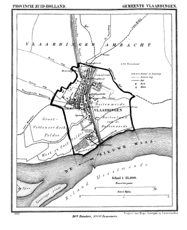
gemeente atlas van nederland - south holland
old maps of vlaardingen
emery walker
1911 maps
parts of old maps of hamburg
maps of hamburg-altstadt
compass roses on maps
compasses in spain
maps from traité de la police, bibliothèque nationale de france
first map of paris from traité de la police
eran laor cartographic collection
john cary
maps of barbary coast
old maps of tartary
eran laor cartographic collection
john cary
1660s maps of the world
atlas maior
old maps of the bay of gibraltar
18th-century maps of gibraltar
synopsis universae philologiae
1710s maps of the world
1860s maps of china
1863 maps of asia
old maps of norwich
james basire
ordnance survey 1:25000 maps (full sheets)
uphall, west lothian
map of ancient assyria by philippe de la rué
maps
latin-language maps
bologna ptolemy
sieges of the eighty years' war
conflicts in 1583
maps from the earth and its inhabitants, vol. xvii
topographic maps of new york (state)
french-language maps
ambroise tardieu
map of the circle of austria by sanson
1700s maps of austria
media from atlas of mutual heritage on dutch east india company
portolan charts by willem and johannes blaeu
atlas maior, vol 2 (sweden, russia, poland, eastern europe, and greece) - joan blaeu, 1667 - bl 114.h(star).2
1667 maps of russia
maps in the library of congress
1862 maps of virginia
considérations géographiques et physiques sur les nouvelles découvertes au nord de la grande mer
1750s maps of the russian empire
fra mauro map
1459
old maps of the new kingdom of granada
maps by willem and johannes blaeu
gemeente atlas van nederland - utrecht
maps of houten
maps of lidingö
1781 in sweden
gemeente atlas van nederland - south holland
1860s maps of south holland
maps of constantinople by braun & hogenberg
1570s maps of istanbul
guide joanne espagne et portugal-1906
french-language maps
guide joanne espagne et portugal-1915
1915 maps
maps in the library of congress
old maps of sichuan
ray in the 19th century
iran in the 1820s
gemeente atlas van nederland - south holland
1860s maps of south holland
media from accademia delle scienze di torino
1575 engravings
media from accademia delle scienze di torino
1577 engravings
lawrence h. slaughter collection of english maps, charts, globes, books and atlases
nypl lionel pincus and princess firyal map division
maps of upper palatinate
old maps of bavaria
maps of paris from bibliothèque nationale de france
maps of paris by braun & hogenberg
old maps of flanders
1635 maps
1610s maps of the netherlands
maps with cartouches
prints by agostino veneziano in the british museum
maps in the british museum
prints by agostino veneziano in the british museum
maps in the british museum
1670 maps of europe
hugo allardt
turgot map of paris, kyoto university library
sheet 4 of the turgot map of paris
tourism advertising posters of germany
spanish-language maps
french-language maps of asia
1750s maps of asia
frontispieces from england
maps by william faden
old maps of brabant
1666 in belgium
map of the circle of austria by sanson
1690s maps of austria
gaspard de chabrol
maps from gallica
1570s maps of the world
typus orbis terrarum
arnold van langren map of southwest africa
renaissance
asia noviter delineata
native indonesians
maps of paris from bibliothèque nationale de france
bird's eye view maps of paris
guide joanne espagne et portugal-1906
french-language maps
1570s maps of the world
typus orbis terrarum
a map of the british empire in america with the french and spanish settlements adjacent thereto
1730s maps of the caribbean
maps of the electorate of cologne
maps made in the 18th century
landais & oberthur
maps from gallica
maps from the earth and its inhabitants, vol. xii
maps of africa
17th-century maps of north carolina
old maps of virginia
media from accademia delle scienze di torino
1577 engravings
media from accademia delle scienze di torino
1577 engravings
1747 maps of new hampshire
english-language maps
maps of braga by braun & hogenberg
braga
maps of the west-indische compagnie
1750 maps
maps of the west-indische compagnie
1747 maps of africa
17th-century maps of moscow
16th-century maps of moscow
glaciers and glaciation (1910)
maps of yakutat bay
latin-language maps
german renaissance
atlas des anciens plans de paris by imprimerie nationale, 1900 from the david rumsey historical map collection
maps of paris from the david rumsey historical map collection
maps in the library of congress
1776 maps of new jersey
gemeente atlas van nederland - north holland
old maps of haarlem
13201 - 13300 of 38,713
Next page
/ 388


![Manatvs located on the Noot [sic] Riuier., 1639](https://cdn.creazilla.com/illustrations/10001304673/manatvs-located-on-the-noot-sic-riuier-1639-md.jpg)


![Lutetia or first plan of the city of Paris taken from Cesar, Strabo, the Emperor Julian and Ammiam Marcellin [Digitized still image] / By MLCDLM, Antoine Coquart](https://cdn.creazilla.com/illustrations/10001224733/lutetia-or-first-plan-of-the-city-of-paris-taken-from-cesar-strabo-the-emperor-julian-and-ammiam-marcellin-digitized-still-image-by-mlcdlm-antoine-coquart-sm.webp)


![Map 22 [Tabula 22], 1477](https://cdn.creazilla.com/illustrations/10001610882/map-22-tabula-22-1477-md.jpg)


