Log in
All resources
Create a design
38,713 Free Artworks of Map
bibliothèque nationale de france
french-language maps of spain
guide joanne espagne et portugal-1906
1906 maps
eran laor cartographic collection
english-language maps
guide joanne espagne et portugal-1915
1915 maps
beschreibung der städt der welt - braun & hogenberg - btv1b52512111k
joan blaeu
latin-language maps
1477 maps
turgot map of paris – derivative files
château de la tournelle (paris)
palace of westminster in art
floor plans of palaces
1710s maps of eastern europe
1710s maps of the balkans
17th-century maps of slovenia
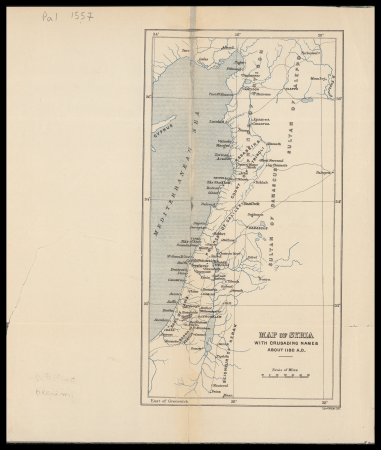
17th-century maps of istria
guide joanne espagne et portugal-1915
1915 maps
gemeente atlas van nederland - south holland
old maps of gorinchem
gemeente atlas van nederland - south holland
maps of maassluis
rus' (eastern europe)
1747 maps of russia
guide joanne espagne et portugal-1906
french-language maps of spain
maps from the mechanical curator collection
1887 maps of sudan
guide joanne espagne et portugal-1915
1915 maps
maps of asia by mercator-hondius
details of old maps
atlas maior, vol 11 (asia) - joan blaeu, 1667 - bl 114.h(star).11
1667 maps
atlas maior, vol 4 (netherlands) - joan blaeu, 1667 - bl 114.h(star).4
1667 maps
1720s maps showing history
1727 maps of africa
old maps of hannover
1757 in hannover
vrbivm praecipvarvm totivs mvndi (1612)
maps of bolsward by braun & hogenberg
maps from the earth and its inhabitants, vol. xii
africa in the 1890s
gemeente atlas van nederland - north holland
maps of haarlemmermeer
old maps of krefeld
1645 in krefeld
17th-century maps of bordeaux
17th-century maps of dordogne
sanborn maps of manhattan published in 1905
irt sixth avenue line stations
maps in the british museum
1780s maps of france
1665 maps of ukraine
1665 maps
maps from the earth and its inhabitants, vol. xii
1892 in africa
carte de barbarie, nigritie, guinée par guillaume delisle (1707)
1718 maps of africa
maps of the ottoman empire by mercator-hondius
map
daniel de la feuille
1747 maps
maps of polders in south holland
17th-century maps of rotterdam
gemeente atlas van nederland - south holland
1860s maps of south holland
maps by willem and johannes blaeu
old maps of franeker
1640s maps of the netherlands
coats of arms on maps
19th-century maps of greece
pierre françois tardieu
guide joanne espagne et portugal-1915
1915 maps
guide joanne espagne et portugal-1915
1915 maps
guide joanne espagne et portugal-1906
french-language maps of spain
map of ancient armenia by philippe de la rué
1650s maps of armenia
maps of exeter by braun & hogenberg
hooker (alias vowell) arms
vrbivm praecipvarvm totivs mvndi (1612)
maps of dokkum by braun & hogenberg
maps of helsingborg by braun & hogenberg
vrbivm praecipvarvm totivs mvndi (1612)
eran laor cartographic collection
romeyn de hooghe
eran laor cartographic collection
john cary
guide joanne espagne et portugal-1906
french-language maps of spain
guide joanne espagne et portugal-1915
1915 maps
guide joanne espagne et portugal-1906
french-language maps of spain
guide joanne espagne et portugal-1906
french-language maps of spain
cornelis huyberts
guillaume sanson
bodleian maps collection
old maps of oxford
maps by isaak tirion
old maps of holland
lawrence h. slaughter collection of english maps, charts, globes, books and atlases
nypl lionel pincus and princess firyal map division
old maps of regions of france
county of artois
media from accademia delle scienze di torino
high renaissance
description de l'universe
1680s maps of scotland
lawrence h. slaughter collection of english maps, charts, globes, books and atlases
nypl lionel pincus and princess firyal map division
maps by girolamo porro
1596 maps of africa
17th-century maps of london
maps of old london (book)
english-language maps
maps by john cary
1823 maps of new york city
circular maps
maps by girolamo porro
1596 maps of africa
maps by girolamo porro
1596 maps of africa
gemeente atlas van nederland - north holland
19th-century maps of den helder
maps of seto inland sea
osaka castle in art
gemeente atlas van nederland - north holland
maps of diemen
maps from the mechanical curator collection available to georeference
maps from the mechanical curator collection
maps of ethnic groups in the whole caucasus
1890s maps of the caucasus
old maps of delft
1649
maps of polders in south holland
old maps of delfland
bologna ptolemy
1477 maps
maps by alexis-hubert jaillot
1730s maps of france
maps in the rijksmuseum amsterdam
maps of paris by frans hogenberg
beschreibung der städt der welt - braun & hogenberg - btv1b52512111k
maps of hormuz by braun & hogenberg
beschreibung der städt der welt - braun & hogenberg - btv1b52512111k
maps of kleve by braun & hogenberg
beschreibung der städt der welt - braun & hogenberg - btv1b52512111k
maps of neuss by braun & hogenberg
beschreibung der städt der welt - braun & hogenberg - btv1b52512111k
maps of valletta by braun & hogenberg
maps from gallica
old maps of genoa
1858 van de velde maps of palestine and jerusalem
eran laor cartographic collection
henricus hondius ii, nova totius terrarum orbis geographica ac hydrographica tabula, 1630
eran laor cartographic collection
prints by cornelius drebbel
old maps of alkmaar
maps from the earth and its inhabitants, vol. xi
french west africa
1866 in the netherlands
maps of almelo
old maps of the history of tunisia
maps of naval battles
cartes de franz schrader
1894 maps of france
maps from the earth and its inhabitants, vol. xii
africa in the 1890s
old maps of duchy of troppau
maps of duchy of jagerndorf
16th-century maps of amsterdam
lodovico guicciardini
david rumsey historical map collection
17th-century maps of iceland
ancienne église saint-hippolyte de paris
churches on turgot map of paris
turgot map of paris, musée carnavalet
maps of paris from paris musées
dienst der publieke werken
old maps of amsterdam
guide joanne espagne et portugal-1906
french-language maps of spain
the loyal west in the times of the rebellion
1803 maps of the united states
maps from the mechanical curator collection available to georeference
maps from the mechanical curator collection
eran laor cartographic collection
edward weller
paintings of battle of lepanto
museo storico navale (venice)
athens in the ottoman era
old maps of athens
17th-century maps of cambridgeshire
old county maps of cambridgeshire
eran laor cartographic collection
emanuel bowen
1652 maps
shipmills
beschreibung der städt der welt - braun & hogenberg - btv1b52512111k
maps of braunschweig by braun & hogenberg
13101 - 13200 of 38,713
Next page
/ 388


![[Agas map of Oxford, 1578], Augustine Ryther](https://cdn.creazilla.com/illustrations/10001154709/agas-map-of-oxford-1578-augustine-ryther-md.jpg)


![Map 24 [Tabula 24], 1477](https://cdn.creazilla.com/illustrations/10001215414/map-24-tabula-24-1477-md.jpg)