Log in
All resources
Create a design
38,713 Free Artworks of Map
maps of paris from the david rumsey historical map collection
atlas des anciens plans de paris by imprimerie nationale, 1900 from the david rumsey historical map collection
atlas map
david rumsey historical map collection
eran laor cartographic collection
maps by willem and johannes blaeu
bibliothèque nationale de france
french-language maps
maps of paris from bibliothèque nationale de france
maps by hendrik hondius the younger
maps of ingolstadt by braun & hogenberg
maps of munich by braun & hogenberg
old maps of the eastern mediterranean
catalan atlas
maps from the earth and its inhabitants, vol. ix
ethnographic maps of asia
curt teich postcard archives
map postcards
gemeente atlas van nederland - south holland
1860s maps of south holland
maps by willem and johannes blaeu
safavid dynasty
guide joanne espagne et portugal-1915
1915 maps
maps in the museo correr
crema in art
maps of paris from bibliothèque nationale de france
nouveau plan de paris by louis brion de la tour
carte de la mer mediterranée (1764) by roux
eran laor cartographic collection
john rocque's 1746 map of london
maps of woolwich
maps of paris from the david rumsey historical map collection
baroque
maps of rotterdam by berckenrode
kolk (rotterdam)
1600 world map by girolamo porro
1600s maps of the world
maps, prints and photographs in royal danish library
old maps of kiel
description de l'universe
1680s maps of england
17th-century maps of denmark
old maps of seas
eran laor cartographic collection
french-language maps
old maps of san antonio, texas
maps by henry wellge
maps by jodocus hondius
maps by petrus bertius
old maps of trinidad and tobago
animals on maps
1910s maps of europe
guides joanne
history of yokohama
maps of yokohama
enceinte of philippe-auguste on old maps
1610s maps of paris
maps of galicia by mercator-hondius
1619 maps
18th-century maps of western europe
jean étienne guettard
carte de la mer mediterranée (1764) by roux
eran laor cartographic collection
maps by john cary
1801 maps
carte de la mer mediterranée (1764) by roux
eran laor cartographic collection
maps from traité de la police, bibliothèque nationale de france
sixth map of paris from traité de la police
bologna ptolemy
1477 maps
maps by willem and johannes blaeu
maps of livonia
historical map collection
maps of new france
16th-century maps of istria
1569 maps
18th-century engravings
viborg maps
maps from the earth and its inhabitants, vol. xi
africa in the 1890s
17th-century maps of trinidad and tobago
animals on maps
maps of hamburg by braun & hogenberg
maps of hamburg-altstadt
18th-century maps of the aegean sea
1780s maps of greece
maps of the ottoman empire by mercator-hondius
map
eran laor cartographic collection
german renaissance,humanism
isaiah thomas (publisher)
1812 maps
old maps of saxony from deutsche fotothek
1630s maps of saxony
maps by hendrik hondius the younger
1640s maps of the world
19th-century maps of vaucluse
1852 maps of france
maps of ven (oresund)
old maps of skåne
atlas des anciens plans de paris by imprimerie nationale, 1900 from the david rumsey historical map collection
maps of paris from the david rumsey historical map collection
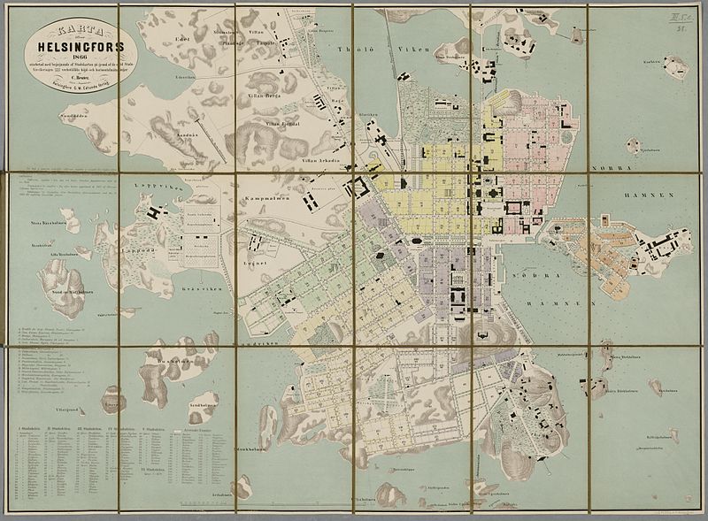
media from the national library of finland
classicism
maps from the mechanical curator collection available to georeference
maps from the mechanical curator collection
maps of america by guillaume delisle (18th century)
1760s maps of the americas
old maps of the carolingian empire
atlas van loon
old maps of seville
1788 maps of spain
old maps of the strait of gibraltar
1762 maps of spain
gemeente atlas van nederland - south holland
maps of zuidland
maps by willem and johannes blaeu
1640s maps of the ottoman empire
1690s maps of grand duchy of lithuania
maps by carolus allard
17th-century maps of silesia
coats of arms on maps
siege of lingen 1605
maps of lingen (ems)
maps by jan janssonius
1650s maps of romania
province of frosinone
papal states
maps of the western ghats
maps of rivers of india
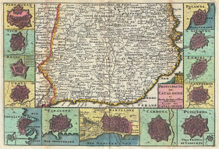
18th-century maps of catalonia
daniel de la feuille
maps of djurgården
djurgårdsslätten
istanbul in the 1600s
matteo florimi
maps of the dutch east india company - thailand
old maps of the dutch east india company
maps by emanuel bowen
britannia depicta
maps of spain by tomas lopez
history of gipuzkoa
1690s maps of the caribbean
1690s maps of the americas
1780s maps of south america
maps in the british museum
atlas des anciens plans de paris by imprimerie nationale, 1900 from the david rumsey historical map collection
maps of paris from the david rumsey historical map collection
atlas des anciens plans de paris by imprimerie nationale, 1900 from the david rumsey historical map collection
maps of paris from the david rumsey historical map collection
atlas des anciens plans de paris by imprimerie nationale, 1900 from the david rumsey historical map collection
maps of paris from the david rumsey historical map collection
atlas des anciens plans de paris by imprimerie nationale, 1900 from the david rumsey historical map collection
maps of paris from the david rumsey historical map collection
maps of territories in the burgundian circle
17th-century maps of the north sea
cornelius aurelius world map
1916 maps
plan routier de la ville et faubourg de paris by jean lattré
maps of paris from bibliothèque nationale de france
maps by willem and johannes blaeu
1630s maps of the caucasus
maps from traité de la police, bibliothèque nationale de france
third map of paris from traité de la police
gemeente atlas van nederland - utrecht
ruwiel
maps from the mechanical curator collection available to georeference
maps from the mechanical curator collection
voyage dans la russie méridionale et la crimée (1840-1842) par anatolii nikolaevich demidov
1853 maps of russia
guide joanne espagne et portugal-1915
1915 maps
1740s maps of the world
maps by emanuel bowen
algeria in the 1880s
old maps of algeria
maps of uppland
1645 in sweden
atlas des anciens plans de paris by imprimerie nationale, 1900 from the david rumsey historical map collection
maps of paris from the david rumsey historical map collection
works of nathaniel dearborn
1850s maps of boston
ptolemy's 4th african map
1477 maps
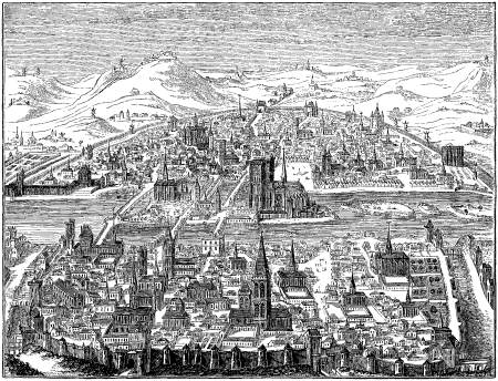
historical images of parvis notre-dame - place jean-paul ii
turgot map of paris – derivative files
turgot map of paris, kyoto university library – derivative files
palais du louvre on old maps
praefectura paranambucae pars borealis, una cum praefectura de itâmaracâ
georg marggraf
maps from the earth and its inhabitants, vol. vii
old maps of jiangsu
maps from the earth and its inhabitants, vol. vii
agricultural maps of china
national museum of maps and rare books, bucharest
maps by abraham ortelius
maps of cambridge by braun & hogenberg
1575 maps of england
maps of the ottoman empire by mercator-hondius
eran laor cartographic collection
19th-century satirical maps
1878 in art
guide joanne espagne et portugal-1906
french-language maps of spain
1640s maps of brazil
georg marggraf
maps by nicolas sanson
jan van somer
12501 - 12600 of 38,713
Next page
/ 388


![Map 12 [Tabula 12], 1477](https://cdn.creazilla.com/illustrations/10000439389/map-12-tabula-12-1477-md.jpg)


![Third plan of the city of Paris, its extent and the towns which surrounded it under the reign of Louis the Young VII of the name [Digitized still image] / By MLCDLM, Antoine Coquart](https://cdn.creazilla.com/illustrations/10000255194/third-plan-of-the-city-of-paris-its-extent-and-the-towns-which-surrounded-it-under-the-reign-of-louis-the-young-vii-of-the-name-digitized-still-image-by-mlcdlm-antoine-coquart-md.png)


