Log in
All resources
Create a design
38,713 Free Artworks of Map
maps in the library of congress
maps by willem and johannes blaeu
maps with figures
joan blaeu
coats of arms on maps
british library
novus atlas sinensis
maps by thomas kitchin
thomas kitchin
latin-language maps
hendrik van langren map of south asia
16th-century maps of the near east
maps of the battle of quatre bras
maps of the battle of ligny
18th-century maps of the strait of magellan
1700s maps of argentina
atlas maior, vol 11 (asia) - joan blaeu, 1667 - bl 114.h(star).11
1660s maps of china
1800s maps of the world
old maps of the world
1730s maps of south carolina
old maps of north america
maps in the library of congress
old maps of anniston, alabama
glaciers and glaciation (1910)
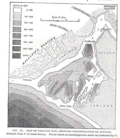
maps of yakutat bay
maps in the library of congress
history of sherbrooke (quebec)
old maps of cádiz
1664 maps
maps by jean-baptiste bourguignon d'anville
maps by thomas kitchin
may 2023 in venice
fra mauro map
zehn karten und ansichten den schlachtfelden des amerikanischen unabhängigkeitskreiges in den staaten pennsylvanien und new york
maps in the library of congress
expressionism,symbolism,bauhaus
maps of mercury
maps of arabia quadrangle
mars topography
maps by girolamo porro
leonardo cernoti
1801 maps of europe
maps by john cary
1849 maps of north america
old maps of canada
fra mauro map details
old maps of thailand
maps of the duchy of courland and semigallia
old maps of livonia
maps by john cary
county of tyrol
maps by willem and johannes blaeu
maps by jodocus hondius
maps from university of amsterdam special collections
atlas der neederlanden
historical images of the jardin du luxembourg
historical images of luxembourg palace
a set of fifty new and correct maps of england and wales
old county maps of northamptonshire
portrait paintings of sitting men with legs crossed
inkwells in art
maps of the united kingdom of the netherlands
françois bohn
maps of the dutch east india company - china
1749 maps of asia
old county maps of middlesex
maps by thomas kitchin
old maps of the sea of japan
rangaku
sanborn maps of manhattan published in 1905
aestheticism
maps by thomas kitchin
andrew dury
1860s maps of palestine
al-salihiyya
historical maps of ethnic groups in romania
nouvelle géographie universelle
details of old maps of amsterdam
maps of dam square
charlotte brontë
branwell brontë
maps by gerard de jode
1590s maps of russia
works by georg matthäus vischer
1678 maps
1650s maps of china
1655 maps of asia
old maps of the punjab region
old maps of uttarakhand
everett d. graff collection of western americana
cherokee nation
old maps of brabant
1666 in belgium
maps in the library of congress
1655 maps of asia
impact craters on mars
gill (martian crater)
maps showing 19th-century history
19th-century maps of south asia
maps of the world with orthographic projection
maps of the world without antarctica
maps by jodocus hondius
1595 maps
17th-century maps of the black sea
maps by willem and johannes blaeu
maps by willem and johannes blaeu
old maps with mercator projection
18th-century maps of the baltic sea
1770s maps of sweden
map of europe by guillaume delisle (1700)
1789 maps of europe
latin-language maps
emery walker
maps in the library of congress
fort lyon (virginia)
maps of mars by the mars global surveyor moc
argyre planitia
1690s maps of eastern europe
maps by carolus allard
danubius pannonico-mysicus
1720s maps of transylvania
maps made in the 17th century
maps by jodocus hondius
maps of the west-indische compagnie
1758 maps
maps in the library of congress
1883 maps of massachusetts
carte de barbarie, nigritie, guinée par guillaume delisle (1707)
maps in the library of congress
maps in the library of congress
bird's eye view maps of alabama
old maps of the south china sea
1680 maps of asia
old maps of gelderland
old maps of zutphen
14th-century maps of the black sea
catalan atlas
german renaissance,northern renaissance
details of the ambassadors (holbein)
maps by john cary
1799 maps
1680s maps of the caucasus
description de l'universe
maps of spain by tomas lopez
history of el bierzo
old maps of cities in texas
maps of fort worth, texas
1770s maps of alaska
robert de vaugondy
maps of ciudad colonial
caribbean sea in art
french-language maps from ios map collection
old maps of carinthia
americae 1562 by diego gutiérrez and hieronymus cock
renaissance
18th-century maps of estonia
old maps of livonia
maps by willem and johannes blaeu
old maps of upper lusatia
topographia austriacarum (merian)
baroque
maps in the library of congress
1885 maps of new york (state)
navigantium atque itinerantium bibliotheca
18th-century maps of south asia
maps of munich by braun & hogenberg
eran laor cartographic collection
turgot map of paris, kyoto university library – derivative files
palais du louvre on old maps
19th-century maps of the black sea
g. h. swanston
17th-century maps of pomerania
old maps of rügen
maps of paris from the david rumsey historical map collection
map of paris by jouvin de rochefort (boutier 133)
atlas maior, vol 1 (northern europe, norway, and denmark) - joan blaeu, 1667 - bl 114.h(star).1
1667 maps
1740s maps of the netherlands
maps of borculo
atlas maior, vol 11 (asia) - joan blaeu, 1667 - bl 114.h(star).11
1667 maps
maps of saguaro national park
oro valley
spanish-language maps
1780s maps of panama
old maps of rhineland-palatinate
old maps of alsace
portrait paintings of leopold ii, grand duke of tuscany
pietro benvenuti
maps of paris from the david rumsey historical map collection
maps of paris by caspar merian
old cartoon maps of europe
1870 cartoons
hildesheim see coat of arms
coats of arms on maps
maps from the earth and its inhabitants, vol. vi
mean precipitation maps
1860s maps of new york (state)
maps showing 1776
engravings of buildings
maps by pieter mortier
maps of san juan, puerto rico
san juan bay, puerto rico
maps by edward wright
molyneux globes
historisk atlas (stockholm, norstedt & söner, 1880)
maps of the history of scandinavia
maps of hersfeld abbey
old maps of hersfeld
11701 - 11800 of 38,713
Next page
/ 388


![Map of Paraguay, Chile, and Strait of Magellan - Guillaume de L'Isle, [1703-1708]](https://cdn.creazilla.com/illustrations/10001534848/map-of-paraguay-chile-and-strait-of-magellan-guillaume-de-lisle-1703-1708-md.jpg)


![[Ten maps and views of the battlefields of the American Revolutionary War in the states of Pennsylvania and New York], 1777](https://cdn.creazilla.com/illustrations/10001017178/ten-maps-and-views-of-the-battlefields-of-the-american-revolutionary-war-in-the-states-of-pennsylvania-and-new-york-1777-md.jpg)