Log in
All resources
Create a design
38,713 Free Artworks of Map
maps in portrait paintings
latin-language maps
novus atlas sinensis
ships on maps
bibliothèque nationale de france
maps with cartouches
maps with figures
maps of the great wall of china
joan blaeu
maps
borders of andorra-france
maps of borders of spain
fort zeelandia, taiwan in art
siege of fort zeelandia
old maps of the united states
copper engravings
merian plan of paris
baroque
adriaan justus enschedé
old maps of haarlem
maps from the earth and its inhabitants, vol. vii
évariste régis huc
old maps of french guiana
1630s maps of brazil
novus atlas sinensis
old maps of shandong
1550s maps of the iberian peninsula
renaissance
cornell university library
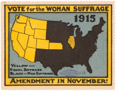
women's rights
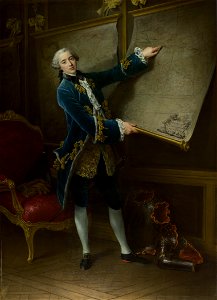
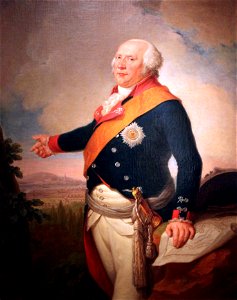
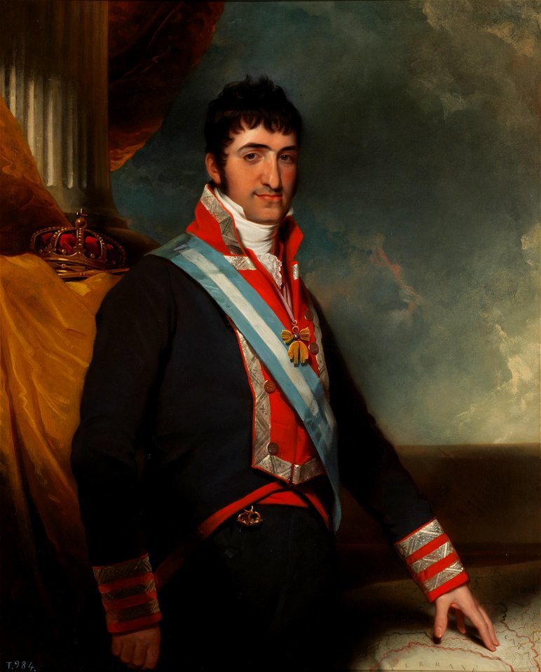
archduke charles
duke of teschen
joannes van doetecum (i)
petrus plancius
caricatures of napoleon i of france
napoleon on elba
old maps of the british empire
illustrations by walter crane
operation passage to freedom
anti-communist propaganda
17th-century maps of the netherlands
1609
1910s maps of somalia
zeila
maps by willem and johannes blaeu
pantanal
17th-century maps of the strait of magellan
maps by nicolas sanson
1770s maps of china
1779 maps
van langren map of southeast asia
1619 maps of asia
18th-century double hemisphere world maps
1720s maps of the world
magni ducatus lithuaniae
history of olsztyn
maps of avesnes-sur-helpe by braun & hogenberg
frederick de wit
bezirk bruck-mürzzuschlag
tragöß-sankt katharein
erlanger family
london
archduke charles
duke of teschen
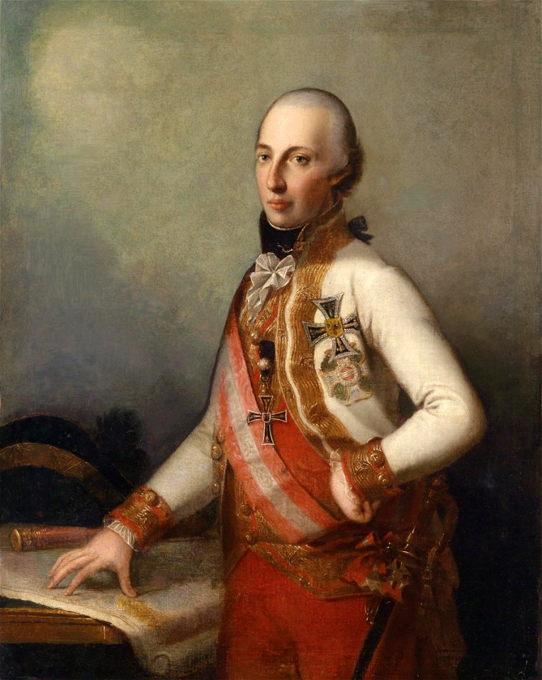
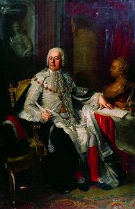
domenico pellegrini
london
perris maps of manhattan published 1852–1853
old brick church (new york city)
turgot map of paris, norman b. leventhal map center
key sheet of the turgot map of paris
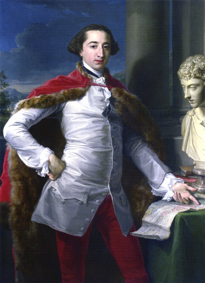
18th-century three-quarter view portrait paintings of men
1794 oil on canvas paintings in germany
john rocque's 1746 map of london
northumberland house
fra mauro map details
roc
maps by edward wright
molyneux globes
turgot map of paris, norman b. leventhal map center
proletarian literature
robert wallis (engraver)
henry warren
18th-century maps of china
18th-century maps of asia
curt teich postcard archives
map postcards
nathaniel whittock
skylines of london
john rocque's 1746 map of london
devonshire house piccadilly
maps of novaya zemlya
india orientalis
paintings by johannes vinckboons in the rijksmuseum amsterdam
old maps of ayutthaya
maps in the library of congress
adriaen van der donck
16th-century maps of antarctica
maps by gerard de jode
maps in the library of congress
adriaen van der donck
maps in the library of congress
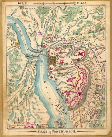
fortifications of port hudson
russo-turkish war (1877–1878) in art
great eastern crisis (1875–78)
john rocque's 1746 map of london
details of old maps of london
1850s maps of ontario
maps by john tallis
spanish-language maps
1785 maps
1777 maps of new york (state)
1777 maps of new jersey
maps of paris in the 1790s
1797 maps
old maps of the province of bergamo
1580 maps
maps by thomas kitchin
andrew dury
1690s maps of the world
copper engravings
1910s maps of somaliland
harar
impact craters on mercury
maps of mercury
19th-century maps of southeast asia
aristide-michel perrot
19th-century maps of the black sea
1870s maps of the caucasus
old maps of banská štiavnica
danubius pannonico-mysicus
maps by guillaume delisle
philippe buache
carta hydrographica y chorographica de las yslas filipinas
baroque painting
maps by nicolaes visscher i
prints by nicolaes berchem
images from the new york public library
male fur clothing in art
male black shoes in portrait paintings
red drapery in portrait paintings
atlas maior, vol 11 (asia) - joan blaeu, 1667 - bl 114.h(star).11
1667 maps
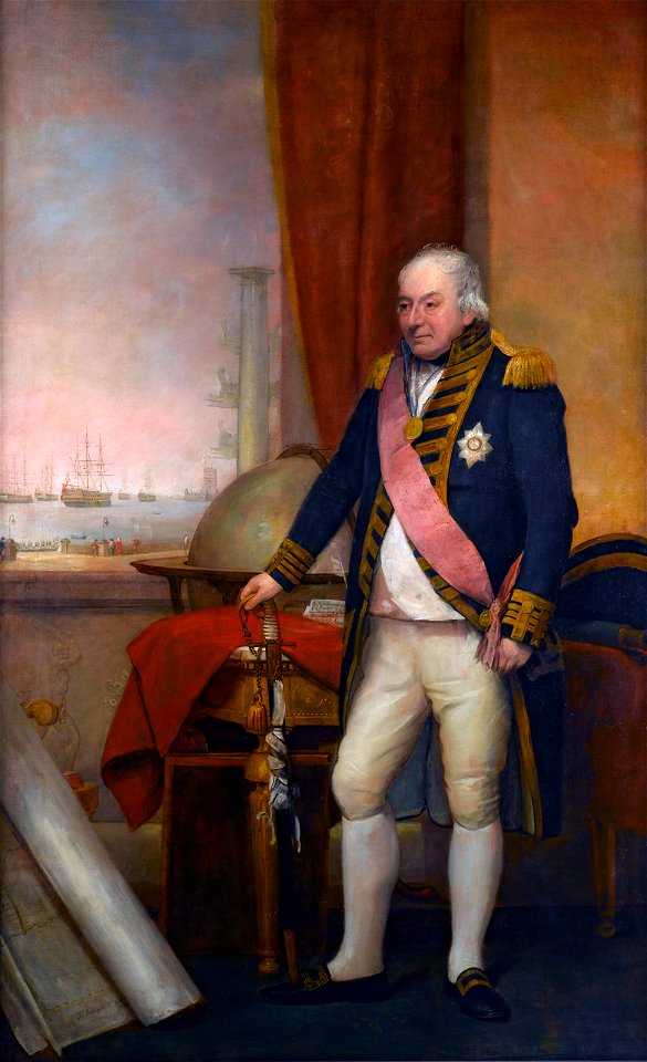
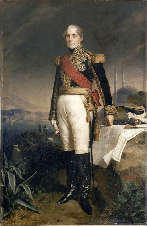
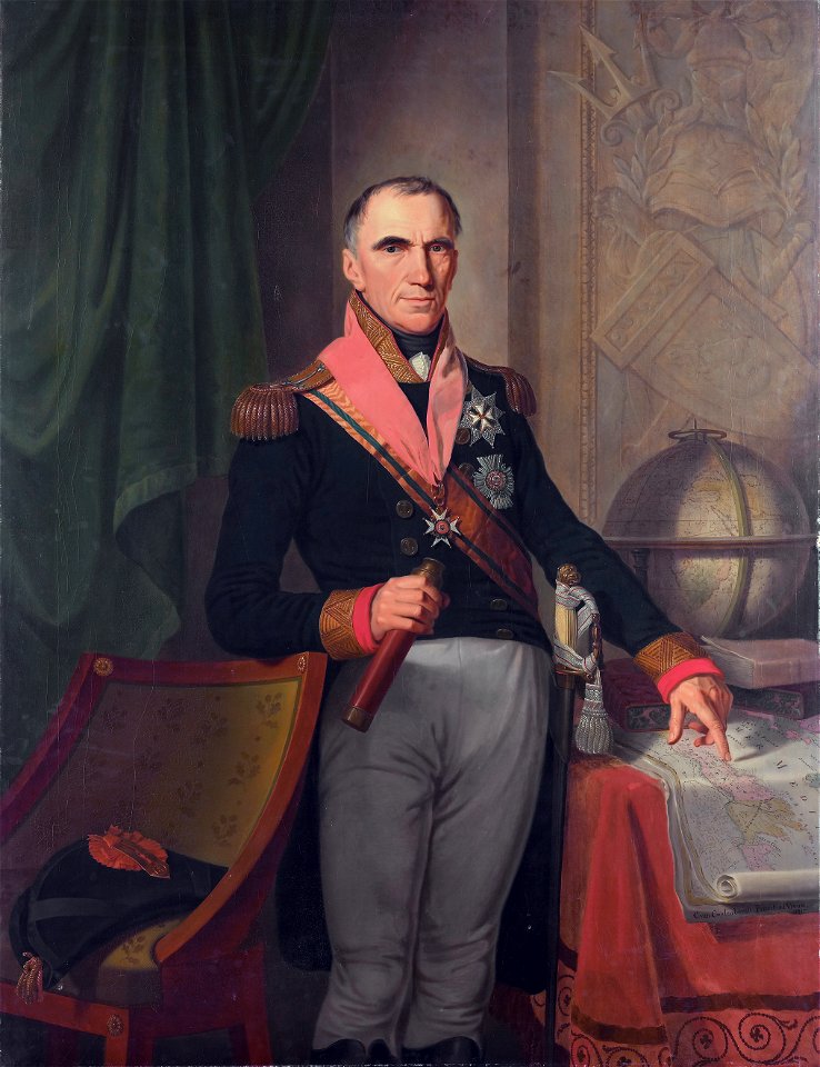
19th-century oil portraits of standing men at full length in military uniforms
stars of chivalric orders in portrait paintings
london
male
spanish empire
madrid
île de la cité in art
paris
draped columns on pedestals in portrait paintings
attributed portrait paintings
portrait paintings of men holding baton
19th-century cabinet portraits
preparatory portrait studies
1786 oil on canvas paintings
1834 maps of new york (state)
maps of the erie railroad
maps made in the 16th century
johannes ruysch
17th-century maps of hungary
old maps of hont county
maps of aboriginal australia
old maps of new south wales
bromfield street (boston, massachusetts)
granary burying ground
maps by christian sgrothen
inde (river)
history of cartography
fra mauro map
terra australis
padrón real
atlas maior, vol 11 (asia) - joan blaeu, 1667 - bl 114.h(star).11
1667 maps
maps from university of amsterdam special collections
atlas der neederlanden
armillary spheres in art
novus atlas sinensis
maps of cambridge by braun & hogenberg
maps of trinity college, cambridge
old maps of bouvet island
bouvet island
caricatures
cartoons
maps by nicolaes visscher i
old maps of assyria
armillary spheres in art
novus atlas sinensis
1660s maps of the ottoman empire
old maps of the danube
1590s maps of the world
1595 maps
maps of the crown of aragon
old maps of medieval iberia
ottoman period in the history of palestine
david rumsey historical map collection
maps of nieuwkoop
aarlanderveen
german renaissance,northern renaissance
details of the ambassadors (holbein)
atlas maior, vol 11 (asia) - joan blaeu, 1667 - bl 114.h(star).11
17th-century maps of korea
john rocque's 1746 map of london
details of old maps of london
old maps of new york city
battle of fort washington
16th-century maps of the persian gulf
maps of the gulf of suez
1630s maps of new york city
manatus map
11501 - 11600 of 38,713
Next page
/ 388