Log in
All resources
Create a design
38,713 Free Artworks of Map
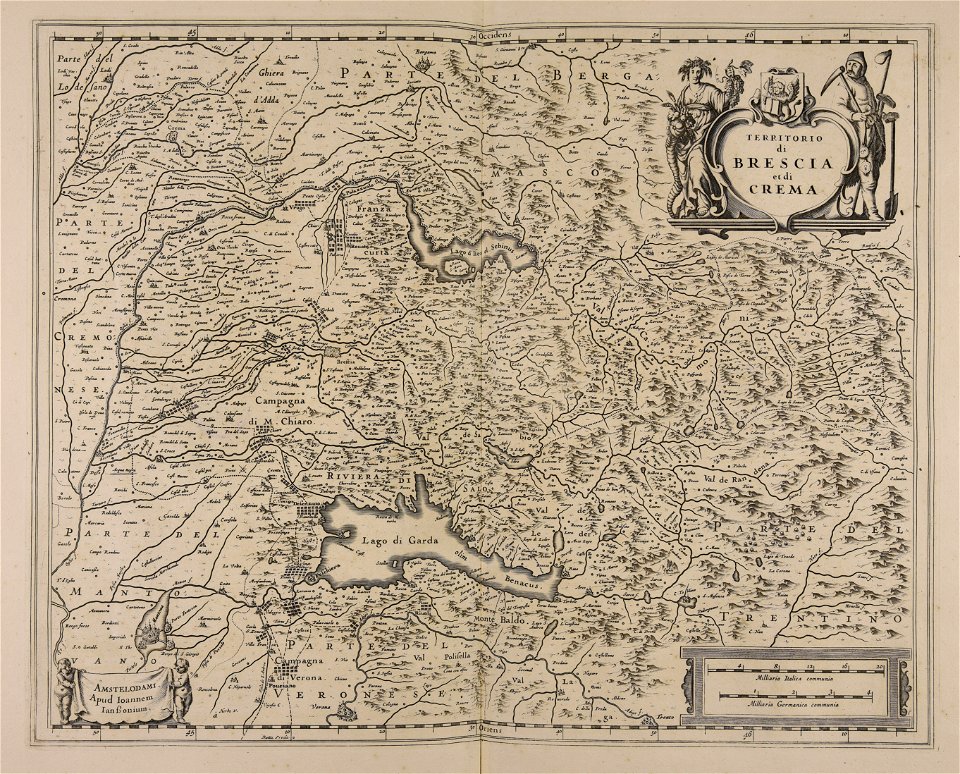
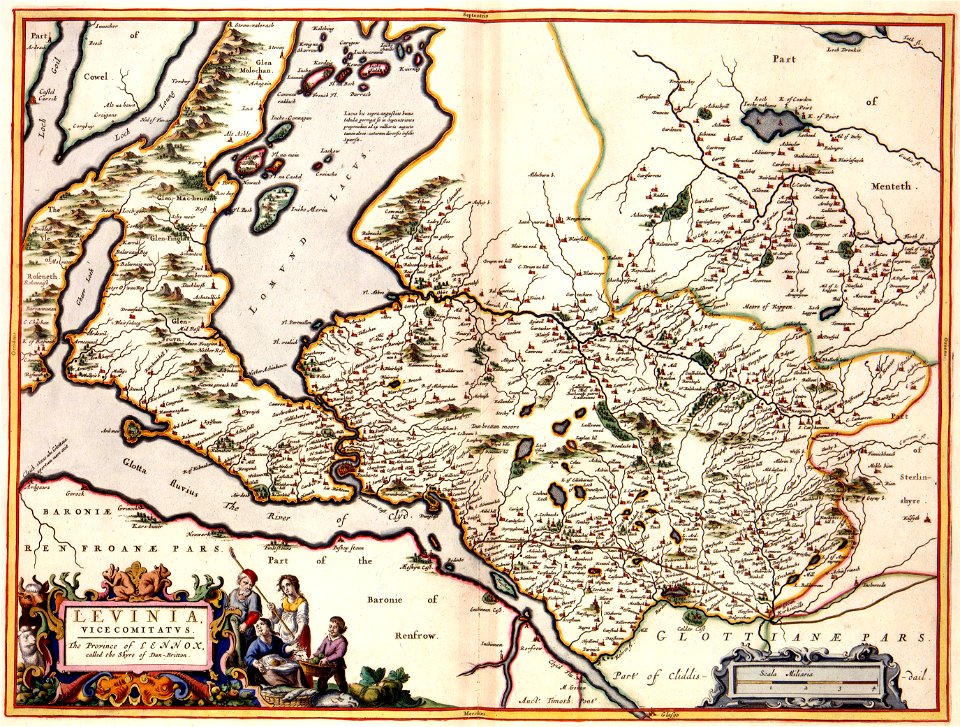
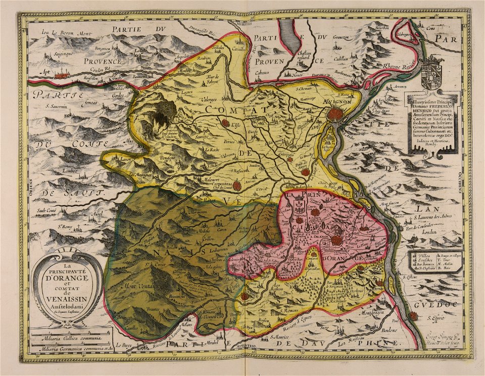
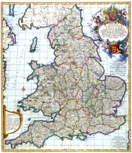
maps made in the 17th century
university of toronto wenceslas hollar digital collection
hollar maps and plans of london
maps in the library of congress
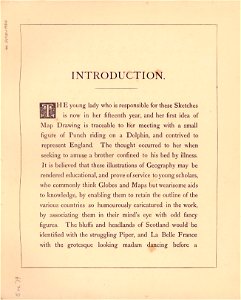
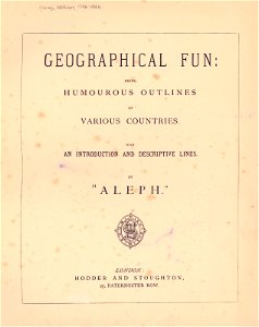
geographical fun - being humourous outlines of various countries
with an introduction and descriptive lines
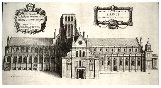
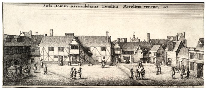
architectural prints by wenzel hollar
atlantis magni tomus quartus (biblioteca comunale di trento)
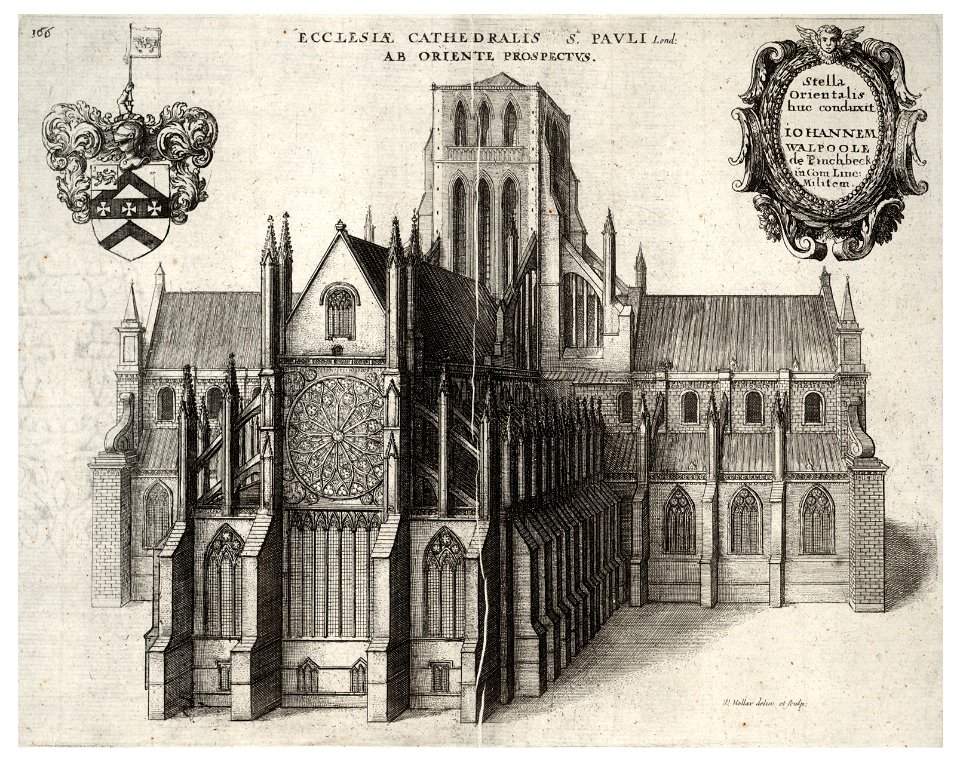
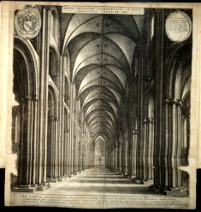
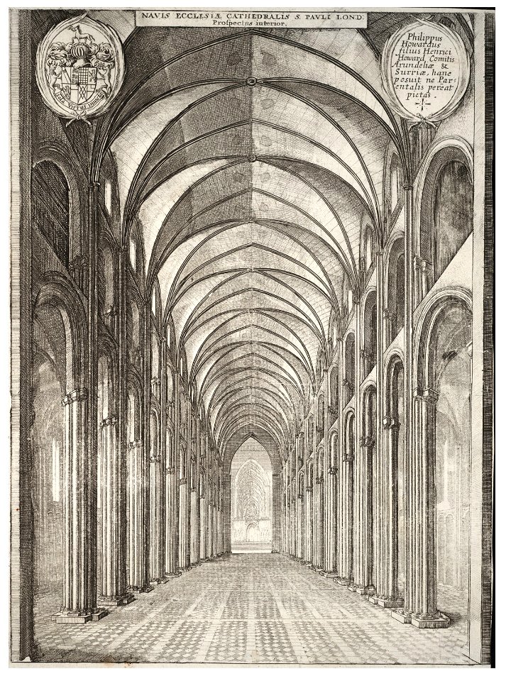
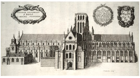
old st paul's cathedral
atlantis magni tomus quintus (biblioteca comunale di trento)
army
maps
media contributed by agad presented in former polska.pl portal
old maps of pomerania
maps made in the 17th century
jan janssonius
architectural prints by wenzel hollar
old st paul's cathedral
university of toronto wenceslas hollar digital collection
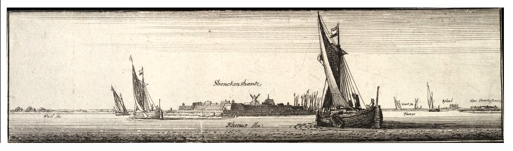
sailing barge
architectural prints by wenzel hollar
old st paul's cathedral
drawings and watercolours of the royal museums greenwich
printing
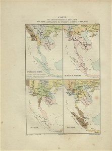
maps of indochina
francis garnier
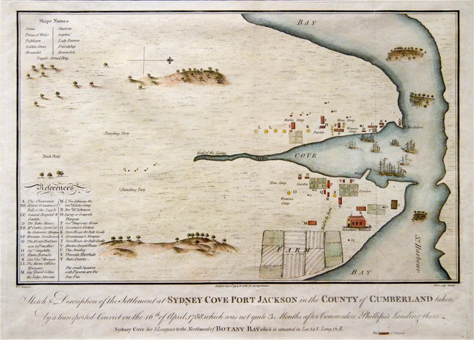
port jackson
sydney cove
maps with cartouches
atlas van der hagen
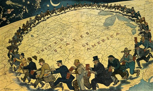
puck
1910
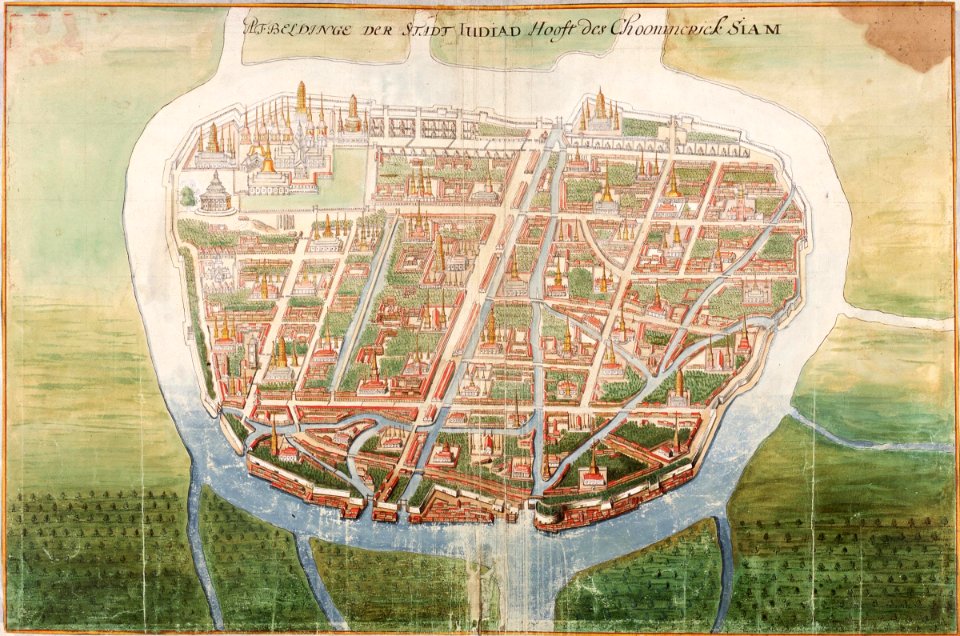
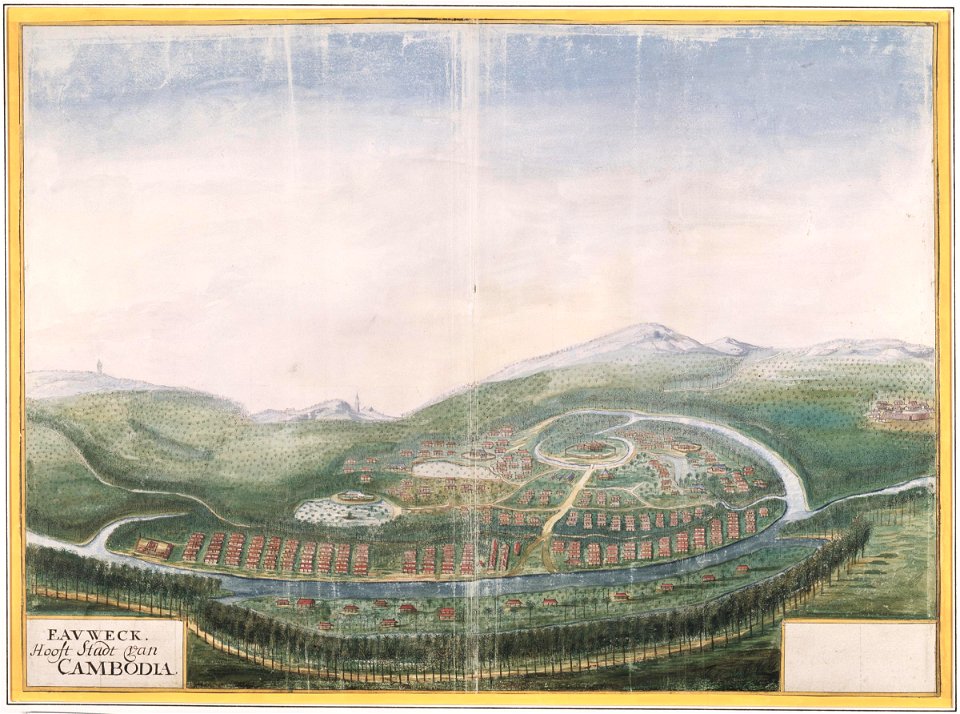
ayutthaya kingdom
1665
maps made in the 17th century
jan janssonius
cornell university library
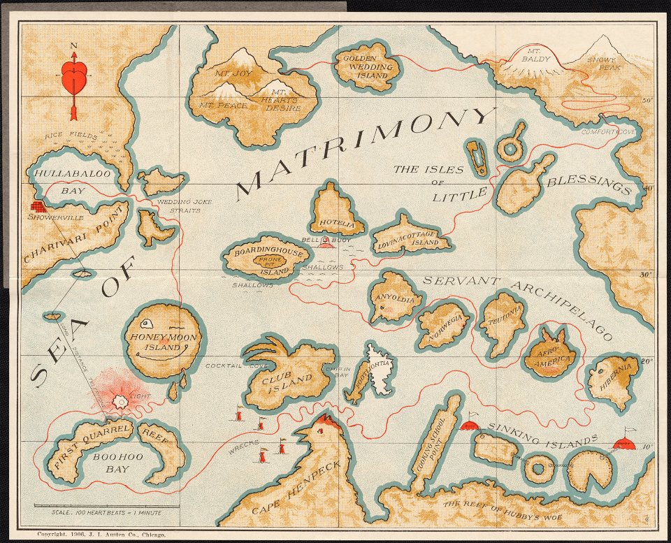
marriage in art
atlantis magni tomus quintus (biblioteca comunale di trento)
maps made in the 17th century
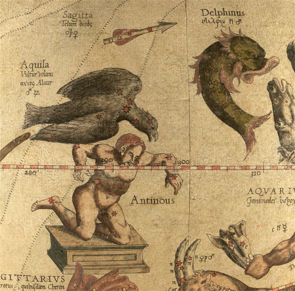
sagitta (constellation)
aquila (constellation)
maps by jacques-nicolas bellin
forbidden city in art
1856 maps
sakhalin
comets in art
printing
atlantis magni tomus quartus (biblioteca comunale di trento)
maps made in the 17th century
atlantis magni tomus primus (biblioteca comunale di trento)
johann baptist homann
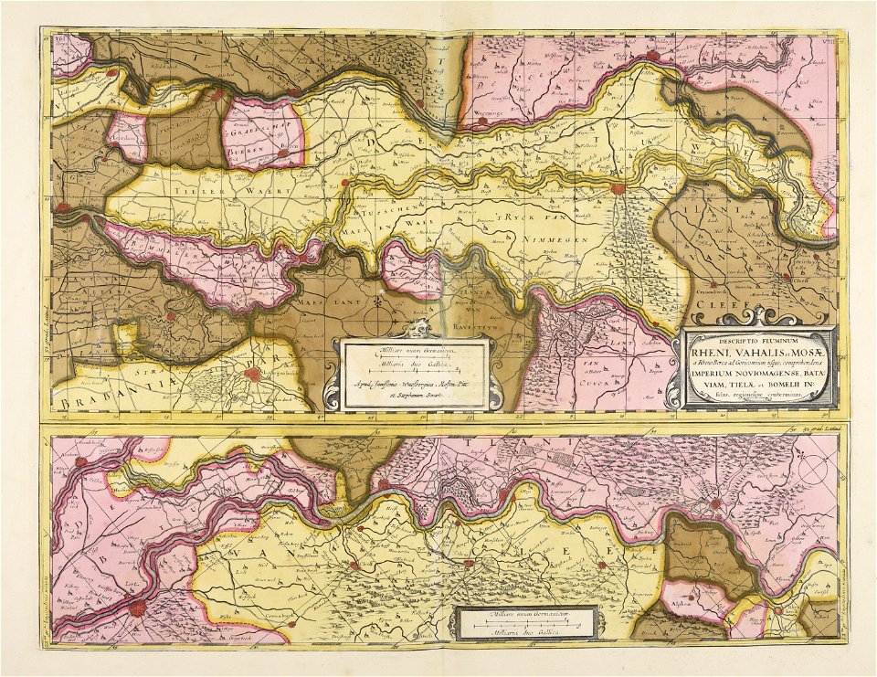
prints from fricx table des cartes des pays-bas at the peace palace library
old maps of flanders
atlantis magni tomus primus (biblioteca comunale di trento)
maps made in the 18th century
maps made in the 17th century
jan janssonius
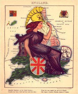
geographical fun - being humourous outlines of various countries
maps in the library of congress
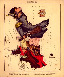
geographical fun - being humourous outlines of various countries
maps in the library of congress
geographical fun - being humourous outlines of various countries
maps in the library of congress
geographical fun - being humourous outlines of various countries
maps in the library of congress
geographical fun - being humourous outlines of various countries
maps in the library of congress
geographical fun - being humourous outlines of various countries
maps in the library of congress
geographical fun - being humourous outlines of various countries
maps in the library of congress
geographical fun - being humourous outlines of various countries
maps in the library of congress
geographical fun - being humourous outlines of various countries
maps in the library of congress
geographical fun - being humourous outlines of various countries
maps in the library of congress
topographic maps made in 18th century
constantinople
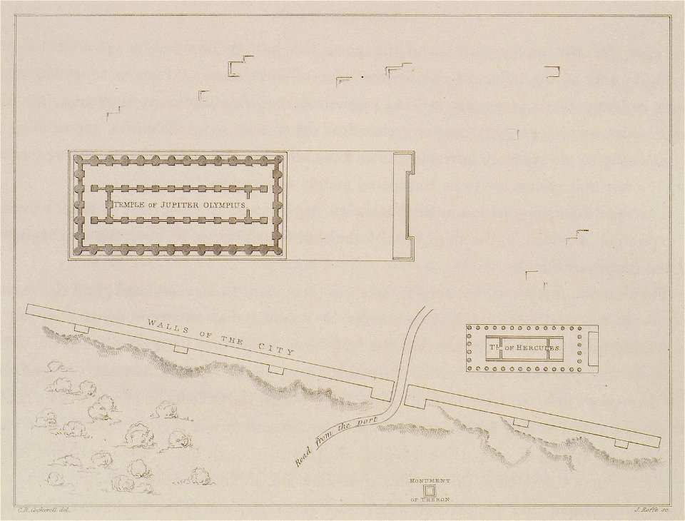
the antiquities of athens and other places in greece (1830)
germany
1568
atlantis magni tomus primus (biblioteca comunale di trento)
maps made in the 17th century
old administrative maps of the ottoman empire
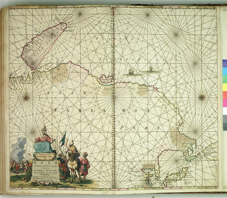
1909 maps of asia
airmail stamps of the united states
blue stamps
charts and maps of the royal museums greenwich
lucas janszoon waghenaer
architectural prints by wenzel hollar
old st paul's cathedral
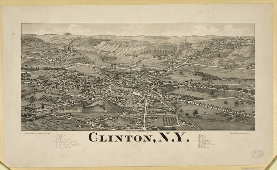
new york
clinton
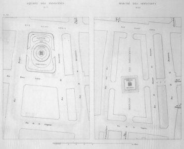
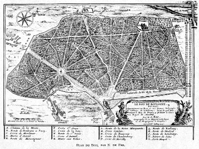
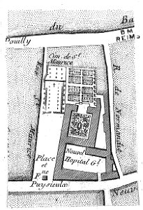
floor plans of paris
engravings of paris
historia de gentibus septentrionalibus
värmdö,
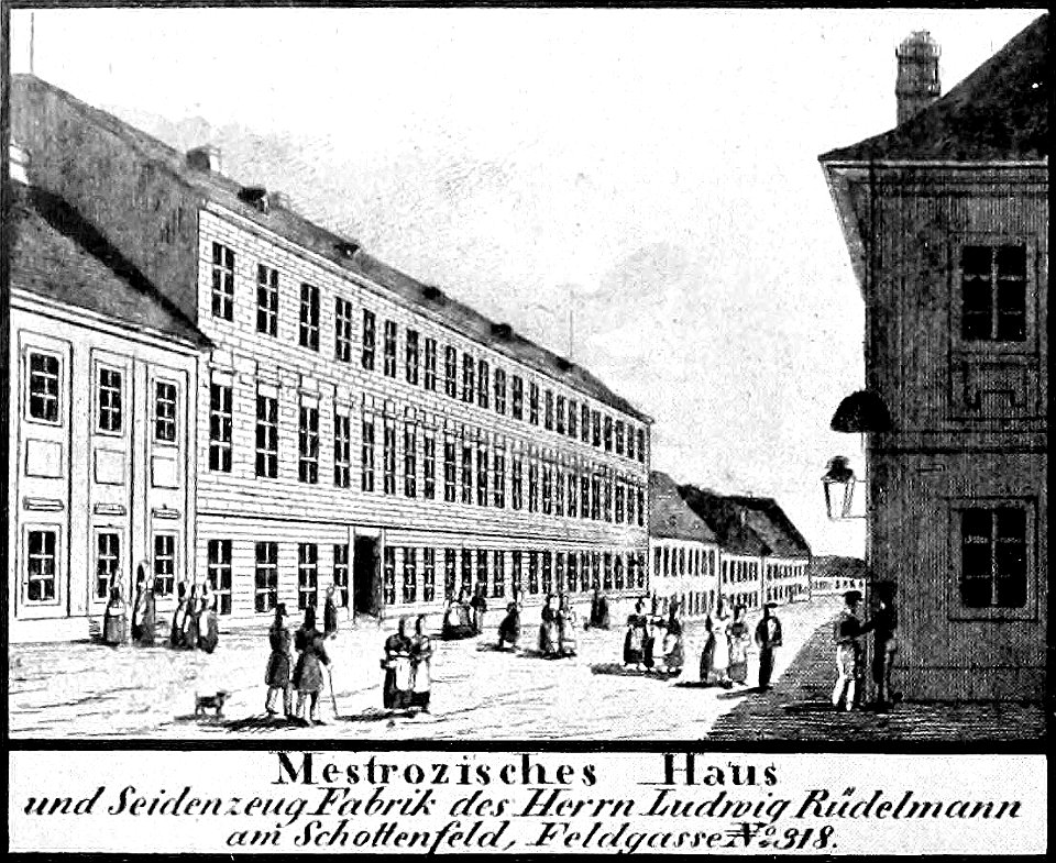
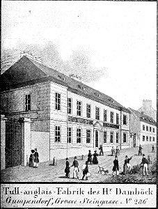
historical images of neubau
vienna in the 1830s
history of cambodia
1665
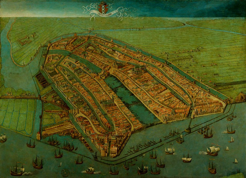
oude kerk amsterdam in art
frederick de wit
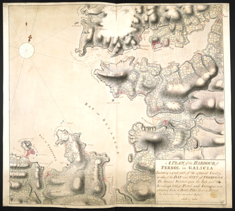
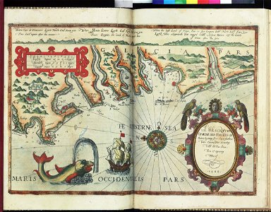
old maps of the province of a coruña
1767 in galicia (spain)
atlas van der hagen
copper engraving
novus atlas sinensis
old maps of jiangsu
erik dahlbergh
belarus
charts and maps of the royal museums greenwich
maps made in the 18th century
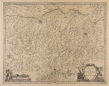
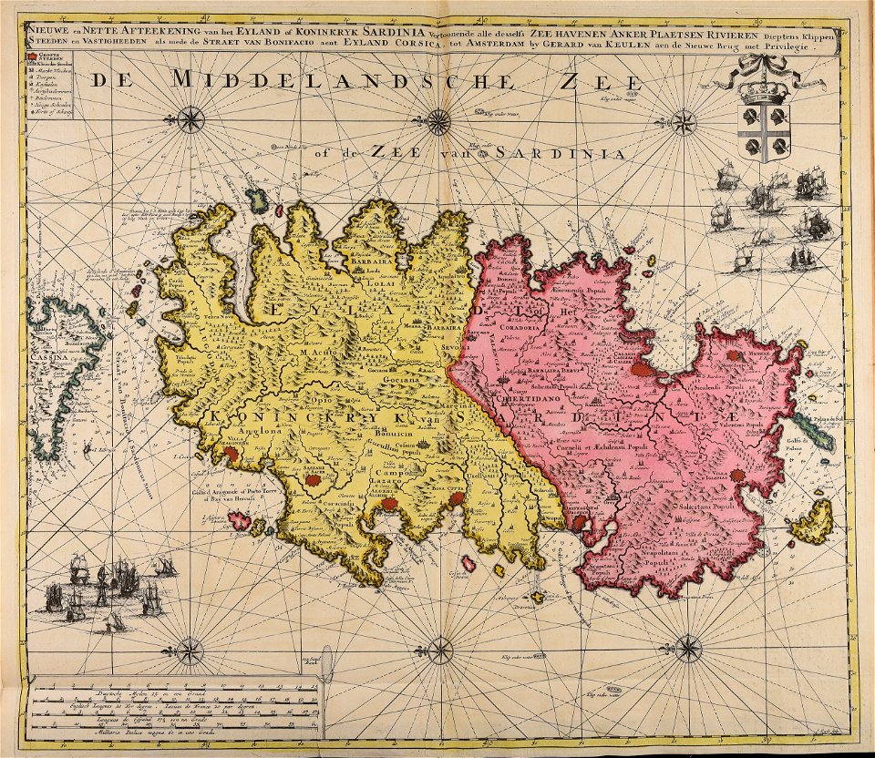
sardinia
old maps of europe
printing
architectural prints by wenzel hollar
old st paul's cathedral
architectural prints by wenzel hollar
old st paul's cathedral
architectural prints by wenzel hollar
old st paul's cathedral
architectural prints by wenzel hollar
london
charts and maps of the royal museums greenwich
lucas janszoon waghenaer
lithographs of paris
1877 in paris
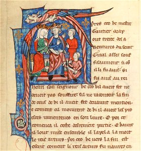
bibliothèque nationale de france français illuminated manuscripts
henry ii of england in miniatures
atlantis magni tomus quintus (biblioteca comunale di trento)
maps made in the 17th century
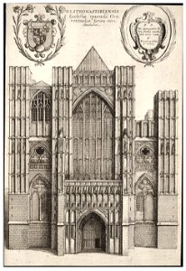
architectural prints by wenzel hollar
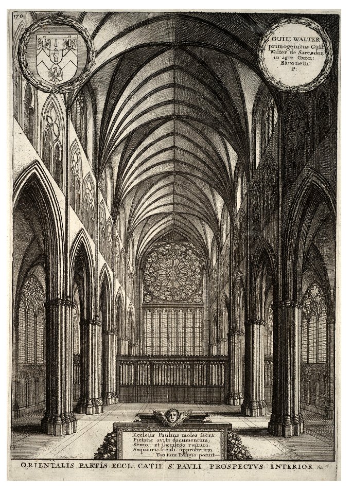
westminster abbey in art
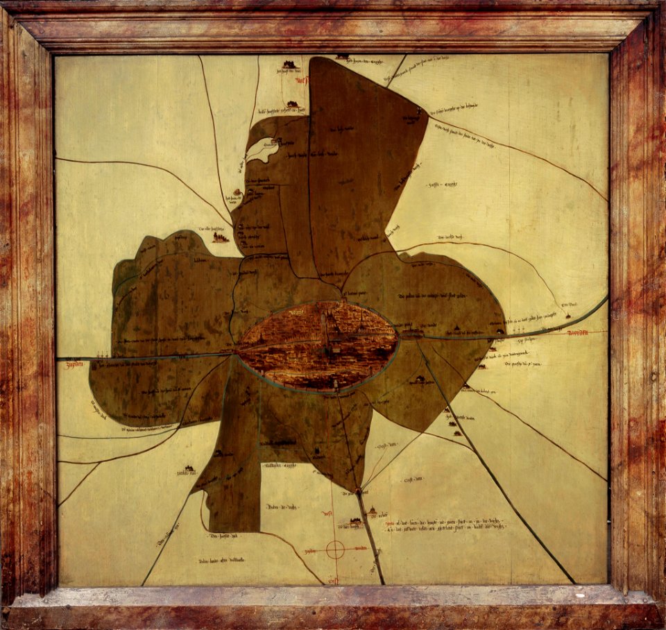
16th-century oil on panel paintings in the netherlands
paintings of amsterdam
prints by wenzel hollar
stranded
historical images of mariahilf
vienna in the 1830s
illustrations from h.corbel
nicolas de fer
atlantis magni tomus primus (biblioteca comunale di trento)
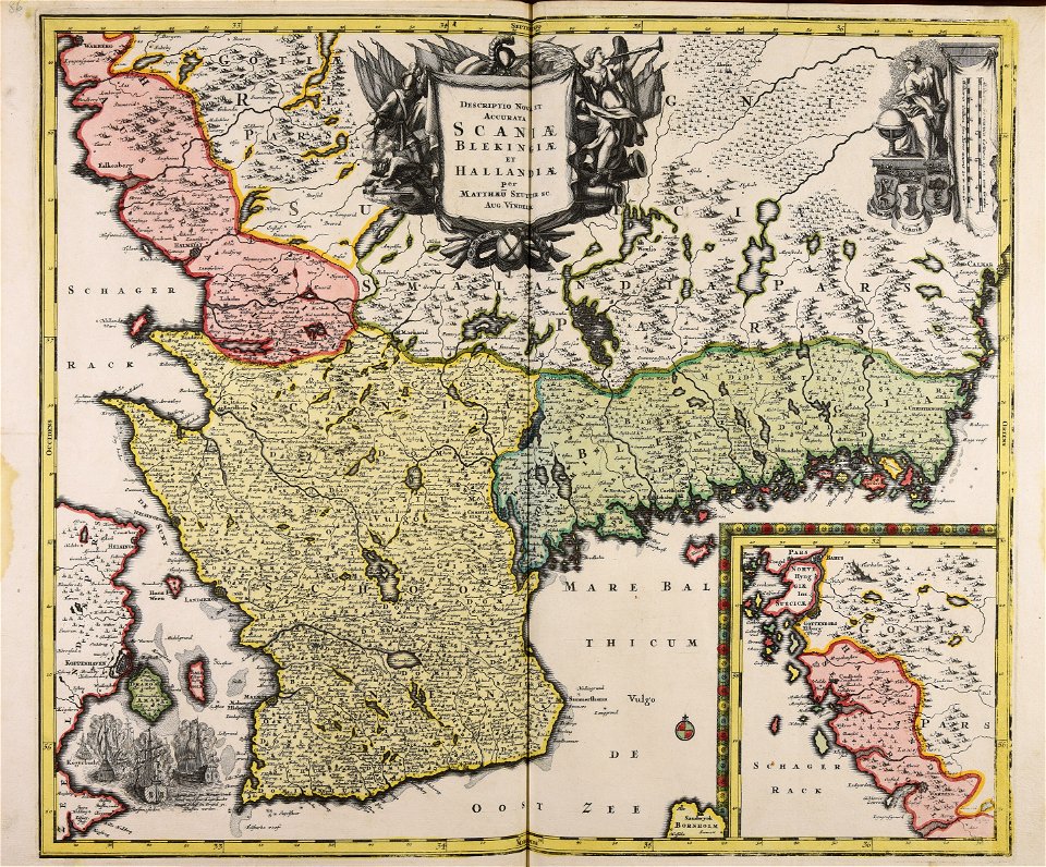
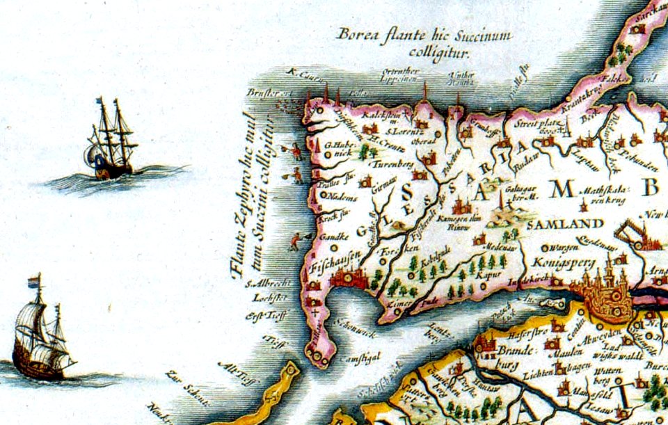
17th-century maps of schleswig-holstein
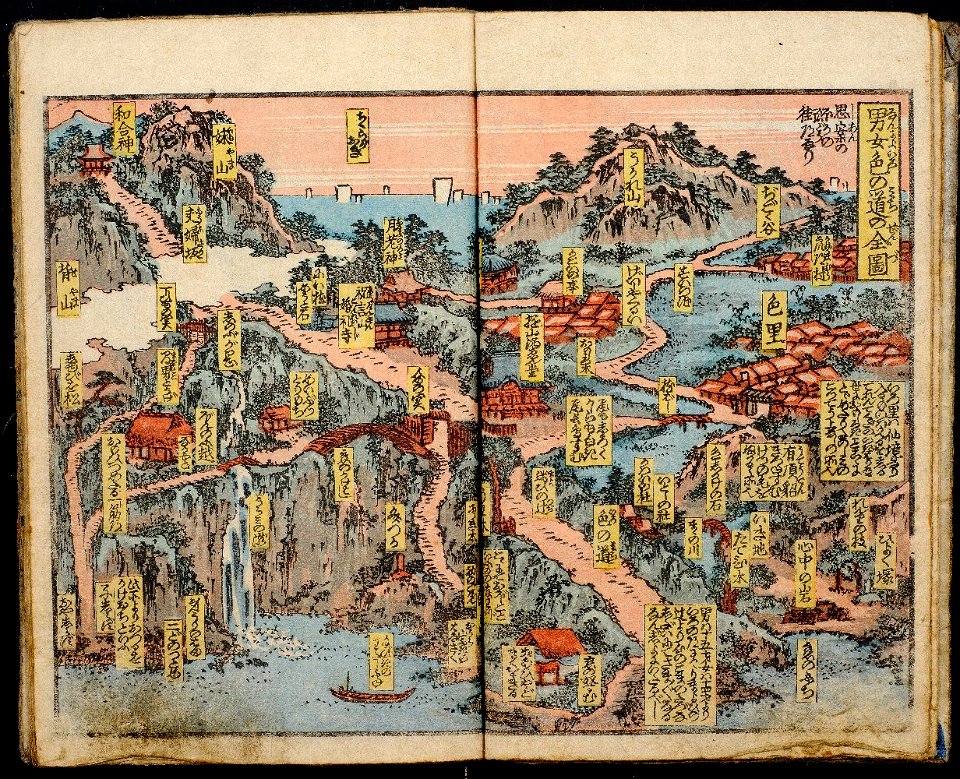
ehon in the honolulu museum of art
richard lane collection
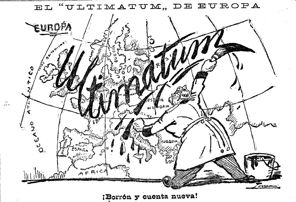
caricatures by manuel tovar in el imparcial
1914
topographical paintings in the centraal museum
16th-century paintings in the centraal museum
atlantis magni tomus secundus (biblioteca comunale di trento)
maps made in the 17th century
atlantis magni tomus secundus (biblioteca comunale di trento)
maps made in the 17th century
english society
somerset
old maps of ireland
ireland
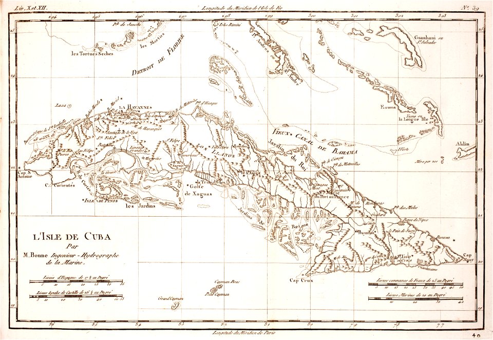
prints from bonne atlas de toutes les parties at the peace palace library
18th-century maps of africa
prints from bonne atlas de toutes les parties at the peace palace library
18th-century maps of cuba
charts and maps of the royal museums greenwich
architectural prints by wenzel hollar
old st paul's cathedral
atlantis magni tomus secundus (biblioteca comunale di trento)
maps made in the 17th century
maps made in the 17th century
giappone
atlantis magni tomus secundus (biblioteca comunale di trento)
maps made in the 17th century
historical images of palais des princes-evêques de liège
maps by willem and johannes blaeu
johann baptist homann
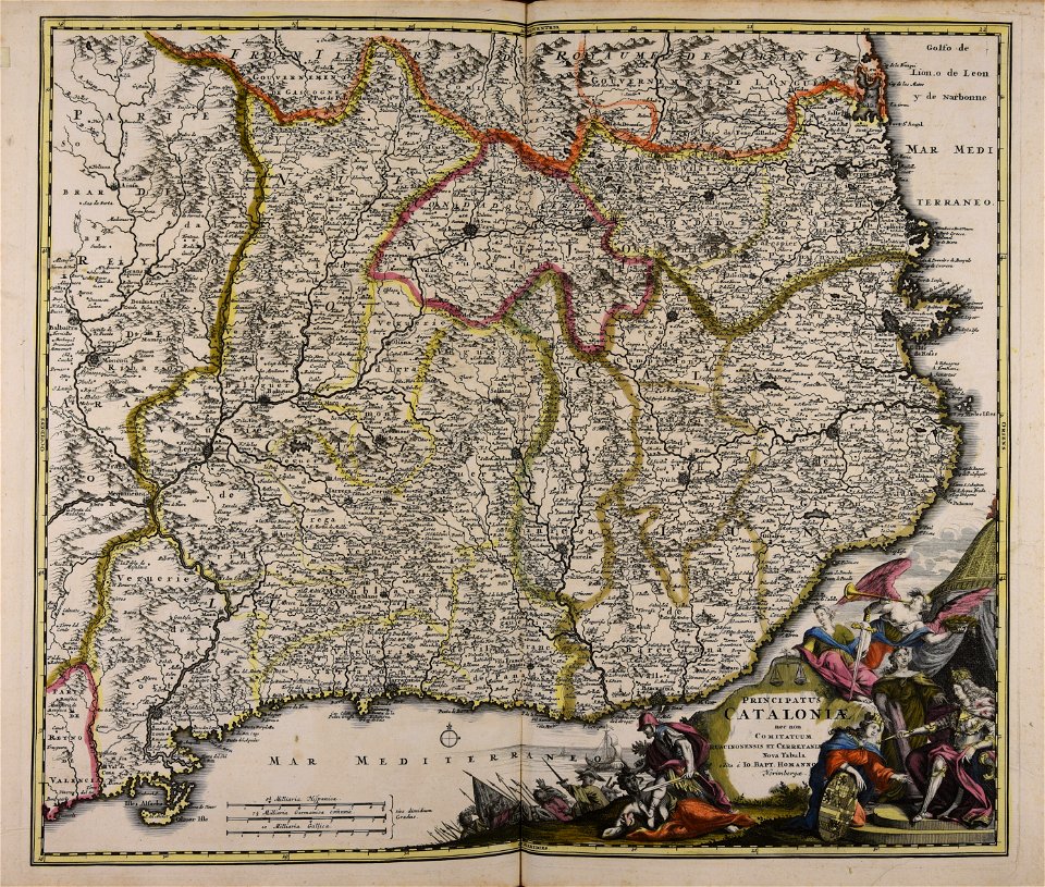
catalonia
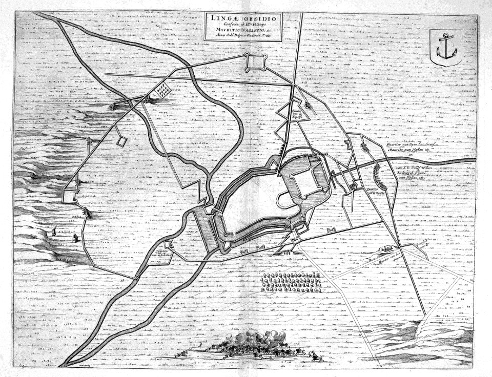
maps of lingen (ems)
atlas beudeker
maps made in the 17th century
nicolaes visscher ii
maps made in the 18th century
gerard valck
historical images of lisbon
1696 in portugal
dutch 17th-century prints in the rijksmuseum amsterdam
ijssel
françois collignon
1646
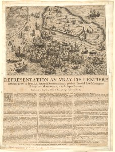
historical images of île de ré
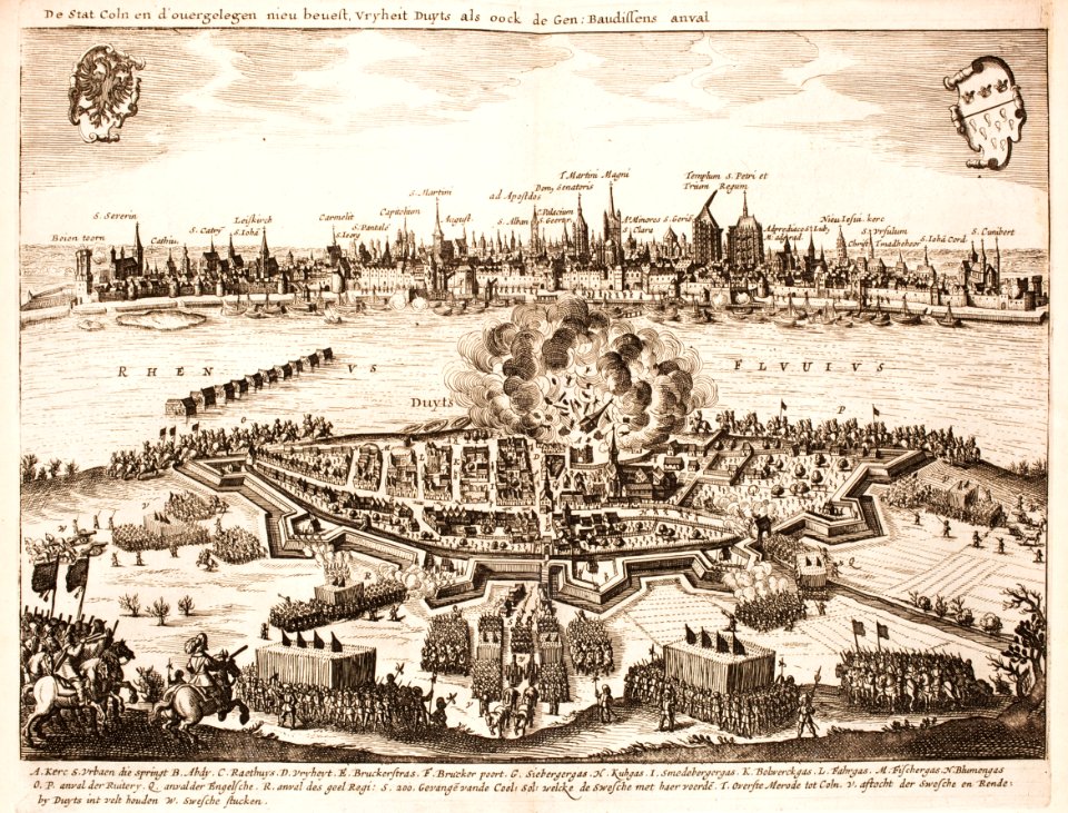
siege of la rochelle
battles of the thirty years' war
cologne
maps made in the 18th century
cornelis danckerts (i)
maps by jacques-nicolas bellin
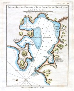
old maps of saint lucia
maps made in the 17th century
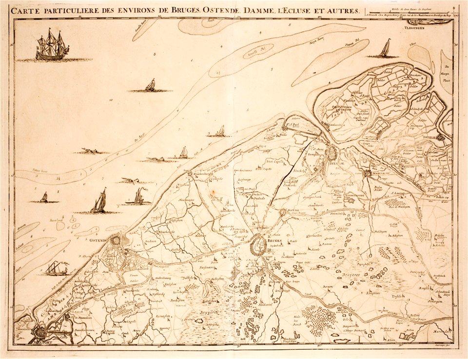
belgio
maps and topographical views by joris hoefnagel
17th-century engravings of towns
bibliothèque municipale de reims
maps of reims
charts and maps of the royal museums greenwich
lucas janszoon waghenaer
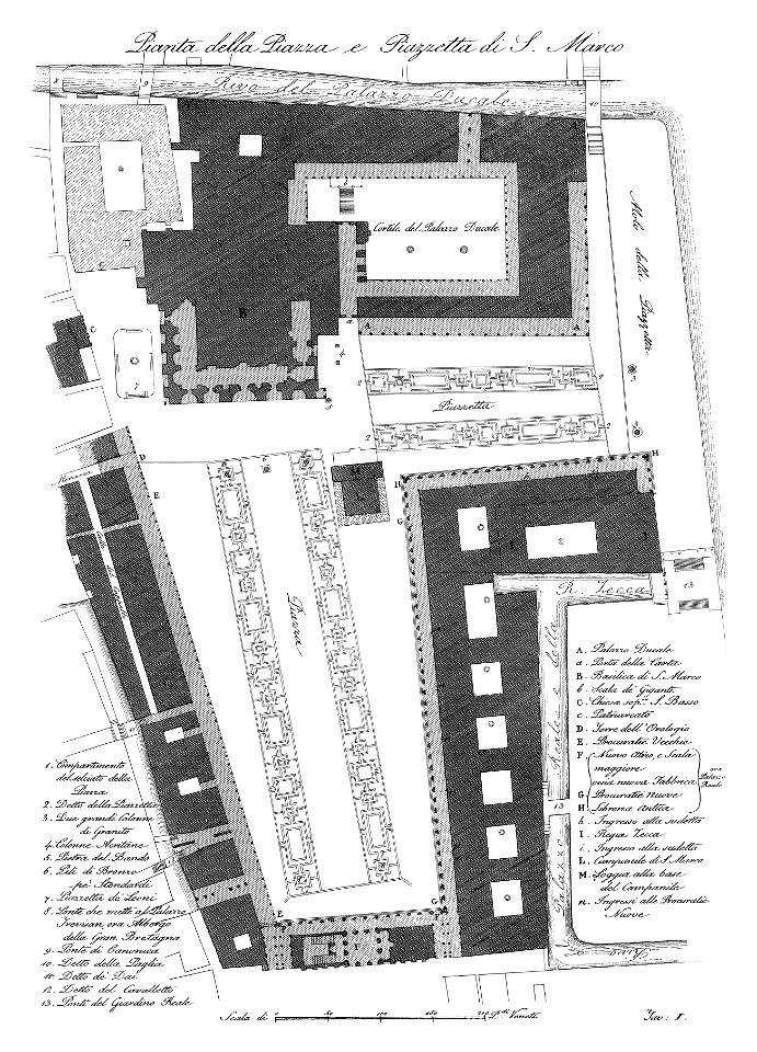
piazza san marco
1831
10501 - 10600 of 38,713
Next page
/ 388