Log in
All resources
Create a design
38,713 Free Artworks of Map
maps in the library of congress
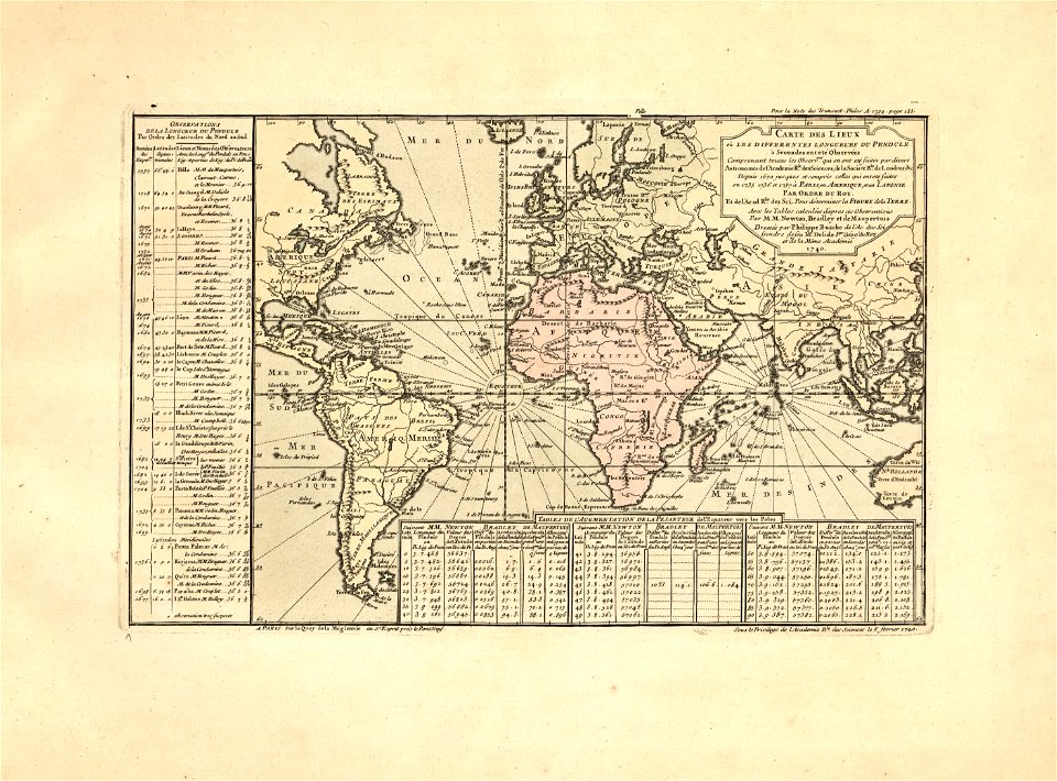
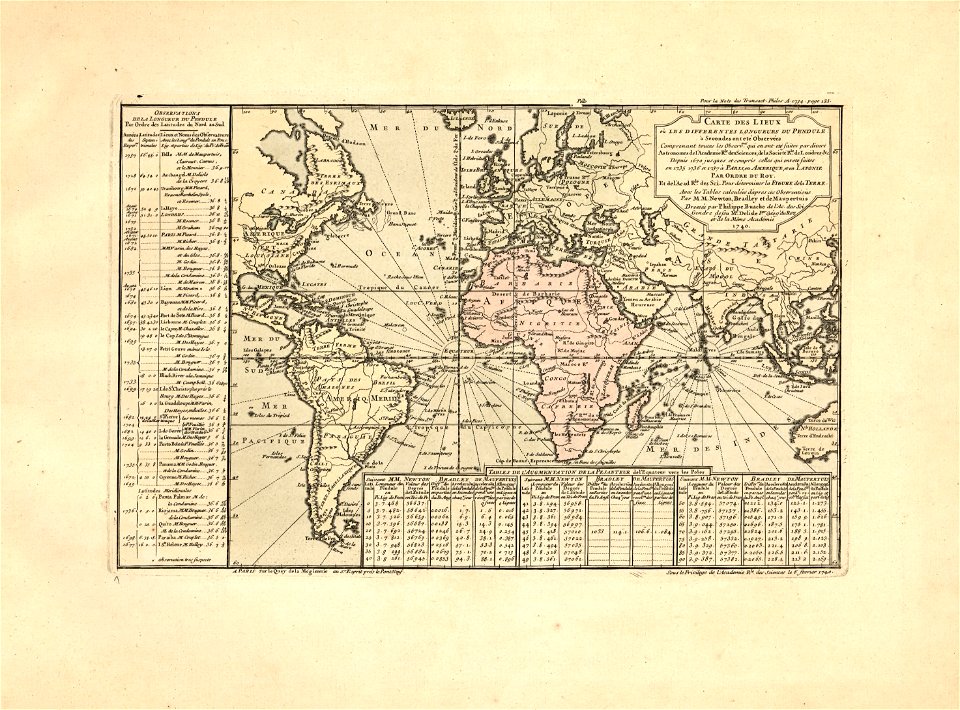
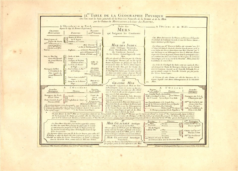
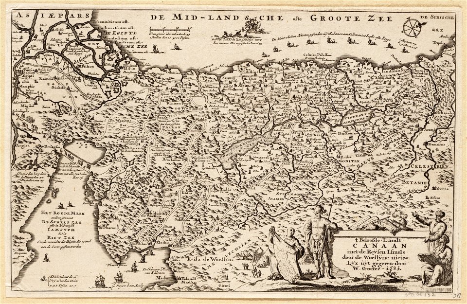
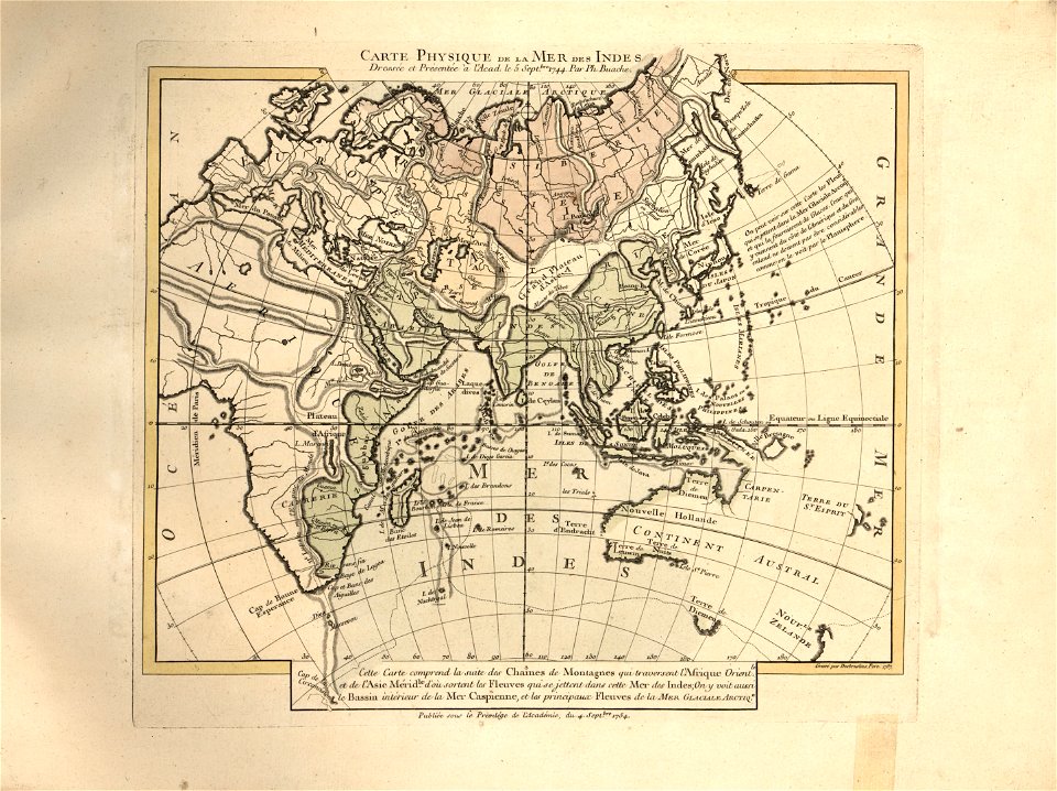
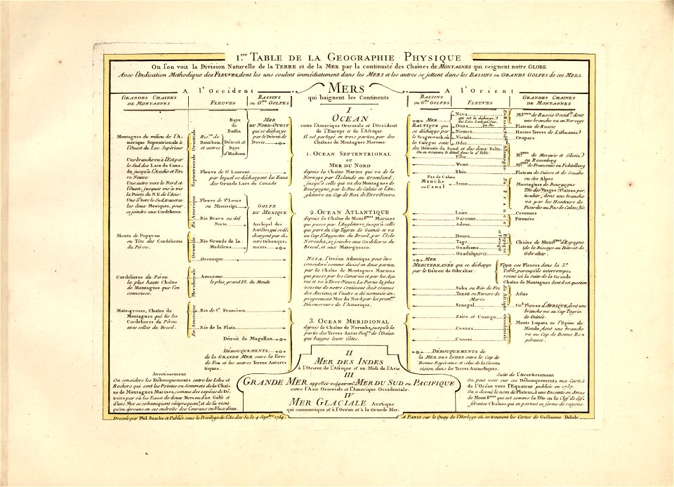
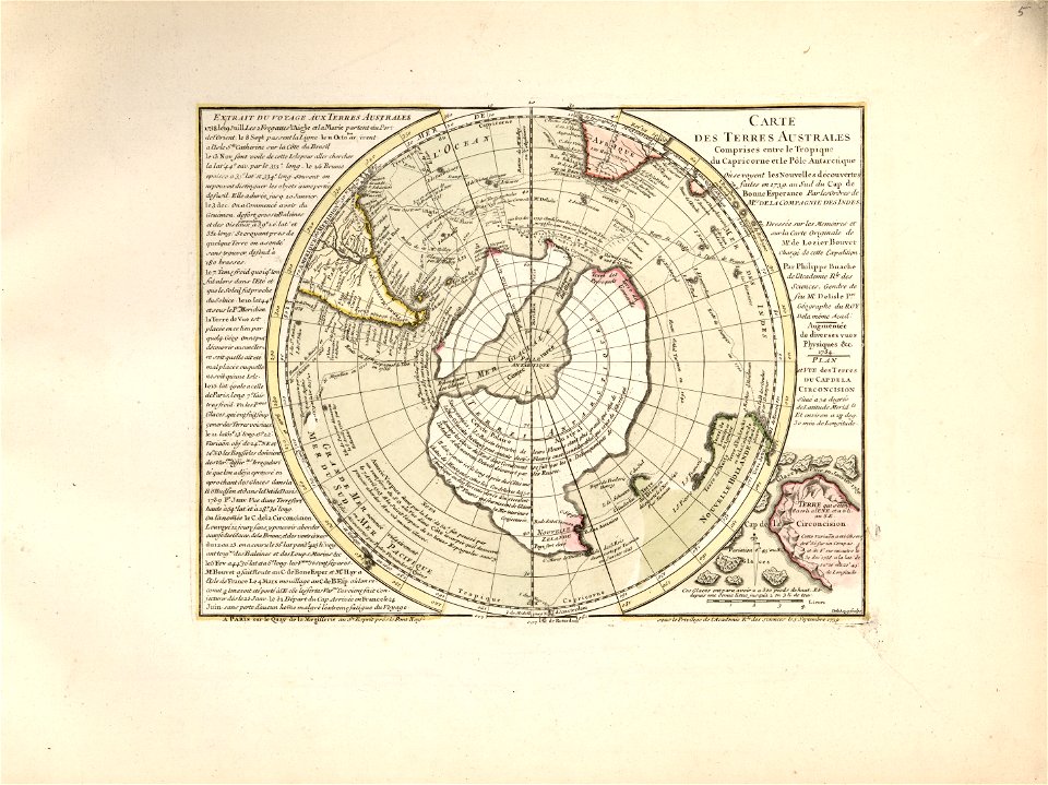
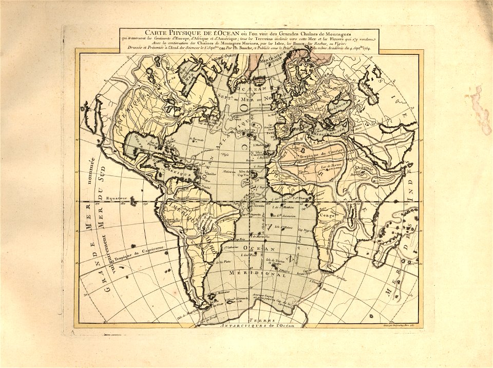
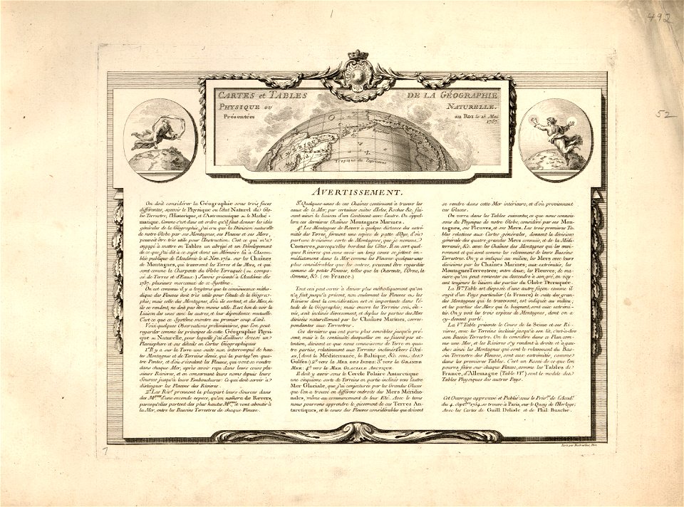
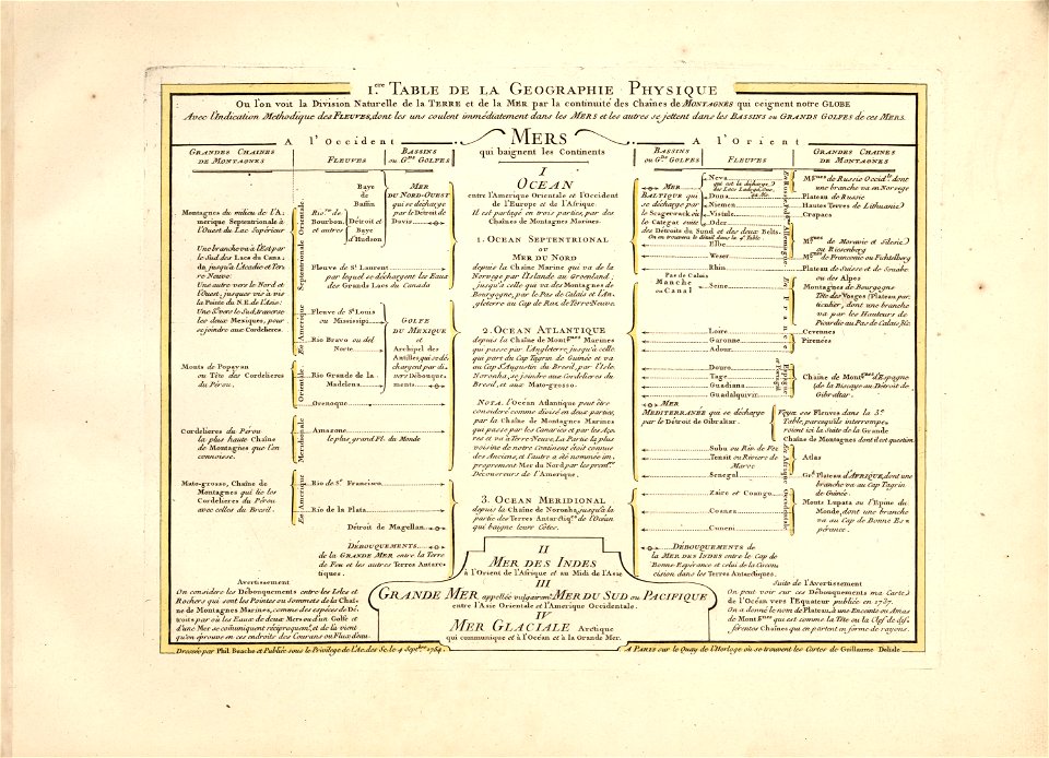
cartes et tables de la géographie physique ou naturelle
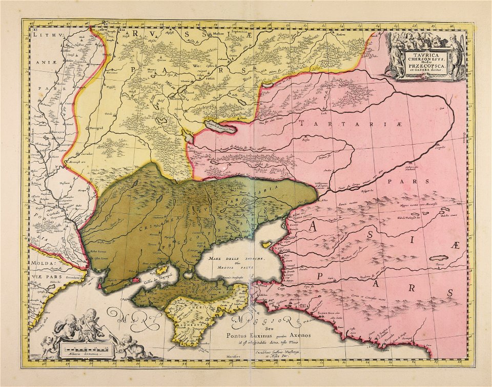
maps made in the 17th century
western europe
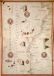
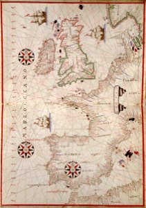
portolan atlas of the mediterranean sea
and the northwest coast of africa
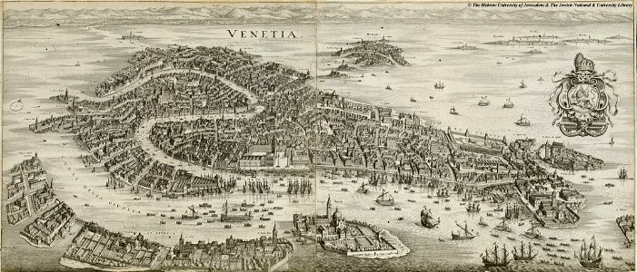
maps in the amsterdam museum
jan janssonius
atlantis magni tomus quartus (biblioteca comunale di trento)
atlantis magni tomus primus (biblioteca comunale di trento)
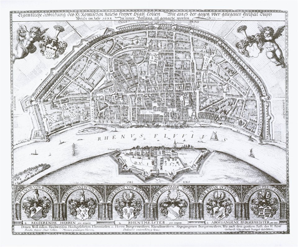
1633 in north rhine-westphalia
old maps of cologne
maps made in the 17th century
jan janssonius
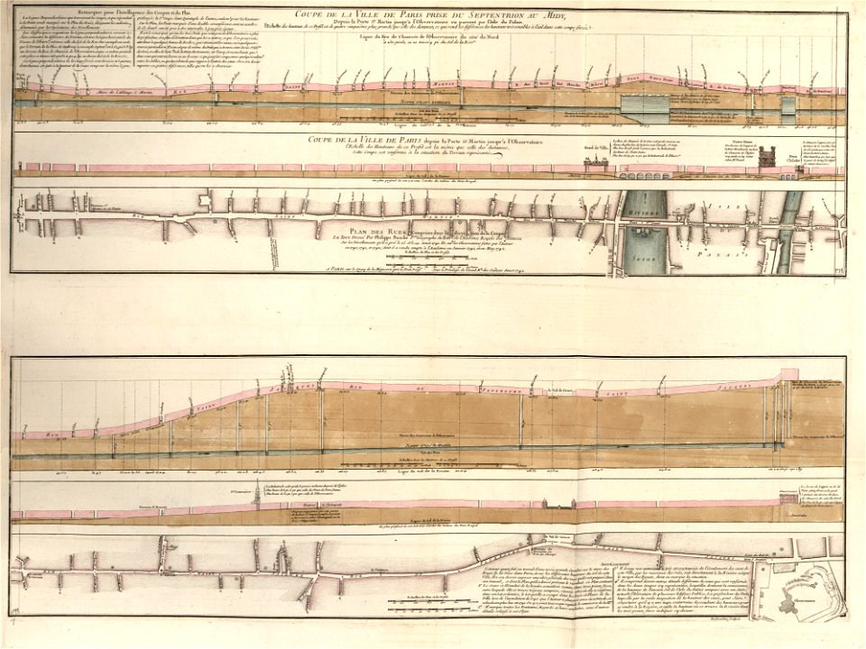
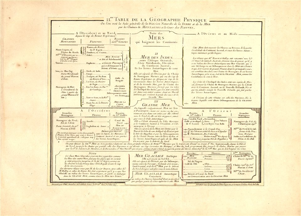
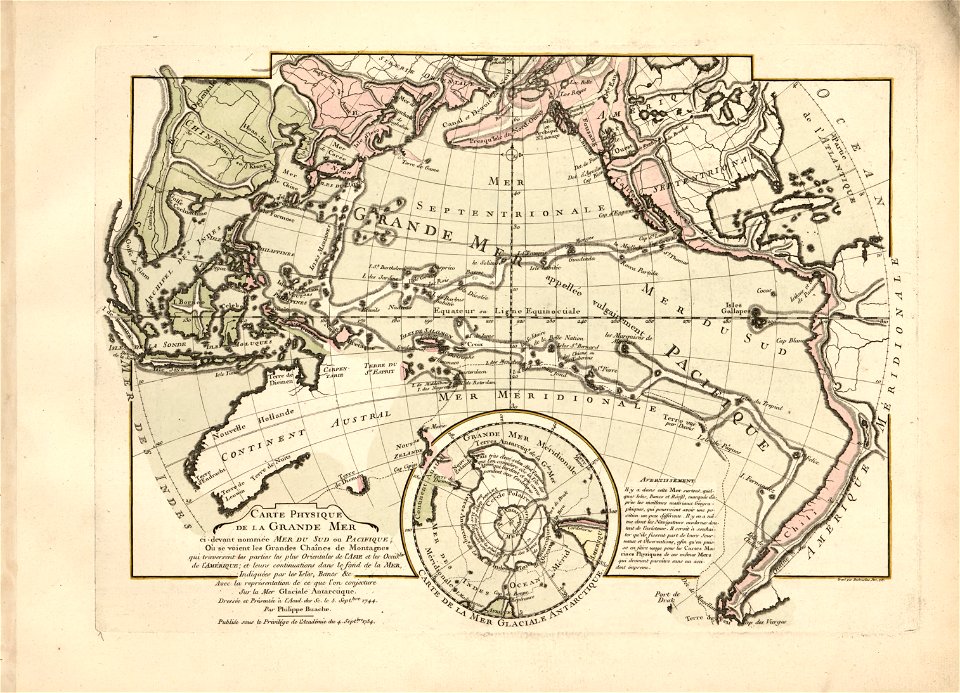
cartes et tables de la géographie physique ou naturelle
maps in the library of congress
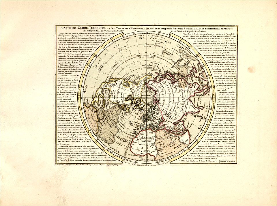
cartes et tables de la géographie physique ou naturelle
maps in the library of congress
cartes et tables de la géographie physique ou naturelle
maps in the library of congress
cartes et tables de la géographie physique ou naturelle
maps in the library of congress
cartes et tables de la géographie physique ou naturelle
maps in the library of congress
cartes et tables de la géographie physique ou naturelle
maps in the library of congress
cartes et tables de la géographie physique ou naturelle
maps in the library of congress
cartes et tables de la géographie physique ou naturelle
maps in the library of congress
cartes et tables de la géographie physique ou naturelle
maps in the library of congress
œuvres de tony garnier conservées au mba lyon
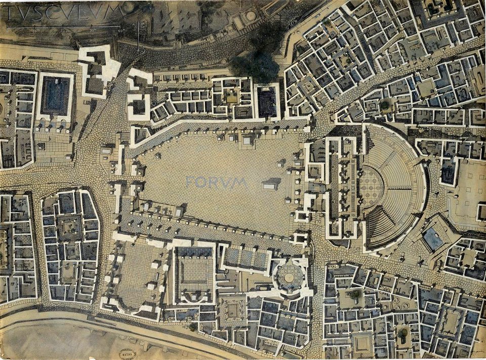
tusculum
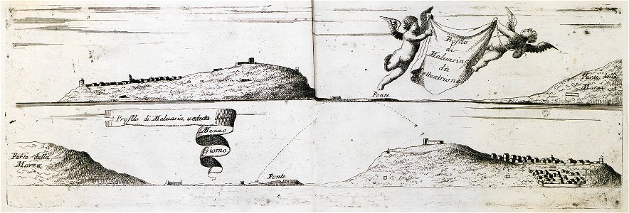
geographical illustrations by coronelli
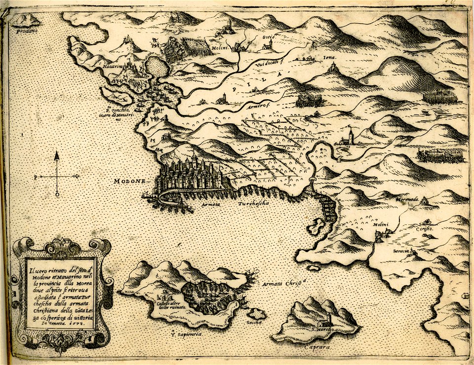
old maps of the peloponnese
maps in the amsterdam museum
atlantis magni tomus primus (biblioteca comunale di trento)
maps made in the 17th century
17th-century engravings
copper engraving
relation d'un voyage du levant 1718
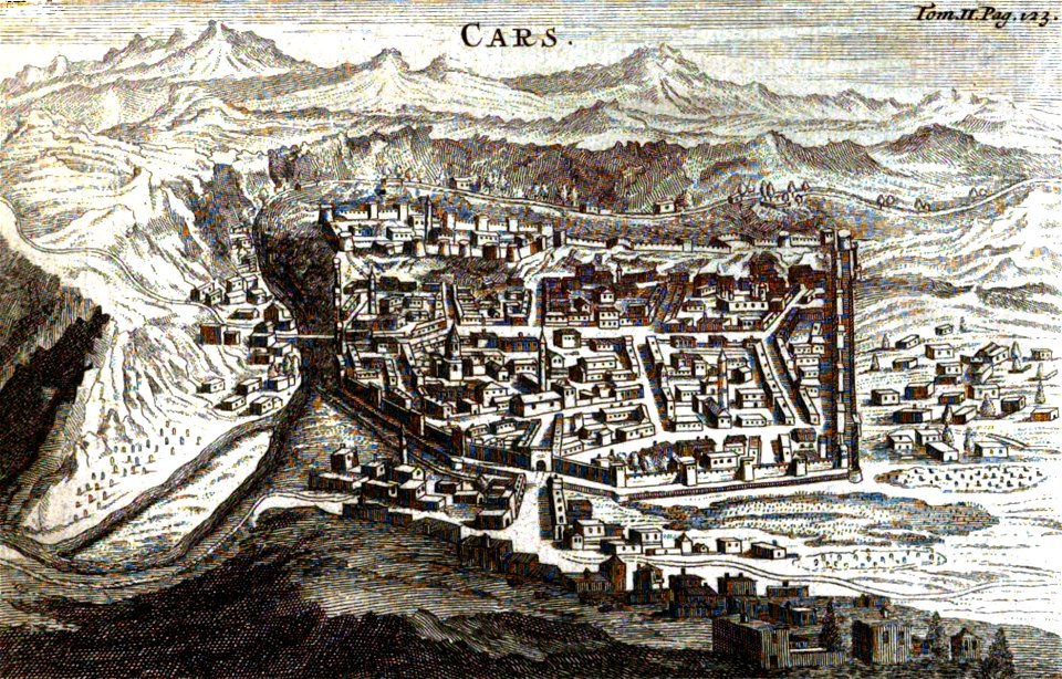
old pictures and maps of kars
atlantis magni tomus secundus (biblioteca comunale di trento)
maps made in the 17th century
prints from dankaerts historis at the peace palace library
ingolstadt
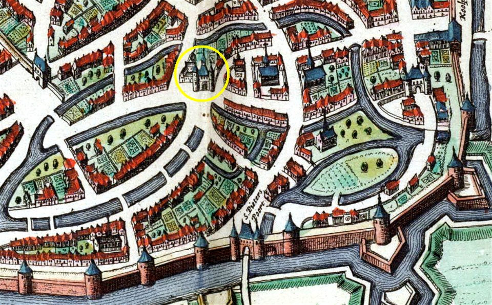
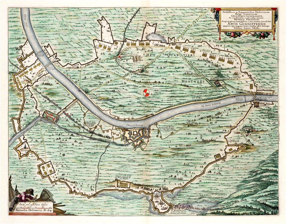
map of maastricht by willem and johannes blaeu (1649)
city gates in maastricht
drawings by samuel de champlain
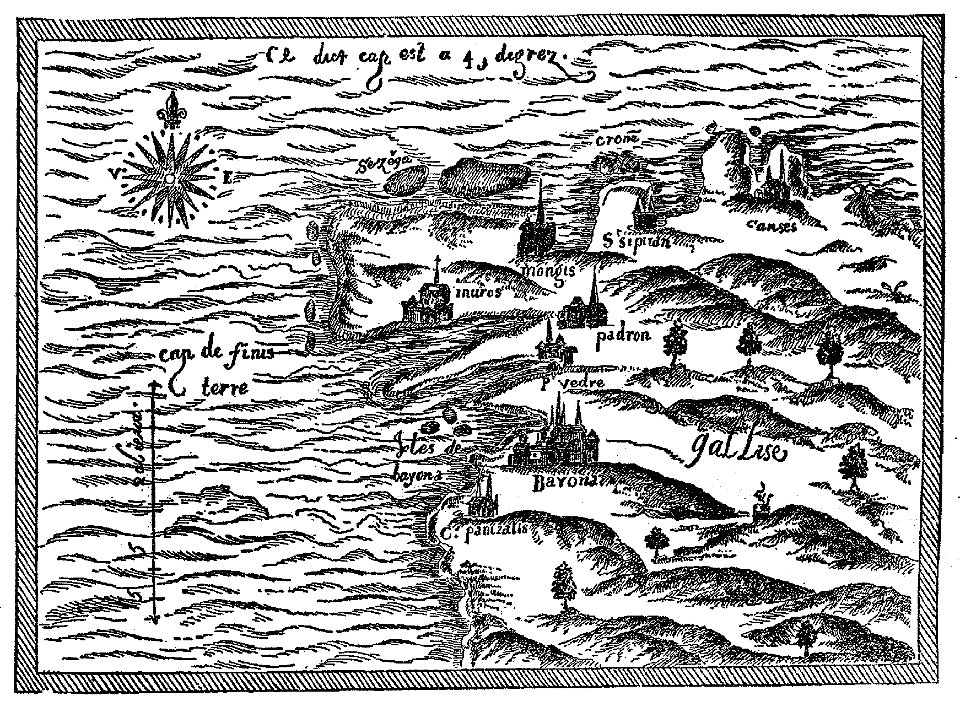
old maps of galicia (spain)
christian von mechel
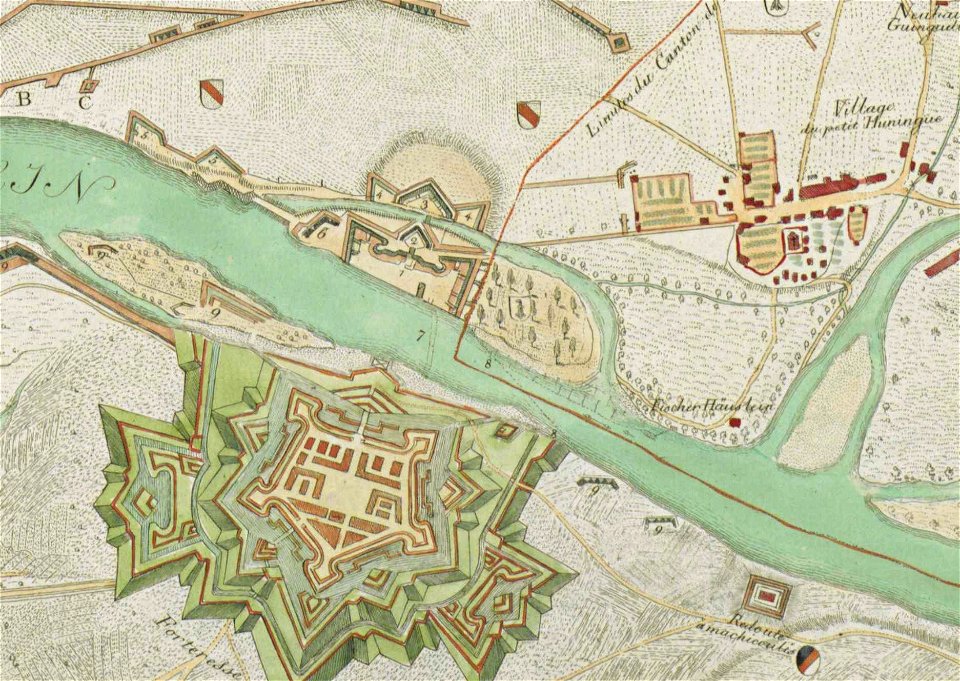
huningue fortress
cartes et tables de la géographie physique ou naturelle
maps in the library of congress
cartes et tables de la géographie physique ou naturelle
maps in the library of congress
cartes et tables de la géographie physique ou naturelle
maps in the library of congress
cartes et tables de la géographie physique ou naturelle
maps in the library of congress
cartes et tables de la géographie physique ou naturelle
maps in the library of congress
cartes et tables de la géographie physique ou naturelle
maps in the library of congress
cartes et tables de la géographie physique ou naturelle
maps in the library of congress
cartes et tables de la géographie physique ou naturelle
maps in the library of congress
cartes et tables de la géographie physique ou naturelle
maps in the library of congress
cartes et tables de la géographie physique ou naturelle
maps in the library of congress
cartes et tables de la géographie physique ou naturelle
maps in the library of congress
charts and maps of the royal museums greenwich
lucas janszoon waghenaer
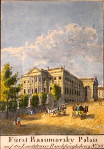
historical images of landstraße
palais rasumofsky
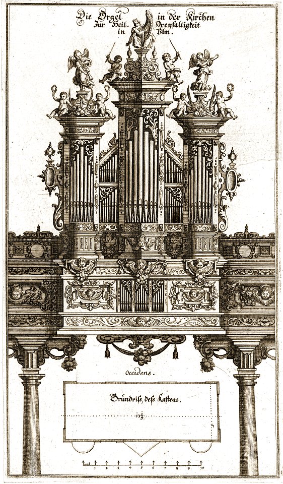
pipe organs in art
history of ulm
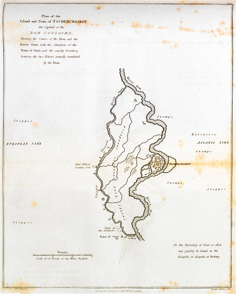
don in rostov oblast
novocherkassk
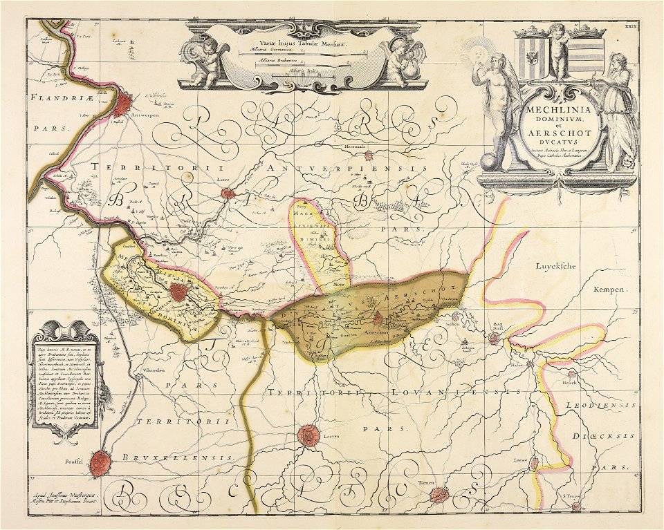
maps made in the 17th century
finlandia
bibliothèque municipale de reims
abbey of saint-remi
maps in the library of congress
western europe
maps in the library of congress
western europe
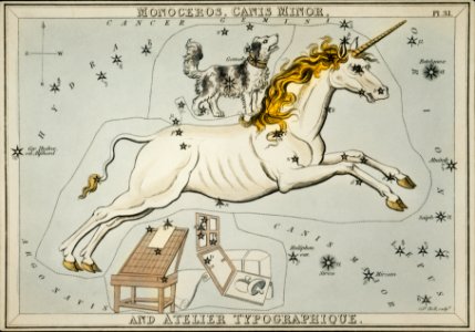
astronomy
maps
charts and maps of the royal museums greenwich
pages using map template with incorrect parameter
nieuwe hollandse scheeps-bouw (1695)
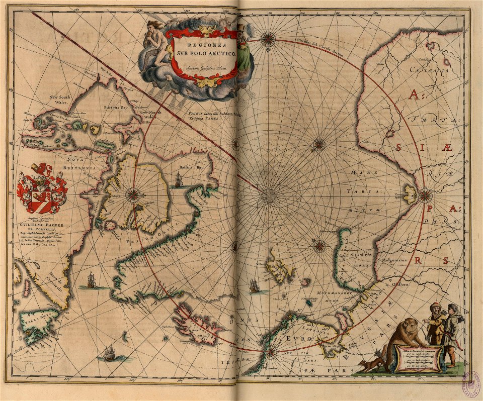
old maps of the arctic
copper engraving
pages using map template with incorrect parameter
nieuwe hollandse scheeps-bouw (1695)
maps in the library of congress
western europe
french prints in the rijksmuseum amsterdam
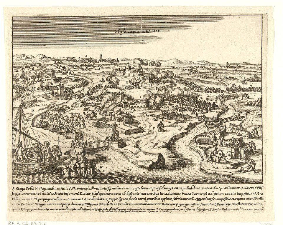
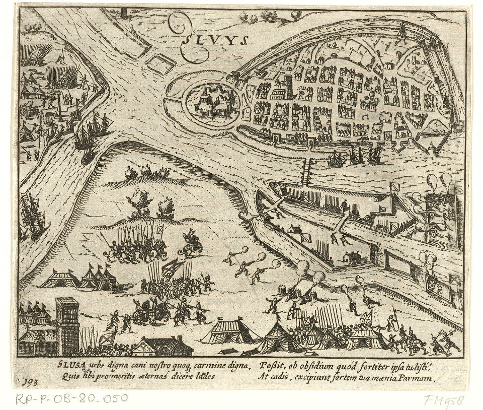
sluis
diagrams of mountains
comparison diagrams
old maps of turin
history of turin
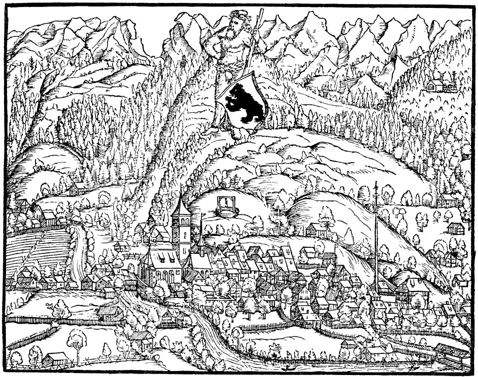
historical images of appenzell
old maps of switzerland
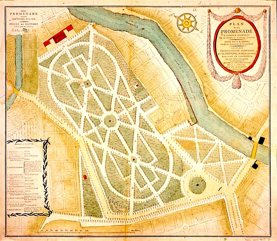
collections de la bibliothèque nationale et universitaire de strasbourg
maps of strasbourg in the 19th century
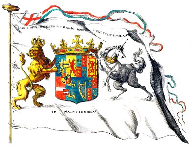
claes jansz. visscher (ii)
circumvallation
maps in the amsterdam museum
maps in the amsterdam museum
maps in the amsterdam museum
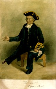
greenwich pensioners
printing
cartes et tables de la géographie physique ou naturelle
maps in the library of congress
cartes et tables de la géographie physique ou naturelle
maps in the library of congress
cartes et tables de la géographie physique ou naturelle
maps in the library of congress
cartes et tables de la géographie physique ou naturelle
maps in the library of congress
cartes et tables de la géographie physique ou naturelle
maps in the library of congress
cartes et tables de la géographie physique ou naturelle
maps in the library of congress
cartes et tables de la géographie physique ou naturelle
maps in the library of congress
cartes et tables de la géographie physique ou naturelle
maps in the library of congress
history of eindhoven
eindhoven
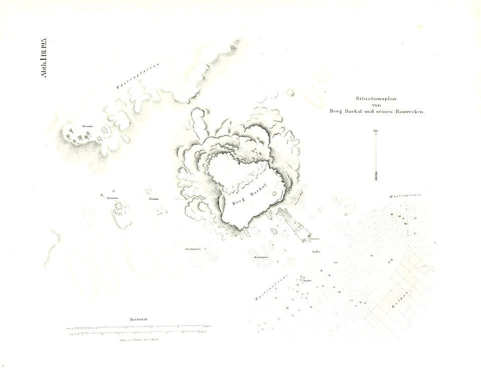
illustrations of jebel barkal
lepsius-projekt - maps
maps in the library of congress
western europe
maps in the library of congress
western europe
flemish 17th-century prints in the rijksmuseum amsterdam
frans hogenberg
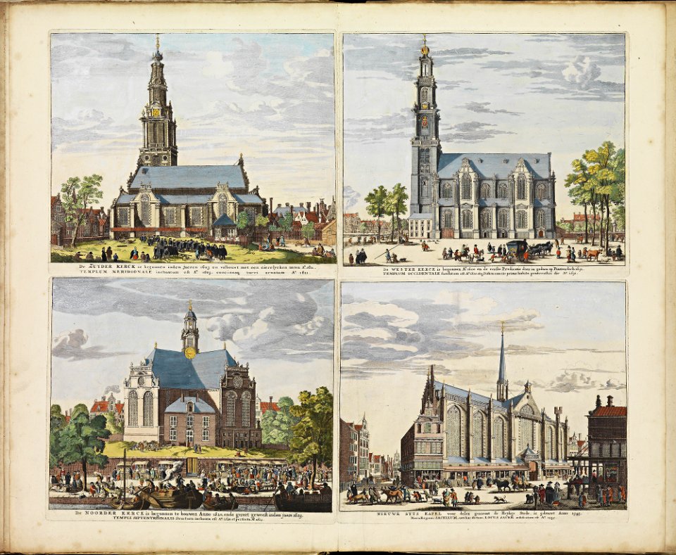
historical images of zuiderkerk (amsterdam)
frederick de wit
maps of the west-indische compagnie
1745
maps from the earth and its inhabitants, vol. vi
charles eugène perron
st mary's church
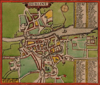
dublin
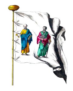
anne baptiste nivelon
rococo
island of love
gatchina
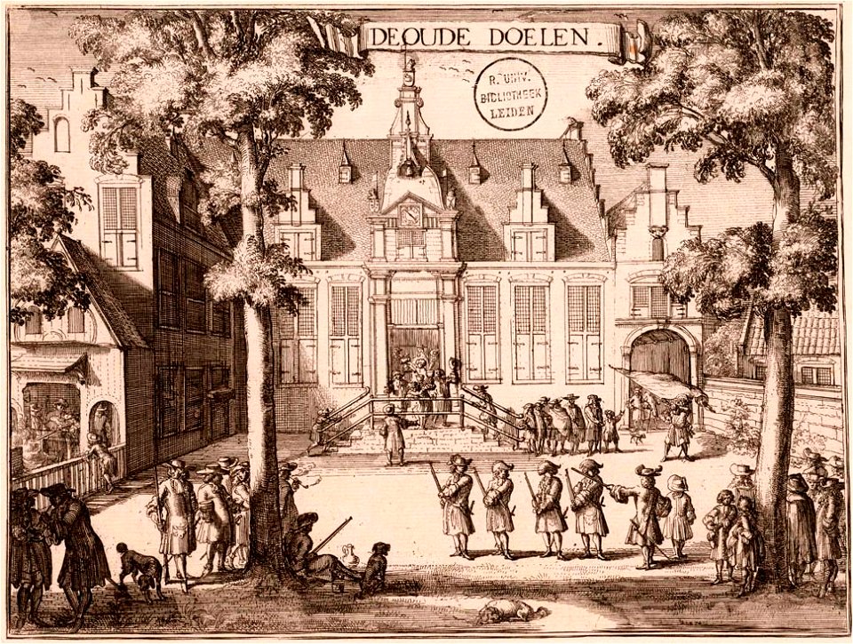
kloveniersschutterij (haarlem)
kloveniersdoelen (haarlem)
university of toronto wenceslas hollar digital collection
architectural prints by wenzel hollar
maps made in the 16th century
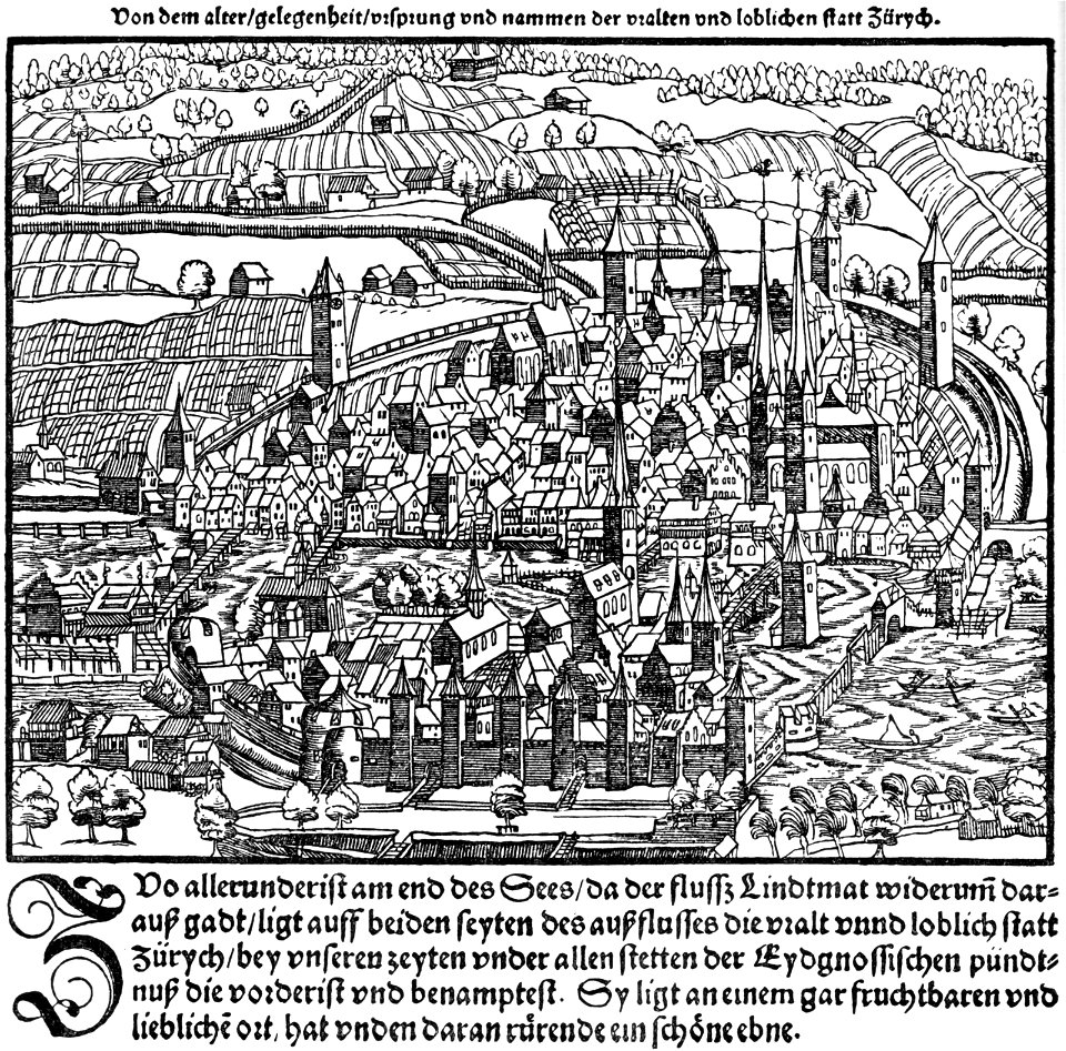
zürich in art
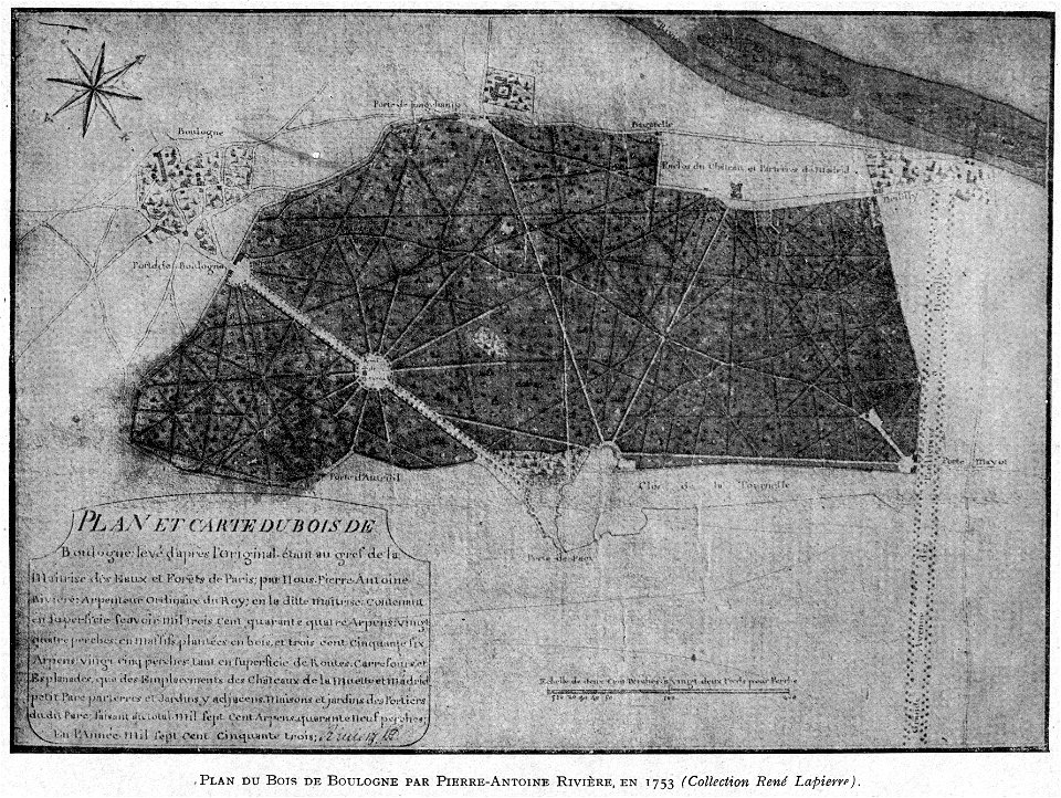
petite histoire du bois de boulogne
illustrations from h.corbel
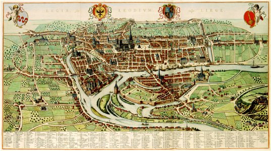
maps of liège in the 17th century
atlas van der hagen
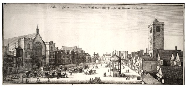
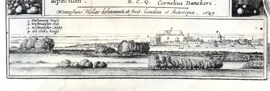
1647 in london
landscape art
old maps of goa
1596
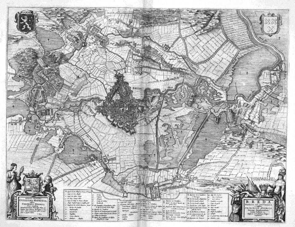
old maps of breda
atlas beudeker
files from the bodleian libraries
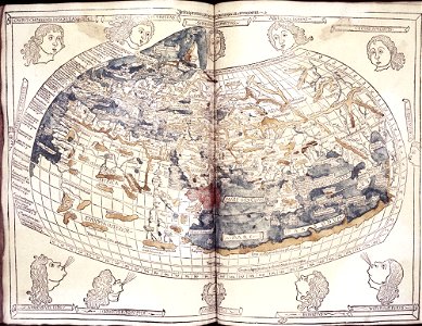
donnus nicolaus germanus
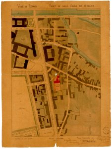
jean-baptiste martenot
1880 maps
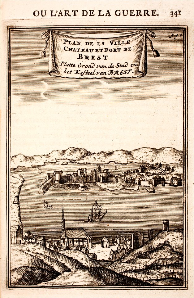
brest (france) in the 17th century
1696 in bretagne
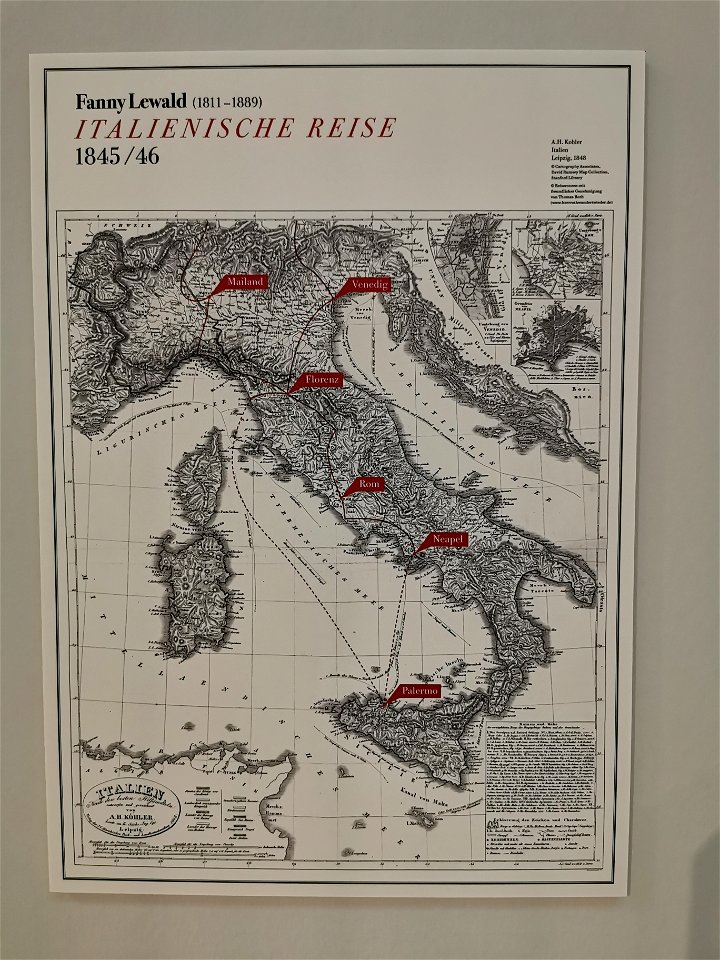
fanny lewald
route
atlantis magni tomus secundus (biblioteca comunale di trento)
maps made in the 17th century
giovanni camocio
methoni
prints from lambert van den bos schauplatz des krieges at the peace palace library
aardenburg
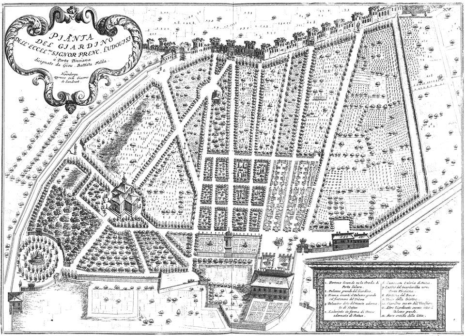
palazzo margherita (rome)
giovanni battista falda
maps made in the 17th century
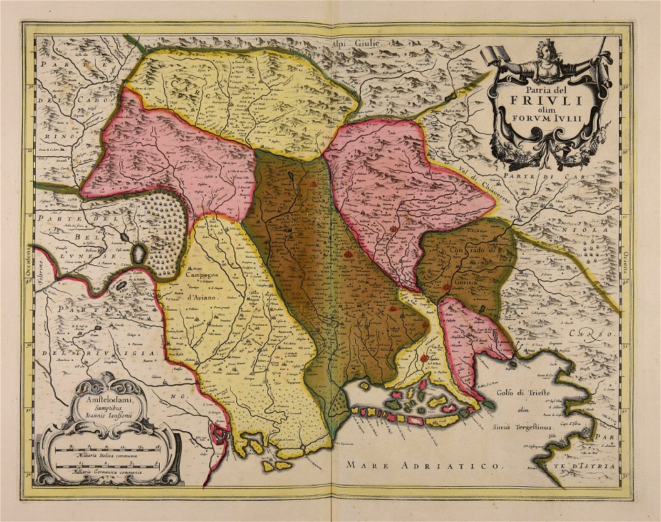
friuli-venezia giulia
charts and maps of the royal museums greenwich
dutch 17th-century prints in the rijksmuseum amsterdam
maps in the rijksmuseum amsterdam
maps made in the 17th century
jan janssonius
maps made in the 17th century
cornelis danckerts (i)
maps made in the 17th century
stormarn
copper engraving
1643 engravings
architectural prints by wenzel hollar
old st paul's cathedral
10301 - 10400 of 38,713
Next page
/ 388