Log in
All resources
Create a design
38,713 Free Artworks of Map
university of toronto wenceslas hollar digital collection
hollar maps and plans of london
maps made in the 17th century
architectural prints by wenzel hollar
charts and maps of the royal museums greenwich
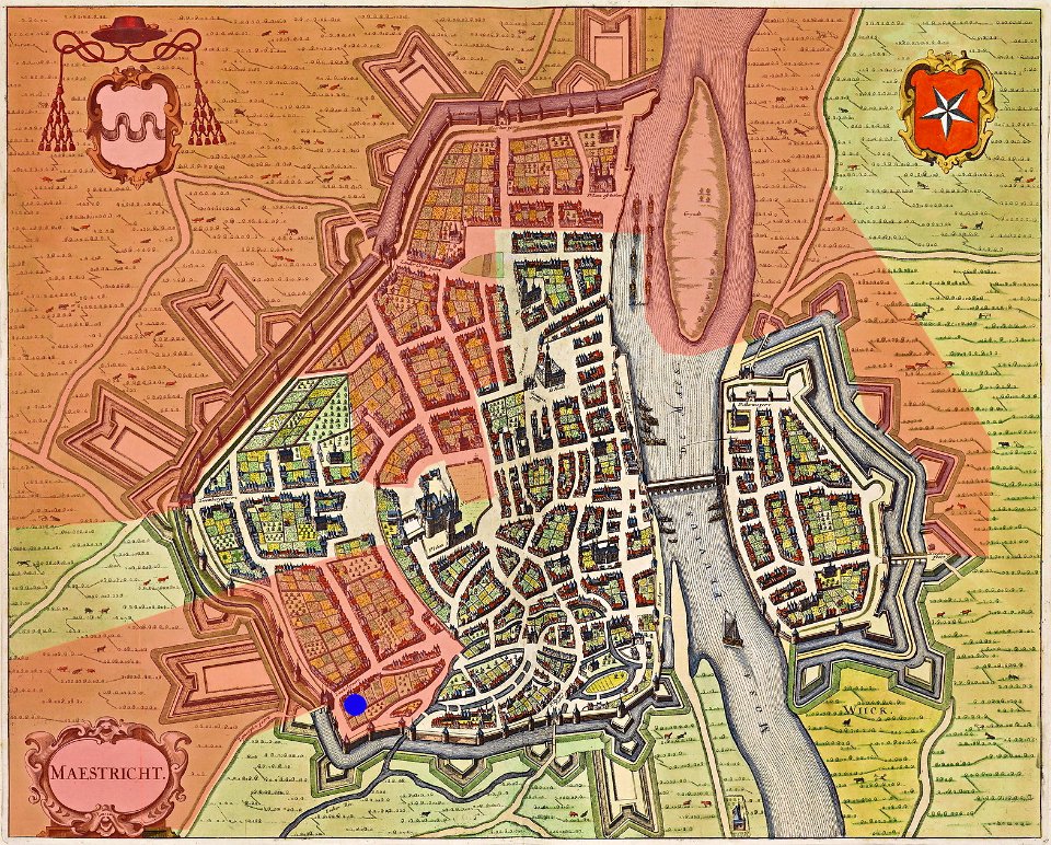
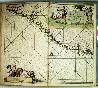
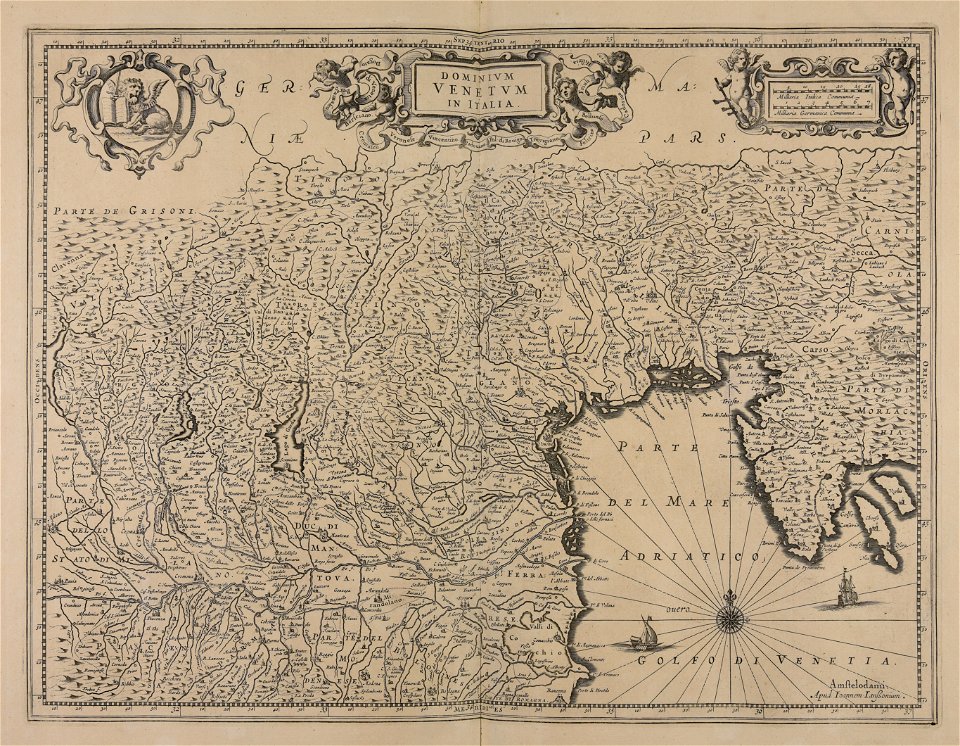
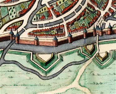
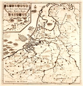
map of maastricht by willem and johannes blaeu (1649)
maps of the west-indische compagnie
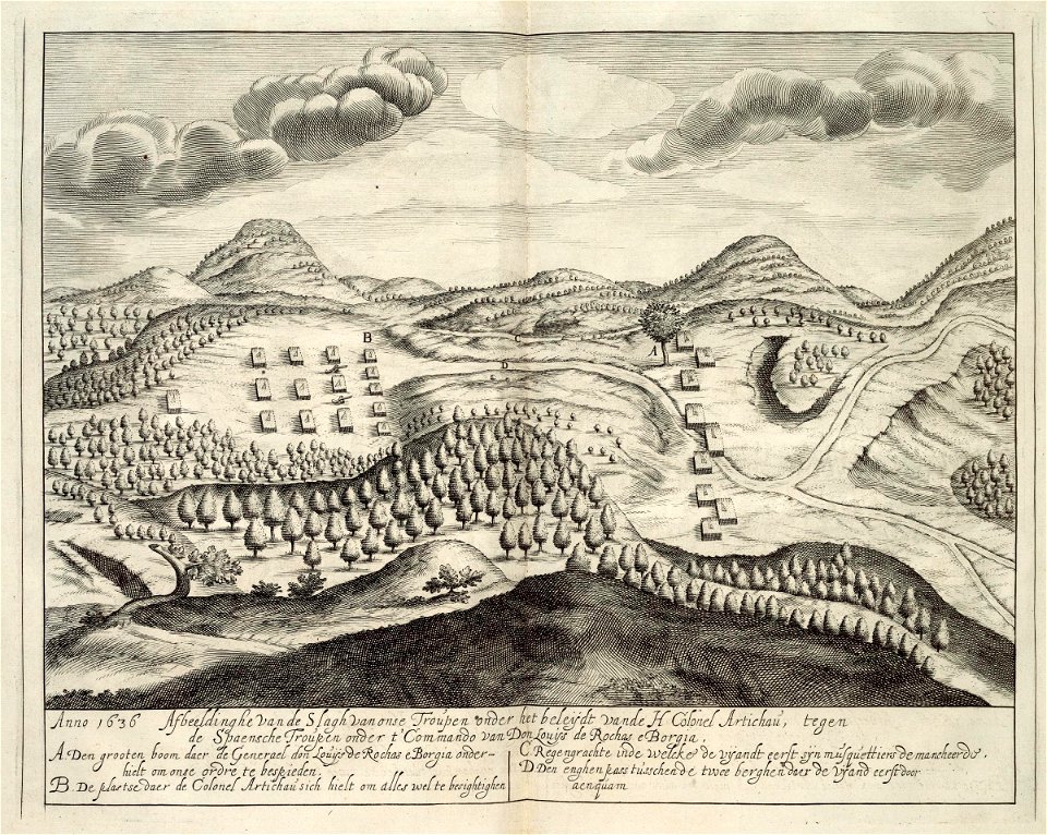
prints from manesson travaux de mars at the peace palace library
atlas de wit 1698
jan janssonius
demolished buildings in groningen (city)
old maps of groningen (city)
university of toronto wenceslas hollar digital collection
architectural prints by wenzel hollar
university of toronto wenceslas hollar digital collection
architectural prints by wenzel hollar
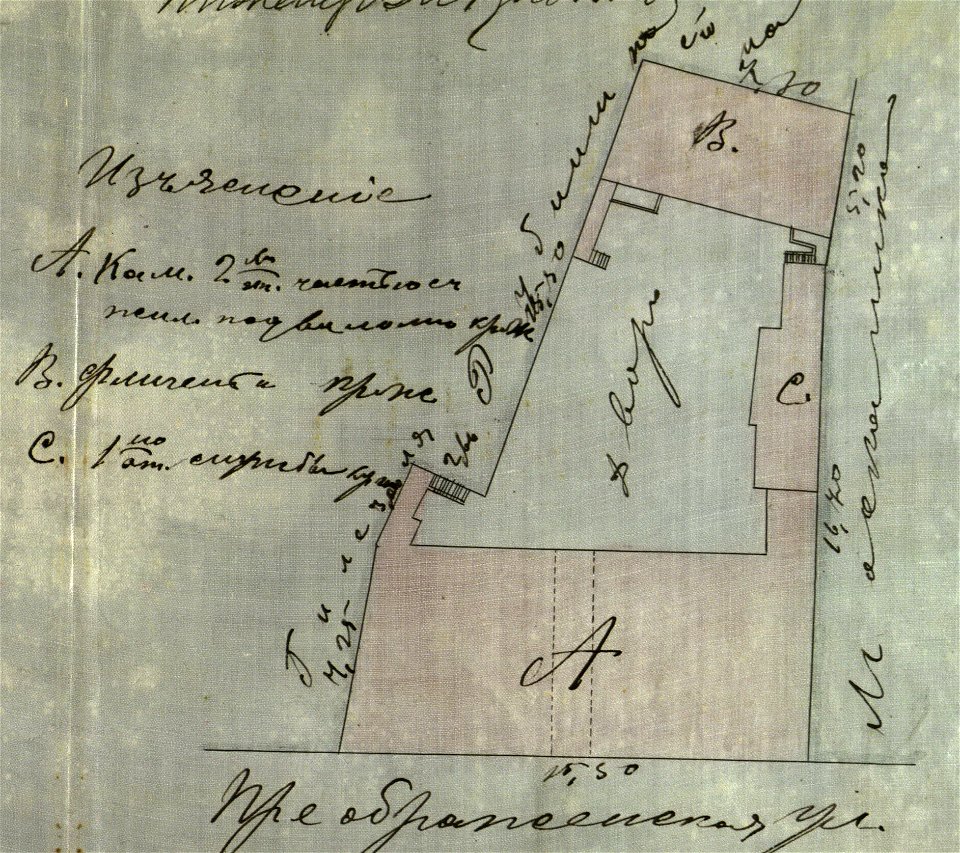
history of troitse-sergiyeva lavra
icons in museum of sergiev posad
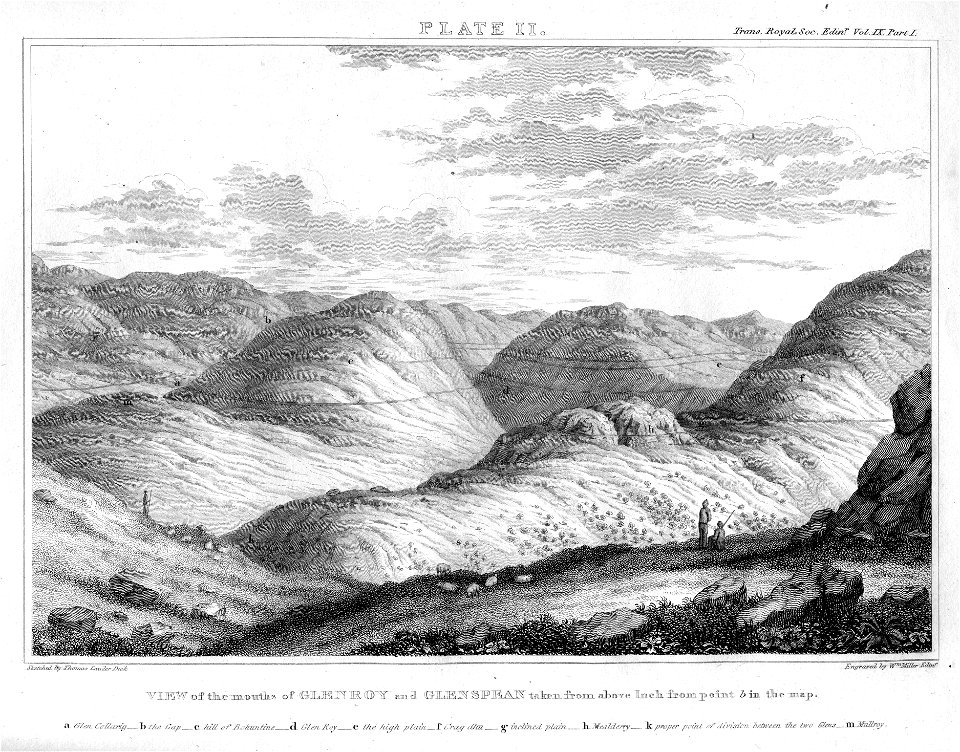
engravings by william miller
joão da gama
old map
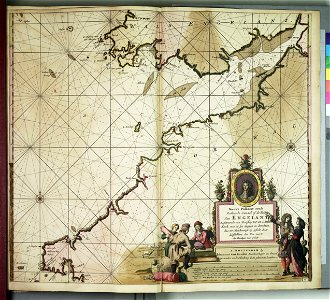
theatrum orbis terrarum (london 1606)
files from the bodleian libraries
drawings and watercolours of the royal museums greenwich
printing
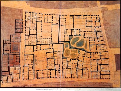
list of paintings and plots by pascal coste and eugène flandin
chehel sotun garden
chicago and the midwest
newberry library
charts and maps of the royal museums greenwich
charts and maps of the royal museums greenwich
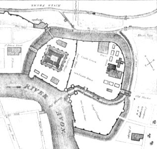
images from bristol past and present (1882)
bristol
maps of the west-indische compagnie
1644
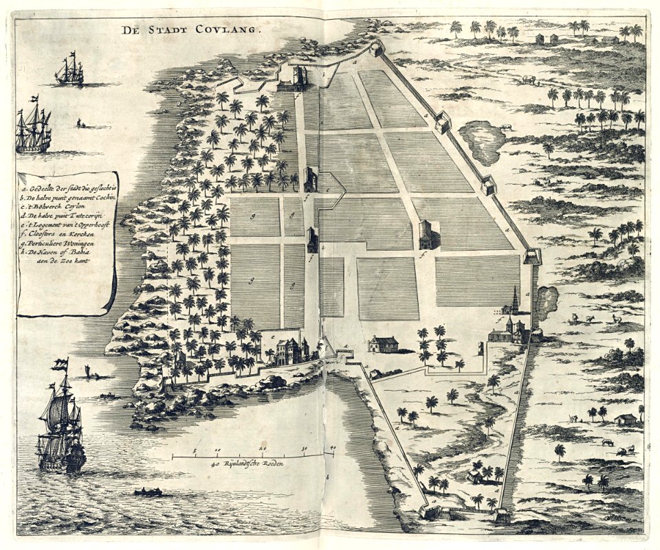
maps of the dutch east india company - india
1672
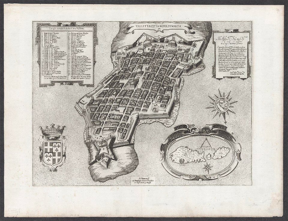
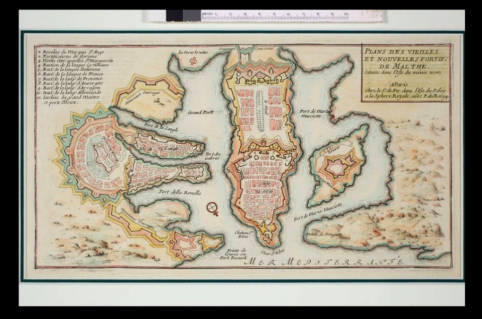
old maps of valletta
matthäus merian
historical maps of lüneburg
am sande (lüneburg)
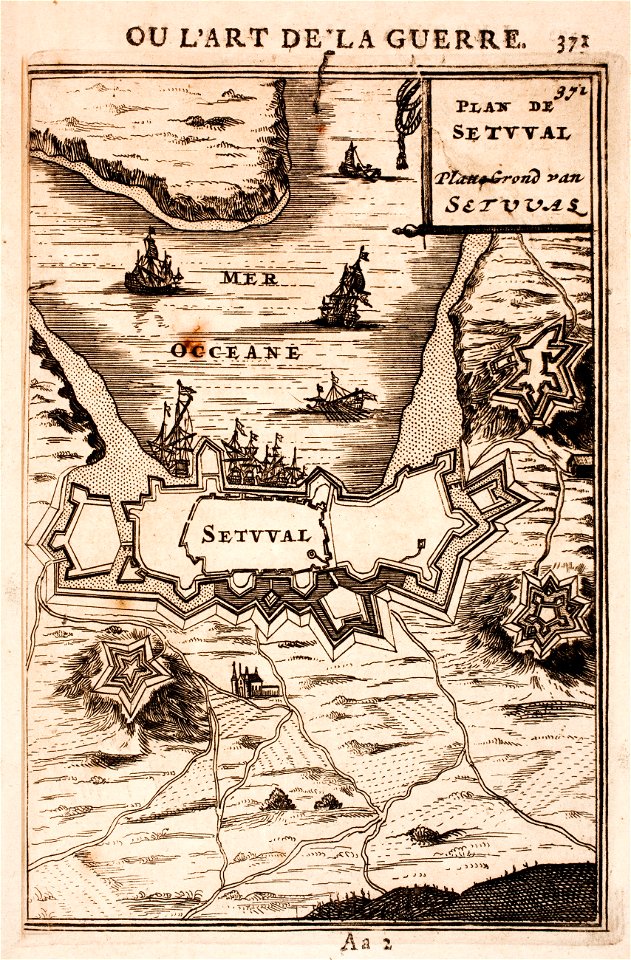
maps of fortifications in portugal
setúbal
prints from manesson travaux de mars at the peace palace library
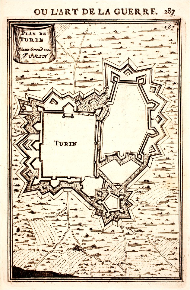
fortifications in italy
map of maastricht by willem and johannes blaeu (1649)
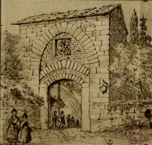
nieuwenhofpoortje
history of antwerp
renaissance
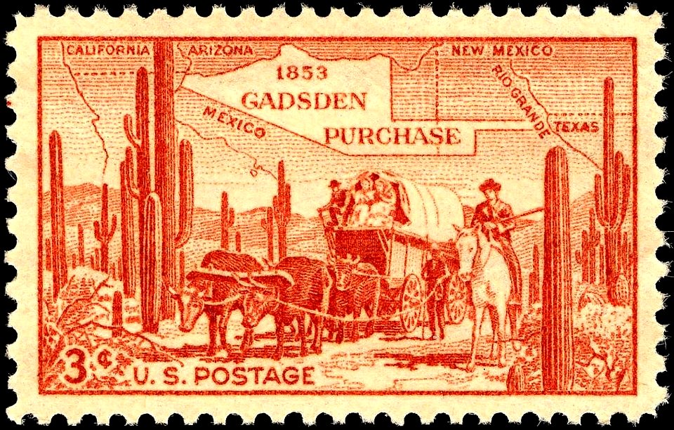
stamps designed by charles r. chickering
brown stamps
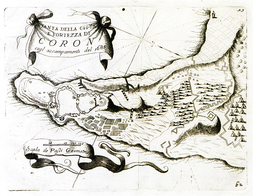
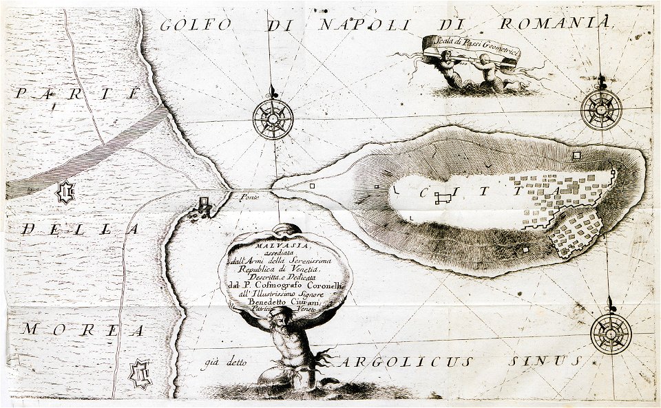
geographical illustrations by coronelli
koroni
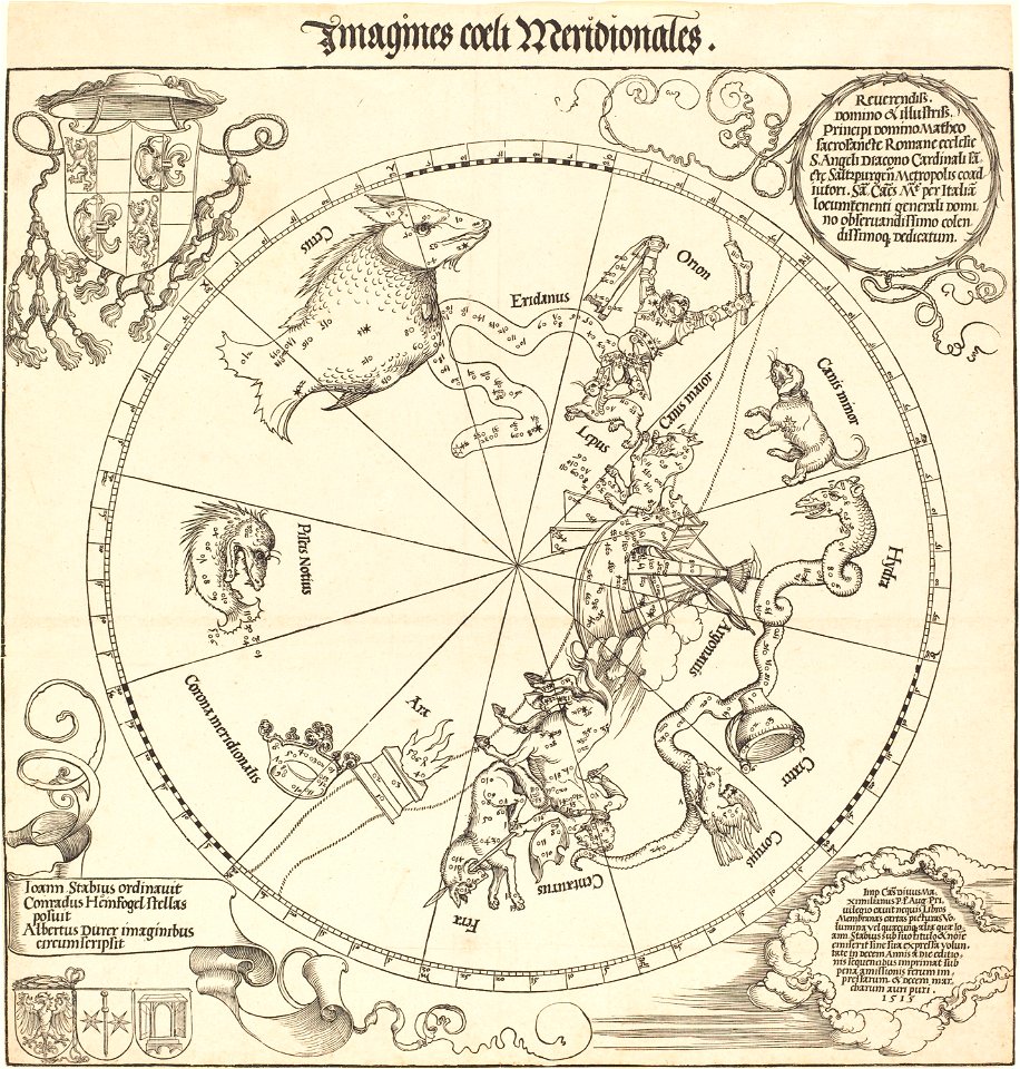
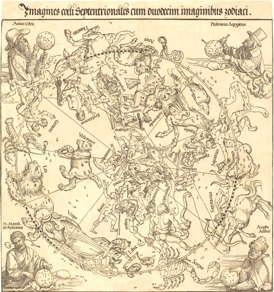
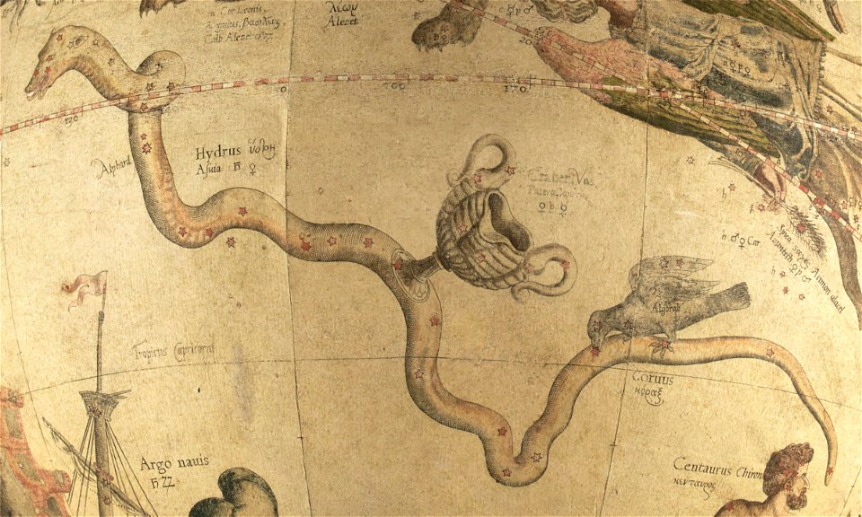
the southern hemisphere of the celestial globe by albrecht dürer
old celestial maps
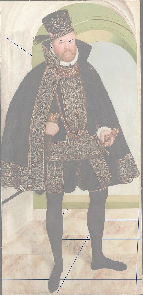
portrait of elector august by lucas cranach the younger (stadt- und bergbaumuseum freiberg)
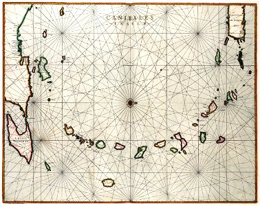
maps with cartouches
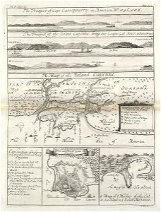
lesser antilles
maps of the west-indische compagnie
1732
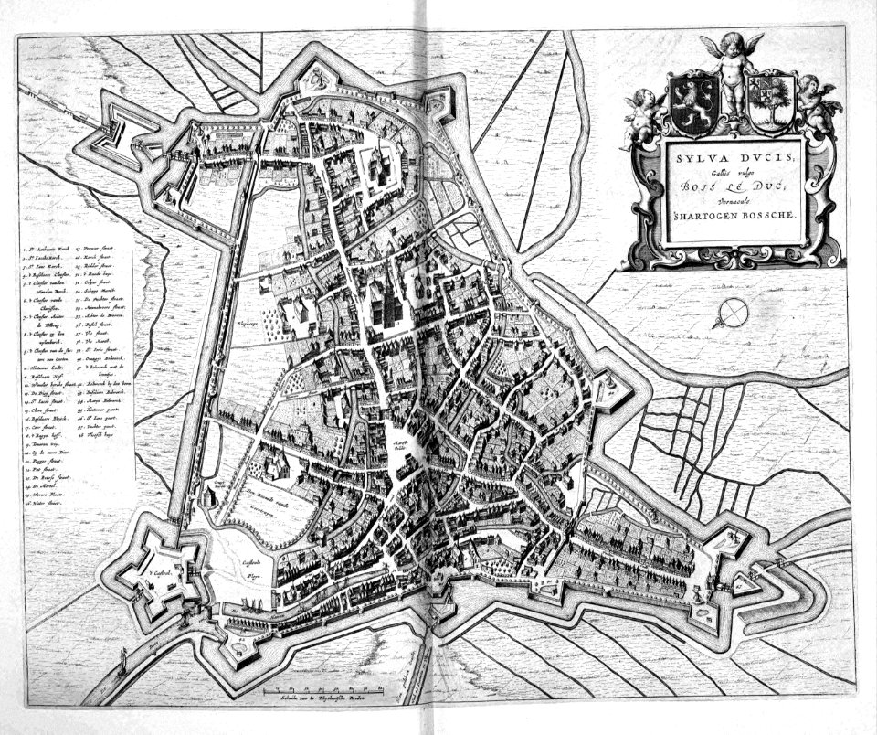
old maps of 's-hertogenbosch
atlas beudeker
map of maastricht by willem and johannes blaeu (1649)
atlas de wit 1698
old maps of valletta
nicolas de fer
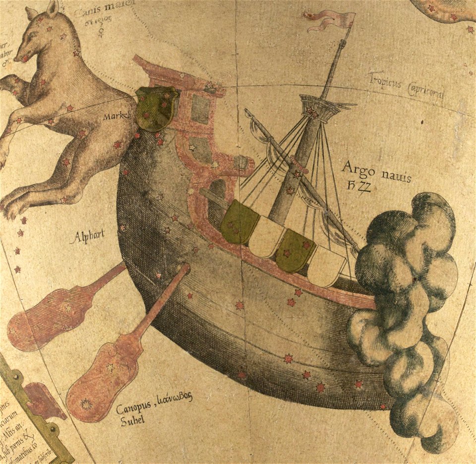
puppis constellation
argo
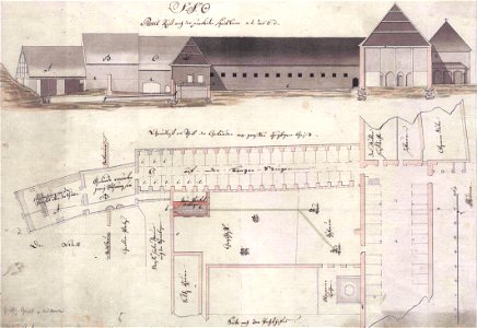
floor plans of buildings in lower saxony
stadtarchiv lüneburg
prints from manesson travaux de mars at the peace palace library
artillery of the ottoman empire
maps made in the 17th century
jan janssonius
old maps of cyprus
cyprus in art
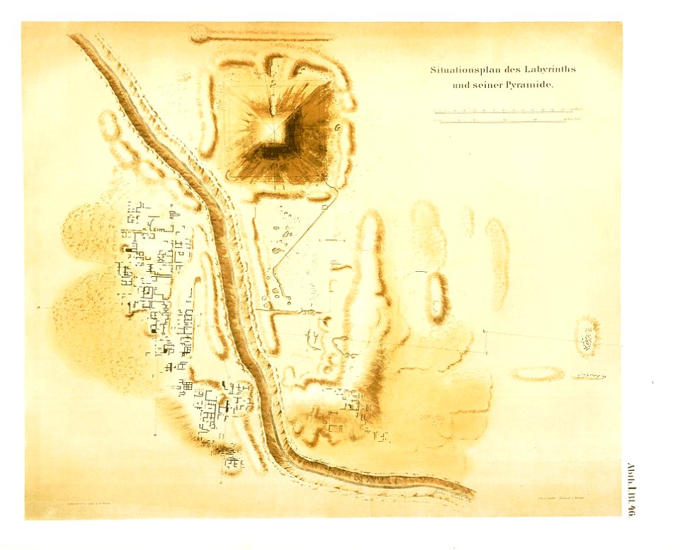
pyramid of amenemhat iii in hawara
lepsius-projekt - pyramids
il devotissimo viaggio di gerusalemme fatto
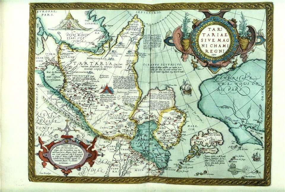
maps made in the 17th century
cina
section schwarzenberg (1843)
oberreit
pages using map template with incorrect parameter
nieuwe hollandse scheeps-bouw (1695)
pages using map template with incorrect parameter
nieuwe hollandse scheeps-bouw (1695)
pages using map template with incorrect parameter
nieuwe hollandse scheeps-bouw (1695)
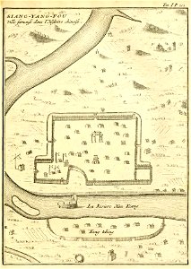
description de la chine
xiangyang
cento vedute di firenze antica
old maps of florence
greece
italy
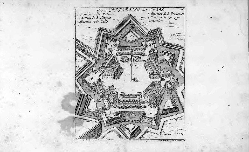
historical images of casale monferrato
old maps of casale monferrato
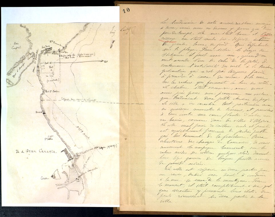
journal de relâches du croiseur ecole d'application l'iphigénie : campagne 1887-88
cartography
old maps of marseille
french navy bases
a history of the holy eastern church
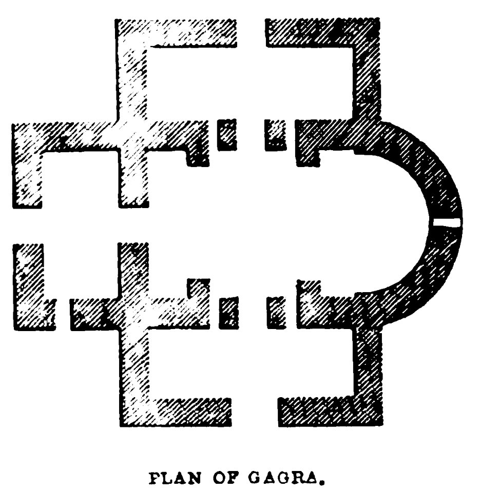
georgia in the 19th century
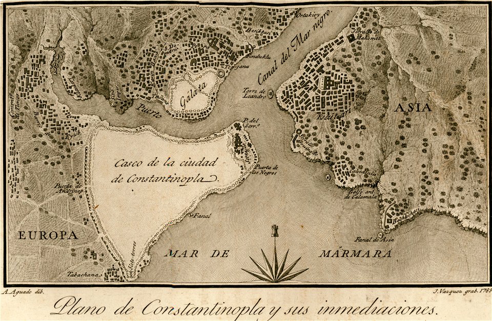
old maps of constantinople
viage á constantinopla
charts and maps of the royal museums greenwich
historical images of minsk
nizki rynak
charts and maps of the royal museums greenwich
featured pictures by evdiam
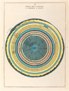
divine comedy
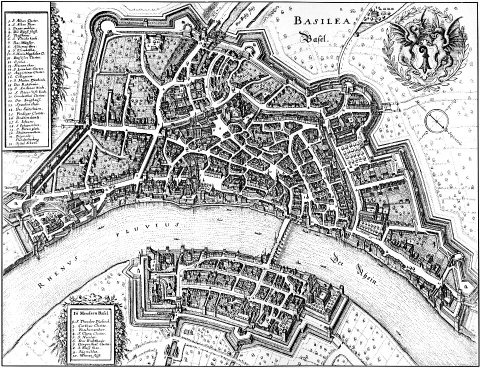
history of basel
mittlere brücke
theatrum orbis terrarum (london 1606)
files from the bodleian libraries
maps made in the 17th century
jan janssonius
engravings by william miller
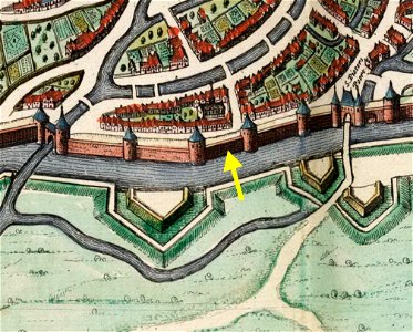
map of maastricht by willem and johannes blaeu (1649)
nieuwenhofwal (maastricht)
prints from the peace palace library
military history of the netherlands
the northern hemisphere of the celestial globe by albrecht dürer
old celestial maps
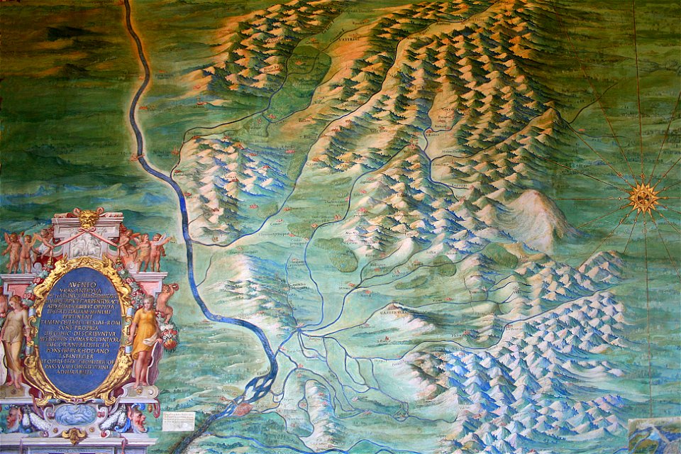
avenionensis ditio et venaisinus comitatus (galleria delle carte geografiche)
maps of comtat venaissin
maps made in the 17th century
frederick de wit
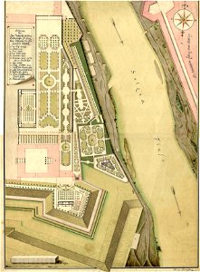
historical images of schloss mirabell and mirabellgarten
salzach in salzburg
atlantis magni tomus primus (biblioteca comunale di trento)
maps made in the 17th century
maps with cartouches
atlas van der hagen
portrait of elector august by lucas cranach the younger (stadt- und bergbaumuseum freiberg)
historical images of minsk
minsk
monasticon gallicanum
rouen in art
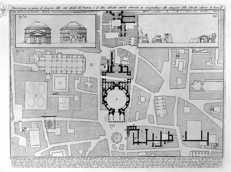
plans of the pantheon (rome)
old maps of rome
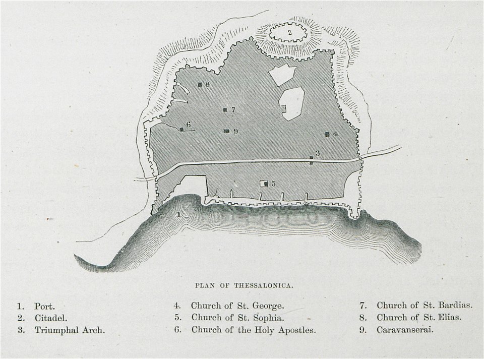
old maps of thessaloniki
day & son
california
san diego
atlantis magni tomus primus (biblioteca comunale di trento)
maps made in the 17th century
maps by gerardus mercator
mercator celestial globe
kutepov's hunting - illustrations (volume 1)
old maps of the tsardom of russia
images of venice by jacopo de' barbari
barbary
geography of füssen
tannheimer berge
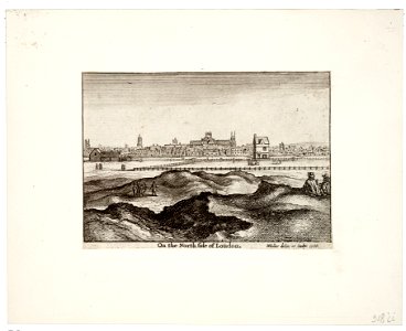
prints by wenzel hollar
views of london
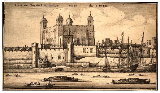
prints by wenzel hollar
tower of london in art
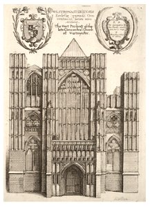
architectural prints by wenzel hollar
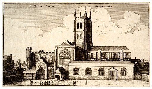
southwark cathedral
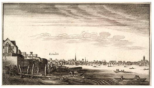
university of toronto wenceslas hollar digital collection
architectural prints by wenzel hollar
university of toronto wenceslas hollar digital collection
prints by wenzel hollar
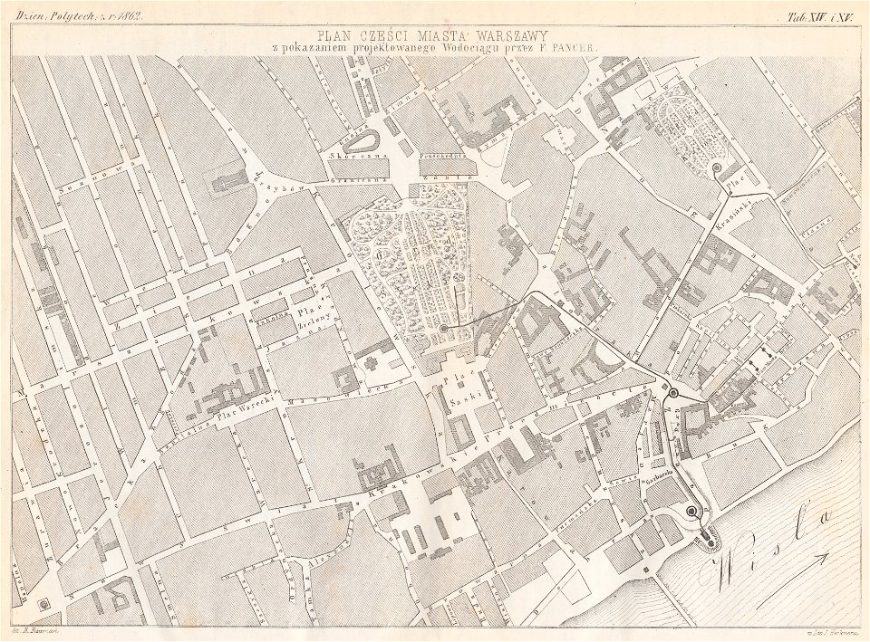
warsaw in the 1860s
feliks pancer
maps and topographical views by joris hoefnagel
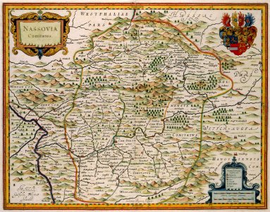
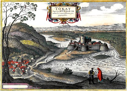
hungary
map of ferrara by andrea bolzoni
viale cavour (ferrara)
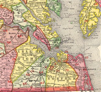
norfolk county
virginia
maps of the dutch east india company - indonesia
1646 drawings in indonesia
atlas de wit 1698
frederick de wit
atlas de wit 1698
frederick de wit
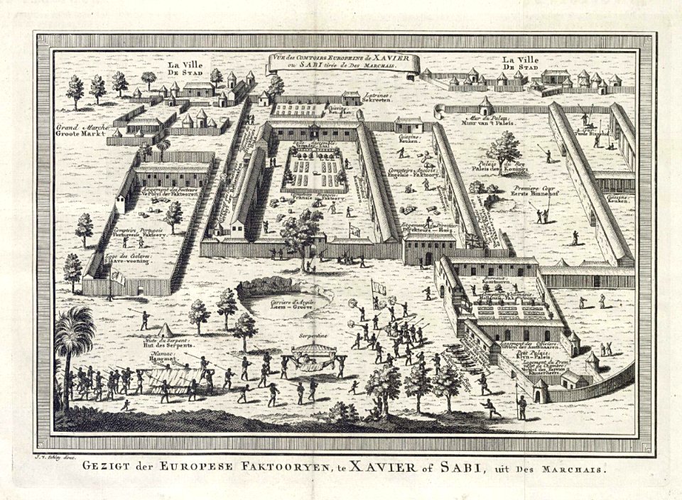
jacobus van der schley
savi
geographical illustrations by coronelli
engravings of monemvasia
images from bau- und kunstdenkmäler des regierungsbezirks wiesbaden (volume 2)
maps of frankfurt-höchst
pictorial history of the russian war 1854-5-6 by george dodd
balkan
diego gutiérrez
renaissance
a.de la motraye's travels through europe, asia, and into part of africa (1723) by la mottraye
18th-century maps of stockholm
eruption fissures of mount etna
fissure vents of mount etna
maps made in the 17th century
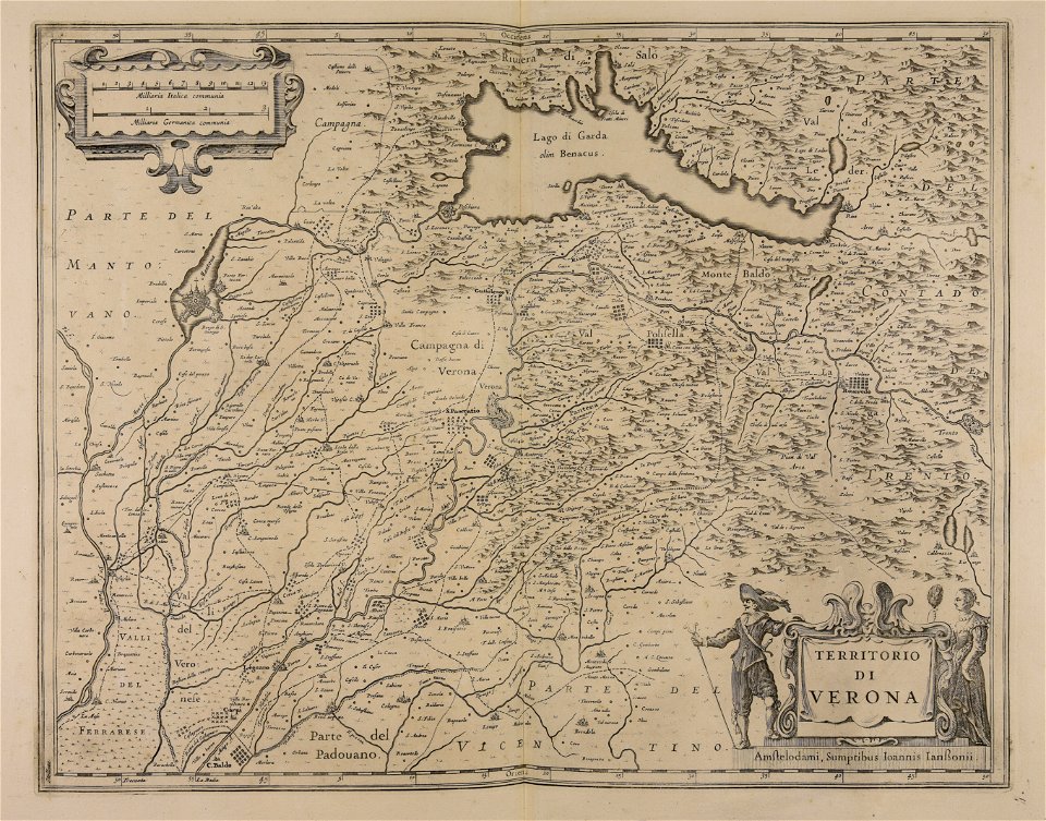
lake garda
maps of reims
rue du marc
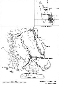
maps of islands of vanuatu
espiritu santo
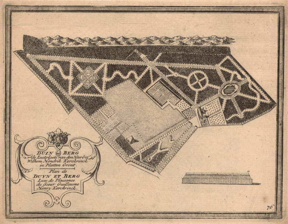
maps of zuid-kennemerland
hendrik de leth
10101 - 10200 of 38,713
Next page
/ 388