Log in
All resources
Create a design
2,560 Free Images of Kaart
maps in the rijksmuseum amsterdam
prints of cartouches in the rijksmuseum amsterdam
history
historical
cc-zero
images from nationaal archief
images from anefo
maps by carolus allard
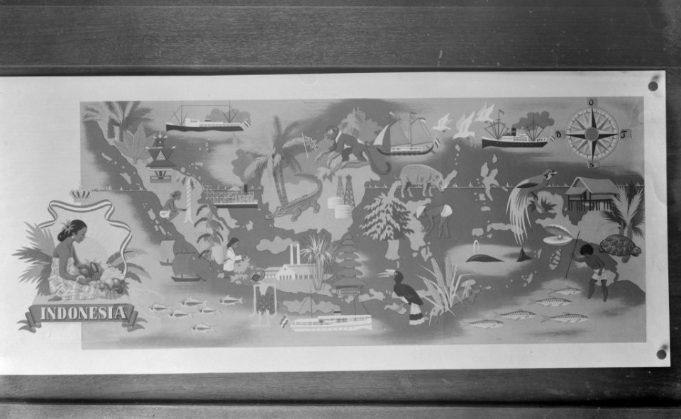
fotocollectie dienst voor legercontacten indonesië
history prints in the rijksmuseum amsterdam
maps in the rijksmuseum amsterdam
etchings of ports and harbours
prints published by claes jansz. visscher (ii) in the rijksmuseum amsterdam
maps in the rijksmuseum amsterdam
prints of cartouches in the rijksmuseum amsterdam
maps in the rijksmuseum amsterdam
maps in the rijksmuseum amsterdam
baroque
maps in the rijksmuseum amsterdam
baroque
prints of cartouches in the rijksmuseum amsterdam
maps in the rijksmuseum amsterdam
history prints in the rijksmuseum amsterdam
maps in the rijksmuseum amsterdam
maps in the rijksmuseum amsterdam
siege by maurice of nassau
prints published by claes jansz. visscher (ii) in the rijksmuseum amsterdam
maps in the rijksmuseum amsterdam
prints by claes jansz. visscher (ii) in the rijksmuseum amsterdam
siege of gennep
maps in the rijksmuseum amsterdam
baroque
maps in the rijksmuseum amsterdam
maps by jodocus hondius ii
maps in the rijksmuseum amsterdam
caspar specht
maps in the rijksmuseum amsterdam
maps by willem and johannes blaeu
maps in the rijksmuseum amsterdam
joachim ottens
old maps of the strait of gibraltar
maps in the rijksmuseum amsterdam
gemeente atlas van nederland - groningen
old maps of delfzijl
prints by jan luyken in the rijksmuseum amsterdam
maps in the rijksmuseum amsterdam
serie 9, nederlandse en duitse gebeurtenissen, 1583-1587
album met 345 prenten van hogenberg
maps in the rijksmuseum amsterdam
old maps of barcelona
maps in the rijksmuseum amsterdam
1793 maps
prints by jan van call in the rijksmuseum amsterdam
maps in the rijksmuseum amsterdam
prints by abraham allard in the rijksmuseum amsterdam
maps in the rijksmuseum amsterdam
lithographs in the rijksmuseum amsterdam
maps in the rijksmuseum amsterdam
historical
history
history
maps
history
maps
history
maps
les forces de l'europe, asie, afrique et amerique, ou description des principales villes, avec leurs fortifications
1702 maps of spain
prints of cartouches in the rijksmuseum amsterdam
maps in the rijksmuseum amsterdam
prints of cartouches in the rijksmuseum amsterdam
maps in the rijksmuseum amsterdam
prints by claes jansz. visscher (ii) in the rijksmuseum amsterdam
maps in the rijksmuseum amsterdam
lithographs in the rijksmuseum amsterdam
maps in the rijksmuseum amsterdam
dutch 17th-century prints in the rijksmuseum amsterdam
siege of gennep
maps in the rijksmuseum amsterdam
baroque
maps in the rijksmuseum amsterdam
baroque
historical
history
historical
history
historical
history
historical
history
historical
history
historical
history
historical
history
historical
history
historical
history
prints by johan frederik clemens in the statens museum for kunst
engraving
prints by johan frederik clemens in the statens museum for kunst
engraving
maps of polders in south holland
18th-century maps of rotterdam
voyage en italie, en sicile et à malte (1778)
maps in the rijksmuseum amsterdam
duin en kruidberg, santpoort
maps of zuid-kennemerland
maps in the rijksmuseum amsterdam
maps of hinnaarderadiel
maps in the rijksmuseum amsterdam
maps of texel
maps in the rijksmuseum amsterdam
wûnseradiel
maps in the rijksmuseum amsterdam
maps by willem and johannes blaeu
maps in the rijksmuseum amsterdam
maps by willem and johannes blaeu
maps of switzerland by johann jakob scheuchzer
maps in the rijksmuseum amsterdam
maps in the rijksmuseum amsterdam
maps by carolus allard
maps of switzerland by johann jakob scheuchzer
maps in the rijksmuseum amsterdam
prints by johan frederik clemens in the statens museum for kunst
engraving
maps by gerardus mercator
kempen (region)
maps in the rijksmuseum amsterdam
maps by carolus allard
drawings by leo gestel in the rijksmuseum amsterdam
expressionism
cartouches by willem and johannes blaeu
maps in the rijksmuseum amsterdam
maps by isaak tirion
1750 maps of africa
maps in the rijksmuseum amsterdam
baarderadeel
maps in the rijksmuseum amsterdam
etchings of ostriches
historical
history
historical
history
historical
history
prints by abraham allard in the rijksmuseum amsterdam
1726 maps of spain
prints of cartouches in the rijksmuseum amsterdam
maps in the rijksmuseum amsterdam
maps in the rijksmuseum amsterdam
maps of franekeradeel
maps in the rijksmuseum amsterdam
dutch golden age painting
maps in the rijksmuseum amsterdam
maps by willem and johannes blaeu
maps of ameland
ballum, ameland
historical
history
historical
history
historical
history
historical
history
historical
history
prints of cartouches in the rijksmuseum amsterdam
maps in the rijksmuseum amsterdam
maps in the rijksmuseum amsterdam
maps by frederick de wit
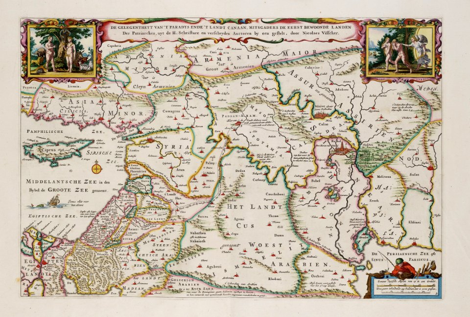
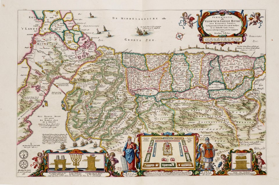
old maps of the stations of the exodus
maps in the rijksmuseum amsterdam
maps in the rijksmuseum amsterdam
maps by carolus allard
prints by claes jansz. visscher (ii) in the rijksmuseum amsterdam
maps in the rijksmuseum amsterdam
maps in the rijksmuseum amsterdam
anna beeck
maps of switzerland by johann jakob scheuchzer
maps in the rijksmuseum amsterdam
maps in the rijksmuseum amsterdam
anna beeck
prints of cartouches in the rijksmuseum amsterdam
maps in the rijksmuseum amsterdam
prints of cartouches in the rijksmuseum amsterdam
maps in the rijksmuseum amsterdam
maps in the rijksmuseum amsterdam
maps by carolus allard
maps in the rijksmuseum amsterdam
maps by carolus allard
maps in the rijksmuseum amsterdam
caspar specht
maps in the rijksmuseum amsterdam
caspar specht
maps in the rijksmuseum amsterdam
caspar specht
lithographs in the rijksmuseum amsterdam
elias spanier
maps in the rijksmuseum amsterdam
caspar specht
maps in the rijksmuseum amsterdam
siege of la rochelle (1627–1628)
maps in the rijksmuseum amsterdam
johannes van den aveelen
les forces de l'europe, asie, afrique et amerique, ou description des principales villes, avec leurs fortifications
portolan charts made in the 18th century
1101 - 1200 of 2,560
Next page
/ 26