Log in
All resources
Create a design
4,578 Free Artworks of Scale
bibliothèque nationale de france
maps from gallica
john rocque
guides joanne
john rocque 1746 london map (216 parts)
paper
british museum
maps in the library of congress
félix robaut
maps by tomas lopez
1786 maps of spain
maps of el bierzo
maps in the library of congress
18th-century maps of martinique
rivista italiana di numismatica 1889
guido antonio zanetti
old maps of finistère
maps from gallica
watercolor paintings in the yale center for british art
realism
illustration
music
bibliothèque nationale de france
félix robaut
bibliothèque nationale de france
félix robaut
l'empire d'allemagne divisé en ses dix cercles en leurs principaux estats. le royaume de bohême et les provinces qui en dépendent - nouvellement reveu et corrigé par le sieur sanson... ; lud. cordier... - btv1b532023318
sanson maps of the circles of germany
bibliothèque nationale de france
félix robaut
interiors of churches in the canton of zürich
oswaldkapelle breite (nürensdorf)
maps in the library of congress
1877 maps of the united states
maps of the united kingdom of the netherlands
françois bohn
paintings in the museu paulista
brazil in history paintings
plano de la bahia de argel situada en la costa de africa - explicacion del ataque que executo en esta bahia el ex.mo señor don antonio barcelo, siendo su mayor general el capitan de navio don joseph... - btv1b53238422p
maps by tomas lopez
caricatures of denmark
p.c. klæstrup
maps published by hendrik de leth
algiers in the 18th century
françois de la pointe
maps of barbary coast
balloon aircraft in art
1837 in london
a plan of the operations of the king's army under the command of general sr. william howe, k.b. in new york and east new jersey, against the american forces commanded by general washington, from the 12th. of october, to the 28th. of november 1776
battle of white plains
bibliothèque nationale de france
félix robaut
bibliothèque nationale de france
félix robaut
éléphant de la bastille
1830 in art
admiralty charts 2601-2800
sligo bay
maps in the library of congress
cartouches by tomas lópez
sanson maps of the netherlands
1670s maps of belgium
maps from university of amsterdam special collections
atlas der neederlanden
john rocque 1746 london map (216 parts)
john rocque
john rocque 1746 london map (216 parts)
john rocque
john rocque 1746 london map (216 parts)
john rocque
ravi varma press
virata
jahangir weighing prince khurram against gold and silver
weighing scale
18th-century maps of kent
maps by thomas kitchin
john rocque 1746 london map (216 parts)
john rocque
john rocque 1746 london map (216 parts)
john rocque
john rocque 1746 london map (216 parts)
john rocque
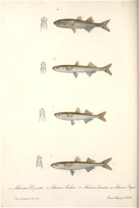
animals
fish
maps from gallica
guides joanne
maps from gallica
guides joanne
17th-century maps of pembrokeshire
maps by jodocus hondius ii
prints by william hogarth in the british museum
realism
festung berlin
baroque
old maps of skagerrak
maps of oslofjorden
maps from university of amsterdam special collections
atlas der neederlanden
midle-sex described with the most famous cities of london and westminster (1610)
bibliothèque nationale de france
midle-sex described with the most famous cities of london and westminster (1610)
context files from gallica
john rocque 1746 london map (216 parts)
john rocque
john rocque 1746 london map (216 parts)
john rocque
john rocque 1746 london map (216 parts)
john rocque
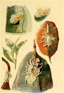
insects
india
18th-century maps of the philippines
baroque painting
maps from gallica
guides joanne
old administrative maps of the ottoman empire
1909 maps of asia
french school,naturalism
château figeac
kentropyx calcarata
ameiva ameiva
cartoons by joseph keppler
puck, 1886
cartoons by joseph keppler
puck, 1886
admiralty charts region b: england wales ireland english channel southern north sea
admiralty charts 2401-2600
maps from gallica
guides joanne
images provided by the münzkabinett (berlin) - 17th century
coins of jahangir
1858 in illinois
1858 maps
landais & oberthur
maps from gallica
bodleian maps collection
old maps of oxford
bird's eye view maps of illinois
maps in the library of congress
portrait paintings of james francis edward stuart
antonio david
printing
woman
bibliothèque nationale de france
guillaume sanson
drawings on vellum in the british museum
sienese school
18th-century maps of hispaniola
maps by juan lopez
carte de france instructive et amusante divisée en quatrevingt six départements - btv1b84949605
bibliothèque nationale de france
maps from gallica
guides joanne
maps from gallica
guides joanne
claude auguste berey
gallia narbonensis
history of greenwich (district of london)
john rocque 1746 london map (a1-h3)
maps from gallica
guides joanne
bibliothèque nationale de france
guillaume sanson
bibliothèque nationale de france
maps by tomas lopez
a plan of the operations of the king's army under the command of general sr. william howe, k.b. in new york and east new jersey, against the american forces commanded by general washington, from the 12th. of october, to the 28th. of november 1776
iona island (new york)
rambha (apsara)
rambha
1610s maps of the netherlands
maps with cartouches
maps from university of amsterdam special collections
atlas der neederlanden
prints by agostino veneziano in the british museum
maps in the british museum
prints by agostino veneziano in the british museum
maps in the british museum
context files from gallica
hendrik de leth
1610s maps of the netherlands
old maps of friesland
carte de france instructive et amusante divisée en quatrevingt six départements - btv1b84949605
bibliothèque nationale de france
maps from gallica
guides joanne
bibliothèque nationale de france
cartouches by tomas lópez
maps by willem and johannes blaeu
1680s maps of indonesia
maps by willem and johannes blaeu
1680s maps of indonesia
17th-century maps of xaintonge
maps by jodocus hondius
paintings in the sonderauftrag linz
german renaissance
context files from gallica
pieter van der keere
maps in the library of congress
birds-eye view of seattle, 1884
japanese illustrated books in the metropolitan museum of art
ehon (picture book) by totoya hokkei
japanese illustrated books in the metropolitan museum of art
ehon (picture book) by totoya hokkei
1941 watercolor paintings
cecil glossop
everett d. graff collection of western americana
maps of the united states
maps of brazil by hendrik hondius
bibliothèque nationale de france
1600s maps of belgium
old maps of flanders
2301 - 2400 of 4,578
Next page
/ 46


![Jessie Willcox Smith – Scales (The Bed-Time Book by Helen Hay Whitney) [from Jessie Willcox Smith: American Illustrator]](https://cdn.creazilla.com/illustrations/7775043/jessie-willcox-smith-scales-the-bed-time-book-by-helen-hay-whitney-from-jessie-w-sm.jpeg)
![Road map of the Pas-de-Calais department / published by Félix Robaut, author of geographical maps,...; litho. by F[éli]x Robaut in Douai; Ed. Boldoduc lith., Félix Robaut, 1848](https://cdn.creazilla.com/illustrations/10000580589/road-map-of-the-pas-de-calais-department-published-by-flix-robaut-author-of-geographical-maps-litho-by-flix-robaut-in-douai-ed-boldoduc-lith-flix-robaut-1848-sm.webp)
![Map of communications in the North of France and part of Belgium including all railways, roads, canals and navigable rivers / executed and published F[éli]x Robaut, ..., Félix Robaut, 1843](https://cdn.creazilla.com/illustrations/10000462604/map-of-communications-in-the-north-of-france-and-part-of-belgium-including-all-railways-roads-canals-and-navigable-rivers-executed-and-published-f-li-x-robaut-f-lix-robaut-1843-sm.jpg)

![Map of France divided by provinces and departments with the population of each capital and its distance from Paris in kilometers / lith. by F[éli]x Robaut, Félix Robaut, 1845](https://cdn.creazilla.com/illustrations/10000876748/map-of-france-divided-by-provinces-and-departments-with-the-population-of-each-capital-and-its-distance-from-paris-in-kilometers-lith-by-flix-robaut-flix-robaut-1845-sm.webp)


![Joanne Guides. Surroundings of Plombières. Scale 10 km. [= Om. 066; 1: 150 000]. L. Thuillier delt, 1891](https://cdn.creazilla.com/illustrations/10000683074/joanne-guides-surroundings-of-plombi-res-scale-10-km-om-066-1-150-000-l-thuillier-delt-1891-sm.jpg)


![Midle-Sex described with the most famous cities of London and Westminster / Described by Iohn Norden; Augme[n]ted by I. Speed; Jodocus Hondius caelavit, 1610](https://cdn.creazilla.com/illustrations/10001324000/midle-sex-described-with-the-most-famous-cities-of-london-and-westminster-described-by-iohn-norden-augmented-by-i-speed-jodocus-hondius-caelavit-1610-md.jpg)
![Midle-Sex described with the most famous cities of London and Westminster / Described by Iohn Norden; Augme[n]ted by I. Speed; Jodocus Hondius caelavit, 1610](https://cdn.creazilla.com/illustrations/10001372370/midle-sex-described-with-the-most-famous-cities-of-london-and-westminster-described-by-iohn-norden-augmented-by-i-speed-jodocus-hondius-caelavit-1610-sm.webp)


![Joanne Guides. Surroundings of Plombières. Scale 10 km. [=Om. 066; 1: 150 000]. L.Thuillier delt, 1889](https://cdn.creazilla.com/illustrations/10001400709/joanne-guides-surroundings-of-plombi-res-scale-10-km-om-066-1-150-000-l-thuillier-delt-1889-sm.jpg)


![[Agas map of Oxford, 1578], Augustine Ryther](https://cdn.creazilla.com/illustrations/10001154709/agas-map-of-oxford-1578-augustine-ryther-md.jpg)


![Utagawa Kuniyoshi – AGEO: Takao of the Miuraya (Miura no Takao) [from The Sixty-nine Stations of the Kisokaido]](https://cdn.creazilla.com/illustrations/7775510/utagawa-kuniyoshi-ageo-takao-of-the-miuraya-miura-no-takao-from-the-sixty-nine-s-sm.jpeg)


![Joanne Guide. The Vosges. The Vosges. Scale, 30 kilometers [=Om. 068; 1: 440,000 approx.]. L. Thuillier delt, 1888](https://cdn.creazilla.com/illustrations/10001545562/joanne-guide-the-vosges-the-vosges-scale-30-kilometers-om-068-1-440-000-approx-l-thuillier-delt-1888-sm.jpg)


