Log in
All resources
Create a design
38,713 Free Artworks of Maps
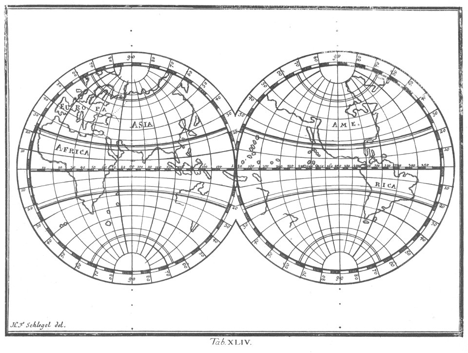
maps made in the 18th century
maps made in the 17th century
johann baptist homann
atlantis magni tomus tertius (biblioteca comunale di trento)
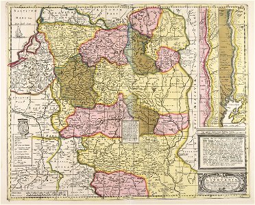
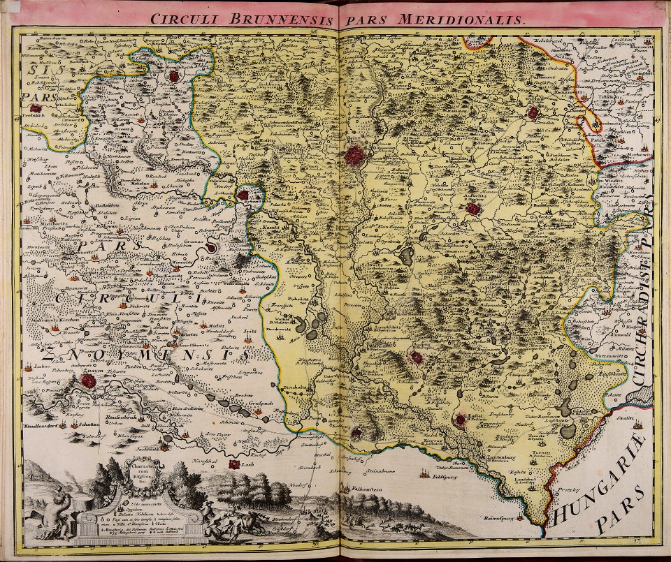
old maps of moravia
johann christoph müller
provided by landsbókasafn íslands
atlantis magni tomus quintus (biblioteca comunale di trento)
maps by pieter schenk (i)
maps with cartouches
1770s maps of the world
elementarwerk
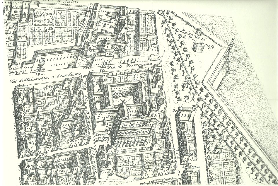
map of ferrara by andrea bolzoni
sant'andrea (ferrara)
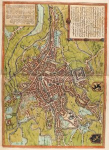
maps of aachen by braun & hogenberg
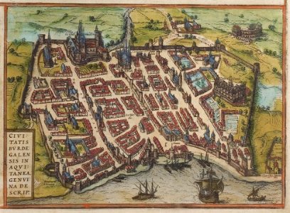
old maps of bordeaux
braun & hogenberg
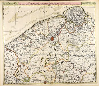
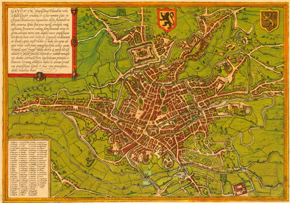
map of ghent by braun & hogenberg
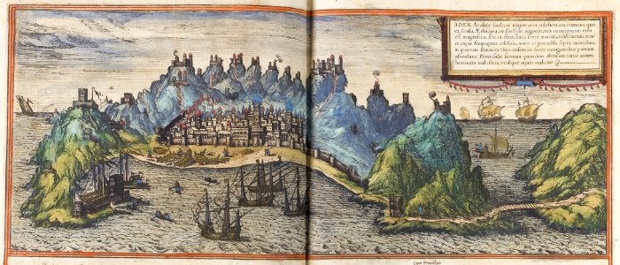
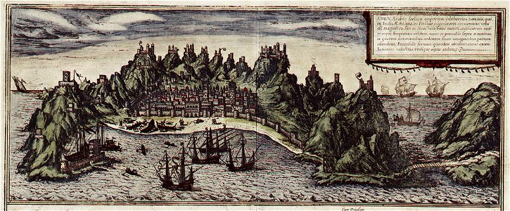
map of aden by braun & hogenberg
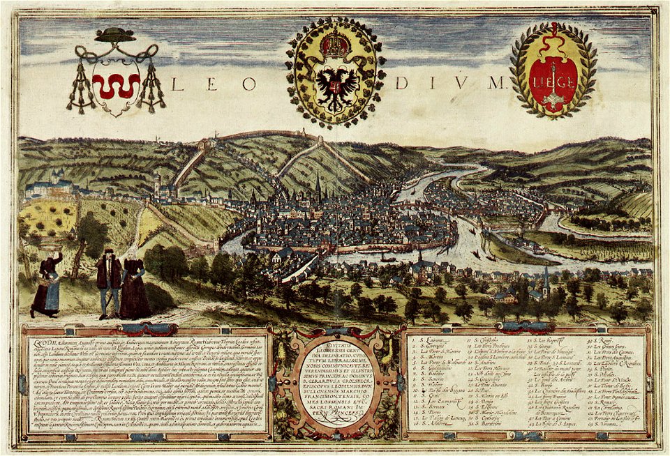
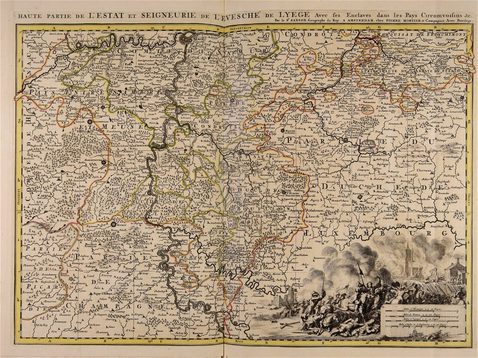
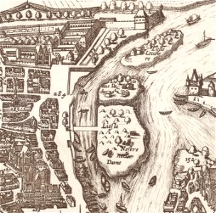
map of liège by braun & hogenberg
map of ghent by braun & hogenberg
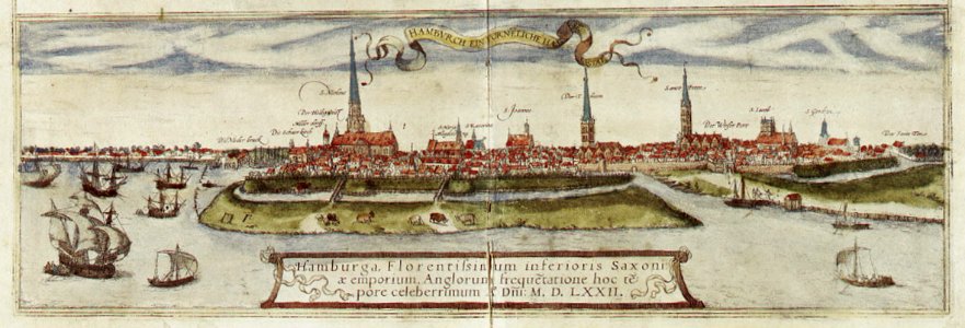
maps of hamburg by braun & hogenberg
maps of hamburg by braun & hogenberg
map of aden by braun & hogenberg
braun & hogenberg
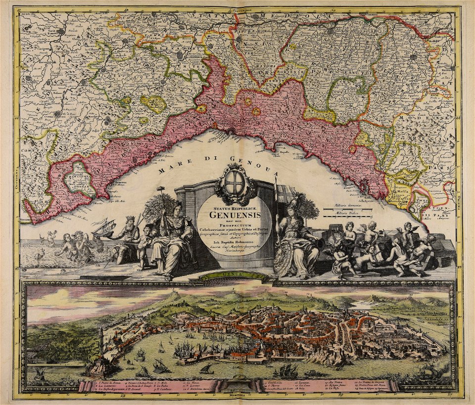
old maps of parma
map of liège by braun & hogenberg
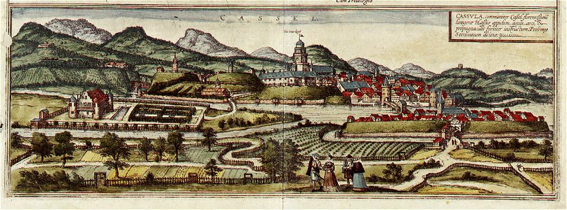
map of kassel by braun & hogenberg
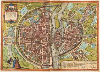
maps of paris by braun & hogenberg
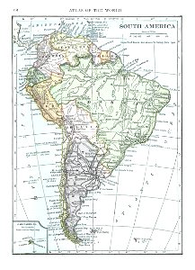
old maps of south america
1909
maps made in the 17th century
gerard valck
charts and maps of the royal museums greenwich
1590 maps
atlantis magni tomus tertius (biblioteca comunale di trento)
maps made in the 17th century
maps made in the 17th century
maps by nicolaes visscher i
maps made in the 18th century
johann baptist homann
17th-century maps of france
maps with cartouches
french colonization in africa
military maps
maps by johannes janssonius
severnaya dvina river
maps made in the 18th century
johann baptist homann
maps made in the 18th century
johann baptist homann
maps made in the 18th century
johann baptist homann
fonds ancely - bibliothèque municipale de toulouse - maps
historical images of pau
bamako in the 1880s
military maps
old maps of île de la cité
île saint-louis
maps made in the 17th century
nicolaes visscher ii
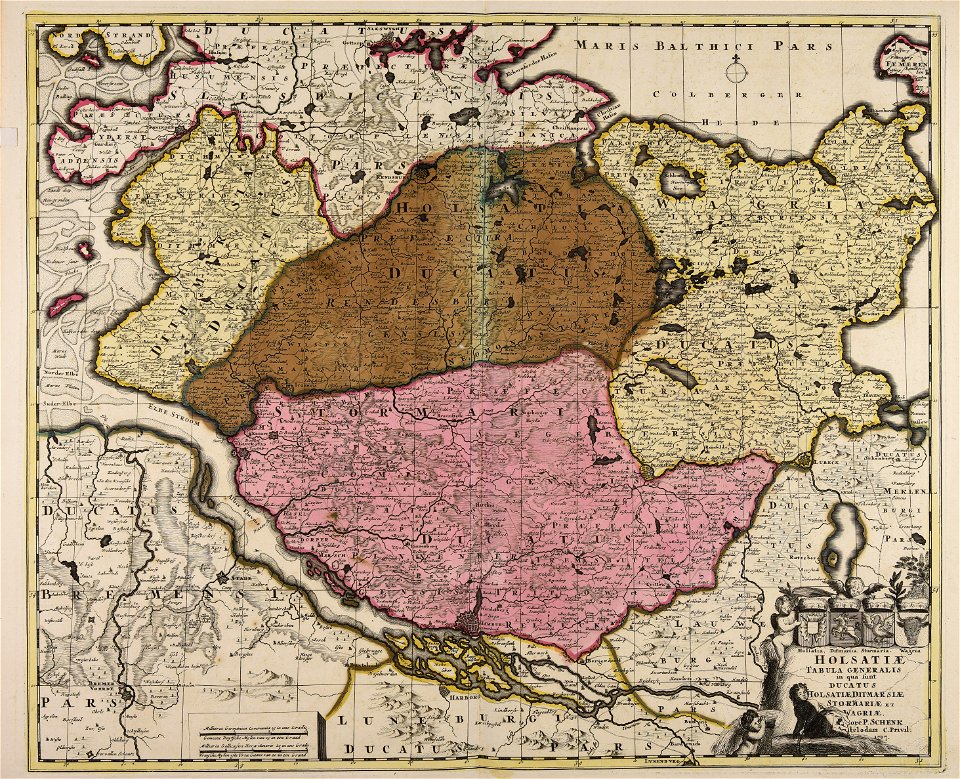
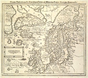
18th-century maps of schleswig-holstein
maps by pieter schenk (i)
maps from the mechanical curator collection
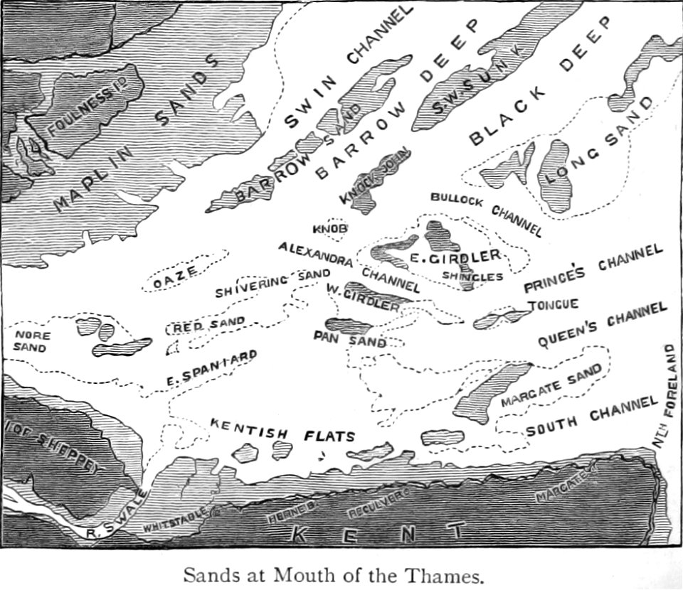
buoy
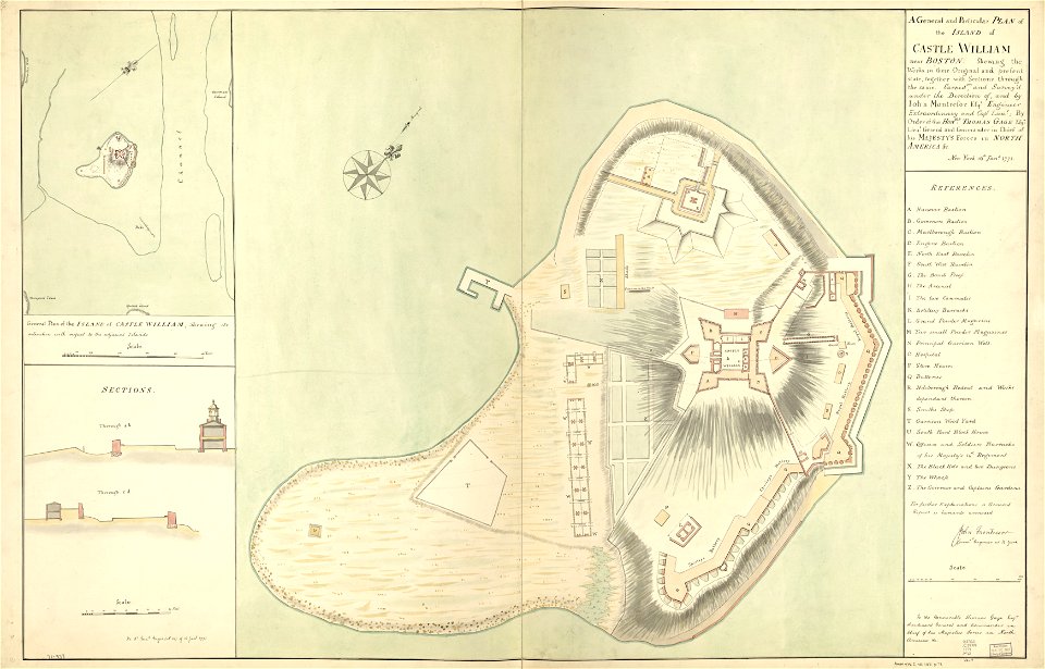
fort independence (massachusetts)
maps in the library of congress
munich in the 19th century
old city maps of munich
prints from the peace palace library
lucan
atlantis magni tomus quintus (biblioteca comunale di trento)
maps made in the 17th century
maps made in the 17th century
cornelis danckerts (i)
maps made in the 18th century
maps by pieter schenk (i)
maps made in the 18th century
gerard valck
maps with cartouches
atlas van der hagen
17th-century maps of france
maps with cartouches
atlas van der hagen (volume 4)
maps with cartouches
history of fashion in paris
paris in the 17th century
atlantis magni tomus quintus (biblioteca comunale di trento)
maps made in the 18th century
maps made in the 18th century
johann baptist homann
maps made in the 18th century
johann baptist homann
mobile river
alabama
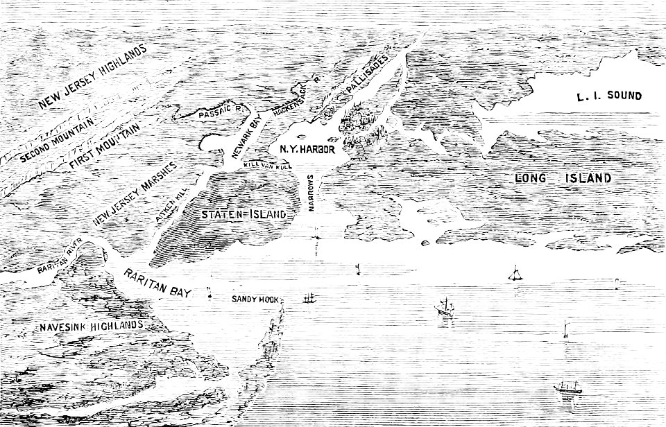
old maps of new york (state)
the palisades (hudson river)
maps made in the 17th century
nicolaes visscher ii
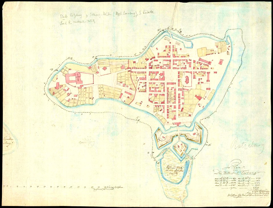
history of ratzeburg
1730 maps of germany
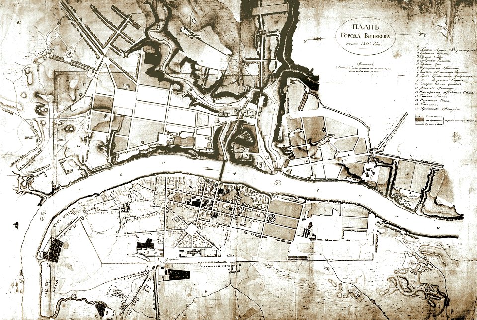
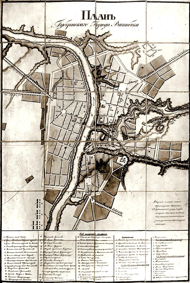
historical images of viciebsk
maps of viciebsk
provided by landsbókasafn íslands
19th-century maps of iceland
provided by landsbókasafn íslands
16th-century maps of iceland
provided by landsbókasafn íslands
16th-century maps of iceland
historical images of słonim
maps of slonim
description de l'universe
old map
historical images of čerykaŭ
maps of čerykaŭ
provided by landsbókasafn íslands
16th-century maps of iceland
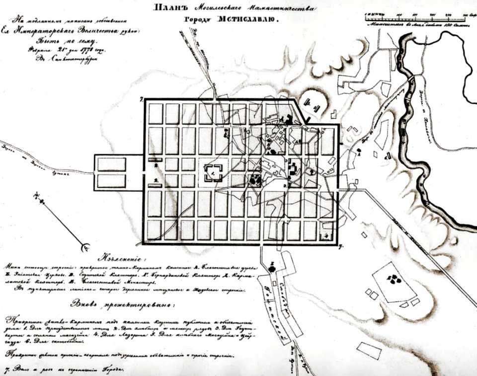
historical images of mscislaŭ
maps of mscislaŭ
historical images of mscislaŭ
maps of mscislaŭ
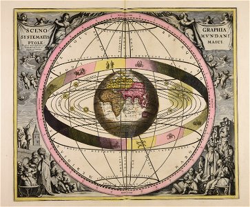
andreas cellarius
1623
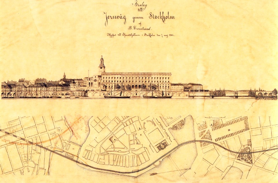
maps of gamla stan
1864 in sweden
maps of aachen by braun & hogenberg
maps of brussels by braun & hogenberg
map of cairo by braun & hogenberg
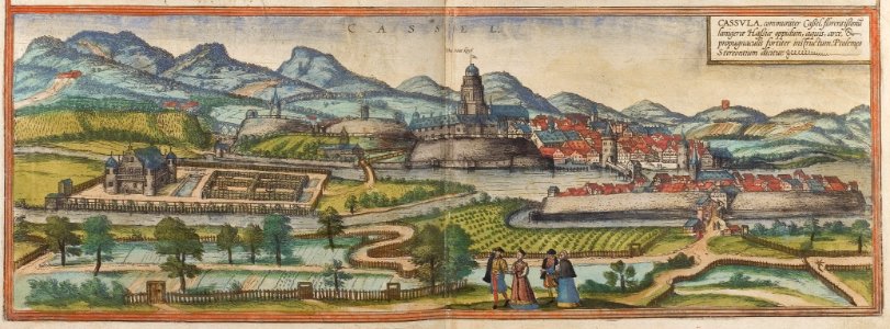
map of kassel by braun & hogenberg
braun & hogenberg
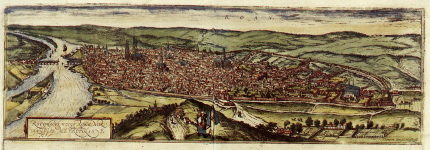
old maps of rouen
old maps of europe
elementarwerk
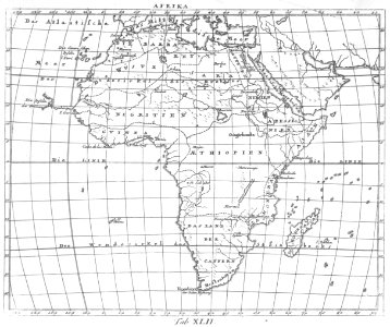
1770s maps of africa
elementarwerk
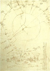
codex atlanticus (f0199)
old maps of milan
johann george schreiber
old maps of saxony
maps of lars kietzlingh
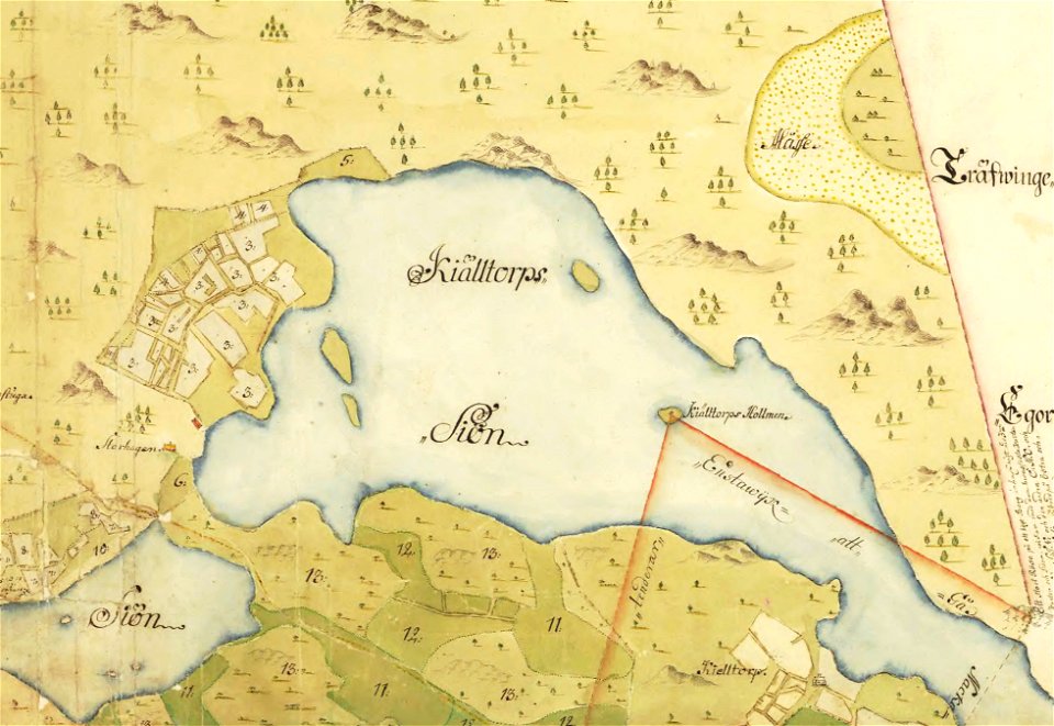
källtorpssjön
maps of stockholm by petrus tillaeus
nybroviken
relation of a journey (sandys)
description de l'universe
art of mauritius
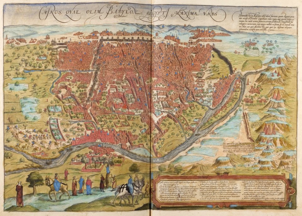
cosmographia (1600) by sebastian münster
1570s maps of spain
1572 in spain
viceroyalty of peru
1646
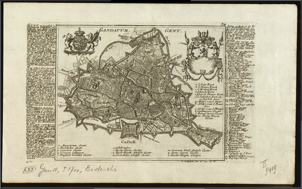
map of ghent by gabriel bodenehr
map of ghent by braun & hogenberg
maps in the stadsarchief amsterdam
cosmographia (1600) by sebastian münster
old map
provided by landsbókasafn íslands
maps made in the 19th century
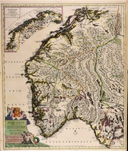
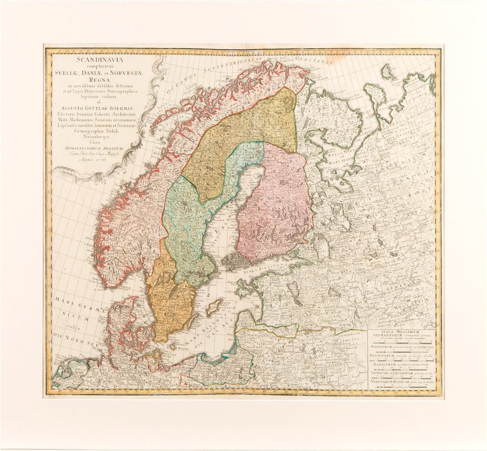
old maps of scandinavia
johann baptist homann
maps of the history of switzerland
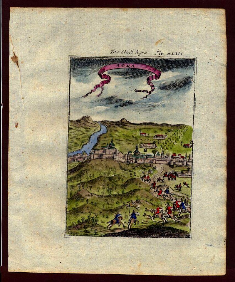
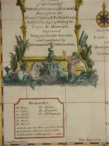
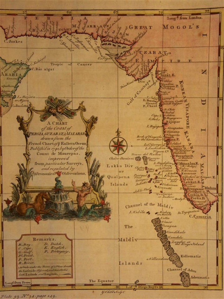
18th-century maps of india
thomas salmon (historian)
18th-century maps of india
thomas salmon (historian)
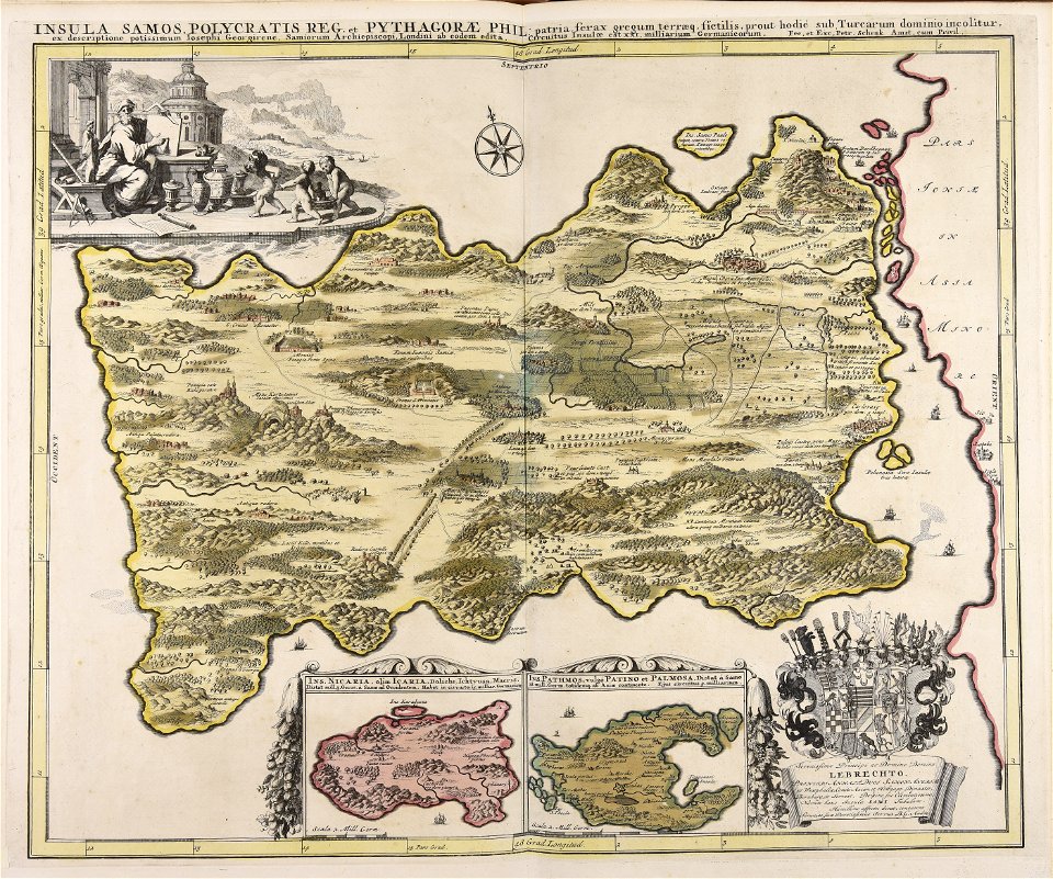
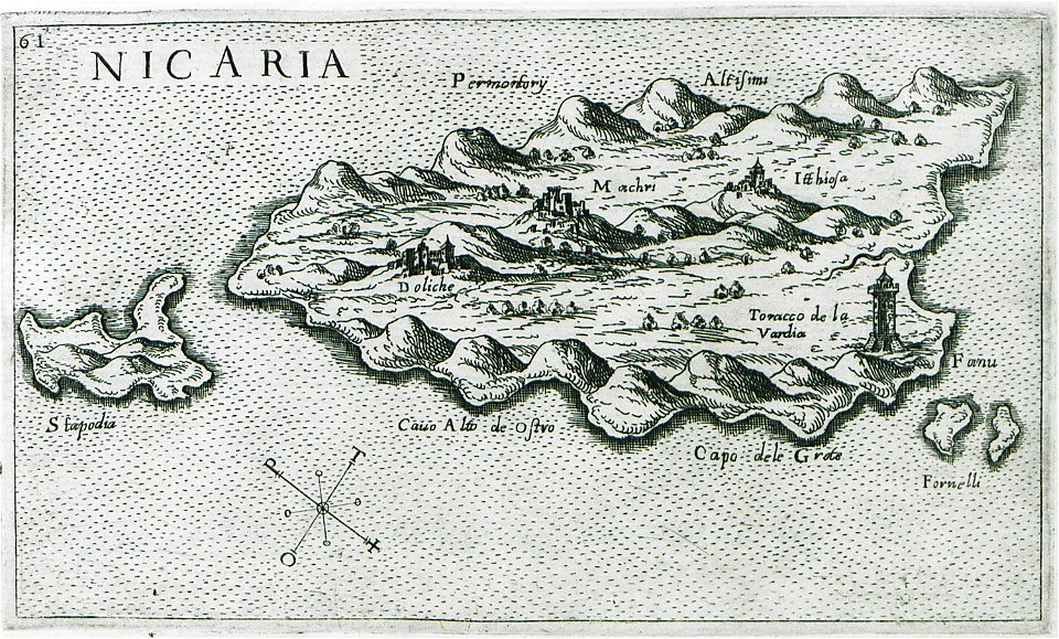
giuseppe rosaccio
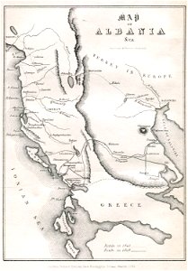
maps of icaria
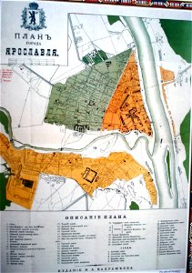
historical plans of yaroslavl
1883 maps
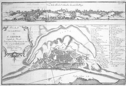
frézier's travel
bahia
drawings (documentary) collection in the library of congress
edward lear
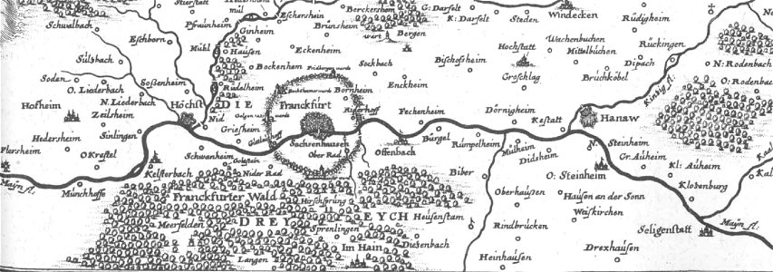
korschenbroich
liedberg
historical images of viciebsk
maps of viciebsk
old maps of hesse
dreieich
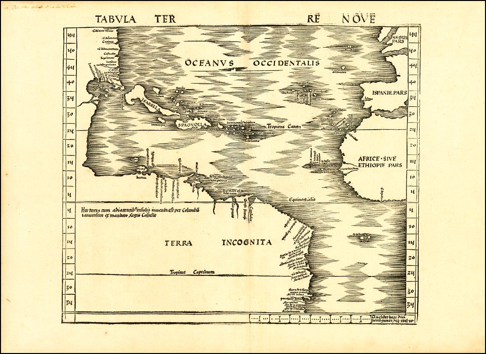
maps by martin waldseemüller
maps of the ore mountains
details of meilenblätter
maps by jonas brolin
kvarteret tegen
6901 - 7000 of 38,713
Next page
/ 388