Log in
All resources
Create a design
38,713 Free Artworks of Map
maps in the library of congress
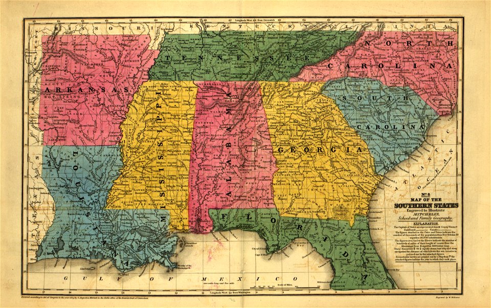
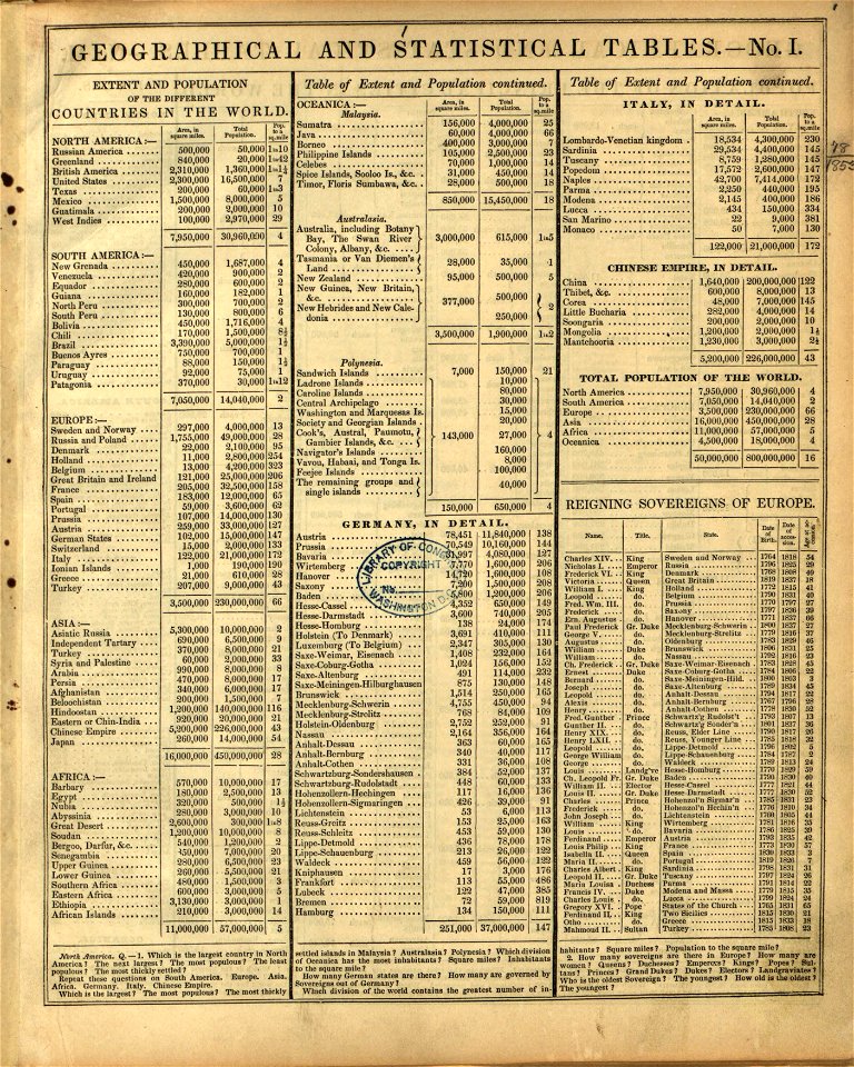
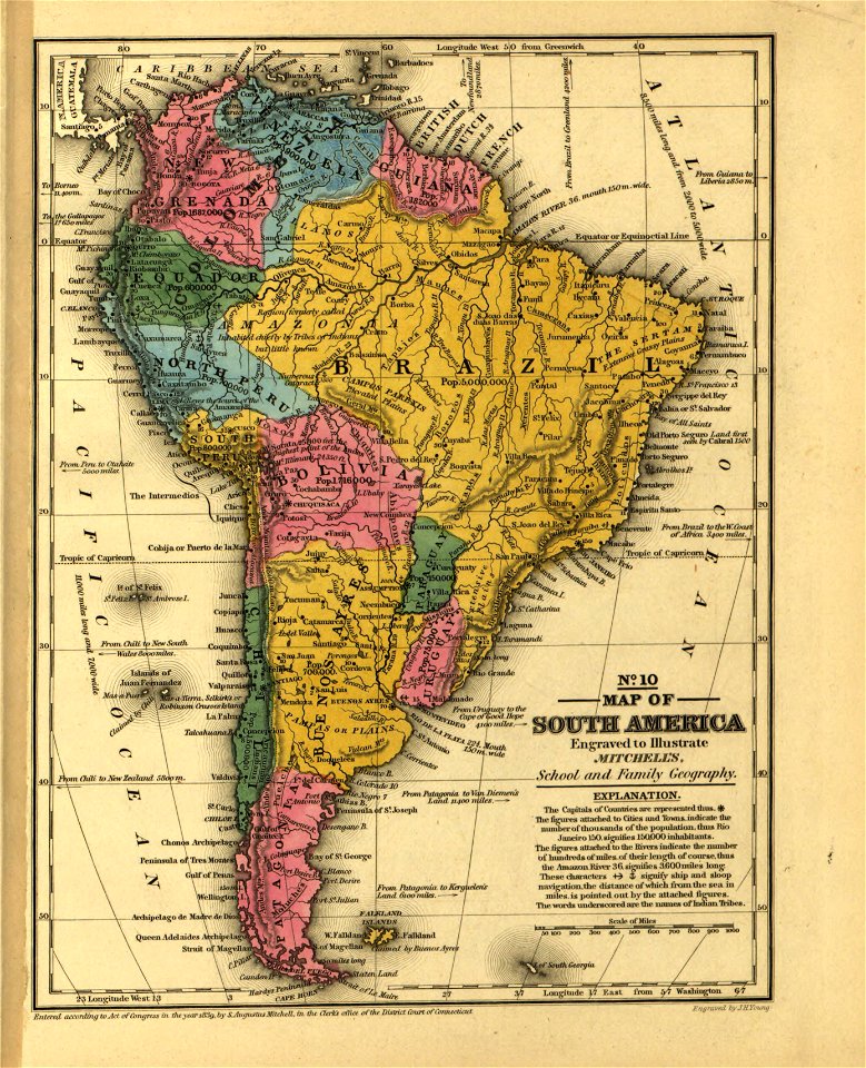
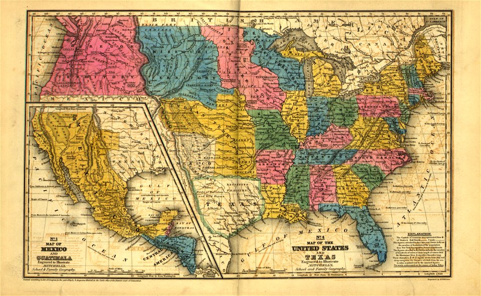
mitchell's school atlas
1828
map „das herzogthum nassau“ by j.b. fischer
maps in the stadsarchief amsterdam
claes jansz. visscher (ii)
charts and maps of the royal museums greenwich
geographical illustrations by coronelli
map of ferrara by andrea bolzoni
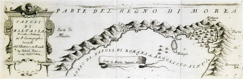
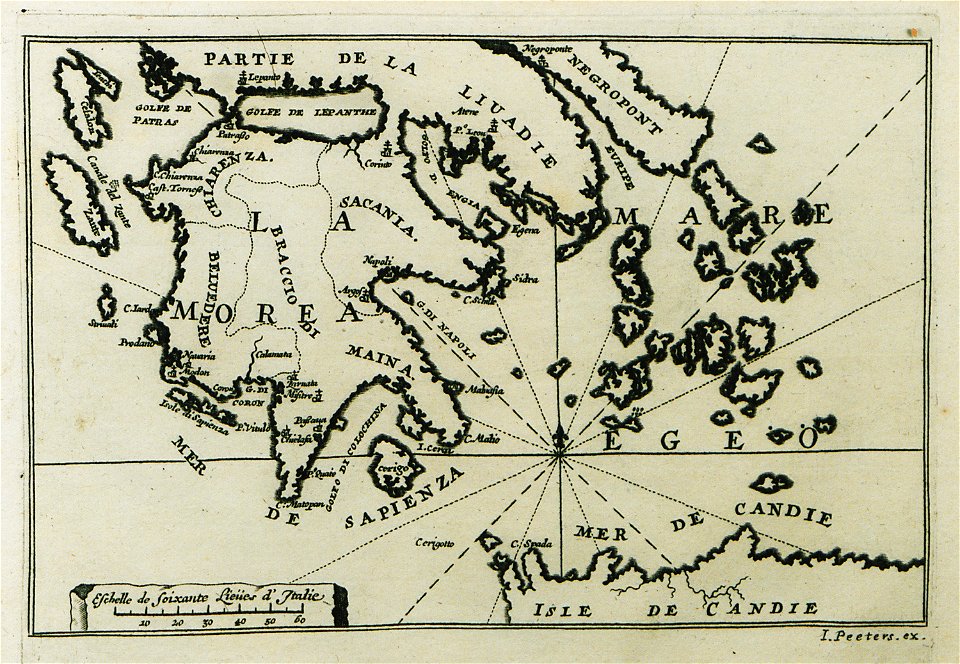
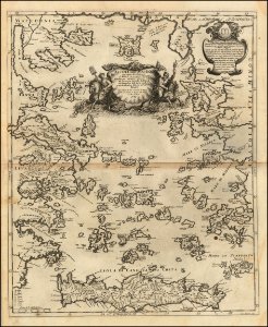
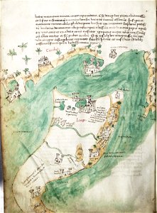
old maps of the peloponnese
maps of the mexican drug war
drug cartels of mexico
images from the new student's reference work
illustration
watermills in leipzig
1650 in leipzig
geographical illustrations by coronelli
old maps of the peloponnese
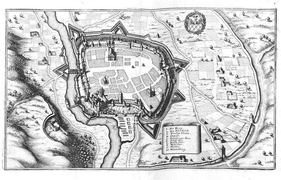
engravings of topographia bohemiae moraviae et silesiae
history of cheb
charte von schwaben (bohnenberger)
maps of heilbronn
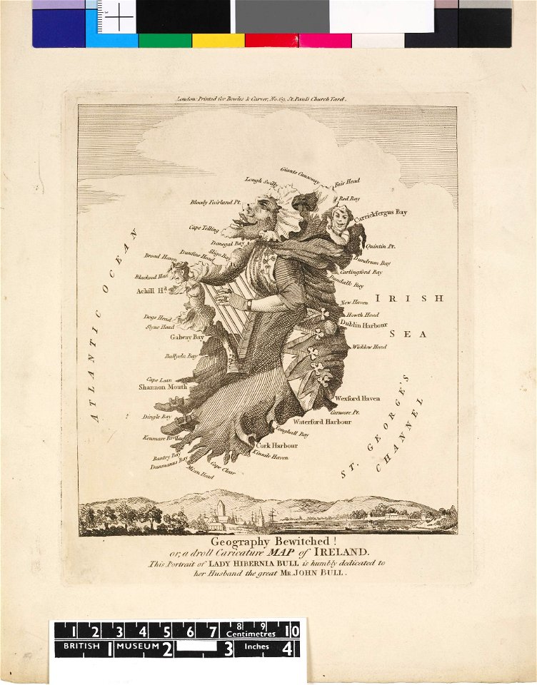
satirical prints in the british museum
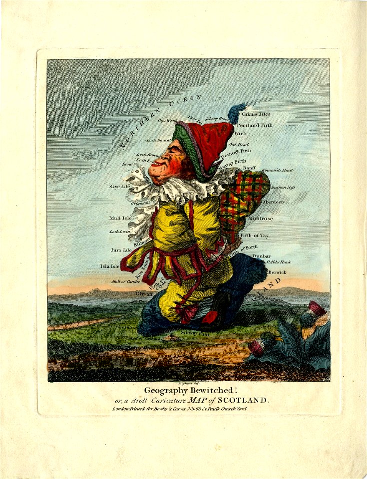
satirical prints in the british museum
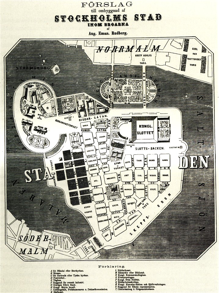
maps of gamla stan
1862 in stockholm
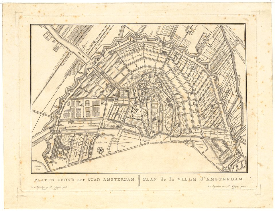
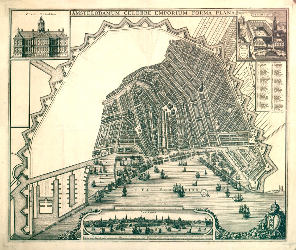
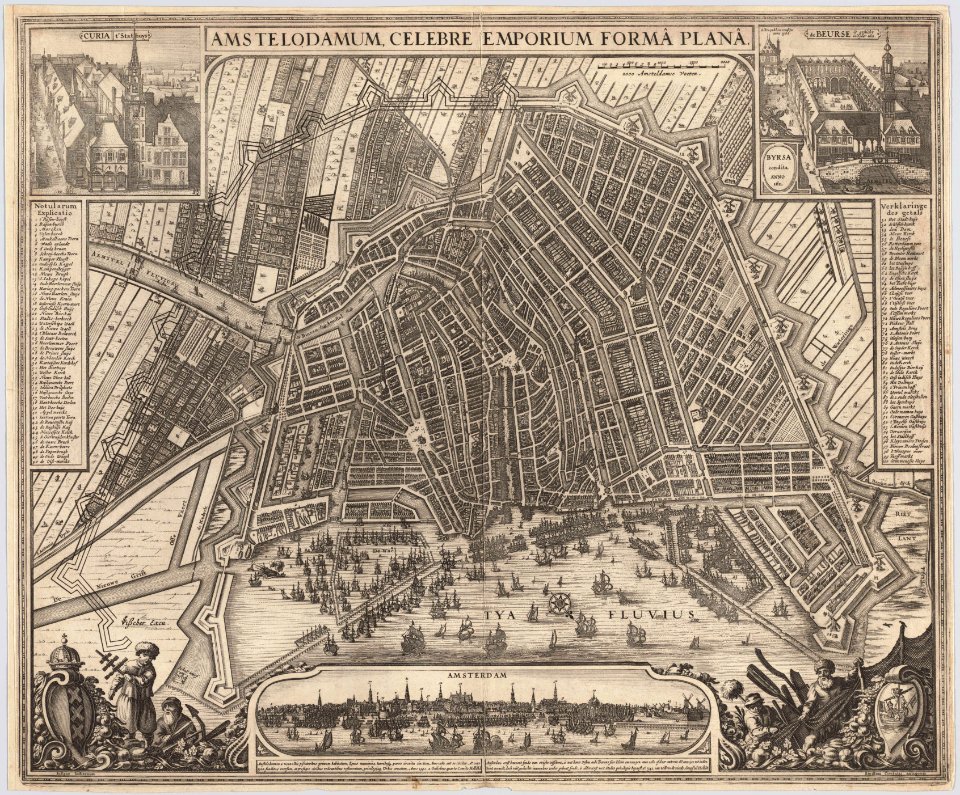
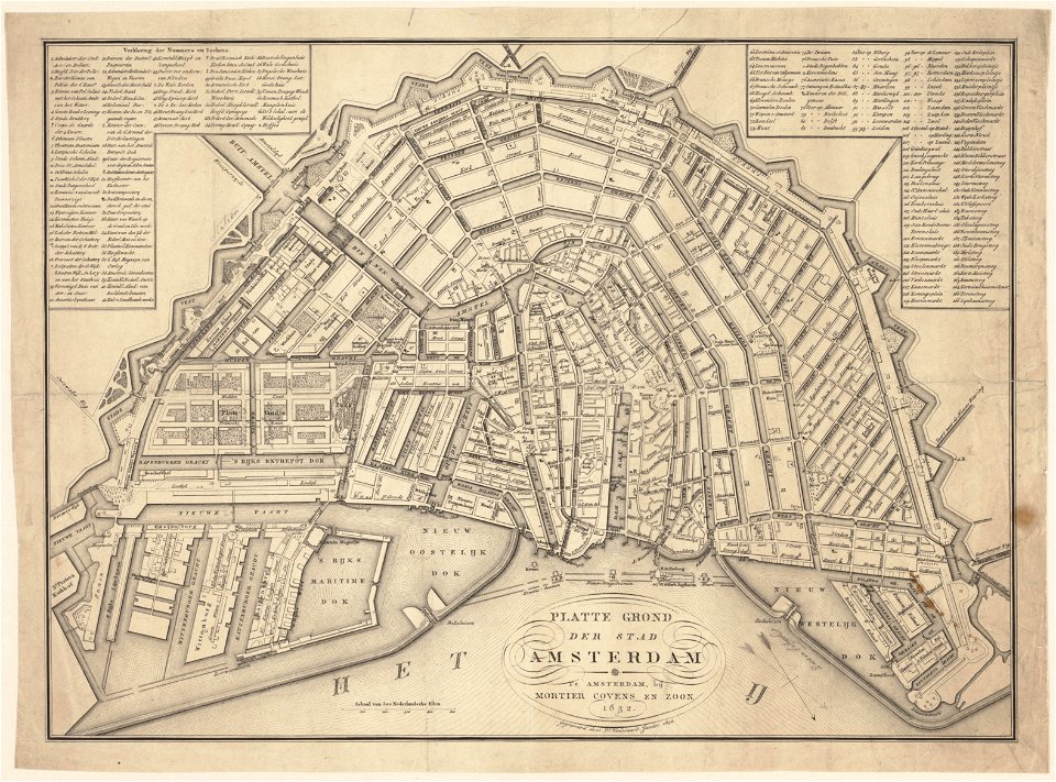
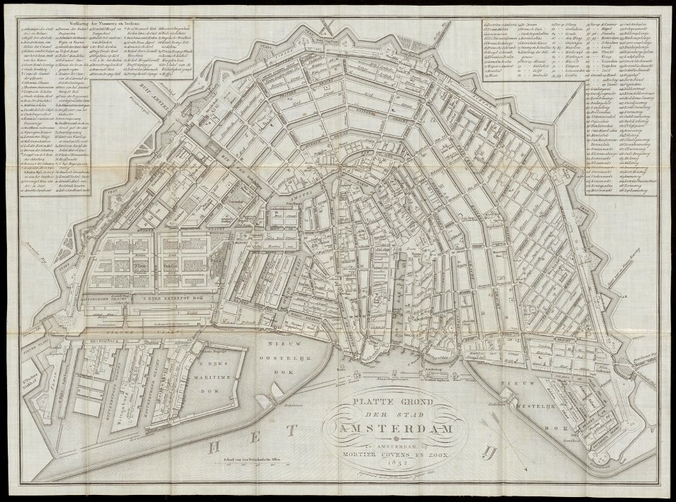
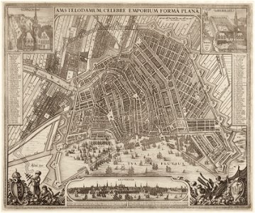
old maps of amsterdam
pierre fouquet junior
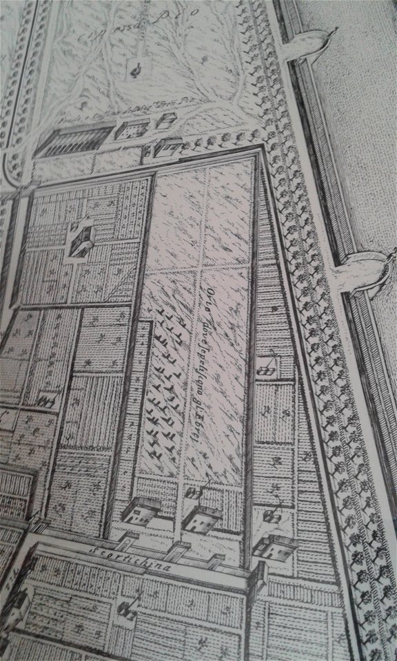
map of ferrara by andrea bolzoni
ghetto (ferrara)
map of ferrara by andrea bolzoni
map of ferrara by andrea bolzoni
porta paola (ferrara)
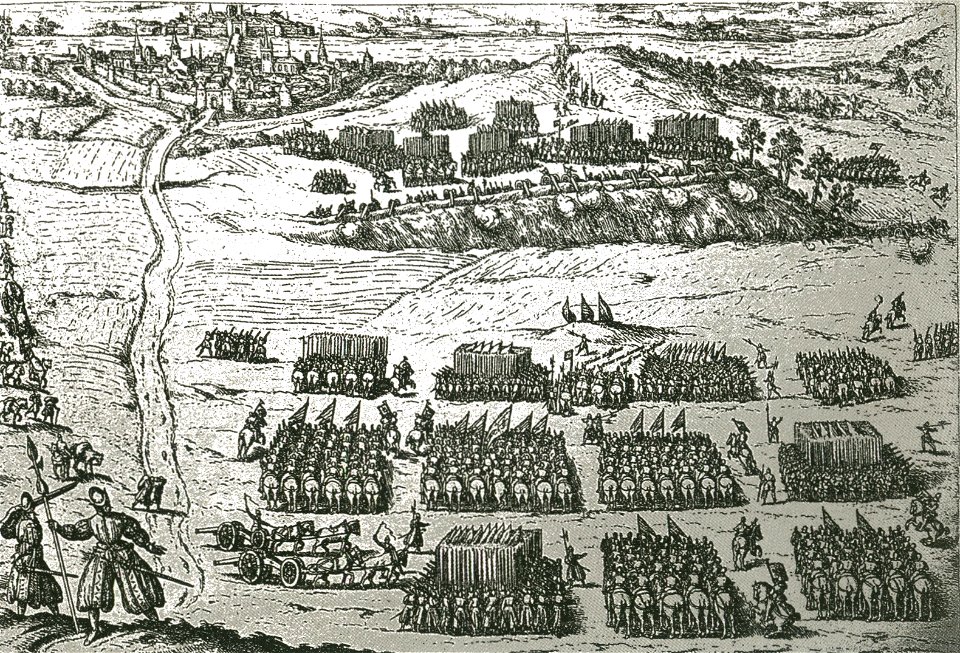
russo-turkish war (1735—1739)
maps by matthäus seutter
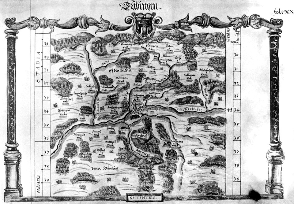
maps of tübingen
1575 in tübingen
il devotissimo viaggio di gerusalemme fatto
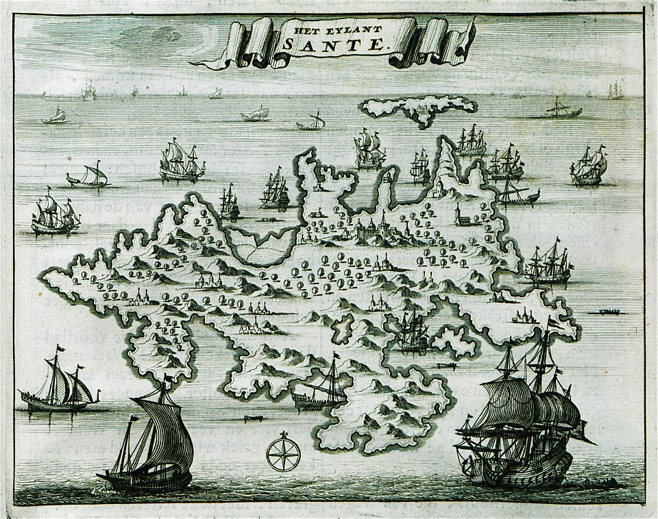
maps of zakynthos
itinerarium hierosolymitanum et syriacum..., 1619
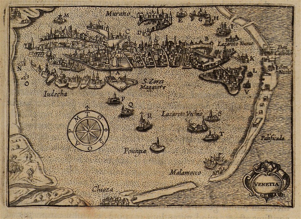
ships on maps
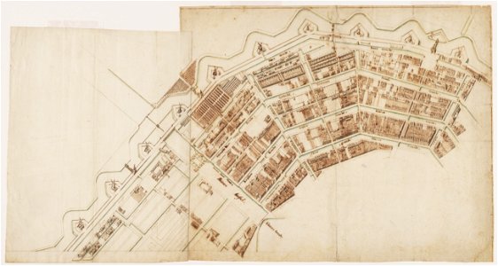
bibliothèque municipale de reims
rès. g 153
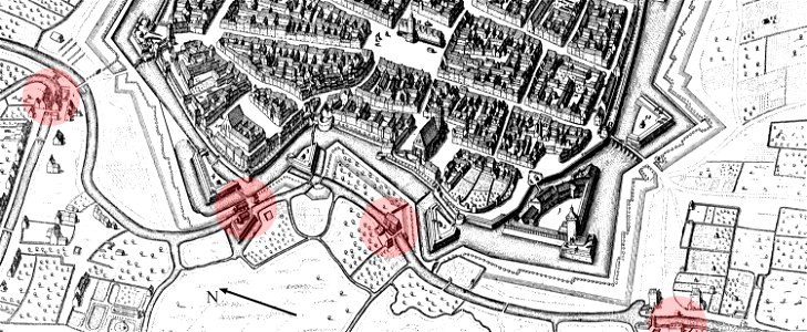
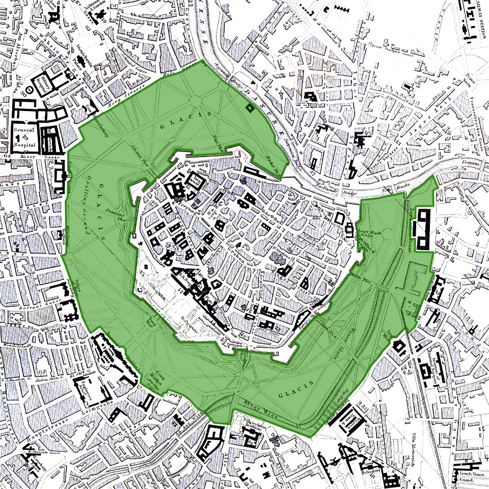
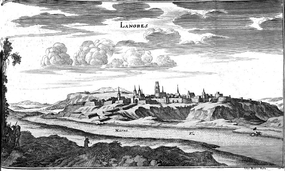
vienna
glacis
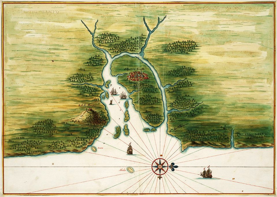
old maps of dutch brazil
1665
description des principales villes (1690)
old maps of greece
old maps of greece
sant
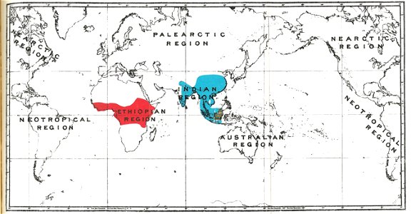
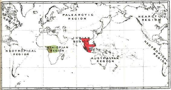
semnopithecus
colobus
gorilla
pongo
relation of a journey (sandys)
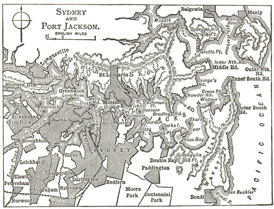
maps in the library of congress
mitchell's school atlas
maps in the library of congress
mitchell's school atlas
maps in the library of congress
mitchell's school atlas
maps in the library of congress
mitchell's school atlas
maps in the library of congress
mitchell's school atlas
maps in the library of congress
mitchell's school atlas
maps in the library of congress
mitchell's school atlas
engravings by matthäus merian
kassel
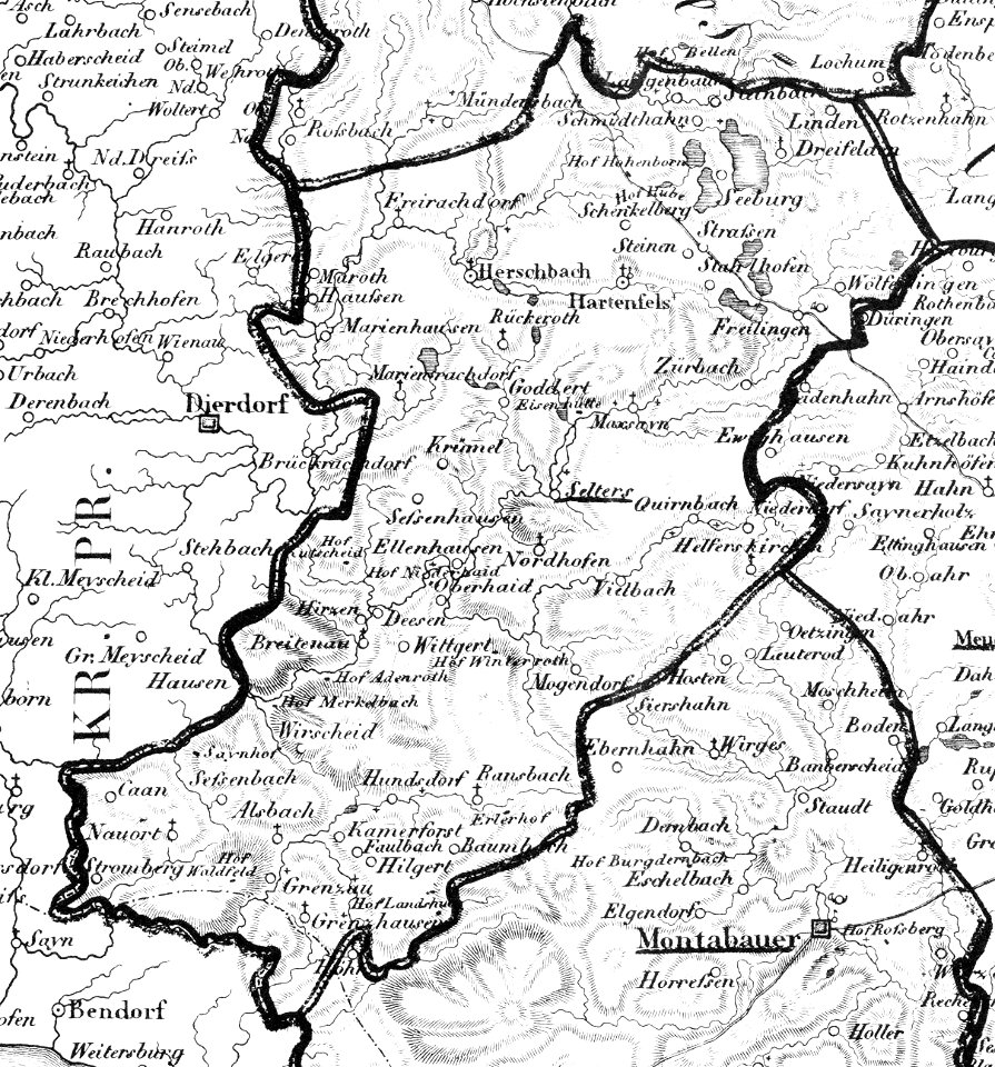
selters (westerwald)
1828
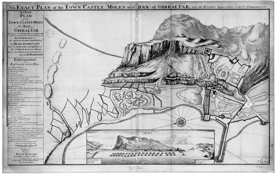
old maps of gibraltar
capture of gibraltar
1747)
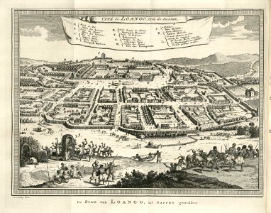
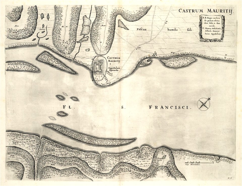
maps of the west-indische compagnie
1747)
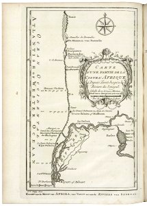
l'isole più famose del mondo
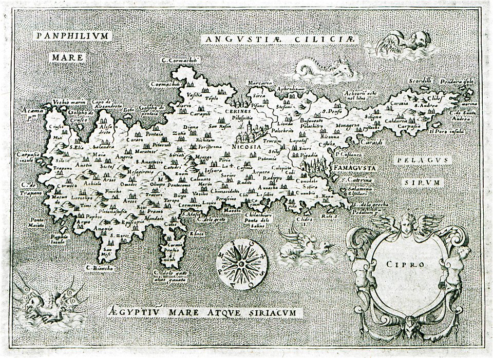
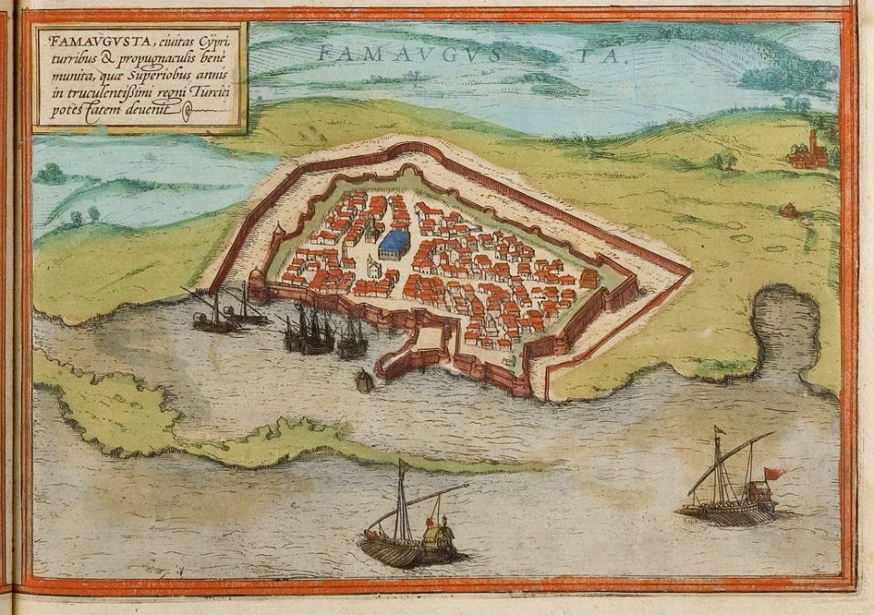
old maps of cyprus
maps in the stadsarchief amsterdam
claes jansz. visscher (ii)
maps in the stadsarchief amsterdam
claes jansz. visscher (ii)
maps in the stadsarchief amsterdam
claes jansz. visscher (ii)
maps in the stadsarchief amsterdam
claes jansz. visscher (ii)
istanbul in the 16th century
maps by sebastian münster
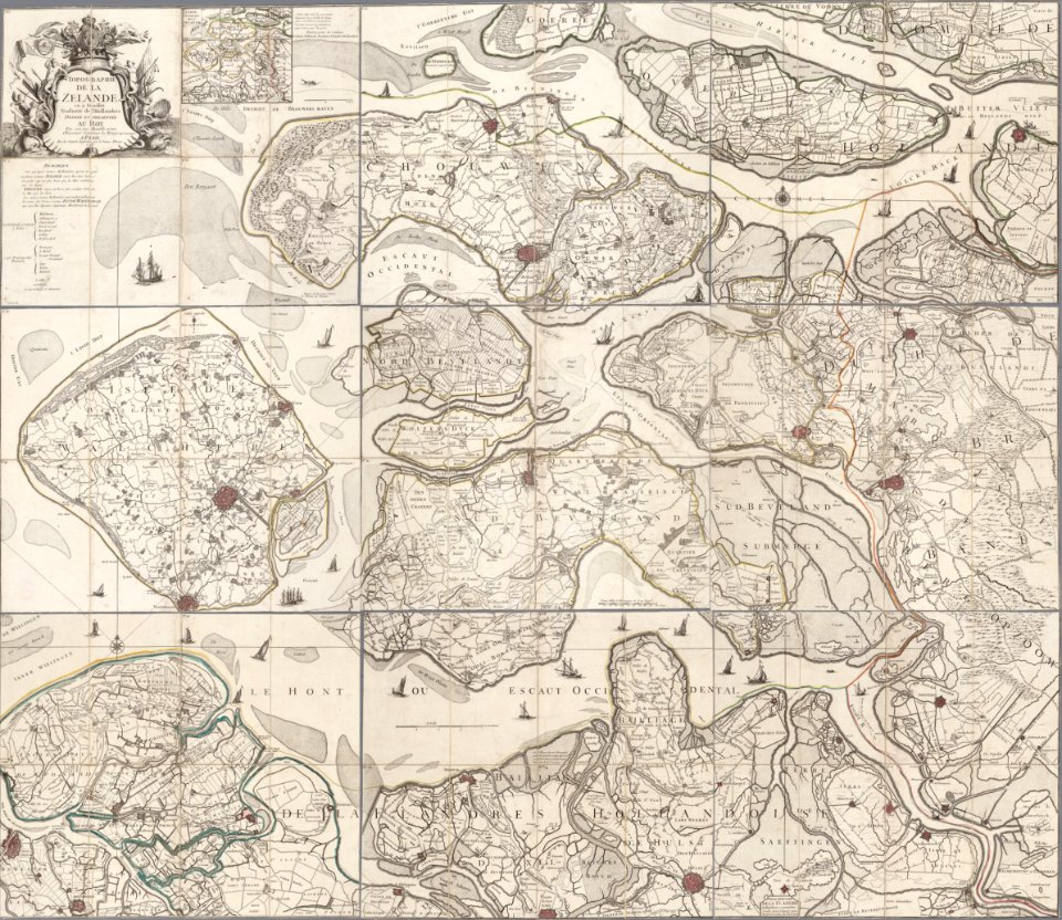
old maps of zeeland
copper engraving
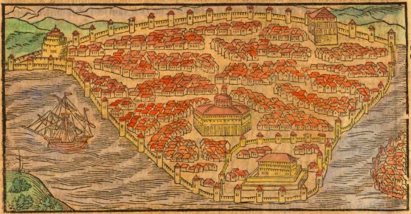
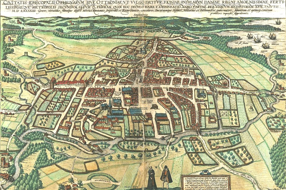
odense å
odense
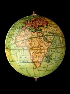
petrus apianus
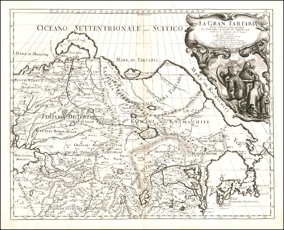
giacomo cantelli da vignola
joan blaeu
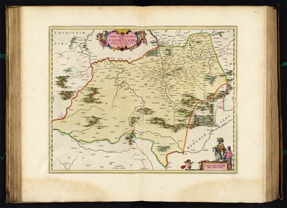
vogtland
charts and maps of the royal museums greenwich
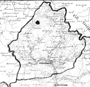
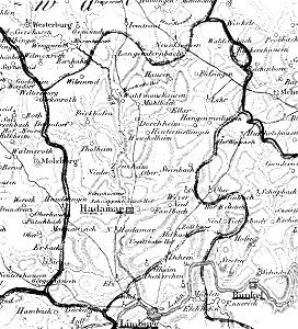
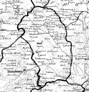
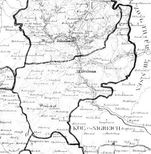
history of dillenburg
1828
map „das herzogthum nassau“ by j.b. fischer
1828
map „das herzogthum nassau“ by j.b. fischer
1828
wallmerod
1828
francesco piranesi
old maps of lazio
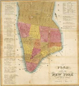
images from the new york public library
cartography of new york city
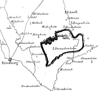
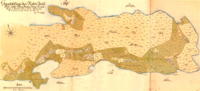
ämteratlas des fürstentums lüneburg von johannes mellinger
mein
old map
surat
maps of lidingö
yttringe
johann christoph müller
maps of rumburk
charts and maps of the royal museums greenwich
joan martines
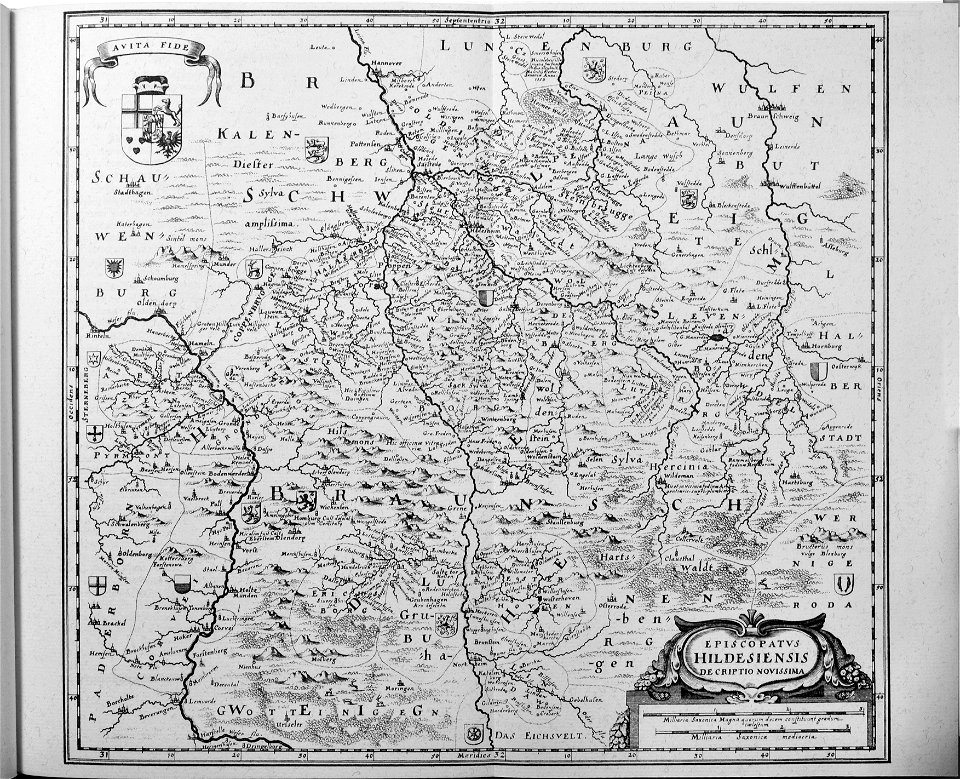
engravings of topographia saxoniae inferioris
old maps of hildesheim
old maps of stockholm by georg biurman
ulvsunda slott - park
historical images of rimini
maps of rimini
chicago and the midwest
newberry library
geographical illustrations by coronelli
old maps of the peloponnese
old maps of saxony
elector of saxony
hiram m. chittenden locks maps and diagrams
ballard locks
walter cooper dendy
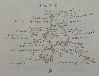
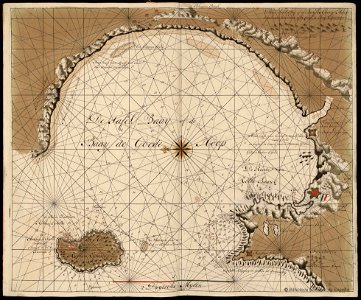
maps of sark
charts and maps of the royal museums greenwich
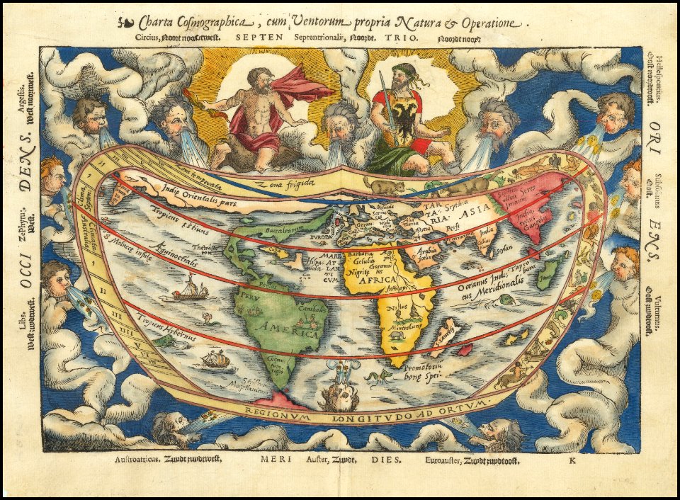
description de l'universe
1680s maps of the world
charts and maps of the royal museums greenwich
runkel (lahn)
1828
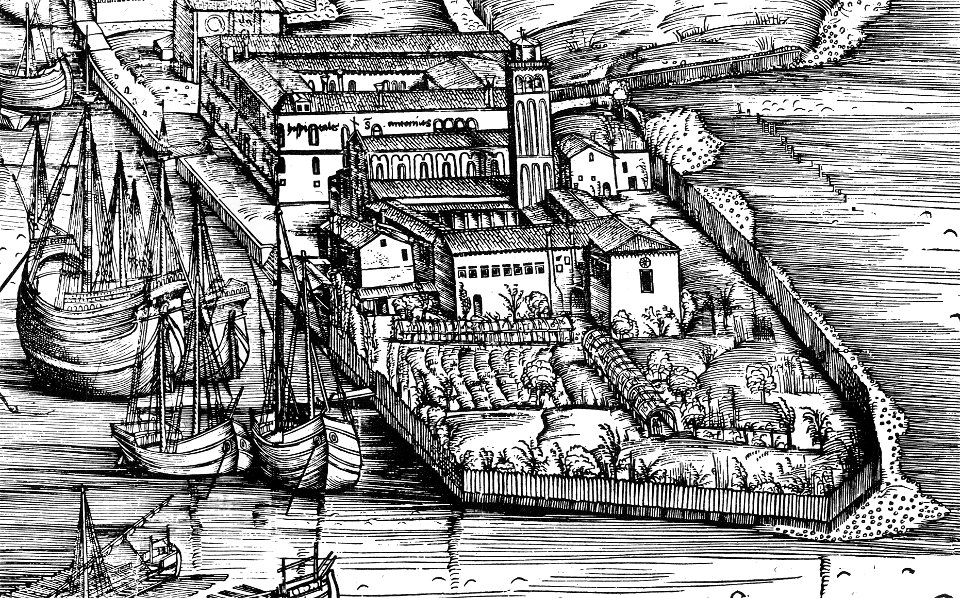
demolished churches in de barbari map
san antonio abate (venice)
theatrum urbium (1610)
old maps of rouen
art works by daniel meisner
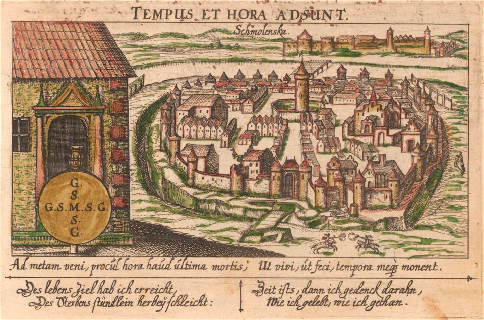
old maps of smolensk
maps in the stadsarchief amsterdam
daniël veelwaard (i)
maps in the stadsarchief amsterdam
daniël veelwaard (i)
charts and maps of the royal museums greenwich
16th-century maps of maastricht
maastricht in the 1560s
giacomo cantelli da vignola
gerard van keulen
copper engraving
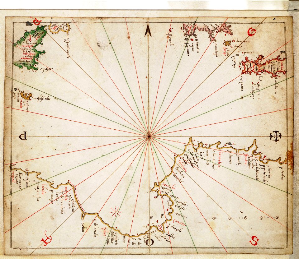
liber insularum archipelagi (royal museums greenwich)
old maps of constantinople
geographical illustrations by coronelli
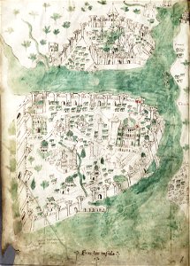
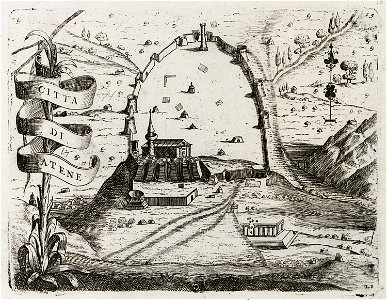
old maps of athens
maps in the stadsarchief amsterdam
claes jansz. visscher (ii)
map „das herzogthum nassau“ by j.b. fischer
1828
maps of the west-indische compagnie
1647
old maps of cyprus
braun & hogenberg
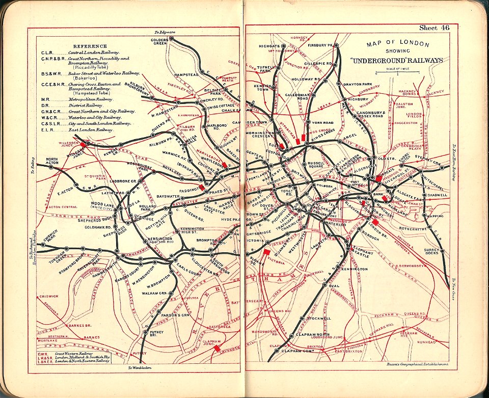
old maps of the london underground
bacon's pocket atlas of london
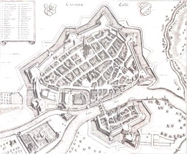
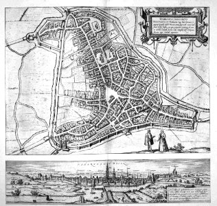
old maps of 's-hertogenbosch
atlas beudeker
liber insularum archipelagi (royal museums greenwich)
1420s maps
small atlas of the russian empire (1796)
ovidiopol
giovanni camocio
and its vicinity (1804)
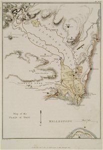
the topography of troy
description de l'universe
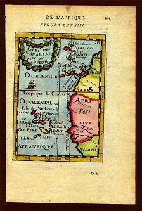
art of cape verde
old maps of kraków
erik dahlbergh
amsterdam in the 1680s
old maps of amsterdam
bibliothèque municipale de reims
rès. g 152
map of cairo by braun & hogenberg
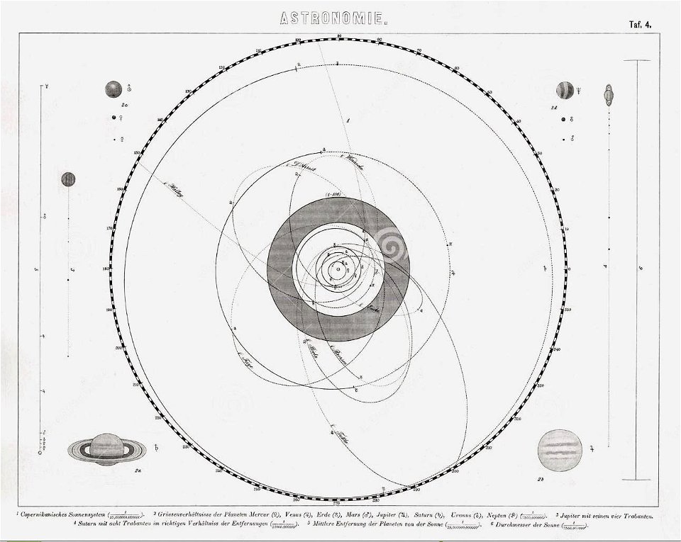
old celestial maps
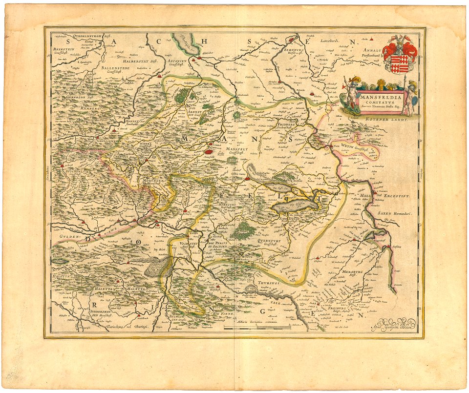
history of mansfeld land
1645 maps
7901 - 8000 of 38,713
Next page
/ 388