Log in
All resources
Create a design
38,713 Free Artworks of Map
charts and maps of the royal museums greenwich
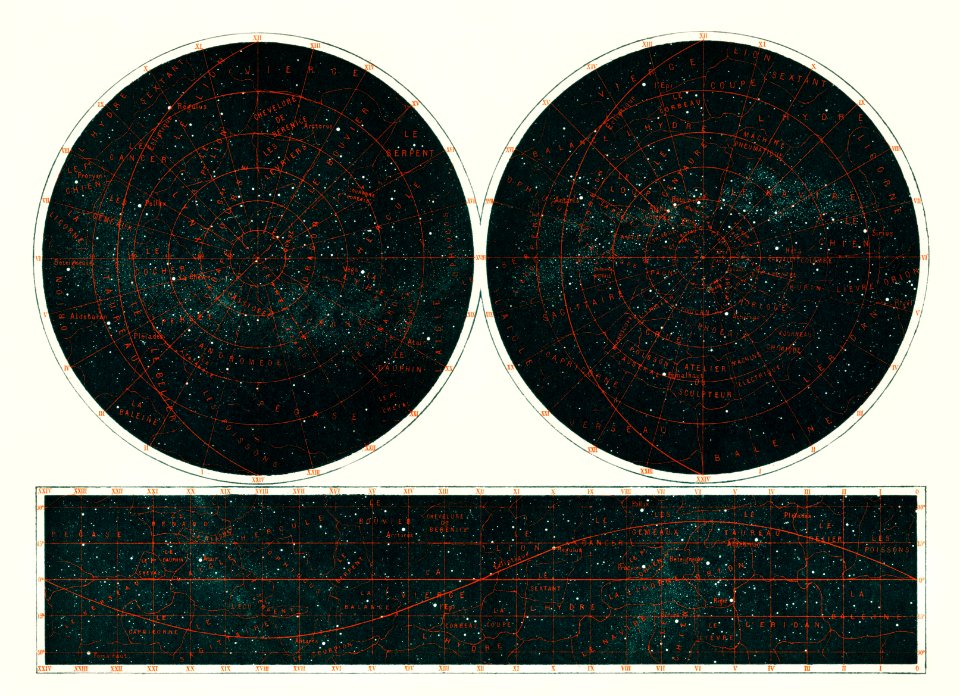
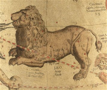
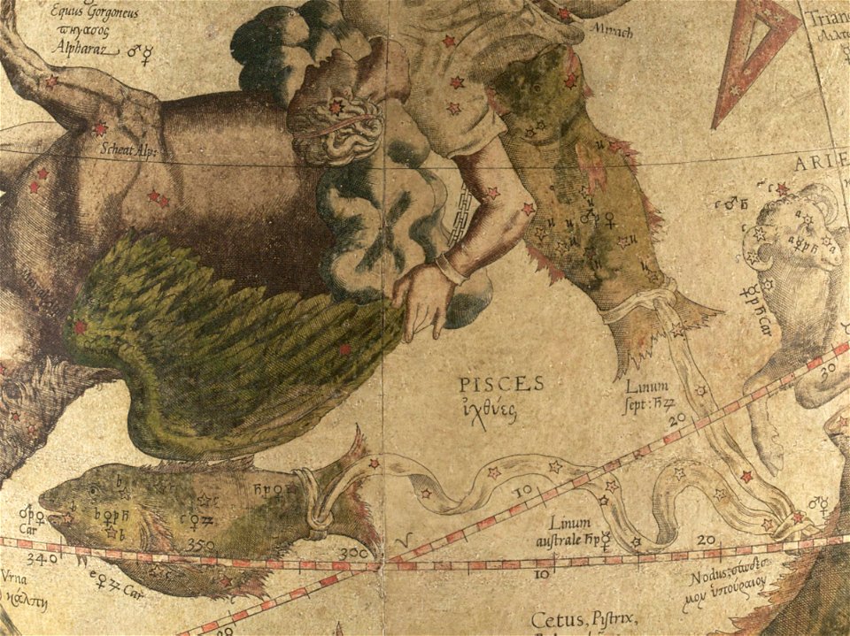
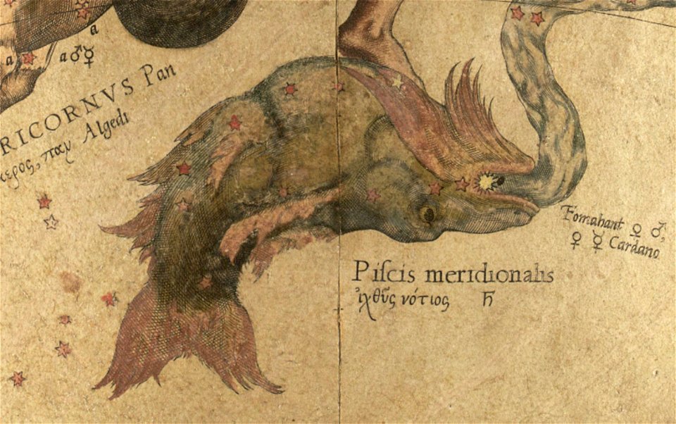
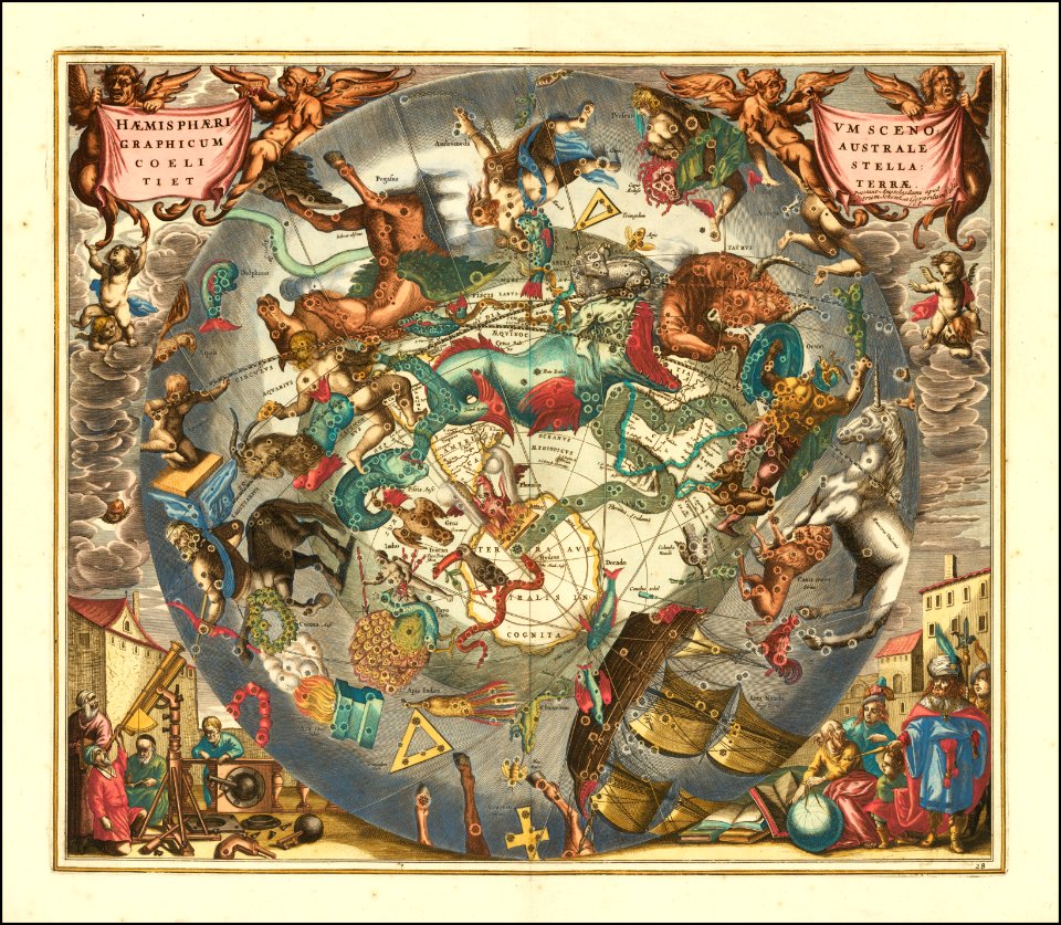
old celestial maps
small atlas of the russian empire (1796)
geographical illustrations by coronelli
gerard valck
maps made in the 18th century
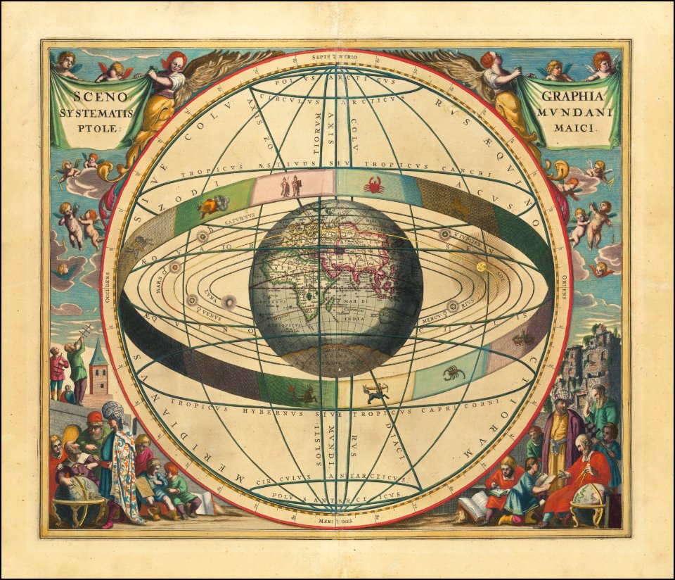
cellarius harmonia macrocosmica
atlantis magni tomus primus (biblioteca comunale di trento)
pieter schenk (i)
description des principales villes (1690)
gerard valck
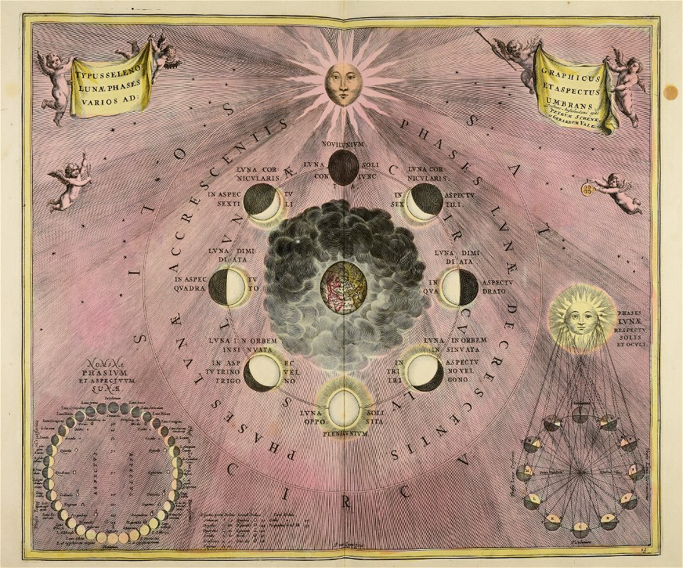
moon
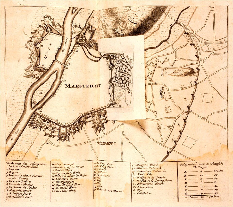
17th-century maps of maastricht
maps of the franco-dutch war
atlantis magni tomus quartus (biblioteca comunale di trento)
maps made in the 17th century
maps
book
maps made in the 18th century
gerard valck
maps made in the 18th century
gerard valck
gerard valck
earth
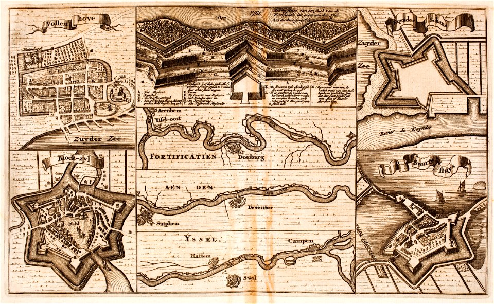
fortifications in the netherlands
zwartsluis
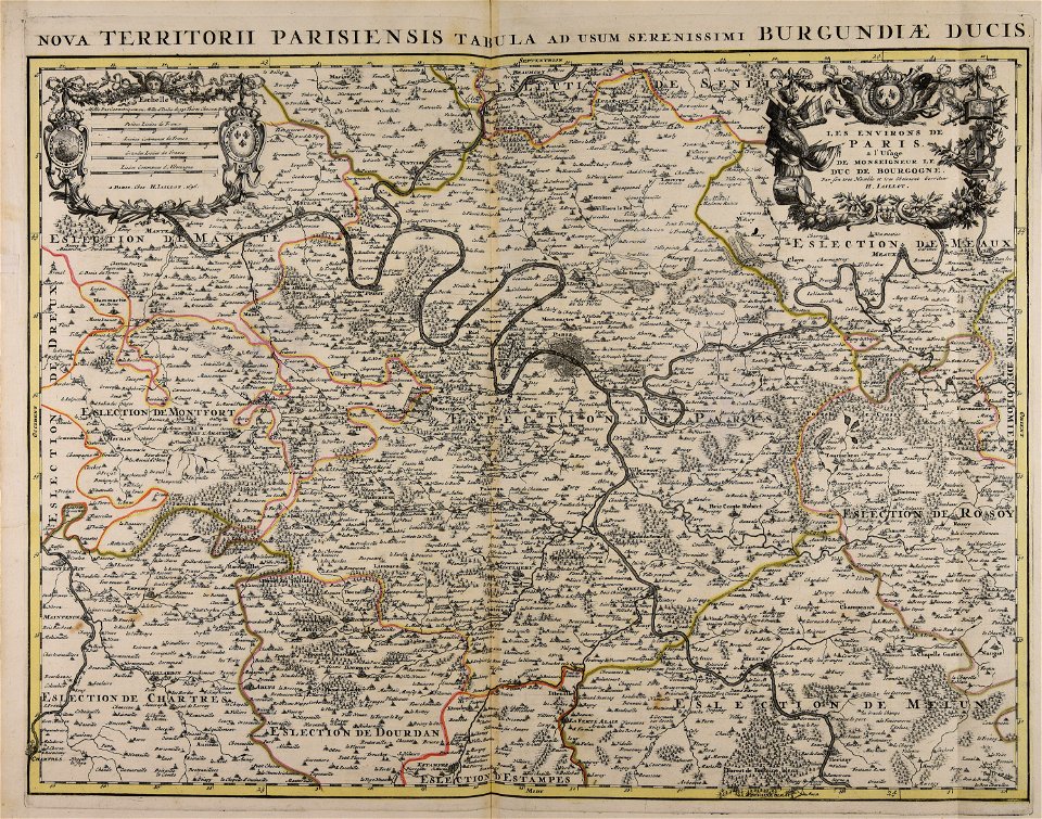
map of paris by claes jansz. visscher - derivate files
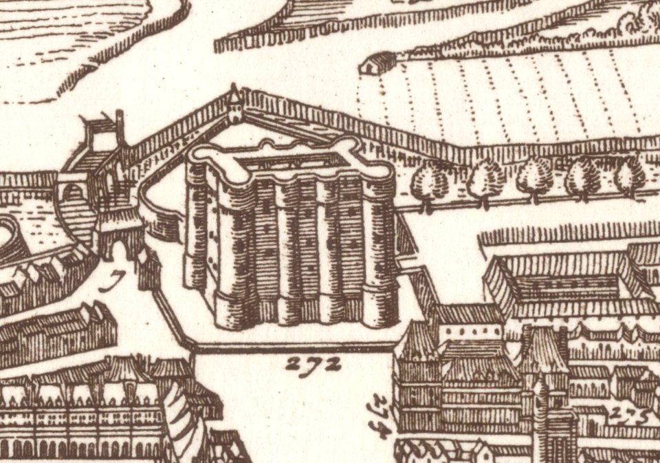
drawings of the bastille
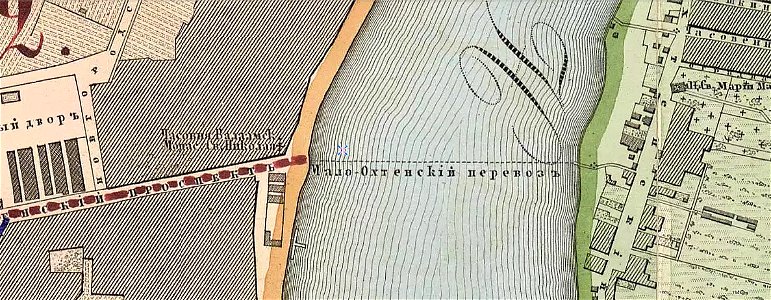
krasnogvardeysky district of saint petersburg
maps made in the 19th century
bibliothèque municipale de reims
rès. g 153
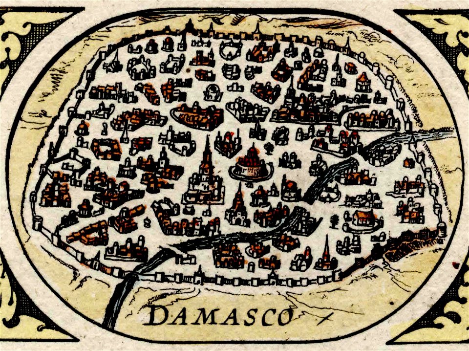
maps of damascus
damascus in art
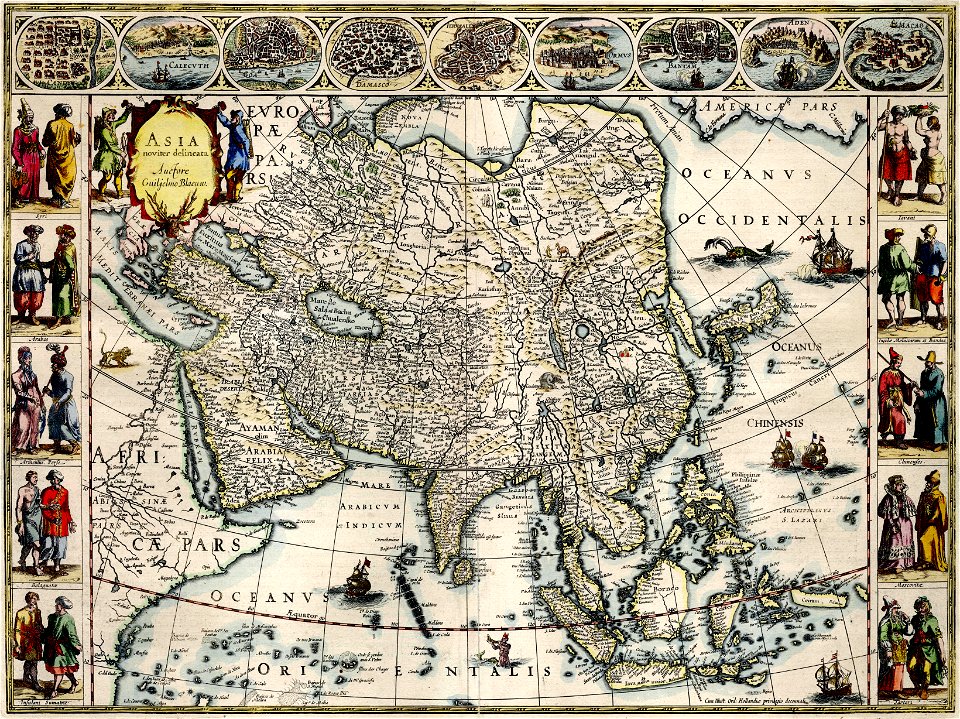
asia noviter delineata
1610s maps of asia
maps by gerardus mercator
mercator celestial globe
la serena
chile
maps by gerardus mercator
mercator celestial globe
maps by gerardus mercator
mercator celestial globe
description des principales villes (1690)
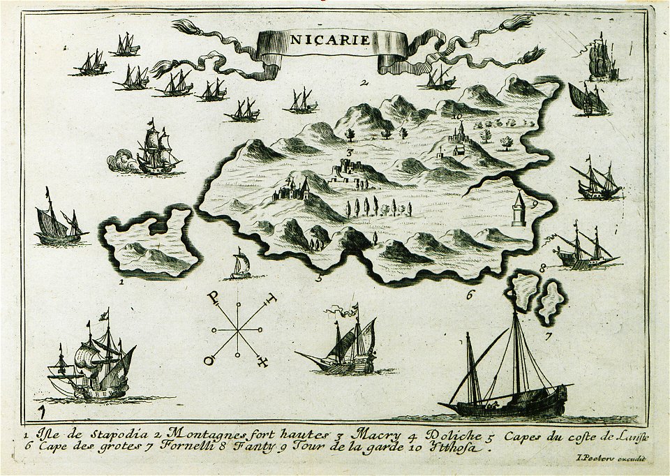
maps of icaria
charts and maps of the royal museums greenwich
charts and maps of the royal museums greenwich
map of ferrara by andrea bolzoni
the northern hemisphere of the celestial globe by albrecht dürer
old celestial maps
atlas of the russian empire (1792)
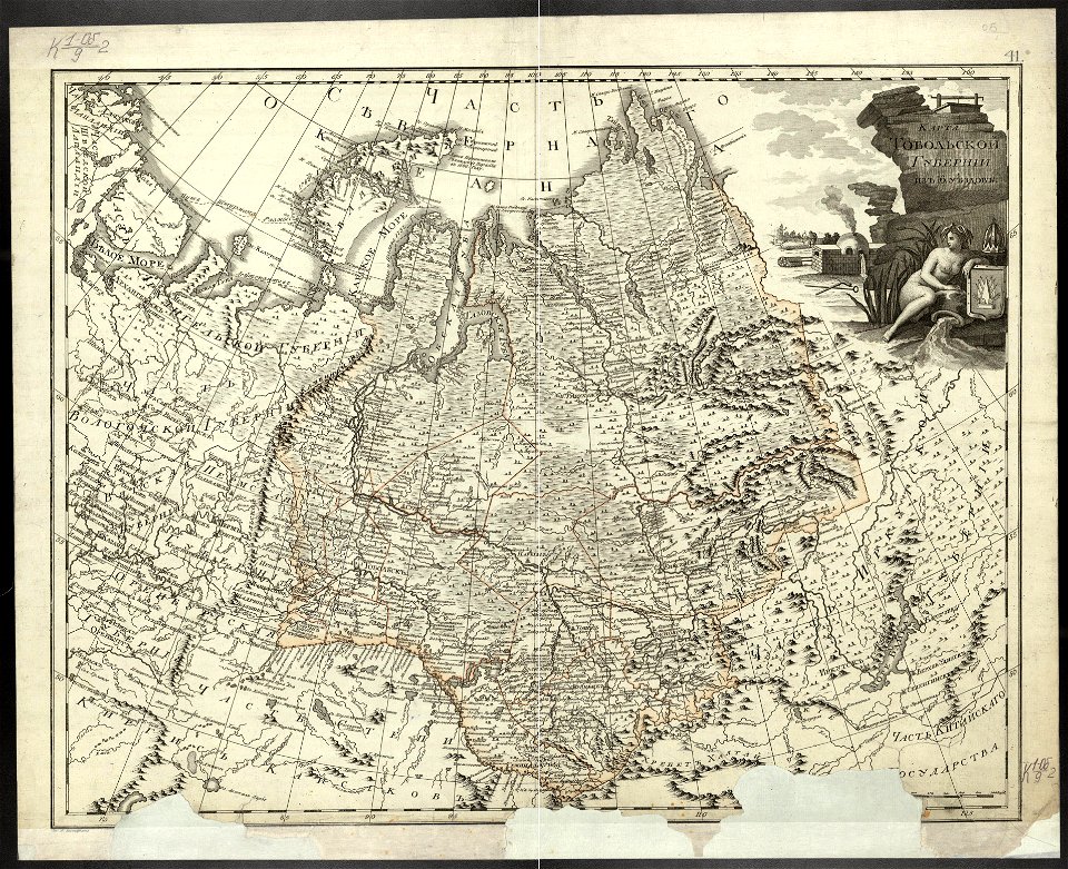
old maps of tobolsk governorate
charts and maps of the royal museums greenwich
charts and maps of the royal museums greenwich
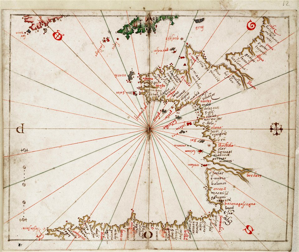
joan martines
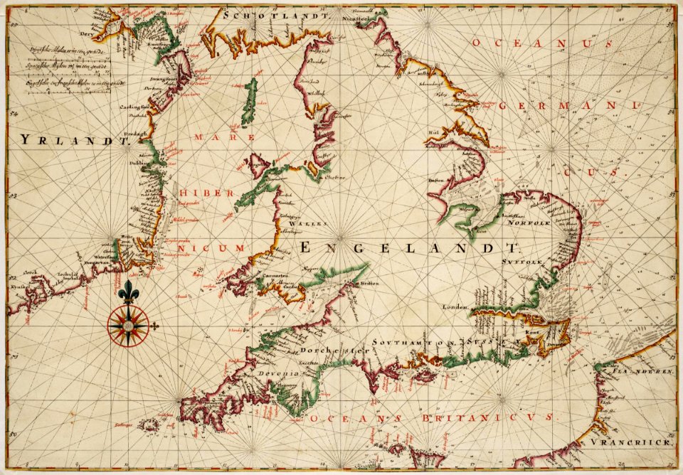
maps by willem and johannes blaeu
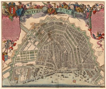
maps in the amsterdam museum
everett d. graff collection of western americana
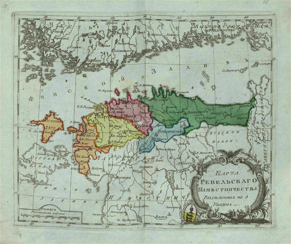
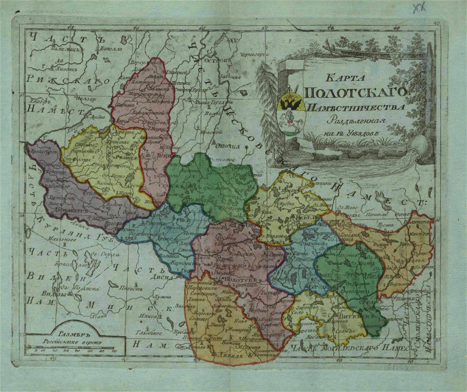
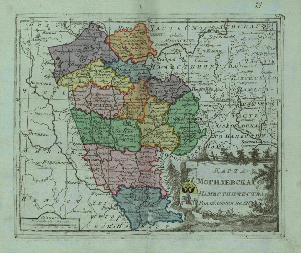
small atlas of the russian empire (1796)
everett d. graff collection of western americana
small atlas of the russian empire (1796)
small atlas of the russian empire (1796)
small atlas of the russian empire (1796)
small atlas of the russian empire (1796)
geographical illustrations by coronelli
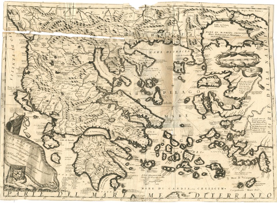
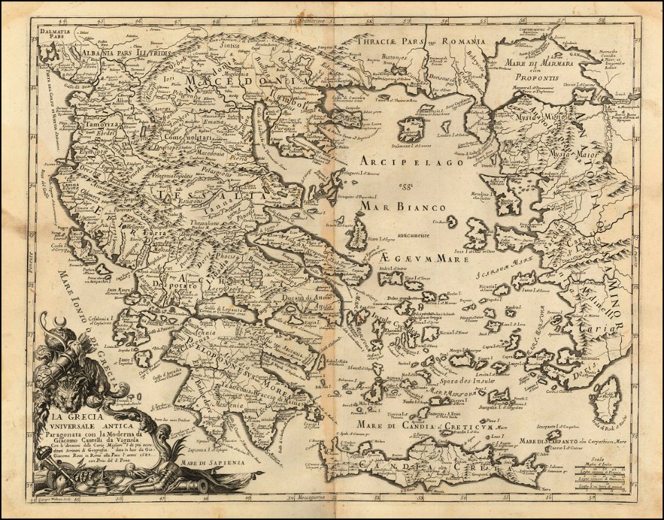
old maps of greece
drawings (documentary) collection in the library of congress
maps of berlin-wannsee
park klein-glienicke
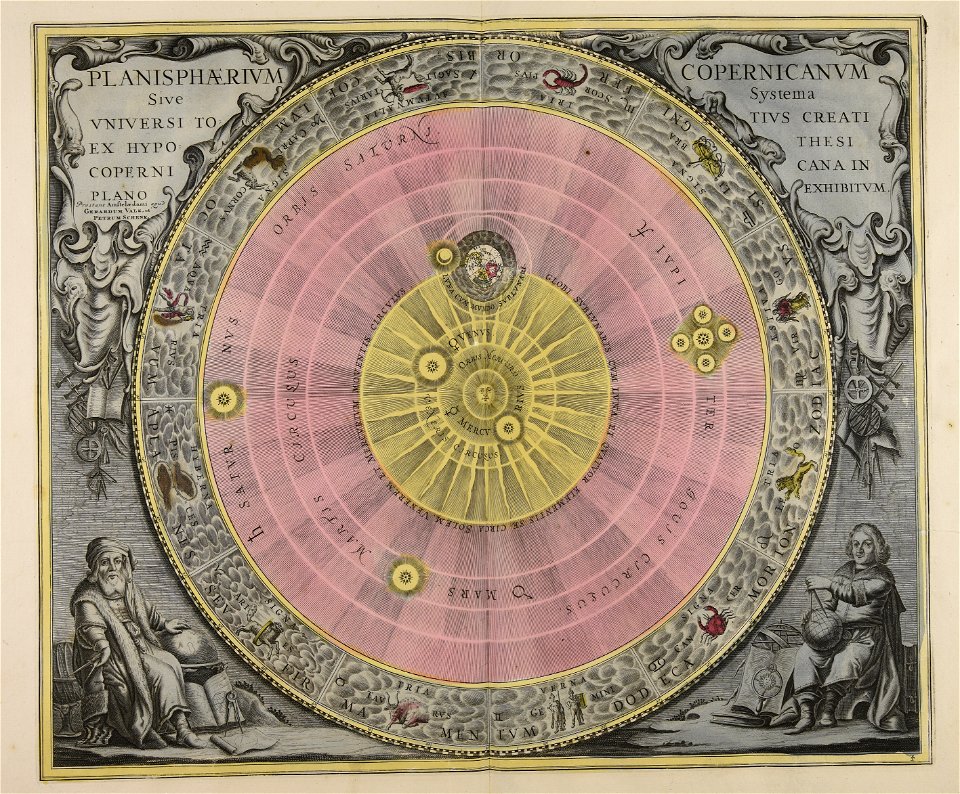
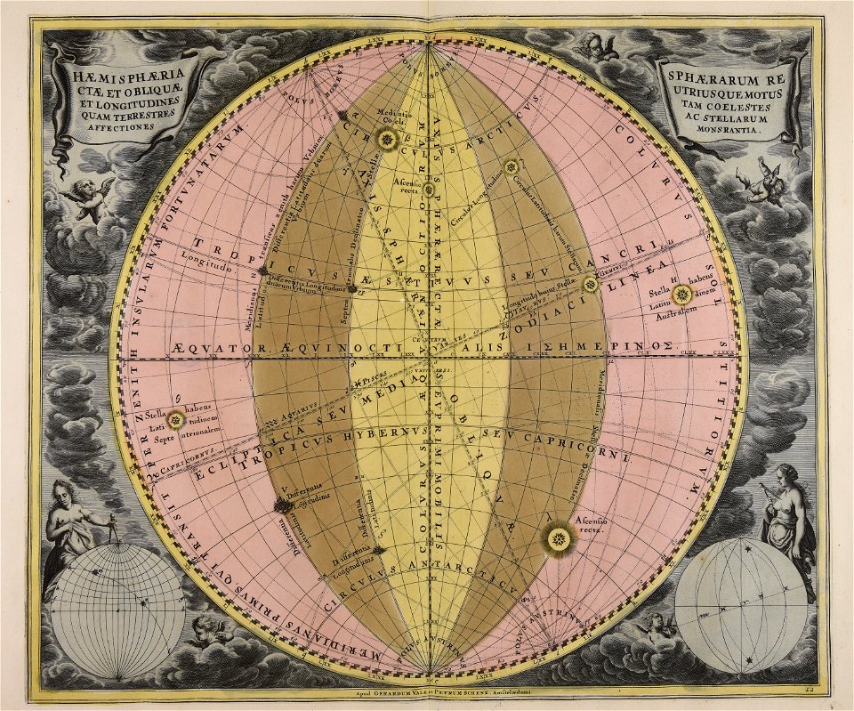
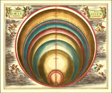
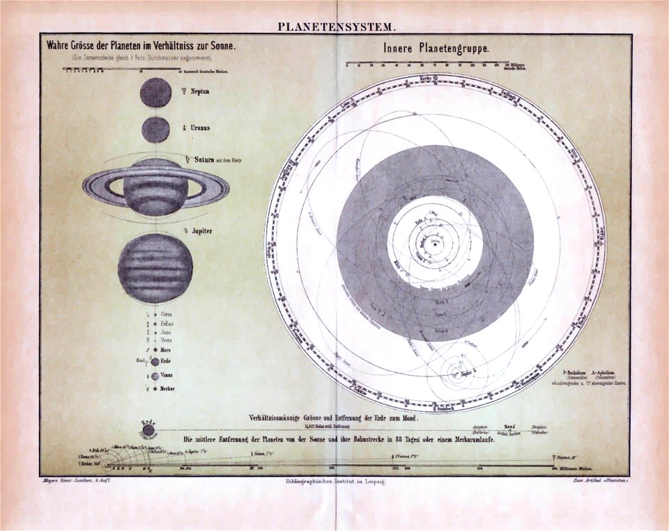
andreas cellarius
andreas cellarius
geocentric model
andreas cellarius
1665
maps of the west-indische compagnie
1647
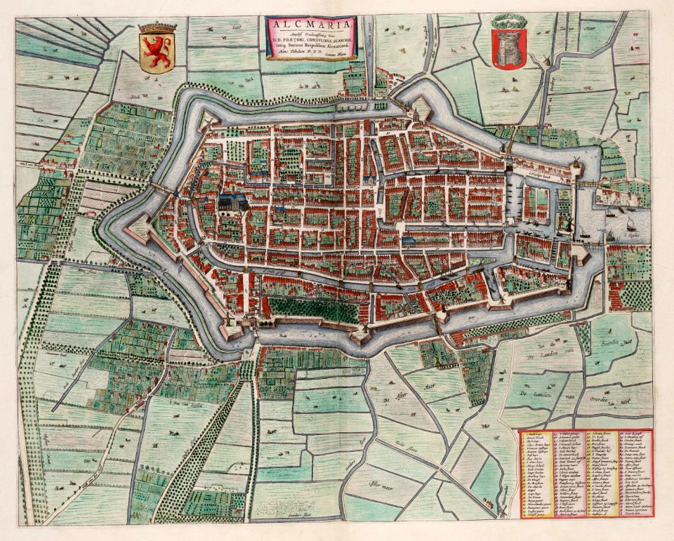
old maps of alkmaar
atlas van loon
maps in the stadsarchief amsterdam
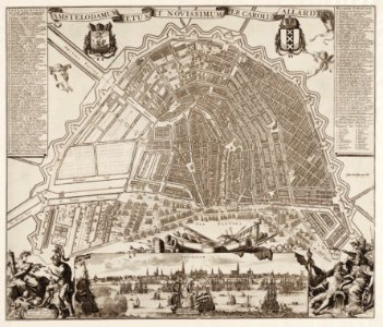
carolus allard
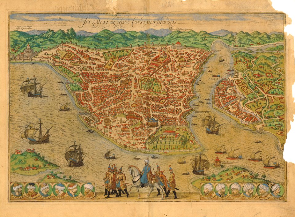
istanbul in the 16th century
maps by sebastian münster
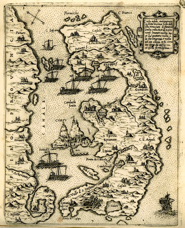
old maps of corfu
giovanni camocio
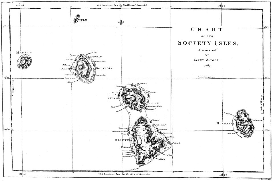
james cook (maps relating to)
18th-century manuscripts
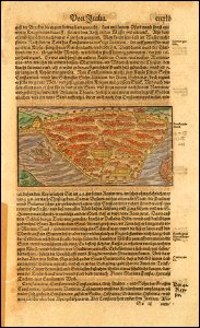
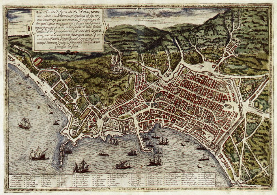
old maps of naples
braun & hogenberg
braun & hogenberg
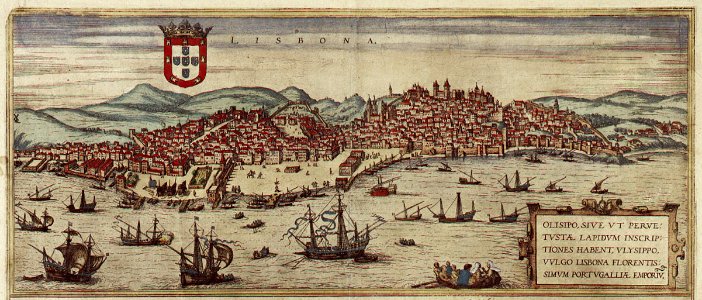
1572 in lisbon
maps by willem and johannes blaeu
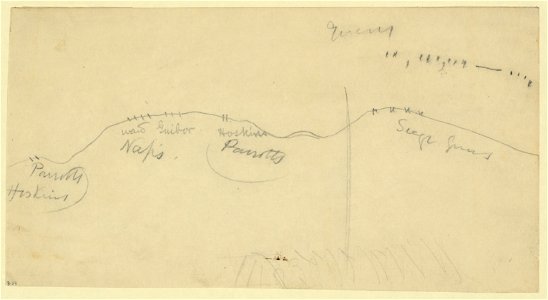
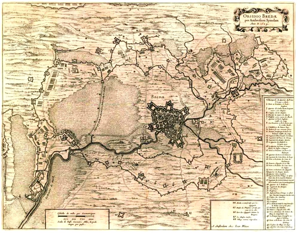
siege of breda 1624-1625
maps of liège in the 17th century
la batte
netherlands in the 1660s
old maps of gelderland
plans of castles in lower saxony
1890s maps
old celestial maps
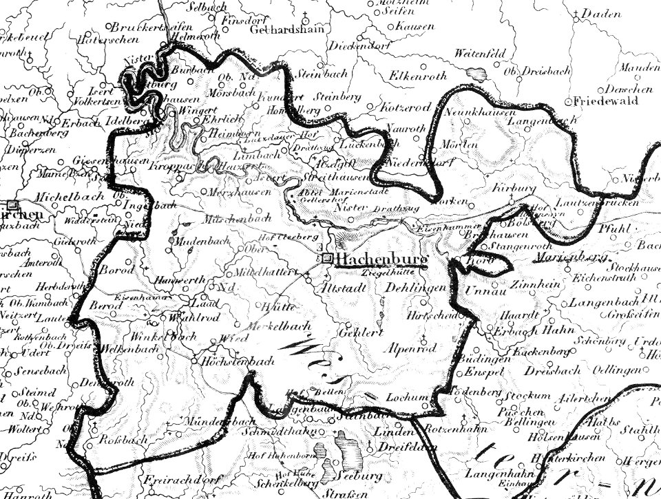
hachenburg
1828
historical maps of warsaw
warsaw in the 1650s
maps in the stadsarchief amsterdam
romeyn de hooghe
atlas of the russian empire (1800)
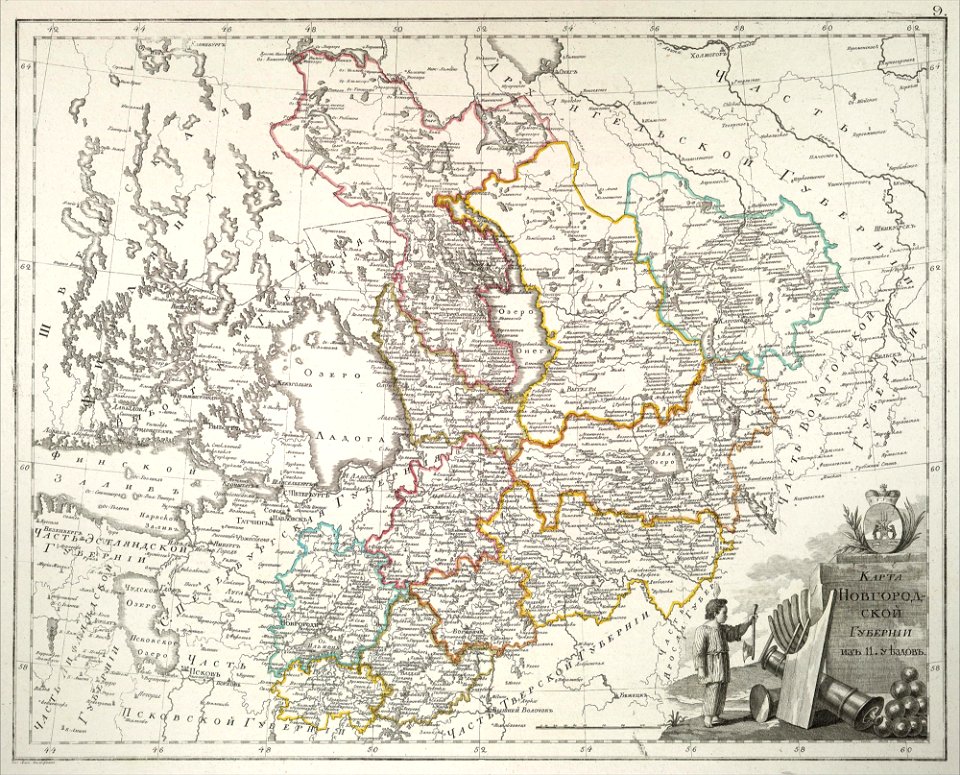
old maps of novgorod governorate
atlas of the russian empire (1800)
old maps of tobolsk governorate
edi expedition
aceh war
maps by royal bavarian land tax commission
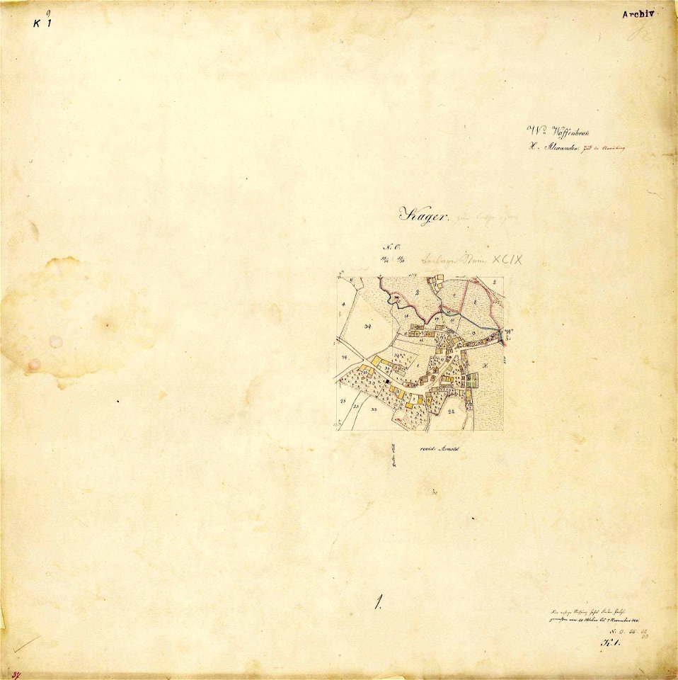
kager
atlas of the russian empire (1792)
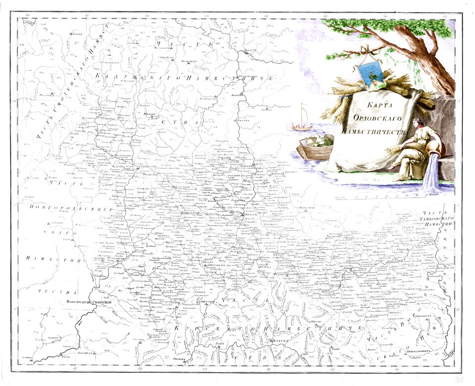
old maps of oryol governorate
maps of lidingö
breviks gård
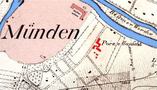
fayence-manufaktur münden
maps of hann. münden
geographical illustrations by coronelli
maps of kefalonia
geographical illustrations by coronelli
maps of lefkada
drawings in the museu antônio parreiras
charts and maps of the royal museums greenwich
joan martines
images from the new student's reference work
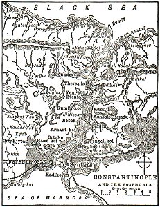
maps of constantinople
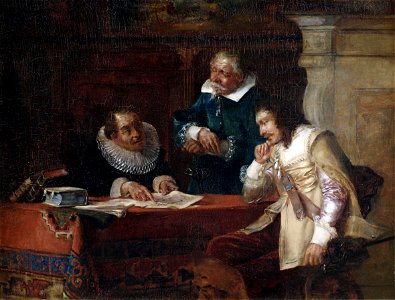
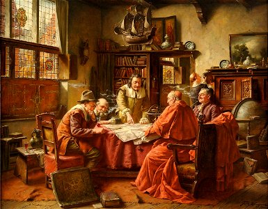
people with maps in art
max gaisser
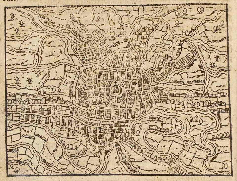
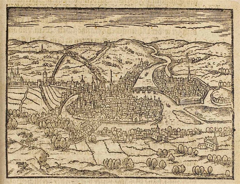
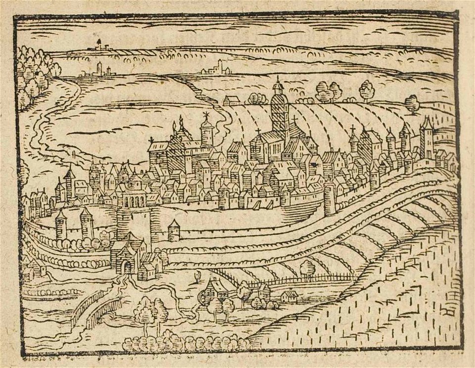
description des principales villes (1690)
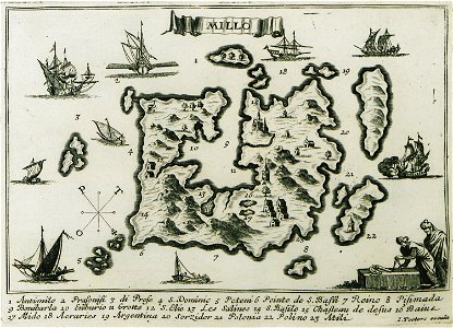
maps of milos
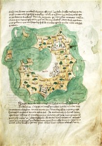
liber insularum archipelagi (royal museums greenwich)
maps of milos
everett d. graff collection of western americana
everett d. graff collection of western americana
old maps of greece
olfert dapper
history of hanau
maps of hanau
people with maps in art
fritz wagner (painter)
relation of a journey (sandys)
17th-century maps of jerusalem
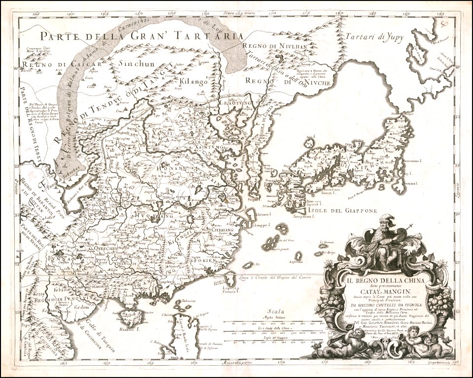
giacomo cantelli da vignola
giacomo cantelli da vignola
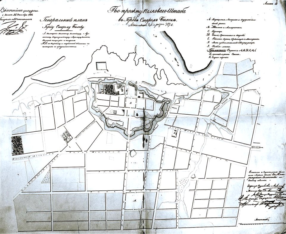
historical images of bychaŭ
plans of bychaŭ castle
old maps of istanbul
braun & hogenberg
charts and maps of the royal museums greenwich
joan martines
geographical illustrations by coronelli
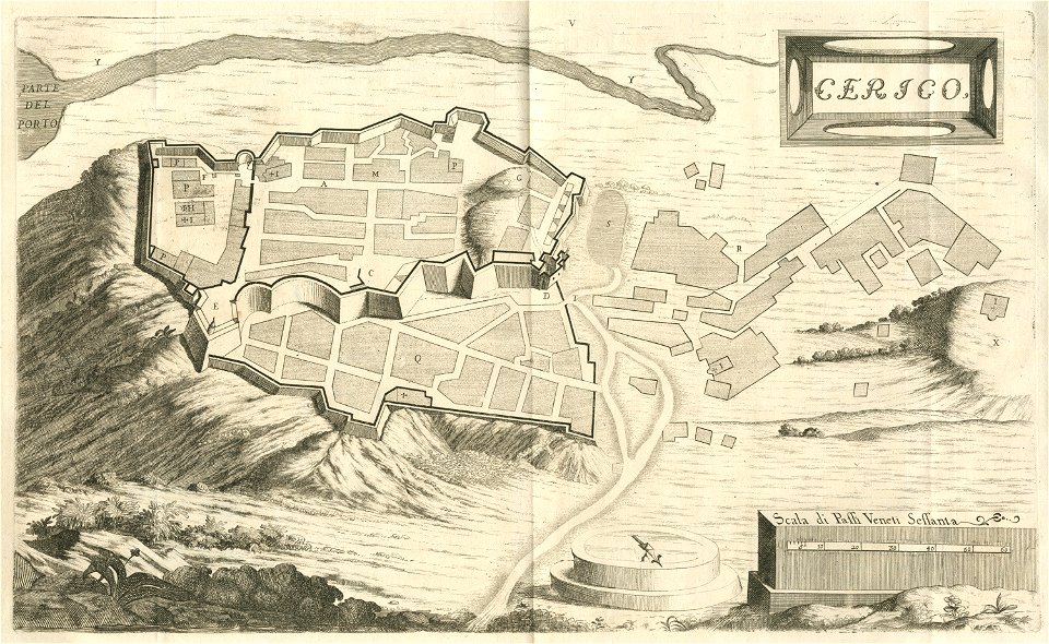
engravings of kythira
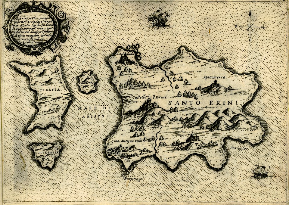
maps about santorini
giovanni camocio
geographical illustrations by coronelli
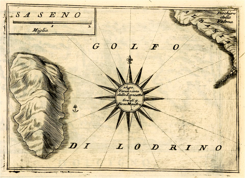
sazan
charts and maps of the royal museums greenwich
description des principales villes (1690)
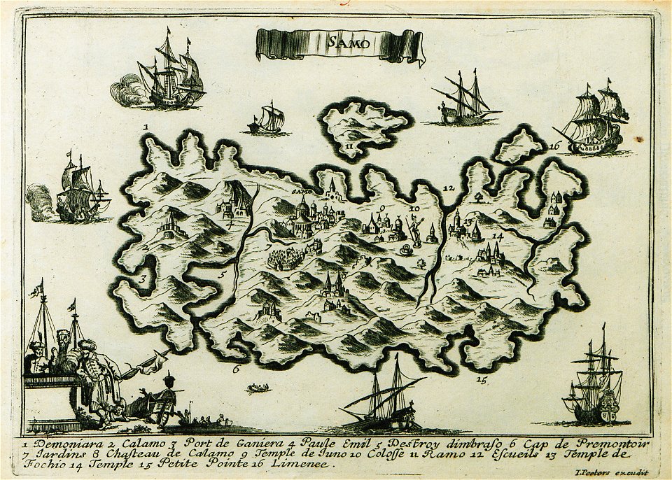
maps of samos
description des principales villes (1690)
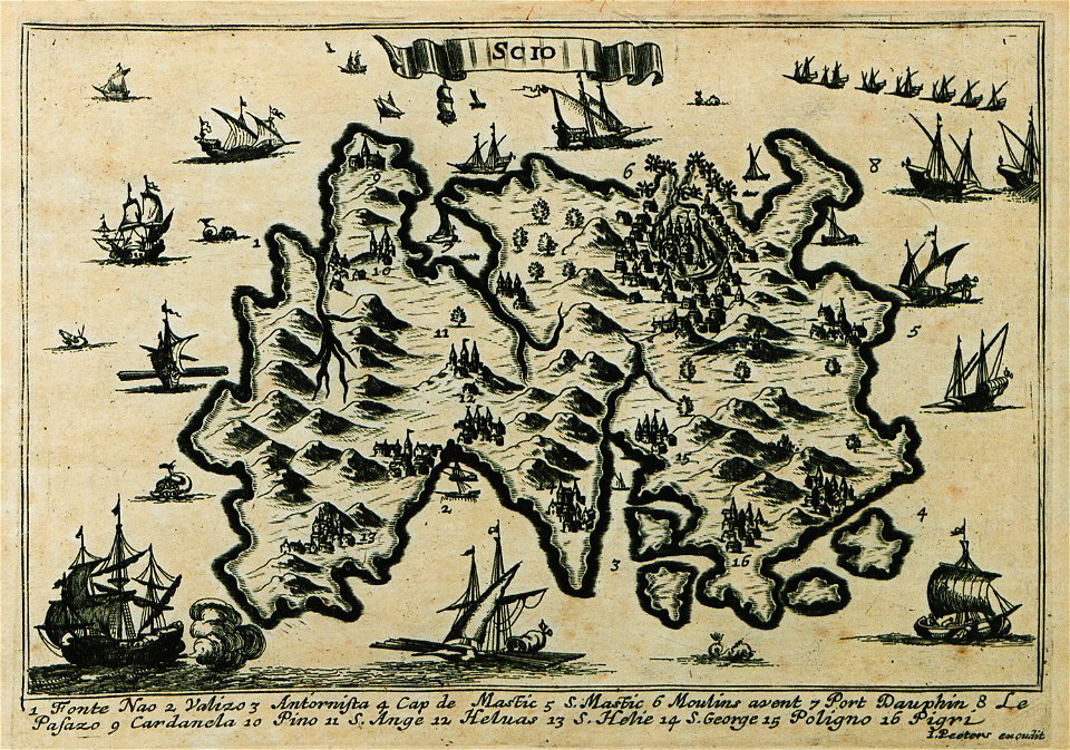
maps of chios
1750s maps of baden-württemberg
swabian circle
old maps of saint petersburg governorate
atlas of the russian empire (1792)
map of ghent by abraham saur
theatrum urbium (1610)
maps of liège in the 17th century
theatrum urbium (1610)
theatrum urbium (1610)
maps of schweinfurt
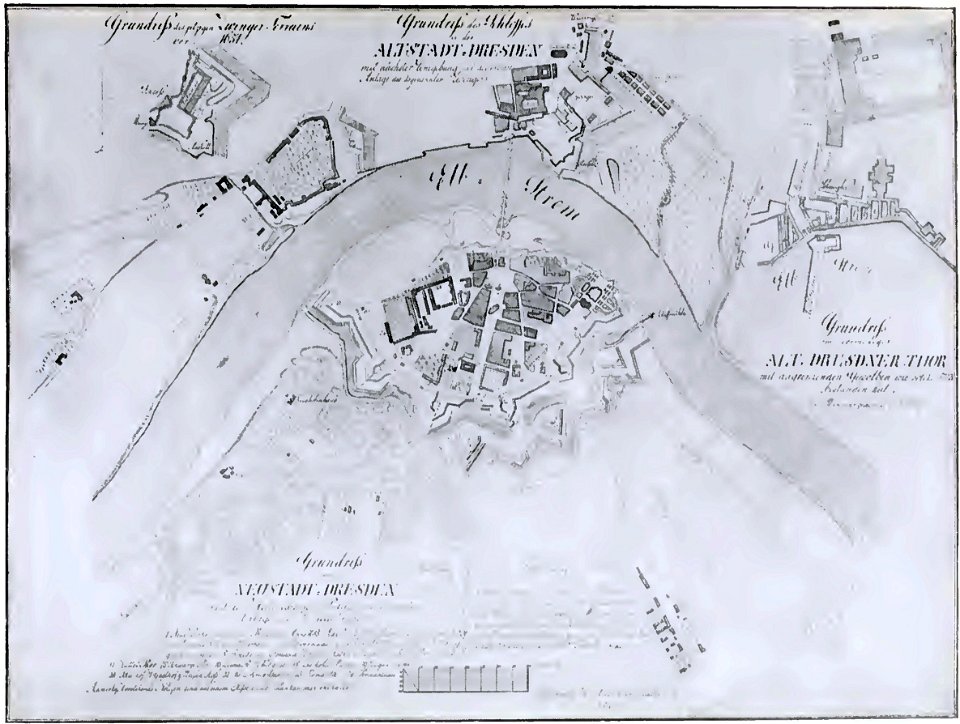
dresden (schumann)
innere neustadt
maps in the stadsarchief amsterdam
romeyn de hooghe
schauplatz der fünf theile der welt
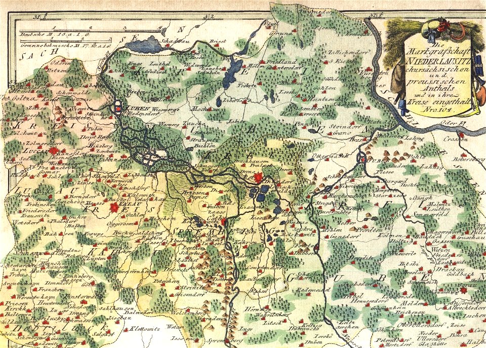
old maps of lusatia
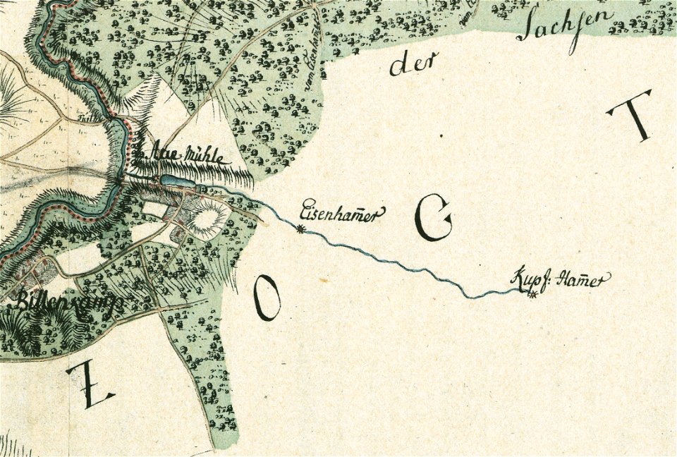
maps by gustav adolf von varendorf
sachsenwald
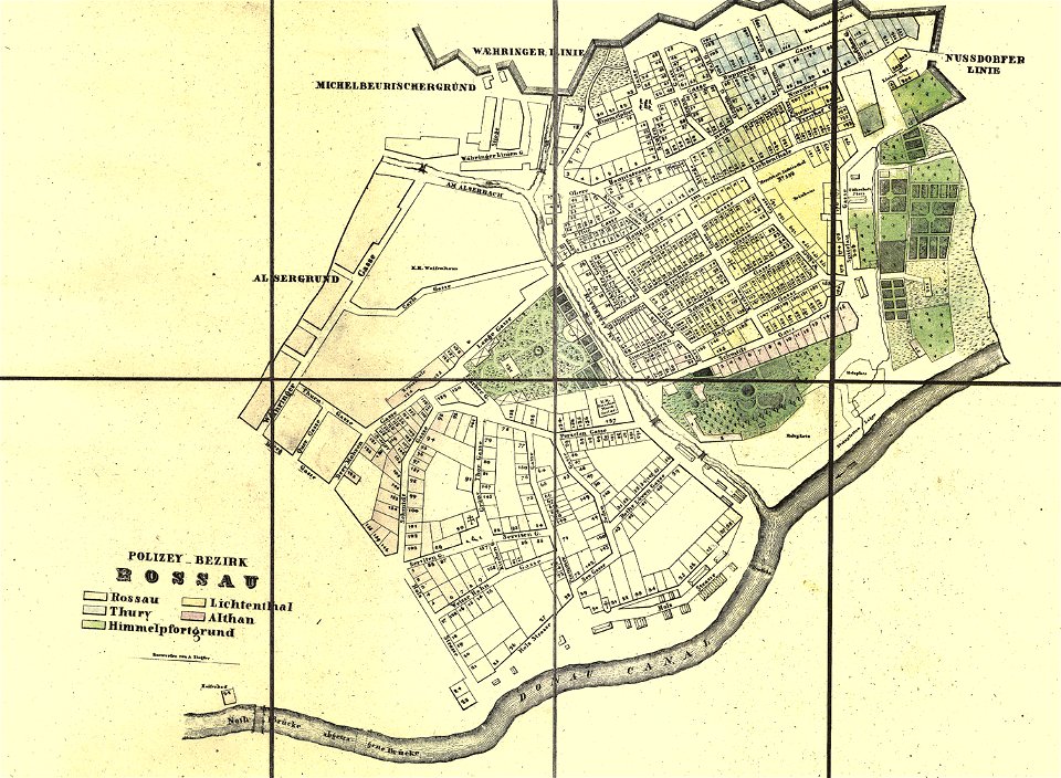
old maps of alsergrund
carl graf vasquez
johannes van keulen
zuiderzeemuseum
7601 - 7700 of 38,713
Next page
/ 388