Log in
All resources
Create a design
38,713 Free Artworks of Map
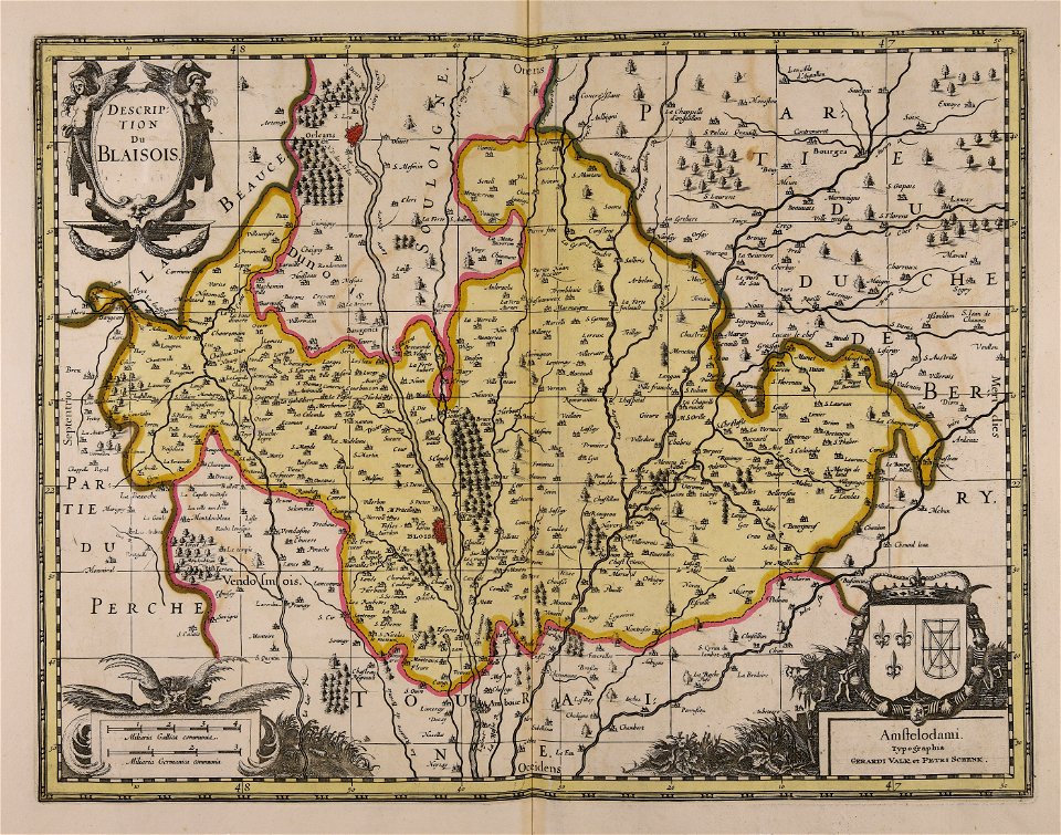
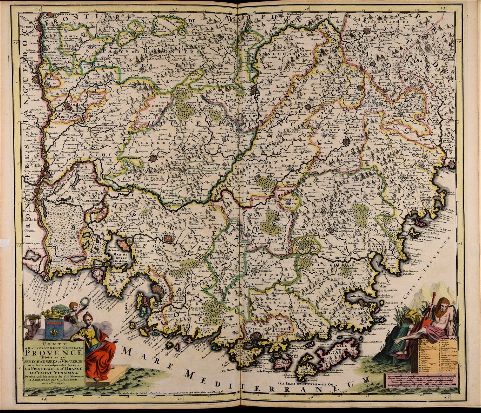
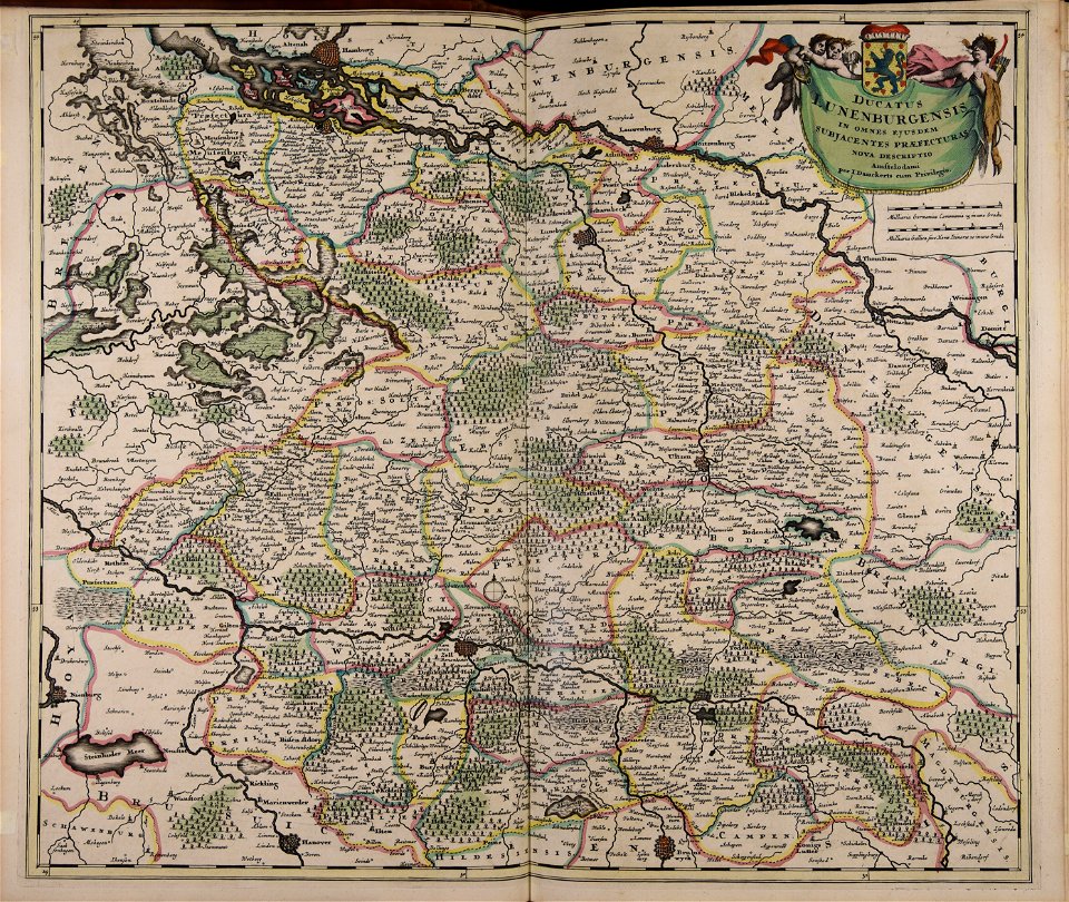
maps made in the 17th century
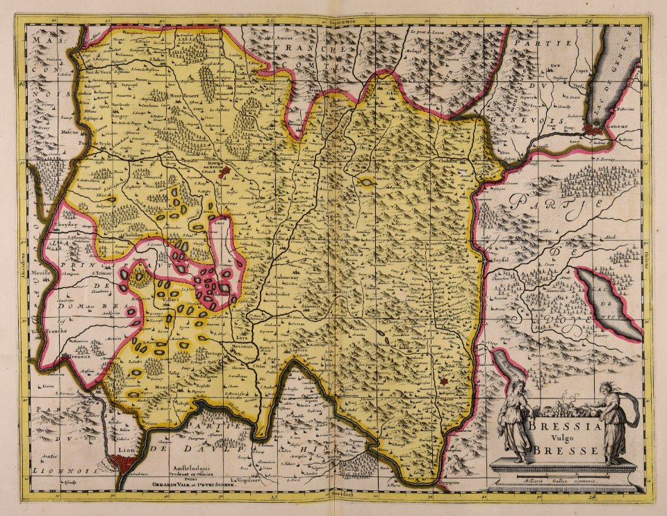
gerard valck
maps by pieter schenk (i)
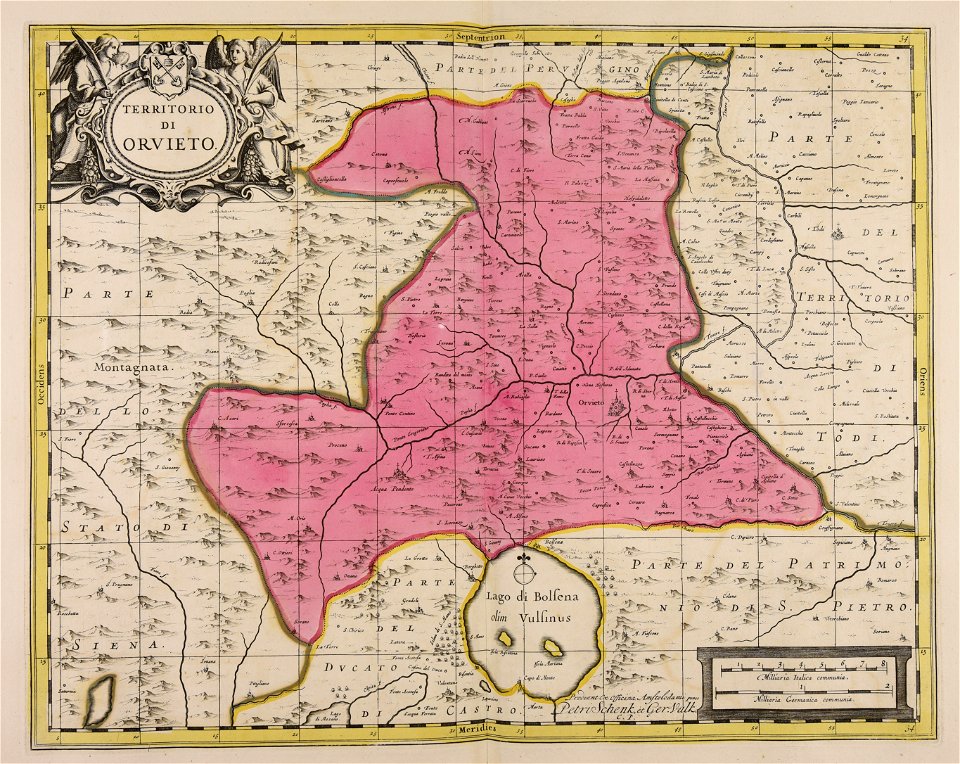
atlantis magni tomus quartus (biblioteca comunale di trento)
atlantis magni tomus secundus (biblioteca comunale di trento)
maps with cartouches
atlas van der hagen
atlantis magni tomus tertius (biblioteca comunale di trento)
jan janssonius
cornell university library
maps made in the 17th century
jan janssonius
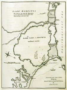
old maps of alexandria
asia and africa
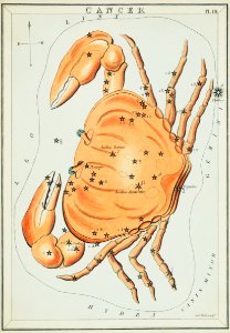
old constellation maps
maps by samuel dunn
map collection of leibniz-institut für länderkunde
asie
cornell university library
jr
maps with cartouches
atlas van der hagen
charts and maps of the royal museums greenwich
1590 maps
maps made in the 17th century
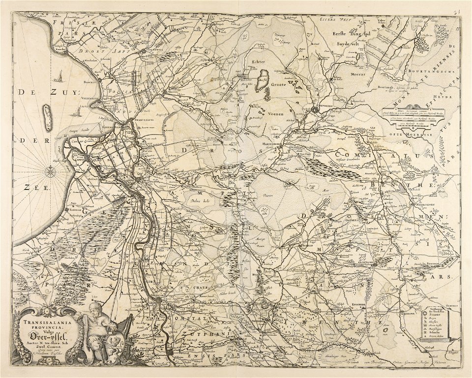
old maps of overijssel
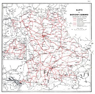
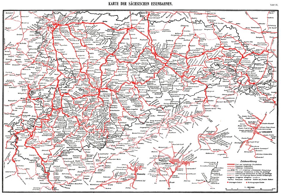
1912 in rail transport in germany
enzyklopädie des eisenbahnwesens
johann christoph winkler
old maps of prague
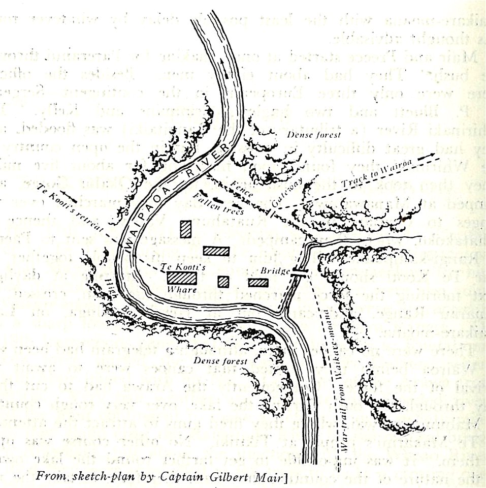
military history of new zealand
maps of battles
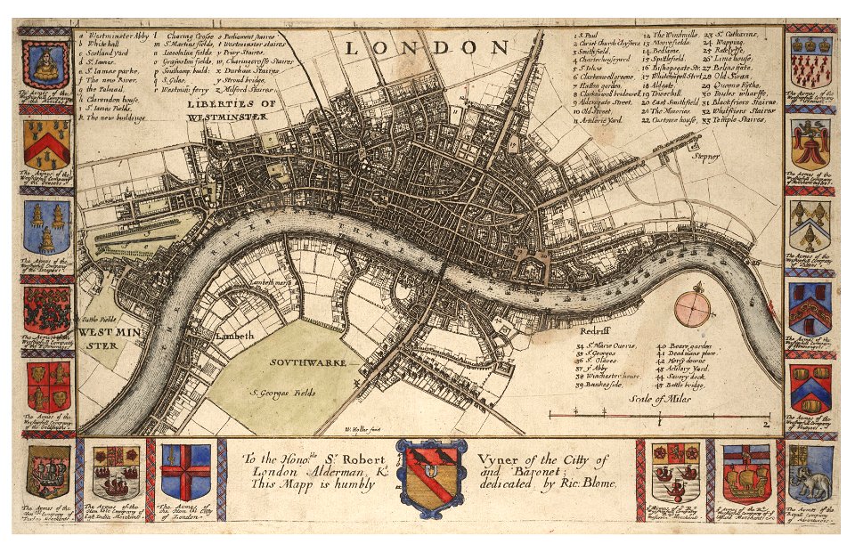
university of toronto wenceslas hollar digital collection
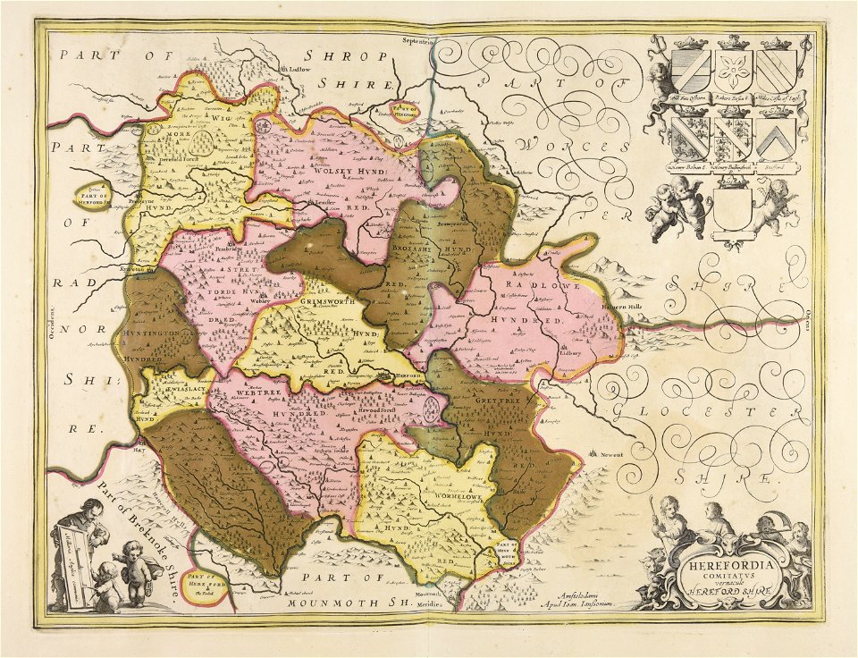
old county maps of cheshire
fonds ancely - bibliothèque municipale de toulouse - maps
joseph-bernard abadie
maps made in the 17th century
old maps of gelderland
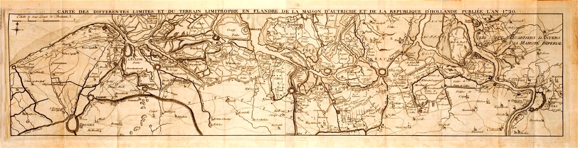
flemish 16th-century prints in the rijksmuseum amsterdam
maps of antwerp city walls
maps made in the 17th century
gerard valck
old maps of the world
1880 maps
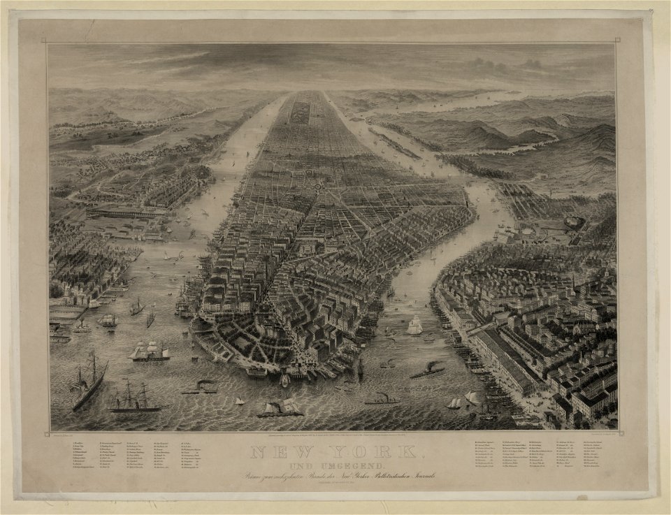
bird's eye view maps of new york city
1867 in new york city
maps with cartouches
atlas van der hagen
cornell university library
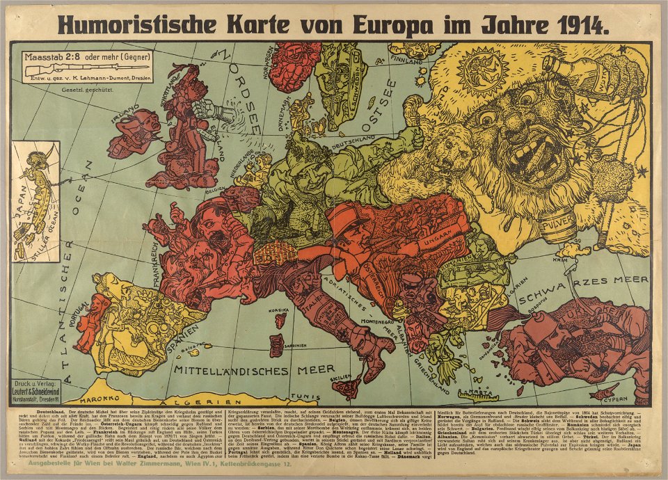
political cartoons
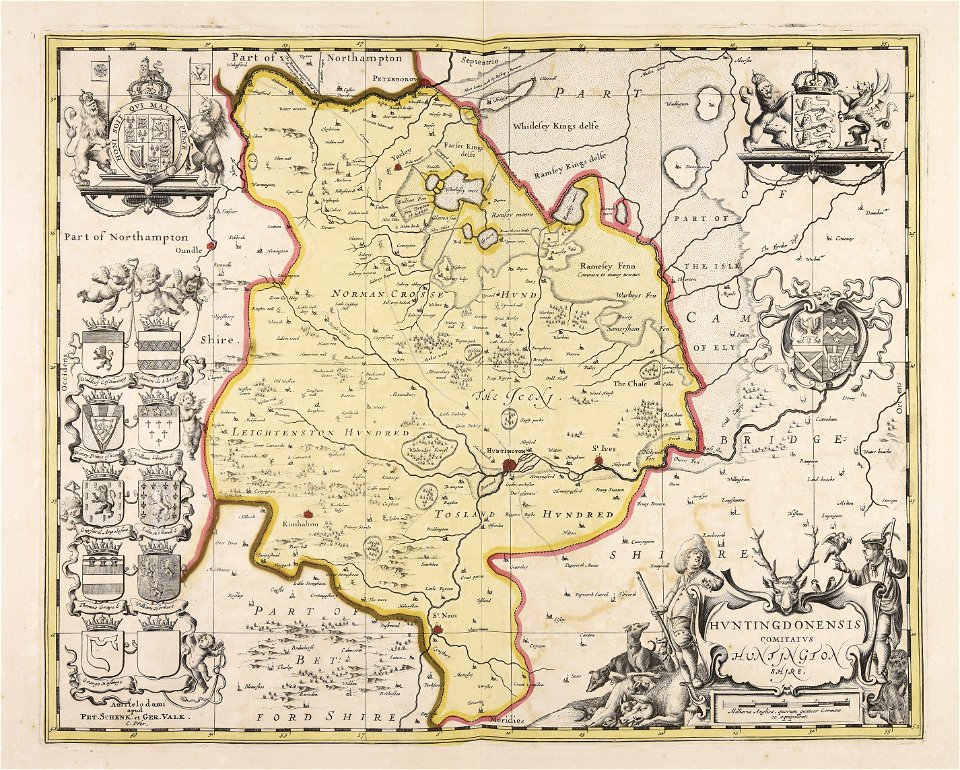
huntingdonshire
gerard valck
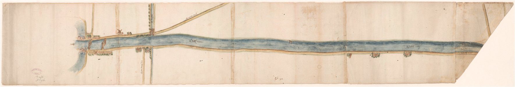
maps of waterways in the netherlands
collections of stadsarchief delft
pictorial history of the russian war 1854-5-6 by george dodd
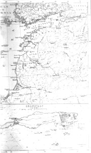
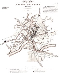
old maps of kronstadt
maps made in the 17th century
jan janssonius
jean-baptiste martenot
1875 maps
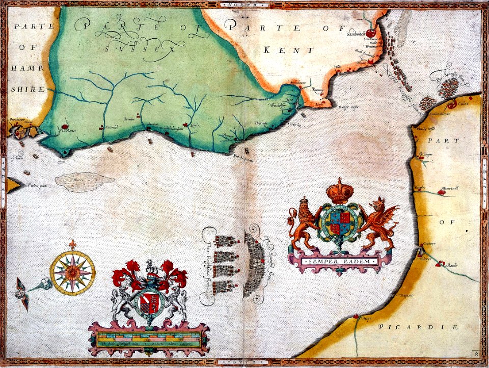
scotland in the early modern period
maps of battles
maps made in the 17th century
gerard valck
unidentified maps
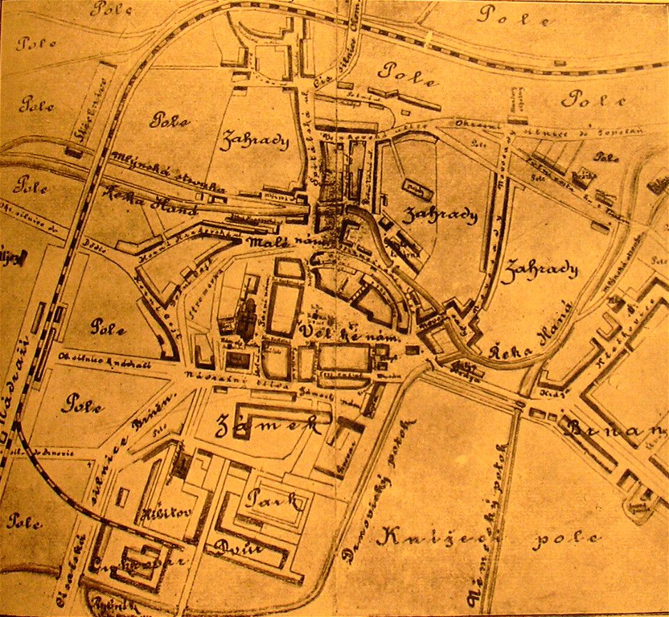
maps of vyškov
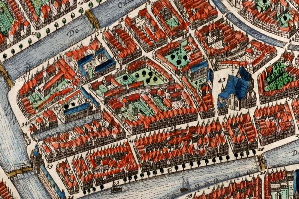
old maps of leiden
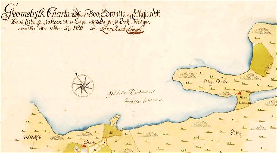
maps of lidingö
grönstaviken
old maps of leipzig
elsterfloßgraben
english civil war
maps of mahilioŭ
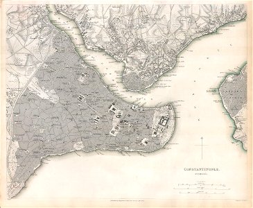
maps of constantinople
mythology
maps
maps made in the 17th century
gerard valck
maps made in the 17th century
gerard valck
university of toronto wenceslas hollar digital collection
history of watford
maps made in the 17th century
gerard valck
old maps of australia
western australia
maps made in the 17th century
jan janssonius
pictorial history of the russian war 1854-5-6 by george dodd
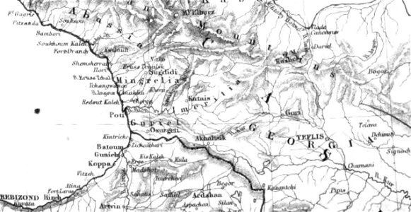
1856 maps of georgia
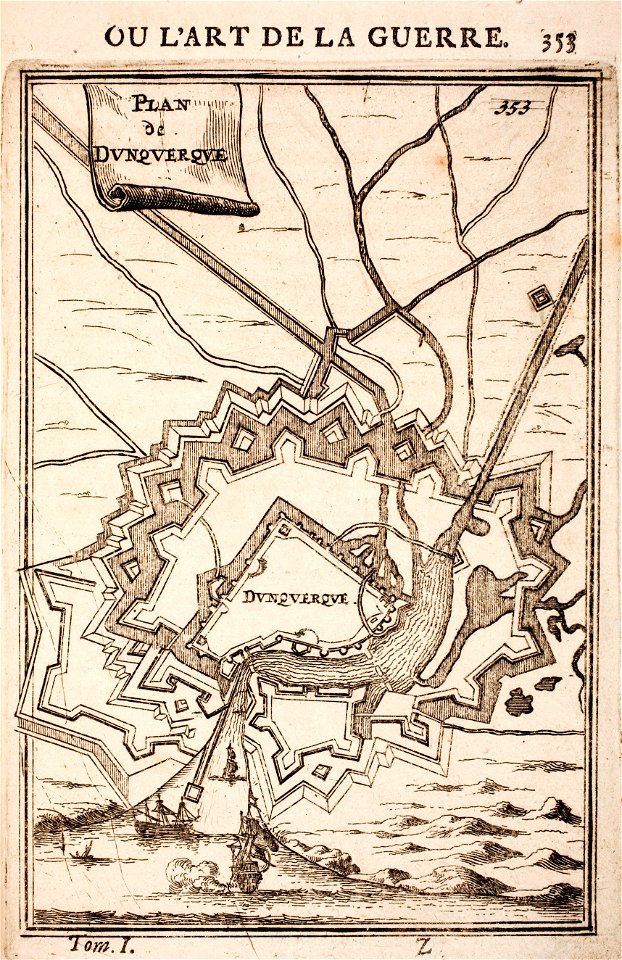
prints from manesson travaux de mars at the peace palace library
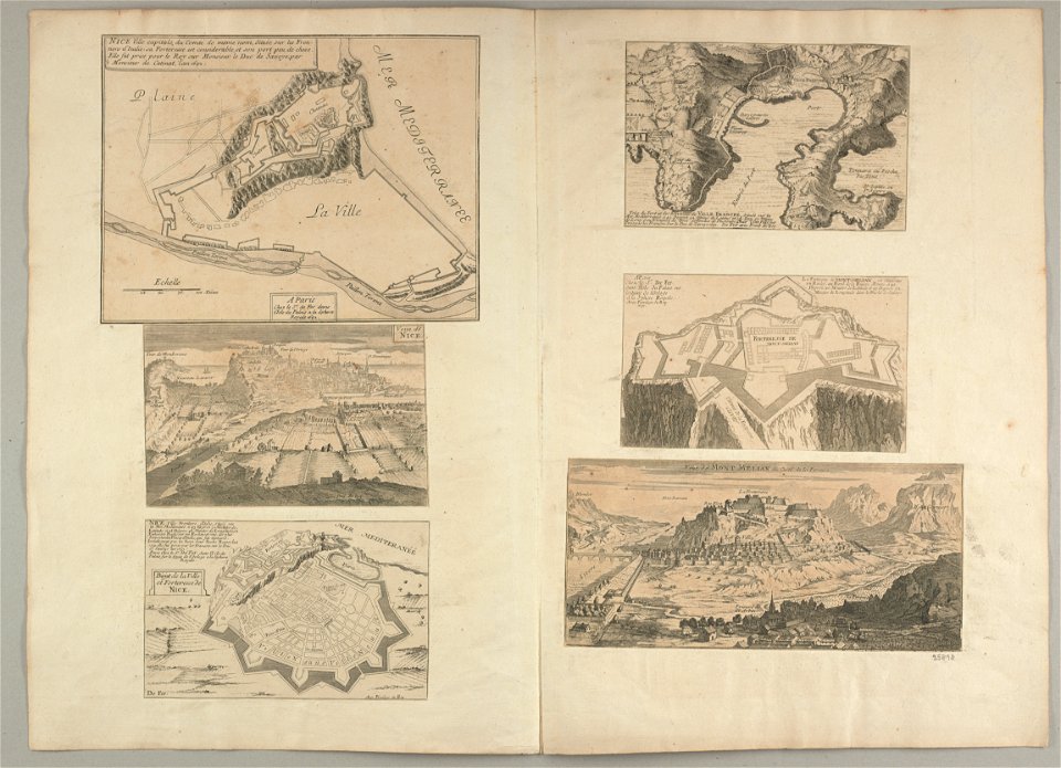
fortifications in france
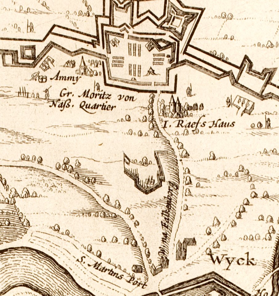
17th-century maps of maastricht
amby (maastricht)
atlantis magni tomus tertius (biblioteca comunale di trento)
maps made in the 18th century
atlas van der hagen (volume 4)
maps with cartouches
old maps of the canton of zürich
maps made in the 16th century
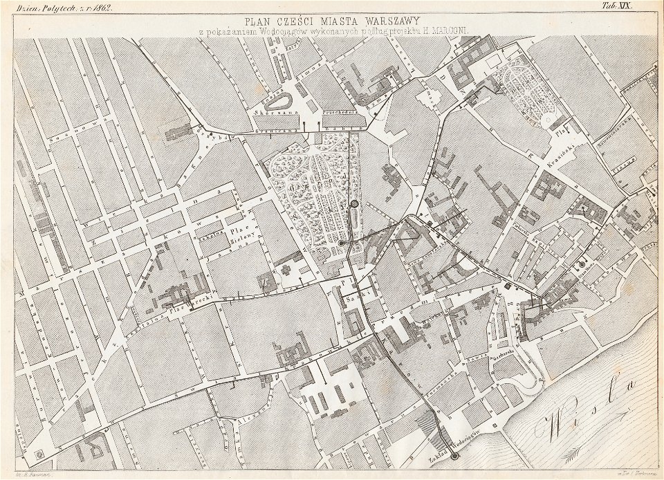
historical maps of warsaw
henryk marconi
dutch 17th-century prints in the rijksmuseum amsterdam
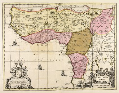
old maps of africa
königlich sächsische staatseisenbahnen
enzyklopädie des eisenbahnwesens
old maps of north brabant
old maps of south holland
old maps of south holland
merwede
maps made in the 17th century
old maps of lower saxony
french colonization in africa
military maps
maps made in the 17th century
gerard valck
prints from the peace palace library
old maps of zeeland
university of toronto wenceslas hollar digital collection
hollar maps and plans of london
charts and maps of the royal museums greenwich
1590 maps
maps with cartouches
atlas van der hagen
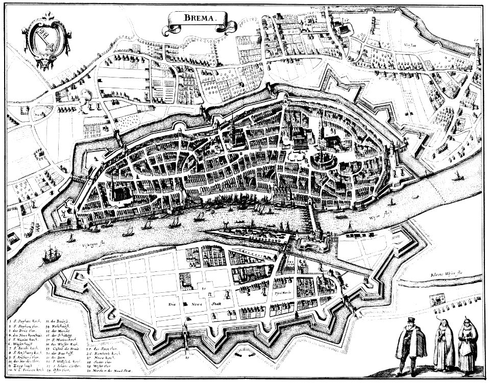
bremen in topographia saxoniae inferioris (merian)
engravings by matthäus merian
dutch 17th-century prints in the rijksmuseum amsterdam
maps in the rijksmuseum amsterdam
gerard valck
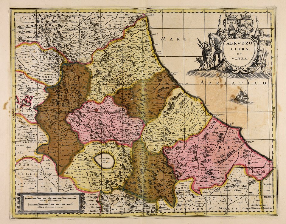
abruzzo
jean-baptiste martenot
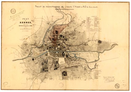
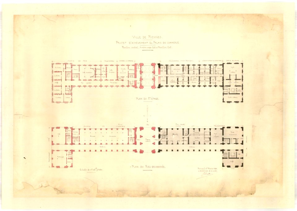
rennes in the 1890s
maps made in the 17th century
gerard valck
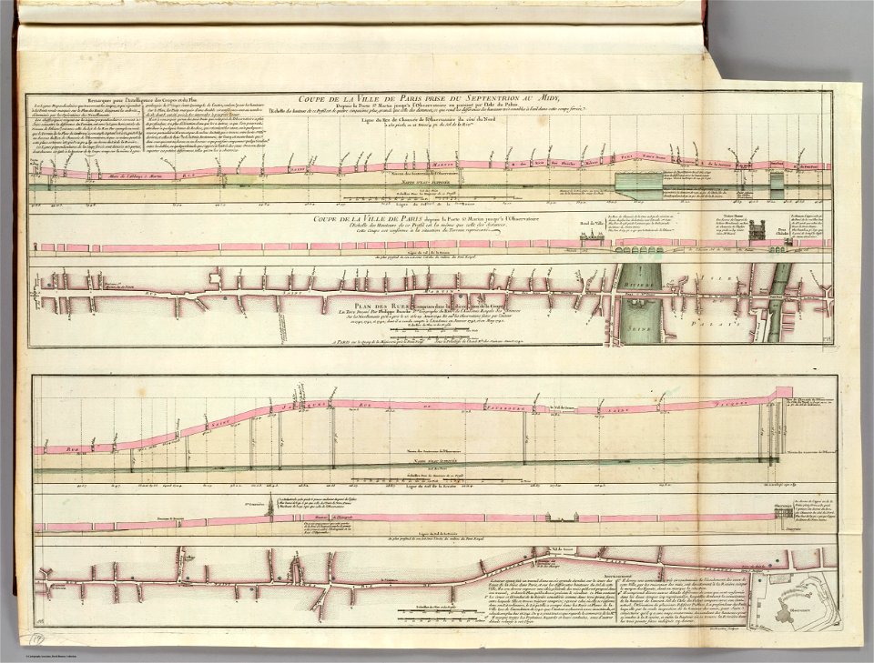
seine river in paris
old submaps of paris
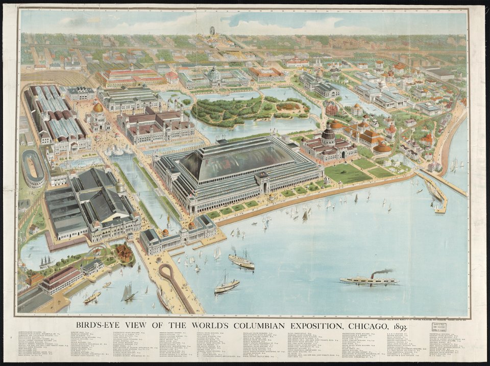
aerial views of the world's columbian exposition
maps of the world's columbian exposition
maps made in the 17th century
gerard valck
history of melbourne
maps of melbourne
koninklijk nederlands aardrijkskundig genootschap
intaglio (printmaking)
historic views of hamburg
st nikolai
maps made in the 17th century
gerard valck
17th-century people of paris
history of fashion in paris
maps made in the 17th century
gerard valck
maps made in the 17th century
cornelis danckerts (i)
atlantis magni tomus tertius (biblioteca comunale di trento)
maps made in the 17th century
maps made in the 17th century
gerard valck
fonds ancely - bibliothèque municipale de toulouse - maps
joseph-bernard abadie
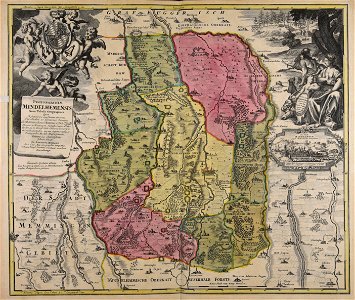
maps made in the 18th century
johann baptist homann
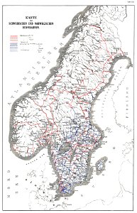
history of rail transport in norway
rail transport maps of norway
engravings by matthäus merian
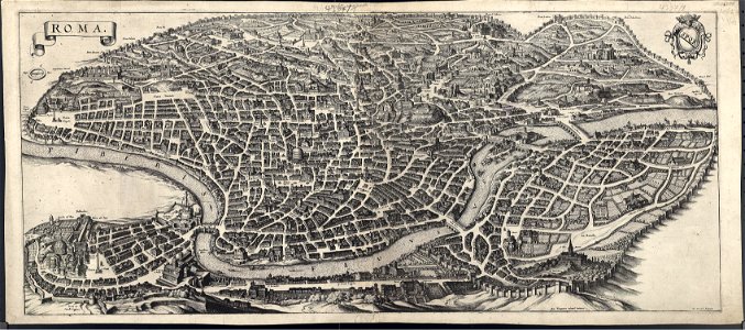
old maps of rome
old maps of gdańsk
augustus mayerberg
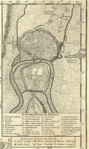
maps of meaux
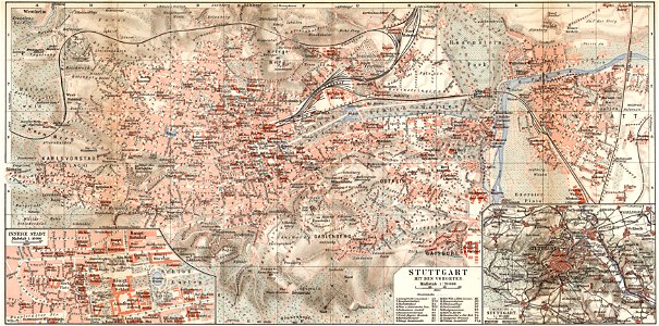
maps of stuttgart
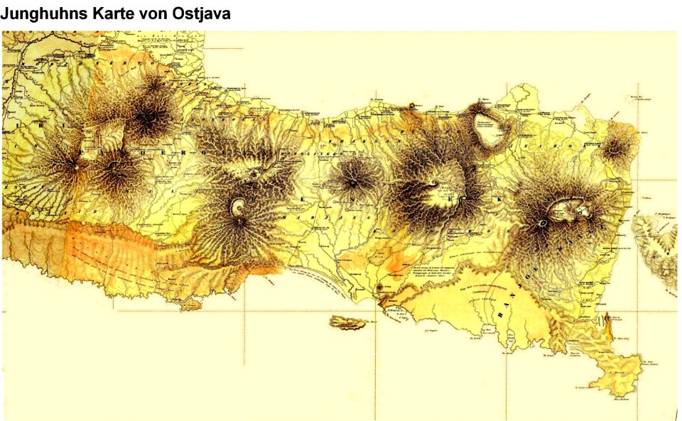
the exploration of the caucasus
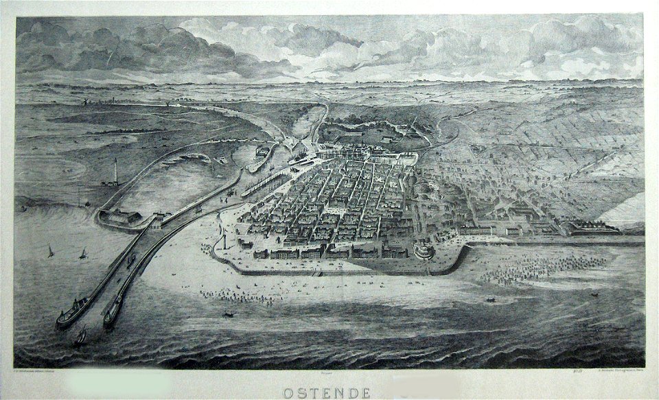
old maps of ostend
maps of sweden
strängnäs
old maps of twente
1841 maps
kizil caves
müller's map of bohemia
maps of mahilioŭ
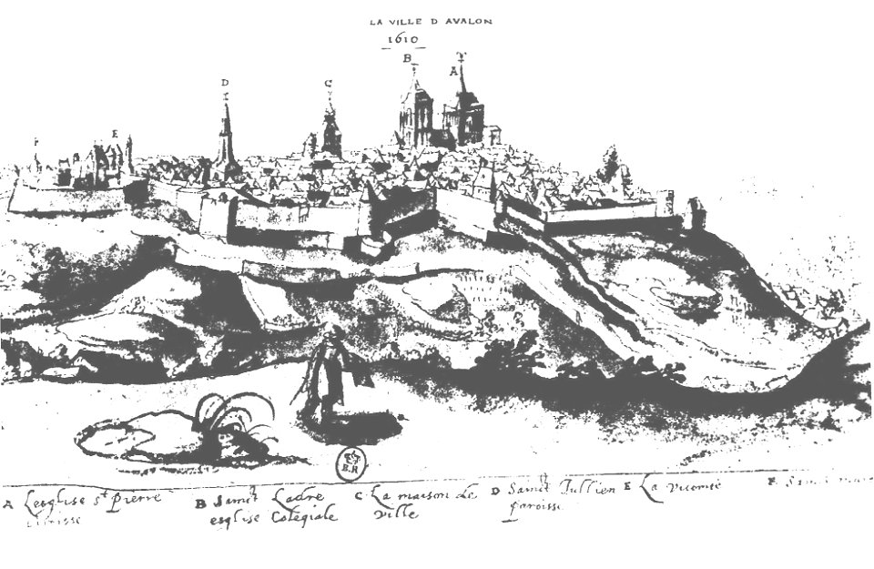
maps of avallon
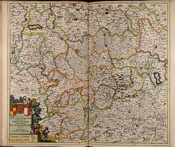
maps of württemberg
langenenslingen
maps of stuttgart
dutch 18th-century prints in the rijksmuseum amsterdam
hendrik de leth
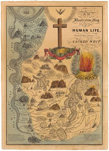
heaven
hell
old maps of the electorate of trier
maps with cartouches
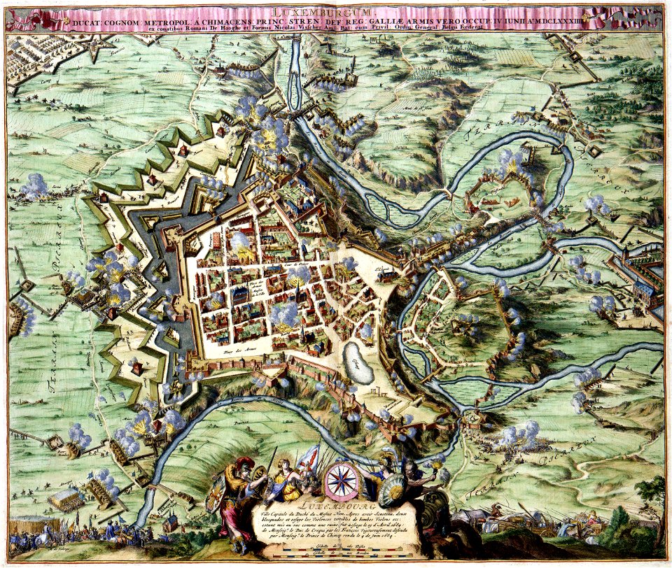
maps of luxembourg city walls
maps with cartouches
6201 - 6300 of 38,713
Next page
/ 388