Log in
All resources
Create a design
38,713 Free Artworks of Map
maps made in the 17th century
maps in the library of congress
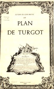
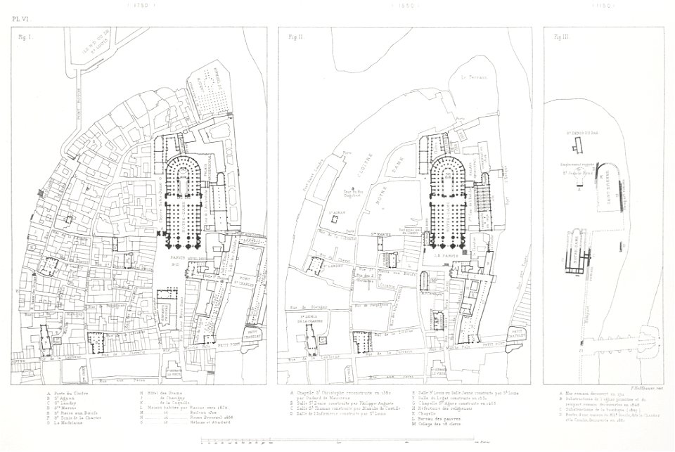
turgot map of paris
david rumsey historical map collection – derivative files
atlantis magni tomus tertius (biblioteca comunale di trento)
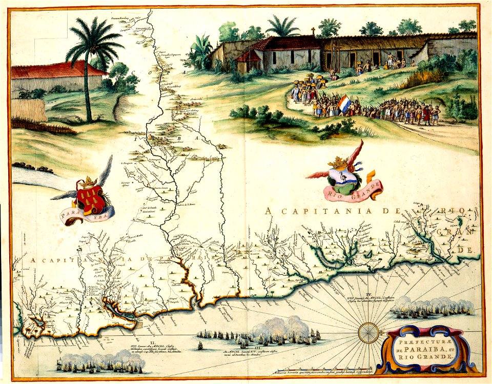
maps of the west-indische compagnie
atlantis magni tomus quartus (biblioteca comunale di trento)
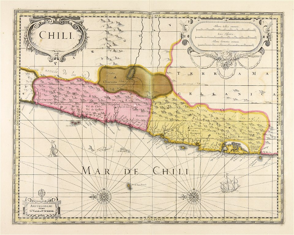
gerard valck
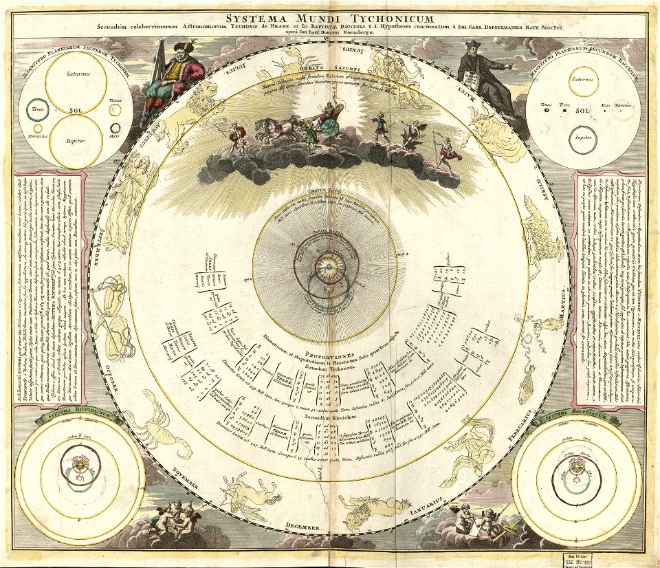
maps made in the 18th century
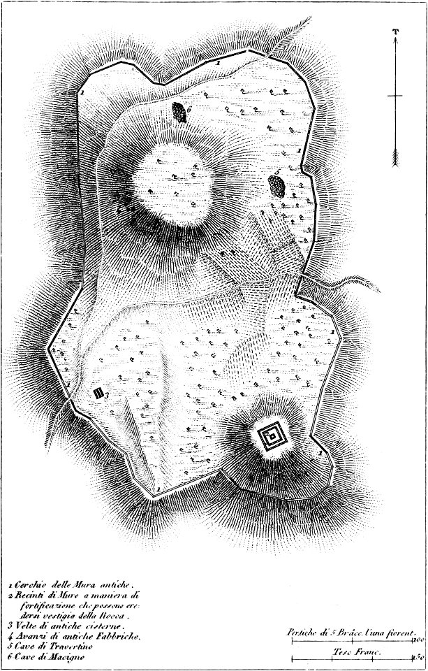
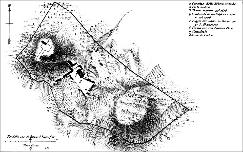
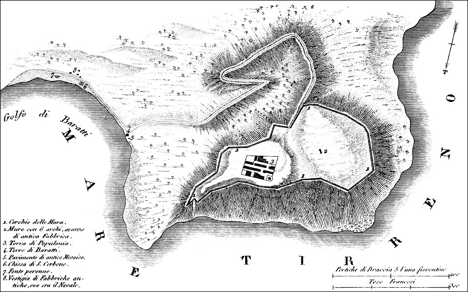
maps of archaeological sites in italy
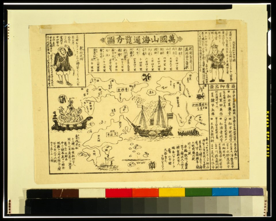
ukiyo-e by unknown artists
nagasaki-e
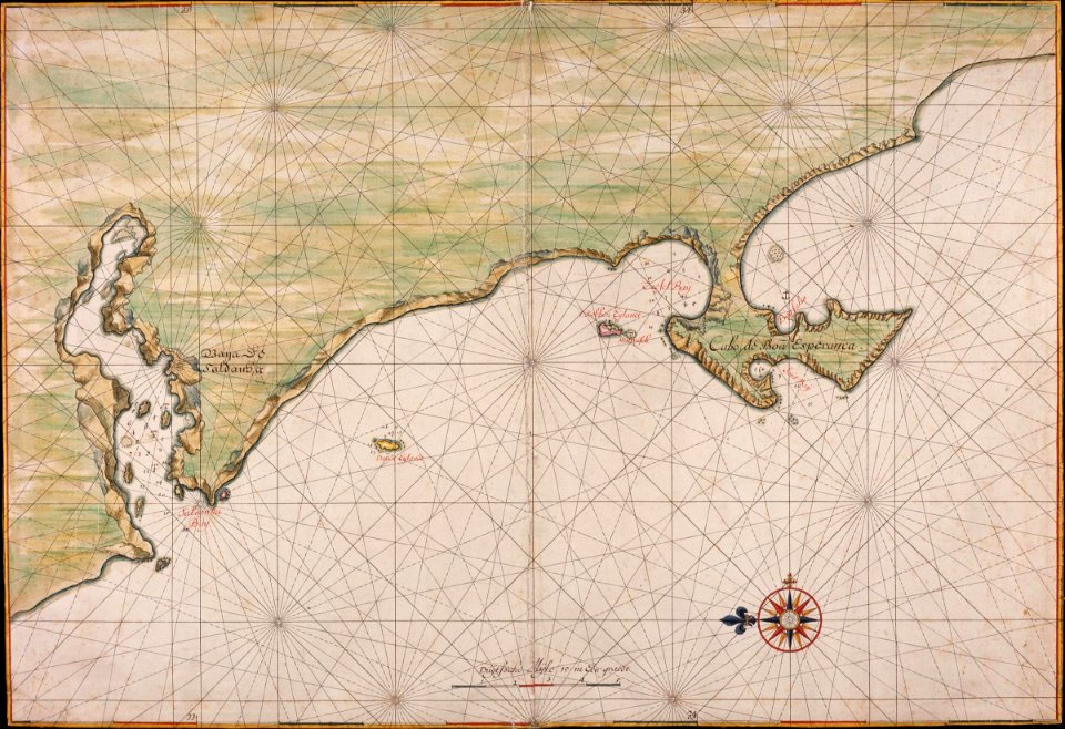
johannes vingboons
1665
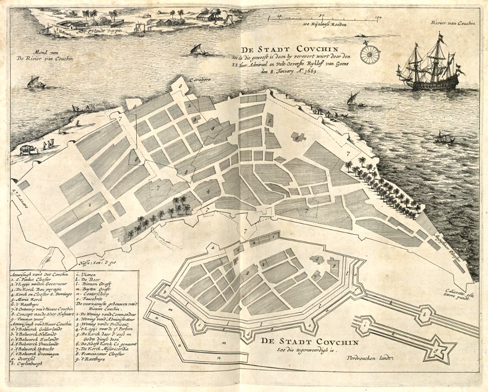
maps of the dutch east india company - india
1672
maps of the west-indische compagnie
1745
makassar
1757
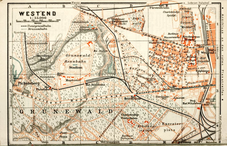
wagner & debes
1914 in berlin
ukiyo-e by unknown artists
nagasaki-e
atlantis magni tomus quartus (biblioteca comunale di trento)
maps made in the 17th century
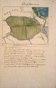
maps of amsterdam-noord
buikslotermeer
old maps of vietnam
nguyễn lords
old maps of landrecies
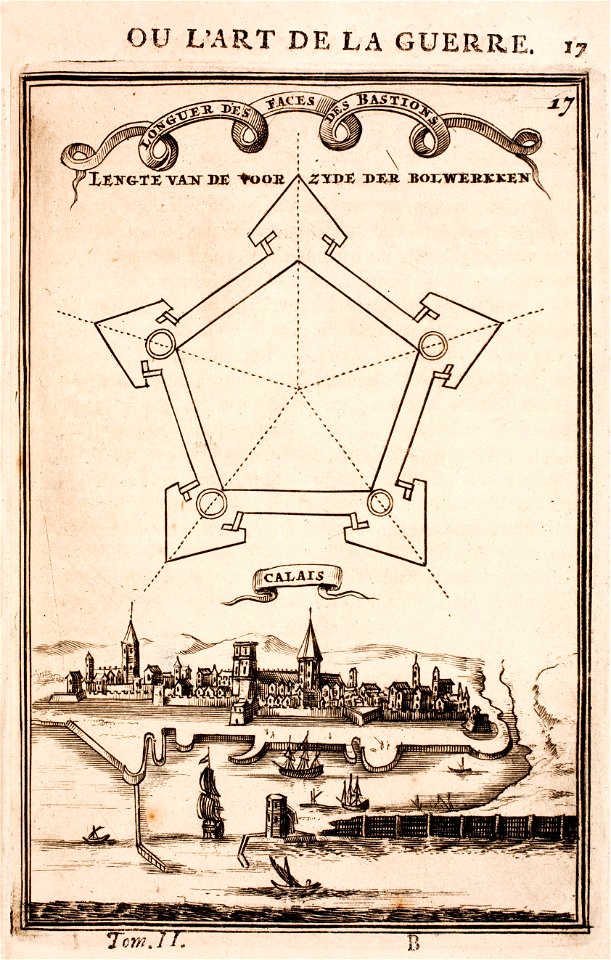
pentagon
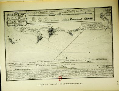
old maps of calais
pentagon
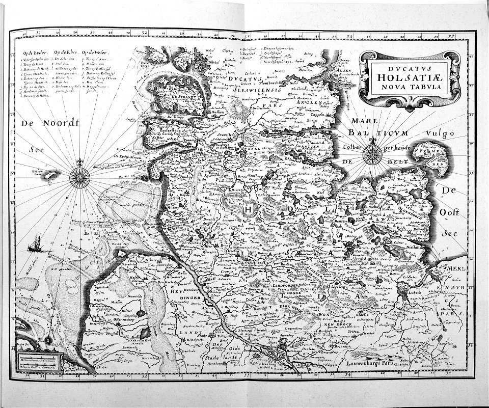
mannheim in the 17th century
maps of mannheim
pictorial history of the russian war 1854-5-6 by george dodd
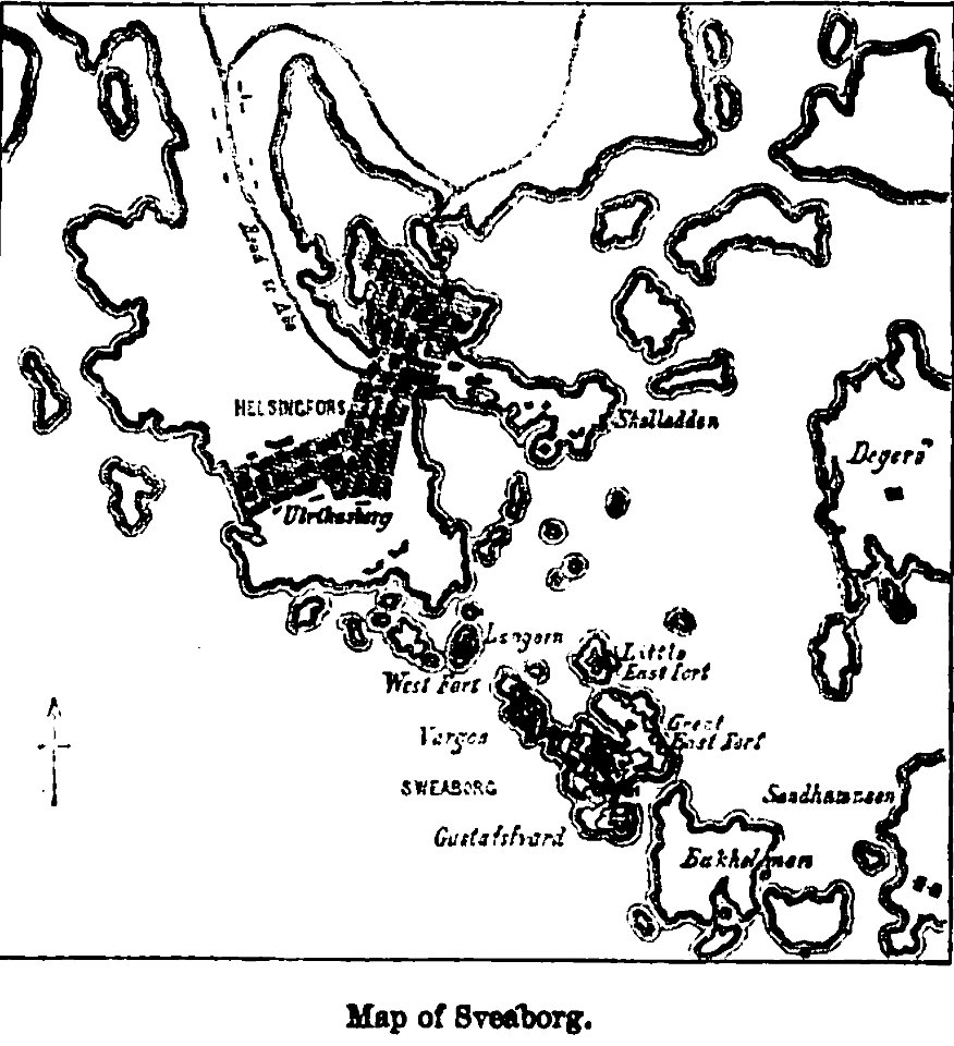
maps of suomenlinna
1887 in bretagne
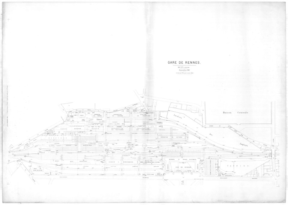
gare de rennes
maps of thionville city walls
louis
maps made in the 18th century
gerard valck
historical images of the place dauphine (paris)
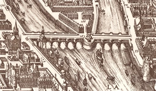
historical images of pont neuf
maps of archaeological sites in italy
old maps of tuscany
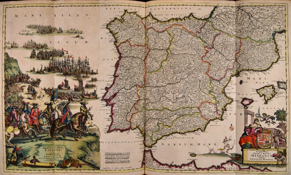
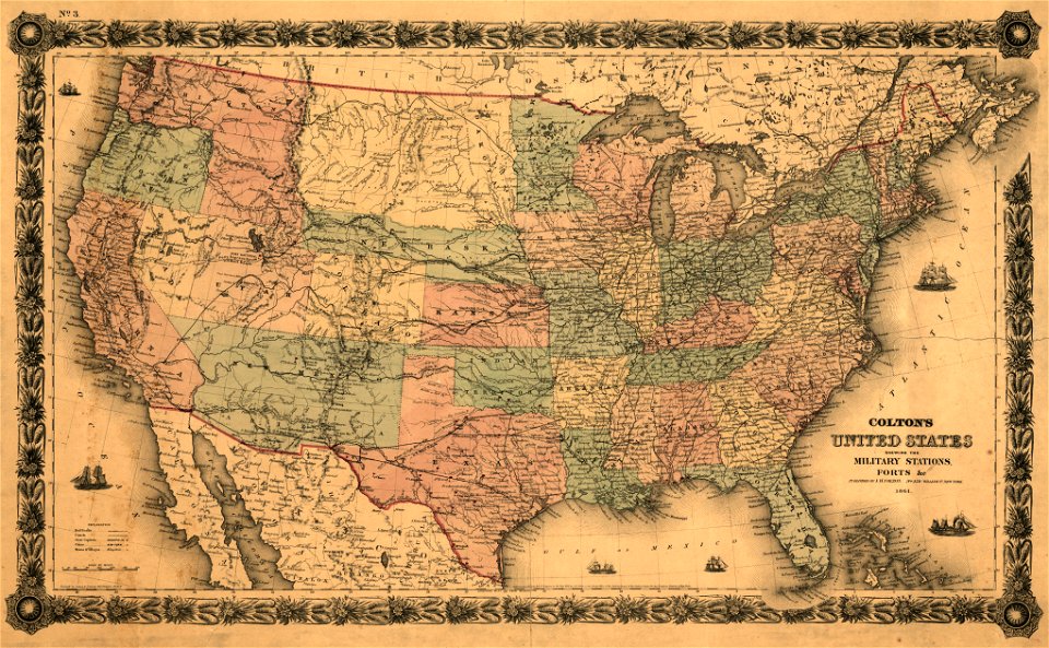
old maps of north america
1843 maps
maps of the west-indische compagnie
1747)
maps of the west-indische compagnie
1773
maps by willem and johannes blaeu
copper engraving
cimetière de clamart
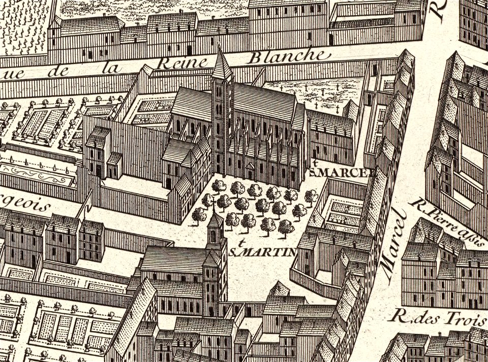
turgot map of paris
images from bristol past and present (1882)
bristol
maps made in the 17th century
jan janssonius
david rumsey historical map collection – derivative files
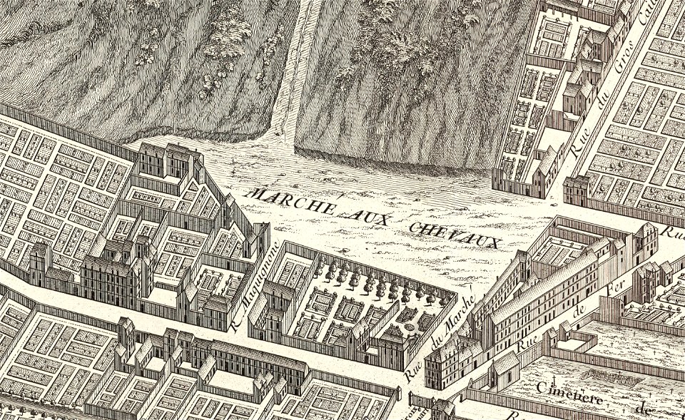
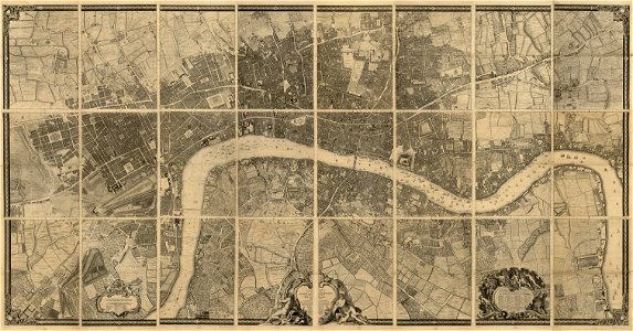
turgot map of paris
turgot map of paris
marché aux chevaux
jerusalem in the 16th century
maps by sebastian münster
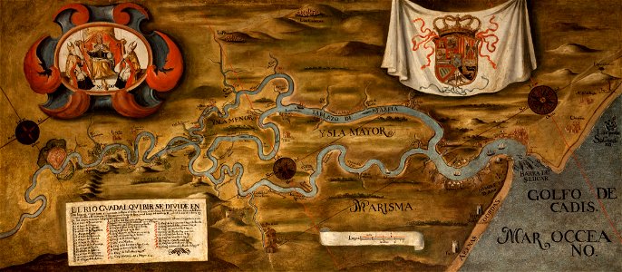
guadalquivir
1760 maps
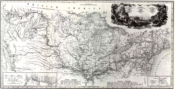
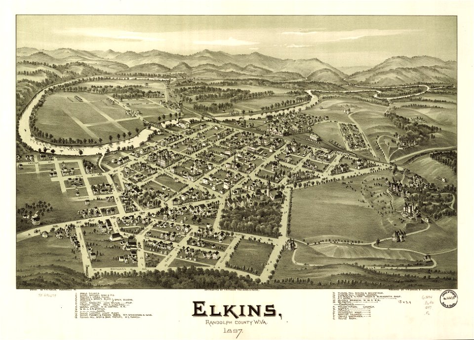
west virginia
elkins
charts and maps of the royal museums greenwich
1682 maps
hawaii in the 1810s
louis choris
collections of staatsbibliothek bamberg
franconian switzerland
16th-century maps of the black sea
maps made in the 16th century
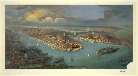
lithographs of new york city
chromolithograph
maps in the library of congress
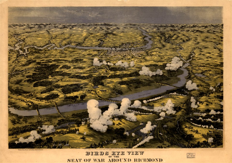
1862 maps of virginia
maps in the library of congress
1862 maps of virginia
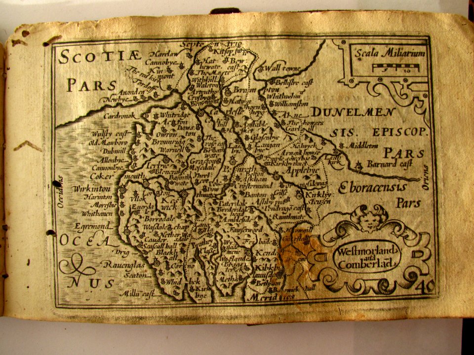
miniature speed atlas (1627) pieter van den keere
pieter van der keere
miniature speed atlas (1627) pieter van den keere
pieter van der keere
maps made in the 17th century
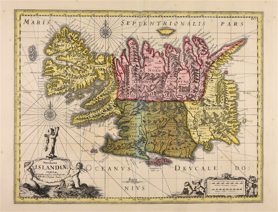
old maps of iceland
maps made in the 18th century
johann baptist homann
bamako in the 1880s
military maps
maps made in the 17th century
jan janssonius
maps made in the 18th century
johann baptist homann
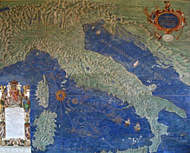
vatican gallery of maps
old maps of italy
1790s drawings
palace park
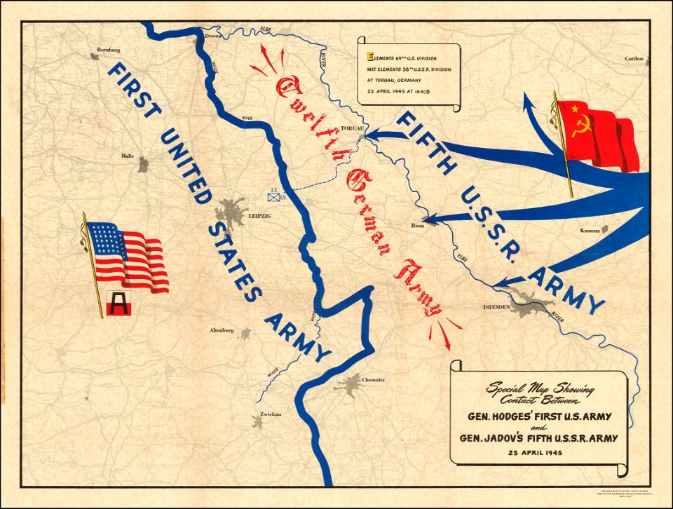
maps of world war ii
gerard valck
spitsbergen
french-language title pages
title pages from france
david rumsey historical map collection – derivative files
turgot map of paris
gerard valck
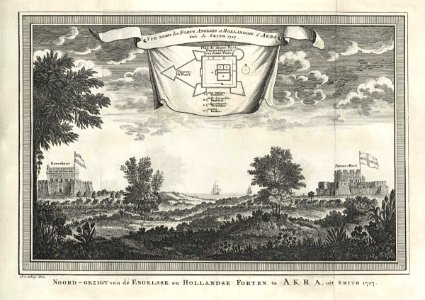
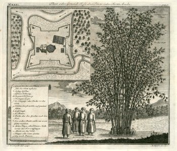
ciling
fort anké
1740
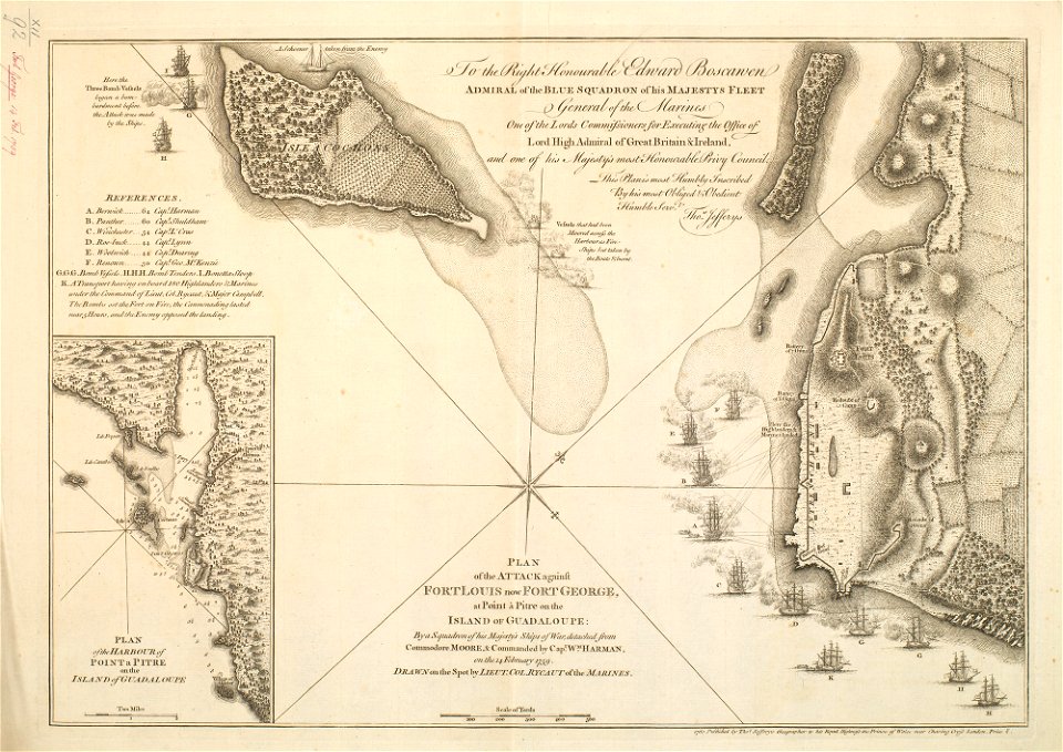
maps of the french and indian war
1768 maps
john rocque 1746 crops from library of congress
1746
17th-century maps of the americas
athanasius kircher
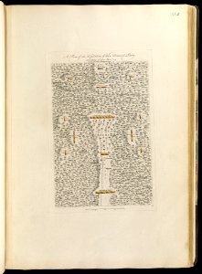
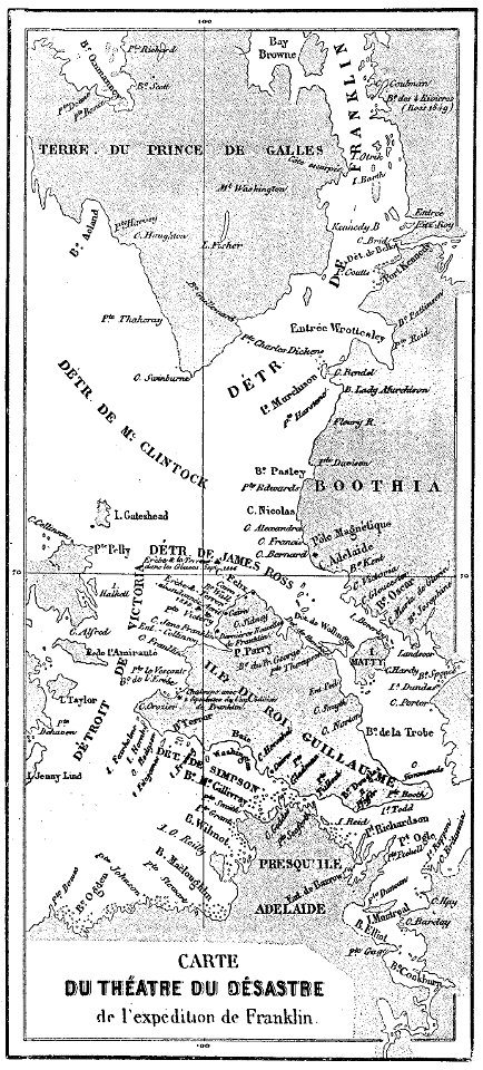
john franklin's lost expedition
volume 1 of le tour du monde
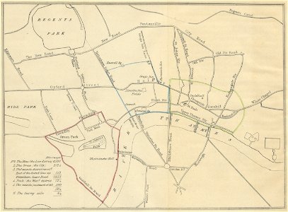
metropolitan improvements (1828) thomas hosmer shepherd
maps from the mechanical curator collection
19th-century maps of london
1840 books
maps from the mechanical curator collection
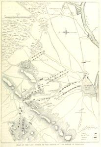
british battles on land and sea
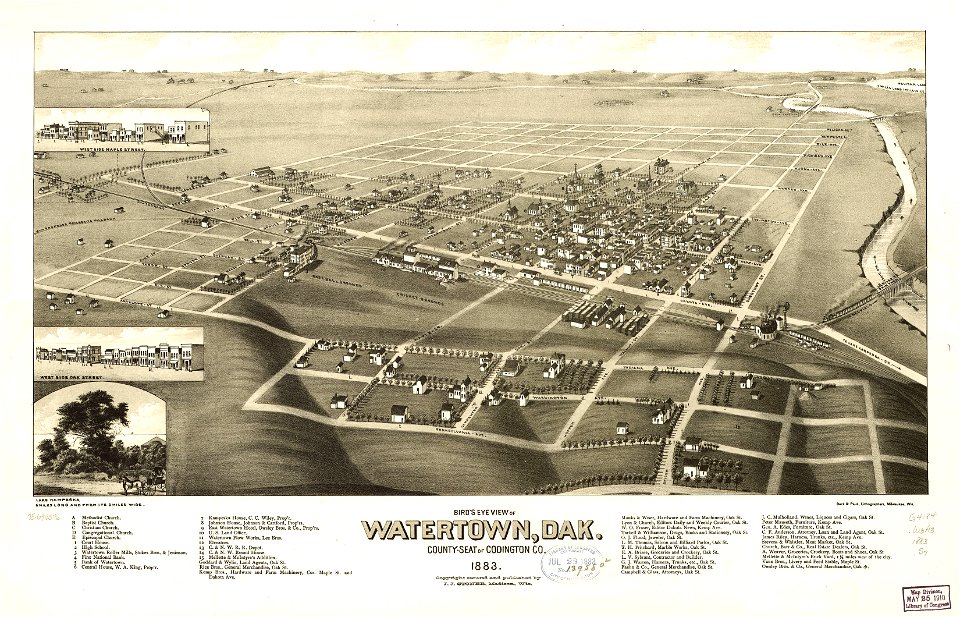
south dakota
watertown
miniature speed atlas (1627) pieter van den keere
pieter van der keere
files from the bodleian libraries
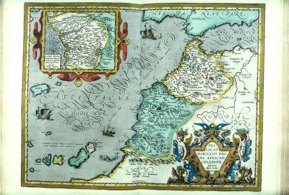
old maps of africa
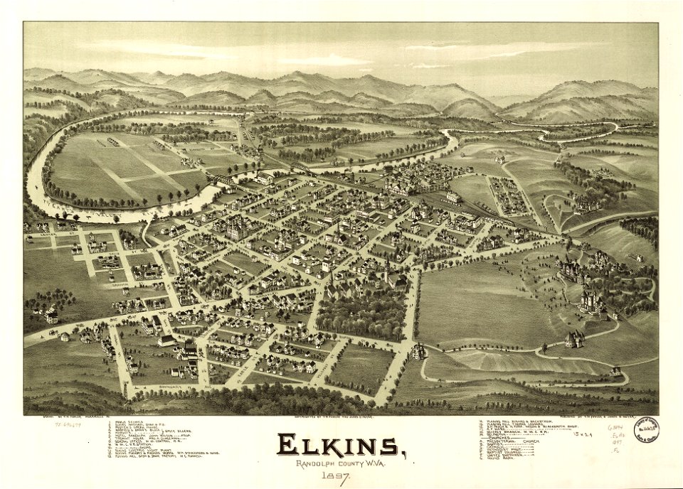
west virginia
elkins
atlantis magni tomus tertius (biblioteca comunale di trento)
maps made in the 17th century
1758
1756
maps with cartouches
curonian
paris in the 16th century
lithographs of paris
caricatures of wilhelm ii of germany
19th-century maps of europe
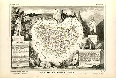
coats of arms of cities in haute-loire
marquis de la fayette
birds in art of france
lions in art
atlas van der hagen (volume 4)
maps with cartouches
history of the french navy
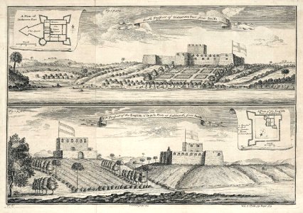
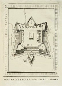
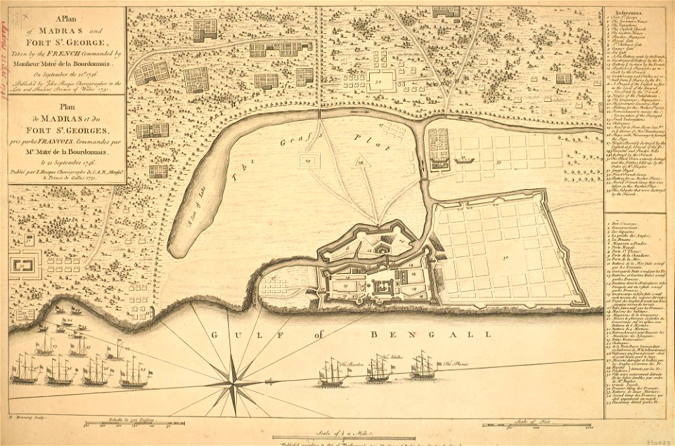
fort st. george
engravings of topographia saxoniae inferioris
maps of hamburg-langenhorn
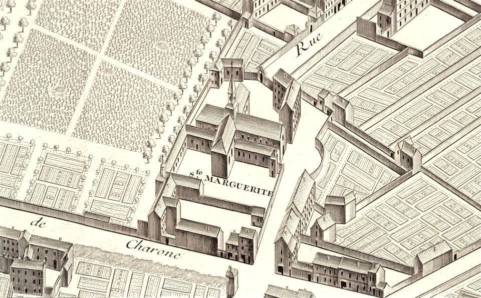
église sainte-marguerite (paris)
turgot map of paris
david rumsey historical map collection – derivative files
turgot map of paris
rue de siam (brest
france
koninklijk nederlands aardrijkskundig genootschap
intaglio (printmaking)
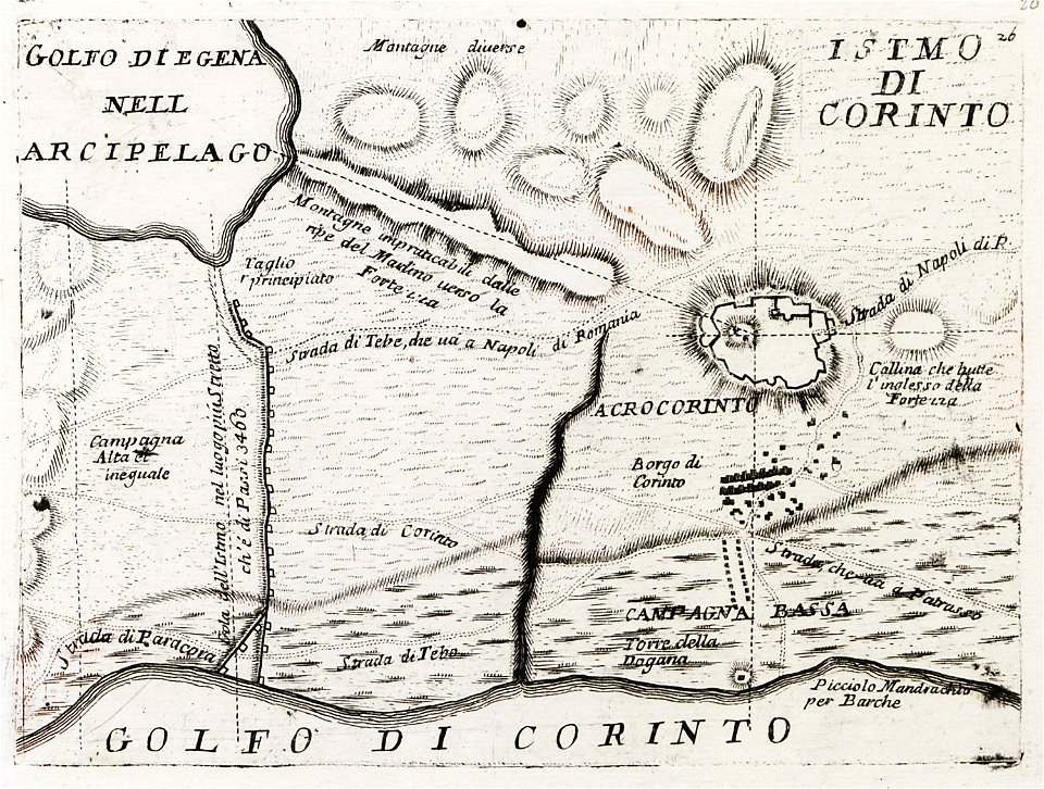
old maps of the peloponnese
maps by coronelli
maps of archaeological sites in italy
old maps of tuscany
maps of archaeological sites in italy
old maps of tuscany
maps in the library of congress
1716 maps
maps in the library of congress
1716 maps
university of toronto wenceslas hollar digital collection
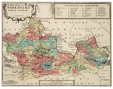
old county maps of berkshire
cornell university library
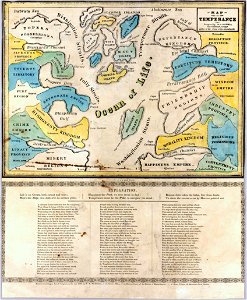
map on temperance
maps made in the 18th century
gerard valck
islands of california
nicolas de fer
david rumsey historical map collection – derivative files
turgot map of paris
1640s maps of france
jan janssonius
maps in the library of congress
1861 maps
maps of the eastern mediterranean
bodleian library
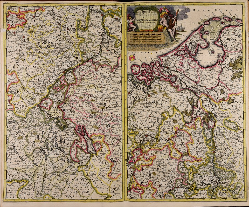
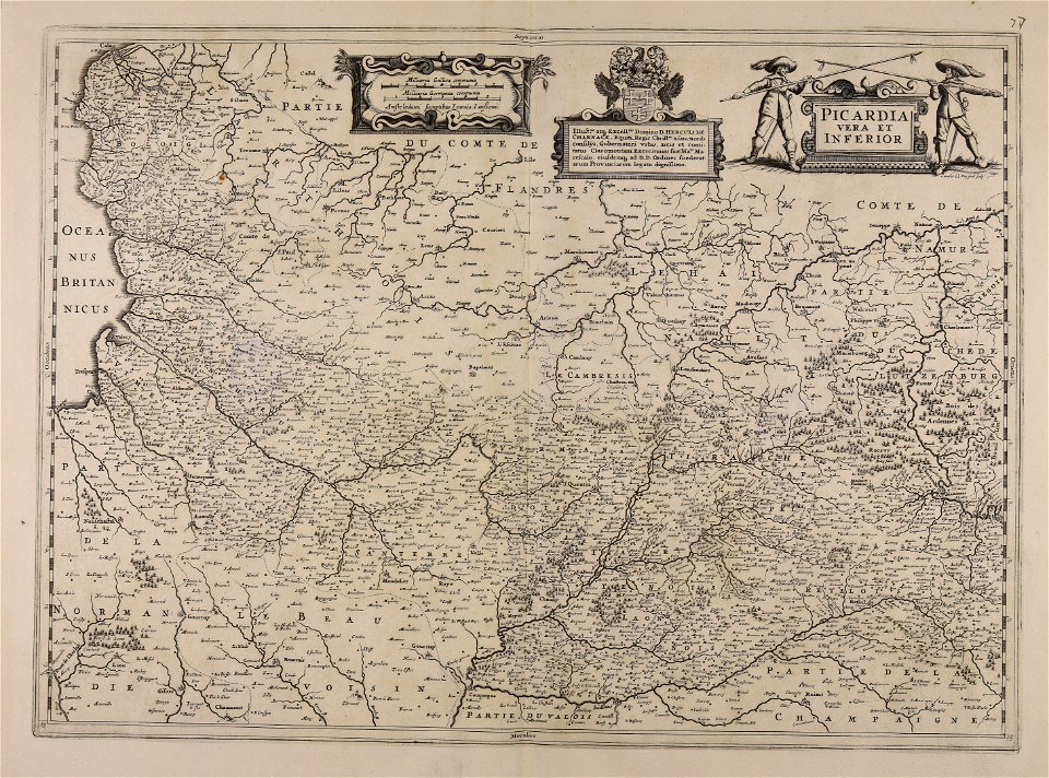
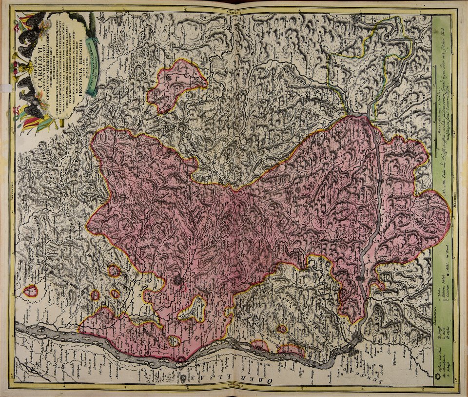
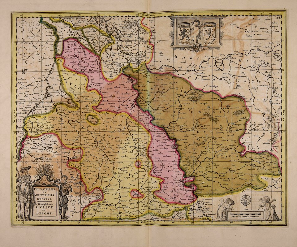
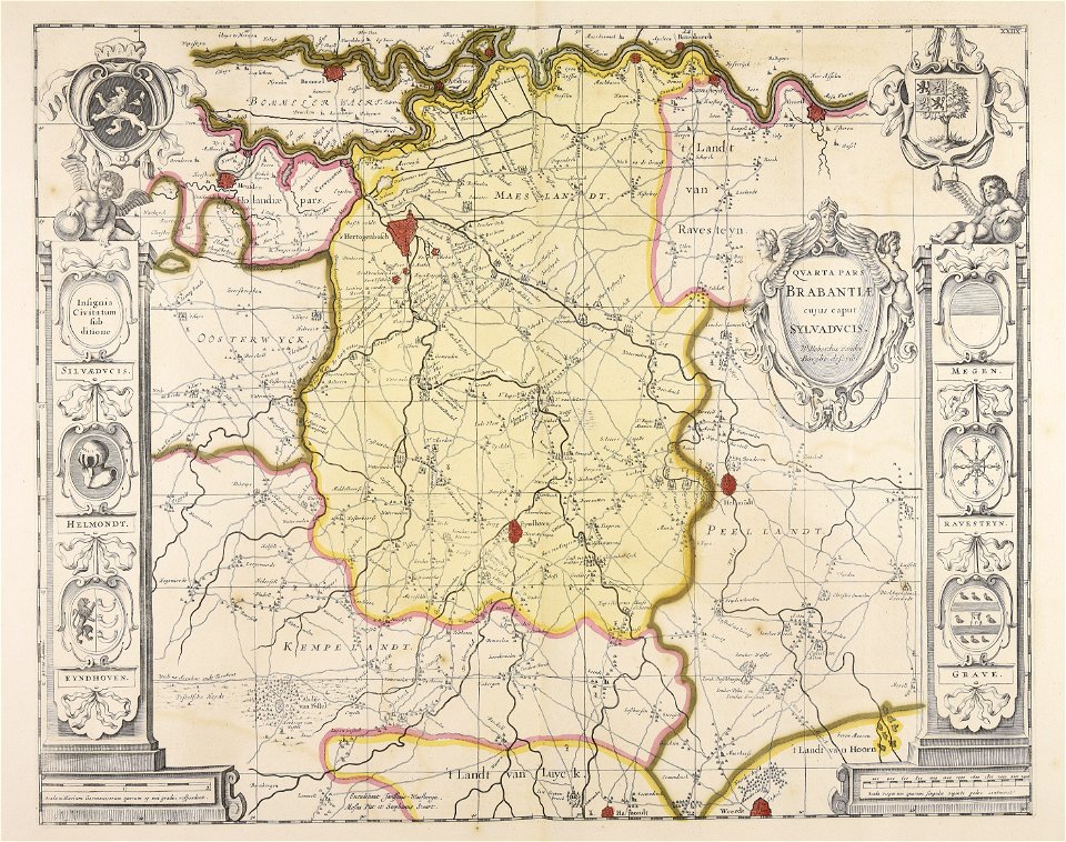
maps of territories in the burgundian circle
atlas novus (blaeu)
maps made in the 17th century
nicolaes visscher ii
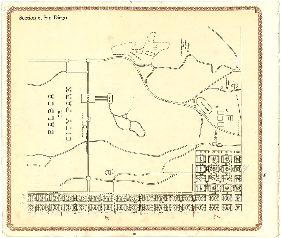
california
san diego
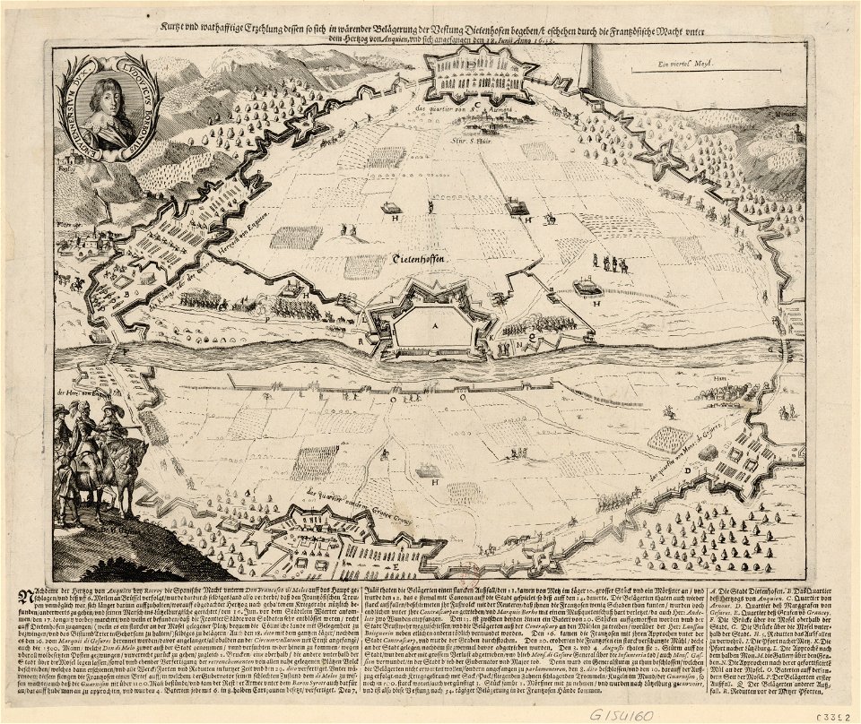
maps of the franco-dutch war
history of the french navy
atlantis magni tomus secundus (biblioteca comunale di trento)
maps made in the 17th century
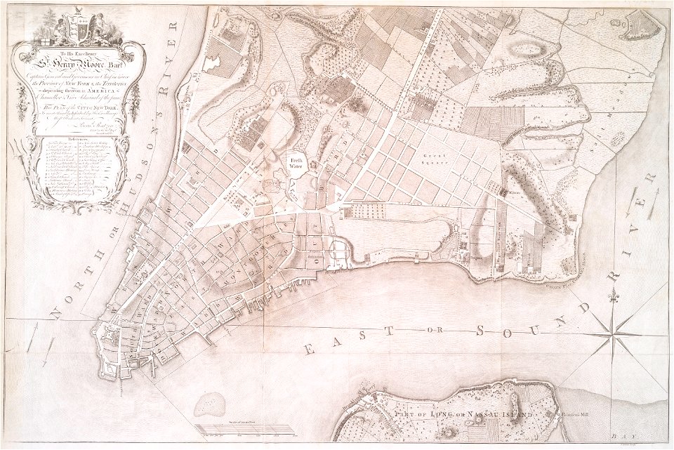
images from the new york public library
new york city
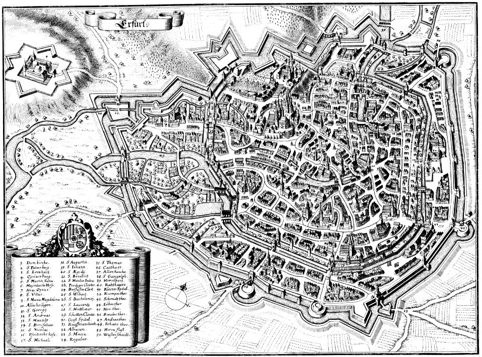
maps of erfurt
erfurt
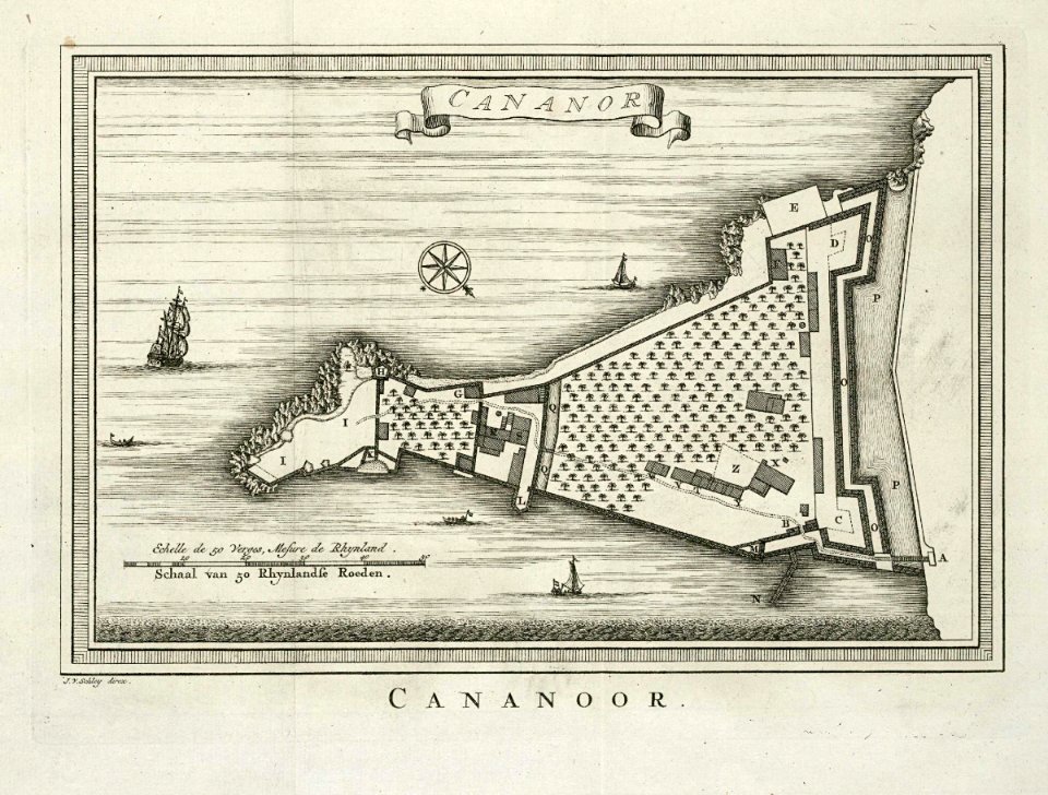
maps of the dutch east india company - india
historical images of st. angelo fort
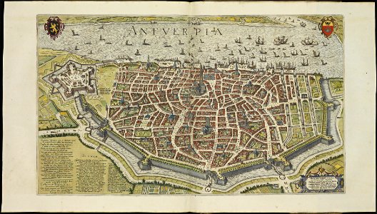
maps of antwerp city walls
frederick de wit
5901 - 6000 of 38,713
Next page
/ 388