Log in
All resources
Create a design
38,713 Free Artworks of Map
charts and maps of the royal museums greenwich
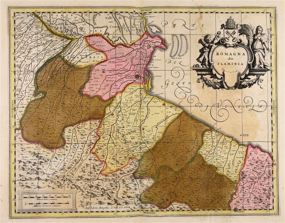
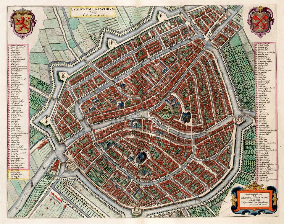
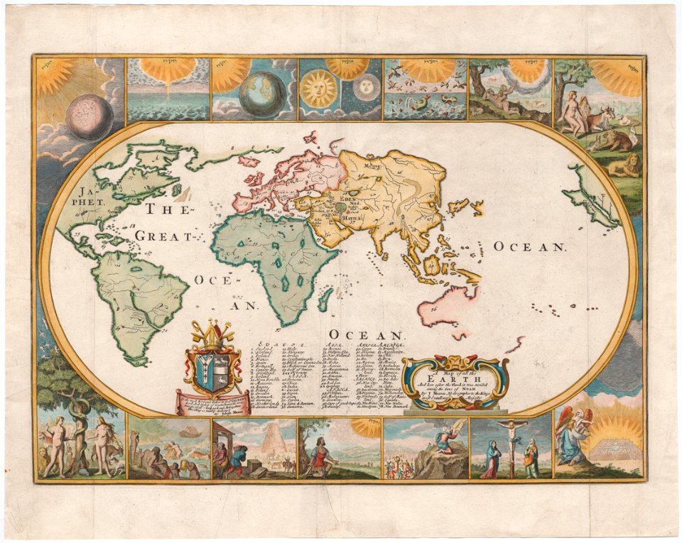
maps made in the 17th century
1682 maps
maps in the library of congress
maps of the west-indische compagnie
maps with cartouches
gerard valck
maps by pieter schenk (i)
atlas van der hagen
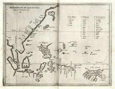
maps of the dutch east india company - indonesia
maps made in the 17th century
gerard valck
maps made in the 17th century
gerard valck
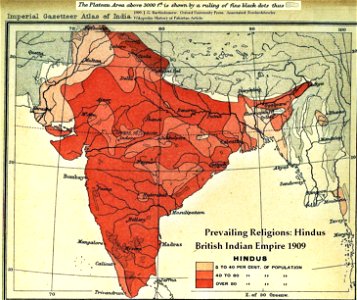
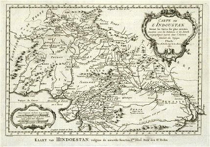
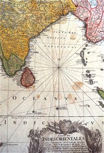
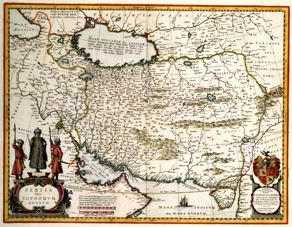
old maps of the indian subcontinent
hindus
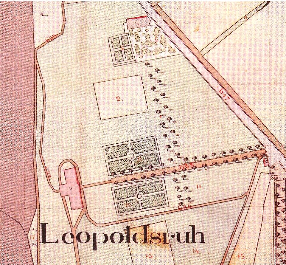
maps by royal bavarian land tax commission
old maps of freising
maps by royal bavarian land tax commission
old maps of freising
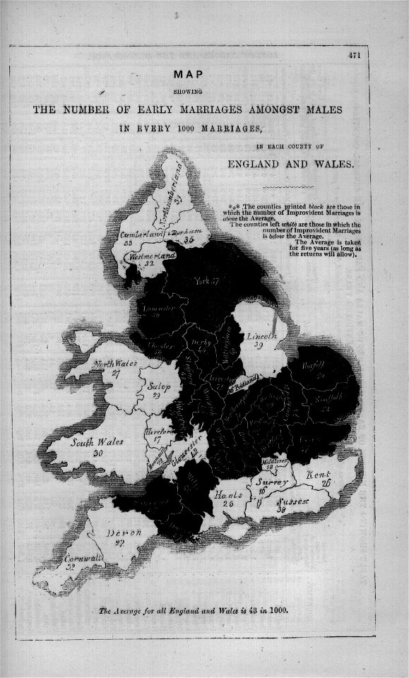
maps in london labour and the london poor (1851)
a map of imola (rcin 912284)
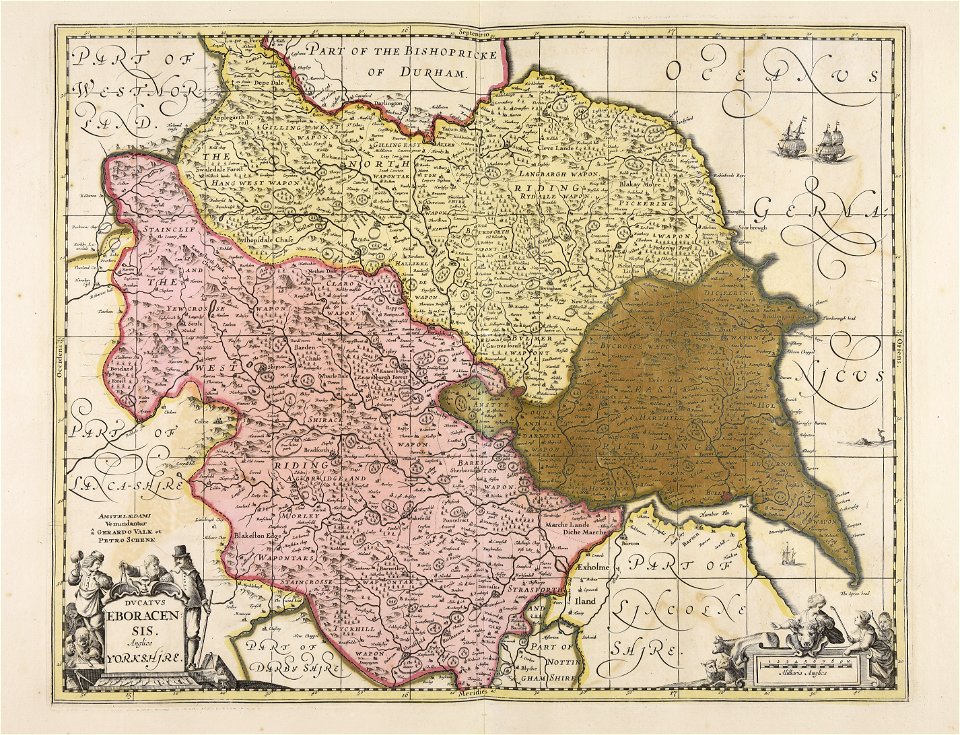
maps by willem and johannes blaeu
atlas van loon
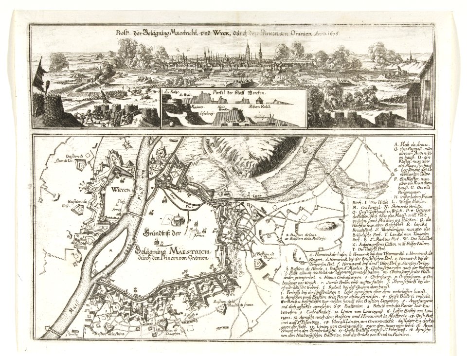
17th-century maps of maastricht
maps of the franco-dutch war
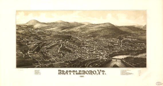
brattleboro
vermont
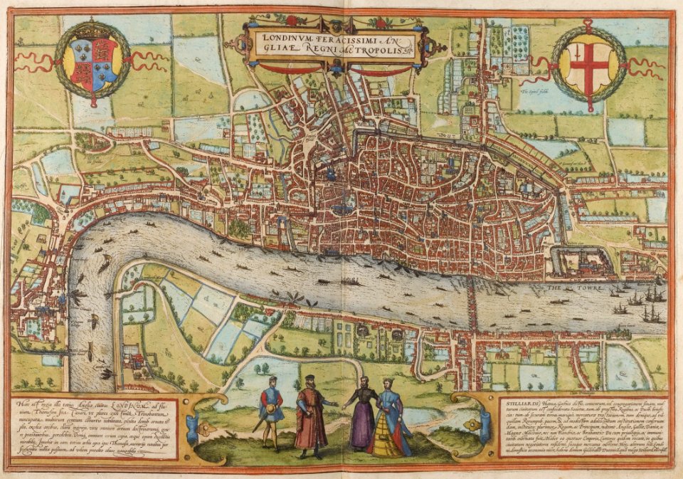
map of london by braun & hogenberg
1572 in london
charts and maps of the royal museums greenwich
1572 maps
maps in the stadsarchief amsterdam
carolus allard
maps of the dutch east india company - mauritius
1638
maps of the dutch east india company - sri lanka
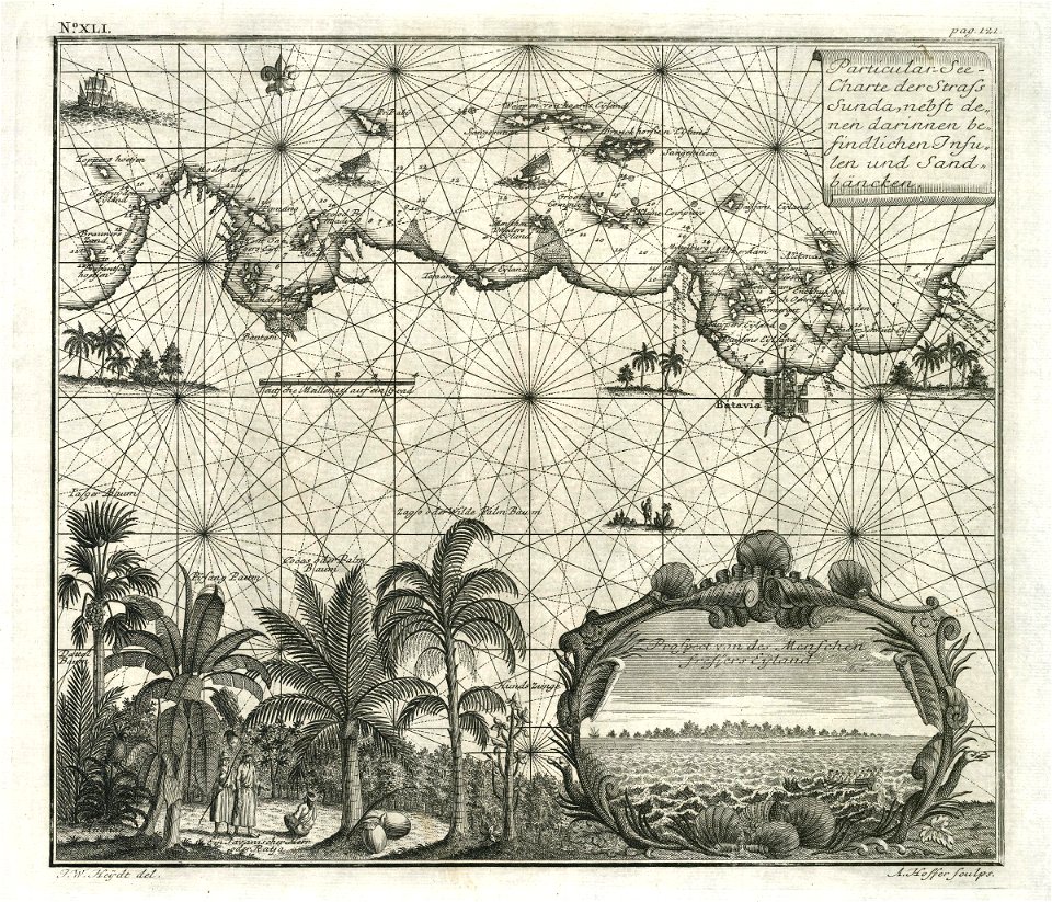
maps of the dutch east india company - indonesia
1720s
maps of the dutch east india company - indonesia
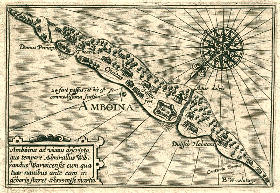
1614
maps of the west-indische compagnie
1705
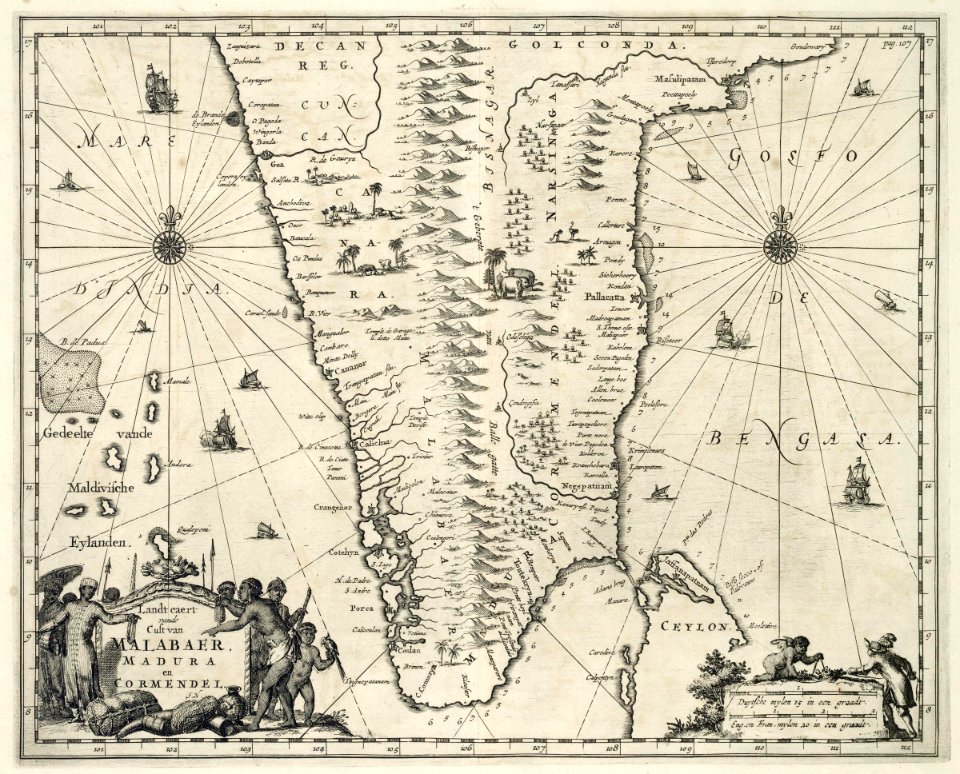
maps of the dutch east india company - india
1682)
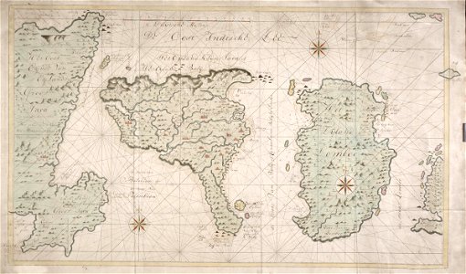
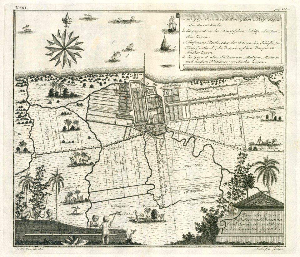
maps of the dutch east india company - indonesia
1744
maps of the dutch east india company - indonesia
1744
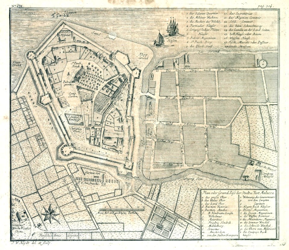
old maps of the dutch east india company - malaysia
1730s
old maps of the dutch east india company
1724
maps of the west-indische compagnie
1716
old maps of the dutch east india company
1747)
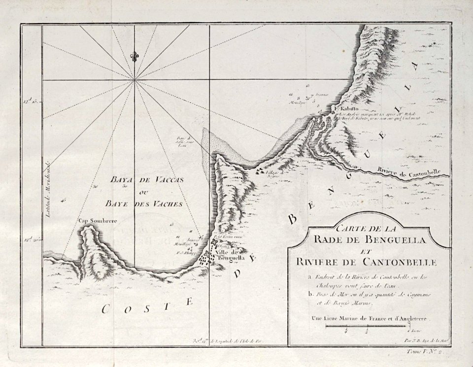
maps of the dutch east india company - mozambique
1747)
maps of the dutch east india company - india
1755
maps of the west-indische compagnie
1773
maps of the west-indische compagnie
1732
old maps of the dutch east india company
1622
maps of the west-indische compagnie
1773
maps of the west-indische compagnie
1746
charts and maps of the royal museums greenwich
1682 maps
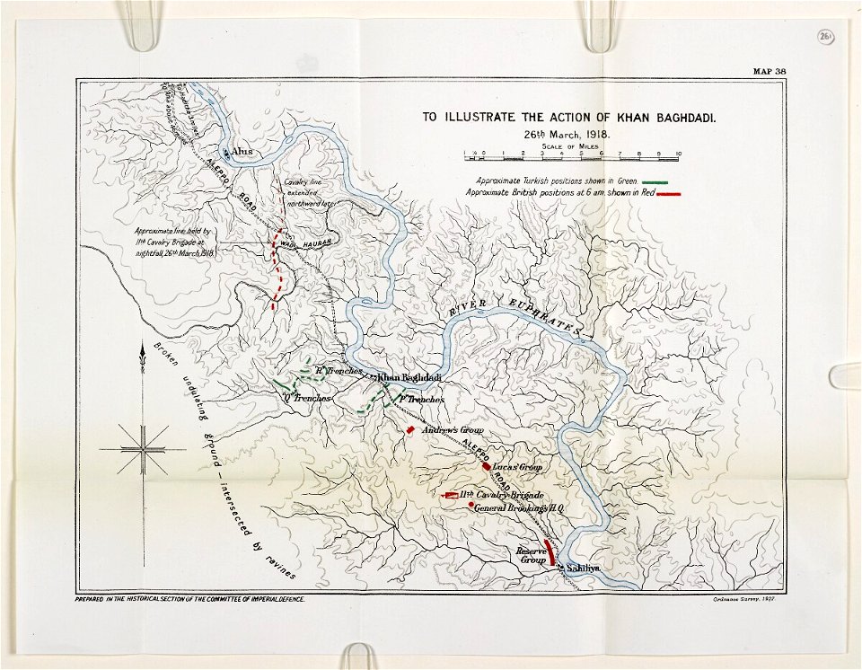
mesopotamian campaign maps of world war i
images from bristol past and present (1882)
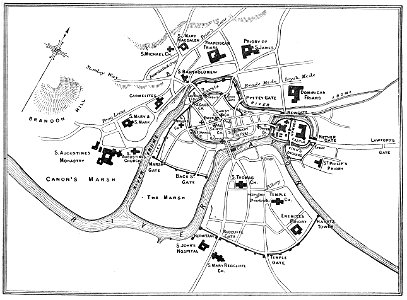
old maps of bristol
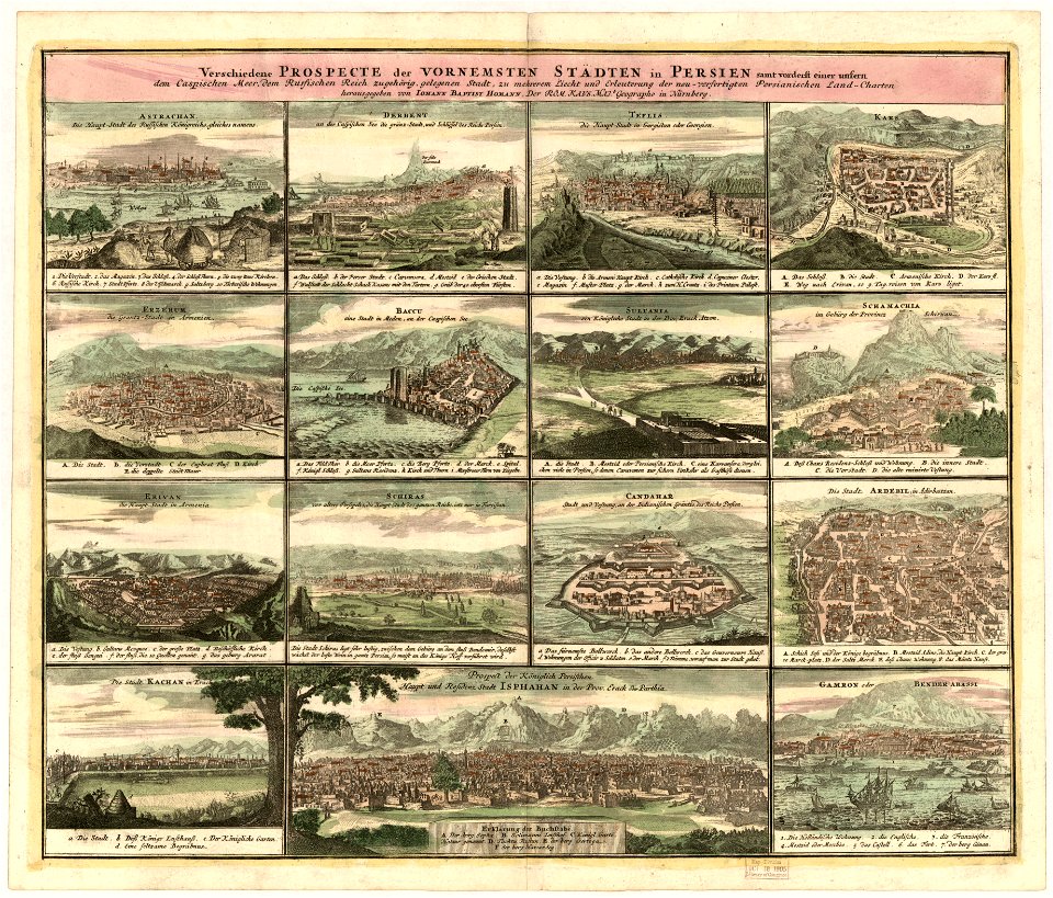
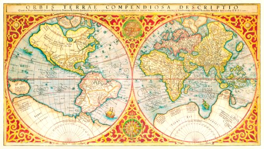
cosmographia (1600) by sebastian münster
1600 maps of iran
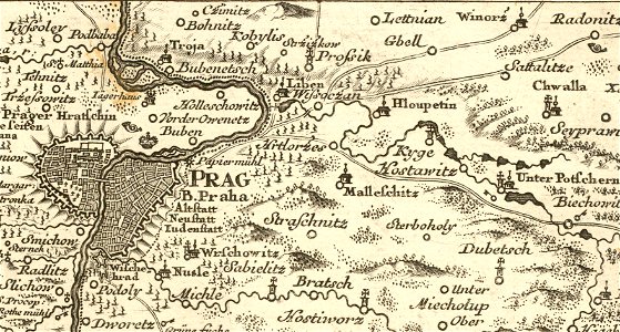
details of müller's map of bohemia
history of hloubětín
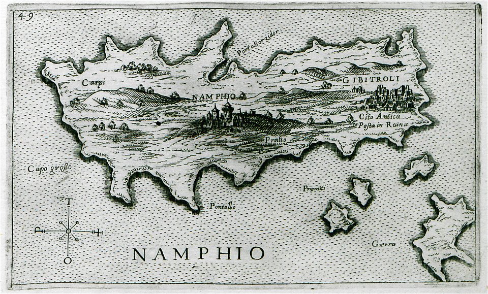
old maps of islands of the aegean sea
giuseppe rosaccio
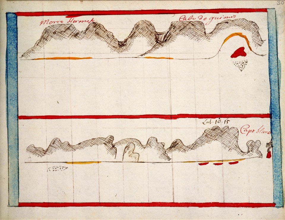
charts and maps of the royal museums greenwich
1682 maps
olfert dapper
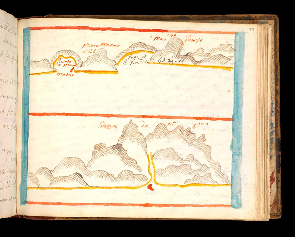
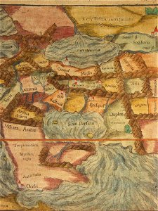
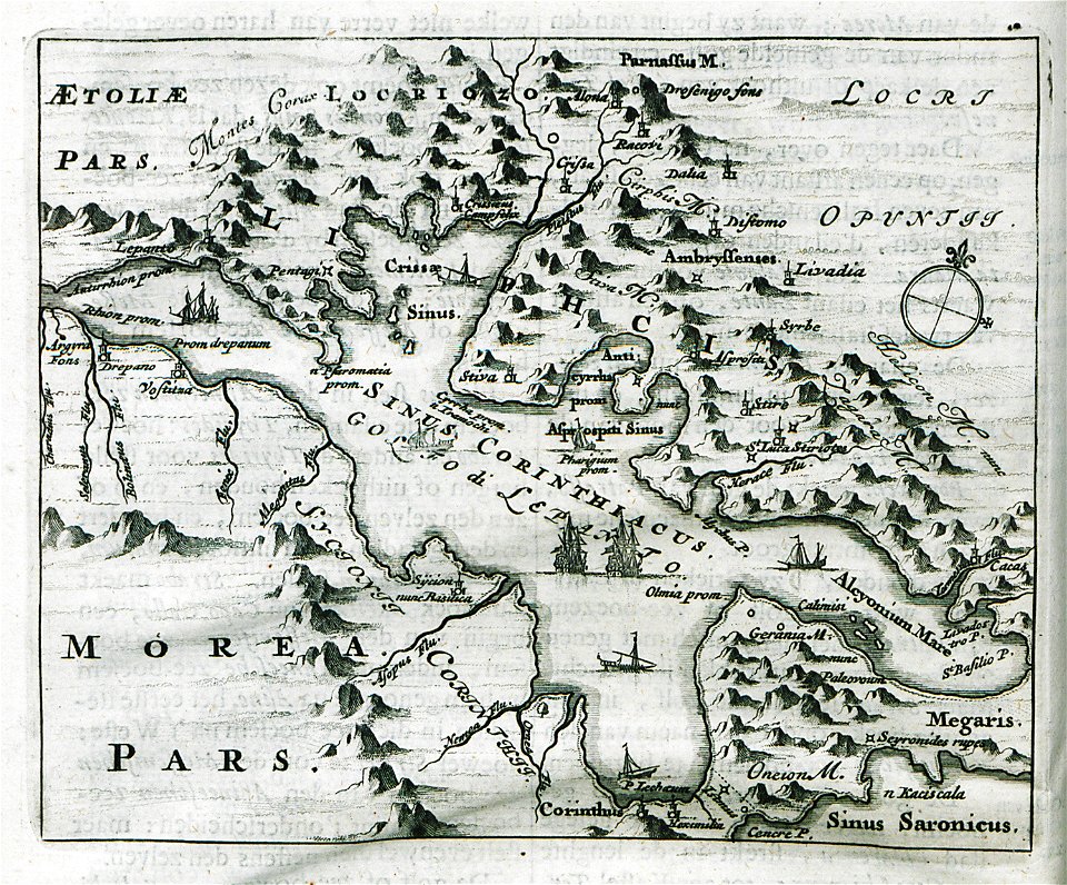
morea
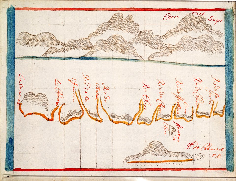
charts and maps of the royal museums greenwich
1682 maps
charts and maps of the royal museums greenwich
1682 maps
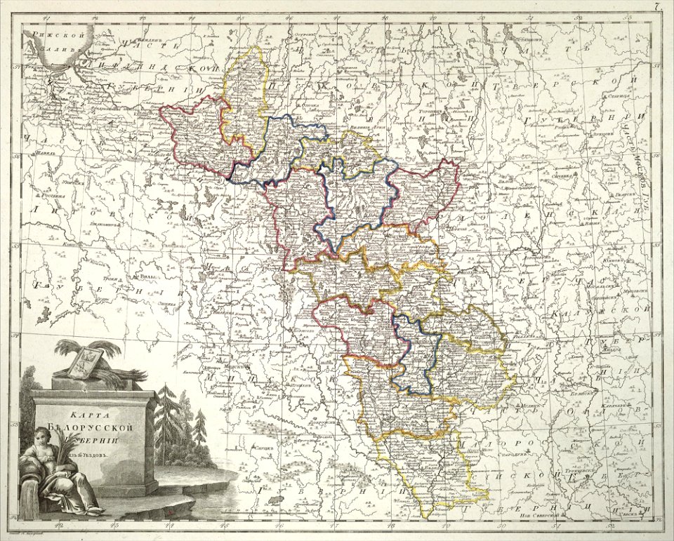
atlas of the russian empire (1800)
old maps of belarus
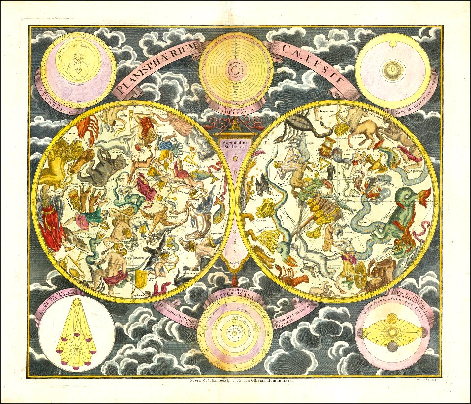
georg christoph eimmart
old celestial maps
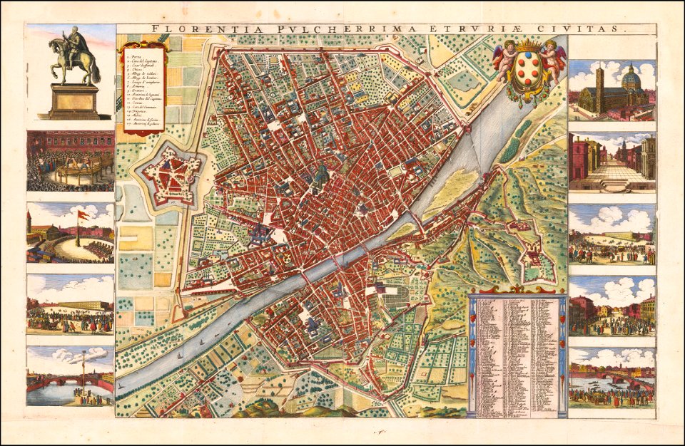
florence in the 1660s
wenzel hollar
drawings in the universitätsbibliothek salzburg
maps made in the 17th century
paintings in the art gallery of south australia
old map
der neue brockhaus 1937
maps by brockhaus
franciscan cadastral maps of slovenia
cekin mansion
maps by willem and johannes blaeu
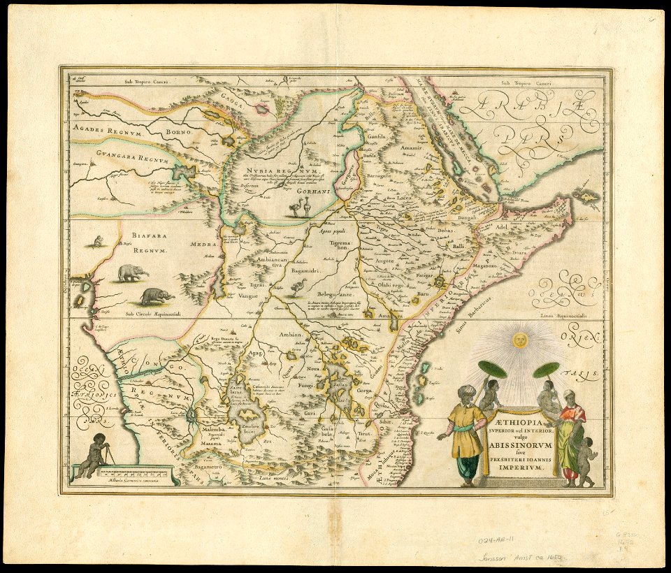
1650 maps of ethiopia
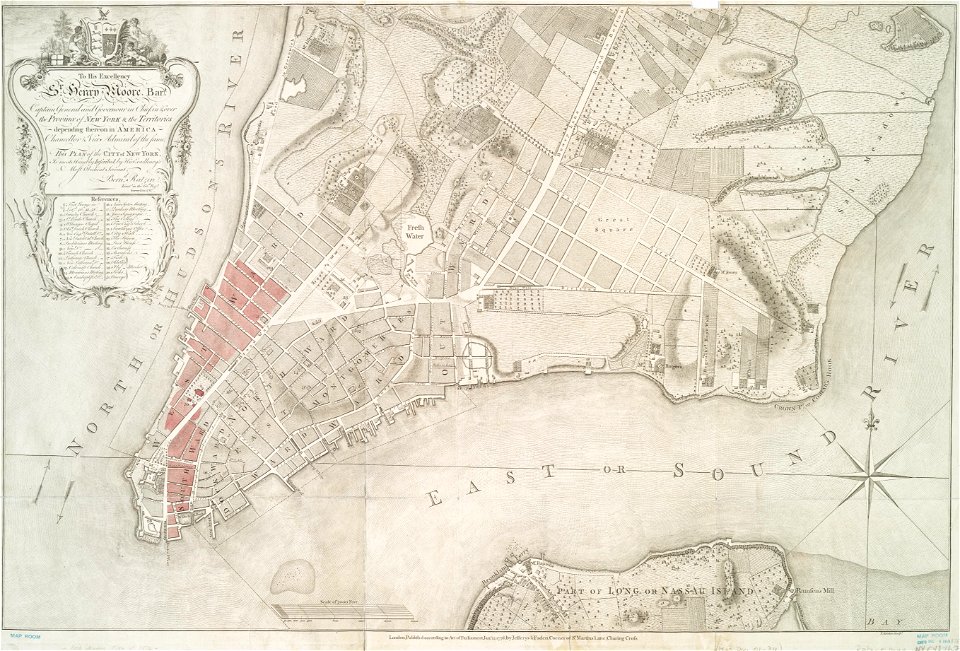
new york
carthage
charts and maps of the royal museums greenwich
1682 maps
charts and maps of the royal museums greenwich
1682 maps
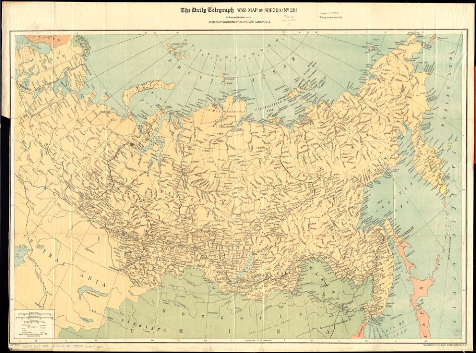
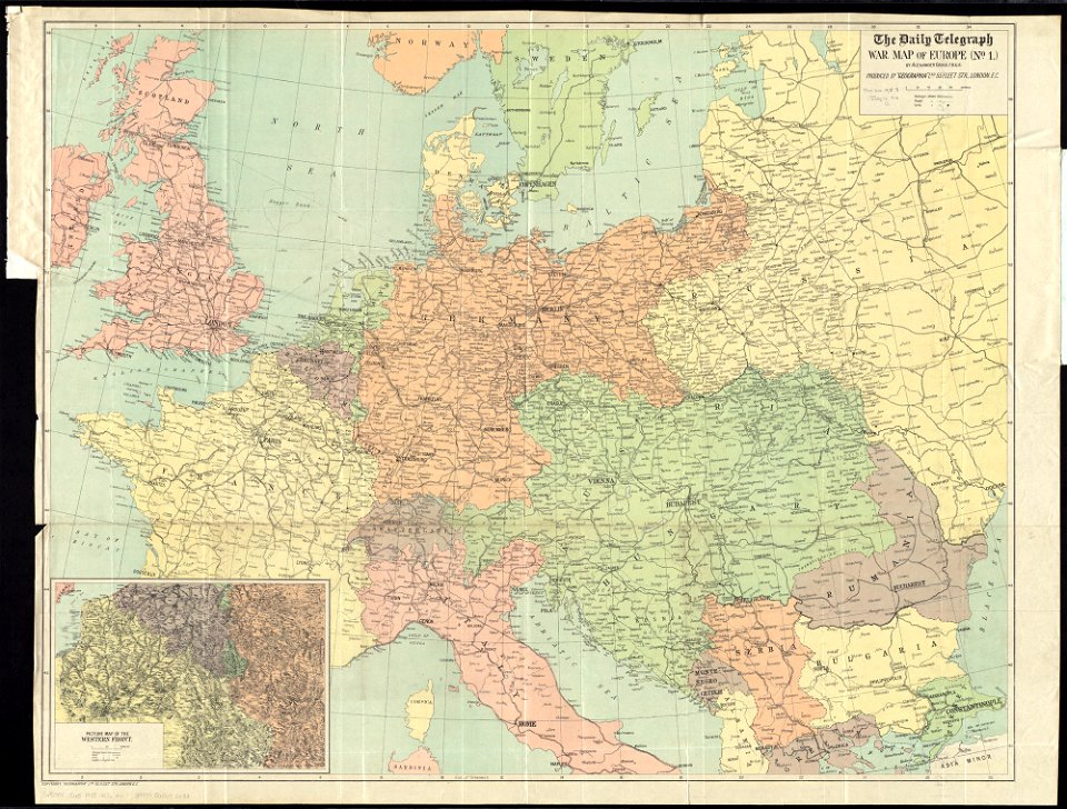
maps of world war i by the daily telegraph
maps of world war i by the daily telegraph
maps in the library of congress
1762 maps
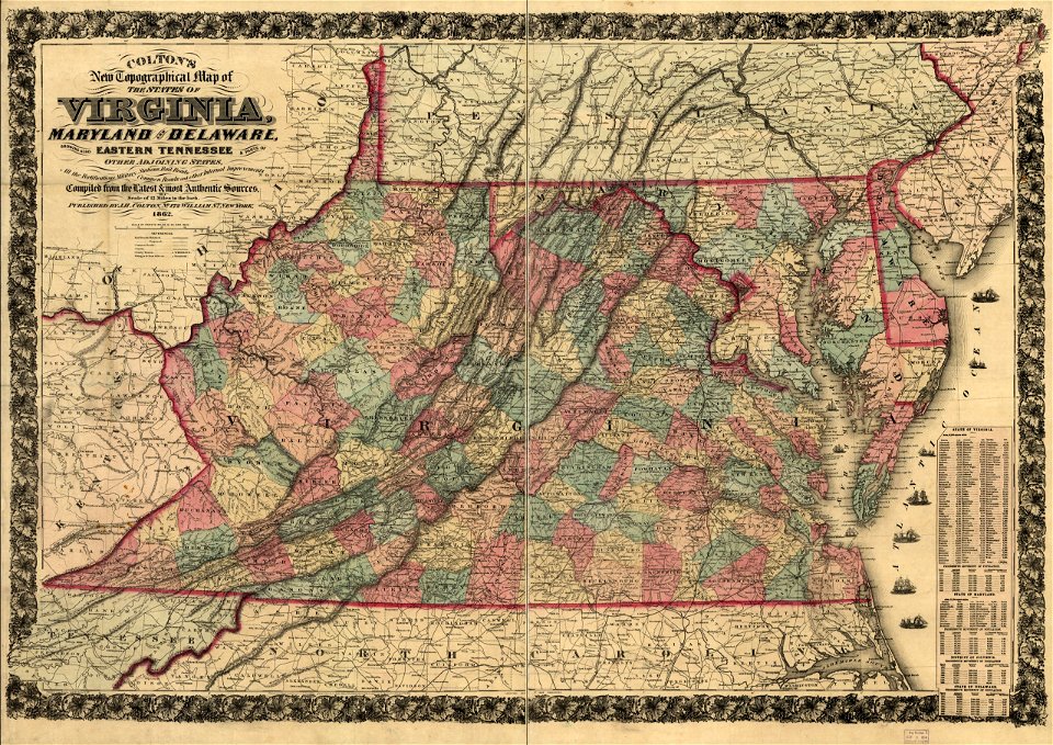
maps in the library of congress
1863 maps of virginia
charts and maps of the royal museums greenwich
1730 maps
charts and maps of the royal museums greenwich
1621 maps
charts and maps of the royal museums greenwich
1600 maps
charts and maps of the royal museums greenwich
1730 maps
charts and maps of the royal museums greenwich
1589 maps
charts and maps of the royal museums greenwich
1682 maps
charts and maps of the royal museums greenwich
1682 maps
old maps published in the gallia christiana
maps of catholic dioceses of france
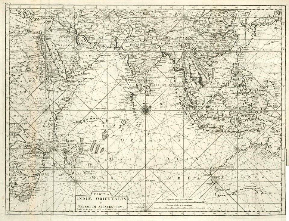
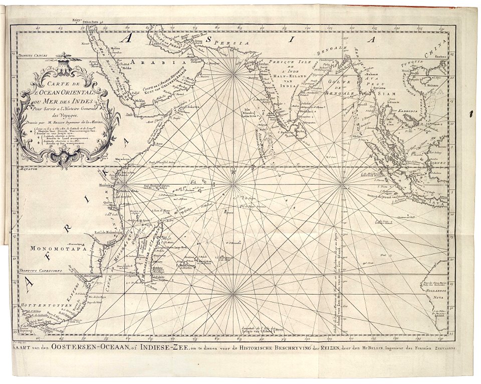
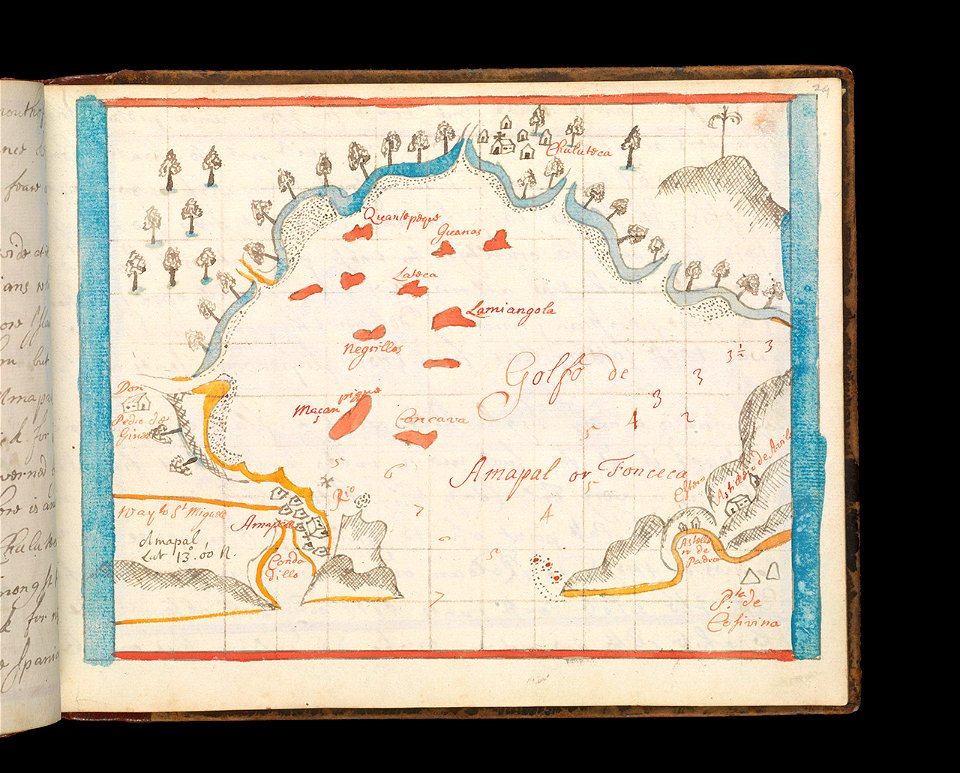
old maps of the indian ocean
robert surcouf
old maps published in the gallia christiana
maps of catholic dioceses of france
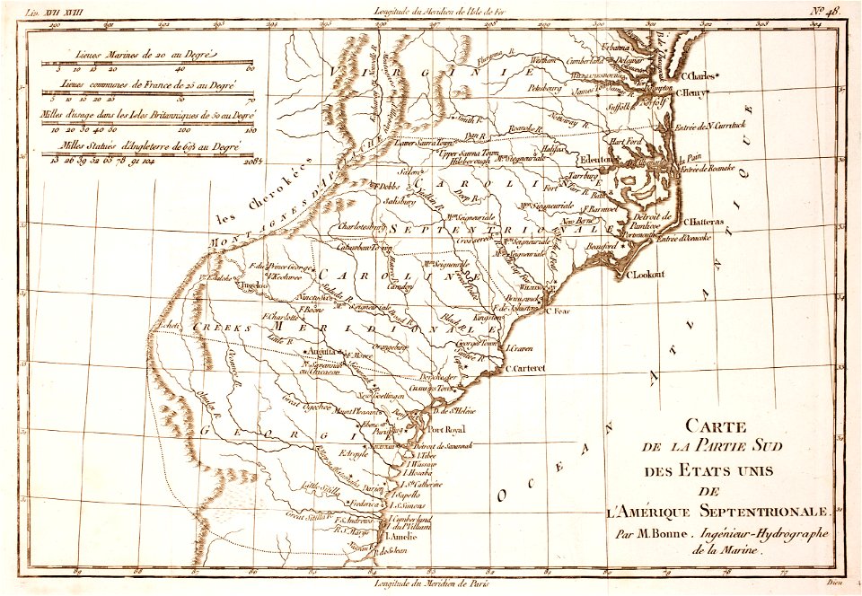
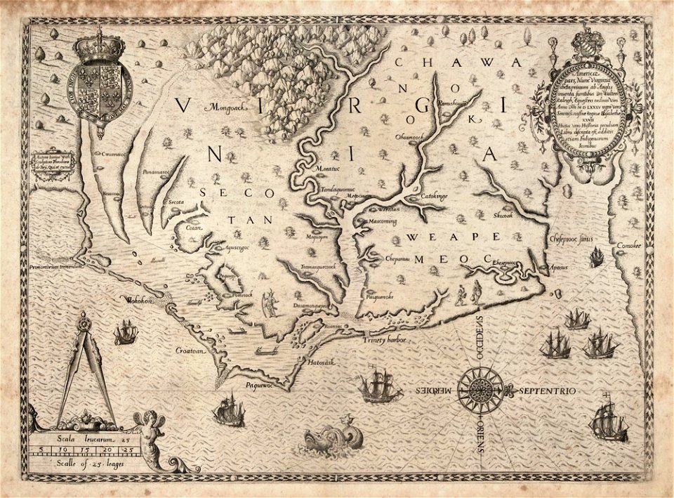
18th-century maps of north carolina
1780 maps
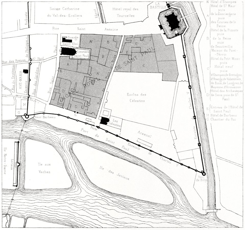
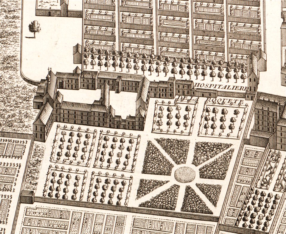
quartier de l'arsenal
bastille
illustration
maps
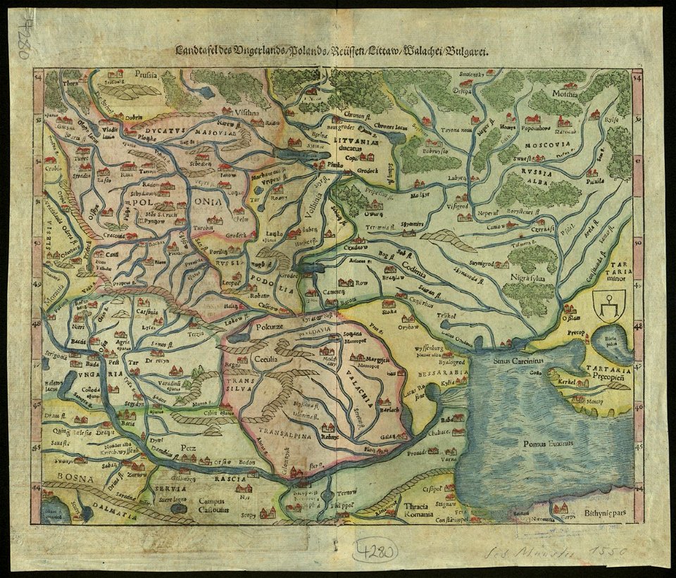
maps by sebastian münster
old maps of slovakia
maximilien de béthune
duc de sully
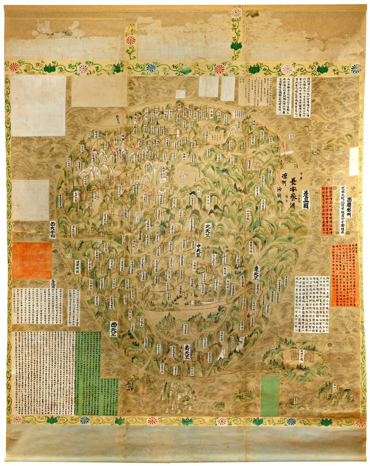
old maps of japan
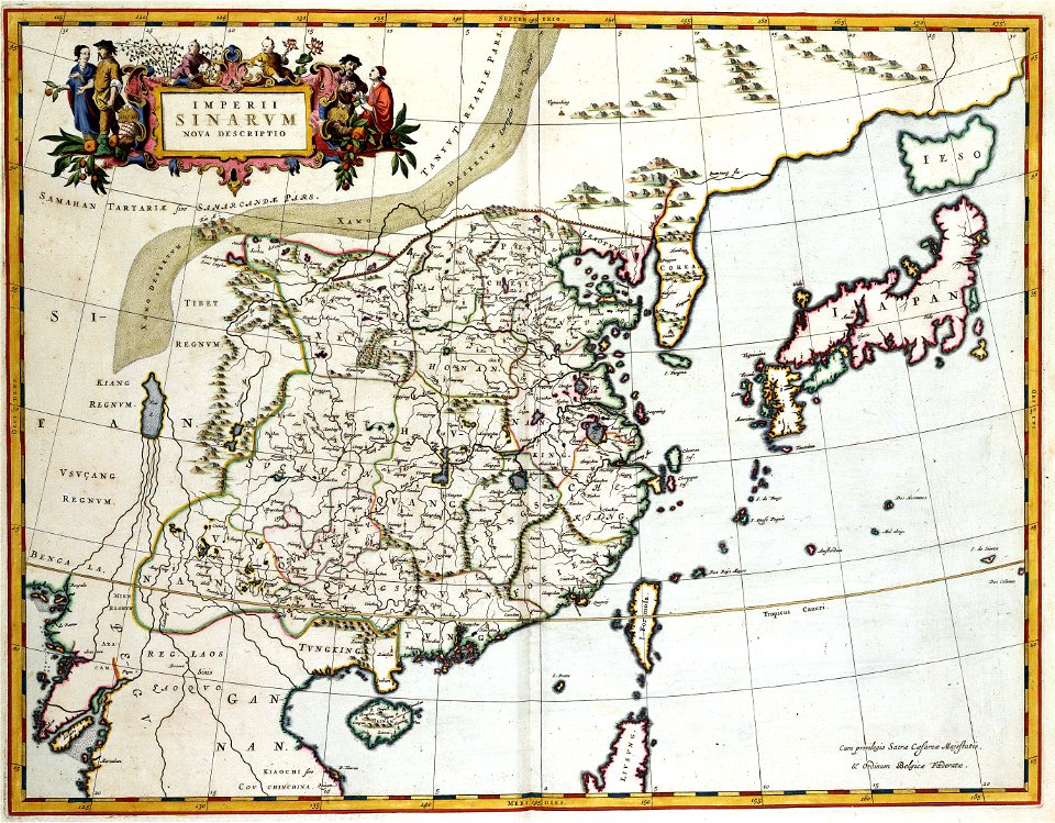
old maps of china
maps with cartouches
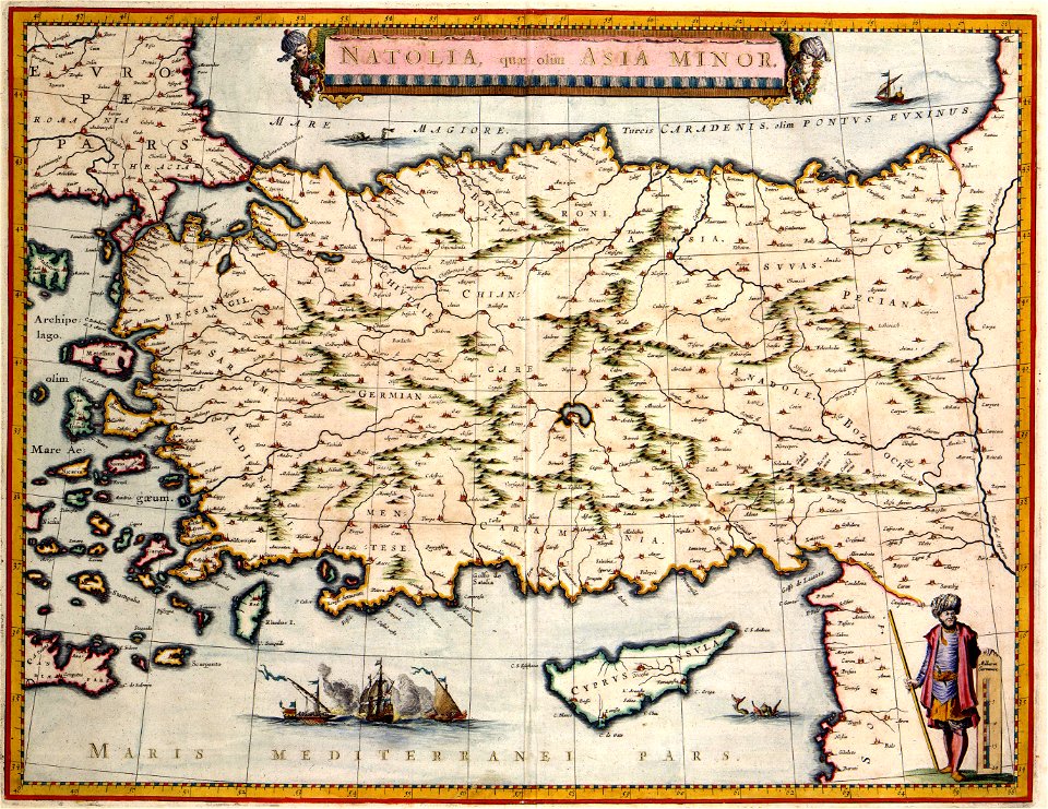
old maps of turkey
atlas van der hagen (volume 4)
maps with cartouches
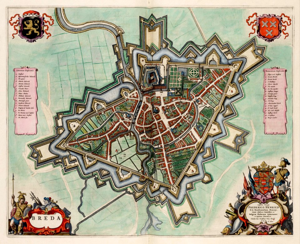
coats of arms of breda
netherlands
bruce county
ontario
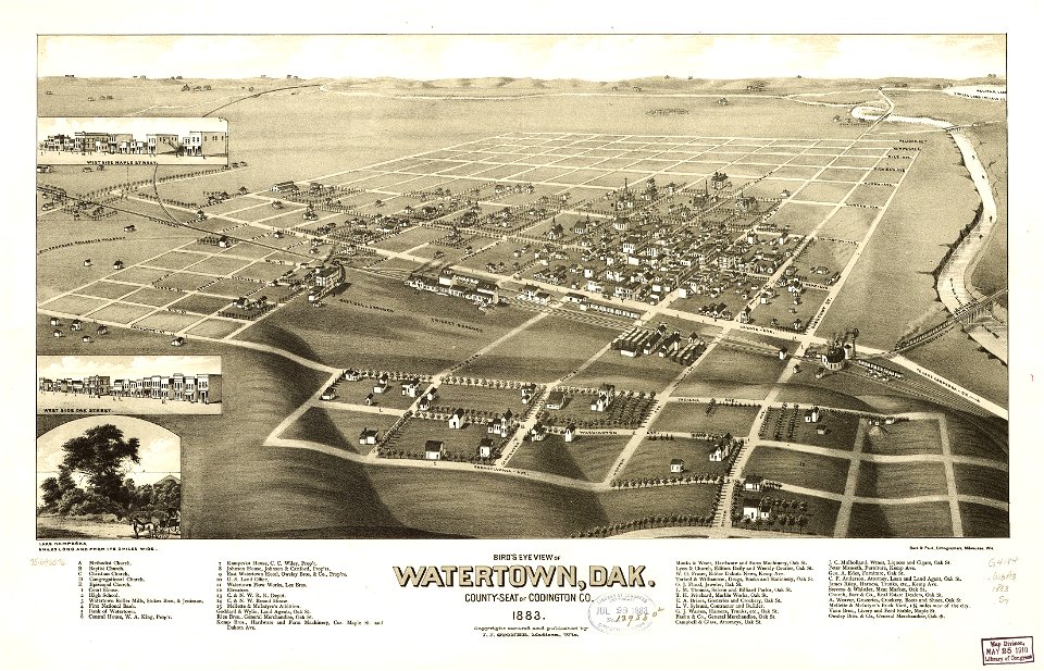
south dakota
watertown
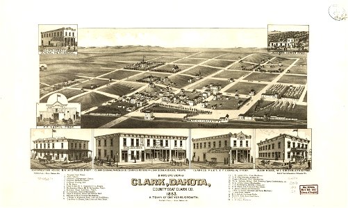
south dakota
clark
north carolina
core
norman b. leventhal map center – derivative files
turgot map of paris
maps made in the 17th century
gerard valck
hand-drawn maps and views of world war i battlefields by h.m.
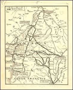
old maps of cameroon
maps made in the 17th century
gulf of trieste
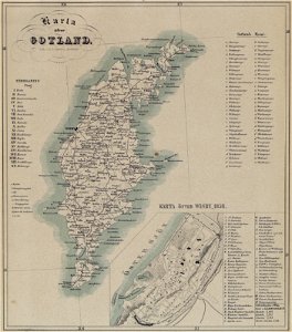
maps of gotland
pehr arvid säve
dutch 17th-century prints in the rijksmuseum amsterdam
netherlands
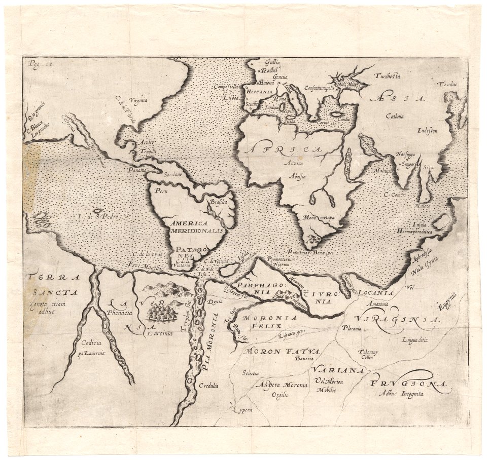
cornell: persuasive cartography: the pj mode collection
1681 maps
fires in new york (state)
new york city
maps made in the 17th century
gerard valck
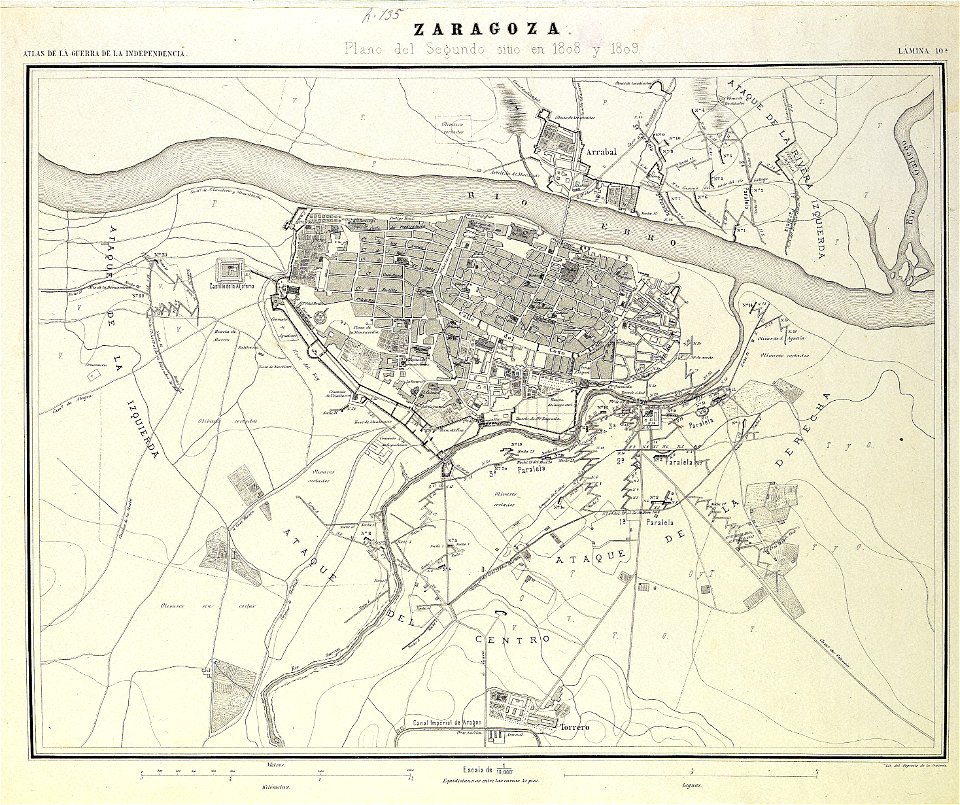
second siege of zaragoza
1868
cornell: persuasive cartography: the pj mode collection
cornell university library
maps made in the 17th century
maps by nicolaes visscher i
cornell university library
puritan
maps with cartouches
atlas van der hagen
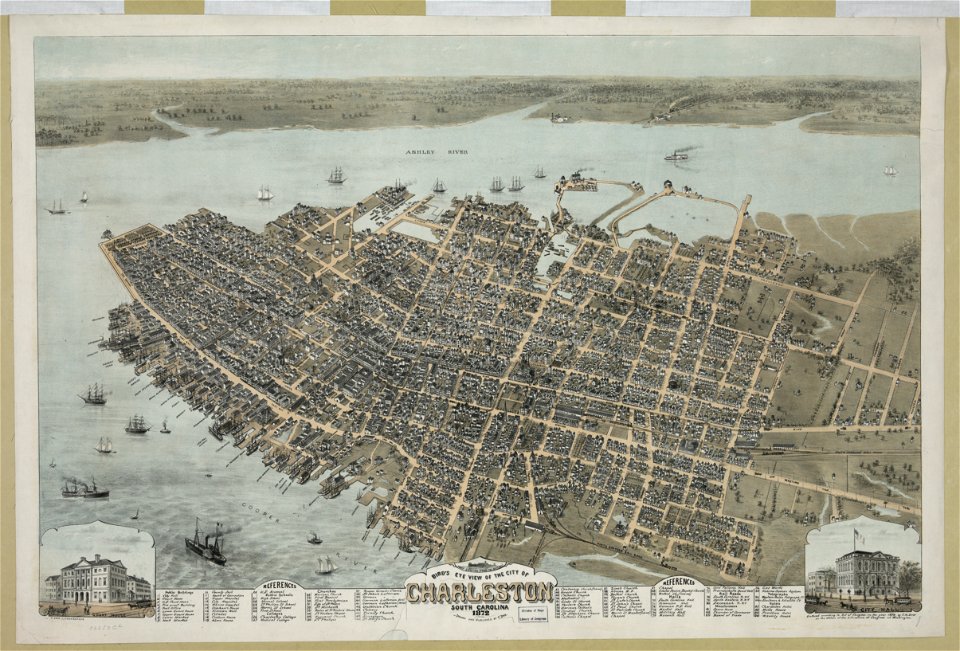
south carolina
charleston
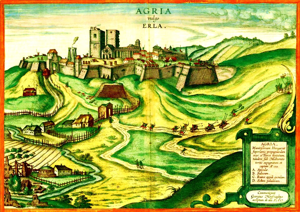
maps and topographical views by joris hoefnagel
braun & hogenberg
maps with cartouches
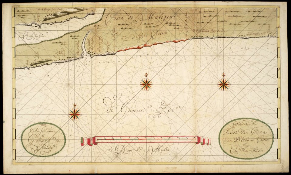
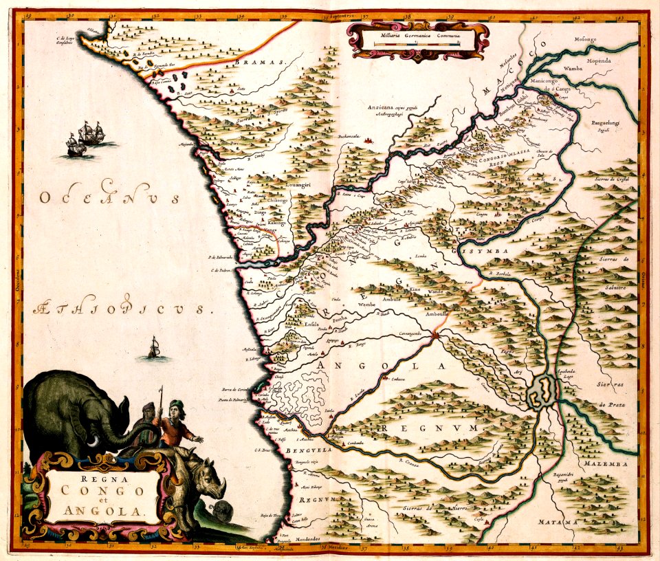
old maps of angola
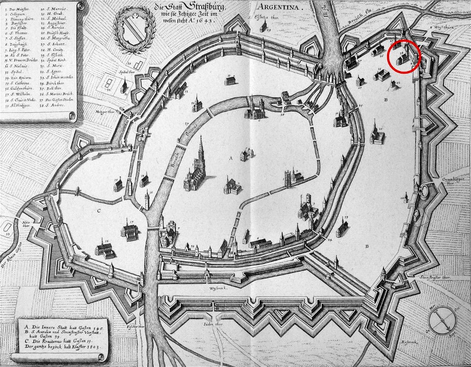
église sainte-aurélie
strasbourg
maps in the library of congress
1862 maps
maps made in the 17th century
gerard valck
4301 - 4400 of 38,713
Next page
/ 388