Log in
All resources
Create a design
36,882 Free Artworks of Map
bibliothèque nationale de france
philippe de la rué
john rocque
john rocque's 1748 map of london and adjacent country
remigius parr
a map of the british empire in america with the french and spanish settlements adjacent thereto
maps in the library of congress
turgot map of paris, kyoto university library – derivative files
curt teich postcard archives
postcards with 2 images
john rocque's 1748 map of london and adjacent country
remigius parr
john rocque's 1748 map of london and adjacent country
remigius parr
john rocque's 1748 map of london and adjacent country
remigius parr
john rocque's 1748 map of london and adjacent country
remigius parr
john rocque's 1748 map of london and adjacent country
remigius parr
john rocque's 1748 map of london and adjacent country
remigius parr
john rocque's 1748 map of london and adjacent country
remigius parr
john rocque's 1748 map of london and adjacent country
remigius parr
john rocque's 1748 map of london and adjacent country
remigius parr
john rocque's 1748 map of london and adjacent country
remigius parr
john rocque's 1748 map of london and adjacent country
remigius parr
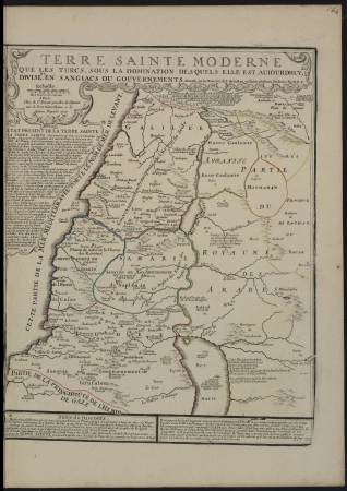
map of modern syria by philippe de la rué
bibliothèque nationale de france
map of modern syria by philippe de la rué
bibliothèque nationale de france
map of modern syria by philippe de la rué
bibliothèque nationale de france
map of paris by jouvin de rochefort (boutier 112)
pont de grammont
collège de lisieux
collège du plessis
postcards of aircraft
map postcards
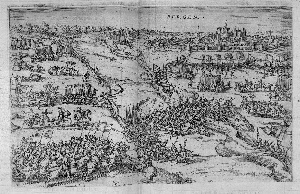
polish-russian war 1609-1618
sigismund's map of moscow
the annals of the voyages of the brothers zeno (1898)
fra mauro map derivative works
map of paris by braun & hogenberg - derivative files
rue des archives (paris)
hôtel de choiseul (rue de richelieu)
salle favart i
a map of the british empire in america with the french and spanish settlements adjacent thereto
maps in the library of congress
a map of the british empire in america with the french and spanish settlements adjacent thereto
maps in the library of congress
seventh map of paris from traité de la police
geographic overlays
historical images of hoher markt (vienna)
engravings of vienna
turgot map of paris, kyoto university library – derivative files
couvent des filles-saint-thomas
map of ancient assyria by philippe de la rué
old maps of mesopotamia
henricus hondius ii, nova totius terrarum orbis geographica ac hydrographica tabula, 1630
eran laor cartographic collection
old submaps of paris 1er arrondissement
paris in the 18th century
a map of the british empire in america with the french and spanish settlements adjacent thereto
maps in the library of congress
a map of the british empire in america with the french and spanish settlements adjacent thereto
maps in the library of congress
a map of the british empire in america with the french and spanish settlements adjacent thereto
maps in the library of congress
map of ancient assyria by philippe de la rué
old maps of mesopotamia
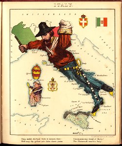
old maps of italy
pictorial maps
french-language maps from ios map collection
old maps of carinthia
postcards of motels in california
curt teich postcard archives
map of maastricht by willem and johannes blaeu (1649)
jekerkwartier (maastricht)
map of maastricht by willem and johannes blaeu (1649)
meuse river in maastricht
the comprehensive history of england (1876)
historical images of st. james's palace
map of ancient armenia by philippe de la rué
bibliothèque nationale de france
map of ancient assyria by philippe de la rué
bibliothèque nationale de france
a new & correct map of england and wales (foster)
1750s maps of england
maps from traité de la police, bibliothèque nationale de france
sixth map of paris from traité de la police
atlas des anciens plans de paris by imprimerie nationale, 1880 from bhvp
dheulland map of paris
1794 maps of the holy roman empire
english-language maps of europe
map of paris by braun & hogenberg - derivative files
rue des archives (paris)
map of ancient armenia by philippe de la rué
bibliothèque nationale de france
map of ancient armenia by philippe de la rué
bibliothèque nationale de france
john rocque's 1748 map of london and adjacent country
a history of london (1884)
john rocque's 1748 map of london and adjacent country
a history of london (1884)
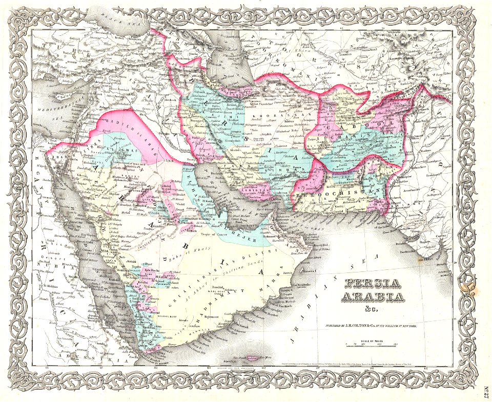
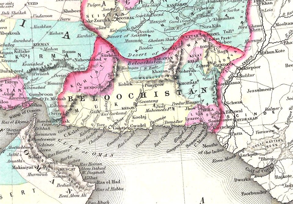
old maps of balochistan
old maps of asia
old submaps of paris 5e arrondissement
porte saint-victor (paris)
british library king's topographical collection
map of paris by françois van hoey
a map of the british empire in america with the french and spanish settlements adjacent thereto
maps in the library of congress
a map of the british empire in america with the french and spanish settlements adjacent thereto
maps in the library of congress
historical images of the place dauphine (paris)
place dauphine on maps
curt teich postcard archives, curt teich & company
postcards of cook county, illinois
nicolas sanson. “mappe-monde, ou carte generale du monde.”
1667 map of madagascar by guillaume sanson
postcards of elk city, oklahoma
curt teich postcard archives
etchings in the rijksmuseum amsterdam
maps in the rijksmuseum amsterdam
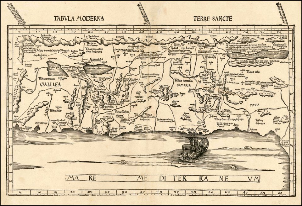
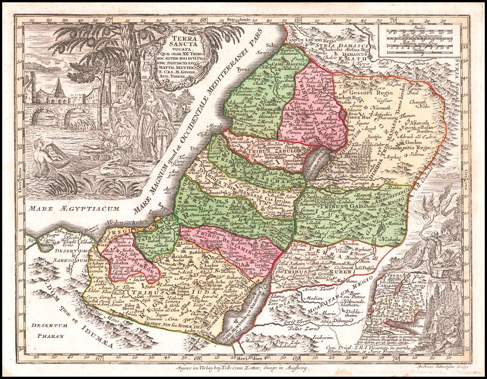
1720s maps of palestine
nicolas de fer
map of maastricht by willem and johannes blaeu (1649)
grote gracht (maastricht)
turgot map of paris, kyoto university library – derivative files
plans of the palais des tuileries
john rocque's 1746 map of london
details of old maps of london
cartography
maps
map of maastricht by willem and johannes blaeu (1649)
kleine gracht (maastricht)
a map of the british empire in america with the french and spanish settlements adjacent thereto
maps in the library of congress
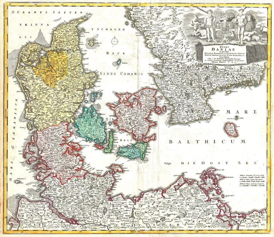
cartes generales de toutes les parties du monde (1658)
1650s maps of saxony
postcards of madison county, illinois
curt teich postcard archives
lawrence h. slaughter collection of english maps, charts, globes, books and atlases
nypl lionel pincus and princess firyal map division
postcards of creek county, oklahoma
curt teich postcard archives
paintings by antônio parreiras in the museu antônio parreiras
1910s paintings by antônio parreiras
map of ancient asia minor by philippe de la rué
bibliothèque nationale de france
windmills in amsterdam
singelgracht
english-language maps
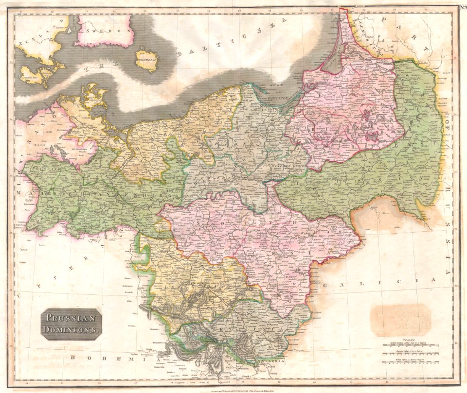
old maps of prussia
turgot map of paris, kyoto university library – derivative files
hôtel de guénégaud (quai de nevers)
backs of postcards in curt teich postcard archives
postcards of clinton, oklahoma
map of ancient asia minor by philippe de la rué
bibliothèque nationale de france
postcards of navajo county, arizona
curt teich postcard archives
bern city map of 1638 by matthäus merian
baroque
a map of the british empire in america with the french and spanish settlements adjacent thereto
1730s maps of the caribbean
italian-language maps
maps with cartouches
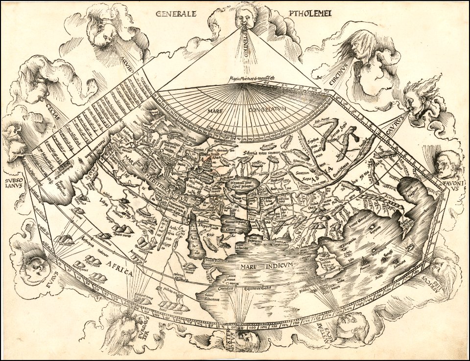
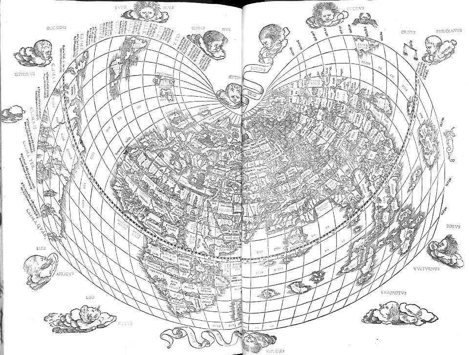
1510s maps of the world
ptolemaic world maps
old maps of balochistan
old maps of asia
map of ancient asia minor by philippe de la rué
bibliothèque nationale de france
maps
city
backs of postcards in curt teich postcard archives
postcards of miami, oklahoma
beschreibung der städt der welt - braun & hogenberg - btv1b52512111k
hierosolyma clarissima totius map by braun & hogenberg
beschreibung der städt der welt - braun & hogenberg - btv1b52512111k
hierosolyma urbs sancta map by braun & hogenberg
map of ancient asia minor by philippe de la rué
bibliothèque nationale de france
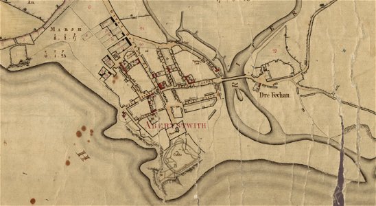
estate maps in the national library of wales
estate maps
1870s maps of australia
1879 maps
map of maastricht by willem and johannes blaeu (1649)
jekerkwartier (maastricht)
maps by martin waldseemüller
1513 maps
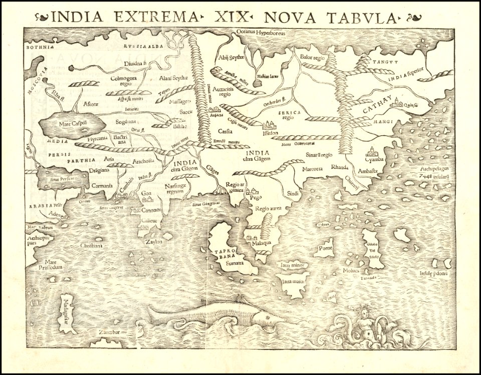
maps by sebastian münster
1540s maps of asia
map of ancient asia minor by philippe de la rué
bibliothèque nationale de france
bern city map of 1638 by matthäus merian
baroque
maps by matthäus seutter
1744 maps
maps by homannsche erben
latin-language maps
cartography
maps
2701 - 2800 of 36,882
Next page
/ 369


![[View of Paris]. / Franciscus Hoiamis fecit., François Van Hoey, 1619](https://cdn.creazilla.com/illustrations/10000789014/view-of-paris-franciscus-hoiamis-fecit-franois-van-hoey-1619-lg.jpg)