Log in
All resources
Create a design
38,713 Free Artworks of Map
bibliothèque nationale de france
maps of paris from bibliothèque nationale de france
environs de paris levés géométriquement by jean delagrive (1731-1742)
africa in the 1890s
maps of africa
maps from the earth and its inhabitants, vol. xii
eran laor cartographic collection
maps by willem and johannes blaeu
maps in the library of congress
old maps of friesland
maps from the earth and its inhabitants, vol. xii
sokoto
maps from the earth and its inhabitants, vol. v
nyoe
gemeente atlas van nederland - north holland
egmond-binnen
guillaume sanson
1674 maps
atlas géographique des quatre parties du monde (delisle)
18th-century maps of the iberian peninsula
maps by willem and johannes blaeu
1635 maps
hakodate city central library
maps by takeshiro matsuura
bird's eye view of knoxville, tennessee, 1886
maps in the library of congress
old maps of southeast asia
jacobus van der schley
curt teich postcard archives
map postcards
maps by willem and johannes blaeu
old maps of friesland
second geological survey of pennsylvania report of progress ppp
james hall
curt teich postcard archives
leather postcards
maps by willem and johannes blaeu
old maps of friesland
1770s maps of the americas
1775 maps
maps in the library of congress
1770s maps showing history
maps of vangiones by sanson
1670s maps of hesse
old maps of the republic of genoa
maps by alexis-hubert jaillot
maps of neuf-brisach city walls
leonhard christoph sturm
eran laor cartographic collection
giovanni maria cassini
eran laor cartographic collection
jacob peeters
engravings by romeyn de hooghe
engravings by jan luyken
eran laor cartographic collection
giovanni maria cassini
eran laor cartographic collection
richard william seale
still-life paintings in the museum of fine arts, ghent
alfred verhaeren
eran laor cartographic collection
giovanni maria cassini
ignatius van der stock
1661 paintings
algiers in the 16th century
martino rota
greifswald in the 17th century
old maps of greifswald
old maps of deventer
renaissance
watercolor drawings by johannes vingboons
old maps of gorée
maps of jerez by braun & hogenberg
maps of conil by braun & hogenberg
sanson maps of the netherlands
1670s maps of the netherlands
maps in the library of congress
1708 maps
maps by pieter mortier
maps from gallica
1780s maps of italy
maps by juan lopez
maps of the dutch east india company - bengal
maps of the dutch east india company - india
rail transport maps of senegal
19th-century maps of senegal
maps by pieter mortier
maps from gallica
maps of the course of the rhine by guillaume sanson
bibliothèque nationale de france
1770s maps of morocco
maps by tomas lopez
map of the circle of upper saxony by sanson
1700s maps of saxony
maps from the earth and its inhabitants, vol. xiv
maps of voyages
sanson maps of north america
maps by nicolas sanson
1750s maps of the netherlands
18th-century maps of zeeland
atlas ou representation du monde universel t. 1 (1633)
17th-century double hemisphere world maps
maps of alcanerilla by braun & hogenberg
context files from gallica
maps of ancient israel by philippe de la rué
eran laor cartographic collection
cartouche (cartography)
cornelis de jode
le antichità romane (piranesi)
neoclassicism
the british monarchy (1743)
maps in the british museum
old maps of the republic of genoa
maps by willem and johannes blaeu
17th-century maps of crete
old maps of candia
maps by willem and johannes blaeu
old maps of friesland
1780s maps of the americas
1787 maps
map of the circle of the rhineland by sanson
1670s maps of rhineland-palatinate
1650s maps of the balkans
philippe de la rué
old maps of the republic of genoa
maps by alexis-hubert jaillot
civitates orbis terrarum. urbium praecipuarum totius mundi. liber quartus
old maps of ancient rome (city)
maps of pangong tso
old maps of ladakh
giovanni battista rossi
1890s maps of yemen
a picturesque tour along the river ganges and jumna in india (1824)
s. j. neele & son
environs de paris levés géométriquement by jean delagrive (1731-1742)
maps of paris from bibliothèque nationale de france
environs de paris levés géométriquement by jean delagrive (1731-1742)
maps of paris from bibliothèque nationale de france
environs de paris levés géométriquement by jean delagrive (1731-1742)
maps of paris from bibliothèque nationale de france
1884 pacific typhoon season track maps
1884 in taiwan
maps from the earth and its inhabitants, vol. xii
africa in the 1890s
environs de paris levés géométriquement by jean delagrive (1731-1742)
maps of paris from bibliothèque nationale de france
environs de paris levés géométriquement by jean delagrive (1731-1742)
maps of paris from bibliothèque nationale de france
illustrations from the archipelago on fire by léon benett
old maps of greece
maps from the earth and its inhabitants, vol. xii
africa in the 1890s
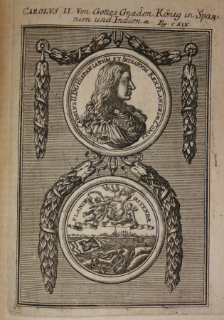
engravings of charles ii of spain
description de l'universe
maps by jakob van der schley
maps of the spratly islands
media contributed by university of illinois urbana-champaign university library
1830 maps of africa
media contributed by university of illinois urbana-champaign university library
1830s maps of egypt
bibliothèque nationale de france
sanson map of lorraine
maps of the iberian peninsula by mercator-hondius
maps by pieter van der keere
maps of the iberian peninsula by mercator-hondius
maps by pieter van der keere
maps of braga by braun & hogenberg
maps from university of amsterdam special collections
atlas der neederlanden
maps of the history of north america
saint paul island (alaska)
maps in the library of congress
1776 maps of new york (state)
maps of bamberg by braun & hogenberg
maps of the caribbean by mercator-hondius
topographischer atlas der schweiz
maps of aletschgletscher
illustrations from the archipelago on fire by léon benett
old maps of greece
maps from the earth and its inhabitants, vol. x
1890s maps of the nile delta
maps from the earth and its inhabitants, vol. xi
africa in the 1890s
maps from the earth and its inhabitants, vol. xiii
africa in the 1890s
nouvelle géographie universelle, vol. viii
1876 maps of india
maps from the earth and its inhabitants, vol. vi
history of uzbekistan
maps of cefala by braun & hogenberg
fort são caetano
maps from the earth and its inhabitants, vol. xii
africa in the 1890s
maps from the earth and its inhabitants, vol. xi
africa in the 1890s
environs de paris levés géométriquement by jean delagrive (1731-1742)
maps of paris from bibliothèque nationale de france
maps from the earth and its inhabitants, vol. xii
africa in the 1890s
africa in the 1890s
maps of africa
environs de paris levés géométriquement by jean delagrive (1731-1742)
maps of paris from bibliothèque nationale de france
environs de paris levés géométriquement by jean delagrive (1731-1742)
maps of paris from bibliothèque nationale de france
environs de paris levés géométriquement by jean delagrive (1731-1742)
maps of paris from bibliothèque nationale de france
19501 - 19600 of 38,713
Next page
/ 388


![Gerardi Mercatoris and I. Hondii Atlas or Representation of the Universal World, and of the Parts of It, Made in Tables and Descriptions Very Ample, and Exact: Divided into Two Volumes [...]. [t. 1].](https://cdn.creazilla.com/illustrations/10000622971/gerardi-mercatoris-and-i-hondii-atlas-or-representation-of-the-universal-world-and-of-the-parts-of-it-made-in-tables-and-descriptions-very-ample-and-exact-divided-into-two-volumes-t-1-sm.jpg)


![Map of the Newly Remodeled Sea Dyke - Dutch Coastal Defenses, Hendrik de Leth, [1737]](https://cdn.creazilla.com/illustrations/10000604534/map-of-the-newly-remodeled-sea-dyke-dutch-coastal-defenses-hendrik-de-leth-1737-sm.webp)


