Log in
All resources
Create a design
38,713 Free Artworks of Map
description de l'universe
alain manesson mallet
bibliothèque nationale de france
copper engraving print
british library
joan blaeu
africa in the 1890s
maps of africa
1667 maps
maps of bamberg by braun & hogenberg
atlas maior, vol 9 (italy) - joan blaeu, 1667 - bl 114.h(star).9
1667 maps of italy
atlas maior, vol 9 (italy) - joan blaeu, 1667 - bl 114.h(star).9
1667 maps of italy
atlas maior, vol 6 (scotland and ireland) - joan blaeu, 1667 - bl 114.h(star).6
1667 maps
atlas maior, vol 6 (scotland and ireland) - joan blaeu, 1667 - bl 114.h(star).6
1667 maps
atlas maior, vol 7 (france i) - joan blaeu, 1667 - bl 114.h(star).7
1667 maps
atlas maior, vol 11 (asia) - joan blaeu, 1667 - bl 114.h(star).11
1667 maps
atlas maior, vol 4 (netherlands) - joan blaeu, 1667 - bl 114.h(star).4
1667 maps
atlas maior, vol 9 (italy) - joan blaeu, 1667 - bl 114.h(star).9
1667 maps of italy
maps of aden by braun & hogenberg
aden
bibliothèque nationale de france
1667 sanson map of africa
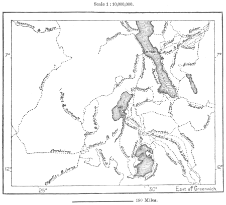
maps from the earth and its inhabitants, vol. xiii
africa in the 1890s
1770s maps of the caribbean
maps by thomas kitchin
a.de la motraye's travels through europe, asia, and into part of africa (1723) by la mottraye
realism
atlas van loon
kuinderburcht
the new forest, its history and its scenery
symbolism
bibliothèque nationale de france
maps by thomas kitchin
maps in the stadsarchief amsterdam
maps by carolus allard
maps from university of amsterdam special collections
atlas der neederlanden
charles william meredith van de velde
eran laor cartographic collection
prints by abraham allard in the rijksmuseum amsterdam
maps in the rijksmuseum amsterdam
maps by johannes vingboons
old maps of kochi, kerala
atlas maior, vol 2 (sweden, russia, poland, eastern europe, and greece) - joan blaeu, 1667 - bl 114.h(star).2
magni ducatus lithuaniae
history of samarkand
maps of samarkand
wały jagiellońskie street in gdańsk
maps of gdańsk by braun & hogenberg
maps from the earth and its inhabitants, vol. xii
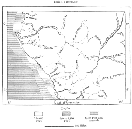
africa in the 1890s
maps from the earth and its inhabitants, vol. xiii
africa in the 1890s
maps from the earth and its inhabitants, vol. xi
africa in the 1890s
maps from géographie illustrée de la france et de ses colonies
maps of isère
maps from the earth and its inhabitants, vol. xii
africa in the 1890s
map of the german empire by louis stanislas d'arcy de la rochette
1773 maps of the holy roman empire
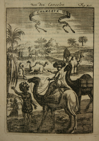
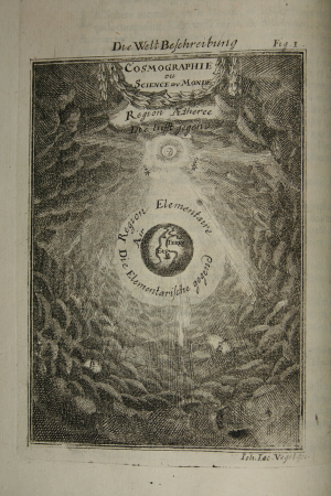
description de l'universe
africa in art
description de l'universe
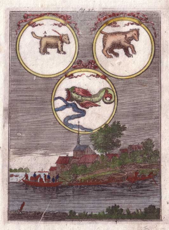
comets in art
description de l'universe
alain manesson mallet
description de l'universe
africa in art
description de l'universe
cosmography
description de l'universe
alain manesson mallet
description de l'universe
alain manesson mallet
description de l'universe
alain manesson mallet
john rocque's 1748 map of london and adjacent country
a history of london (1884)
description de l'universe
constellations in art
description de l'universe
alain manesson mallet
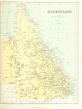
19th-century maps of queensland
australia (1873) by booth
our arctic province, alaska and the seal islands (1886)
old maps of alaska
our arctic province, alaska and the seal islands (1886)
old maps of alaska
description de l'universe
1685 in spain
maps from the earth and its inhabitants, vol. xiii
africa in the 1890s
maps from the earth and its inhabitants, vol. xii
africa in the 1890s
maps from the earth and its inhabitants, vol. xiii
africa in the 1890s
maps from the earth and its inhabitants, vol. x
geography of egypt
curt teich postcard archives
map postcards
19th-century maps of south australia
australia (1873) by booth
the cruise of the marchesa (1889)
19th-century maps of sulawesi
19th-century maps of tasmania
australia (1873) by booth
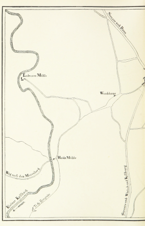
in the volcanic eifel. a holiday ramble (1896)
old maps of eifel
description de l'universe
africa in art
description de l'universe
alain manesson mallet
in the volcanic eifel. a holiday ramble (1896)
old maps of eifel
description de l'universe
cosmography
description de l'universe
alain manesson mallet
topographischer atlas der schweiz
eiger
maps of bamberg by braun & hogenberg
maps of bamberg by braun & hogenberg
maps of bamberg by braun & hogenberg
maps of rotterdam by braun & hogenberg
maps of gouda by braun & hogenberg
bibliothèque nationale de france
maps by thomas kitchin
maps of ancient italy by philipp clüver
old maps of the alps
turgot map of paris, kyoto university library – derivative files
collégiale saint-honoré
map of modern syria by philippe de la rué
1650s maps of palestine
old maps of north holland
abraham deur
maps of bamberg by braun & hogenberg
maps of bamberg by braun & hogenberg
paintings by wybrand hendriks
proveniershof, haarlem
maps of goa by linschoten
maps
vedute di roma (piranesi, ed. 1839)
neoclassicism
a.de la motraye's travels through europe, asia, and into part of africa (1723) by la mottraye
realism
bibliothèque nationale de france
guillaume sanson
east prospect of the city of philadelphia
independence hall in art
maps of heraklion by braun & hogenberg
maps of corfu by braun & hogenberg
gemeente atlas van nederland - groningen
maps of noordbroek
old maps of edinburgh
maps from gallica
grosser deutscher atlas
old maps of england
old maps of freiburg im breisgau
gregorius sickinger
kaart van het hoogheemraadschap van schieland, 1611-1635
17th-century maps of rotterdam
dheulland map of paris
maps by a. taride
bodleian maps collection
1610s maps of the world
atlas sive cosmographicae (gerardus mercator, 1623)
maps of corsica by gerardus mercator
old maps of auvergne
1660s maps of france
17th-century maps of southern africa
maps by willem and johannes blaeu
maps in the staats- und universitätsbibliothek hamburg
latin-language book pages
eran laor cartographic collection
isaak tirion
robert gordon of straloch
1650s maps of scotland
siege of bergen-op-zoom 1622
conflicts in 1622
old maps of the american civil war
francis d'avignon
turgot map of paris – derivative files
église saint-jean-en-grève
vedute di roma (piranesi, ed. 1839)
neoclassicism
vedute di roma (piranesi, ed. 1839)
neoclassicism
the generall historie of virginia (john smith)
17th-century maps of virginia
maps from encyclopædia britannica
emery walker
high renaissance,renaissance
old maps of milan
maps by willem and johannes blaeu
old maps of gelderland
19201 - 19300 of 38,713
Next page
/ 388


![Carte des costes de Cochin China, Tunquin, et partie de celles de la Chine = Map of the coasts of Cochinchina, of Tunquin, en porseinlyk van de Chineesse-kust / J. v. Schley, Jakob van der Schley, [1773]](https://cdn.creazilla.com/illustrations/10000699035/carte-des-costes-de-cochin-china-tunquin-et-partie-de-celles-de-la-chine-map-of-the-coasts-of-cochinchina-of-tunquin-en-porseinlyk-van-de-chineesse-kust-j-v-schley-jakob-van-der-schley-1773-sm.webp)


![[Edward Wright, Chart of the World ], Edward Wright, 1610](https://cdn.creazilla.com/illustrations/10000975501/edward-wright-chart-of-the-world-edward-wright-1610-md.jpg)


![Scotia antiqua, qualis priscis temporibus, Romanis praesertim, cognita fuit quam in lucem eruere conabatur / R. Gordonius a Straloch... [1653], 1654](https://cdn.creazilla.com/illustrations/10000806371/scotia-antiqua-qualis-priscis-temporibus-romanis-praesertim-cognita-fuit-quam-in-lucem-eruere-conabatur-r-gordonius-a-straloch-1653-1654-md.jpg)


