Log in
All resources
Create a design
38,713 Free Artworks of Map
topographic map of france, 1864
lemercier & cie.
maps from the earth and its inhabitants, vol. iv
bibliothèque nationale de france
maps of spain by tomas lopez
maps from the earth and its inhabitants, vol. xviii
maps from the earth and its inhabitants, vol. xiv
maps from the earth and its inhabitants, vol. viii
1870s maps of london
19th-century maps of yorkshire
maps from the earth and its inhabitants, vol. viii
maps of the mekong
maps from the earth and its inhabitants, vol. iv
1870s maps of london
maps from the earth and its inhabitants, vol. xviii
old maps of valparaíso
maps from the earth and its inhabitants, vol. iv
old maps of sheffield
maps from the earth and its inhabitants, vol. iv
old maps of leeds
maps from the earth and its inhabitants, vol. iv
maps of falmouth, cornwall
maps from the earth and its inhabitants, vol. iv
public transport maps of london
maps from the earth and its inhabitants, vol. iv
old maps of the isle of arran
maps from the earth and its inhabitants, vol. xv
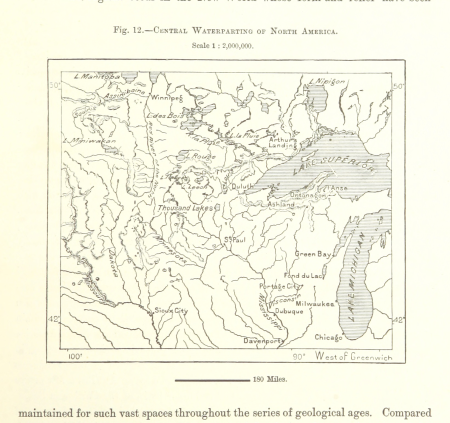
hydrological maps of the united states
maps from the earth and its inhabitants, vol. xviii
1870s maps of peru
maps from the earth and its inhabitants, vol. xiv
old maps of sydney
maps of ardabil province
maps of sabalan
maps from the earth and its inhabitants, vol. xiii
1878 maps of africa
maps from the earth and its inhabitants, vol. xviii
maps of weather and climate of south america
maps from the earth and its inhabitants, vol. iv
precipitation maps
maps from the earth and its inhabitants, vol. iv
old maps of leeds
maps of spain by tomas lopez
1783 maps of spain
maps of spain by tomas lopez
1766 maps of spain
maps of the province of ávila
maps of spain by tomas lopez
maps of spain by tomas lopez
old maps of castile and león
maps of spain by tomas lopez
1783 maps of spain
maps of spain by tomas lopez
1783 maps of spain
st thomas' hospital (southwark)
guy's hospital
maps from the earth and its inhabitants, vol. iv
1880s maps of england
atlas maior, vol 5 (england) - joan blaeu, 1667 - bl 114.h(star).5
17th-century maps of yorkshire
atlas maior, vol 2 (sweden, russia, poland, eastern europe, and greece) - joan blaeu, 1667 - bl 114.h(star).2
17th-century maps of prussia
atlas maior, vol 2 (sweden, russia, poland, eastern europe, and greece) - joan blaeu, 1667 - bl 114.h(star).2
17th-century maps of scandinavia
victorian architecture
festival of empire
topographic map of france, 1864
lemercier & cie.
topographic map of france, 1864
lemercier & cie.
topographic map of france, 1864
lemercier & cie.
topographic map of france, 1864
lemercier & cie.
topographic map of france, 1864
lemercier & cie.
topographic map of france, 1864
lemercier & cie.
topographic map of france, 1864
lemercier & cie.
topographic map of france, 1864
lemercier & cie.
topographic map of france, 1864
lemercier & cie.
topographic map of france, 1864
lemercier & cie.
turgot map of paris, kyoto university library – derivative files
hôtel de mortemart
turgot map of paris, david rumsey historical map collection – derivative files
bastille
leipzig in the 17th century
baroque
maps of south asia by mercator-hondius
brazilian paintings in the museu antônio parreiras
antônio rafael pinto bandeira
london & birmingham railway
charles frederick cheffins
topographic map of france, 1864
lemercier & cie.
topographic map of france, 1864
lemercier & cie.
topographic map of france, 1864
lemercier & cie.
topographic map of france, 1864
lemercier & cie.
topographic map of france, 1864
lemercier & cie.
topographic map of france, 1864
lemercier & cie.
topographic map of france, 1864
lemercier & cie.
topographic map of france, 1864
lemercier & cie.
topographic map of france, 1864
lemercier & cie.
topographic map of france, 1864
lemercier & cie.
topographic map of france, 1864
lemercier & cie.
topographic map of france, 1864
lemercier & cie.
topographic map of france, 1864
lemercier & cie.
topographic map of france, 1864
lemercier & cie.
topographic map of france, 1864
lemercier & cie.
1645 maps of belgium
ships on maps
maps in the library of congress
bird's eye view maps of indiana
prints by johan teyler in the rijksmuseum amsterdam
albums in the rijksmuseum amsterdam
barcelona in the 1800s
maps by juan lopez
beschreibung und contrafactur der vornembster stät der welt, liber primus civitates orbis terrarum
maps of koblenz by braun & hogenberg
1799 maps of the russian empire
maps by john cary
maps by willem and johannes blaeu
old maps of bergen op zoom
daniel friedrich sotzmann
grosser deutscher atlas
maps by willem and johannes blaeu
17th-century maps of france
town maps by l. r. burleigh
delhi, new york
maps from the earth and its inhabitants, vol. xvi
maps of the mexican war of independence
maps from the earth and its inhabitants, vol. v
1870s maps of finland
maps from the earth and its inhabitants, vol. xviii
maps of indigenous territories of colombia
maps from the earth and its inhabitants, vol. xiv
1870s maps of australia
maps from the earth and its inhabitants, vol. xiv
old maps of sydney
maps from the earth and its inhabitants, vol. iii
population density maps of germany
maps from the earth and its inhabitants, vol. x
maps of lake victoria
maps from the earth and its inhabitants, vol. iv
maps of the humber estuary
maps from the earth and its inhabitants, vol. viii
temperature maps
maps from the earth and its inhabitants, vol. xiii
maps indicating exploration
maps from the earth and its inhabitants, vol. xii
19th-century maps of the azores
maps from the earth and its inhabitants, vol. xv
1870s maps of quebec
maps from the earth and its inhabitants, vol. iv
1870s maps of london
maps from the earth and its inhabitants, vol. v
maps of spitsbergen
maps from the earth and its inhabitants, vol. xv
temperature maps of north america
maps from the earth and its inhabitants, vol. iv
bathymetric maps of the irish sea
maps from the earth and its inhabitants, vol. iv
old maps of bristol
maps from the earth and its inhabitants, vol. viii
maps of the mekong
maps from the earth and its inhabitants, vol. iv
old maps of the firth of forth
maps from the earth and its inhabitants, vol. iv
maps of rochester, kent
maps from the earth and its inhabitants, vol. iv
old maps of exeter
maps from the earth and its inhabitants, vol. vii
1870s maps of japan
maps from the earth and its inhabitants, vol. iv
19th-century maps of cornwall
maps from the earth and its inhabitants, vol. xiv
1870s maps of australia
maps from the earth and its inhabitants, vol. iv
1870s maps of scotland
maps from the earth and its inhabitants, vol. xvi
maps of central america
19th-century maps of sierra leone
maps of rivers of sierra leone
maps from the earth and its inhabitants, vol. iv
maps of guildford
maps from the earth and its inhabitants, vol. iv
19th-century maps of the english channel
maps of borders of ecuador
1870s maps of ecuador
maps from the earth and its inhabitants, vol. iv
old maps of swansea
16101 - 16200 of 38,713
Next page
/ 388


![Beschreibung und Contrafactur der Vornembster stät der Welt, liber primus [Civities of the World], 1574](https://cdn.creazilla.com/illustrations/10000943568/beschreibung-und-contrafactur-der-vornembster-stt-der-welt-liber-primus-civities-of-the-world-1574-sm.webp)


