Log in
All resources
Create a design
38,713 Free Artworks of Map
joan blaeu
bibliothèque nationale de france
copper engraving print
british library
1667 maps
maps by willem and johannes blaeu
maps from the earth and its inhabitants, vol. x
map - museu antônio parreiras
antônio parreiras
beschreibung der städt der welt - braun & hogenberg - btv1b52512111k
maps of the land of valkenburg
guillaume sanson
church towers in hamburg
jan diricks van campen
maps in the staats- und universitätsbibliothek hamburg
1852 maps of hamburg
plan de paris levé par les ordres du roy, 1900
proletarian literature
paulownia tomentosa (cultivated in north america)
nrcs new york (state) distribution maps
maps of amersfoort by braun & hogenberg
maps by willem and johannes blaeu
avenionensis ditio et venaisinus comitatus (galleria delle carte geografiche)
maps by john cary
1811 maps
map of ancient asia minor by philippe de la rué
1650s maps of turkey
gemeente atlas van nederland - south holland
old maps of delft
gemeente atlas van nederland - north holland
old maps of haarlem
historisk atlas (stockholm, norstedt & söner, 1880)
maps of 13th-century germany
typus orbis terrarum
1570 maps of asia
1600 world map by girolamo porro
leonardo cernoti
1600 world map by girolamo porro
leonardo cernoti
maps of krimpenerwaard
atlas novus (blaeu)
details of old maps of the united kingdom
cartouches by sanson family
media from the national library of finland
classicism
illustrations from the english lakes (1905)
maps of the lake district
historisk atlas (stockholm, norstedt & söner, 1880)
old maps of the polish-lithuanian commonwealth
maps from the earth and its inhabitants, vol. x
maps of africa
maps of rivers of india
1886 maps of india
drawings in the museu antônio parreiras
paper and graphite
paintings in the museu antônio parreiras
wood
drawings in the museu antônio parreiras
paper and graphite
atlas maior, vol 9 (italy) - joan blaeu, 1667 - bl 114.h(star).9
1667 maps of italy
atlas maior, vol 9 (italy) - joan blaeu, 1667 - bl 114.h(star).9
1667 maps of italy
atlas maior, vol 11 (asia) - joan blaeu, 1667 - bl 114.h(star).11
1667 maps
atlas maior, vol 12 (america) - joan blaeu, 1667 - bl 114.h(star).12
1667 maps
atlas maior, vol 9 (italy) - joan blaeu, 1667 - bl 114.h(star).9
1667 maps of italy
beschreibung der städt der welt - braun & hogenberg - btv1b52512111k
maps of nîmes by braun & hogenberg
brazilian paintings in the museu antônio parreiras
antônio rafael pinto bandeira
maps in the library of congress
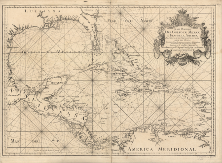
1750s maps of the caribbean
atlas maior, vol 4 (netherlands) - joan blaeu, 1667 - bl 114.h(star).4
1667 maps
atlas maior, vol 12 (america) - joan blaeu, 1667 - bl 114.h(star).12
1667 maps
atlas maior, vol 12 (america) - joan blaeu, 1667 - bl 114.h(star).12
1667 maps
atlas maior, vol 6 (scotland and ireland) - joan blaeu, 1667 - bl 114.h(star).6
1667 maps
beschreibung der städt der welt - braun & hogenberg - btv1b52512111k
maps of dunkerque by braun & hogenberg
beschreibung der städt der welt - braun & hogenberg - btv1b52512111k
maps of groningen by braun & hogenberg
beschreibung der städt der welt - braun & hogenberg - btv1b52512111k
maps of heidelberg by braun & hogenberg
maps of london by braun & hogenberg
eran laor cartographic collection
maps of groningen by braun & hogenberg
martinikerk (groningen)
maps in the library of congress
18th-century maps of sumatra
maps of london by john norden (1593)
maps by pieter van der keere
maps by guillaume delisle showing history
old maps of alexander the great's empire
e. a. wallis budge
1920 maps
gemeente atlas van nederland - south holland
1860s maps of south holland
maps from the earth and its inhabitants, vol. xii
canary islands in the 1890s
maps of rotterdam by berckenrode
kolk (rotterdam)
maps from the earth and its inhabitants, vol. xii
canary islands in the 1890s
maps from university of amsterdam special collections
atlas der neederlanden
maps from university of amsterdam special collections
atlas der neederlanden
maps of spain by tomas lopez
1769 maps of spain
maps in the library of congress
1755 maps
turgot map of paris, kyoto university library – derivative files
foire saint-germain on old maps
maps of the iberian peninsula by guillaume delisle
1700s maps of the iberian peninsula
maps of the iberian peninsula by guillaume delisle
1700s maps of the iberian peninsula
guide joanne normandie-1912
french-language maps
turgot map of paris, kyoto university library – derivative files
hôtel de condé
old maps of the british empire
illustrations by walter crane
coats of arms of erbach family
coats of arms on maps
topographia westphaliae (merian)
baroque
cross of trier in heraldry
coats of arms on maps
description de l'universe
old maps of karpathos
maps by willem and johannes blaeu
siege of groenlo 1627
topographischer atlas der schweiz
mur (dit) d'hannibal
eran laor cartographic collection
cartouches by joseph roux
jan karel donatus van beecq
hernán cortés
maps of philippsburg city walls
old maps of philippsburg
maps in the library of congress
brookside mills
turgot map of paris, kyoto university library – derivative files
historical images of palais bourbon
drawings in the museu antônio parreiras
paper and charcoal
1570s maps of north rhine-westphalia
1570s maps of lower saxony
atlas van der hagen (volume 4)
german renaissance
maps by petrus schenk
1750s maps of saxony
maps from the earth and its inhabitants, vol. x
1890 maps of africa
maps from the earth and its inhabitants, vol. x
1890 maps of africa
maps from the earth and its inhabitants, vol. x
1890 maps of africa
maps from the earth and its inhabitants, vol. x
1890 maps of africa
maps from the earth and its inhabitants, vol. xi
africa in the 1890s
maps of cefala by braun & hogenberg
national museum of tanzania
maps by pieter van der keere
covent garden in art
17th-century engravings
coenraet decker
map of paris by françois quesnel
hôtel du petit-bourbon
maps from the earth and its inhabitants, vol. xii
canary islands in the 1890s
the loyal west in the times of the rebellion (illinois)
cairo, illinois in the 1860s
maps by willem and johannes blaeu
old maps of dordrecht
gemeente atlas van nederland - south holland
1860s maps of south holland
maps of austro-prussian war
old maps of czechia
history of attendorn
kloster ewig
dripps maps of manhattan published in 1867
neoclassicism
maps by frederick william beechey
northwest passage
floor plans of fortresses
daugavgrīva castle
de praecipvis totivs vniversi vrbibvs, liber secvndvs (1575)
maps of wissembourg by braun & hogenberg
de praecipvis totivs vniversi vrbibvs, liber secvndvs (1575)
maps of neuss by braun & hogenberg
de praecipvis totivs vniversi vrbibvs, liber secvndvs (1575)
maps of kleve by braun & hogenberg
laying the atlantic telegraph cable from ship to shore (1857)
valentia island
maps by willem and johannes blaeu
old maps of gorinchem
maps by pieter van der keere
maps by abraham ortelius
old maps of the balearic islands
maps of spain by tomas lopez
15001 - 15100 of 38,713
Next page
/ 388


![[Railway site between Amsinckstrasse and Oberhafen]](https://cdn.creazilla.com/illustrations/10001444772/railway-site-between-amsinckstrasse-and-oberhafen-md.jpg)


![Maps of the coat of arms of Naters and Pancras Gors / A. Steyaart invenit; I. Stemmers sculpsit; I. Luiken fecit cum aqua forti, Romeyn de Hooghe, [1701]](https://cdn.creazilla.com/illustrations/10000526878/maps-of-the-coat-of-arms-of-naters-and-pancras-gors-a-steyaart-invenit-i-stemmers-sculpsit-i-luiken-fecit-cum-aqua-forti-romeyn-de-hooghe-1701-md.jpg)
![General map and images of the eylande of West Voorn / I. Luiken fecit cum aqua forti; A. Steyaart invented; I. Stemmer's sculpsit, Romeyn de Hooghe, [1701]](https://cdn.creazilla.com/illustrations/10001191356/general-map-and-images-of-the-eylande-of-west-voorn-i-luiken-fecit-cum-aqua-forti-a-steyaart-invented-i-stemmer-s-sculpsit-romeyn-de-hooghe-1701-md.jpg)


