Log in
All resources
Create a design
38,713 Free Artworks of Map
maps of africa
africa in the 1890s
bibliothèque nationale de france
maps from the earth and its inhabitants, vol. xii
gemeente atlas van nederland - south holland
1860s maps of south holland
joan blaeu
maps from the mechanical curator collection
eran laor cartographic collection
maps of ghent by braun & hogenberg
gemeente atlas van nederland - south holland
1860s maps of south holland
territory in bird life
river severn in art
maps of polders in south holland
old maps of the hague
maps from the mechanical curator collection available to georeference
maps from the mechanical curator collection
charts and maps of the royal museums greenwich
1777 maps of new york (state)
maps by pieter schenk (i)
maps by gerard valck
1665 maps of ukraine
1665 maps
maps of amsterdam in the rijksmuseum amsterdam
map of amsterdam, 1544
ordnance survey 1:25000 maps (full sheets)
maps of linlithgow
1602 in the netherlands
siege of grave 1602
eran laor cartographic collection
emanuel bowen
18th-century maps of veneto
1700s maps of slovenia
maps from the earth and its inhabitants, vol. iv
topographic maps of scotland
maps from the earth and its inhabitants, vol. vii
dungan revolt
hoogheemraadschap rijnland map, 2nd edition, 1687
gemeenlandshuis zwanenburg in art
maps from the earth and its inhabitants, vol. xi
africa in the 1890s
civitates orbis terrarvm, liber primvs (1577)
maps of tangier by braun & hogenberg
novus atlas sinensis
old maps of jiangxi
maps of ghent by braun & hogenberg
maps of ghent by braun & hogenberg
maps of ghent by braun & hogenberg
map of ghent by jan blaeu
maps of bruges by jan blaeu
17th-century maps of europe
latin-language maps
maps from the earth and its inhabitants, vol. x
1910s maps of somaliland
maps from the earth and its inhabitants, vol. xiii
somaliland
academic art,rococo revival
joint issues 2011
eran laor cartographic collection
joan blaeu
gemeente atlas van nederland - south holland
maps of haastrecht
maps of emden by braun & hogenberg
1576 in lower saxony
maps by thomas kitchin
1782 maps of africa
guide joanne normandie-1912
1912 maps of france
cartes de franz schrader
1894 maps of france
jakobsbergs gård, järfälla municipality
maps of järfälla
gemeente atlas van nederland - north brabant
demen
1899 maps of south america
old maps of suriname
gemeente atlas van nederland - south holland
1860s maps of south holland
siege of philippsburg (1676)
17th-century fortress plans
maps from the mechanical curator collection available to georeference
maps from the mechanical curator collection
territory in bird life
river severn in art
maps of the kingdom of jaén (crown of castile)
maps of spain by tomas lopez
maps of lithuania by gerardus mercator
1630s maps of lithuania
eran laor cartographic collection
johann christoph haffner
maps by edward wright
molyneux globes
maps by willem and johannes blaeu
old maps of alexandria
maps by jodocus hondius
maps by petrus bertius
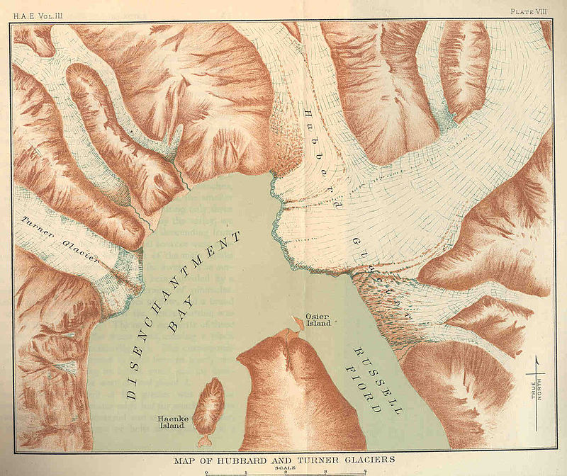
glaciers and glaciation (1910)
maps of glaciers of alaska
hofgartentor (würzburg)
maps of baroque gardens
1747 persia map by emanuel bowen
1740s maps of georgia
gemeente atlas van nederland - south holland
1860s maps of south holland
maps of ghent by petrus schenck
17th-century maps of southeast asia
description de l'universe
maps from the earth and its inhabitants, vol. xii
africa in the 1890s
maps from the earth and its inhabitants, vol. xii
africa in the 1890s
maps from the earth and its inhabitants, vol. xii
africa in the 1890s
maps from the earth and its inhabitants, vol. xii
africa in the 1890s
maps of the cape of good hope
old maps of cape peninsula
old maps of constantinople
emery walker
maps by willem and johannes blaeu
old maps of leiden
maps by nicolas sanson
guillaume sanson
1572 in london
1572 maps
lawrence h. slaughter collection of english maps, charts, globes, books and atlases
pre-raphaelite brotherhood
portolan charts by willem and johannes blaeu
old maps of holland
map of ghent by pierre husson
maps of ghent by i. tirion
maps of bruges by jacques harrewijn
maps of goa by braun & hogenberg
maps of diu by braun & hogenberg
st. helena - a physical, historical, and topographical description of the island (1875) by melliss
maps from the mechanical curator collection
gemeente atlas van nederland - gelderland
maps of ophemert
tower of babel in engravings
maps by nicolaes visscher i
maps in the staats- und universitätsbibliothek hamburg
maps of hamburg-altstadt
maps in the library of congress
1877 maps of the united states
africa and its inhabitants, vol. ii
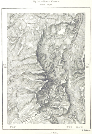
charles eugène perron
tourism advertising posters of germany
german-language maps of germany
charles frederick cheffins
railway lines in egypt
maps of spain by tomas lopez
maps of zamora
maps in the library of congress
1875 maps of california
maps in the library of congress
maps of adams county, illinois
old maps of china in harvard map collection
1749 maps of asia
gardens in north rhine-westphalia
romanticism
nuremberg in the 1650s
baroque
old maps of gelderland
old maps of zutphen
19th-century maps of england and wales
maps in the british museum
glaciers and glaciation (1910)
hubbard glacier
old maps of siberia
erik palmqvist
maps of aegadian islands
the odyssey (butler)
atlas maior, vol 6 (scotland and ireland) - joan blaeu, 1667 - bl 114.h(star).6
1667 maps
maps of the kingdom of córdoba (crown of castile)
maps of spain by tomas lopez
maps of the dutch east india company - india
dutch suratte
maps of erfurt by braun & hogenberg
maps of jena by braun & hogenberg
old maps of île saint-louis
jean-baptiste scotin
cartes de franz schrader
1894 maps of france
trouvelot (martian crater)
mars topography
maps of rivers of equatorial guinea
komo (river)
1660s maps of spain
1667 maps
maps from the earth and its inhabitants, vol. xii
maps of africa
maps from the earth and its inhabitants, vol. xii
africa in the 1890s
maps from the earth and its inhabitants, vol. xii
africa in the 1890s
maps from the earth and its inhabitants, vol. xiii
africa in the 1890s
maps by matthäus merian
baroque
13801 - 13900 of 38,713
Next page
/ 388


![Hambvrgvm / [Georg Braun. Franz Hogenberg], Frans Hogenberg, circa 1590](https://cdn.creazilla.com/illustrations/10001490839/hambvrgvm-georg-braun-franz-hogenberg-frans-hogenberg-circa-1590-md.jpg)