Log in
All resources
Create a design
38,713 Free Artworks of Map
joan blaeu
bibliothèque nationale de france
latin-language maps
maps by willem and johannes blaeu
eran laor cartographic collection
bologna ptolemy
emanuel bowen
maps in the library of congress
john cary
ships on maps
mississippian sites
plaquemine culture
flood of paris in 1740
philippe buache
gemeente atlas van nederland - north holland
19th-century maps of amsterdam
maps of antwerp by braun & hogenberg
maps of antwerp city walls
ptolemy's 7th european map
bologna ptolemy
latin-language maps
bologna ptolemy
old maps of the viceroyalty of peru
old maps of peru
maps by willem and johannes blaeu
old maps of gouda
counties of england in art
1590 engravings
maps in the library of congress
18th-century maps of martinique
gemeente atlas van nederland - limburg
19th-century maps of maastricht
maps from the mechanical curator collection
19th-century maps of the nile river
fire and sword in the sudan (1896) by slatin
maps from the mechanical curator collection
1747 persia map by emanuel bowen
details of old maps
j. l. k. van dort
maps of colombo
midden-delfland in the 18th century
maps of midden-delfland
maps by alexis-hubert jaillot
old maps of poland
johannes honterus
renaissance
maps by john cary
1799 maps
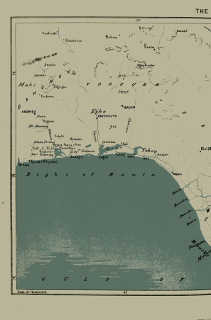
africa and its inhabitants, vol. ii
charles eugène perron
maps of woman's heart
love hearts
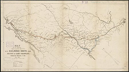
rail transport maps of massachusetts
1845 maps
17th-century maps of crimea
1640s maps of ukraine
18th-century maps of rome
neoclassicism
maps by pieter van der keere
maps by abraham ortelius
antoine-françois tardieu
maps from gallica
charts and maps of the royal museums greenwich
1777 maps
18th-century maps of the mediterranean sea
1745 maps
camps topographiques de la campagne de mdcclvii, en westphalie
bornum (hannover)
media contributed by university of illinois urbana-champaign university library
negroland
ptolemy's 8th european map
bologna ptolemy
description de l'universe
1685 maps of russia
eran laor cartographic collection
emanuel bowen
enskede slakthus
slakthusområdet
maps made in the 17th century
forts in the netherlands
17th-century maps of istanbul
maps by jan janssonius
eran laor cartographic collection
maps by tomas lopez
hendrik van langren map of south asia
1590s maps of iran
maps of tartary by mercator-hondius
old maps of turkestan
maps of paris from bibliothèque nationale de france
maps of paris by braun & hogenberg
maps in the library of congress
1664 maps
old maps of the bay of gibraltar
18th-century maps of gibraltar
novus atlas sinensis
old maps of sichuan
plan de la ville et faubourg de paris, divisé en ses 48 sections by mondhare & jean
maps of paris from bibliothèque nationale de france
old maps of manhattan, new york city
1851 maps
19th-century maps of seine-et-marne
maps of the forest of fontainebleau
regierungsbezirk hildesheim
copper engravings
17th-century maps of sweden
1660s maps of norway
latin-language maps
bologna ptolemy
maps of amsterdam in the rijksmuseum amsterdam
map of amsterdam, 1544
old maps of douarnenez
old maps of brest
atlas maior, vol 5 (england) - joan blaeu, 1667 - bl 114.h(star).5
old county maps of montgomeryshire
atlas maior, vol 5 (england) - joan blaeu, 1667 - bl 114.h(star).5
old county maps of denbighshire
maps by willem and johannes blaeu
pisco, peru
maps from the earth and its inhabitants, vol. vi
1891 maps of georgia
maps of paris from the david rumsey historical map collection
maps of paris by caspar merian
atlas maior, vol 5 (england) - joan blaeu, 1667 - bl 114.h(star).5
old county maps of worcestershire
atlas maior, vol 5 (england) - joan blaeu, 1667 - bl 114.h(star).5
old county maps of bedfordshire
maps from the earth and its inhabitants, vol. ix
maps indicating exploration
maps in the library of congress
old maps of florida
gemeente atlas van nederland - north holland
old maps of beverwijk
maps by willem and johannes blaeu
maps of the duchy of limburg
maps by willem and johannes blaeu
old maps of overijssel
maps from the earth and its inhabitants, vol. v
maps of railway lines in norway
maps from the earth and its inhabitants, vol. xii
maps of africa
maps from university of amsterdam special collections
atlas der neederlanden
maps from the earth and its inhabitants, vol. vi
georgia in the 1890s
plenilunii lumina austriaca philippica
1645 maps
eran laor cartographic collection
edward weller
nouvelle géographie universelle, vol. xii
charles eugène perron
turgot map of paris, kyoto university library – derivative files
petit luxembourg on old maps
maps in the phoebus foundation
maps by pieter van der keere
cartes de franz schrader
old maps of algeria
1800s maps of egypt
maps by john cary
victory expedition
northwest passage
maps from the earth and its inhabitants, vol. xii
maps of africa
media from the national library of finland
classicism
maps by edward wright
molyneux globes
maps of tangier by braun & hogenberg
maps of asilah by braun & hogenberg
r. hausermann, carte de la terre sainte, 1914
eran laor cartographic collection
old maps of north brabant
1645 maps of belgium
maps of tunis by braun & hogenberg
eran laor cartographic collection
1640s maps of the tsardom of russia
17th-century maps of circassia
glaciers and glaciation (1910)
maps of inside passage
maps by willem and johannes blaeu
coats of arms on maps
chicago and the midwest, newberry library
maps by rand mcnally
maps of spain by tomas lopez
1783 maps of spain
1801 map of turkey in asia by john cary
1801 maps of the ottoman empire
maps in the library of congress
old maps of france
maps of mountains of cantal
cartes de franz schrader
17th-century maps of zeeland
old maps of south holland
maps from the earth and its inhabitants, vol. xviii
maps of the conquest of peru
maps from the earth and its inhabitants, vol. vii
population density maps of china
eran laor cartographic collection
matthew paris
maps of frankfurt (main) by braun & hogenberg
frankfurt-altstadt
gemeente atlas van nederland - south holland
19th-century maps of rotterdam
gemeente atlas van nederland - south holland
1860s maps of south holland
works by johan vinckeboons
image restoration
maps by john cary
1836 maps
maps by willem and johannes blaeu
old maps of the arctic
12901 - 13000 of 38,713
Next page
/ 388


![[Nova et accuratissima totius terrarum orbis tabula]., Joan Blaeu, 1664](https://cdn.creazilla.com/illustrations/10001308540/nova-et-accuratissima-totius-terrarum-orbis-tabula-joan-blaeu-1664-md.jpg)


![[a] Bedfordiensis Comitatvs; [b] Bvckinghamiensis Comitatvs, Joan Blaeu, 1667](https://cdn.creazilla.com/illustrations/10001510670/a-bedfordiensis-comitatvs-b-bvckinghamiensis-comitatvs-joan-blaeu-1667-md.jpg)


![Map of Ceylon - European Colonial Establishments, Jakob van der Schley, [1750]](https://cdn.creazilla.com/illustrations/10000562848/map-of-ceylon-european-colonial-establishments-jakob-van-der-schley-1750-sm.webp)


![[Map of the defeat of the Confederate ship Alabama by the U.S. steamer Kearsarge on June 19, 1864, off Cherbourg, France].](https://cdn.creazilla.com/illustrations/10001534884/map-of-the-defeat-of-the-confederate-ship-alabama-by-the-us-steamer-kearsarge-on-june-19-1864-off-cherbourg-france-md.jpg)


