Log in
All resources
Create a design
8,995 Free Images of Scales
bibliothèque nationale de france
maps from university of amsterdam special collections
atlas der neederlanden
copperplate print
special collections of the university of amsterdam
carte generale du tres-haut, tres-puissant et tres chrestien royaume de france
maps by isaak tirion
isaak tirion
historical
history
map of l'evesché du mans by jaillot and cordier
bibliothèque nationale de france
bibliothèque nationale de france
ambroise tardieu
bibliothèque nationale de france
carolus allard
la russie blanche ou moscovie divisée suivant l'estendue des royaumes, duchés, principautés, provinces et peuples... - par le sr. sanson - btv1b531921368
guillaume sanson
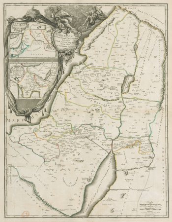
maps of ancient israel by philippe de la rué
map of modern syria by philippe de la rué
maps by willem and johannes blaeu
1640s maps of belgium
prints by william hogarth in the british museum
realism
pierre antoine tardieu
maps from gallica
monopoly
pentagon
maps from university of amsterdam special collections
atlas der neederlanden
maps from university of amsterdam special collections
atlas der neederlanden
maps from university of amsterdam special collections
atlas der neederlanden
maps from university of amsterdam special collections
atlas der neederlanden
maps from university of amsterdam special collections
atlas der neederlanden
maps from university of amsterdam special collections
atlas der neederlanden
maps from university of amsterdam special collections
atlas der neederlanden
maps from university of amsterdam special collections
atlas der neederlanden
maps from university of amsterdam special collections
atlas der neederlanden
maps from university of amsterdam special collections
atlas der neederlanden
maps from university of amsterdam special collections
atlas der neederlanden
maps from university of amsterdam special collections
atlas der neederlanden
maps from university of amsterdam special collections
atlas der neederlanden
maps of portugal by fernando álvares seco
bibliothèque nationale de france
maps of alsace, breisgau and sundgau by gerardus mercator
maps by willem and johannes blaeu
arnold van langren map of southwest africa
renaissance
veteris novae que urbis amstelodamensis ichnographia, continens publica aedificia ; veterem subnigrioribus... delineata auctore d. stalpaert - btv1b53212660h
bibliothèque nationale de france
veteris novae que urbis amstelodamensis ichnographia, continens publica aedificia ; veterem subnigrioribus... delineata auctore d. stalpaert - btv1b53212660h
bibliothèque nationale de france
maps of the holy roman empire
1767 maps of germany
17th-century maps of nord (department)
maps of artois
christianity
history
wales in the 1600s
latin text
maps by willem and johannes blaeu
1640s maps of scotland
maps of andalusia by mercator-hondius
bibliothèque nationale de france
maps of provence by pierre-jean de bompar
bibliothèque nationale de france
maps of wallachia by gerardus mercator
maps by willem and johannes blaeu
historical
history
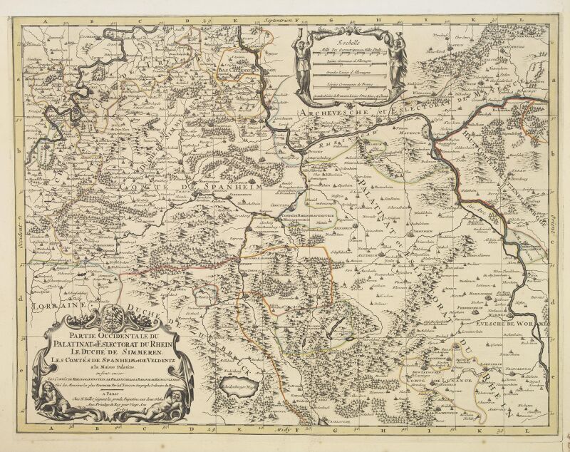
maps of the palatinate of the rhine
1692 maps of rhineland-palatinate
carte de barbarie, nigritie, guinée par guillaume delisle (1707)
university of washington
animals
fish
maps in the british museum
prints by albert flamen
maps from university of amsterdam special collections
atlas der neederlanden
maps from university of amsterdam special collections
atlas der neederlanden
1640s maps of greece
marco boschini
bibliothèque nationale de france
sanson maps of the holy land
constellation
seventh
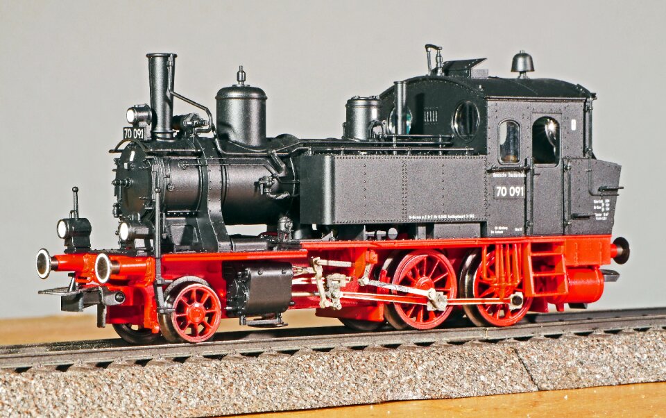
vehicle
toy
historical
history
historical
history
historical
history
maps from university of amsterdam special collections
atlas der neederlanden
maps from university of amsterdam special collections
atlas der neederlanden
monkan-bō kōshin
1347 works
mythology
symbol
maps in the stadsarchief amsterdam
dutch golden age painting
the triumph of henry iv (met, 42.187)
flemish baroque painting,baroque
maps from university of amsterdam special collections
atlas der neederlanden
maps from university of amsterdam special collections
atlas der neederlanden
map of the circle of austria by sanson
1700s maps of austria
18th-century maps of strasbourg
1740s maps of france
maps from university of amsterdam special collections
atlas der neederlanden
maps in the library of congress
plaine de grenelle
1836 maps of africa
ambroise tardieu
john rocque 1746 crops from library of congress
maps in the library of congress
18th-century portrait paintings in tate britain
portrait paintings by arthur devis
animals
fish
animals
fish
animals
fish
facebook ad
draft
maps from university of amsterdam special collections
atlas der neederlanden
maps from university of amsterdam special collections
atlas der neederlanden
maps from university of amsterdam special collections
atlas der neederlanden
maps from university of amsterdam special collections
atlas der neederlanden
geography
travel
john rocque 1746 crops from library of congress
maps in the library of congress
actinopterygii
chordata
carte generale du tres-haut, tres-puissant et tres chrestien royaume de france
bibliothèque nationale de france
carte generale du tres-haut, tres-puissant et tres chrestien royaume de france
bibliothèque nationale de france
carte generale du tres-haut, tres-puissant et tres chrestien royaume de france
bibliothèque nationale de france
carte generale du tres-haut, tres-puissant et tres chrestien royaume de france
bibliothèque nationale de france
carte generale du tres-haut, tres-puissant et tres chrestien royaume de france
bibliothèque nationale de france
carte generale du tres-haut, tres-puissant et tres chrestien royaume de france
bibliothèque nationale de france
carte generale du tres-haut, tres-puissant et tres chrestien royaume de france
bibliothèque nationale de france
carte de la mer méditerranée en trois feuilles (dheulland et al.)
old maps of the central mediterranean
carte generale du tres-haut, tres-puissant et tres chrestien royaume de france
bibliothèque nationale de france
carte de la mer méditerranée en trois feuilles (dheulland et al.)
old maps of the central mediterranean
icons
symbol
energy levels
remaining
conciergerie - cellules
19th-century paintings
1660s maps of france
maps of lyonnais
history
forest
historical
history
california
history
carte de barbarie, nigritie, guinée par guillaume delisle (1707)
bibliothèque nationale de france
carte generale du tres-haut, tres-puissant et tres chrestien royaume de france
bibliothèque nationale de france
partie du duché de milan, la principauté de piemont, le montferrat, la république de genes... - hubert jaillot - btv1b53177614j
reverse sides from gallica
carte generale du tres-haut, tres-puissant et tres chrestien royaume de france
bibliothèque nationale de france
carte generale du tres-haut, tres-puissant et tres chrestien royaume de france
bibliothèque nationale de france
carte generale du tres-haut, tres-puissant et tres chrestien royaume de france
bibliothèque nationale de france
carte generale du tres-haut, tres-puissant et tres chrestien royaume de france
bibliothèque nationale de france
carte generale du tres-haut, tres-puissant et tres chrestien royaume de france
bibliothèque nationale de france
7601 - 7700 of 8,995
Next page
/ 90


![New map of the dike county of Dregterlandt MDCCXXIII / [Govert Oostwoudt], Hendrik de Leth, 1723](https://cdn.creazilla.com/illustrations/10000357283/new-map-of-the-dike-county-of-dregterlandt-mdccxxiii-govert-oostwoudt-hendrik-de-leth-1723-md.jpg)

![Gulf of Mexico Map - *J. v. Schley & Bellin Marine Engraving*, Jakob van der Schley, [1773]](https://cdn.creazilla.com/illustrations/10000578116/gulf-of-mexico-map-j-v-schley-bellin-marine-engraving-jakob-van-der-schley-1773-md.jpg)
![Thieler Waard – Card with Hochwasserschutz 1729, Willem Albert Bachiene, [1759]](https://cdn.creazilla.com/illustrations/10000639099/thieler-waard-card-with-hochwasserschutz-1729-willem-albert-bachiene-1759-md.jpg)


![Carte particuliére de l'Isle d'Amboine / J. V. Schley direct, Jakob van der Schley, [1763]](https://cdn.creazilla.com/illustrations/10000789471/carte-particuli-re-de-l-isle-d-amboine-j-v-schley-direct-jakob-van-der-schley-1763-md.jpg)

![New map of the dike county of Dregterlandt MDCCXXIII / [Govert Oostwoudt], Hendrik de Leth, 1723](https://cdn.creazilla.com/illustrations/10001049964/new-map-of-the-dike-county-of-dregterlandt-mdccxxiii-govert-oostwoudt-hendrik-de-leth-1723-md.jpg)


![Carte des environs de Batavia = Map of the outskirts of Batavia / J. v. Schley direct, Jakob van der Schley, [1755]](https://cdn.creazilla.com/illustrations/10001436890/carte-des-environs-de-batavia-map-of-the-outskirts-of-batavia-j-v-schley-direct-jakob-van-der-schley-1755-md.jpg)


![Cambriae typus / Auctore Humfredo Lhuydo Denbigiense Cambrobritanno; Petrus Kaerius coela[vit], 1607](https://cdn.creazilla.com/illustrations/10001017812/cambriae-typus-auctore-humfredo-lhuydo-denbigiense-cambrobritanno-petrus-kaerius-coela-vit-1607-md.jpg)


![Provinciae, regionis Galliae, vera exactissimaq[ue] descriptio. Provence / Petro Joanne Bompario auctore; H. Picart sculpsit., 1619](https://cdn.creazilla.com/illustrations/10001442834/provinciae-regionis-galliae-vera-exactissimaq-ue-descriptio-provence-petro-joanne-bompario-auctore-h-picart-sculpsit-1619-md.jpg)


![Kaart van geheel Guajana of de Wilden-kust, en die der Spaansche Westindiën, op het Noord-end van Zuid Amerika, Isaak Tirion, [1767]](https://cdn.creazilla.com/illustrations/10000300014/kaart-van-geheel-guajana-of-de-wilden-kust-en-die-der-spaansche-westindin-op-het-noord-end-van-zuid-amerika-isaak-tirion-1767-md.jpg)


![Special map of a part of Dutch Brabant, Guelders and Cleves or the surroundings of Grave, Ravestein, Helmont, Nijmegen, Fort de Schenk, Cleves, Gennip, Emmerick &c. / I. Condet f. 1748, Johannes Condet, [1748]](https://cdn.creazilla.com/illustrations/10000963180/special-map-of-a-part-of-dutch-brabant-guelders-and-cleves-or-the-surroundings-of-grave-ravestein-helmont-nijmegen-fort-de-schenk-cleves-gennip-emmerick-c-i-condet-f-1748-johannes-condet-1748-md.jpg)
![T Hoogh-Heemraetschap vande Uytwaterende Sluysen in Kennemerlant and West Frieslant / [Johannes Douw], Isaak Tirion, [1756]](https://cdn.creazilla.com/illustrations/10000841147/t-hoogh-heemraetschap-vande-uytwaterende-sluysen-in-kennemerlant-and-west-frieslant-johannes-douw-isaak-tirion-1756-sm.webp)


![Map of the craftsmanship of the Old and New Streuyt / A. Steyaart invenit; I. Stemmer's sculpsit; I. Shutters fecit cum aqua forti, Romeyn de Hooghe, [1701]](https://cdn.creazilla.com/illustrations/10000536041/map-of-the-craftsmanship-of-the-old-and-new-streuyt-a-steyaart-invenit-i-stemmers-sculpsit-i-shutters-fecit-cum-aqua-forti-romeyn-de-hooghe-1701-md.jpg)
![T Hoogh-Heemraetschap vande Uytwaterende Sluysen in Kennemerlant and West Frieslant / [Johannes Douw], Isaak Tirion, [1756]](https://cdn.creazilla.com/illustrations/10000976652/t-hoogh-heemraetschap-vande-uytwaterende-sluysen-in-kennemerlant-and-west-frieslant-johannes-douw-isaak-tirion-1756-md.jpg)


![T Hoogh-Heemraetschap vande Uytwaterende Sluysen in Kennemerlant and West Frieslant / [Johannes Douw], Isaak Tirion, [1756]](https://cdn.creazilla.com/illustrations/10000560278/t-hoogh-heemraetschap-vande-uytwaterende-sluysen-in-kennemerlant-and-west-frieslant-johannes-douw-isaak-tirion-1756-md.jpg)
![Persian and Indian Ocean Coastline Map (1740), Jakob van der Schley, [1773]](https://cdn.creazilla.com/illustrations/10000761796/persian-and-indian-ocean-coastline-map-1740-jakob-van-der-schley-1773-md.jpg)
![Map of the polder of Nieuw-Helle-Voet / I. Luiken fecit cum aqua forti; A. Steyaart invented; I. Stemmer's sculpsit, Romeyn de Hooghe, [1701]](https://cdn.creazilla.com/illustrations/10001032148/map-of-the-polder-of-nieuw-helle-voet-i-luiken-fecit-cum-aqua-forti-a-steyaart-invented-i-stemmer-s-sculpsit-romeyn-de-hooghe-1701-md.jpg)
![T Hoogh-Heemraetschap vande Uytwaterende Sluysen in Kennemerlant and West Frieslant / [Johannes Douw], Isaak Tirion, [1756]](https://cdn.creazilla.com/illustrations/10001440533/t-hoogh-heemraetschap-vande-uytwaterende-sluysen-in-kennemerlant-and-west-frieslant-johannes-douw-isaak-tirion-1756-md.jpg)