Log in
All resources
Create a design
8,995 Free Images of Scales
bibliothèque nationale de france
marco boschini
atlas géographique des quatre parties du monde (delisle)
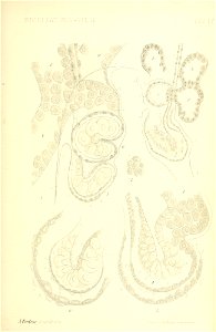
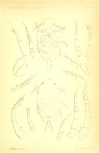
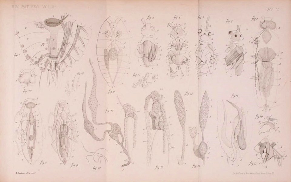
scale insects
smithsonian libraries
le cocciniglie italiane viventi sugli agrumi: pt.1-3 (1893-1896)
maps of ports and fortresses of the mediterranean by marco boschini (1651)
maps of the islands of greece by marco boschini (1658)
guillaume sanson
context files from gallica
engravings by marcantonio raimondi in the metropolitan museum of art
religious engravings in the metropolitan museum of art
17th-century maps of dordogne
philippe de la rué
topographischer atlas der schweiz
old maps of fribourg
model
male
model
male
model
male
model
male
winter 2015-16 luxor, egypt
checkflicr
paintings of themis
pierre subleyras
prints by cherubino alberti
baroque
17th-century maps of crete
old maps of candia
maps of alcanerilla by braun & hogenberg
context files from gallica
19th-century maps of russia
russia in the 1860s
old maps of antikythera
old maps of kythira
maps by petrus schenk
1750s maps of saxony
maps of the islands of greece by marco boschini (1658)
old maps of lesbos
maps of the islands of greece by marco boschini (1658)
history of lesbos
grenzkarte der preussischen, russischen und oestreichischen monarchien (1796)
maps of pomerania province
atlas géographique des quatre parties du monde (delisle)
bibliothèque nationale de france
barbizon school
eugène cicéri
maps of ports and fortresses of the mediterranean by marco boschini (1651)
bibliothèque nationale de france
maps of ports and fortresses of the mediterranean by marco boschini (1651)
bibliothèque nationale de france
maps of ports and fortresses of the mediterranean by marco boschini (1651)
palaiokastro
atlas géographique des quatre parties du monde (delisle)
bibliothèque nationale de france
bibliothèque nationale de france
guillaume sanson
maps of south america by mercator-hondius
bibliothèque nationale de france
maps of ports and fortresses of the mediterranean by marco boschini (1651)
bibliothèque nationale de france
bibliothèque nationale de france
maps by tomas lopez
atlas géographique des quatre parties du monde (delisle)
bibliothèque nationale de france
l'alsace divisée en ses principales parties, dressée sur les mémoires les plus nouveaux - par le sr.sanson... - btv1b530329041
guillaume sanson
maps of ports and fortresses of the mediterranean by marco boschini (1651)
bibliothèque nationale de france
atlas géographique des quatre parties du monde (delisle)
bibliothèque nationale de france
atlas géographique des quatre parties du monde (delisle)
bibliothèque nationale de france
maps of ports and fortresses of the mediterranean by marco boschini (1651)
bibliothèque nationale de france
atlas géographique des quatre parties du monde (delisle)
bibliothèque nationale de france
map of italy by guillaume delisle (1700)
bibliothèque nationale de france
atlas géographique des quatre parties du monde (delisle)
bibliothèque nationale de france
maps of ports and fortresses of the mediterranean by marco boschini (1651)
bibliothèque nationale de france
atlas géographique des quatre parties du monde (delisle)
bibliothèque nationale de france
atlas géographique des quatre parties du monde (delisle)
bibliothèque nationale de france
atlas géographique des quatre parties du monde (delisle)
bibliothèque nationale de france
maps of the islands of greece by marco boschini (1658)
old maps of euboea
smithsonian libraries
scale insects
smithsonian libraries
scale insects
smithsonian libraries
scale insects
smithsonian libraries
scale insects
smithsonian libraries
scale insects
smithsonian libraries
scale insects
smithsonian libraries
scale insects
smithsonian libraries
scale insects
smithsonian libraries
scale insects
smithsonian libraries
scale insects
maps of ancient italy by philipp clüver
maps of ancient sicily
balance
england
gigapixel examples
checkflicr2
curt teich postcard archives, curt teich & company
mitiwanga beach
ordnance survey 1:25000 maps (full sheets)
uphall, west lothian
postcards from flickr to be checked
postcards by lucien waléry
context files from gallica
history of samos
context files from gallica
history of rhodes
maps from gallica
old maps of rome
maps of the islands of greece by marco boschini (1658)
history of kythira
volhynian voivodeship (1569–1795)
maps of volhynia
16th-century maps of crete
old maps of candia
maps of the islands of greece by marco boschini (1658)
context files from gallica
maps of blois by braun & hogenberg
urbanisation in loir-et-cher
carte du mexique et de la floride by guillaume delisle (1703)
bibliothèque nationale de france
atlas géographique des quatre parties du monde (delisle)
bibliothèque nationale de france
l'alsace divisée en ses principales parties, dressée sur les mémoires les plus nouveaux - par le sr.sanson... - btv1b530329041
guillaume sanson
maps of ports and fortresses of the mediterranean by marco boschini (1651)
bibliothèque nationale de france
bibliothèque nationale de france
guillaume dheulland
bibliothèque nationale de france
guillaume sanson
la seigneurie d'utrecht dressé sur les memoires les plus nouveaux - par le sr sanson... - btv1b53213984m
guillaume sanson
maps of ports and fortresses of the mediterranean by marco boschini (1651)
bibliothèque nationale de france
bibliothèque nationale de france
guillaume sanson
bibliothèque nationale de france
guillaume sanson
atlas géographique des quatre parties du monde (delisle)
bibliothèque nationale de france
atlas géographique des quatre parties du monde (delisle)
bibliothèque nationale de france
atlas géographique des quatre parties du monde (delisle)
bibliothèque nationale de france
atlas géographique des quatre parties du monde (delisle)
bibliothèque nationale de france
bibliothèque nationale de france
guillaume sanson
haute partie de l'evesché de munster subdivisé en ses principales juridictions... - par le sr. sanson - btv1b532024323
guillaume sanson
smithsonian libraries
scale insects
smithsonian libraries
scale insects
smithsonian libraries
scale insects
smithsonian libraries
scale insects
smithsonian libraries
scale insects
atlas géographique des quatre parties du monde (delisle)
18th-century maps of the iberian peninsula
map of the upper rhenian circle by sanson
maps by nicolas sanson
robert demachy
pictorialism
gigapixel examples
checkflicr2
cartouches by tomas lópez
the signs of the zodiac by jacob jordaens
flemish baroque painting,baroque
maps of the ganges river
old maps of bengal
maps of the islands of greece by marco boschini (1658)
context files from gallica
historical
history
atlas géographique des quatre parties du monde (delisle)
bibliothèque nationale de france
atlas géographique des quatre parties du monde (delisle)
bibliothèque nationale de france
atlas géographique des quatre parties du monde (delisle)
bibliothèque nationale de france
maps of the course of the rhine by guillaume sanson
bibliothèque nationale de france
4901 - 5000 of 8,995
Next page
/ 90


![Rock and For[tez]za of Garabuse / by Marco Boschini, Marco Boschini, 1651](https://cdn.creazilla.com/illustrations/10000518564/rock-and-fortezza-of-garabuse-by-marco-boschini-marco-boschini-1651-md.jpg)


![Western part of Swedish Lapponia taken from those of Andr[é] Burae[us] and Isaac Massa / By Sr. Sanson, ..., 1741](https://cdn.creazilla.com/illustrations/10000654352/western-part-of-swedish-lapponia-taken-from-those-of-andr-buraeus-and-isaac-massa-by-sr-sanson-1741-md.jpg)


![Siciliae antiquae descriptio. 15; Corsicae antiquae descriptio. 16; Sardiniae antiquae descriptio / auctore Phil[ippo] Cluverio; Henry le Roy fecit, 1624](https://cdn.creazilla.com/illustrations/10001349357/siciliae-antiquae-descriptio-15-corsicae-antiquae-descriptio-16-sardiniae-antiquae-descriptio-auctore-phil-ippo-cluverio-henry-le-roy-fecit-1624-sm.jpg)