Log in
All resources
Create a design
8,995 Free Images of Scale
bibliothèque nationale de france
maps from university of amsterdam special collections
atlas der neederlanden
copperplate print
special collections of the university of amsterdam
atlas der neederlanden deel v: holland 4. noord-holland
abraham deur
hendrik de leth
statues of abraham lincoln (1915)
maps of spain by tomas lopez
maps of the kingdom of seville
maps of spain by tomas lopez
landais & oberthur
maps from gallica
historical
history
statues of abraham lincoln (1915)
auction catalogues
statues of abraham lincoln (1915)
people with sculptures
historical
history
historical
history
rue de la pépinière (paris)
prints in musée carnavalet
rail transport maps of massachusetts
1845 maps
statues of abraham lincoln (1915)
western sanitary commission
maps by emanuel bowen
negroland
statues of abraham lincoln (1915)
the new york times
statues of abraham lincoln (1915)
emancipation memorial (boston)
alexander marshal - florilegium
watercolour
considérations géographiques et physiques sur les nouvelles découvertes au nord de la grande mer
1750s maps of the russian empire
lincoln financial foundation collection
statues of abraham lincoln (1915)
national geographic magazine, 1915
statues of abraham lincoln (1915)
icons
db
service
icons
maps of spain by tomas lopez
old maps of guadeloupe
maps from university of amsterdam special collections
atlas der neederlanden
landais & oberthur
maps from gallica
emancipation memorial (washington, d.c.)
statues of abraham lincoln (1915)
emancipation memorial (washington, d.c.)
statues of abraham lincoln (1915)
alexander marshal - florilegium
watercolour
statues of abraham lincoln (1915)
miami herald
historical
history
historical
history
orbit
nasa
water
boat
orbit
nasa
wildlife
nature
statues of abraham lincoln (1915)
new york herald tribune
old maps of asturias
1777 maps of spain
old maps of asturias
1777 maps of spain
old maps of asturias
1777 maps of spain
maps from gallica
guides joanne
old maps of the balearic islands
maps of spain by tomas lopez
maps from university of amsterdam special collections
atlas der neederlanden
maps from university of amsterdam special collections
atlas der neederlanden
maps from university of amsterdam special collections
atlas der neederlanden
maps from university of amsterdam special collections
atlas der neederlanden
maps from university of amsterdam special collections
atlas der neederlanden
prints by gilles demarteau from numelyo
gilles demarteau
1670s maps of the iberian peninsula
georg widmann
la rioja (spain) in the 18th century
old maps of la rioja (spain)
map of the upper rhenian circle by sanson
maps by nicolas sanson
fish with tribal pattern
tribal fish
fish with tribal pattern
tribal fish
maps by jean-baptiste bourguignon d'anville
1727 maps of africa
map of the upper rhenian circle by sanson
1700s maps of north rhine-westphalia
maps of the islands of greece by marco boschini (1658)
history of kythira
old maps of the region of murcia
maps of spain by tomas lopez
maps from university of amsterdam special collections
atlas der neederlanden
maps from university of amsterdam special collections
atlas der neederlanden
maps from university of amsterdam special collections
atlas der neederlanden
maps from university of amsterdam special collections
atlas der neederlanden
maps from university of amsterdam special collections
atlas der neederlanden
maps from university of amsterdam special collections
atlas der neederlanden
maps from university of amsterdam special collections
atlas der neederlanden
maps from university of amsterdam special collections
atlas der neederlanden
statues of abraham lincoln (1915)
statues in florence
statues of abraham lincoln (1915)
emancipation memorial (boston)
emancipation memorial (washington, d.c.)
statues of abraham lincoln (1915)
considérations géographiques et physiques sur les nouvelles découvertes au nord de la grande mer
isla de los estados
landscape
vancouver
nature
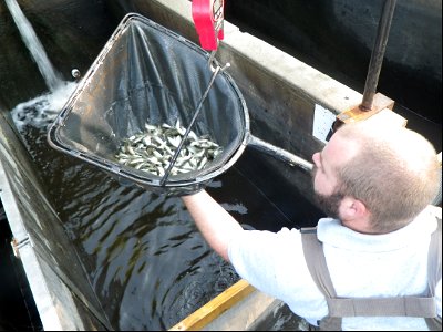
fish
science
italy
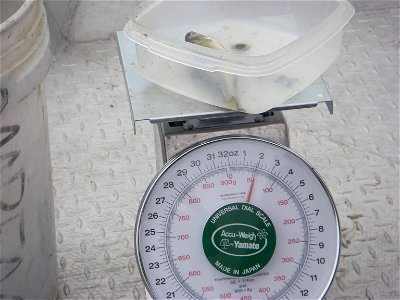
scale
tree
maps facing east
anton wied
gustav freytag (cartographer)
old maps of karlovy vary
old maps of norway
guillaume sanson
general charte der in den herzoglich bremen - und verdenschen aemtern und gerichten ottersberg, osterholtz, lilienthal, bremervörde, rotenburg und achim belegenen mööre, und der seit 1750 darin... - btv1b531196435
bibliothèque nationale de france
antoine-françois tardieu
pierre antoine tardieu
background
abstract
high renaissance
pirro ligorio
maps by willem and johannes blaeu
1640s maps of ukraine
bibliothèque nationale de france
guillaume sanson
general charte der in den herzoglich bremen - und verdenschen aemtern und gerichten ottersberg, osterholtz, lilienthal, bremervörde, rotenburg und achim belegenen mööre, und der seit 1750 darin... - btv1b531196435
bibliothèque nationale de france
maps in the library of congress
1718 maps of north america
le comté de zélande dressé sur les memoires les pl. nouveaux - par le sr sanson... - btv1b53213970d
guillaume sanson
maps of the course of the rhine by guillaume sanson
bibliothèque nationale de france
bibliothèque nationale de france
cartouches by tomas lópez
general charte der in den herzoglich bremen - und verdenschen aemtern und gerichten ottersberg, osterholtz, lilienthal, bremervörde, rotenburg und achim belegenen mööre, und der seit 1750 darin... - btv1b531196435
bibliothèque nationale de france
bibliothèque nationale de france
guillaume sanson
nouvelle géographie universelle, vol. xiv
bibliothèque nationale de france
maps of ports and fortresses of the mediterranean by marco boschini (1651)
bibliothèque nationale de france
old maps of norway
guillaume sanson
maps of spain by tomas lopez
1769 maps of spain
maps of spain by tomas lopez
1768 maps of spain
maps from university of amsterdam special collections
atlas der neederlanden
maps from university of amsterdam special collections
atlas der neederlanden
maps from university of amsterdam special collections
atlas der neederlanden
maps from university of amsterdam special collections
atlas der neederlanden
maps from university of amsterdam special collections
atlas der neederlanden
historical
history
old maps of norway
guillaume sanson
maps from gallica
guides joanne
sanson maps of the circles of germany
bibliothèque nationale de france
bibliothèque nationale de france
guillaume sanson
7301 - 7400 of 8,995
Next page
/ 90


![Map of the department of Ille & Vilaine / published [...] by Landais & Oberthur, lithographers; with the assistance of Mr. G. Corbe, chief road agent of the dept., 1847](https://cdn.creazilla.com/illustrations/10000314825/map-of-the-department-of-ille-vilaine-published-by-landais-oberthur-lithographers-with-the-assistance-of-mr-g-corbe-chief-road-agent-of-the-dept-1847-sm.webp)


![Topographic map of the south-western slope of Menez-haut / surveyed and drawn up [...] by AM Kamelin, 1849](https://cdn.creazilla.com/illustrations/10001387383/topographic-map-of-the-south-western-slope-of-menez-haut-surveyed-and-drawn-up-by-am-kamelin-1849-sm.webp)


![Kennemerland Water Board Map - Rijnland Water Board, Hendrik de Leth, [1729]](https://cdn.creazilla.com/illustrations/10000578202/kennemerland-water-board-map-rijnland-water-board-hendrik-de-leth-1729-md.jpg)
![Kennemerland Water Board Map - Rijnland Water Board, Hendrik de Leth, [1729]](https://cdn.creazilla.com/illustrations/10000534022/kennemerland-water-board-map-rijnland-water-board-hendrik-de-leth-1729-md.jpg)
![Kennemerland Water Board Map - Rijnland Water Board, Hendrik de Leth, [1729]](https://cdn.creazilla.com/illustrations/10000405711/kennemerland-water-board-map-rijnland-water-board-hendrik-de-leth-1729-md.jpg)
![Kennemerland Water Board Map - Rijnland Water Board, Hendrik de Leth, [1729]](https://cdn.creazilla.com/illustrations/10001090722/kennemerland-water-board-map-rijnland-water-board-hendrik-de-leth-1729-md.jpg)


![Kennemerland Water Board Map - Rijnland Water Board, Hendrik de Leth, [1729]](https://cdn.creazilla.com/illustrations/10000704117/kennemerland-water-board-map-rijnland-water-board-hendrik-de-leth-1729-md.jpg)
![Kennemerland Water Board Map - Rijnland Water Board, Hendrik de Leth, [1729]](https://cdn.creazilla.com/illustrations/10000761895/kennemerland-water-board-map-rijnland-water-board-hendrik-de-leth-1729-md.jpg)
![Kennemerland Water Board Map - Rijnland Water Board, Hendrik de Leth, [1729]](https://cdn.creazilla.com/illustrations/10000978808/kennemerland-water-board-map-rijnland-water-board-hendrik-de-leth-1729-md.jpg)
![Kennemerland Water Board Map - Rijnland Water Board, Hendrik de Leth, [1729]](https://cdn.creazilla.com/illustrations/10001059183/kennemerland-water-board-map-rijnland-water-board-hendrik-de-leth-1729-md.jpg)
![Kennemerland Water Board Map - Rijnland Water Board, Hendrik de Leth, [1729]](https://cdn.creazilla.com/illustrations/10001181332/kennemerland-water-board-map-rijnland-water-board-hendrik-de-leth-1729-md.jpg)
![Kennemerland Water Board Map - Rijnland Water Board, Hendrik de Leth, [1729]](https://cdn.creazilla.com/illustrations/10001456497/kennemerland-water-board-map-rijnland-water-board-hendrik-de-leth-1729-md.jpg)
![Kennemerland Water Board Map - Rijnland Water Board, Hendrik de Leth, [1729]](https://cdn.creazilla.com/illustrations/10001510543/kennemerland-water-board-map-rijnland-water-board-hendrik-de-leth-1729-md.jpg)
![Kennemerland Water Board Map - Rijnland Water Board, Hendrik de Leth, [1729]](https://cdn.creazilla.com/illustrations/10001356914/kennemerland-water-board-map-rijnland-water-board-hendrik-de-leth-1729-sm.webp)


![Kennemerland Water Board Map - Rijnland Water Board, Hendrik de Leth, [1729]](https://cdn.creazilla.com/illustrations/10001035907/kennemerland-water-board-map-rijnland-water-board-hendrik-de-leth-1729-md.jpg)
![Kennemerland Water Board Map - Rijnland Water Board, Hendrik de Leth, [1729]](https://cdn.creazilla.com/illustrations/10001040533/kennemerland-water-board-map-rijnland-water-board-hendrik-de-leth-1729-md.jpg)
![Kennemerland Water Board Map - Rijnland Water Board, Hendrik de Leth, [1729]](https://cdn.creazilla.com/illustrations/10001321586/kennemerland-water-board-map-rijnland-water-board-hendrik-de-leth-1729-md.jpg)
![Kennemerland Water Board Map - Rijnland Water Board, Hendrik de Leth, [1729]](https://cdn.creazilla.com/illustrations/10001117580/kennemerland-water-board-map-rijnland-water-board-hendrik-de-leth-1729-md.jpg)


