Log in
All resources
Create a design
8,995 Free Images of Scale
bibliothèque nationale de france
marco boschini
maps of ports and fortresses of the mediterranean by marco boschini (1651)
maps of the islands of greece by marco boschini (1658)
high tunnel
soil health
micro-irrigation
community agriculture
small-scale agriculture
guillaume sanson
abbildung des ohrts iringen und wie selbiger von georg fridrichen margrafen zu baden verschantzet worden, anno 1621 - btv1b53238701j
baroque
maps of cadiz by braun & hogenberg
bibliothèque nationale de france
maps of ports and fortresses of the mediterranean by marco boschini (1651)
bibliothèque nationale de france
map of the circle of franconia by sanson
bibliothèque nationale de france
maps of the islands of greece by marco boschini (1658)
old maps of the sporades
maps of ports and fortresses of the mediterranean by marco boschini (1651)
bibliothèque nationale de france
maps of ports and fortresses of the mediterranean by marco boschini (1651)
bibliothèque nationale de france
carte de barbarie, nigritie, guinée par guillaume delisle (1707)
bibliothèque nationale de france
maps of ports and fortresses of the mediterranean by marco boschini (1651)
bibliothèque nationale de france
bibliothèque nationale de france
guillaume sanson
maps of ports and fortresses of the mediterranean by marco boschini (1651)
bibliothèque nationale de france
atlas géographique des quatre parties du monde (delisle)
18th-century maps of the world
maps of ports and fortresses of the mediterranean by marco boschini (1651)
old maps of heraklion
bibliothèque nationale de france
guillaume sanson
bibliothèque nationale de france
guillaume sanson
atlas géographique des quatre parties du monde (delisle)
18th-century maps of france
maps of ports and fortresses of the mediterranean by marco boschini (1651)
bibliothèque nationale de france
bibliothèque nationale de france
guillaume sanson
atlas géographique des quatre parties du monde (delisle)
folded maps
bibliothèque nationale de france
guillaume sanson
maps of ports and fortresses of the mediterranean by marco boschini (1651)
palaiokastro
history
forest
skulpturenpark lehmbruck-museum duisburg
expressionism
checkflicr2
gogapixelai
gigapixel examples
checkflicr2
gigapixel examples
checkflicr2
lerp scales of australian
checkflicr2
context files from gallica
crete under venetian rule
atlas géographique des quatre parties du monde (delisle)
18th-century double hemisphere world maps
map collection of leibniz-institut für länderkunde
maps of spain by tomas lopez
map collection of leibniz-institut für länderkunde
maps of spain by tomas lopez
smithsonian libraries
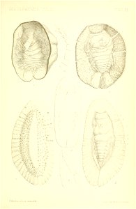
scale insects
smithsonian libraries
scale insects
smithsonian libraries
scale insects
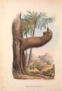
mammals
zoology
sculptor's studio
biblioteca di storia e cultura del piemonte "giuseppe grosso"
maps of italy
maps of meldorf by braun & hogenberg
maps of heide by braun & hogenberg
maps of the islands of greece by marco boschini (1658)
old maps of amorgos
maps of dordrecht by braun & hogenberg
bibliothèque nationale de france
grenzkarte der preussischen, russischen und oestreichischen monarchien (1796)
maps of podolia governorate
maps of the islands of greece by marco boschini (1658)
old maps of kos
maps of the islands of greece by marco boschini (1658)
old maps of nisyros
a topographical map of the county of berks (1761)
bibliothèque nationale de france
a topographical map of the county of berks (1761)
bibliothèque nationale de france
bibliothèque nationale de france
braun/hogenberg dreizehn orte
maps of budapest by braun & hogenberg
maps of vienna by braun & hogenberg
maps of the islands of greece by marco boschini (1658)
old maps of tilos
maps of ports and fortresses of the mediterranean by marco boschini (1651)
bibliothèque nationale de france
historical
history
historical
history
maps of alsace by guillaume sanson
1660s maps of baden-württemberg
works after joseph vernet
seascapes
checkflicr2
gogapixelai
maps of béthune by braun & hogenberg
bibliothèque nationale de france
maps by matthäus merian
baroque
maps of the islands of greece by marco boschini (1658)
old maps of anafi
maps of brno by braun & hogenberg
bibliothèque nationale de france
maps of the islands of greece by marco boschini (1658)
old maps of kalymnos
maps of the islands of greece by marco boschini (1658)
old maps of andros
description of the nobility of hainaut by braun & hogenberg
bibliothèque nationale de france
maps of the islands of greece by marco boschini (1658)
old maps of alonissos
grenzkarte der preussischen, russischen und oestreichischen monarchien (1796)
old maps of austrian silesia
maps of munich by joris hoefnagel
bibliothèque nationale de france
araragi tsukihi
nisemonogatari
animals
nature
printing
clock
wildlife
people
printing
clock
high tunnel
vegetables
high tunnel
vegetables
high tunnel
vegetables
high tunnel
vegetables
mosquito
insects
justice scales
vortex
printing
clock
printing
clock
spring
sign
background
circle
high tunnel
vegetables
high tunnel
plants
high tunnel
vegetables
dillingen an der donau
baroque
friedrich friedländer
works after joseph vernet
seascapes
maps of the islands of greece by marco boschini (1658)
history of chalki
maps of the county of mark
guillaume sanson
historical
history
john rocque 1746 london map (a1-h3)
clerkenwell
elliott cresson photo, 1840
maps of béthune by braun & hogenberg
bibliothèque nationale de france
5201 - 5300 of 8,995
Next page
/ 90