Log in
All resources
Create a design
20,348 Free Images of Plan
history
historical
plans of castles and towers by carlo nigra
bibliothèque nationale de france
maps of paris from the david rumsey historical map collection
atlas des anciens plans de paris by imprimerie nationale, 1900 from the david rumsey historical map collection
dheulland map of paris
atlas map
david rumsey historical map collection
torri e castelli e case forti del piemonte dal 1000 al secolo xvi. il novarese
historical
history
architectural drawings of luxembourg palace
historical images of luxembourg palace
landais & oberthur
maps from gallica
historical images of saints olha and elizabeth church, lviv
plans of churches in lviv
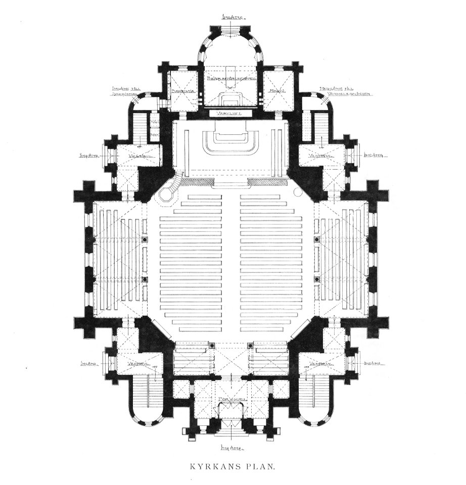
drawings in the nationalmuseum stockholm
fredrik wilhelm scholander
maps of paris from paris musées
baroque
engravings of topographia braunschweig lüneburg
baroque
plan routier de la ville et faubourg de paris by jean lattré
maps of paris from bibliothèque nationale de france
the crystal palace (book)
victorian architecture
plan routier de la ville et faubourg de paris by jean lattré
maps of paris from bibliothèque nationale de france
atlas des anciens plans de paris by imprimerie nationale, 1900 from the david rumsey historical map collection
maps of paris from the david rumsey historical map collection
anglo-dutch wars
zeeuws archief
atlas des anciens plans de paris by imprimerie nationale, 1900 from the david rumsey historical map collection
maps of paris from the david rumsey historical map collection
charles william meredith van de velde
eran laor cartographic collection
historical
history
historical
history
sconces in belgium
lillo
architectural drawings of luxembourg palace
historical images of luxembourg palace
london and its environs - a practical guide to the metropolis and its vicinity, illustrated by maps, plans and views (1862)
crystal palace in sydenham
plans of synagogues in austria
synagoge im alten akh wien
1757 in lower saxony
1758 engravings
torri e castelli e case forti del piemonte dal 1000 al secolo xvi. il novarese
plans of castles and towers by carlo nigra
plan de la ville et faubourg de paris, divisé en ses 48 sections by mondhare & jean
maps of paris from paris musées
heusteigschule, pläne
kaisersaal der kaiserpfalz goslar
engravings in the yale center for british art
john thomas smith (1766-1833)
engravings in the yale center for british art
john thomas smith (1766-1833)
turgot map of paris, kyoto university library – derivative files
chapelle saint-éloi (paris)
drawings in the yale center for british art
gerrit jan schouten
plan de la ville et faubourg de paris, divisé en ses 48 sections by mondhare & jean
maps of paris from the stanford libraries
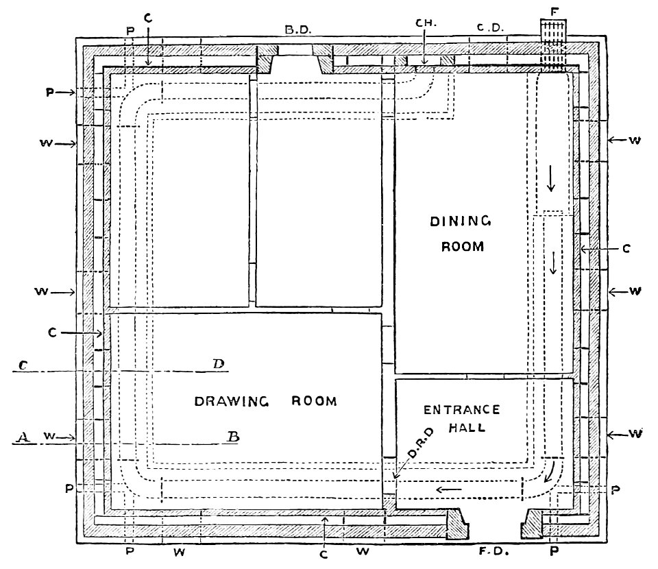
houses and gardens by e.l. lutyens (1913)
orchards, bramley, surrey
drawings of paris by alfred bonnardot
floor plans in musée carnavalet
algiers in the 19th century
old maps of algiers
cityscape
skyline
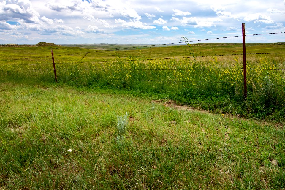
grass
field
passenger train
vehicle
travel
close
train
sign
landscape
nature
blm california news release photos
wildfire
saint-nicolas-de-bourgueil
bourgueil, avoine
floor plans of synagogues in czechia
synagogue in opava
curt teich postcard archives
postcards of chicago
plan routier de la ville et faubourg de paris by jean lattré
maps of paris from bibliothèque nationale de france
atlas des anciens plans de paris by imprimerie nationale, 1900 from the david rumsey historical map collection
maps of paris from the david rumsey historical map collection
atlas des anciens plans de paris by imprimerie nationale, 1900 from the david rumsey historical map collection
maps of paris from the david rumsey historical map collection
herrliche geschichte
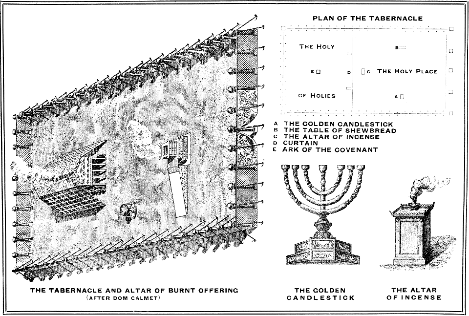
practical handbook for the study of the bible
torri e castelli e case forti del piemonte dal 1000 al secolo xvi. il novarese
plans of castles and towers by carlo nigra
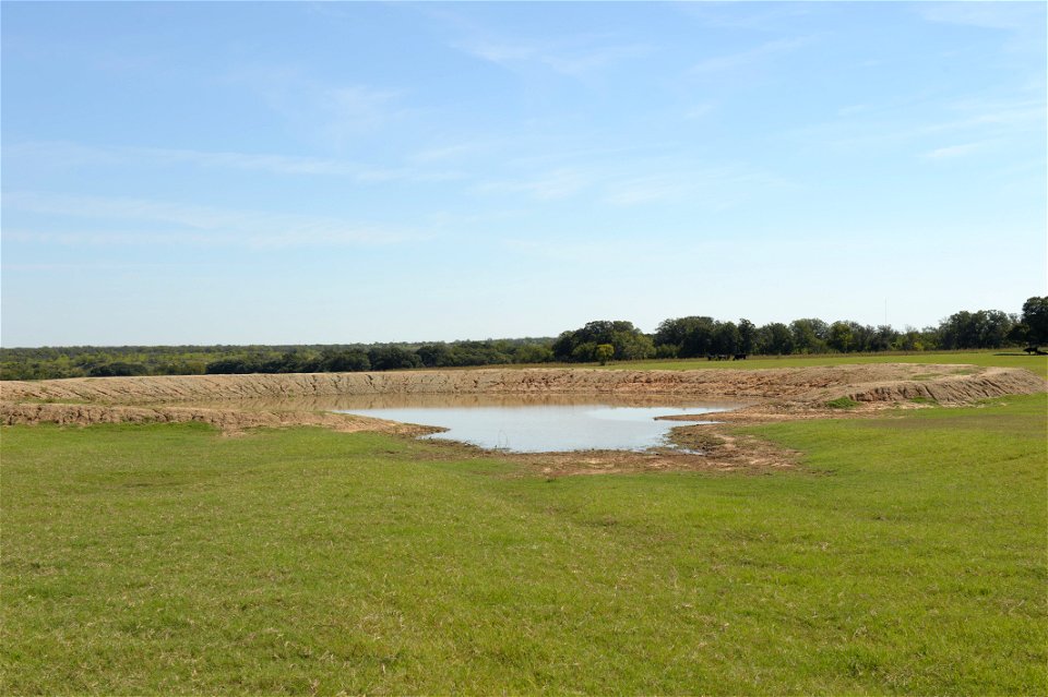
ranch
nrcs
athens
attica
field
plan
landscape
nature
maps in the staats- und universitätsbibliothek hamburg
1840 maps of hamburg
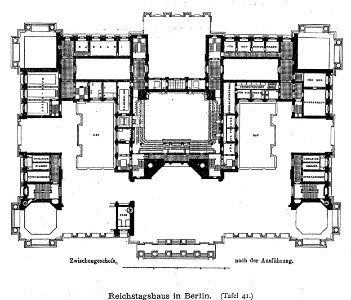
1870s maps of berlin
1871 in berlin
historical
history
historical
history
historical
history
historical
history
harper's weekly illustrations by thomas nast
harper's weekly, 1880
maps of paris from the barry lawrence ruderman antique maps inc.
maps of paris by louis-joseph mondhare
travel brochure
365photo
architecture
salamanca
foundation
vehicle
landscape
rock
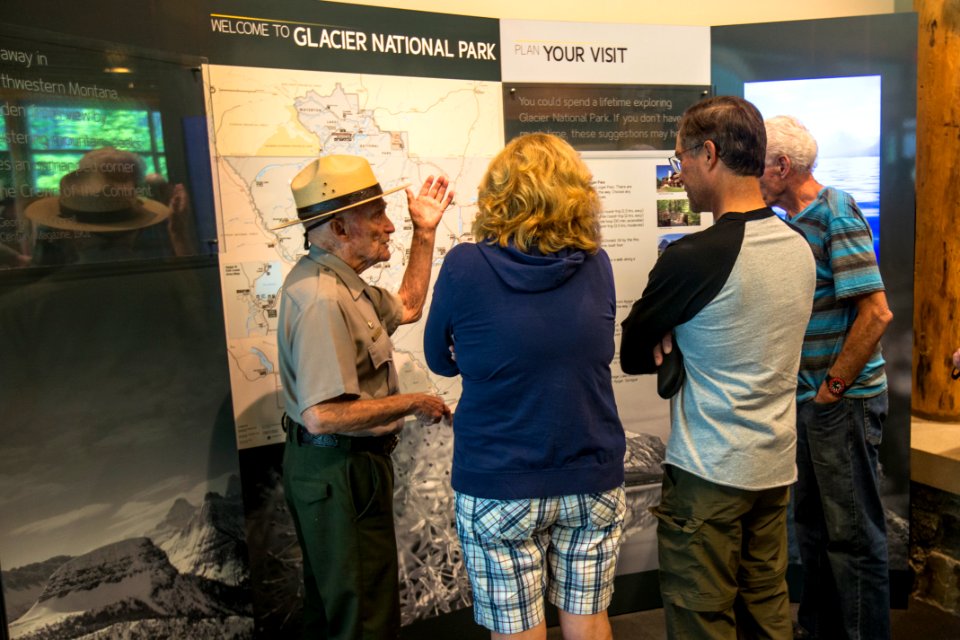
glacier national park
ranger
people
water
aircraft
flight
australia
vehicle
landscape
winter
water
grass
conservation plans
forest
business
time
topographia westphaliae (merian)
baroque
josef theodor hansen
hammershus in art
historical
history
historical
history
historical
history
historical images of vosstaniya square
classicism
torri e castelli e case forti del piemonte dal 1000 al secolo xvi. il novarese
tower (suna)
torri e castelli e case forti del piemonte dal 1000 al secolo xvi. il novarese
castello di castellazzo novarese
historical images of castello di aymavilles
plans of castles and towers by carlo nigra
prints by jacques callot in the national gallery of art
etching and engraving on laid paper
black and white photographs of kyiv
1901 in kyiv
the boston blue book
1898 in boston
learning
ipad
graphics of werner berner from wrocław
drawings by taddeo zuccari in the metropolitan museum of art
mannerism
houses and gardens by e.l. lutyens (1913)
marshcourt, stockbridge, hampshire
historical
history
historical
history
old maps of liège (city)
fort de la chartreuse
ionian antiquities (1769)
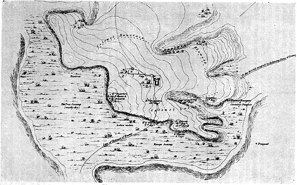
revenge! (1896)
lancelot speed
drawings in the nationalmuseum stockholm
fredrik wilhelm scholander
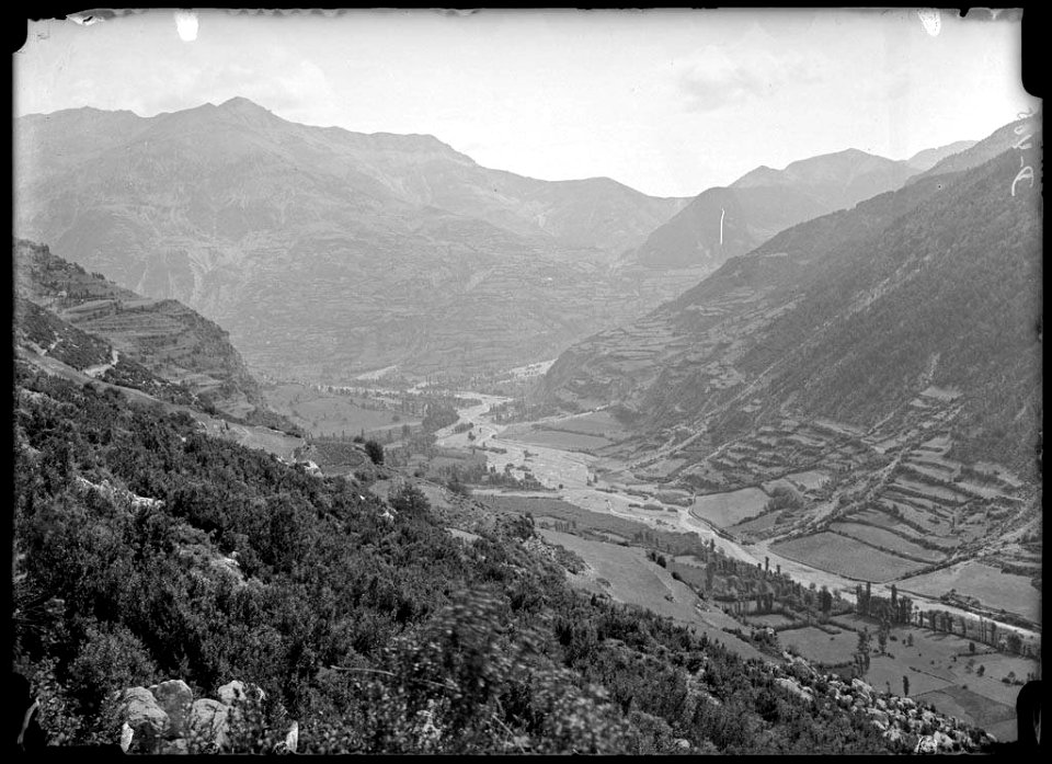
pasargadae in the 19th century
voyage en perse
houses and gardens by e.l. lutyens (1913)
orchards, bramley, surrey
development & character of gothic architecture (1890)
gothic architecture in france
charles william meredith van de velde
eran laor cartographic collection
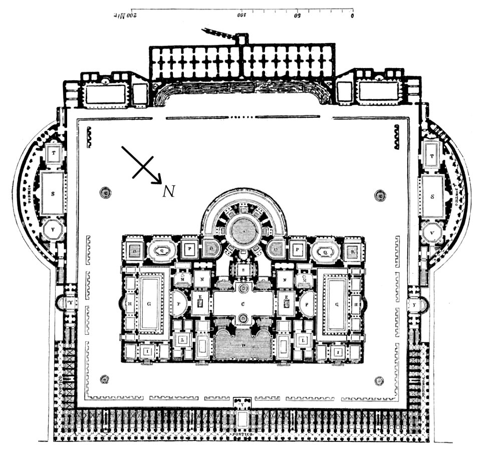
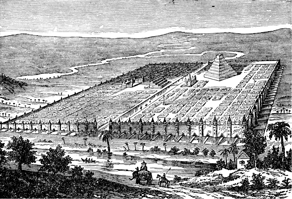
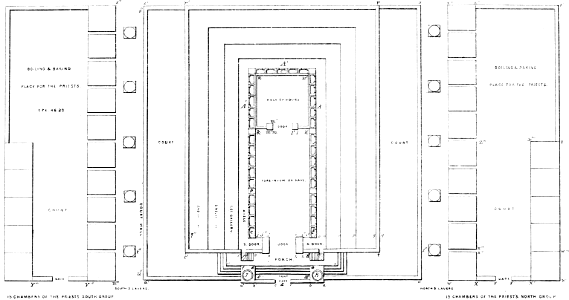
solomon's temple
7801 - 7900 of 20,348
Next page
/ 204