Log in
All resources
Create a design
16,781 Free Images of Language
bibliothèque nationale de france
👶 people & body emoji
body language
chorographia britanniae (1741-1742)
finger
hands
👌 fingers emoji
hand sign
ok
gesture
the comprehensive history of england (1876)
english-language maps showing history
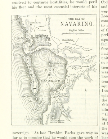
19th-century maps of greece
pierre françois tardieu
robert cordier (engraver)
1789 maps of france
robert cordier (engraver)
1789 maps of france
18th-century maps of the bosphorus
joseph roux
18th-century maps of the indian ocean
guillaume dheulland
drawings (print room), leiden university library
ars aemula naturae, leiden university library
collection drawings and prints from het utrechts archief
david mill
im wilden westen - eine künstlerfahrt durch die prairien und felsengebirge der union (1890)
native american languages
prints by louis-léopold boilly
louis-léopold boilly
drawings (print room), leiden university library
ars aemula naturae, leiden university library
scotland's story by h. e. marshall
union jack in art
henri laurens
abstract art
the comprehensive history of england (1876)
english-language maps showing history
english-language sheet music of songs
mother carey's chickens (1911)
scotland's story by h. e. marshall
conversation
message
the comprehensive history of england (1876)
english-language maps showing history
theatre geographique du royaume de france (1632)
maps of perigord
evesché de la rochelle, dédié à... messire henry de laval, évesque de la rochelle par son très humble et très obéisfant serviteur - g. sanson... - btv1b53227146h
bibliothèque nationale de france
bibliothèque nationale de france
johannes le francq van berkhey
bibliothèque nationale de france
tranquillo mollo
l'alsace divisée en ses principales parties - sçavoir les landgraviats de haute, et basse alsace et le suntgaw - par le sr. sanson... ; cordier sculpsit - btv1b531794616
guillaume sanson
lettre autographe signée d'andré saglio, dit drésa, à jacques rouché, 16 novembre 1923 (manuscrit autographe) - btv1b53150677b
bibliothèque nationale de france
map of modern syria by philippe de la rué
1650s maps of palestine
bibliothèque nationale de france
guillaume sanson
breathing a vein (gillray)
😃 emoji
finger
😃 emoji
finger
😃 emoji
finger
😃 emoji
victory
😃 emoji
victory
😃 emoji
victory
old maps of vermandois
maps of somme river
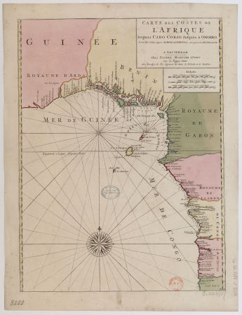
17th-century maps of africa
maps from gallica
historical
history
historical
history
historical
history
bibliothèque nationale de france
félix robaut
1730s maps of the philippines
baroque painting
bibliothèque nationale de france
hendrik de leth
archevesché et eslectorat de cologne avec ses enclaves dans les pays circonvoisins. tiré des mémoires les plus nouveaux - par le sr sanson... - btv1b532023960
guillaume sanson
1830s maps of puerto rico
nathaniel currier
carte de la province de berry (1707) by jaillot
bibliothèque nationale de france
partie orientale du temporel de l'archevesché et eslectorat de mayence - et le comté de reineck - par le sieur sanson... - btv1b53202373t
guillaume sanson
monument national du hartmannswillerkopf
antoine bourdelle
bibliothèque nationale de france
hendrik de leth
carte particulière des costes de l'afrique qui comprend le royaume de gualata ... - btv1b8595466g
maps by pieter mortier
carte particulière des costes de l'afrique qui comprend le royaume de gualata ... - btv1b8595466g
maps by pieter mortier
bibliothèque nationale de france
maps by thomas kitchin
bibliothèque nationale de france
guillaume sanson
lettre autographe signée d'andré saglio, dit drésa, à jacques rouché, 16 novembre 1923 (manuscrit autographe) - btv1b53150677b
bibliothèque nationale de france
1690s maps of the ottoman empire
guillaume sanson
ornament
food
rome in the 1550s
high renaissance
17th-century maps of carmarthenshire
17th-century maps of pembrokeshire
18th-century maps of england and wales
chorographia britanniae (1741-1742)
chorographia britanniae (1741-1742)
18th-century maps of staffordshire
chorographia britanniae (1741-1742)
18th-century maps of hampshire
book illustrations in the british museum
woodcuts by hans schäufelein
chorographia britanniae (1741-1742)
18th-century maps of hertfordshire
maps and topographical views by joris hoefnagel
1580s maps of spain
maps of rodrigues island
old maps of mauritius
chorographia britanniae (1741-1742)
18th-century maps of surrey
chorographia britanniae (1741-1742)
18th-century maps of leicestershire
book illustrations in the british museum
woodcuts by hans schäufelein
chorographia britanniae (1741-1742)
18th-century maps of devon
😃 emoji
finger
openmoji 12.2
finger
forbidden
😃 emoji
😃 emoji
victory
😃 emoji
hands
😃 emoji
finger
forbidden
😃 emoji
photographs by emmy andriesse in amsterdam
death customs of the netherlands
paraguay, o prov. de rio de la plata cum regionibus adiacentibus tucuman et sta cruz de la sierra - (blaeu) - btv1b8596658x
1640s maps of south america
chorographia britanniae (1741-1742)
18th-century maps of cheshire
rome in the 1550s
high renaissance
chorographia britanniae (1741-1742)
18th-century maps of worcestershire
chorographia britanniae (1741-1742)
18th-century maps of warwickshire
rome in the 1550s
high renaissance
chorographia britanniae (1741-1742)
18th-century maps of suffolk
chorographia britanniae (1741-1742)
18th-century maps of shropshire
18th-century maps of herefordshire
old county maps of herefordshire
chorographia britanniae (1741-1742)
1740s maps of wales
18th-century maps of norfolk, england
chorographia britanniae (1741-1742)
chorographia britanniae (1741-1742)
18th-century maps of rutland
chorographia britanniae (1741-1742)
18th-century maps of bedfordshire
chorographia britanniae (1741-1742)
18th-century maps of derbyshire
chorographia britanniae (1741-1742)
1740s maps of wales
😃 emoji
woman
😃 emoji
woman
😃 emoji
man
😃 emoji
woman
😃 emoji
woman
😃 emoji
face
😃 emoji
finger
😃 emoji
victory
historical
history
historical
history
14501 - 14600 of 16,781
Next page
/ 168


![The Course of the Somme in the vicinity of which course are situated, the Ponthieu, the Amienois, the Santerre and the Vermandois / By N. de Fer... Scale of Three Hours of Travel [=1: 139 200 ]; H. Van Loon sculp, Herman van Loon, 1709](https://cdn.creazilla.com/illustrations/10000794475/the-course-of-the-somme-in-the-vicinity-of-which-course-are-situated-the-ponthieu-the-amienois-the-santerre-and-the-vermandois-by-n-de-fer-scale-of-three-hours-of-travel-1-139-200-h-van-loon-sculp-herman-van-loon-1709-md.jpg)


![Carpetaniae partis descr. / [Georgius Hoefnaglius], Joris Hoefnagel, 1584](https://cdn.creazilla.com/illustrations/10000765930/carpetaniae-partis-descr-georgius-hoefnaglius-joris-hoefnagel-1584-sm.jpg)


![Paraguay, o prov. de Rio de La Plata cum regionibus adiacentibus Tucuman et Sta Cruz de la Sierra / [Blaeu], 1640s](https://cdn.creazilla.com/illustrations/10001055781/paraguay-o-prov-de-rio-de-la-plata-cum-regionibus-adiacentibus-tucuman-et-sta-cruz-de-la-sierra-blaeu-1640s-sm.webp)


![A Map of South Wales: West from London / T. Badeslade delin[eavit]; W.H. Toms Sculp[sit], 1741](https://cdn.creazilla.com/illustrations/10000319175/a-map-of-south-wales-west-from-london-t-badeslade-delineavit-wh-toms-sculpsit-1741-sm.webp)


![A Map of North Wales: N. West from London / T. Badeslade delin[eavit]; W.H. Toms Sculp[sit], 1741](https://cdn.creazilla.com/illustrations/10001551176/a-map-of-north-wales-n-west-from-london-t-badeslade-delineavit-wh-toms-sculpsit-1741-sm.webp)