Log in
All resources
Create a design
16,781 Free Images of Language
bibliothèque nationale de france
history
historical
cc-zero
images from nationaal archief
images from anefo
photographs by unknown photographer from anefo
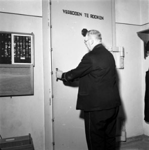
uncategorized media with description in dutch language
skipped images from nationaal archief
maps from gallica
pages of books about mathematics
books about geometry
maps of amsterdam by braun & hogenberg
bibliothèque nationale de france
chorographia britanniae (1741-1742)
bibliothèque nationale de france
regnorum hispaniae nova descriptio (blaeu)
bibliothèque nationale de france
maps of rotterdam by berckenrode
baroque
maps of the islands of greece by marco boschini (1658)
old maps of serifos
maps of tønder by braun & hogenberg
maps of eutin by braun & hogenberg
maps of barbary coast by mercator-hondius
bibliothèque nationale de france
1777 maps of south america
maps by thomas kitchin
situs terrae promissionis by christian van adrichom
bibliothèque nationale de france
maps of dillenburg by braun & hogenberg
maps of siegen by braun & hogenberg
maps of eckernförde by braun & hogenberg
bibliothèque nationale de france
maps of damascus by braun & hogenberg
bibliothèque nationale de france
maps of grenoble by braun & hogenberg
maps of romans by braun & hogenberg
17th-century maps of maastricht
baroque
bibliothèque nationale de france
braun/hogenberg dreizehn orte
pierre moullart-sanson
guillaume sanson
maps of orléans by braun & hogenberg
bibliothèque nationale de france
maps of innsbruck by braun & hogenberg
bibliothèque nationale de france
maps of groningen by braun & hogenberg
bibliothèque nationale de france
territorium argentoratense (1652 map)
context files from gallica
maps of cadiz by braun & hogenberg
bibliothèque nationale de france
maps of limburg by aegidius martini
bibliothèque nationale de france
old maps of emmerich am rhein
baroque
chorographia britanniae (1741-1742)
bibliothèque nationale de france
bibliothèque nationale de france
maps by thomas kitchin
maps of brielle by braun & hogenberg
brielle in the 16th century
maps of limburg by aegidius martini
bibliothèque nationale de france
maps from gallica
guides joanne
maps of famagusta by braun & hogenberg
bibliothèque nationale de france
maps of bergen op zoom by braun & hogenberg
bibliothèque nationale de france
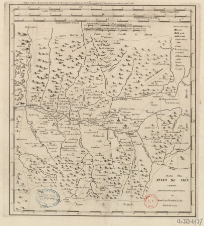
maps of the kingdom of jaén (crown of castile)
maps of spain by tomas lopez
landais & oberthur
maps from gallica
atlas van der hagen (volume 4)
atlas van der hagen
military
ocean
military
army
maps of spain by tomas lopez
1780 maps of spain
vigo in the 18th century
1702 maps of spain
1760s maps of the iberian peninsula
1762 maps of spain
maps of the kingdom of córdoba (crown of castile)
maps of spain by tomas lopez
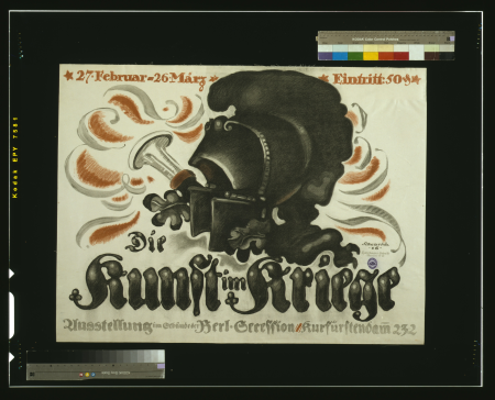
world war i posters in the library of congress
art collections in germany
world war i war bond posters of austria-hungary
world war i posters in the library of congress
charles william meredith van de velde
eran laor cartographic collection
historical
history
historical
history
historical
history
historical
history
historical
history
scotland's story by h. e. marshall
catherine douglas
maps by pieter van der keere
maps by abraham ortelius
eran laor cartographic collection
cornelis de bruyn
maps by pieter van der keere
old maps of north brabant
bethlem royal hospital
realism
antoine-françois tardieu
maps from gallica
maps by pieter van der keere
maps by abraham ortelius
maps with azimuthal equidistant projection
french-language maps of antarctica
illustrations by warwick goble
nala-damayanti
portrait of the artist's son jorge manuel theotokopoulos (el greco)
spanish renaissance,mannerism
military
army
military
army
nature
game
historical
history
historical
history
historical
history
historical
history
historical
history
historical
history
historical
history
vieilles chansons et rondes pour les petits enfants
history of tobacco
paintings of ganga
shantanu
17th-century maps of the moluccas
latin-language maps
italian-language posters
ottavio rodella tavio
a history of the town and parish of nantwich, or wich-malbank, in the county palatine of chester (1883)
english-language family trees
prints (print room), leiden university library
dirk eversen lons
illustrations by warwick goble
disrobing of draupadi
historical
history
historical
history
historical
history
historical
history
historical
history
flagpole
history
historical
history
historical
history
iceland
maps
journal of the straits branch of the royal asiatic society (1885)
arend ludolf van hasselt
maps of the iberian peninsula by guillaume delisle
1700s maps of the iberian peninsula
map of the upper rhenian circle by sanson
1690s maps of hesse
1750s maps of central america
maps by tomas lopez
maps of raucourt
maps of sedan
map of the circle of the rhineland by sanson
1700s maps of rhineland-palatinate
prints (print room), leiden university library
dirk eversen lons
eran laor cartographic collection
claes jansz. visscher (ii)
eran laor cartographic collection
claes jansz. visscher (ii)
aucuba japonica - botanical illustrations
flora by h. witte (pngs)
map of the circle of the rhineland by sanson
1730s maps of rhineland-palatinate
1750s maps of central america
maps by tomas lopez
nicolaes visscher ii
maps from gallica
japanese prints in the metropolitan museum of art
yokohama-e by utagawa yoshitora
peace sign
hand sign
ornament
wine
12901 - 13000 of 16,781
Next page
/ 168


![Rotterdam / [M. Merian], Matthäus Merian](https://cdn.creazilla.com/illustrations/10000529192/rotterdam-m-merian-matth-us-merian-sm.jpg)


![Gades ab occiduis insulae partibus: captus hic anno 1564 / Depingebat Georg[ius] Houfnaglius, between 1564 and 1640](https://cdn.creazilla.com/illustrations/10001498652/gades-ab-occiduis-insulae-partibus-captus-hic-anno-1564-depingebat-georg-ius-houfnaglius-between-1564-and-1640-md.jpg)


![A Table of all the Cross Roads in England and Wales.To follow Plate 4 / [Badeslade]; W.H. Toms sculp., 1741](https://cdn.creazilla.com/illustrations/10001514902/a-table-of-all-the-cross-roads-in-england-and-walesto-follow-plate-4-badeslade-wh-toms-sculp-1741-md.jpg)