Log in
All resources
Create a design
16,781 Free Images of Language
bibliothèque nationale de france
smithsonian libraries
letter
english language
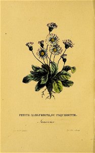
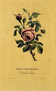
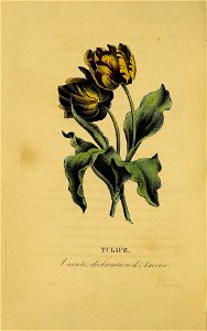
flower
leaves
stem
flower language
flowers in literature
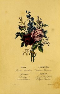
nouveau langage des fleurs, ou, parterre de flore : contenant le symbole et le langage des fleurs, leur histoire et leur origine mythologique, ainsi que les plus jolis vers composés a ce sujet
maps of alexandria by braun & hogenberg
bibliothèque nationale de france
maps by nicolas sanson
guillaume sanson
maps by willem and johannes blaeu
17th-century maps of lorraine
a map of the british empire in america with the french and spanish settlements adjacent thereto
1730s maps of the caribbean
maps of hrodna by braun & hogenberg
bibliothèque nationale de france
maps of santander by braun & hogenberg
bibliothèque nationale de france
abbatia heresfeldensis vulgo t'stift hirsfeldt - btv1b53040447r
bibliothèque nationale de france
maps of lyon by braun & hogenberg
bibliothèque nationale de france
map of the bosphorus strait by guillaume sanson (1665)
bibliothèque nationale de france
poikilē stoa: ethnikē eikonographēnenē epetēris ... etos 1-16, 1881-1914 (1894)
paulos kalligas
maps by jodocus hondius
old maps of nassau
maps of france by hendrik hondius
old maps of cambrai
panoramic maps of seville by braun & hogenberg
maps of cadiz by braun & hogenberg
la porte de saint bernard - btv1b53181603x
porte saint-bernard
maps of heidelberg by braun & hogenberg
maps of speyer by braun & hogenberg
1590s maps of transylvania
1590s maps of hungary
18th-century maps of vienna
pierre françois tardieu
atlas van der hagen
mount wutai
flashcards
alphabet
garland
flag
garland
flag
alphabet
o
letter h
vintage
letter d
vintage
letter l
vintage
letter d
vintage
zofia de witte, potocka (née glavani)
kiselyov (surname)
old maps of hainaut (province)
1590s maps of belgium
17th-century maps of switzerland
maps by pieter van der keere
old maps of leiden
baroque
pieter van der keere
history of zutphen
île-de-france in the 17th century
context files from gallica
maps by richard william seale
1750 maps of africa
maps of catania by braun & hogenberg
mount etna in the 16th century
bibliothèque nationale de france
dheulland map of paris
maps of île-de-france by françois de la guillotière
context files from gallica
maps by willem and johannes blaeu
bibliothèque nationale de france
maps of győr by braun & hogenberg
bibliothèque nationale de france
maps of tivoli (italy) by braun & hogenberg
bibliothèque nationale de france
maps of brussels by braun & hogenberg
bibliothèque nationale de france
19th-century maps of the isle of wight
william price
maps of barbary coast by mercator-hondius
bibliothèque nationale de france
bibliothèque nationale de france
maps of lothian by timothy pont
bibliothèque nationale de france
sanson maps of asia
maps by nicolas sanson
sanson maps of asia
maps of alhama de granada by braun & hogenberg
bibliothèque nationale de france
maps of gdańsk by braun & hogenberg
bibliothèque nationale de france
maps of bilbao by braun & hogenberg
bibliothèque nationale de france
maps by nicolas sanson
guillaume sanson
bibliothèque nationale de france
maps of wales by humphrey llwyd
map of amsterdam by gerrit de broen (ii)
bibliothèque nationale de france
maps of cologne by braun & hogenberg
bibliothèque nationale de france
maps of deventer by braun & hogenberg
bibliothèque nationale de france
maps of provence by pierre-jean de bompar
bibliothèque nationale de france
maps of brixen by braun & hogenberg
bibliothèque nationale de france
map of amsterdam by gerrit de broen (ii)
bibliothèque nationale de france
maps of japan by mercator-hondius
bibliothèque nationale de france
abbatia heresfeldensis vulgo t'stift hirsfeldt - btv1b53040447r
bibliothèque nationale de france
maps of florence by braun & hogenberg
maps of genoa by braun & hogenberg
maps of tönning by braun & hogenberg
maps of husum by braun & hogenberg
maps of île-de-france by françois de la guillotière
context files from gallica
maps of douai by braun & hogenberg
bibliothèque nationale de france
a cidade de angra na ilha de iesu xpo da tercera que esta em 39 graos - btv1b53194481x
bibliothèque nationale de france
maps of edinburgh by braun & hogenberg
bibliothèque nationale de france
maps of setenil de las bodegas by braun & hogenberg
maps of lebrija by braun & hogenberg
maps of bristol by braun & hogenberg
bibliothèque nationale de france
maps by pieter van der keere
1600s maps of norway
admiralty charts region r: usa and mexico west coasts
admiralty charts 401-600
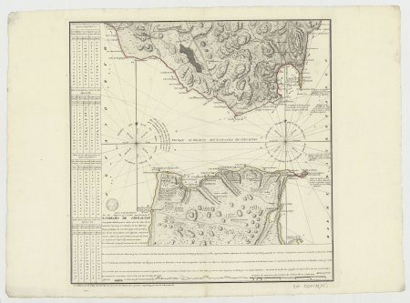
old maps of the strait of gibraltar
1762 maps of spain
flower
leaves
flower
leaves
flower
leaves
flower
leaves
bird
maps
historical
history
historical
history
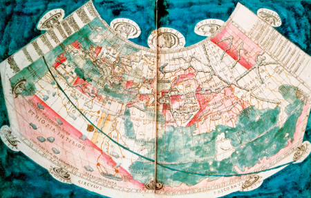
1470s maps of the world
latin-language maps
eran laor cartographic collection
johann martin will
books by leon battista alberti
italian renaissance
flower
leaves
an account of the laplanders of finmark, their language, manners, and religion (nmk.2021.0112)
rugs
charles william meredith van de velde
eran laor cartographic collection
eran laor cartographic collection
james basire
paintings by ludwig knaus
kittens in art
eran laor cartographic collection
gerard de jode
historical
history
historical
history
historical
history
flower
leaves
flower
leaves
astronomy
maps
flower
leaves
astronomy
maps
universal language selector icons
wmf agora icon set
historical
history
world war i posters in the library of congress
vojtěch preissig
italian-language posters
1890 posters
an account of the laplanders of finmark, their language, manners, and religion (nmk.2021.0112)
national museum of art, architecture and design
an account of the laplanders of finmark, their language, manners, and religion (nmk.2021.0112)
national museum of art, architecture and design
an account of the laplanders of finmark, their language, manners, and religion (nmk.2021.0112)
sami clothing in art
11701 - 11800 of 16,781
Next page
/ 168


![Lotharingia ducatus, vulgo Lorraine / [Blaeu], 1631](https://cdn.creazilla.com/illustrations/10000348612/lotharingia-ducatus-vulgo-lorraine-blaeu-1631-sm.webp)


![Anaplus Bosphori Thracii / ex indagationibus Petri Gyllii; delineatus [a] Gulielmo Sanson..., 1665](https://cdn.creazilla.com/illustrations/10001604206/anaplus-bosphori-thracii-ex-indagationibus-petri-gyllii-delineatus-a-gulielmo-sanson-1665-md.jpg)


![L'Isle de France. Parisiensis agri descrip[tio]. Fr. Guilloterius... describebat..., 1598](https://cdn.creazilla.com/illustrations/10000399587/lisle-de-france-parisiensis-agri-descriptio-fr-guilloterius-describebat-1598-md.jpg)

![Javerinum vulgo Rab / [...] communicat Georgius Houfnaglius MDXCVII, between 1597 and 1640](https://cdn.creazilla.com/illustrations/10000798898/javerinum-vulgo-rab-communicat-georgius-houfnaglius-mdxcvii-between-1597-and-1640-md.jpg)


![A new chart of the isle of Wight [Bognor Regis - Durlston head], William Price, 1800](https://cdn.creazilla.com/illustrations/10000679901/a-new-chart-of-the-isle-of-wight-bognor-regis-durlston-head-william-price-1800-md.jpg)

![Provincae Lauden seu Lothien et Linlitouo / [Mercator], 1646](https://cdn.creazilla.com/illustrations/10000737732/provincae-lauden-seu-lothien-et-linlitouo-mercator-1646-md.jpg)


![L'Isle de France. Parisiensis agri descrip[tio]. Fr. Guilloterius... describebat..., 1598](https://cdn.creazilla.com/illustrations/10001477496/lisle-de-france-parisiensis-agri-descriptio-fr-guilloterius-describebat-1598-md.jpg)