Log in
All resources
Create a design
2,560 Free Images of Kaart
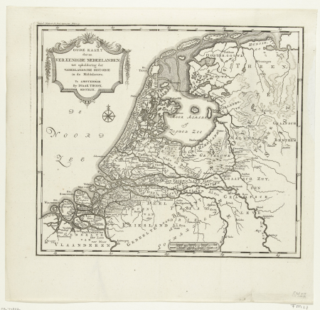
maps in the rijksmuseum amsterdam
isaak tirion
history
historical
maps by isaak tirion
cc-zero
images from anefo
images from nationaal archief
joachim ottens
algemeene landsdrukkerij (the hague)
old maps of de biesbosch
jan christiaan sepp
old maps of french guiana
old maps of cayenne
maps of brugse vrije by pieter pourbus
pieter pourbus
maps of utrecht (city) city walls
old maps of utrecht (city)
maps of maarssen
maarssenbroek
gemeente atlas van nederland - overijssel
prints of cartouches in the rijksmuseum amsterdam
maps in the rijksmuseum amsterdam
christian sgrothen
guelders
drawings by johan frederik clemens in the statens museum for kunst
pencil
old maps of gelderland
isaak tirion
gemeente atlas van nederland - south holland
maps of spijkenisse
maps in the rijksmuseum amsterdam
maps of lek river
maps in the rijksmuseum amsterdam
maps of lek river
maps in the rijksmuseum amsterdam
maps of lek river
maps in the rijksmuseum amsterdam
maps of lek river
18th-century maps of the malay archipelago
maps in the rijksmuseum amsterdam
gemeente atlas van nederland - north brabant
maps of baarle-nassau
maps in the rijksmuseum amsterdam
maps of lek river
historical
history
drawings by johan frederik clemens in the statens museum for kunst
pencil
historical
history
grote of sint-bartholomeüskerk (schoonhoven)
old maps of schoonhoven
geldersweert, ingen
gelders archief
corte cronikel
maps in the rijksmuseum amsterdam
maps of lek river
history of the low countries
netherlands in the 1620s
media from stadsarchief rotterdam
baroque
atlas van loon
kuinderburcht
maps of groningen by braun & hogenberg
ebbingepoort (groningen)
historical
history
historical
history
historical
history
historical
history
jacobus stellingwerff
monasteries in gouda
maps in the rijksmuseum amsterdam
maps of lek river
historical
history
historical
history
historical
history
historical
history
maps in the rijksmuseum amsterdam
reinier & josua ottens
historical
history
historical
history
historical
history
maps by isaak tirion
1740s maps of japan
maps in the rijksmuseum amsterdam
reinier & josua ottens
historical
history
historical
history
old maps of haarlem
haarlemmerhout
portrait paintings of men in the rijksmuseum amsterdam
american paintings in the rijksmuseum amsterdam
historical
history
map of brugse vrije by pieter claeissens de jonge
pieter claeissens
maps in the rijksmuseum amsterdam
evert maaskamp
maps in the rijksmuseum amsterdam
maps by isaak tirion
maps in the rijksmuseum amsterdam
joachim ottens
maps by johannes vingboons
old maps of south holland
maps in the rijksmuseum amsterdam
willem albert bachiene
historical
history
construction drawings in the stadsarchief amsterdam
old maps of amsterdam
kaart van het hoogheemraadschap van schieland, 1611-1635
17th-century maps of rotterdam
map of brugse vrije by pieter claeissens de jonge
drawings in the groeningemuseum
old maps of utrecht (city)
atlas van loon
maps in the rijksmuseum amsterdam
joachim ottens
maps in the rijksmuseum amsterdam
johannes leupenius
maps in the rijksmuseum amsterdam
johannes leupenius
maps in the rijksmuseum amsterdam
isaak tirion
historical
history
maps in the rijksmuseum amsterdam
joachim ottens
maps in the rijksmuseum amsterdam
joachim ottens
maps in the rijksmuseum amsterdam
old maps of india
art collection of the delft university of technology
maps of gouda by braun & hogenberg
prints of cartouches in the rijksmuseum amsterdam
maps in the rijksmuseum amsterdam
media contributed by university of illinois urbana-champaign university library
1794 maps of africa
maps in the rijksmuseum amsterdam
johannes leupenius
maps by jean-baptiste bourguignon d'anville
maps by isaak tirion
maps in the rijksmuseum amsterdam
johannes ratelband
maps in the rijksmuseum amsterdam
joachim ottens
maps in the rijksmuseum amsterdam
joachim ottens
prints of cartouches in the rijksmuseum amsterdam
maps in the rijksmuseum amsterdam
historical
history
maps in the rijksmuseum amsterdam
johannes leupenius
maps in the rijksmuseum amsterdam
johannes leupenius
maps in the rijksmuseum amsterdam
maps by isaak tirion
maps in the rijksmuseum amsterdam
maps by isaak tirion
dutch 17th-century prints in the rijksmuseum amsterdam
war of the jülich-kleve succession
maps in the rijksmuseum amsterdam
johannes leupenius
eran laor cartographic collection
willem albert bachiene
algemeene landsdrukkerij (the hague)
maps in the rijksmuseum amsterdam
eran laor cartographic collection
isaak tirion
historical
history
gemeente atlas van nederland - gelderland
maps of doorwerth
prints of cartouches in the rijksmuseum amsterdam
maps in the rijksmuseum amsterdam
maps in the rijksmuseum amsterdam
joachim ottens
algemeene landsdrukkerij (the hague)
maps in the rijksmuseum amsterdam
prints published by pieter schenk (ii)
maps in the rijksmuseum amsterdam
maps in the rijksmuseum amsterdam
old maps of tholen
maps in the rijksmuseum amsterdam
1627 maps
maps in the rijksmuseum amsterdam
david coster
gemeente atlas van nederland - gelderland
old maps of wageningen
maps by willem and johannes blaeu
copper engravings
maps in the rijksmuseum amsterdam
joachim ottens
101 - 200 of 2,560
Next page
/ 26