Log in
All resources
Create a design
26,918 Free Images of Etc
maps from the earth and its inhabitants, vol. iv
a system of modern geography (1810)
history
historical
lullabies of many lands collected and rendered into english verse by a. strettell.
1880s maps of the british isles
spring
london
plants
flower
pen and ink drawings in the rijksmuseum amsterdam
thomas cool
pen and ink drawings in the rijksmuseum amsterdam
thomas cool
het verheerlykt nederland of kabinet van hedendaagsche gezigten
1740 engravings
official portrait of emperor mutsuhito (by edoardo chiossone)
the americana - a universal reference library (1903)
nature
spring
nature
spring
nature
spring
spring
london
spring
london
maps in the topographia austriacarum (merian)
baroque
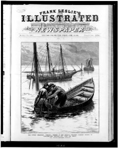
frank leslie's illustrated newspaper, 1880
frank leslie
engravings of topographia austriacarum
baroque
maps in the topographia austriacarum (merian)
baroque
maps in the topographia austriacarum (merian)
baroque
engravings of topographia austriacarum
baroque
historical
history
historical
history
historical
history
historical
history
historical
history
historical
history
historical
history
vaccaria hispanica - botanical illustrations
jan kops - flora batava, volume 18
cartouche (cartography)
cornelis de jode
coding da vinci nieder.rhein.land 2021
romanticism
façade occidentale de la cathédrale saint-étienne de bourges
engravings from la france illustrée
willem schellinks
messina in art
paintings by anthonis mor in the gemäldegalerie alte meister (kassel)
high renaissance
drawings by antoon derkinderen in the rijksmuseum amsterdam
symbolism
lullabies of many lands collected and rendered into english verse by a. strettell.
ciconia ciconia (illustrations)
maps from the earth and its inhabitants, vol. iv
old maps of the firth of forth
maps from the earth and its inhabitants, vol. iv
1880s maps of the british isles
maps from the earth and its inhabitants, vol. iv
1880s maps of ireland
reconstruction of ruysch's africa map by stanley
dans les ténèbres de l'afrique (1890)
maps from the earth and its inhabitants, vol. iv
19th-century maps of kent
1810s maps of the iberian peninsula
a system of modern geography (1810)
ghosts & ghoulish scenes - skulls
our earth and its story
a smaller history of greece, from the earliest times to the roman conquest (1897)
maps of troas
l'oncle de l'europe (1906)
charles léandre
vegas reise omkring asia og europa
fra mauro map derivative works
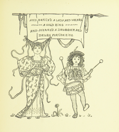
lullabies of many lands collected and rendered into english verse by a. strettell.
drummers in art
lullabies of many lands collected and rendered into english verse by a. strettell.
cradles in art
a system of modern geography (1810)
1810s maps of the pacific ocean
atlas geográfico y descripción geográfica y estadística de la república oriental del uruguay (1896)
a system of modern geography (1810)
1810s maps of italy
voyage à travers l'amérique du sud (1869)
orientalist painting
our earth and its story
eduard pechuël-loesche
a system of modern geography (1810)
old maps of the holy land
a smaller history of greece, from the earliest times to the roman conquest (1897)
ten thousand campaign
drawings by leo gestel in the rijksmuseum amsterdam
expressionism
a system of modern geography (1810)
1810s maps of south america
maps from the earth and its inhabitants, vol. iv
old maps of hartlepool
maps from the earth and its inhabitants, vol. iv
old maps of the hebrides
maps from the earth and its inhabitants, vol. iv
19th-century maps of the isle of man
maps from the earth and its inhabitants, vol. iv
maps of ben nevis
lullabies of many lands collected and rendered into english verse by a. strettell.
mothers and children in art
drawings by jan van goyen in the rijksmuseum amsterdam
dutch golden age painting
lullabies of many lands collected and rendered into english verse by a. strettell.
garrulus glandarius (illustrations)
a system of modern geography (1810)
1810s maps of denmark
maps from the earth and its inhabitants, vol. iv
1880s maps of the british isles
l'oncle de l'europe (1906)
charles léandre
a system of modern geography (1810)
1810s maps of france
a smaller history of greece, from the earliest times to the roman conquest (1897)
battle of thermopylae
19th-century maps of new south wales
australia (1873) by booth
maps from the earth and its inhabitants, vol. iv
1880s maps of the british isles
cycling images from the british library mechanical curator collection
the brighton road - the classic highway to the south (1922)
a system of modern geography (1810)
1810s maps of turkey
maps from the earth and its inhabitants, vol. iv
old maps of hadrian's wall
a system of modern geography (1810)
1810s maps of the austrian empire
maps from the earth and its inhabitants, vol. iv
old maps of glasgow
a system of modern geography (1810)
1810s maps of europe
a system of modern geography (1810)
1810s maps of arabia
the americana - a universal reference library (1908)
romanticism
a system of modern geography (1810)
1810s maps of scotland
ghosts & ghoulish scenes - skulls
maps from the earth and its inhabitants, vol. iv
19th-century maps of county durham
maps from the earth and its inhabitants, vol. iv
1880s maps of the british isles
maps from the earth and its inhabitants, vol. iv
maps of the firth of clyde
john and sebastian cabot. a study (1886)
cabot's 1544 maps of north america
maps from the earth and its inhabitants, vol. iv
19th-century maps of lincolnshire
a system of modern geography (1810)
1810s maps of switzerland
women of the world from the british library mechanical curator collection
george montbard
reconstruction of ruysch's africa map by stanley
im dunkelsten afrika (1890) by wobeser
a system of modern geography (1810)
1810s maps of the russian empire
maps from the earth and its inhabitants, vol. iv
old maps of derby
a system of modern geography (1810)
1810s maps of asia
ghosts & ghoulish scenes
a system of modern geography (1810)
1810s maps of the netherlands
a system of modern geography (1810)
1810s maps of the balkans
a system of modern geography (1810)
1810s maps of france
maps from the earth and its inhabitants, vol. iv
1880s maps of the british isles
a system of modern geography (1810)
1810s maps of germany
cycling images from the british library mechanical curator collection
the brighton road - the classic highway to the south (1922)
maps from the earth and its inhabitants, vol. iv
1880s maps of the british isles
lullabies of many lands collected and rendered into english verse by a. strettell.
fig leaves in art
maps from the earth and its inhabitants, vol. iv
19th-century maps of lancashire
a system of modern geography (1810)
old maps of the holy land
atlas geográfico y descripción geográfica y estadística de la república oriental del uruguay (1896)
little folks in feathers and fur, and others in neither (1875)
illustrations by albin mesnel
john and sebastian cabot. a study (1886)
1520s maps of the americas
9201 - 9300 of 26,918
Next page
/ 270