Log in
All resources
Create a design
8,202 Free Images of Documentary
bibliothèque nationale de france
drawings (documentary) collection in the library of congress
alfred waud
drawings by alfred waud
urban
film
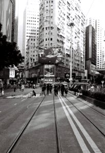
city
sunny
journal
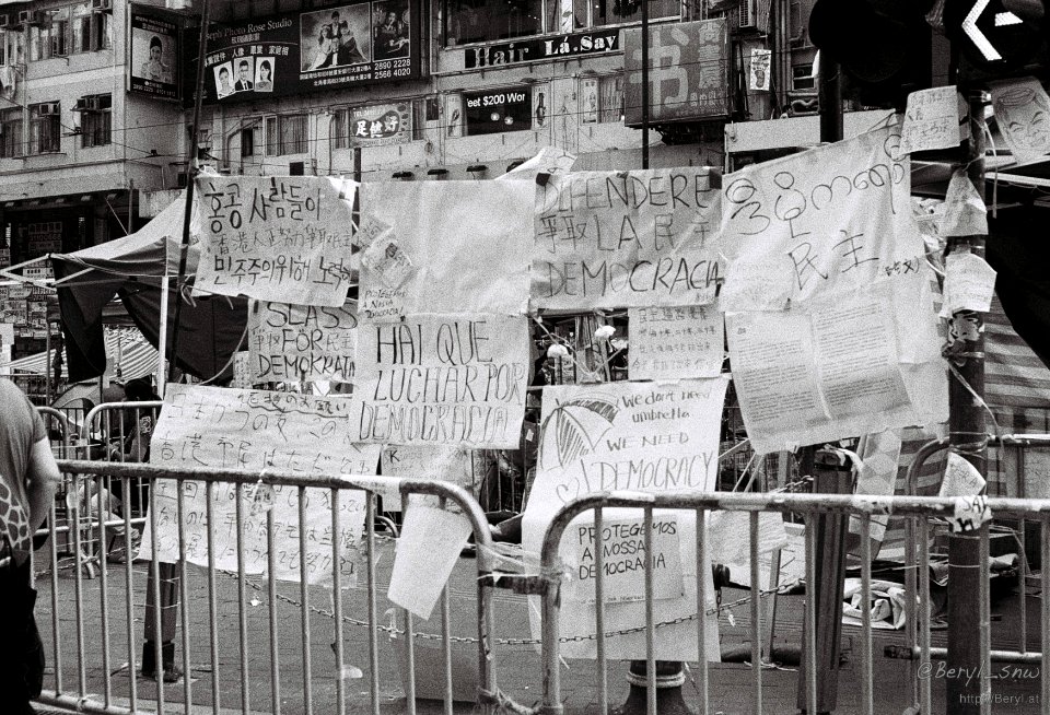
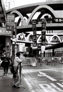
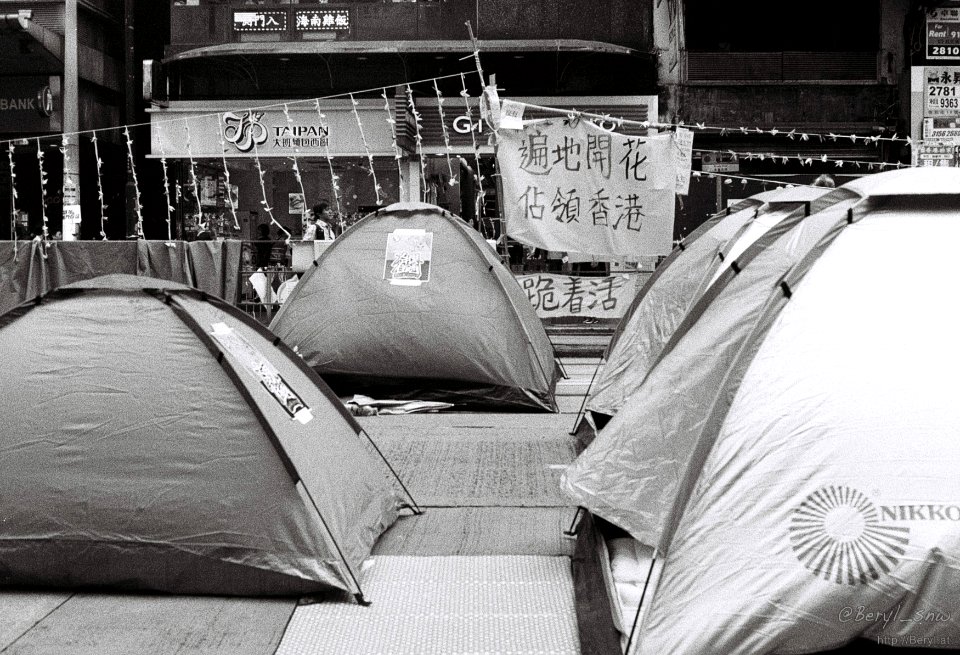
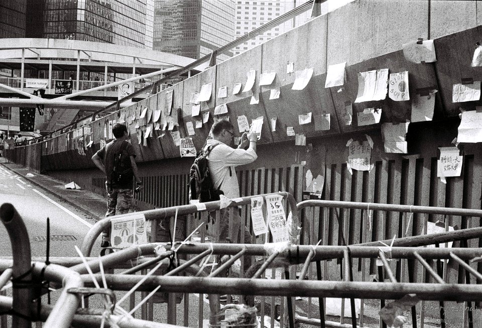
protest
maps by willem and johannes blaeu
17th-century maps of xaintonge
drawings (documentary) collection in the library of congress
drawings by alfred waud
territorium argentoratense (1652 map)
bibliothèque nationale de france
drawings (documentary) collection in the library of congress
william waud
drawings (documentary) collection in the library of congress
munson's hill
drawings (documentary) collection in the library of congress
drawings by alfred waud for harper's weekly
drawings (documentary) collection in the library of congress
drawings by alfred waud
manassas national battlefield park
drawings by alfred waud
maps from gallica
baroque
palais de justice de montpellier
jacques-jean barre
drawings (documentary) collection in the library of congress
arthur lumley
carte du mexique et de la floride by guillaume delisle (1703)
bibliothèque nationale de france
drawings (documentary) collection in the library of congress
drawings by alfred waud
1650s maps of the balkans
philippe de la rué
drawings (documentary) collection in the library of congress
drawings by alfred waud for the new york illustrated news
old maps of the republic of genoa
maps by alexis-hubert jaillot
carte particulière des environs de paris (1674)
maps of dourdan
carte particulière des environs de paris (1674)
bibliothèque nationale de france
carte particulière des environs de paris (1674)
bibliothèque nationale de france
map of the circle of the rhineland by sanson
1670s maps of rhineland-palatinate
drawings (documentary) collection in the library of congress
frank hamilton taylor
drawings (documentary) collection in the library of congress
james fuller queen
limousin (province) by century
jean fayen
carte particulière des environs de paris (1674)
bibliothèque nationale de france
carte particulière des environs de paris (1674)
bibliothèque nationale de france
carte particulière des environs de paris (1674)
maps of dourdan
maps by jean-baptiste bourguignon d'anville
1750s maps of the caribbean
history of montpellier
jacques-jean barre
carte particulière des environs de paris (1674)
maps of dourdan
carte particulière des environs de paris (1674)
bibliothèque nationale de france
bibliothèque nationale de france
maps by thomas kitchin
mappe-monde by guillaume delisle (18th century)
claude auguste berey
people
city
people
city
people
city
people
city
carte particulière des costes de l'afrique qui comprend le royaume de cacheo, le province de gelofo etc. - btv1b8595501g
maps by pieter mortier
drawings of the american civil war
drawings by alfred waud
drawings (documentary) collection in the library of congress
edwin forbes
drawings of the american civil war
drawings by alfred waud
drawings (documentary) collection in the library of congress
neoclassicism
drawings (documentary) collection in the library of congress
neoclassicism
drawings (documentary) collection in the library of congress
james fuller queen
maps by alexis-hubert jaillot
maps by guillaume sanson
drawings of the american civil war
drawings by alfred waud
antoine-françois tardieu
maps from gallica
drawings (documentary) collection in the library of congress
drawings by alfred waud for harper's weekly
antoine-françois tardieu
maps from gallica
drawings (documentary) collection in the library of congress
drawings by alfred waud for harper's weekly
drawings (documentary) collection in the library of congress
neoclassicism
books from the british library
clermont (ship, 1807)
people
city
celebrities
people
people
city
people
city
shopping
city
vehicle
city
brabantia ducatus - tabula ducatus brabantiae continens marchionatum sacri impery et dominium mechliniense - magna cura edita a petri verbist - btv1b53042443n
bibliothèque nationale de france
brabantia ducatus - tabula ducatus brabantiae continens marchionatum sacri impery et dominium mechliniense - magna cura edita a petri verbist - btv1b53042443n
bibliothèque nationale de france
map of the bosphorus strait by guillaume sanson (1665)
bibliothèque nationale de france
18th-century maps of sri lanka
maps by thomas kitchin
brabantia ducatus - tabula ducatus brabantiae continens marchionatum sacri impery et dominium mechliniense - magna cura edita a petri verbist - btv1b53042443n
bibliothèque nationale de france
brabantia ducatus - tabula ducatus brabantiae continens marchionatum sacri impery et dominium mechliniense - magna cura edita a petri verbist - btv1b53042443n
bibliothèque nationale de france
drawings (documentary) collection in the library of congress
prisoners of war in the american civil war
maps of ancient rome by braun & hogenberg
high renaissance
john rocque's 1748 map of london and adjacent country
remigius parr
battle of brandy station
edwin forbes
drawings (documentary) collection in the library of congress
drawings by alfred waud
drawings (documentary) collection in the library of congress
drawings by alfred waud
bibliothèque nationale de france
maps of limousin by jean fayen
drawings (documentary) collection in the library of congress
james fuller queen
drawings by alfred waud for the new york illustrated news
drawings by alfred waud
drawings (documentary) collection in the library of congress
drawings by alfred waud
drawings (documentary) collection in the library of congress
drawings by alfred waud
drawings (documentary) collection in the library of congress
drawings by alfred waud for harper's weekly
people
city
drawings (documentary) collection in the library of congress
james fuller queen
territorium argentoratense (1652 map)
bibliothèque nationale de france
bibliothèque nationale de france
auguste souze
bibliothèque nationale de france
maps of limousin by jean fayen
maps of alsace by guillaume sanson
1660s maps of alsace
water
tree
people
face
a map of the british empire in america with the french and spanish settlements adjacent thereto
bibliothèque nationale de france
a map of the british empire in america with the french and spanish settlements adjacent thereto
bibliothèque nationale de france
a map of the british empire in america with the french and spanish settlements adjacent thereto
bibliothèque nationale de france
a map of the british empire in america with the french and spanish settlements adjacent thereto
bibliothèque nationale de france
a map of the british empire in america with the french and spanish settlements adjacent thereto
bibliothèque nationale de france
soongsil university
an jung-sik
maps of the course of the rhine by guillaume sanson
bibliothèque nationale de france
bibliothèque nationale de france
guillaume sanson
drawings (documentary) collection in the library of congress
drawings by alfred waud
drawings (documentary) collection in the library of congress
john rubens smith
jean-fréderic phélypeaux
guillaume dheulland
aqueduc saint-clément (montpellier)
bibliothèque nationale de france
16th-century maps of le havre
ferrando bertelli
drawings (documentary) collection in the library of congress
drawings by alfred waud
bibliothèque nationale de france
guillaume sanson
maps from gallica
guides joanne
people
city
7001 - 7100 of 8,202
Next page
/ 83

![Xaintonge with the country of Aulnis, Brovageais, land of Arvert etc. / [Blaeu], 1662](https://cdn.creazilla.com/illustrations/10001453725/xaintonge-with-the-country-of-aulnis-brovageais-land-of-arvert-etc-blaeu-1662-md.jpg)


![Special map of the surroundings of Paris / By Mess[ieu]rs of the Royal Academy of Sciences in the year 1674; engraved by F. de la Pointe, 1678](https://cdn.creazilla.com/illustrations/10000758505/special-map-of-the-surroundings-of-paris-by-mess-ieu-rs-of-the-royal-academy-of-sciences-in-the-year-1674-engraved-by-f-de-la-pointe-1678-sm.jpg)
![Special map of the surroundings of Paris / By Mess[ieu]rs of the Royal Academy of Sciences in the year 1674; engraved by F. de la Pointe, 1678](https://cdn.creazilla.com/illustrations/10000844188/special-map-of-the-surroundings-of-paris-by-messieurs-of-the-royal-academy-of-sciences-in-the-year-1674-engraved-by-f-de-la-pointe-1678-sm.webp)
![Special map of the surroundings of Paris / By Mess[ieu]rs of the Royal Academy of Sciences in the year 1674; engraved by F. de la Pointe, 1678](https://cdn.creazilla.com/illustrations/10001139298/special-map-of-the-surroundings-of-paris-by-messieurs-of-the-royal-academy-of-sciences-in-the-year-1674-engraved-by-f-de-la-pointe-1678-sm.webp)


![Special map of the surroundings of Paris / By Mess[ieu]rs of the Royal Academy of Sciences in the year 1674; engraved by F. de la Pointe, 1678](https://cdn.creazilla.com/illustrations/10000404866/special-map-of-the-surroundings-of-paris-by-messieurs-of-the-royal-academy-of-sciences-in-the-year-1674-engraved-by-f-de-la-pointe-1678-sm.webp)
![Special map of the surroundings of Paris / By Mess[ieu]rs of the Royal Academy of Sciences in the year 1674; engraved by F. de la Pointe, 1678](https://cdn.creazilla.com/illustrations/10001362978/special-map-of-the-surroundings-of-paris-by-messieurs-of-the-royal-academy-of-sciences-in-the-year-1674-engraved-by-f-de-la-pointe-1678-sm.webp)
![Special map of the surroundings of Paris / By Mess[ieu]rs of the Royal Academy of Sciences in the year 1674; engraved by F. de la Pointe, 1678](https://cdn.creazilla.com/illustrations/10001486678/special-map-of-the-surroundings-of-paris-by-messieurs-of-the-royal-academy-of-sciences-in-the-year-1674-engraved-by-f-de-la-pointe-1678-md.jpg)


![Special map of the surroundings of Paris / By Mess[ieu]rs of the Royal Academy of Sciences in the year 1674; engraved by F. de la Pointe, 1678](https://cdn.creazilla.com/illustrations/10000606815/special-map-of-the-surroundings-of-paris-by-messieurs-of-the-royal-academy-of-sciences-in-the-year-1674-engraved-by-f-de-la-pointe-1678-sm.webp)
![Special map of the surroundings of Paris / By Mess[ieu]rs of the Royal Academy of Sciences in the year 1674; engraved by F. de la Pointe, 1678](https://cdn.creazilla.com/illustrations/10000776389/special-map-of-the-surroundings-of-paris-by-messieurs-of-the-royal-academy-of-sciences-in-the-year-1674-engraved-by-f-de-la-pointe-1678-sm.webp)


![Part of the St Clément aqueduct in Montpellier [Peyrou section, plan and elevation]](https://cdn.creazilla.com/illustrations/10000498243/part-of-the-st-clment-aqueduct-in-montpellier-peyrou-section-plan-and-elevation-md.jpg)
![Abla de Grace / [Ferrando Bertelli], Ferrando Bertelli, 1568](https://cdn.creazilla.com/illustrations/10001599324/abla-de-grace-ferrando-bertelli-ferrando-bertelli-1568-md.jpg)


