Log in
All resources
Create a design
3,579 Free Images of Chart
history
statistics
historical
graph
infographic
bar graph
💡 objects emoji
diagram
office
line graph
board
chart
lucas janszoon waghenaer
1610s maps of norway
cartouches by willem and johannes blaeu
pieter goos
lawrence h. slaughter collection of english maps, charts, globes, books and atlases
nypl lionel pincus and princess firyal map division
historical
history
historical
history
historical
history
historical
history
historical
history
drawings in the cooper–hewitt, smithsonian design museum
rococo
people
flag
1740s maps of the united kingdom
maps in the british museum
drawings by johan frederik clemens in the statens museum for kunst
gray wash
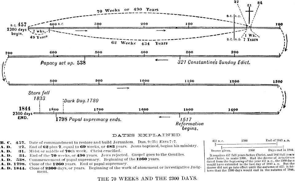
great controversy 1888
checkflicr2
a map of the provinces of new york and new jersey, with a part of pennsylvania and the province of quebec
lawrence h. slaughter collection of english maps, charts, globes, books and atlases
a map of the provinces of new york and new jersey, with a part of pennsylvania and the province of quebec
lawrence h. slaughter collection of english maps, charts, globes, books and atlases
plants
office
historical
history
eran laor cartographic collection
willem albert bachiene
a map of the provinces of new york and new jersey, with a part of pennsylvania and the province of quebec
lawrence h. slaughter collection of english maps, charts, globes, books and atlases
historical
history
😃 emoji
money
portolan charts by willem and johannes blaeu
copper engravings
le neptune francois
le neptune francois
library of congress - misc
checkflicr2
old maps of the province of a coruña
lucas janszoon waghenaer
business
computer
eran laor cartographic collection
willem albert bachiene
historical
history
historical
history
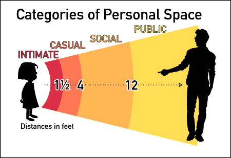
personal space
proximity
harper's magazine, 1861
engravings
😃 emoji
office
civil ensigns in the ottoman empire
flag charts of turkey
1670s maps of the iberian peninsula
hugo allardt
harper's magazine, 1861
engravings
1780s maps of the philippines
old maps of palau
diagrams of krkonoše mute signs
symbol charts
maps by pieter mortier
le neptune francois
le neptune francois
1693 illustrations
le neptune francois
1693 illustrations
maps by willem and johannes blaeu
maps of the wadden sea
historical
history
historical map collection
maps by emanuel bowen
illustrations of jean de la fontaine's fables by jean-baptiste oudry
dominique sornique
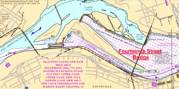
water
boat
family
money
technology
computer
historical
history
maps in the topographia austriacarum (merian)
baroque
eran laor cartographic collection
willem albert bachiene
portolan charts by willem and johannes blaeu
old maps of friesland
buenos aires
reuse
auguste iii blanchard
louis-jules masselot
catalan atlas, 1959 reproduction
catalan charts
growth
money
😃 emoji
office
1660s maps of taiwan
1667 maps
post-impressionism,pont-aven school,symbolism,synthetism,cloisonnism,impressionism,primitivism
drawings in the national gallery of art (washington, d.c.)
eran laor cartographic collection
willem albert bachiene
latin alphabet charts
german renaissance
project 365
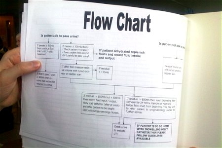
flow chart
historical
history
historical
history
paintings in tianjin museum
mei qing
catalan atlas, 1959 reproduction
catalan charts
maps by pieter mortier
le neptune francois
works by johan vinckeboons
image restoration
😃 emoji
office
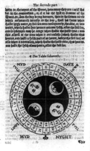
astrology
horoscope
lucas janszoon waghenaer
bretagne in the 1580s
icons
growth
😃 emoji
office
😃 emoji
office
😃 emoji
office
😃 emoji
office
maps in the topographia austriacarum (merian)
baroque
animals
icons
historical
history
maps in the topographia austriacarum (merian)
baroque
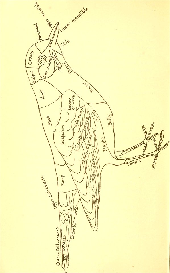
anatomy
bird
united states
animals
portolan charts by willem and johannes blaeu
dutch east india company
😃 emoji
money
😃 emoji
money
😃 emoji
office
historical
history
historical
history
historical
history
historical
history
😃 emoji
office
😃 emoji
office
paintings in tianjin museum
wang jian (painter)
charts and maps of the royal museums greenwich
1584 maps
charts and maps of the royal museums greenwich
1584 maps
media from the national library of finland
classicism
history
theory
😃 emoji
office
maps in the topographia austriacarum (merian)
baroque
2001 - 2100 of 3,579
Next page
/ 36


![Color Chart with Annotations [verso], Paul Gauguin, between 1884 and 1888](https://cdn.creazilla.com/illustrations/10000896674/color-chart-with-annotations-verso-paul-gauguin-between-1884-and-1888-sm.jpg)